Download Agreement, Release, and Acknowledgement of Risk:
You (the person requesting this file download) fully understand mountain climbing ("Activity") involves risks and dangers of serious bodily injury, including permanent disability, paralysis, and death ("Risks") and you fully accept and assume all such risks and all responsibility for losses, costs, and damages you incur as a result of your participation in this Activity.
You acknowledge that information in the file you have chosen to download may not be accurate and may contain errors. You agree to assume all risks when using this information and agree to release and discharge 14ers.com, 14ers Inc. and the author(s) of such information (collectively, the "Released Parties").
You hereby discharge the Released Parties from all damages, actions, claims and liabilities of any nature, specifically including, but not limited to, damages, actions, claims and liabilities arising from or related to the negligence of the Released Parties. You further agree to indemnify, hold harmless and defend 14ers.com, 14ers Inc. and each of the other Released Parties from and against any loss, damage, liability and expense, including costs and attorney fees, incurred by 14ers.com, 14ers Inc. or any of the other Released Parties as a result of you using information provided on the 14ers.com or 14ers Inc. websites.
You have read this agreement, fully understand its terms and intend it to be a complete and unconditional release of all liability to the greatest extent allowed by law and agree that if any portion of this agreement is held to be invalid the balance, notwithstanding, shall continue in full force and effect.
By clicking "OK" you agree to these terms. If you DO NOT agree, click "Cancel"...
Hey everyone! This is my first trip report, so hopefully it turns out well.
Sydney (AlessiaAscent) and I had been discussing our summer mountain plans for a while this year. We're planning on doing a trip with all the San Juan 14ers in July, so we were thinking about strategies to climb our remaining 14ers outside of that timeframe. We'd been honing our ski mountaineering and snow climbing skills this past winter and spring, and ended up having a couple of days to spend in the mountains this past week or two.
However, over the past couple weeks, Colorado seems to have been in the process of its brief springtime, meaning plenty of rain, along with snow up high. The forecast for Longs called for a narrow window of decent weather in the morning of the day of our climb, so we tentatively planned to get out there, with the expectation of turning around due to weather. Mountain Forecast and the NWS both seemed to think that it would be somewhat cloudy overnight and in the morning, with snow and thunderstorms rolling in around noon. That meant that the plan was to start quite early.
We drove to the trailhead on the evening of 6/4 and totally missed the no camping signs when we arrived (whoops). We slept in the back of the car that night to be able to get an unpleasantly early alpine start. Here comes the first item in a series of small missteps. I had worn fleece pants for the drive up, with the intention of sleeping in them. Upon arrival at the trailhead, I realized that I had completely forgotten my waterproof snow climbing pants at home. That meant that I'd be climbing in pants that are essentially one step above pajama pants. Yippee. I least I remembered the gaiters. Still, my optimism certainly dwindled.
Our alarms went off at 1:30am. I opened the car door before pressing unlock on the keys, which led to a wonderful car alarm symphony in the middle of the night. What a nice way to start the day. After a pop tart and some banana bread, we were off, and started up the trail just before 2, with the goal of being at least below 13k by noon, and with a turnaround time of 10am. Sydney and I took a gamble by not bringing snowshoes, and it totally paid off. The trail was about 70-80% dry below tree-line, and the snowy sections were packed well enough as to not posthole (even with the less-than-ideal freeze below tree-line due to the clouds). I hate snowshoeing with a passion, so I was giddy at leaving them behind.
We walked through a significant cloud a little below 11k, and lost the trail a couple times in the fog. The GPS line came in clutch. It seems like approach miles don't really count when they occur in the dark. Above the cloud, a little below chasm junction, we spotted a headlamp in the distance. The glow of the front range cities also came into view, with a faint silhouette of the diamond to the right, under the full moon. We continued up to Granite Pass, when we began to see the first hints of what would be one of the most beautiful sunrises I've ever seen.
Dark cloud inversions at dawn
At around this point, we caught up to the mystery headlamp, to meet David (daway8 on the forum), who was returning to the mountain after getting turned around by conditions on the narrows on memorial day weekend. We talked about to mountains for a little while before parting ways; we'd end up running into him a couple more times throughout the day. We also saw one other headlamp, perhaps an hour behind us. At this point, the boulder field lay ahead.
A snowy north face under a full moon
The boulder field had its fair share of post-holing, but not enough to warrant dragging snowshoes up there.
A closer look at the cables
Sydney and I had brought a rope with a tentative plan of rappelling the cables. We didn't expect the north face to be so filled in though, meaning that we'd have absolutely zero chance of finding the bolts. We ended up stashing the rope at the keyhole; that thing isn't light.
Sydney in the boulder fieldA very memorable sunriseFirst light on the keyhole
After some pretty tiring trail breaking through the boulder field, we took a proper break at the keyhole to fuel up, ditch the rope, and don crampons. We arrived at the keyhole around 5:45am, which was pretty good given that it was only 15 minutes after our goal time. Sydney and I aren't exactly known for punctuality on the trail. The Agnes Vaille shelter was still 100% full of snow. We saw David again briefly at the keyhole and discussed beta.
On the north face and on pretty much every slope past the keyhole, there was ample evidence of the mountain sluffing off quite a bit of the new snow. There were plenty of small wet slides and ample roller balls. Still, the overnight freeze was much better up high. There was also quite a bit of new powder, with thin (<1in) wind slabs in places. There was nothing of major concern in the snowpack, but the name of the game was still certainly to get down early.
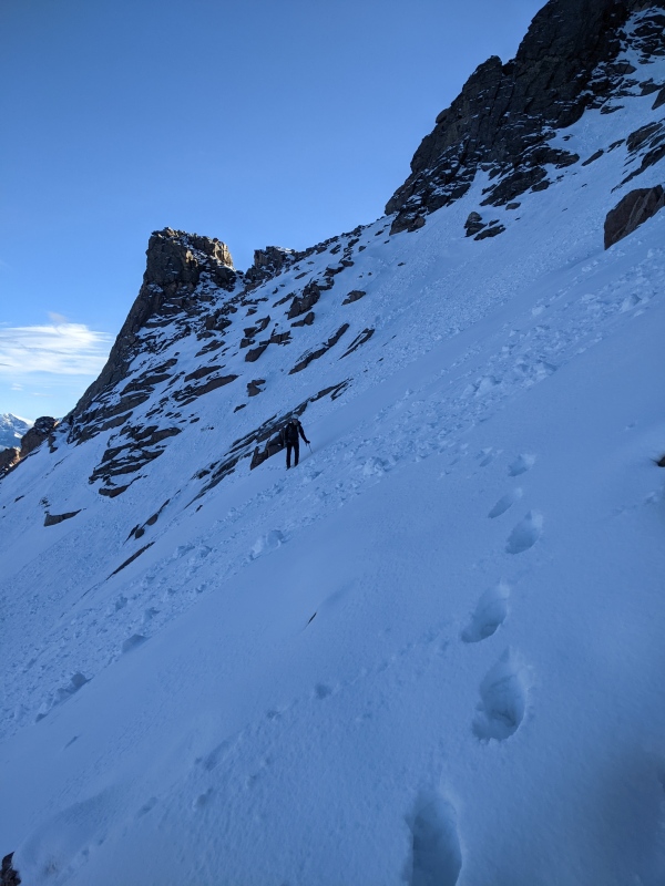
We started across the ledges, which weren't too bad, it just took a second to find the best route through the rockier sections. Sydney had crampon issues shortly across the ledges, but she was able to resolve them. It was just a matter of slowly negotiating the terrain features.
Ledges and trough, seen from keyholeNear the end of the ledges
The snow looks like a powdery, unconsolidated mess in some of these pictures, but it was actually quite tacky and nicely crampon-able. We made it across the ledges without too many issues and started up the trough. There was a fair amount of avalanche debris in the trough, but the current snow conditions seemed fine. Due to route limitations on the ledges, we entered the trough 100-200ft lower than the summer route.
View up the trough (taken on the descent)
The trough had some exhausting post-holing in places, but was simple enough to ascend. There should be a decent booter in place now, assuming new snow doesn't bury it too much.
Now for the main event: the narrows. The snowiness of the narrows are abundantly clear this year. We topped out on the trough to see this:
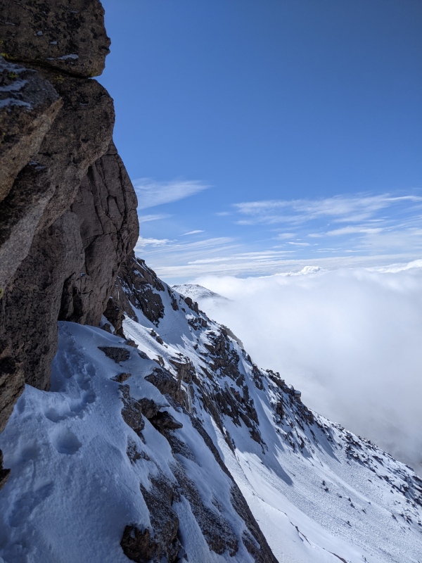
Pretty full-on view of the narrowsBeautiful views of the rest of the park from the top of the trough, with some nice cloud inversions
The narrows looked legit, and they were, but the snow was far more consolidated than these pictures would suggest. We made quick work of the first exposed walkway moves, and then slowed down for the snowfield traverse.
Starting out on the snowfieldI quickly switched to facing in to kick steps
This is definitely an exposed, slow-going no fall zone. However, the snow conditions were way better than expected. The snow was supportive, nicely crampon-able, and stable. Anything less, and we would've turned around here. The snow was also even better on the way back when the boot pack became a little more packed. Still, the traverse was most certainly heads-up.
This photo of us on the traverse was taken by Daway8, used in his peak condition report.
We took a quick break after rounding the arete at the end of the snowfield. I had no idea what the homestretch would look like with the snow conditions, but it ended up being a straightforward, moderate snow slope, with pretty deep new powder. It's in for skiing right now, all the way down to Keplinger's.
The homestretch (taken on descent). Note the roller balls
A few minutes later, we reached the unlikely summit, a few minutes before 9am
Summit with clouds rolling in all aroundFootsteps on the final stretch of the summit plateauLooking towards what I think is Mt. MeekerCloud inversions of this nature mean that it's time to go
We left the summit around 9:15, hoping to be across the narrows before getting shrouded in fog and clouds. At the bottom of the homestretch, we ran into David again, who recounted a challenging crossing of the narrows. He said that Cameron (the mystery headlamp behind us in the morning) had made it about halfway across the narrows before turning back. David explained that, in an effort to avoids a narrows crossing on the descent, he was planning on down-climbing the cables. We wished him good luck and continued to our dreaded narrows descent. The appearance of more roller balls on the homestretch made us nervous for the warming snow on the narrows, but we were able to descend them before the warmed up in any significant way, thankfully. The return trip was significantly easier with an established boot pack.
The narrows, after the return tripA closer look at the boot pack (we went to the lower ledge and then scrambled up the rocks on the ascent; not recommended)
With a sigh of relief, with began our descent down the trough, still in decent weather.
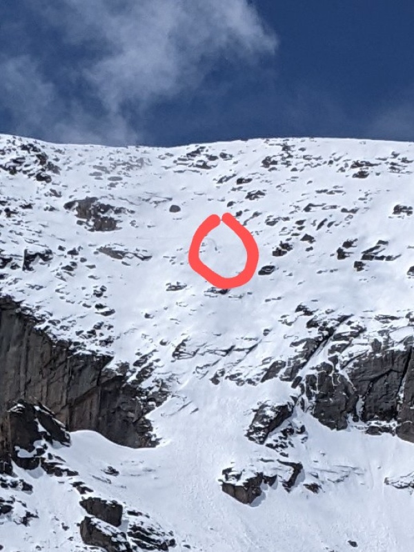
The crossing of the ledges was uneventful, except for when we heard what sounded like thunder. I turned to look west and noticed that it was not, in fact lightning, but a mountain sluffing off snow from the top of a distant cliff. It looked like a waterfall.
The snow fell from this cliff, into the basin below
We collected our stuff at the keyhole and descended the boulder field in very sloppy snow conditions.
A look at the cables on the descent of the boulder field
Eventually, we spotted David on the cables
A gnarly-looking down climb
We were very glad to read his condition report once we returned home, since that meant that he made it down safely. We continued through a scorching-hot boulder field, and down into the clouds. The clouds rolled in pretty fast, but thankfully weren't giving off much rain or snow, but still enough moisture to soak my hair on the hike down.
Some in the vicinity of Granite Pass on the descentBeautiful 360 views at Chasm Junction
This continued to a soggy, uneventful hike down.
An extremely spicy burrito in Lyons on the drive back concluded this full-on, very memorable, very beautiful day in the mountains.
Thumbnails for uploaded photos (click to open slideshow):
Looks like a great outing, and very impressive across the Narrows. I was looking at Longs from the summits of Taylor Peak and Powell Peak (in RMNP) a couple weeks ago and wondered how that route would be. Good luck in the San Juans and be safe out there!
You guys made it much much easier for me to get the summit this time - don't think I would have made it across the Narrows if you two hadn't put in such a nice bootpack just ahead of me! I just put up my own very much more wordy trip report of the same route up but with Cables descent (plus my own little bits of excitement!)
Narrows look exposed as ever---summer conditions are sketch but nothing compared to this. That first ten yards out of the trough is damn terrifying. Good job staying safe and getting a snowy summit. Y'all are beasts!
Caution: The information contained in this report may not be accurate and should not be the only resource used in preparation for your climb. Failure to have the necessary experience, physical conditioning, supplies or equipment can result in injury or death. 14ers.com and the author(s) of this report provide no warranties, either express or implied, that the information provided is accurate or reliable. By using the information provided, you agree to indemnify and hold harmless 14ers.com and the report author(s) with respect to any claims and demands against them, including any attorney fees and expenses. Please read the 14ers.com Safety and Disclaimer pages for more information.
Copyright: Route information, text, risk factors, maps, GPX files, charts, photos, 14ers.com-created map imagery, flythroughs, and other content provided in this route description are copyrighted by 14ers.com and may not be copied, reproduced, republished, distributed, modified, or used to create derivative works without prior written permission.
Please respect private property: 14ers.com supports the rights of private landowners to determine how and by whom their land will be used. In Colorado, it is your responsibility to determine if land is private and to obtain the appropriate permission before entering the property.