Download Agreement, Release, and Acknowledgement of Risk:
You (the person requesting this file download) fully understand mountain climbing ("Activity") involves risks and dangers of serious bodily injury, including permanent disability, paralysis, and death ("Risks") and you fully accept and assume all such risks and all responsibility for losses, costs, and damages you incur as a result of your participation in this Activity.
You acknowledge that information in the file you have chosen to download may not be accurate and may contain errors. You agree to assume all risks when using this information and agree to release and discharge 14ers.com, 14ers Inc. and the author(s) of such information (collectively, the "Released Parties").
You hereby discharge the Released Parties from all damages, actions, claims and liabilities of any nature, specifically including, but not limited to, damages, actions, claims and liabilities arising from or related to the negligence of the Released Parties. You further agree to indemnify, hold harmless and defend 14ers.com, 14ers Inc. and each of the other Released Parties from and against any loss, damage, liability and expense, including costs and attorney fees, incurred by 14ers.com, 14ers Inc. or any of the other Released Parties as a result of you using information provided on the 14ers.com or 14ers Inc. websites.
You have read this agreement, fully understand its terms and intend it to be a complete and unconditional release of all liability to the greatest extent allowed by law and agree that if any portion of this agreement is held to be invalid the balance, notwithstanding, shall continue in full force and effect.
By clicking "OK" you agree to these terms. If you DO NOT agree, click "Cancel"...
The east face of South Lookout has intrigued me for years, its craggy skyline intruding on the space above Ophir Pass if one chances to look that way from the highway north of Silverton. I had all but given up on it as a snow climb, because the direct lines are ephemeral and the most aesthetic couloir leads to a notch which must require unaesthetic shenanigans to negotiate.
On the heels of our latest, generous winter, dust and a sunny spell in April kickstarted the isothermic setup, but unsettled weather and new snow in early May put a damper on it, and conditions were a mixed bag by the time Amy and Steve rolled into town with a shortlist of Silverton-area objectives. Regardless, Kylie and I had a blast joining them for a couple preseason stairmaster sessions. So it was I found myself on V5 overlooking Paradise Basin, tracing with fresh enthusiasm unforeseen possibilities on South Lookout's east face.
Over the following week the team assembled. The criteria for inclusion: Must Wake Up This Early.
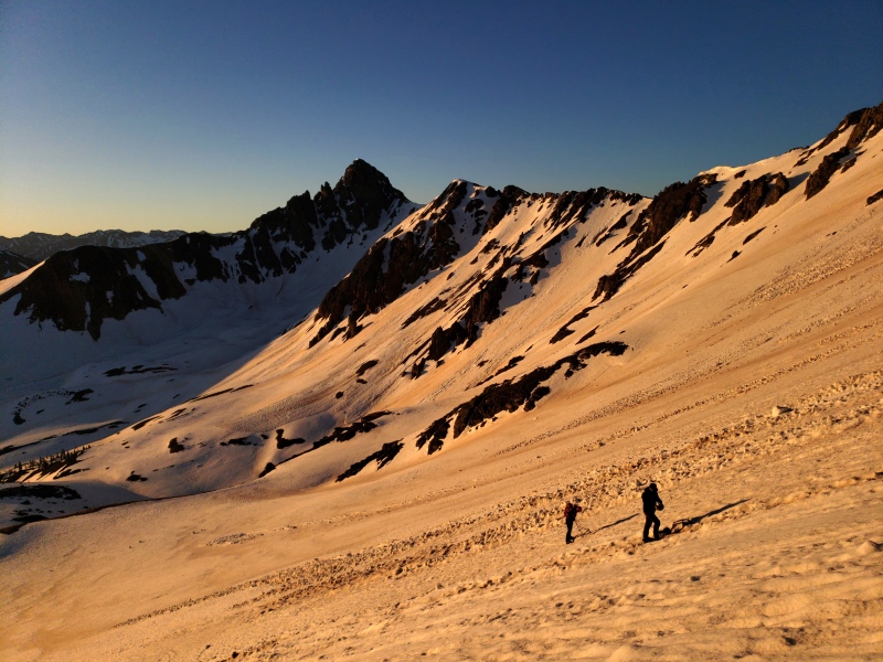
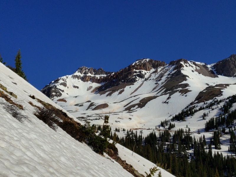
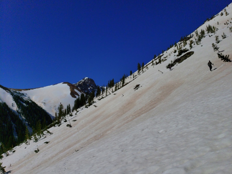
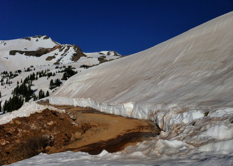
Amy and Kevin are the only takers. We rendezvous in Ridgway at three o'clock and haul over Red Mountain, up the Ophir Pass road to a switchback below the summit. In the summer a trail departs from here and follows the 11,400' contour south into Paradise Basin. Though we figure it will be snowed under, we hope to roughly track it in order to stay out of the trees.
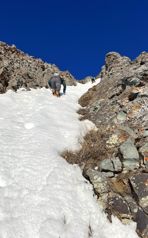
Snow conditions are inspiring, so we install crampons for the dark, mile-long sidehill, which affords the unexpected opportunity to dial in crampon fitment. Surgery is performed; the prognosis is terminal. Nevertheless we press on, round the hill into Paradise Basin at first light, and keeping north of the drainage, contour up to the bench at 12,000' where the thawing tarn is still buried under feet of snow.
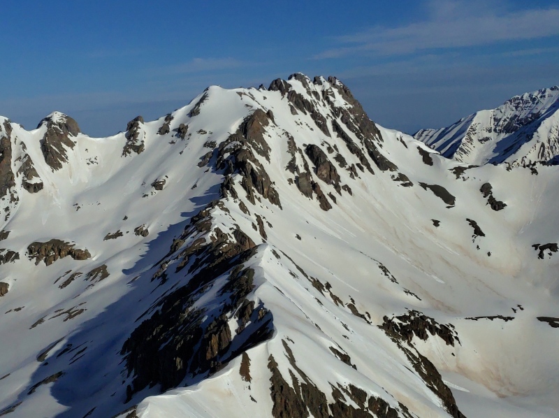
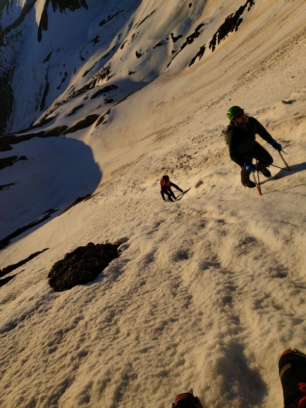
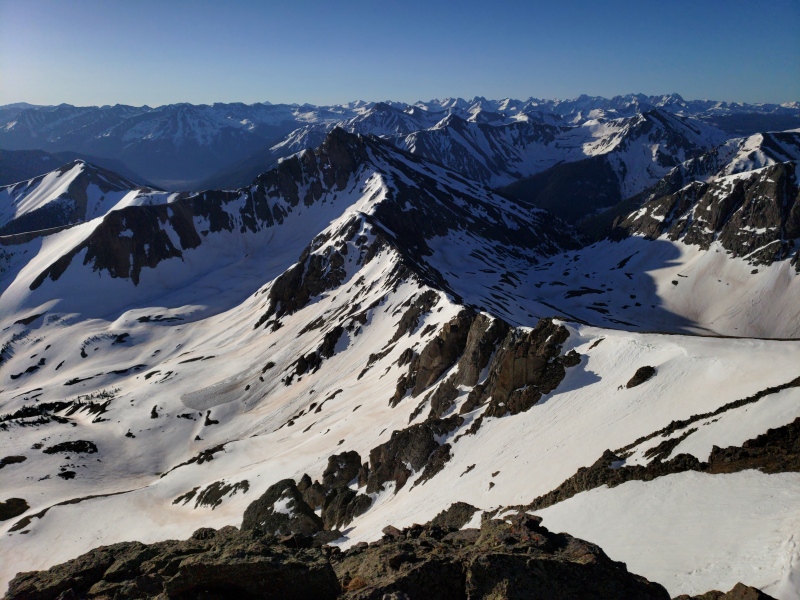
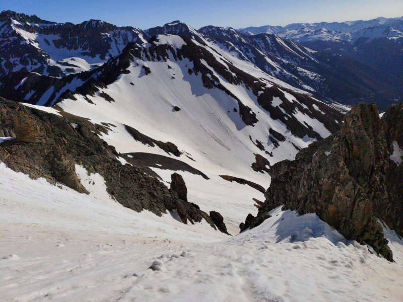
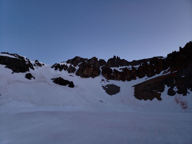
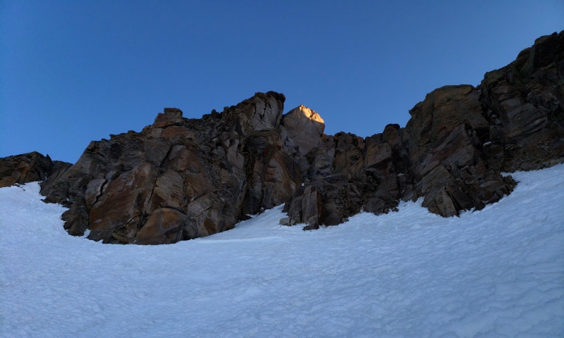
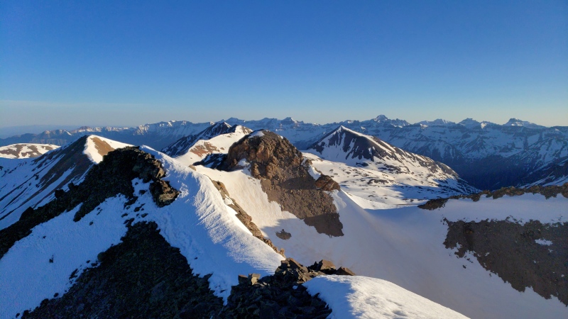
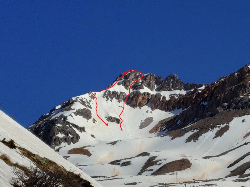
With the mountain in full view and shade draining from the parallel couloirs of its east face, it's encouraging to see no trace of rockfall at the bottom despite several days in full sun the week prior. The most direct line I saw from V5 has melted out at the summit, leaving a sad pile of choss exposed. We quickly decide to take the right branch to the top of the long dividing buttress and there cross to the leftmost finger (which we dub the "Pinky") of the left arm, aiming for a snowfield that should meet the ridge just south of the main summit.
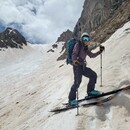
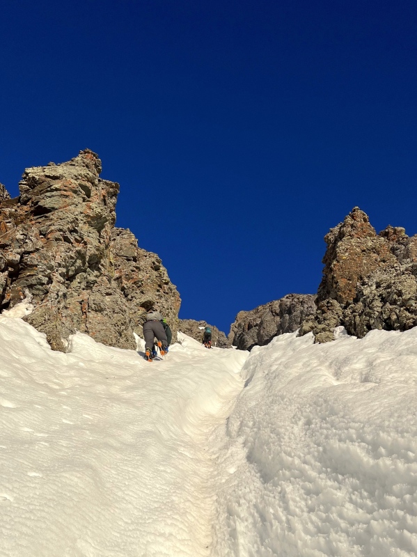
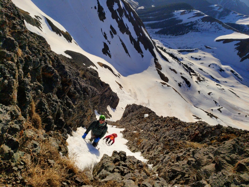
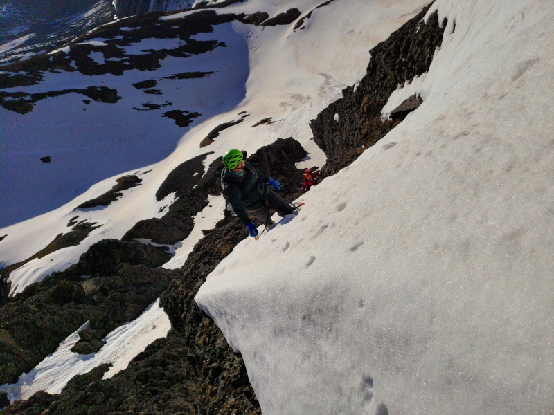
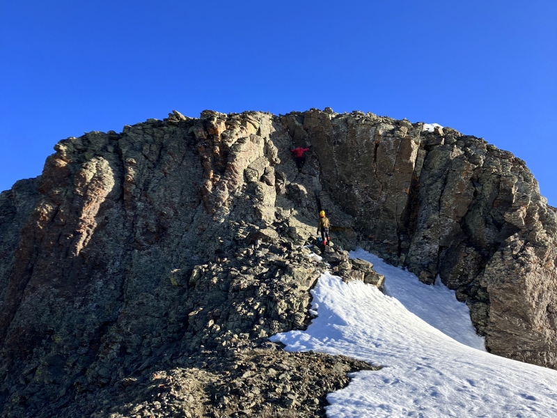
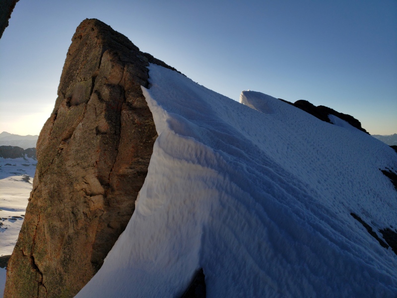
On fantastic snow we cruise up the apron and get into the business of the steepening couloir, bisected by a mostly shallow runnel, and after 400 feet we arrive at the comfortable apex of the cleaver to our left. The finger directly above appears to connect to the higher snowfield but--not liking the transition--we traverse over to scope the Pinky, hidden from our vantage point by a slanting rock fin. Wonderfully exposed to the couloir yawning beneath us, this narrow strip of warming snow leads to a reasonable-looking mixed transition to easier terrain. Sixty feet of pleasing steepness and a couple frozen fairy dust sticks yield to a snow arete on the right margin of the upper snowfield and relenting slopes to the ridge beyond.
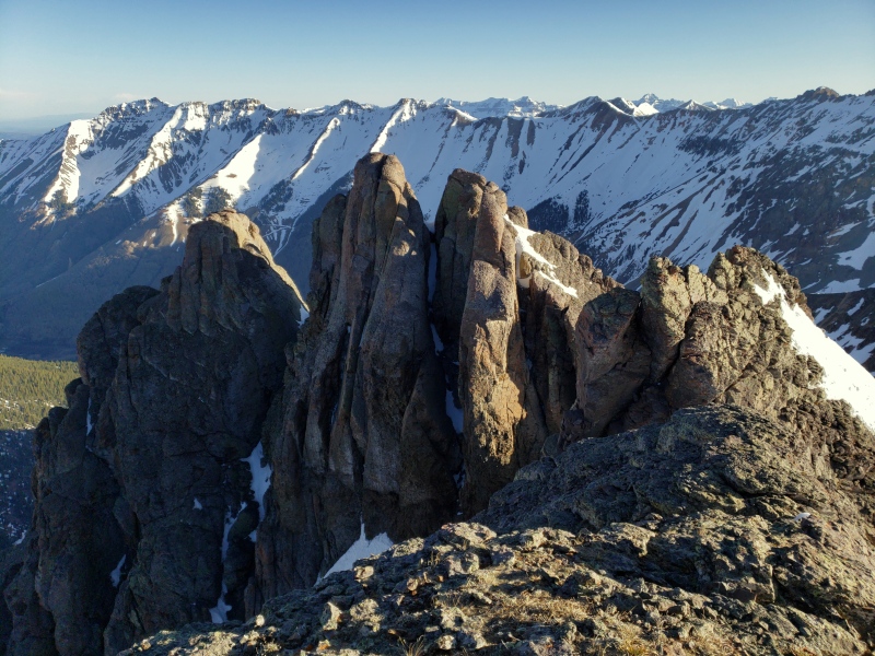
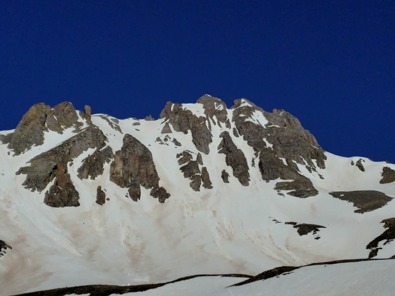
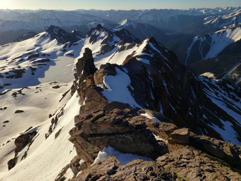
We stand on an island of snow encircled by cliffs, and it is at this moment I realize I have no specific recollection of our route up this peak many summers ago. The foreign-looking summit block lies to the north. Opposite, tall broken cliffs block passage to the mellow terrain of the south ridge. We first poke around to the south and east, searching for our escape, finding only marginal ledges I assume to be the weakness we used before.
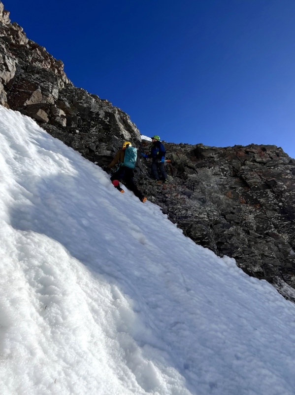
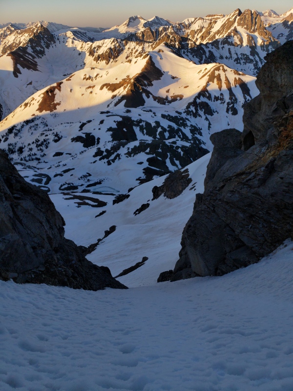
On to the slabby, outward-sloping dihedral to reach the summit. As is often the case it appears much easier up close. Regardless, the consequences of bungling this section are apparent: Fall onto snow, rocket off mountain, terminal velocity pancake. Amy and I enjoy scrambling what is perhaps the only 20 feet of solid rock within a mile, while Kevin naps in the sun. With a sense of urgency we steal glances at the rugged scenery, especially of the abrupt and probably temporal north summit, then return carefully below to work out the descent.
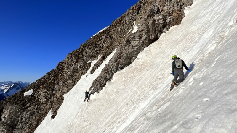
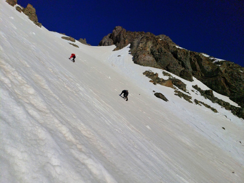
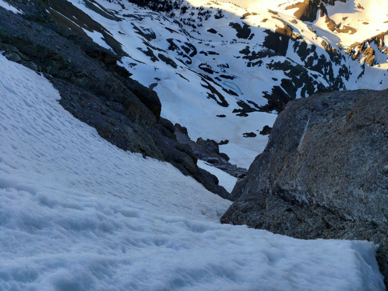
Without deliberation we downclimb the south edge of the snowfield and traverse onto the adjacent ledge, shallow and choked with the kind of rubble that feels so desperate under cramponed boots. It's not optimal. Later, Kevin says he "saw the other side." Scooting on our butts to the lip, we scrape our way down a bodylength of wobbly blocks and side-step gingerly to the sweet security of snow once more. By comparison the remaining 800-foot downclimb and glissade of the still-firm main east couloir is downright blithe.
We retrace our steps to the road, contemplating the marmot problem, music that old people listen to, and how South Lookout deserves its own name. We like Pico Cortada, if loosely synonymous with "broken" (a vast understatement), mainly because you're going to want some espresso.
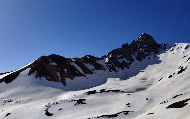
On the way out from South Lookout I noticed a couloir on the south face of its "big brother" across the gap and decided to check it out on my day off. Considering southern aspects will be shaded a bit later, I sleep an extra hour and leave Montrose at 3:15. Sometimes I think it's worth getting up at this hour just to have 550 to myself. With mothlike tenacity I follow the beam through the darkness and in a blink I'm there once again.
Avoiding the wet, muddy road, I wander up an unplowed road bed through the trees and cross the Ophir Pass road at an armor-clad utility pole 400 feet higher. I continue on firm snow up the undulating slopes of rock glaciers beneath the crumbling ridge that feeds them, startling a fox headed the same direction under dawning skies.
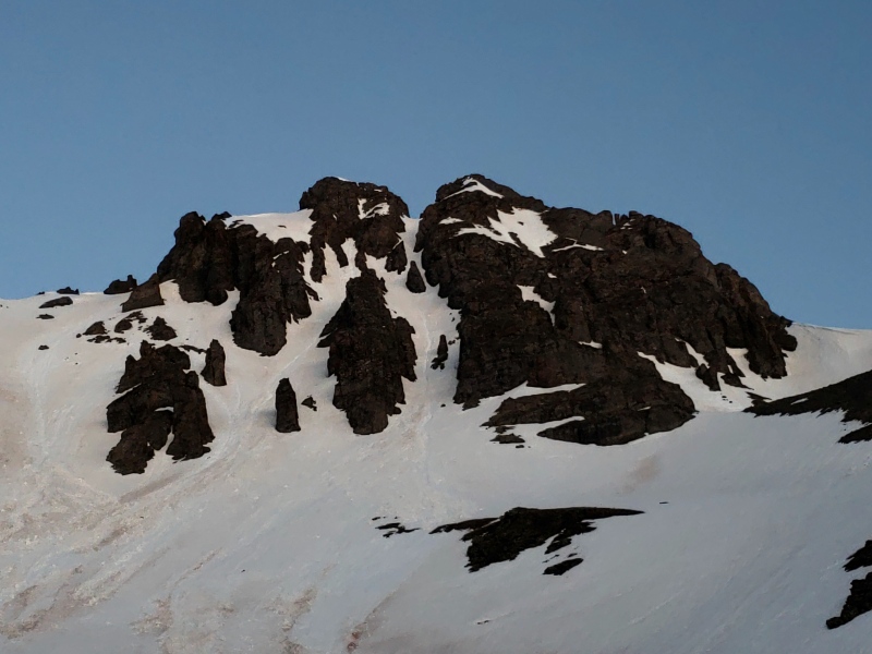
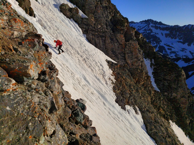
Soon I'm below my intended route and glad as before at the lack of rockfall evident in the debris from when this face shed the storm snow. I put on my crampons and start up the apron, veering right around an outcrop and then directly up towards the slot which breaks the cliffs here to offer smooth passage. A 12-inch crown below the gap indicates the snow from early May still lingers above this point, and it turns to a weak-freeze slurry. Now I'm booting. Still, I can't hope for better conditions (or any conditions, really) on a south face this time of year.
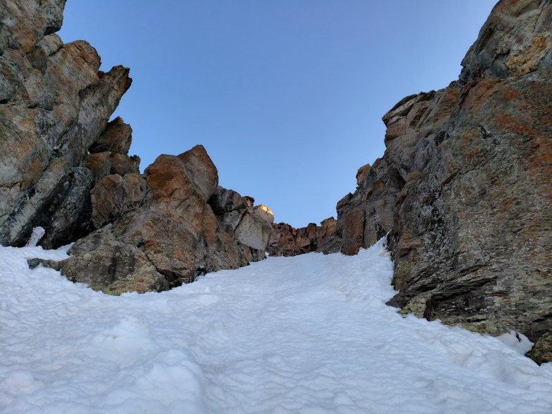
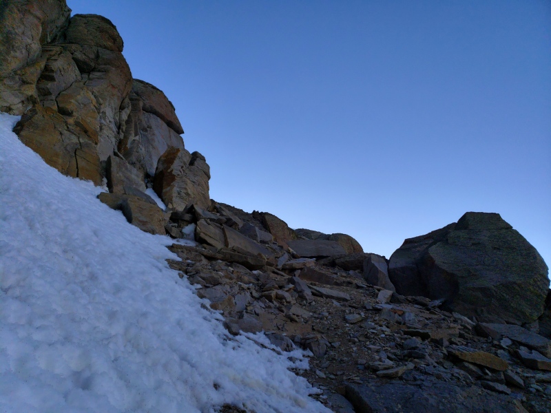
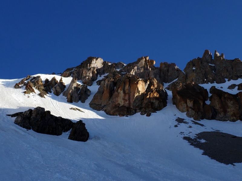
Up through a patch of junky snow and ice in the next constriction I climb towards a wall, knowing I'll turn right soon to access a higher snowfield, wondering if the rock section will be spicy. It isn't, but the snow turns to complete garbage before those few screeching steps through a jumble of boulders perched on the gravelly spur.
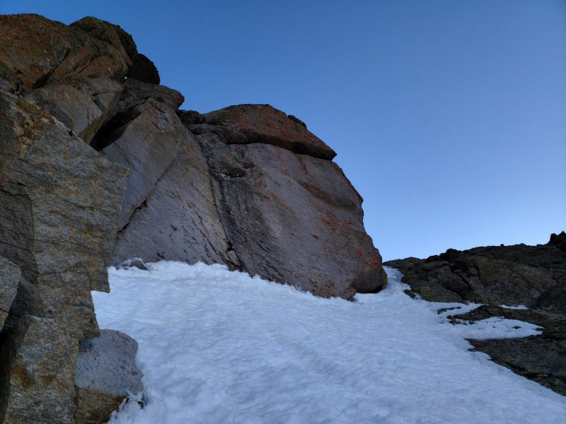
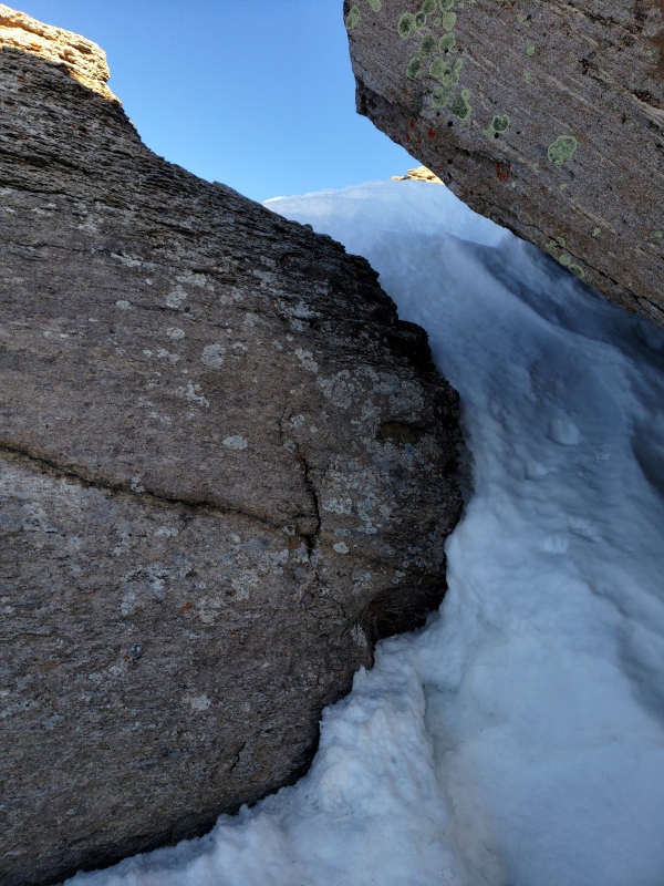
Beyond is a snowfield that should extend down from a prow on the ridge and at its apex, surprisingly, a blind corner guarded by a narrow chunk of ice. Brittle and bulging from a paper-thin, delaminated slab, the ice is mostly unusable but offers an awkward respite from rhythmic plunging. Now the blind crest is only a few meters up, and mounting concern that I am overhanging the east ridge fades as I pop up into a roomy pocket with a scenic window to the north. To my left a diagonal, snow-choked gap between two boulders promises an exit, and I duck through to sunshine on the ridge and a short walk to the summit.
I spend some time looking out and text Kylie my plan to descend the standard route. Though my recollection of the route we took years ago is nonexistent, this is a bicentennial and it's cairned as if there were more than one logical path down the south ridge. Thus filled with artificial confidence I pick my way down, trying to stay in the snow since I had decided to put my crampons back on.
400 feet below the summit, off the ridge to the left I notice a stout ramp leading back to the south bowl and opt to quit the ridge, facing in at first, then switchbacking broadly to save my burning quads. A handful of seat-scorching glissades on bulletproof snow lead back to the road and my truck, where I doze off wondering if I'll wake up here again tomorrow.
Thanks for reading.
Lookout south face
Lower couloir
Next constriction
Crossover
Blind corner
Blind corner from topout
In the pocket
Final passage
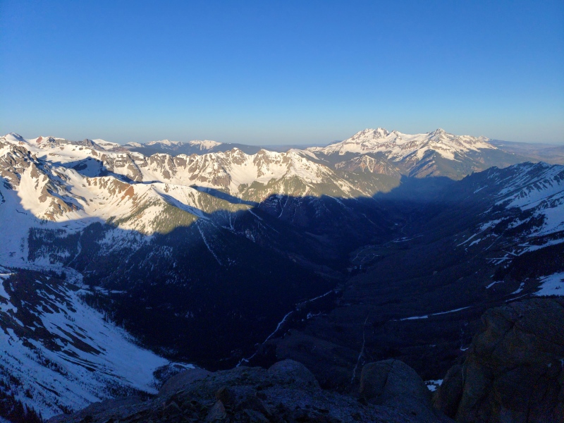
E ridge above Columbine Lake
View N
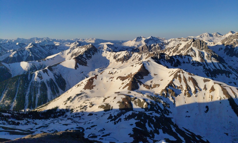
T12
Ophir
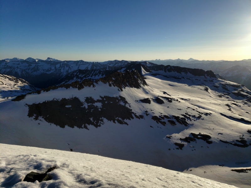
V5, Twin Sisters, S Lookout, etc.
Back in S bowl
Ophir Pass road
Route
Route notes:
South Lookout's east face is a fun climb with a short approach. Steep snow, maybe a couple moves of M1, and class 3 or 4 to the summit. Probably difficult to catch in decent shape for climbing. I would guess this or some variations have been skied. Probably the only way to ski continuously off the summit is by the line we originally intended to climb. The skinny couloir to the notch also seems eye-catching enough to have been plucked by now.
Lookout's south face is an engaging climb on mostly moderate snow and probably rarely any ice. The approach can be made extremely short once Ophir Pass is plowed (east side only), however the route may not exist by this point most years. It seems like it would ski decently in winter.
Thumbnails for uploaded photos (click to open slideshow):
I see the photos don't have their FIGURE formats. Have you lost the ability to edit the report, as in an error on the page or something? PM any details and I can take care of it. The upgrade to the new PHP version may be handling your image inserts differently that before and I would just need to know how you're doing it with the image "pool" (drag-n-drop or something else).
Nice work on that south lookout snow climb, after reading Ben's report that spicy snow climb is maybe a nicer option if you can line the conditions up perfectly
After full chipmunk mode, a term coined by Kevin, we were given the full chipmunk salute. This was a sign of a job well done. They knew they were in good company. And they said, "Knock 'em down. Turn it around. C'mon defense work!"
And you went out the next day?! I asked Kylie if you ever get tired. Guess what she said?
Amy I forgot about that! Were they in echelon? All that talk about chipmunks must have summoned them. I went out on Memorial Day. Felt like the next day.
Someone should take gear to that notch and see how the N side of the summit goes.
...your only trip report of 2023 was not the one snow climb I did in the last 4 years!
@blazintoes I'm all the tired for both of us haha
Caution: The information contained in this report may not be accurate and should not be the only resource used in preparation for your climb. Failure to have the necessary experience, physical conditioning, supplies or equipment can result in injury or death. 14ers.com and the author(s) of this report provide no warranties, either express or implied, that the information provided is accurate or reliable. By using the information provided, you agree to indemnify and hold harmless 14ers.com and the report author(s) with respect to any claims and demands against them, including any attorney fees and expenses. Please read the 14ers.com Safety and Disclaimer pages for more information.
Please respect private property: 14ers.com supports the rights of private landowners to determine how and by whom their land will be used. In Colorado, it is your responsibility to determine if land is private and to obtain the appropriate permission before entering the property.

")
")
")
")
")
")
")
")
")
")
")
")
")
")
")
")
")
")
")
")
")
")
")
")
")
")
")
")
")
")
")
")
")
")
")
")
")
")
")
")
")