Download Agreement, Release, and Acknowledgement of Risk:
You (the person requesting this file download) fully understand mountain climbing ("Activity") involves risks and dangers of serious bodily injury, including permanent disability, paralysis, and death ("Risks") and you fully accept and assume all such risks and all responsibility for losses, costs, and damages you incur as a result of your participation in this Activity.
You acknowledge that information in the file you have chosen to download may not be accurate and may contain errors. You agree to assume all risks when using this information and agree to release and discharge 14ers.com, 14ers Inc. and the author(s) of such information (collectively, the "Released Parties").
You hereby discharge the Released Parties from all damages, actions, claims and liabilities of any nature, specifically including, but not limited to, damages, actions, claims and liabilities arising from or related to the negligence of the Released Parties. You further agree to indemnify, hold harmless and defend 14ers.com, 14ers Inc. and each of the other Released Parties from and against any loss, damage, liability and expense, including costs and attorney fees, incurred by 14ers.com, 14ers Inc. or any of the other Released Parties as a result of you using information provided on the 14ers.com or 14ers Inc. websites.
You have read this agreement, fully understand its terms and intend it to be a complete and unconditional release of all liability to the greatest extent allowed by law and agree that if any portion of this agreement is held to be invalid the balance, notwithstanding, shall continue in full force and effect.
By clicking "OK" you agree to these terms. If you DO NOT agree, click "Cancel"...
Trailhead: Cheyenne Mtn State Park Route: Talon trail, then Dixon trail and Mountain Loop with Dragon's Backbone Loop Length: 18 miles Vertical: 4750 feet Partners: Solo
There is a lot of history associated with Cheyenne Mtn. Most recently, it has been the home for NORAD (North American Air Defense Command), but there is a lot more that occurred well before the 1950's. You can read about much of it here And you can read more about the NORAD facility in the mountain here
The facility was carved out of solid rock. While it is totally closed to the public now - and I think it has been since 911 - I had the good luck to tour the facility in the early 1990's. It was really something to see. Buildings on coil springs, an internal generator system that made more noise than the engines on the aircraft carrier I was on and the vault door that would seal the facility that weighs something like 25 tons but can be closed by as few as two people if necessary. My guess is that the balance and engineering of those doors is something else - especially since the technology is from the 1950's
Maybe that's why I have always been fascinated by Cheyenne Mtn. I was a kid in the 50's and when I started hiking up mountains in the early 60's, I guess Cheyenne Mtn was always on my list. And it took 60 years to satisfy that urge, but I FINALLY got it done.
It seemed that the best way to hike up Cheyenne Mtn was from Cheyenne Mtn State Park. Most of Colorado's state parks have well marked trails and Cheyenne Mtn SP is no different. The hike involves two major trails - the Talon and the Dixon. I should note here that the first time I went up Cheyenne, I did not do the Dragon's Backbone Spur. I was just running out of time, but I knew I would come back and get it - which I did on 26May2023. Most of the pictures in this report are from my first venture and obviously, any showing the Dragon's Backbone are from the second.
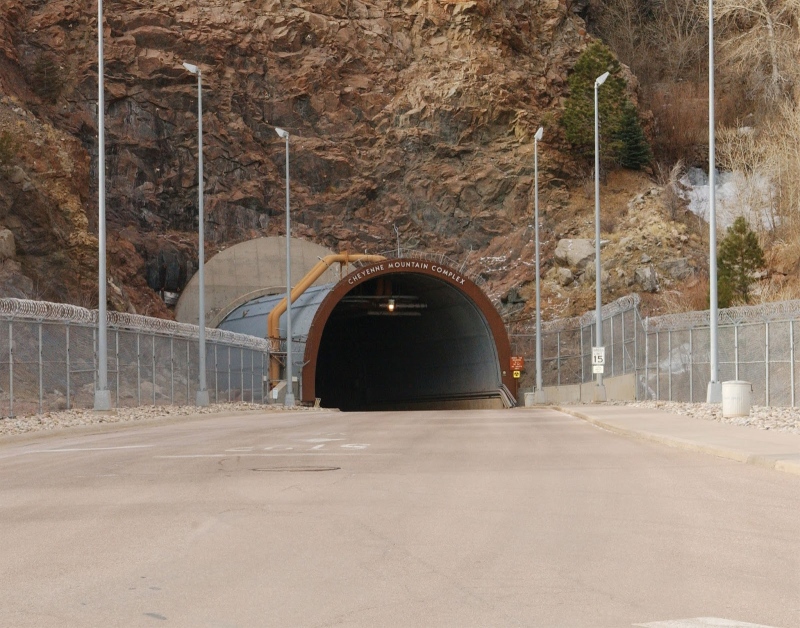
This is the actual north entrance to the complex You might also recognize the entrance from the Canadian made TV series Stargate SG1
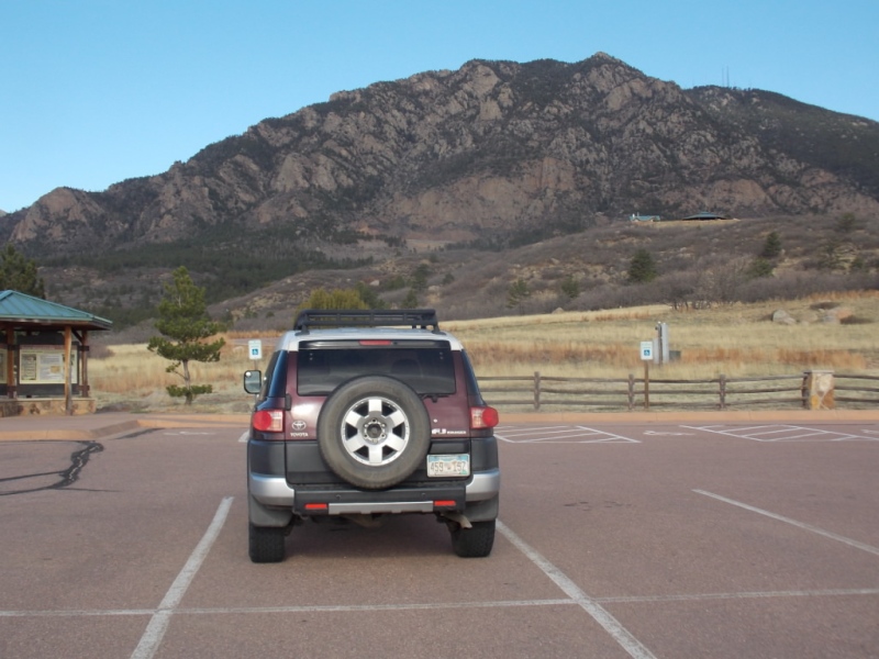
There is a large parking area that serves as the starting point for the hike. It is located off to the left not long after you pass the entrance gate to the park. Note - be sure you take the exit off CO115 marked Cheyenne Mtn State Park - NOT the one just north of it marked Cheyenne Mtn Space Force Station...
My FJ all alone in the parking lot.
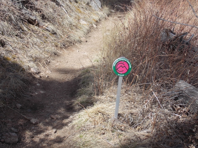
You start out on the Talon trail which is marked with yellow markers. A note about the trail marking system at the park - all trails are VERY well marked Some (like the Dixon) have mile markers and all are color coded. I think it would be pretty tough to get lost in this park but I imagine someone has managed it.
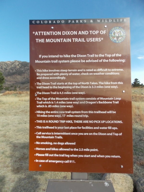
A warning sign just as you start out.
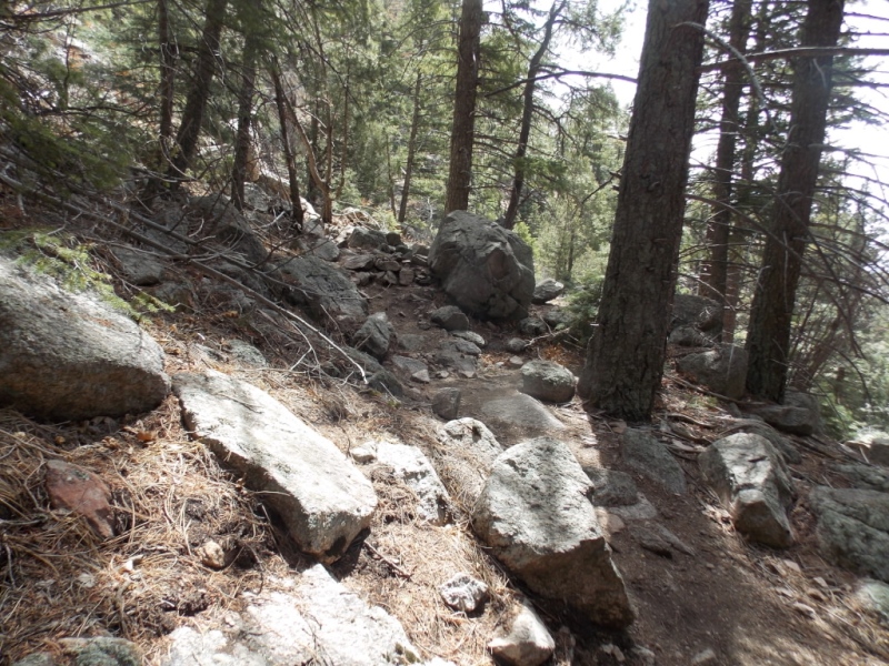
Typical views along the trail
After a couple easy miles on the Talon trail, you transition to the Dixon trail. From what I read, the Dixon trail hasn't been open all that long. While the Talon trail is a pretty easy bike route (I encountered several cyclists on my way down), the Dixon trail is a bit more challenging and is closed to bikes and horses at the 2.5 mile post.
Typical Dixon trail down low.
Views open up as you gain elevation.
And then you hit the end of the trail for bikes and honestly, the trail gets a lot more fun after this.
Typical trail beyond the 2.5 mile mark.
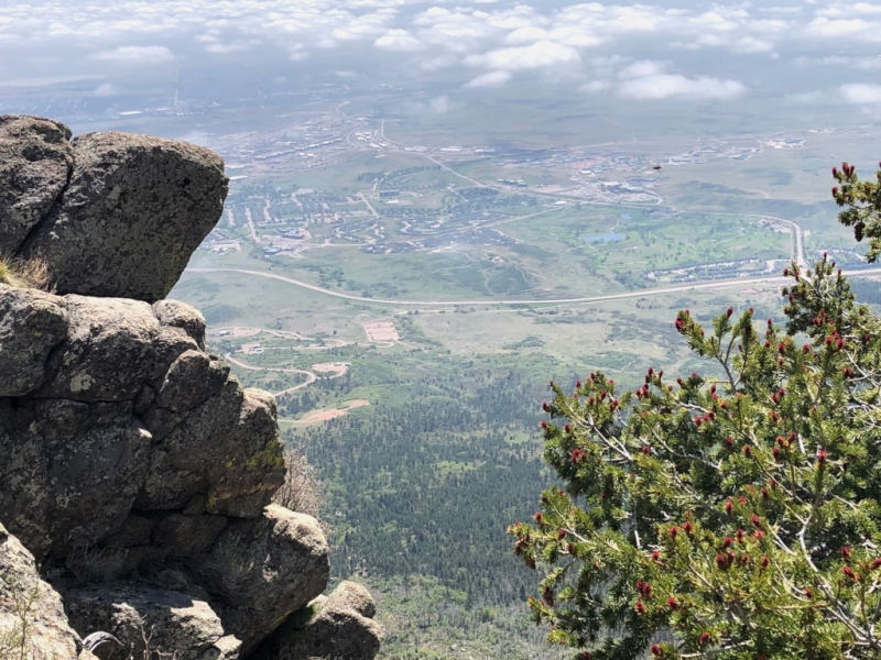
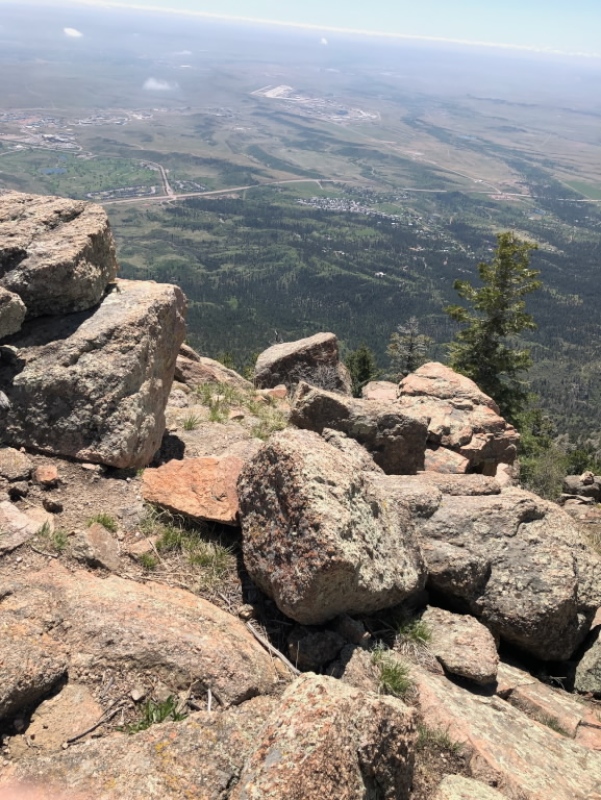
And the views keep getting better
Having been an air crewman while I was in the Navy, I am always interested - and respectful - of military crash sites and I paused to pay my respects at this one.
And the views continue...
There was actually some snow on the Dixon trail in late April. I was surprised to see it at such a low altitude.
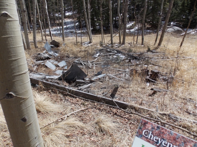
The Dixon trail ends at the Dixon Homestead site but continues on as the Mountain Loop trail.
Not much left of the cabin...
Cheyenne Mountain is also known for the Antenna Farm on the summit. The area is fenced off with No Trespassing signs
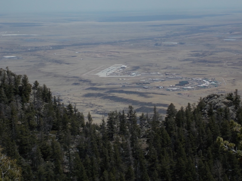
On my way around the Mountain Loop trail, I stopped for some lunch with this as my view.
I think that is Peterson Field??
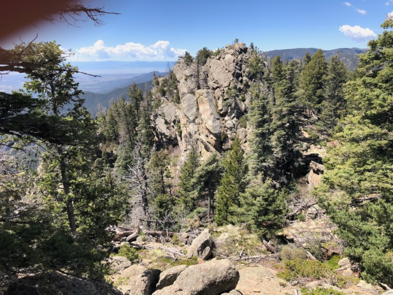
As I stated earlier, I didn't do the Dragon's Backbone loop on my first trip up, but did catch it later. The following pictures were taken on that trip. BTW - I highly recommend doing this loop. There is a little exposure (very little, actually) and some easy scrambling possibilities along the way. Route finding - while not as easy as the other trails I mentioned - is still straight forward with cairns and markers to help.
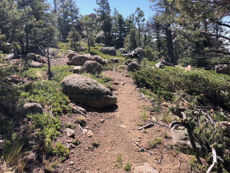
The start of the Dragon's Backbone trail.A little exposure...
Views along the backbone.
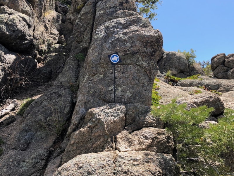
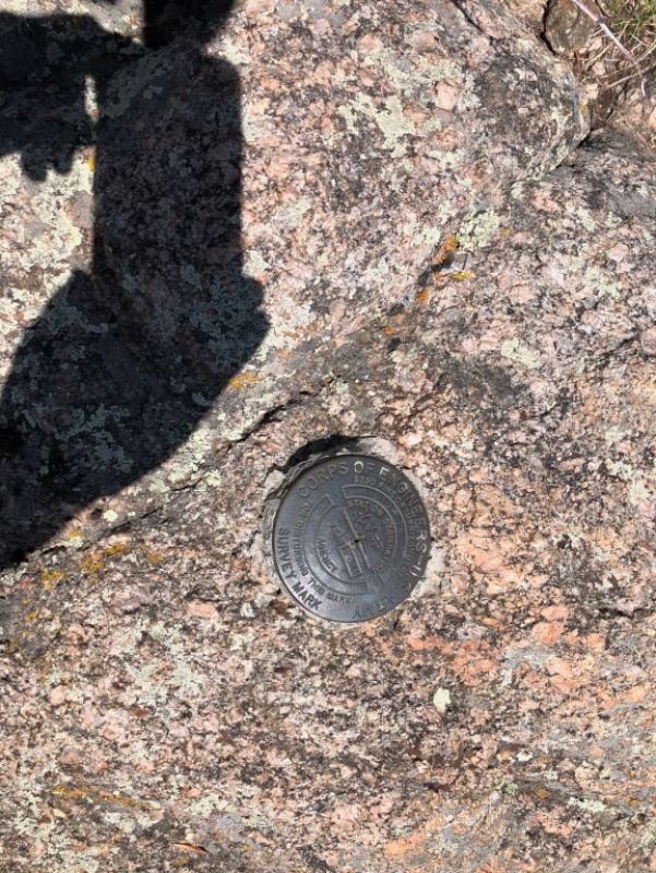
Robbers Roost - the highpoint of the backbone, I believe.And the occasional arrow to guide you when the trail isn't obvious.Robbers Roost benchmark.And the view from that benchmark.
And a short vid... I have no idea why I called it "background" rather than "backbone"... Guess I'm getting old...
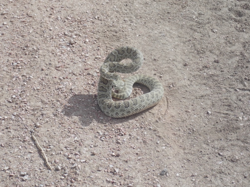
And then there was this... Spotted it in the middle of the trail very close to the trailhead on my way out on my first trek. The moral of the story is that sometimes the view one should look at on an easy trail is the trail.
Yikes! A western diamond back rattlesnake!
A couple notes about this hike - I've included a couple Strava links below - one for my first trip up and one from just the Dragon's Backbone loop. As you will see, it's a long day. Someone with better biking skills than I have (which means almost everybody...) can make this a lot easier by riding most of the trail. I chose to walk the whole thing the first time and took my bike the second time but only made it up the route a little over a mile where I decided I could walk faster and with less effort. Also, this can be a hot, dry hike so take water!
Great report, Jay. Why is it that rattlesnakes always seem to take a break in the middle of a trail?? My closest snake encounter was with a lounging monster snake (maybe a foot circumference and 25' long...;-) ha, ha...seemed like it, anyway) in the middle of a trail. Maybe the park needs to put trail markers at snake eye level, "Don't lounge in the middle of the trail"?? Thanks for posting this.
Erika - Yeah - like I said, it was on my list for decades. Turned out to be a lotta fun - albeit a long day.
Amy - Well... Let's just say that in my younger days, I was very, very naughty, but now that I have aged some (or a lot...), I'm just getting better at hiding it? :-) Nice reference to the annual NORAD tracking Santa Claus. I had forgotten all about that...
Tom - Yeah - snakes... I'm not really afraid of them but I didn't see that one until the last minute - about the time I heard the rattle. Probably because I was too busy looking at the scenery and not at the trail so it did give me a bit of a pause... Lesson learned... I hope...
All - thanks for your nice comments. Much appreciated!!!
When I first arrived in Colorado Springs 2.5 years ago, my first goal was to climb all the most prominent peaks visible from Colorado Springs. This was either my second or 3rd, too lazy to look it up. I did this in January 2021. There was snow but only between the Devils backbone and the main summit do I recall any snow that was deep enough to impede progress. No snakes on my hike, fortunately. The only time I ran into a snake hiking was descending the Tongue Range at Lake George, NY. Similar story, it was just sunning itself on the trail as I bounded down the trail. I saw it in time, mostly because it did rattle at me in warning. So I went WAY around it. Long hike but mostly on very good trail, as I recall. Thanks again.
Thanks, man!! It's great to hear from you! Hope all is well. And yeah, my FJ is still going strong - 256K miles on and still no real maintenance beyond the normal stuff.
I logged in to read, like and comment on this 6/7/2023 12:29pm
This is one of your best TR's, Jay.
You do a great job taking the reader along (like Matt says)
Like the history, the informative plaques, sad to see the plane wreckage.
Interesting tidbit on the Frog Leg King.
This looks like a great hike, perhaps best for shoulder season.
I'll refer to this when I'm ready to tackle it.
Thanks! :-)
Had the chance to work there recently after visiting some of the army bunkers on Vis in former Yugoslavia. Interestingly enough, the layouts were the same albeit on a grander scale. Designed to take a bombing for sure. The tunnel support in there has an insane safety factor, not withstanding the giant coils.
Ryan - Thanks for your observations about the facility. My memory is a little hazy as it was 30 years ago when I was there but I imagine the internal structure hasn't changed much since then. Cool that you got to do some work there - not many people can say that.
Caution: The information contained in this report may not be accurate and should not be the only resource used in preparation for your climb. Failure to have the necessary experience, physical conditioning, supplies or equipment can result in injury or death. 14ers.com and the author(s) of this report provide no warranties, either express or implied, that the information provided is accurate or reliable. By using the information provided, you agree to indemnify and hold harmless 14ers.com and the report author(s) with respect to any claims and demands against them, including any attorney fees and expenses. Please read the 14ers.com Safety and Disclaimer pages for more information.
Please respect private property: 14ers.com supports the rights of private landowners to determine how and by whom their land will be used. In Colorado, it is your responsibility to determine if land is private and to obtain the appropriate permission before entering the property.


")
")
")
")
")
")
")
")
")
")
")
")
")
")
")
")
")
")
")
")
")
")
")
")
")
")
")
")
")
")
")
")
")


