| Report Type | Full |
| Peak(s) |
Hagerman Peak - 13,848 feet |
| Date Posted | 05/30/2023 |
| Date Climbed | 05/28/2023 |
| Author | kyrawhitworth |
| Additional Members | RyanOlsonDDS |
| Spring snow on Hagerman |
|---|
|
Spring Snow on Hagerman: An Elks Centennial Peak Adventure Quick Stats: Two people, 13.9 miles, 4,750 feet (it seemed like so much more vert than this!) Preface: Personally, the rock in the Elks scares me. The looseness, the choss, the crumbly mess, no thank you. Hence, when we realized we had "only" two Elk centennial peaks left I decided to look into Hagerman. We had seen it from Snowmass a few years back on a memorial day weekend and I figured that it would likely be a similar climb to Snowmass if there was a snow route. The S face seemed very doable and with the record snowpack we thought--hey maybe we can even bring skis! I was able to book a Geneva Lake spot for memorial day so things seemed to be pretty set. We chatted with some folks who had done Hagerman before in June to get an idea of how it went and I read through every trip report I could find. We called off-roading companies and found that past Crystal, the road was not drivable due to "2-3 feet of consistent snow" and that Lizard lake had flooded onto the road so clearance was needed. All good we thought. We had everything packed up and ready to go and were ready for the weekend adventure. We downloaded multiple gpx files as we knew a lot of navigation would occur over snow and in the dark. Day 1: We left Loveland at 2:30am to beat any holiday traffic. The drive was smooth and we stopped at Crystal Mill to take some photos in the morning light. Lizard Lake was indeed flooded but there was no issue for my husband, Ryan, driving the FJ. We made it Crystal and the road was dry as far as we could see so we kept driving. We were only able to drive another 0.5 miles until the road was impassible due to snow. We turned around and were able to park far enough so that another car could turn around there too. There is an excellent campsite before where we stopped marked on the climb13ers gpx file. We ate some food and grabbed our gear. It was 7:45 and the snow on that first stretch of road was HARD. It was slanted enough that honestly it was a little spooky with the river raging below. We carried skis over this section. You can actually see Hagerman towering in the distance. 
Shortly after this we were on better ground with snow so we decided to put on skis. We hoped there would be consistent snow coverage from this point (lol). No--it was very patchy. Snow and then dirt, dirt, water, and then snow. The road went from patchy to patchier. We ended up carrying our skis for about half of the way to the Lead King Basin 4WD TH. Not awesome to have a heavy pack plus skis on the pack we learned. Snow bridges over the stream crossings held for us on the way up so our feet stayed dry at least. 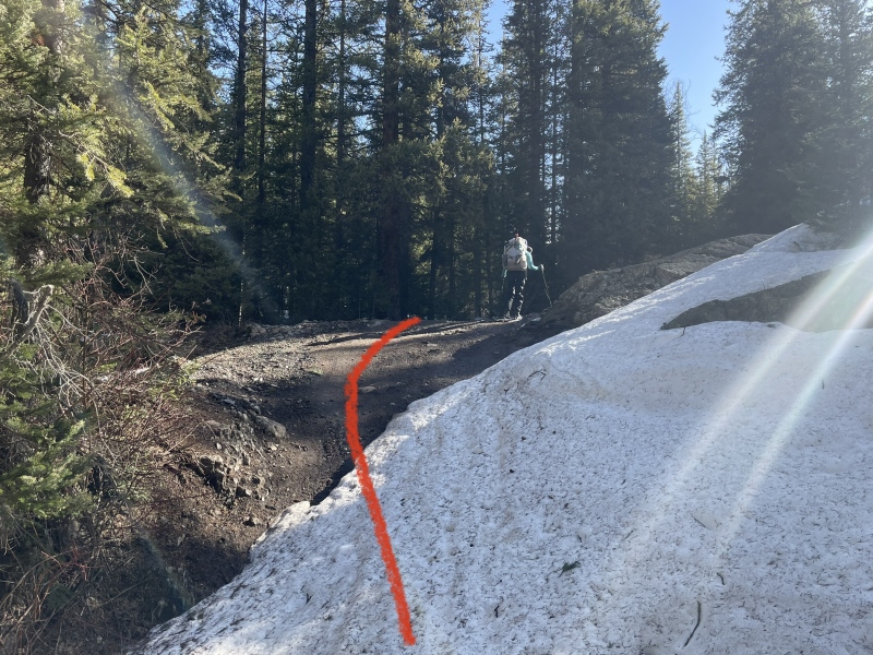
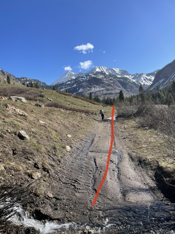
There was a cool dude in a cabin just after the bridge crossing before the 4WD TH for Lead King Basin. If anyone knows his story, let me know! Once past the 4WD TH, you continue on some flat terrain until you being to switchback next to the waterfall and up towards Geneva Lake. This was a ton of side stepping so we couldn't put skis back on despite the snow being more consistent at this point. You get your first good view of the bells from here. 
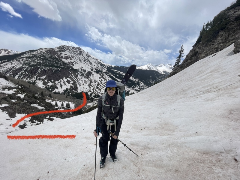
Once you cross over below some cliff bands and running water, you climb steeply towards the lake. We skinned a little bit but once the lake came into view it was clear we'd be sidestepping again so we carried skis halfway around the lake. At this point, Snowmass and Hagerman clearly come into view. 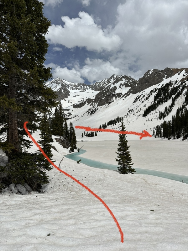
There was a supportive snow bridge at the far side of the lake that allowed for easy crossing. We set up camp and relaxed for the rest of the day admiring the stellar view of Snowmass. We got there around 12:45pm. You can clearly see the S ridge and W slopes. We had a faint hope that someone else might be up there but we were totally alone. It's always a bit eerie for me knowing you're way out somewhere and it's just us. We set our alarm for 2am. Although I had inflated my brand new pad at home to make sure it was good to go, it died on me. So I was freezing cold feeling the snow beneath me in the tent. I don't sleep well to begin with so a zero sleep night for me was rough. 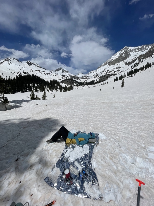
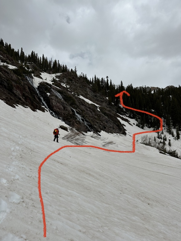
Day 2: We put on our clothes and gear and took a bit of time just getting everything together before heading out. We had buried the bear can in the snow so we had to dig it out and struggle to open it to get some of our food. Our waters were cold but thankfully didn't freeze. It felt below freezing in the night but I run pretty cold. We put on skis hoping we could skin up to the gully since snow was so consistent. Going through the trees was honestly very confusing in the darkness and snow. We relied heavily on the gpx tracks that we had downloaded checking every few minutes to make sure we were on route still (not a good idea to rely blindly on a gpx track but sometimes you don't have much choice). Side stepping again became too difficult in the hard snow on skis so we carried skis for a bit. The small lake mentioned in other reports was frozen solid. Once you finally exit the trees to connect with a trail junction for four pass loop and north fork, things open up dramatically. We followed a drainage and angled up towards where we'd head up Hagerman. It was pretty tiring getting up this section and it just seemed steeper than it looked. 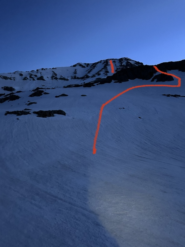
There's a small cliff band you have to climb up and for us there was only a small amount of rock to go over. We dropped our skis before this point as we determined it would be too steep and tiring to carry skis up the gully. The bells came into view at this point so views were stellar. We angled up towards the S face and started up the gully. 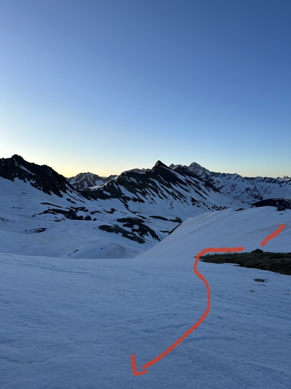
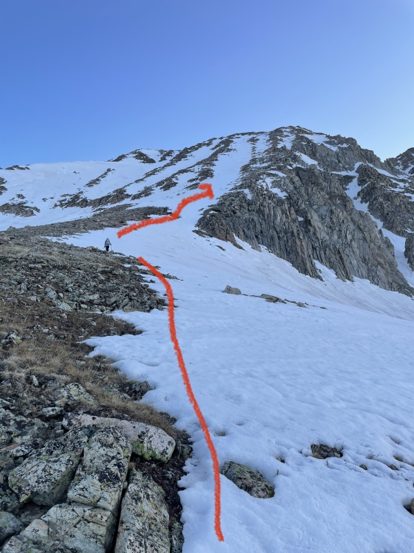
Sun had risen at this point but the gully itself would not get sun for a while (about 7:45am was when it got sun). The snow was hard so crampons and axe it was. I am telling you that the photos do not do the steepness justice. It felt so so much steeper than it looked. We were very cautious with our footing as with hard snow it would be pretty difficult to self arrest. I stayed on the snow as I was pretty ok zig zagging back and forth. Ryan decided to head up more on the rocks which was slower going but he was more comfortable there. It was slow and careful going. The gully seems short when you first look up at it. It is not. The adjacent gully had evidence of a slide and there were some old looking rollers so we tried to pace as best we could to avoid going down when things got soft enough to potentially be weird. 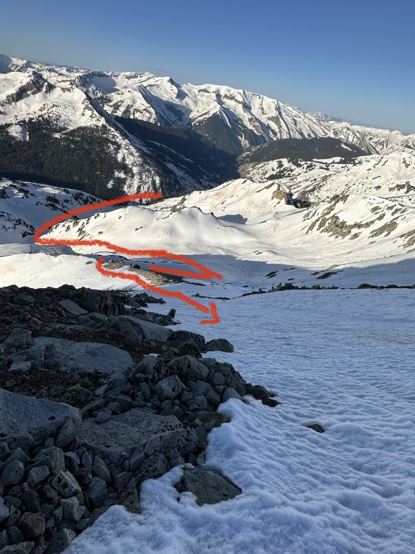
At last we popped out on the ridge and the rest of the route comes into view along with panoramic views of the Elks. There was a massive terrifying cornice on the ridge but it was very apparent on where to not step. 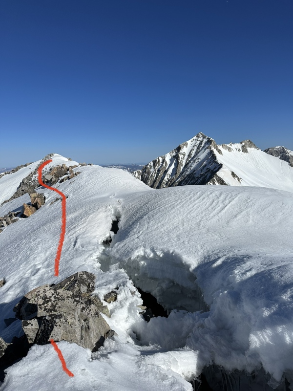
There were a few spots of going down/up rocks in crampons which caused us both to snag our pants and tear them. Ryan's tore completely open and so he had to step very slowly to not catch them on anything until we got to the summit. 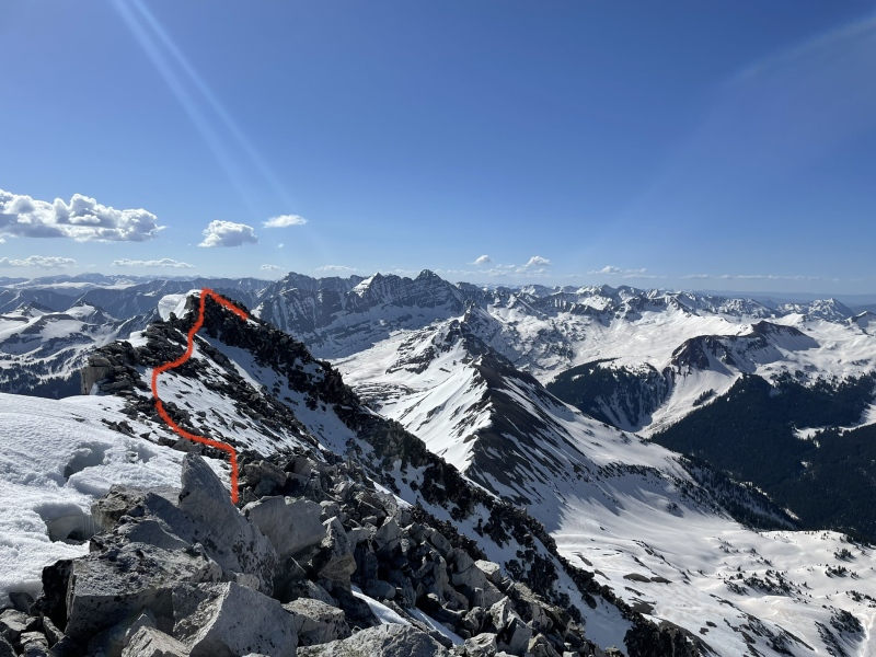
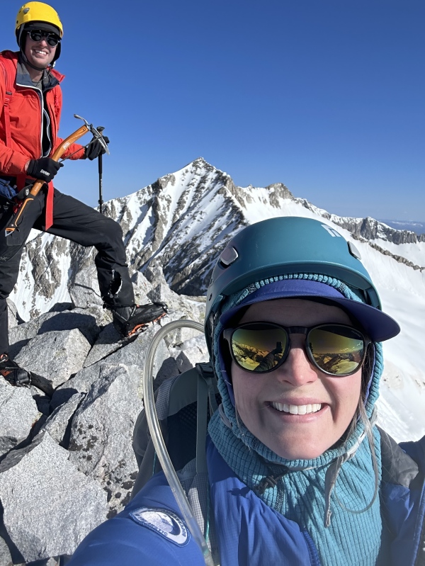
From the summit you are rewarded with stellar views of the Elks and beyond. We summitted at 8:30am. We could see lots of groups on Snowmass and their glissade down looked so nice. It's funny how visible the summit white rock block on Snowmass is. We sat on the summit for a bit letting the snow soften up. There was no wind, clear skis, and Ryan even had cell service. We both agreed that these were the best summit views of any peak we'd done to date. Something about views in the Elks are just special (maybe because they are all hard earned). We decided to descend the exact same way we came up. We knew we had a long day ahead but honestly didn't realize how long. We carefully navigated back along the ridge and headed down the gully. The snow had softened up enough but wasn't slush at all so it seemed good/safe enough. I still zig zagged a lot because I was a bit worried about slipping. I kept thinking the grade would lessen and I would comfortably glissade but the snow was a touch too hard to do so. 
We came down the same cliff band as when we came up. We glissaded a bit here and we were excited to pick our skis back up. The snow was perfectly soft but not mashed potatoes yet so we knew we could ski a decent portion back to camp. 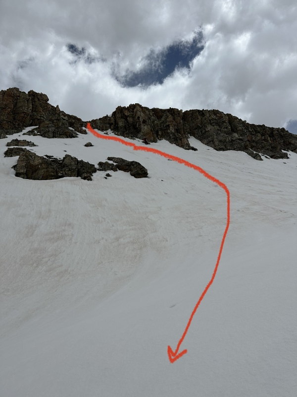
We put our skis back on and really enjoyed skiing down the drainage to the trail intersection. Soft nice gentle turns. 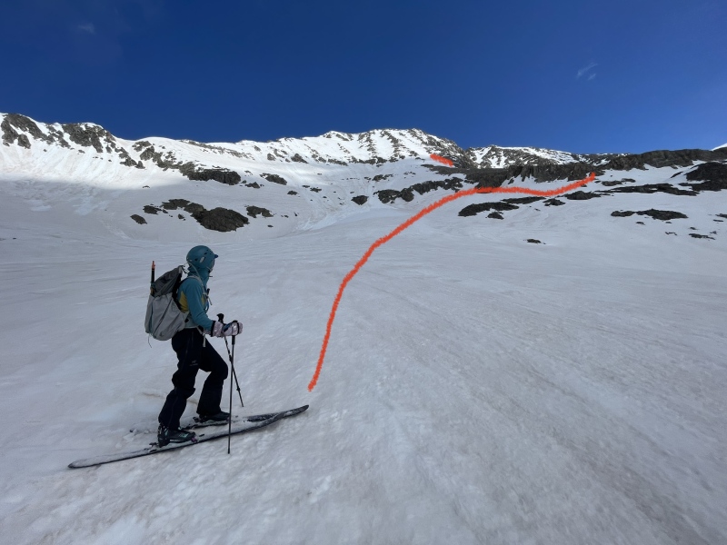
We were able to ski all the way back to camp (with some scooting). Amazing how much easier it is to navigate in the daylight! 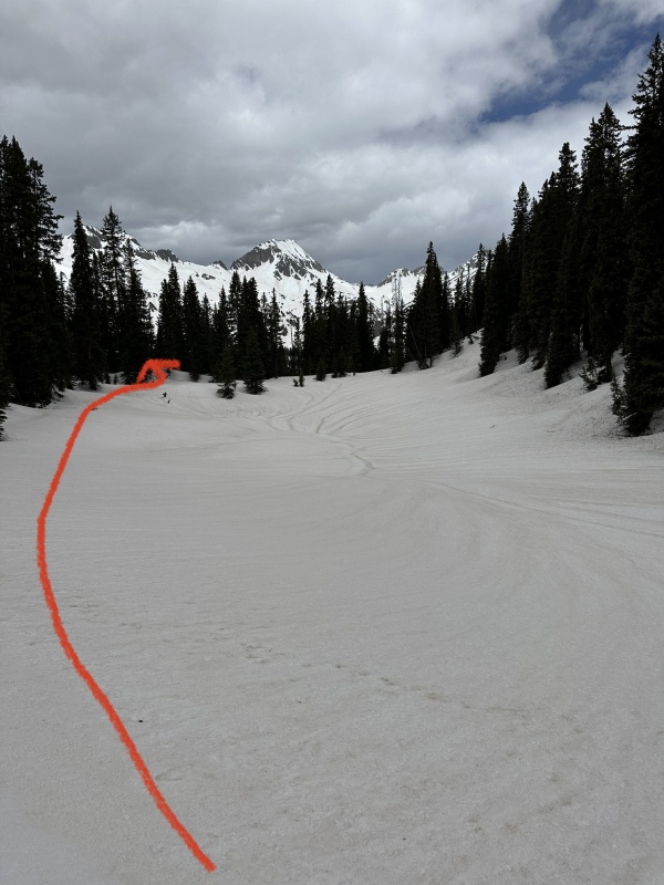
We packed up camp, drank a Four Loko because Ryan is a Four Loko "athlete" (they sent us a swag box for posting summit photos so here we are). We got moving again around 2pm. Snow was very soft at this point but still pretty supportive. We skinned small bit around the lake and then put skis back on packs (and by packs I mean Ryan carried both sets of skis because it was such a nightmare trying to put the skis on my pack). The side stepping on the slope headed down into the basin was truly a nightmare this time around. We ended up taking a more direct line to catch the north fork trail because it was easier to just go straight down and fight willows than side step soft snow with giant packs. Once back on the road, the terrain was much more gentle. I honestly should have switch into my trail runners but I had no way to put my ski boots on my pack. We were both fading. I took my skis back from Ryan after we got to the Lead King Basin 4WD TH. 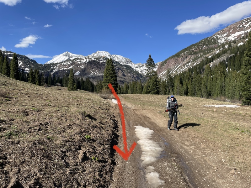
The last section along the road back to the car was better with the softer snow at least. We arrived back to the car at 6:30pm. I am very thankful that my ski boots are as flexible as they are because hiking nearly 14 miles RT in them was not fun for my feet. We drove directly to the Slow Groovin(?) BBQ place other trip reports mentioned in Marble. Oh my god it was so good (and not just because we were damaged). We stayed near Redstone (stopped to look at the coke ovens on the way there-neat!) and slept very well. Closing thoughts: We should have brought snowshoes instead of skis. We really thought we'd be able to skin much of the road and it made it pretty taxing that we had to carry them instead. I still think this route as a snow route is better than alternative options but I truly have issues with the looseness that is the Elks. That being said going later in June where you aren't camping on the snow and can drive to the 4WD TH is likely a more comfortable option. This was more difficult than Snowmass and we determined that it was the most difficult peak that we had done so far. A larger group would have been nice because it's often hard to keep morale up with just two people (and one of them being me the pessimist). Ryan is seriously the best partner one could ever hope for (I hear he's a pretty good dentist too so if you need one in Noco...). I would say that it can be done in a day from the LKB TH but the views from camp at Geneva Lake were so incredible that it might be worth the pack in just to have those moments. I'm sorry I don't have more photos of navigating through the trees up to the trail intersection which was the weirdest part in terms of trying to figure out where to go. Feel free to reach out to me on Instagram (@kawaii.kyra) if you have more questions! I do check messages on here as well just not as often. Best of luck to those reading this who are looking to summit this peak! Thumbnails for uploaded photos (click to open slideshow): ")
")
")
")
")
")
")
")
")
")
")
")
")
")
")
")
")
")
")
")
|
| Comments or Questions | |||
|---|---|---|---|
|
Caution: The information contained in this report may not be accurate and should not be the only resource used in preparation for your climb. Failure to have the necessary experience, physical conditioning, supplies or equipment can result in injury or death. 14ers.com and the author(s) of this report provide no warranties, either express or implied, that the information provided is accurate or reliable. By using the information provided, you agree to indemnify and hold harmless 14ers.com and the report author(s) with respect to any claims and demands against them, including any attorney fees and expenses. Please read the 14ers.com Safety and Disclaimer pages for more information.
Please respect private property: 14ers.com supports the rights of private landowners to determine how and by whom their land will be used. In Colorado, it is your responsibility to determine if land is private and to obtain the appropriate permission before entering the property.


