| Report Type | Full |
| Peak(s) |
"South Wilson" - 14,105 feet |
| Date Posted | 05/24/2023 |
| Date Climbed | 05/19/2023 |
| Author | daway8 |
| Additional Members | Ssgustafson |
| South Wilson Spring Climb |
|---|
|
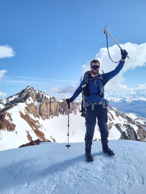
South Wilson may be "only" a 14er sub-summit to some but in the words of my climbing partner upon reaching the summit "that was a total butt-kicker." This is a formidable peak in a remote and beautiful setting. Since the sub-summits don't get a lot of love, I'm writing this report to give a little more beta and publicity for this route. Special thanks to TakeMeToYourSummit for giving lots of valuable insight on this route beforehand and to my partner Ssgustafson - I think we both agreed that we would have been much more likely to turn back before the summit on this one had we been solo. 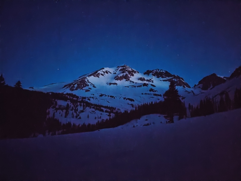
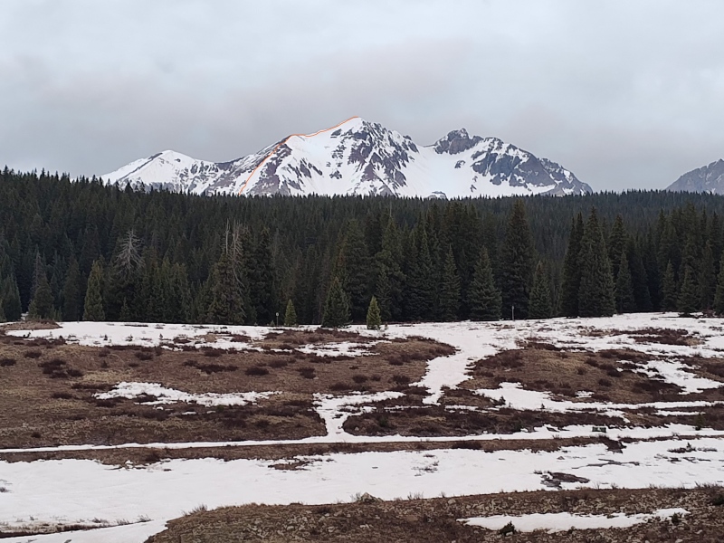
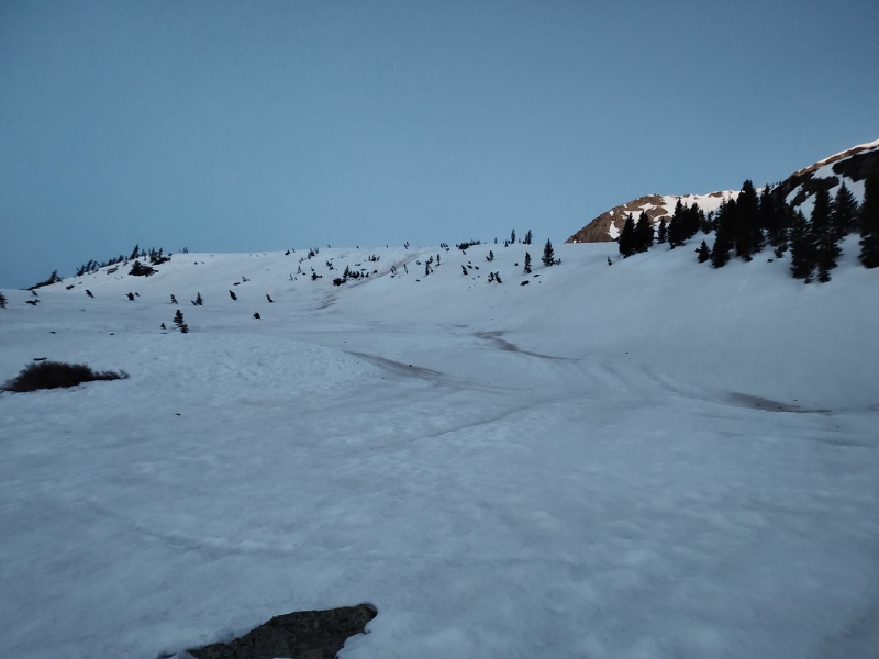
Trailhead: Cross Mountain Trailhead Trail: Mt. Wilson East Face trail to ~11,200ft then South Wilson SE face (path of least resistance) Stats: 12.25mi, 4,650ft gain. Difficulty: Class 2 with moderate to steep snow climb (I use "moderate" in comparison to rankings of other peaks - slope angle shading indicates mostly no more than 35-45 degrees. Measuring a photo where I paused in a steep section, I was surprised that it only seems to show about 35 degrees - I could have sworn at the time that it was at least 45 degrees. This "felt" much steeper than Lackawanna which reportedly has a max angle of 37 degrees and upon uploading my tracks to the 14ers map I do indeed see we crossed at least a few tiny sections of purple (46-50 degrees) and even appear to have went over a couple dots of blue (51-59 degrees). I believe that data because there was a time or two when I felt like it was so steep that I needed to front-point, only to discover the hard way that strap-on crampons on Keens are horrid for front-pointing - instead I crawled up those really steep stints using some slightly unorthodox methods of axe work...) Avy danger: rated Low with the only concern being wet slides in the afternoon. Temperatures dropped a few degrees below freezing and skies were clear overnight. Did an early start to optimize conditions and avoid possible afternoon storms (that didn't ever hit). There were some small wet slides that ran in the basin a day or so before we came plus at least a couple that ran between the start and end of our hike, but nothing that threatened us. Start time: 2am (worked well for snow conditions - not so much for sleep...) Finish time: 2:45pm (the upper portions were very tiring, especially with no sleep, and the ripples on the way back through the woods didn't help). Team: David and Scott (btw, if you've never met Scott, his climbing resume is rather impressively unusual - as you can see in his profile he's 59yrs old and just finished the 14ers last August - but the impressive thing is that he didn't start until he was 55yrs old! I'm 15yrs younger and certainly not in terrible shape but this guy totally smoked me on the steep sections near the top! Check out his Finisher thread here) Look for my typical large, bolded sections (like the one below) if you want to jump quickly to a particular section for beta. Route Overview/Trailhead/Stream Crossing This route starts at Cross Mountain Trailhead, right off of Colorado 145. In summer there would appear to be parking for a good number of vehicles at the trailhead but the available area was reduced due to portions still covered in snow for this hike. Even so, there was still room for multiple vehicles in the dry portion of the trailhead. There is a no camping sign at the trailhead but directly across the street is an area where camping is allowed (in a rather bare looking open area). Again in summer it looks like there is room for multiple vehicles but it had enough snow that I didn't want to try to drive up into that area. So instead we overnighted at Lizard Head Pass, about 3 minutes up the road. The main paved portion was free of snow but there appears to be more abundant space in summer that was covered in significant snow still. We "slept" in our vehicles since so much of the ground was still covered in snow (Scott has a better car camping setup than me so he actually got some sleep, whereas I basically laid in the passenger seat of my Jeep for a few hours with my eyes closed - gotta work on that setup...). As you can see in the satellite overview below, there is a lot of time spent blundering through the snow filled forest. The squigglyness of the orange line is a testament to my poor route finding skills, though I think Scott also contributed a squiggle or two! :-D 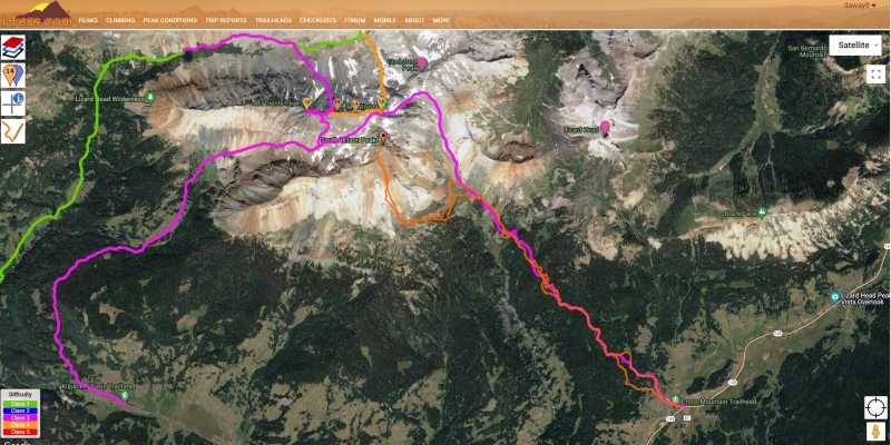
As noted above, the upper portions of this hike felt pretty steep. The below elevation profile accurately captures the approximate "feel" of this climb, including the sadistically steep little finish following where it briefly levels off and even drops a little bit just to rub it in (see "Difficulty" section in the intro for notes on actual slope angles). 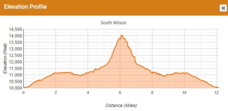

Be sure to notice the small bridge (easy to miss if you start in the dark) - the stream was running pretty strong and would not be pleasant to cross without the bridge (I couldn't tell whether or not driving over the stream might be viable in summer). Also be sure to find the large drainpipe going under the dirt road maybe 50 yards or so ahead - otherwise you'll get soaked in the creek as you turn left to the trail. 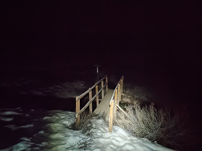
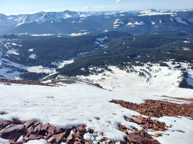
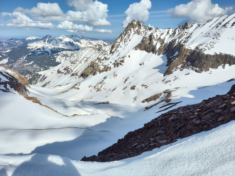
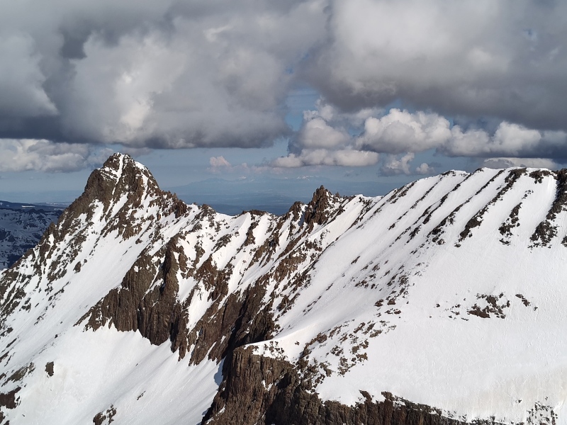
There's supposedly a good trail to follow here in summer - you can even see portions of it in satellite - but when snow covered and starting in the dark it's easy to flounder around, even with GPS tracks loaded. Be warned that the Wilson East Face tracks have you go on a bit of a roller coaster ride rippling up/down little hills that are rather bothersome on the way back. We occasionally over-corrected and made things probably a little worse. Couldn't really decide if it might potentially have been better to try to stay lower or higher - be prepared for some drudgery here. The Basin As you start to come out of the trees the views are quite impressive - and a little intimidating - massive snow covered slopes towering up all around. This would be an sketchy basin to be in when avy danger is higher - as is, there were small wet slides here and there even with the low avy danger present on this spring day. But nothing that was an issue. 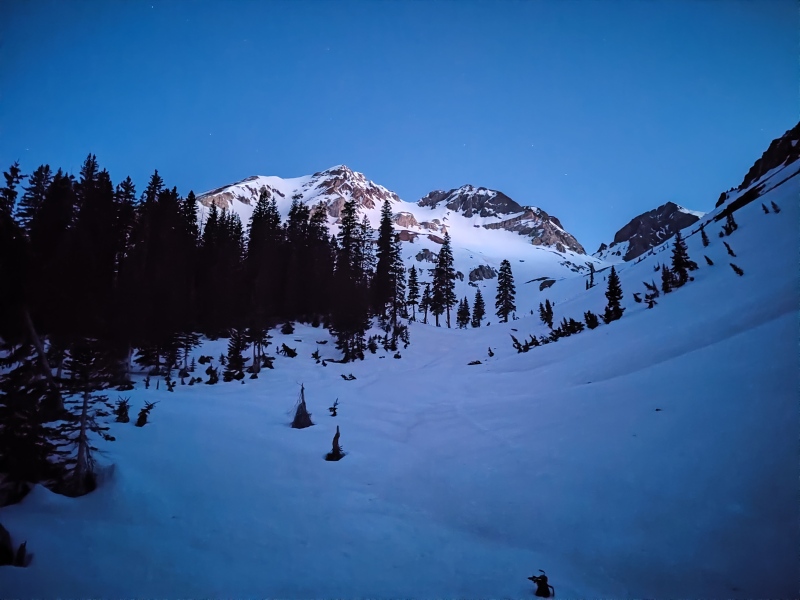
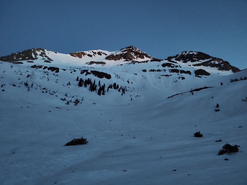
Once in the basin, you have the option to take a direct line up some slopes or stay on the path of least resistance and then swing SW along a more gentle shelf. Knowing that a lot of steep slopes were still ahead we opted to stick with the gentler approach. 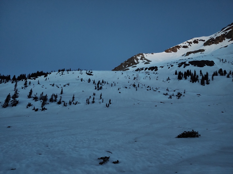

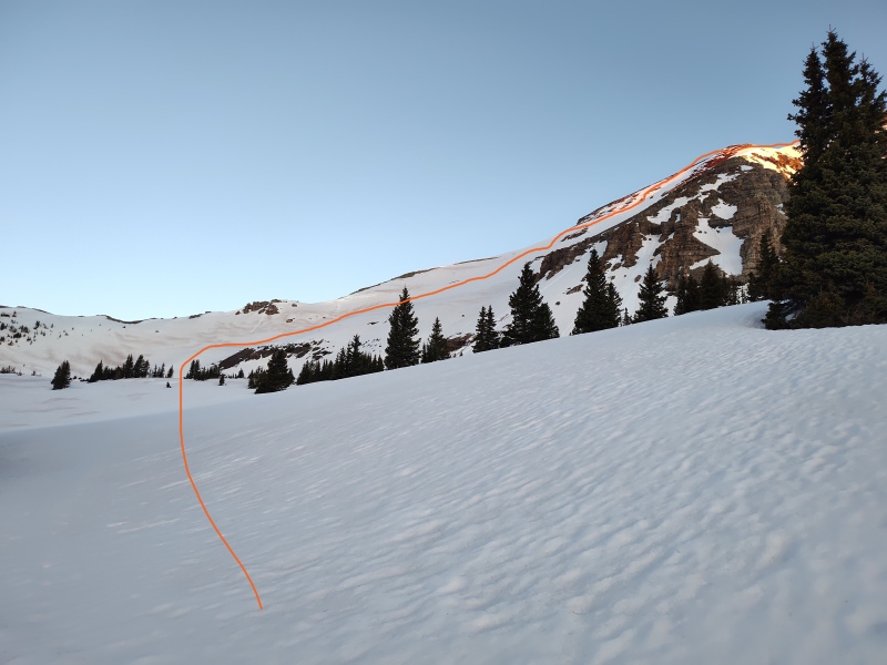
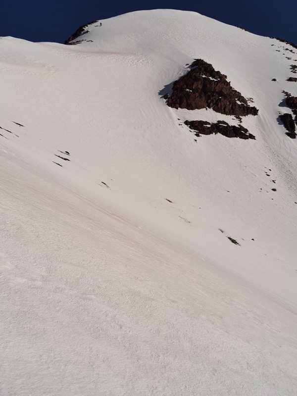
The Snow Climb One key reason for timing this trip the way I did was that I heard from multiple sources that this route is horrid when dry due to a preponderance of loose dinner plate rocks (a fact we verified in a few dry segments up top) but quite doable when covered with good snow. With our 2am start time following a clear night with below freezing temperatures we hit the slopes a little before the sun did and found great quality snow. We put crampons on at about 12k and left the on until we were down to about the same place. 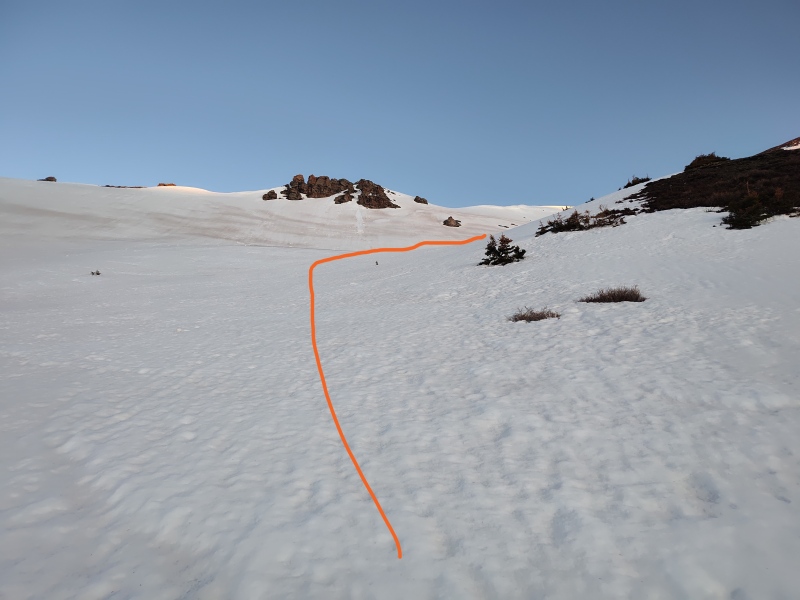
We briefly discussed whether to try to gain and follow the ridge but, seeing that some of it was bare and knowing that everyone complained about the awful rock in this area when it's dry, plus seeing some minor wet slides that had come off the ridge the day before, we decided to stick with the snow climb. 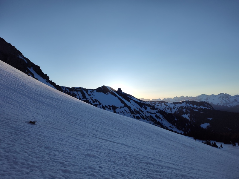
The climb started off gentle enough that I had contemplated using snowshoes with the ascent bars up but we opted instead to use crampons from the start. The slope doesn't really relent until the upper ridge and gets slowly steeper so it becomes increasingly sketchy to stop and switch gear on the ever steepening snow. I provided a quick review of proper self-arrest techniques, both for my own benefit and to make sure Scott had the proper holds and such refreshed in his mind in case needed before things got too risky. 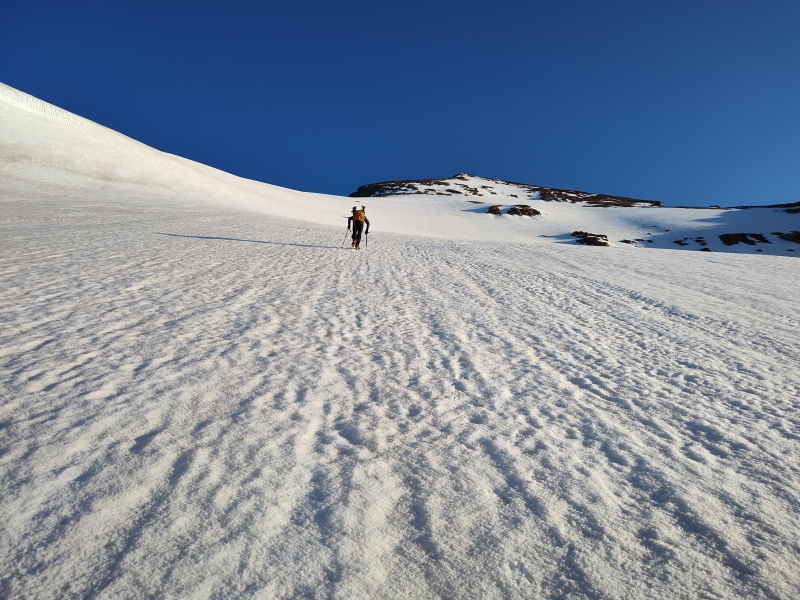
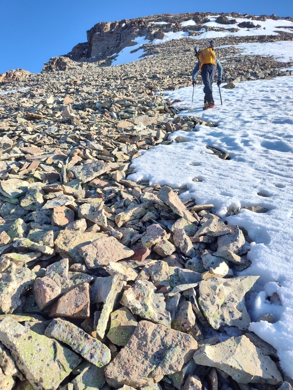
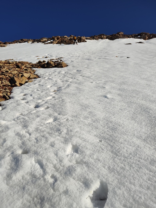
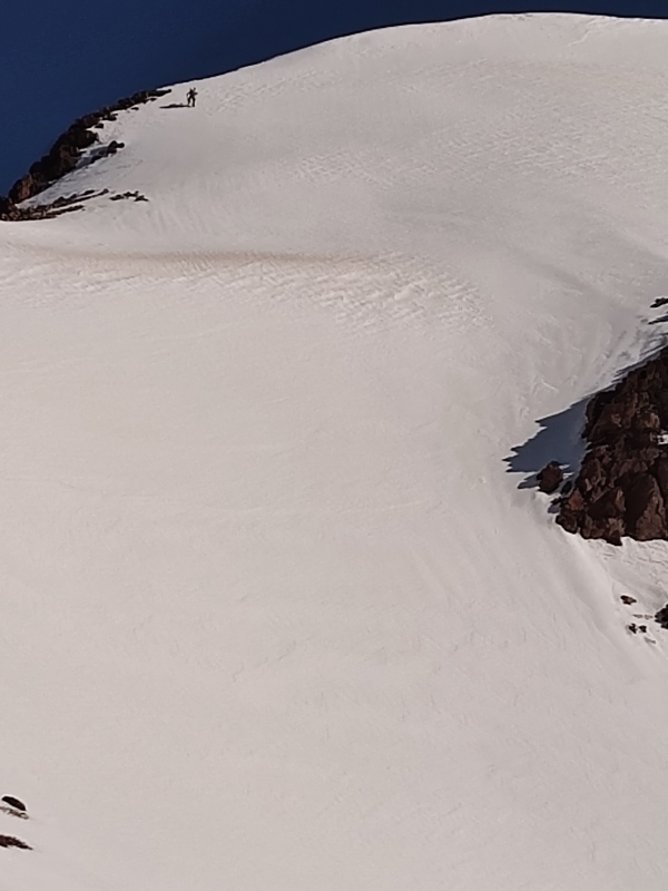
We stayed close for much of the way up but as we got higher in elevation I started to really feel my total lack of sleep (along with the last 4 days I had just spent in Iowa - those are my excuses and I'm sticking with them) while Scott, with his luxurious 3 or so hours of sleep, started to pull further and further ahead (making for some rather neat shots showing the scale of this slope). 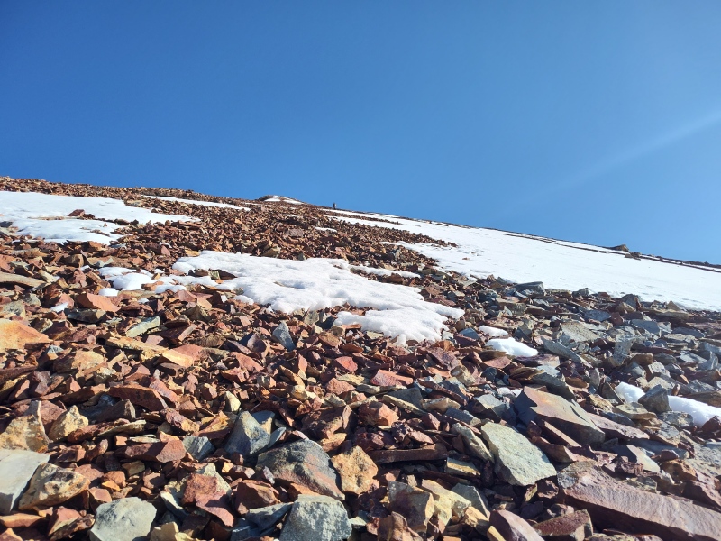
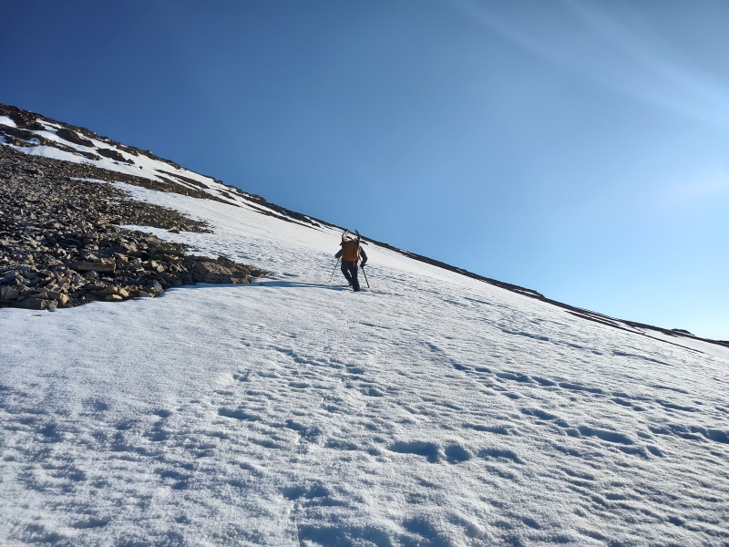
We had to start zig-zagging a bit as we got near the upper ridge to try to stay on snow. There were times we could have went further right to keep more on snow but in some areas the snow looked so steep with so much of a slide way down to unfriendly territory that we decided once or twice it was easier to go up a small section of rock to get the next snow field rather than swinging too wide, although we confirmed that the rock is exceptionally loose garbage - I agree that I would NOT want to come up an entire slope of this when dry! 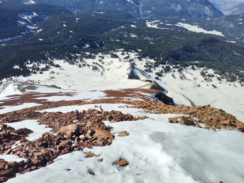
Below is a little Where's Waldo fun - or in this case Where's Scott? He had the afterburners going on the upper ridge while I was happy to pause for some documentation. 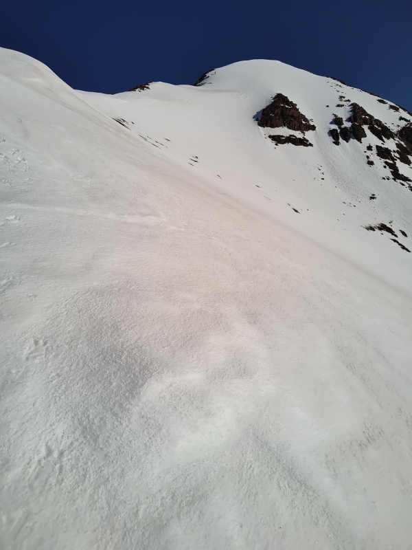
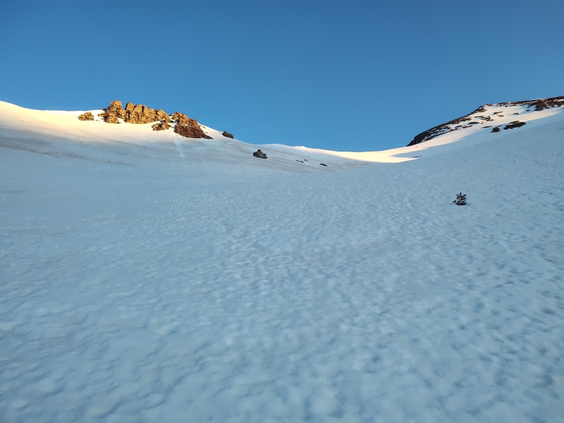
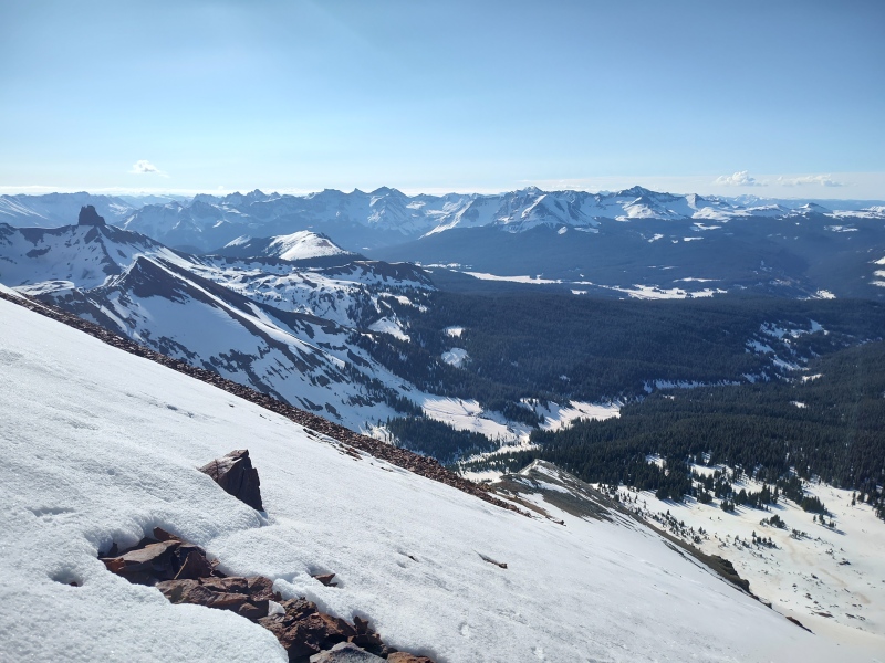
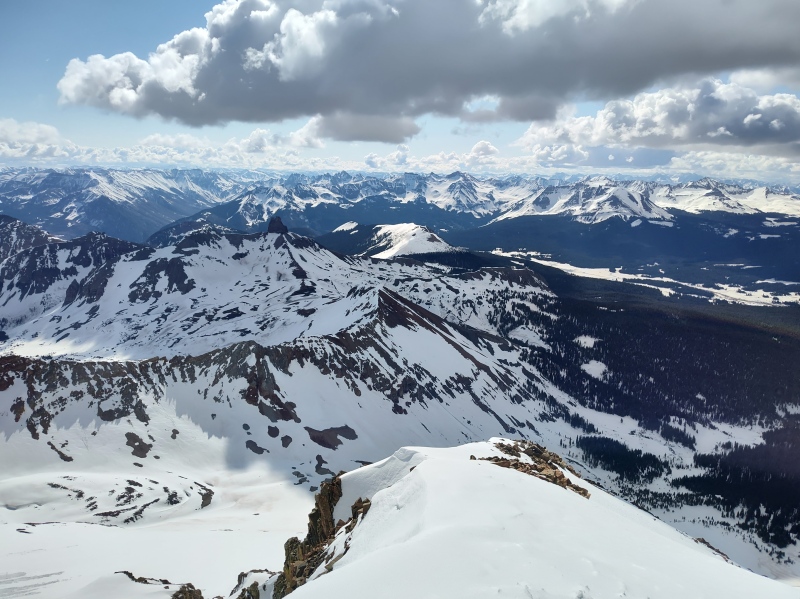
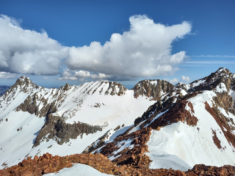
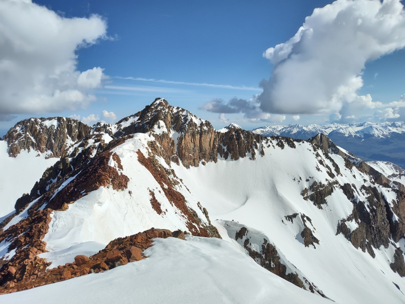
The Surroundings There are some great spots to pause and soak in the breathtaking views (it was totally only the views taking away my breath - it had nothing to do with the steep slopes, sleep deprivation and high altitude!) 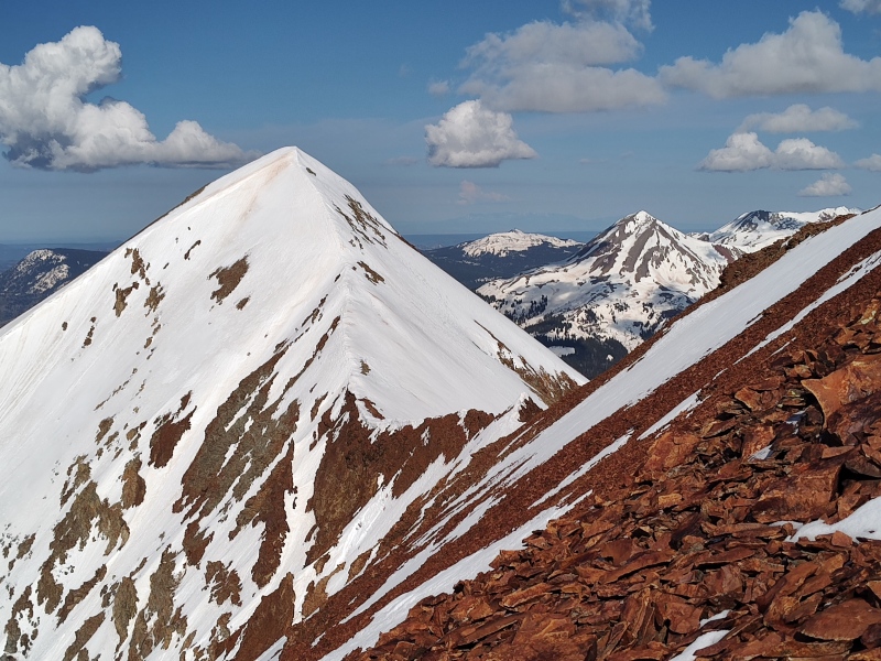
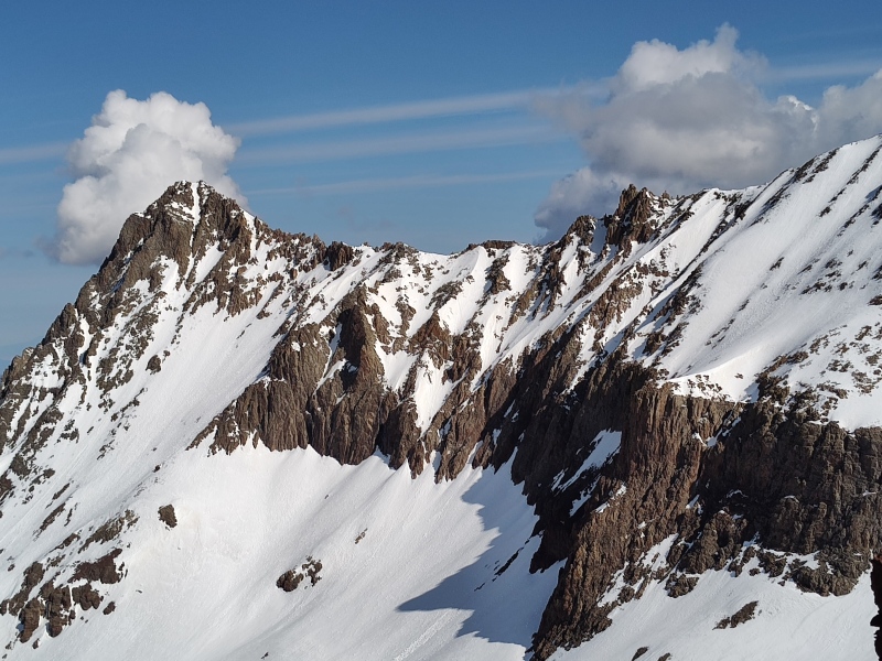
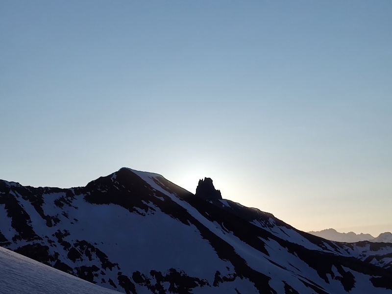
Looking at the El Diente - Wilson traverse I could easily see why the FKT crossing this winter was such an ordeal - I did it when totally dry - looks a bit more interesting now. I hope to go back later to repeat it in a more ridge-proper way to get Pin Point and West Wilson, but I'll probably wait for it to dry out a bit. 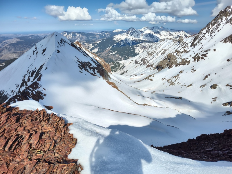
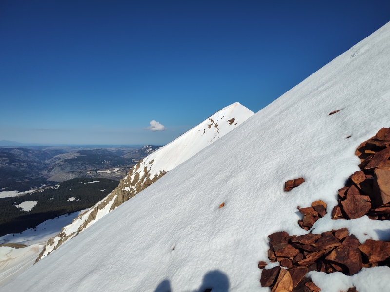
Final Approach and Summit After a rather long stretch of coming up at a rather hefty angle there's finally a slight bit of reprieve upon reaching the upper ridge. Though there's then a short section that's just narrow enough to be mildly uncomfortable with a steep wall of snow over cliffs to the left (west) and long steep slopes of snow to the right (east). A far cry from a Knife Edge and not quite narrow enough to qualify as a cat walk - just enough to make a guy pause and carefully examine things (the fact that Scott's crampons barely sank into the snow gave reassurance that everything was well consolidated). 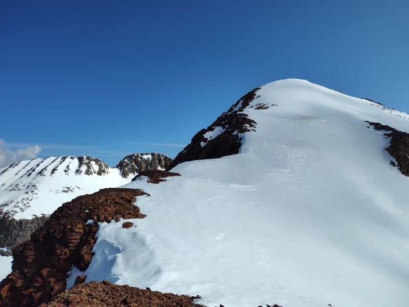
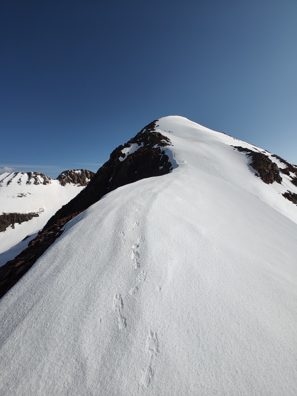
Then there's a small little section just below the summit that gets crazy steep for a brief little pitch (the slope shading does show our tracks passing over a tiny section in excess of 50 degrees near here). For that section (as well as a spot or two a little lower) I had wanted to and tried to do some front-pointing, since that seemed the most natural way to deal with a slope that steep. But the strap-on crampons I had on my regular summer hiking boots - while they worked fantastic most of the way up - they just aren't suited at all to front-pointing. So instead I invented my own technique to stubbornly work my way up these sections (I say "invented" but I'm sure I'm not the only one to resort to whatever such a technique might be called, if it has a name - other than perhaps "dumb idea."). So basically, I got down to a more or less crawling position, toes pointed outward so the sides of the crampons would be fully engaged and instead of plunging the shaft of the ice axe into the snow for a self belay, I instead grabbed the head of the axe and with the shaft parallel to the snow I punched the pick into the snow - kind of almost like self-arresting my way up the mountain - or a perpetual preemptive upward moving self-arrest! :-D Any actual mountaineers reading this may be groaning and rolling their eyes at my poor command of proper terminology and technique - but, hey, it worked! Wouldn't want to do that for sections any longer than the few short steep pitches we encountered without real crampons and mountaineering boots but my hikeneering method got the job down on this one (I was confident in my ability to do an actual self-arrest if needed and later proved while glissading that I could indeed do a controlled descent). 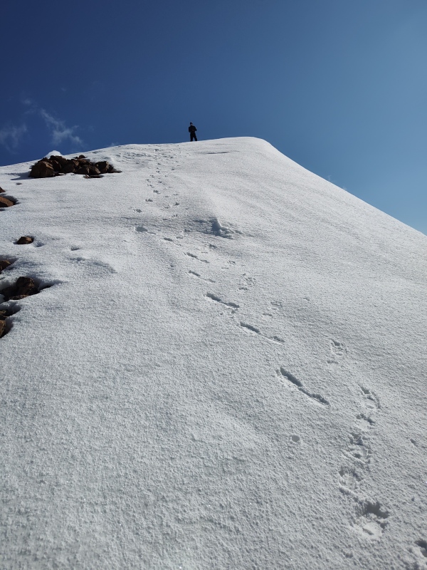
The Descent So by the time I finally lugged my weary sleep deprived body up onto the summit there were slightly ominous clouds starting to build all around. So we had to debate waiting on summit until threatening clouds develop into thunderstorms that strike us dead with lightning or plunging to likely death by glissading down way too steep slopes. We opted to go out quickly rather than wait to go out with a bang (though no bangs ever ended up coming). Had this been solid uninterrupted snow the entire way this could well have been one of the most awesome, epic glissades in the history of mankind (ok, well, at least one of the best glissades of my life). As it was, I took a highly cautious approach until we got below all the exposed rock and then let it rip for a good finish. Since I had a little higher confidence on doing steep glissades, I took the lead and asked Scott to hang slightly behind and yell if the mountainside started to break loose (thankfully it didn't). If we had a good clear descent line I would've taken my crampons off to avoid the danger of catching and flipping. As is, I not only left the crampons on but basically kept them at least slightly engaged along with the pick of my ice axe for much of the steep upper section, going down feet first on my belly in these steeper sections. How steep was it? Well even with crampons scraping over the surface and the pick of my ice axe dug into the snow there were times I still kept sliding down anyways, which was a little unnerving, so then I would throw all my weight onto the ice axe to come to a full stop. Then periodically I would carefully traverse over to dodge some rocks and continue. 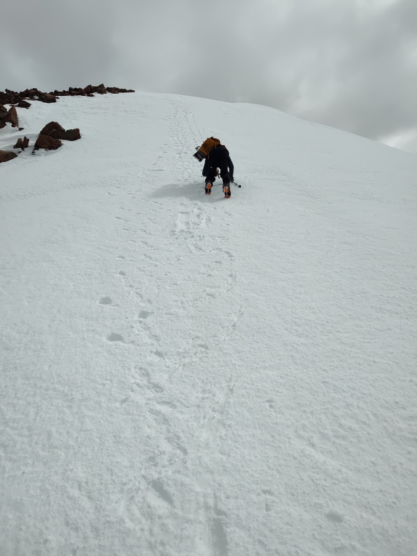
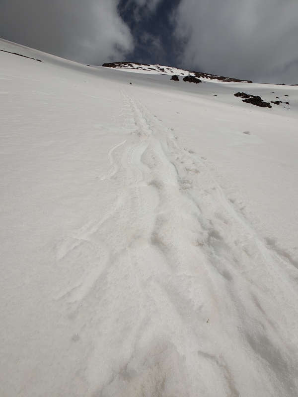
The snow was reasonably firm in the upper sections but once I got speed going on the lower part I eventually started feeling myself sink into the snow and basically started paddling to try to keep the glissade going as long as possible. Between that and my overlay large pack with too much gear on it, I made some rather interested looking glissade tracks, lol. I didn't record the exact details but we dropped over 2k feet in about an hour. We could have easily done it in a fraction of the time but I was worried about gaining too much speed, especially in the steep upper sections with some exposed rock below. So I didn't let loose until clear of all the rocks. Once we fully ran out of steam for the glissade we switched to snowshoes and generally did far better than expected for this time of year - I don't recall any of the knee to waist deep postholing others around the state have been reporting. In fact, with snowshoes, we did fairly minimal sinking as compared to other sufferfests I've done. 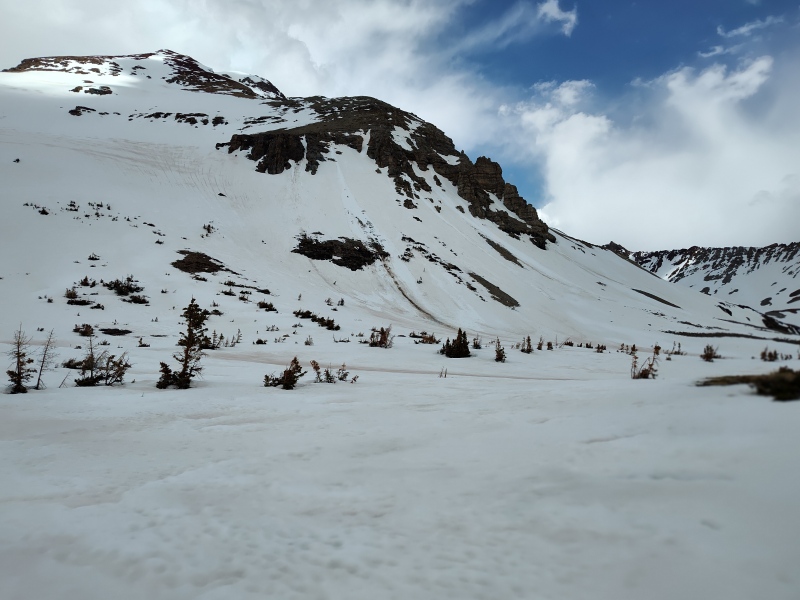
As we exited the basin I glanced nervously at the various wet slides here and there that I'm fairly certain weren't there in the morning. They all seemed to come from obvious places like a cornice break or from off some steep, partly exposed cliffs etc, so there was nothing that was an immediate threat to us or the path we came down. Still, it's always slightly uncomfortable to realize that the mountains have been moving while you've been out and about... 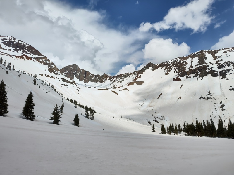

The hike back through the trees was a real drag - as is any return that includes bits of uphill and floundering blindly through trees over dirty snow trying to find your tracks from the morning (there's a reason I'm not a hunter...). This is where it's good to have a partner for distracting conversation or bring earbuds to listen to some music... We arrived back at the trailhead without having seen a soul the entire day (just some old ski tracks). 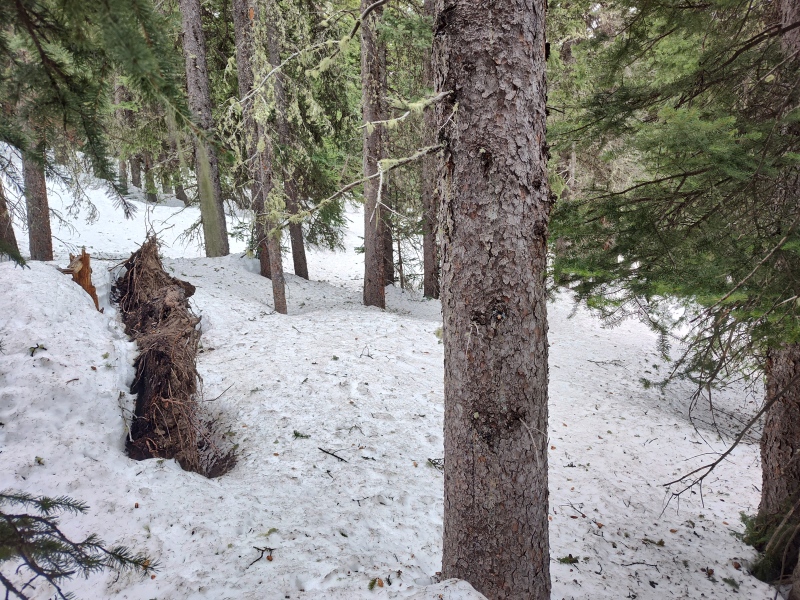
The Aftermath Since this hike took 12hr 45min and I started it with basically zero sleep, there was no way I was going to make the 7.5hr drive to FTC that same day. I briefly pondered whether I wanted to drive 5hrs to join the waterlogged Spring Gathering wallowing in misery near Twin Lakes but decided that wasn't going to happen either. Scott invited me to go grab a bite with him in Telluride but I felt a surge of motivation to try to drive at least part of the way toward the Spring Gathering and possibly get up early Saturday to drive the rest of the way to join the gang. That motivation died after about the first 10 minutes on the road, after which I concentrated on not dying by falling asleep at the wheel. Eventually I decided with the way I felt, that finding the nearest hotel on the road home was the wise choice. I then stumbled across a surprise winner in the form of Chipeta Lodge in Ridgway (I had previously been pretty much unaware of the existence of the town, not to mention the hotel). This place has a wonderful property full of beautiful flowering trees (I was glad I packed my Allegra...) and a key highlight is the huge, elevated outdoor hot tub with views of multiple surrounding 13ers and other peaks. Also scored a free upgrade to a room with a whirlpool tub. Plus they have an on-site restaurant that had live music that night and I was tempted by but didn't indulge in the on-site spa. Surprisingly the pricing wasn't too much higher than I've sometimes paid for some small, lame room in much less scenic spots (though with most ski resorts closed for the season and the summer crowds not yet arrived I may have hit the sweet spot for pricing). 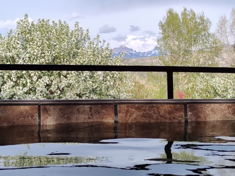
My Times I didn't record as many splits as I typically do but this still gives a few key points for reference. 2am - Start from Cross Mountain Trailhead 6:42am - Crampons on at 12k 7:51am - Switching back and forth from snow to dirt/rock at 13,100ft. Scott cranks into high gear as I settle into low gear. 9:02am - On ridge at 13,855ft with view of El Diente. About 5.79mi in. 9:24am - South Wilson summit; about 6mi from trailhead (Scott was waiting there for maybe an hour or two, :-D ) 9:47am - Begin descent. 10:47am - Over 2k feet lower after controlled glissading ~2:45pm - Back at Cross Mountain Trailhead. GPX NOTE: The path through the woods is a bit wonky - these tracks will get you in the general area but feel free to blaze a variation that looks a little less like a drunkard stumbling across a trampoline park. Also the big arcing swing to the SW then up around to the snow climb could be short circuited but would come at the price of some steeper terrain down low - our path going up took more or less the least steep path to get to the bottom of the climb, then we did a little bit of short cutting coming down. Beware of potential stream crossings if you turn too low below the basin. Thumbnails for uploaded photos (click to open slideshow): ")
")
")
")
")
")
")
")
")
")
")
")
")
")
")
")
")
")
")
")
")
")
")
")
")
")
")
")
")
")
")
")
")
")
")
")
")
")
")
")
")
")
")
")
")
")
")
")
|
| Comments or Questions | ||||||||||||
|---|---|---|---|---|---|---|---|---|---|---|---|---|
|
Caution: The information contained in this report may not be accurate and should not be the only resource used in preparation for your climb. Failure to have the necessary experience, physical conditioning, supplies or equipment can result in injury or death. 14ers.com and the author(s) of this report provide no warranties, either express or implied, that the information provided is accurate or reliable. By using the information provided, you agree to indemnify and hold harmless 14ers.com and the report author(s) with respect to any claims and demands against them, including any attorney fees and expenses. Please read the 14ers.com Safety and Disclaimer pages for more information.
Please respect private property: 14ers.com supports the rights of private landowners to determine how and by whom their land will be used. In Colorado, it is your responsibility to determine if land is private and to obtain the appropriate permission before entering the property.