| Report Type | Full |
| Peak(s) |
Hunchback Mountain - 13,143 feet White Dome - 13,628 feet Peak Three - 13,487 feet Peak One - 13,599 feet Peak Two - 13,475 feet Beartown Bald - 12,772 |
| Date Posted | 04/24/2023 |
| Date Climbed | 10/15/2022 |
| Author | supranihilest |
| Additional Members | whileyh |
| The Hunchback of White Dome | ||||||||||||||||||||||||||||||||||||||||
|---|---|---|---|---|---|---|---|---|---|---|---|---|---|---|---|---|---|---|---|---|---|---|---|---|---|---|---|---|---|---|---|---|---|---|---|---|---|---|---|---|
|
With winter rapidly approaching Whiley and I wanted to make at least one successful trip into the Weminuche in 2022. I qualify the trip needed to be successful, because we'd gone into the Weminuche earlier in June, with a forecast we knew was stupid to try and get anything done in, backpacked up into Leviathan Basin under increasingly dark and threatening skies, set up camp in the rain, got poured on all night, woke up in a death mist with less than 100 foot visibility and all of our gear soaked, and decided to pack up and hike out in the rain after being in the wilderness for less than 24 hours. Stupid and a total waste of time. 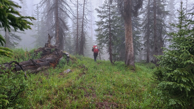
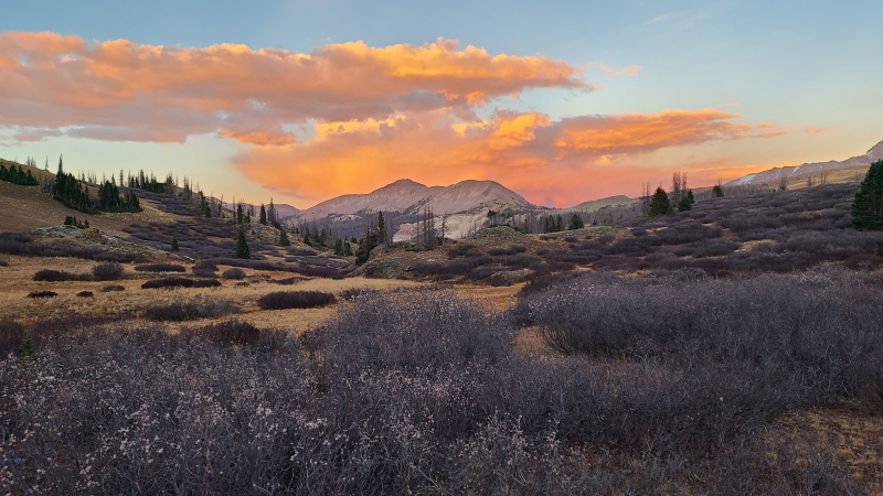
We didn't make another trip until after the first snow, with another storm predicted the evening of our second day there that would undoubtedly end anything more serious for the year. Also stupid, but we also figured we'd do the easier peaks the second day and clean up whatever was left the following year. I was more worried we'd get in trouble driving out over Stony Pass than get in trouble on the peaks, but we pushed forward regardless. We weren't going deep into the Weminuche anyway, just doing the peaks around Beartown that we so far had neglected. For our first day we planned on doing the peaks immediately west of Hunchback Pass: Hunchback Peak, White Dome, Peak One, Peak Three, and Peak Two. I was also going to do twelver Beartown Bald (12,755') if I had the time and energy; Whiley had already done it. We drove back to Beartown the day before (huge thanks to Whiley for always doing the 4WD driving) and made camp before the Hunchback Pass trailhead in a spot we'd used a few times before. She slept in her truck, and I in a tent. It was cold when we got up the next day - the muddy road and nearby creek were frozen solid - but the sun came out and quickly warmed everything up. 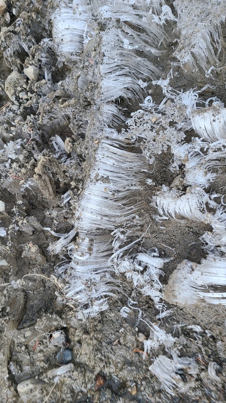
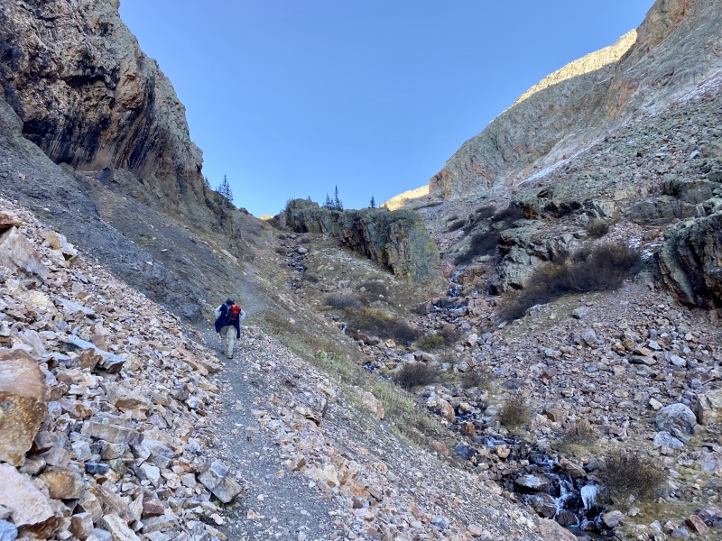
We were soon off on the Continental Divide trail up Hunchback Pass, which by now we were very familiar with. 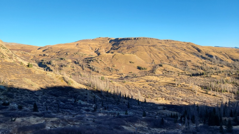
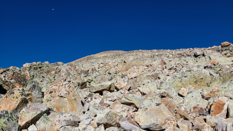
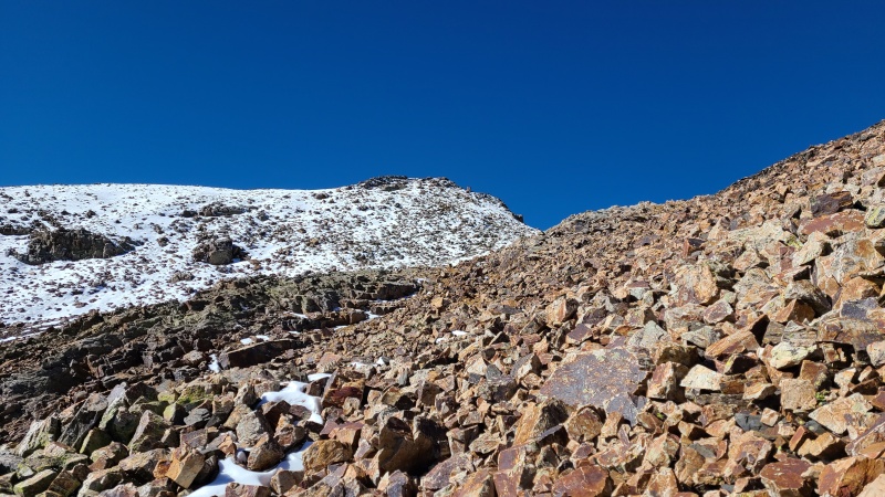
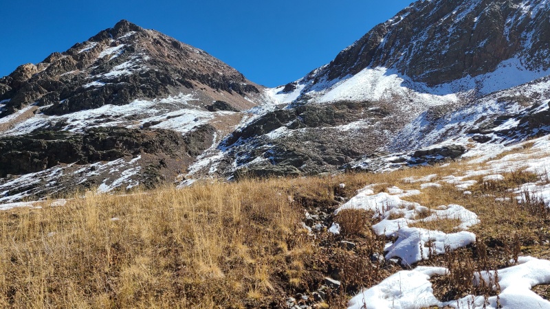
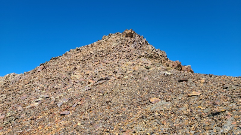
The part of the trail that crests the pass and drops down into Vallecito Creek is one of my favorites, since the rocks here are downright bizarre. While we wouldn't be going far enough to get the views I really wanted, we did get the strange rainbow of rocks that make up Hunchback Mountain. We'd ascended to the pass instead of making a more direct line right up Hunchback's north slopes because the latter was covered in snow, and we inevitably would have been slowed enough that it wouldn't be worth the shorter distance. Once at the pass the route up Hunchback is simple as can be: hike west along the ridge, enjoy the rocks, and then stand on top of the mountain. The rock might be a feast for the eyes but it is a bit obnoxious to walk on. That's the only difficulty, though. 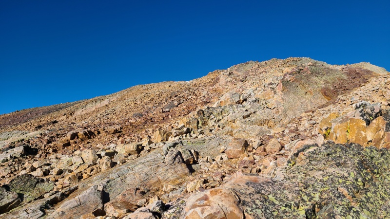
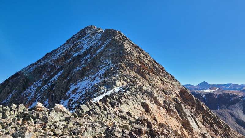
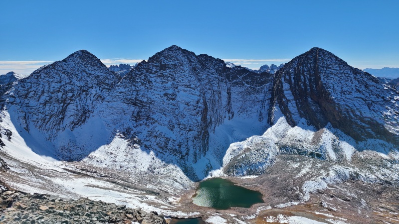
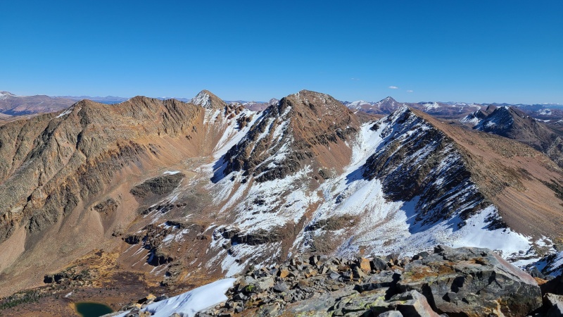
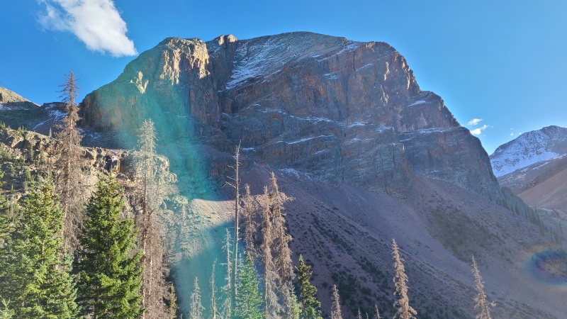
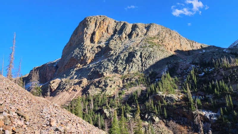
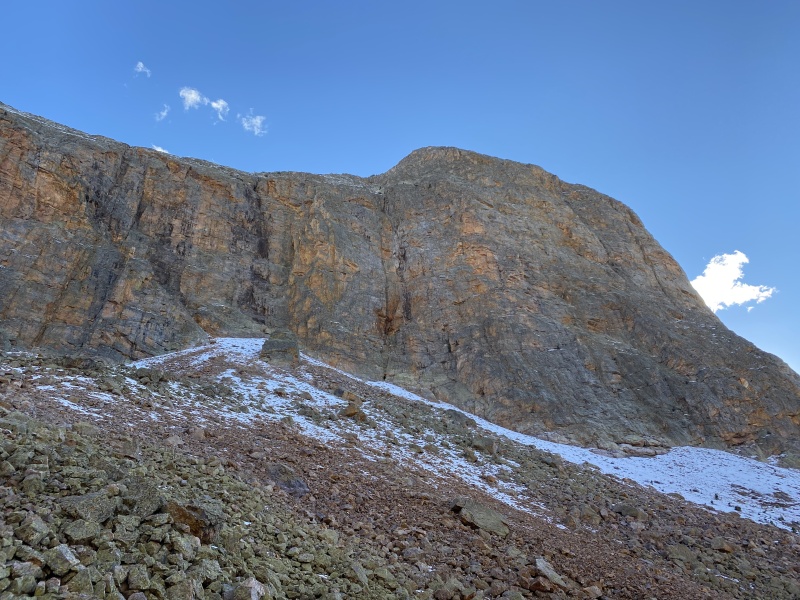
Hunchback had come and gone in a jif. Whiley had done it two years earlier on our way into the Rock Creek group, but hadn't gone further. White Dome looked wonderful - and not all that white - from Hunchback and we briefly discussed the route up it. The northeast side of the peak was guarded by what looked like formidable cliffs, and we also thought there'd be some snow or water to contend with. The east ridge/slopes of the peak looked better, since there were no cliffs and it was a bit less steep, so we just decided to try that instead. Getting down Hunchback's northwest ridge was easy, though we had to be a little careful on the icy snow there, since the ridge was still in shade. 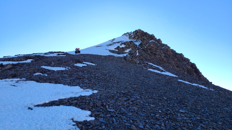
Once off Hunchback and in the valley below we started in a more southern direction than if we'd scrambled straight up the peak. A mess of slabs preceded the cliffs and we didn't really feel like finding a way through any of it, even if it was easy, so we stuck with our original plan. This might have been a bit further out of the way but it was all easy, maxing out at annoying Class 2 up the chunky boulders from the east. 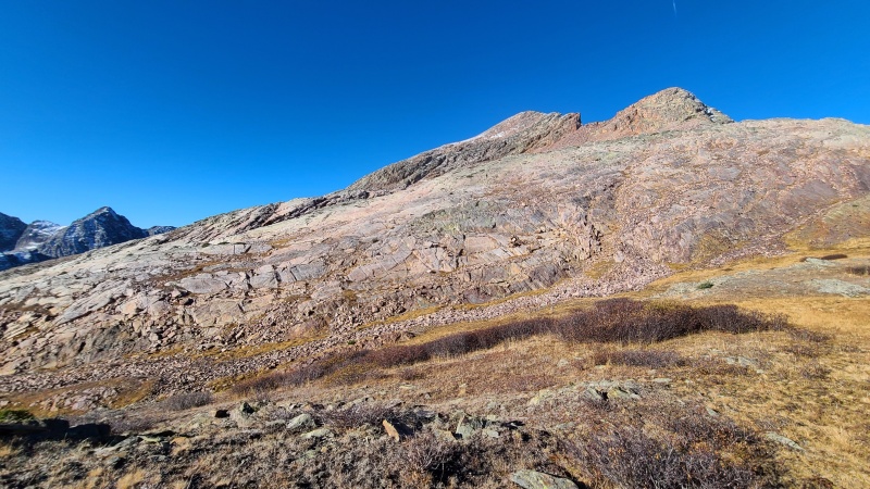
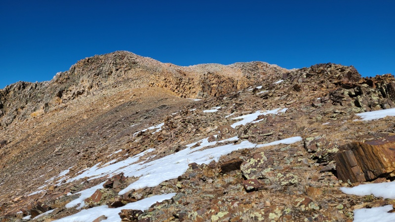
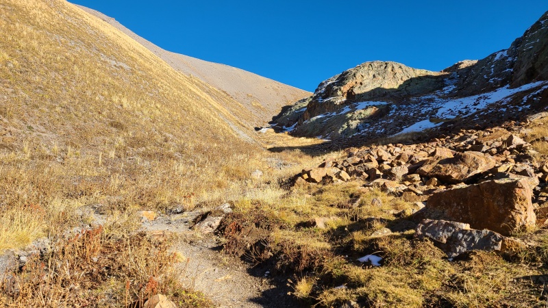
The descent off White Dome ended up being the best part of the day, as far as fun goes. A short stretch of broken rock led us to a steep and exposed catwalk. We took the tippy talus on the ridge slowly as the ridge narrowed, and tried to stay off the snow on northern aspects. 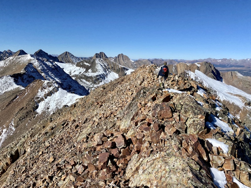
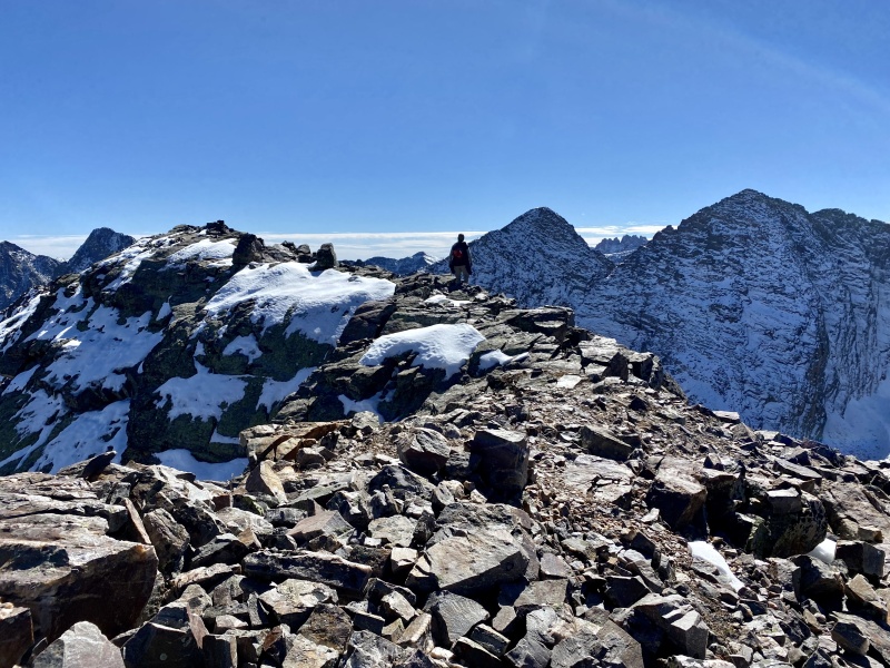
Eventually the ridge solidified and became narrow enough that we were in Class 3 scrambling terrain. We dropped briefly into the north side of the ridge on solid ledges, traversing just below the ridge crest until we hit a lovely knife edge reminiscent of the knife edge on Kelso Ridge, except climbing down instead of up. Rock quality here was excellent, and the exposure added a bit of spice to the ridge. We hadn't been expecting this but we sure were enjoying it! 
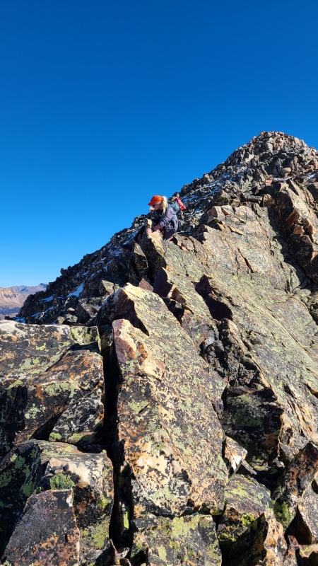
We each took our own ways down the knife edge, which of course was all too short. Beyond the knife edge there was still a fair amount of steep Class 2+ and Class 3 scrambling to get closer to the saddle, where the ridge widened again and became easy. 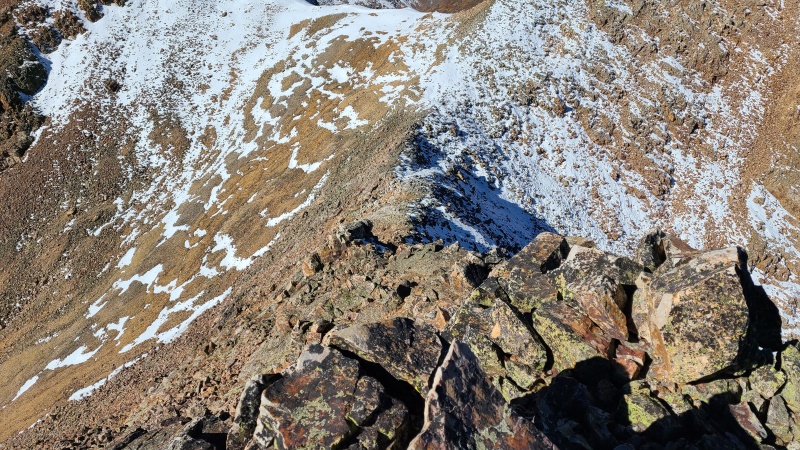
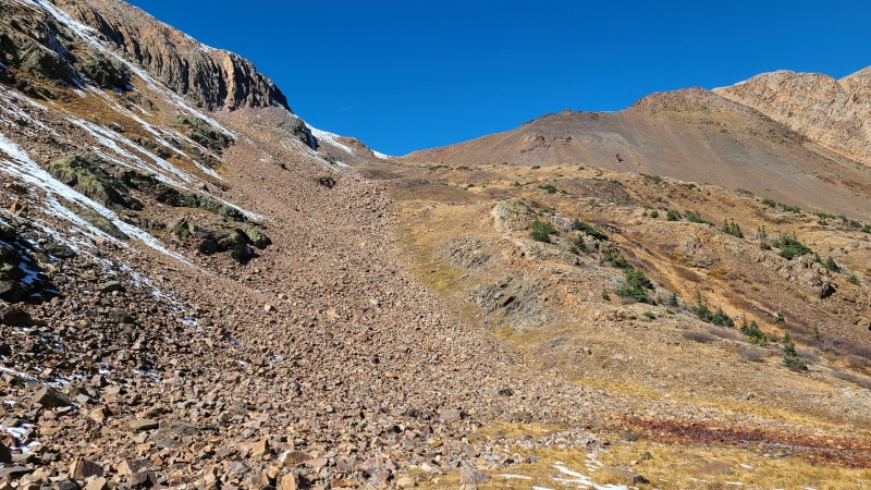
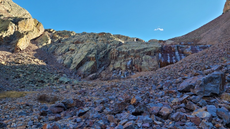
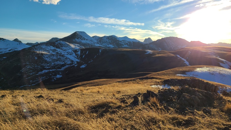
We didn't know it at the time but unfortunately this was the end of the scrambling for us for the day. There might have been some up and over a rough point on the ridge, but this point was snowy enough that we dropped down to the east and bypassed it instead. The rock here was the usual angular garbage but almost certainly faster than climb up the same angular garbage with snow on it. From the bottom of White Dome's southwest ridge all the way to Peak One was Class 2. Going over the ridge bump would have had at least a little bit of scrambling. 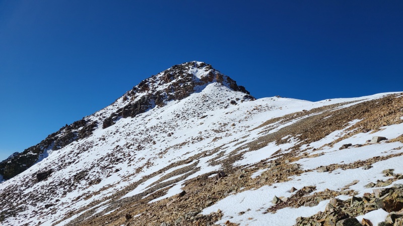

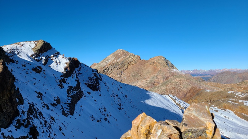
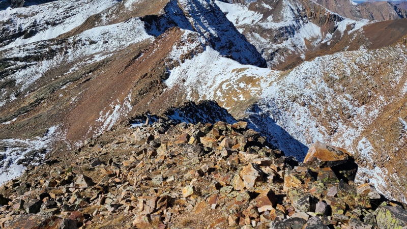
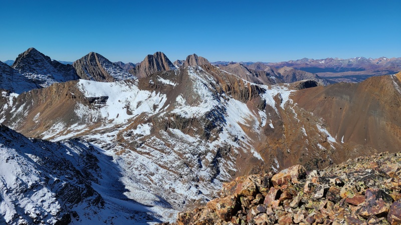
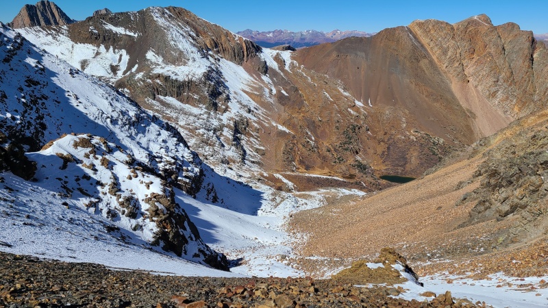
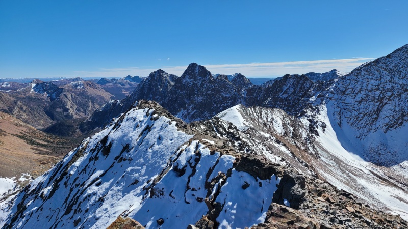
From Peak One we had a good view of the ridge to Peak Three as it ran perpendicular across our view. The entire thing was covered in snow and looked like it would contain a fair amount of scrambling. 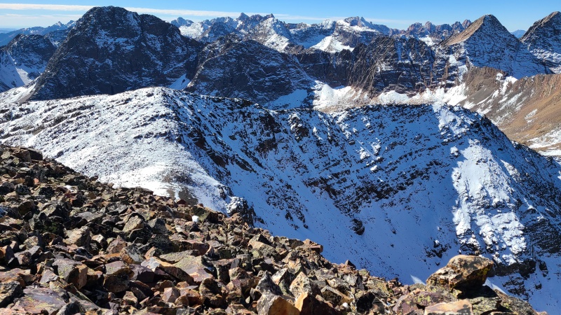
We didn't want to get into the snow here either, if we could avoid it, and when we were at the saddle immediately north of One just such an opportunity presented itself. A talus gully dropping to the west, only half full of snow, would get us below the opposing slope that people usually use as a descent from Two and Three. We could use it as both ascent and descent instead. It would require more elevation loss than the ridge but we didn't care, the snow on the ridge made it an easy decision. 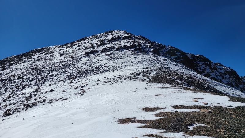
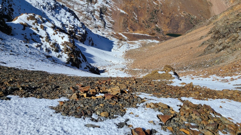
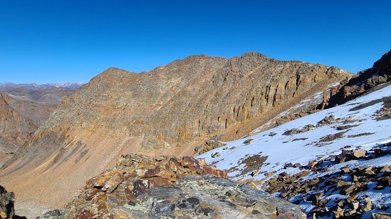
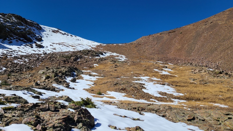
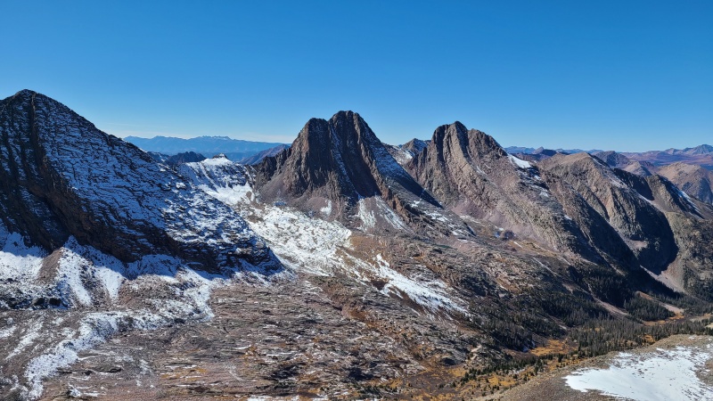
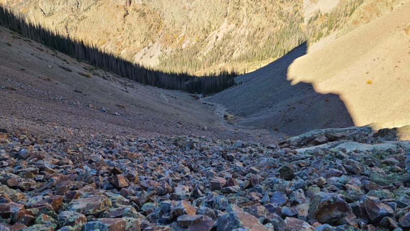
We dropped into the gully and made good time down it, though the rock was of the roly-poly type. The northern side was dry, owing to its southern exposure, and before we knew it we were down in the valley and contouring around some outcrops there, mostly on grass. 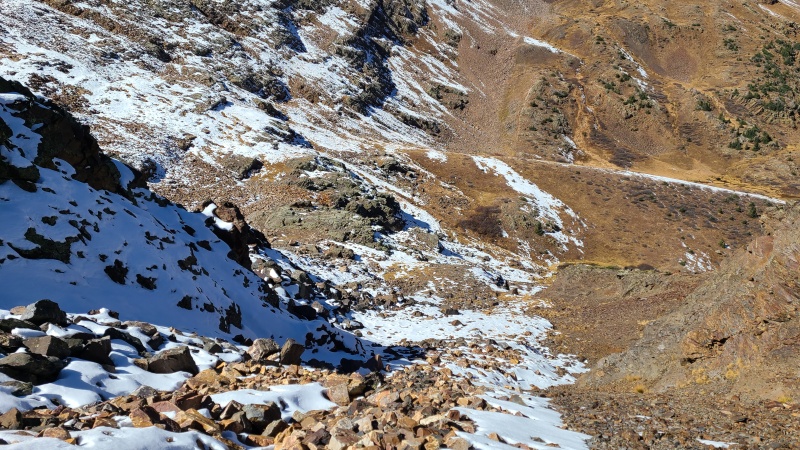
The slope up from the valley floor was likewise grass that turned into the usual red talus, but this side was both less steep and less snowy, so we also made good time up to the Two/Three saddle. 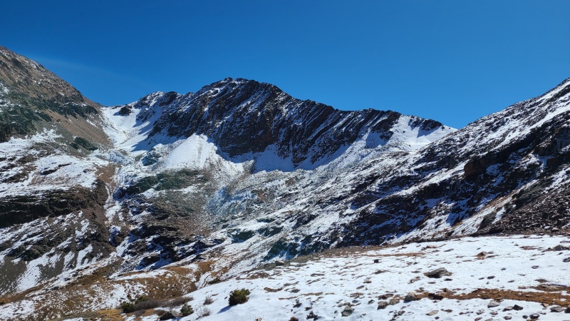
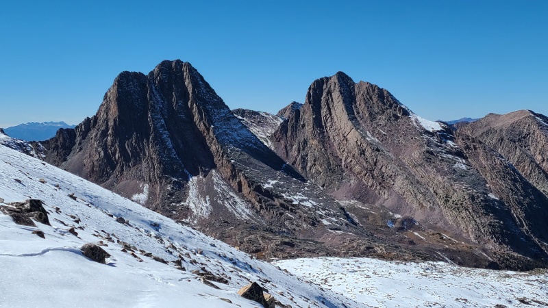
Unfortunately the ascent up Three was going to be extremely annoying and by far the worst part of the day, since it was all snow covered talus and boulders for the nearly 600 foot ascent to the summit. Three was a truly awful peak in these conditions, with knee deep punch crust over the top of boulders and more angular junk. 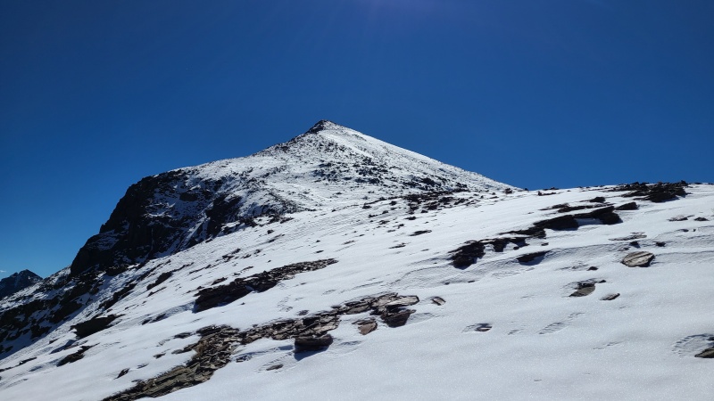
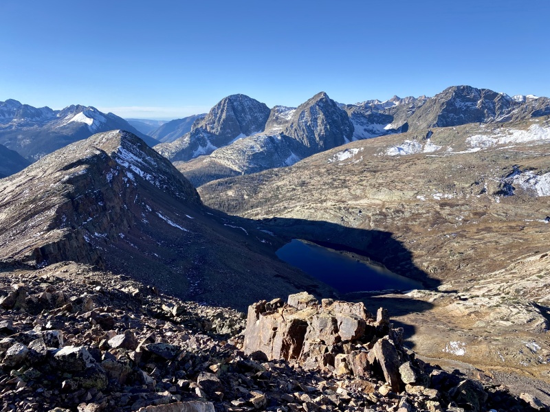
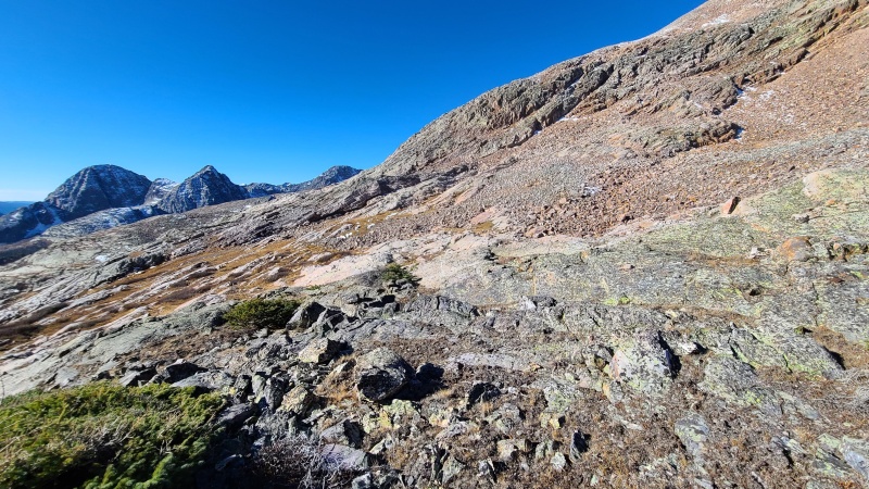
It was an exhausting effort huffing and puffing up Three, only made slightly enjoyable by the incredible views of the Grenadiers. Only Point 12,936 in the Kendall massif had views as good as Three, so we made sure to pump ourselves up by talking about the Grenadiers every time a flood of curse words spilled out of our mouths. 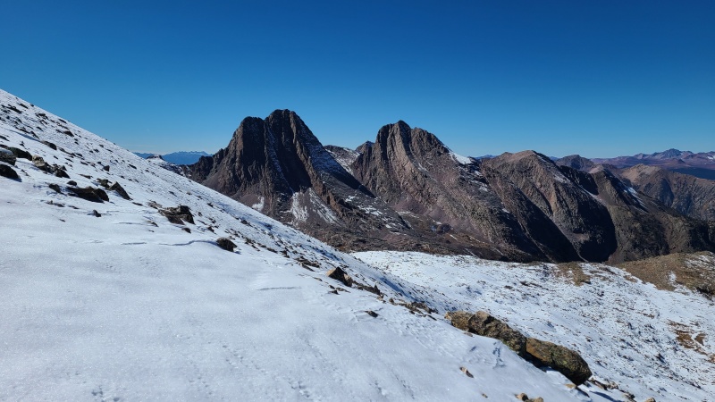
Remarkably, we weren't even at the halfway point distance-wise. We both had one more thirteener left, and I was going to do twelver Beartown Bald, but little did we know there was still ten miles to go. We figured after four thirteeners and at what appeared to be the farthest point from our start we were actually halfway done. Sucks to be us. Back down Three we went, attempting to stay in our previous postholes and creating postholes anew where we didn't. 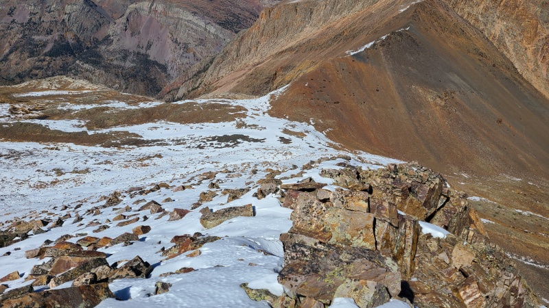
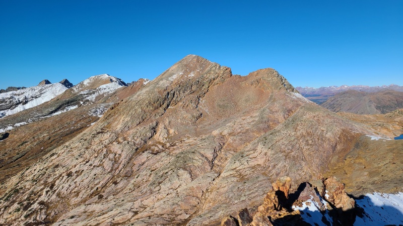
Peak Two at least was going to be easy, since it was another big heap of smashed up rock bits, just smaller bits and easier on the feet and ankles. 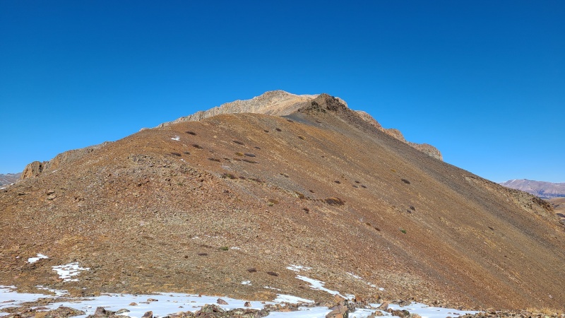
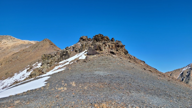
Of course, right before the summit we had some more snow. "Fuck you snow". That's what I call it. All dry except for the area just below the summit ridge, which also had some big boulders in it. Fuck you too, Two. Just kidding. We love you. 
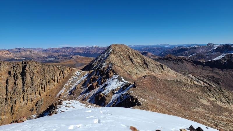
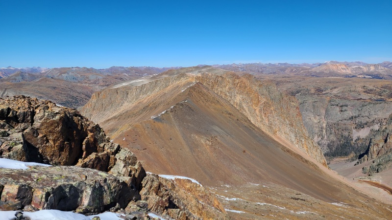
From Two's lumpy summit we had a great view all the way down to the Colorado trail, which would get us back to the eastern side of the Continental Divide where we started. It was a loooong way down, so we quickly reversed course back to the Two/Three saddle and then to the valley. 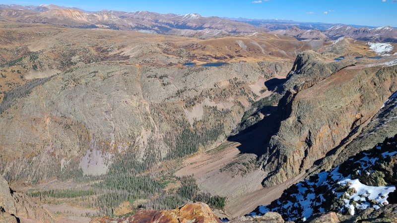
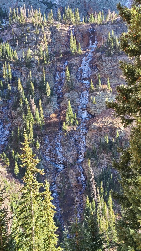
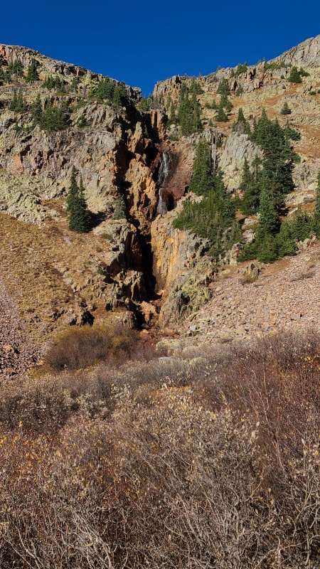
The valley was more of the same rock all the way to the trail, punctuated only by a large cliff and waterfall that we skirted on descender's left on Class 2 talus. The waterfalls were in a partially frozen state. I wondered if there'd be any ice climbing on them, but I didn't wonder if the effort to get there for the ice would be worth it: the obvious answer is that it would not. 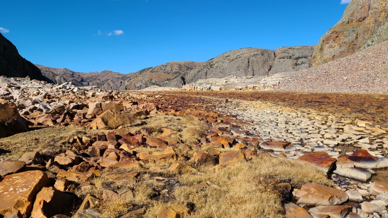

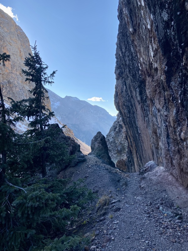
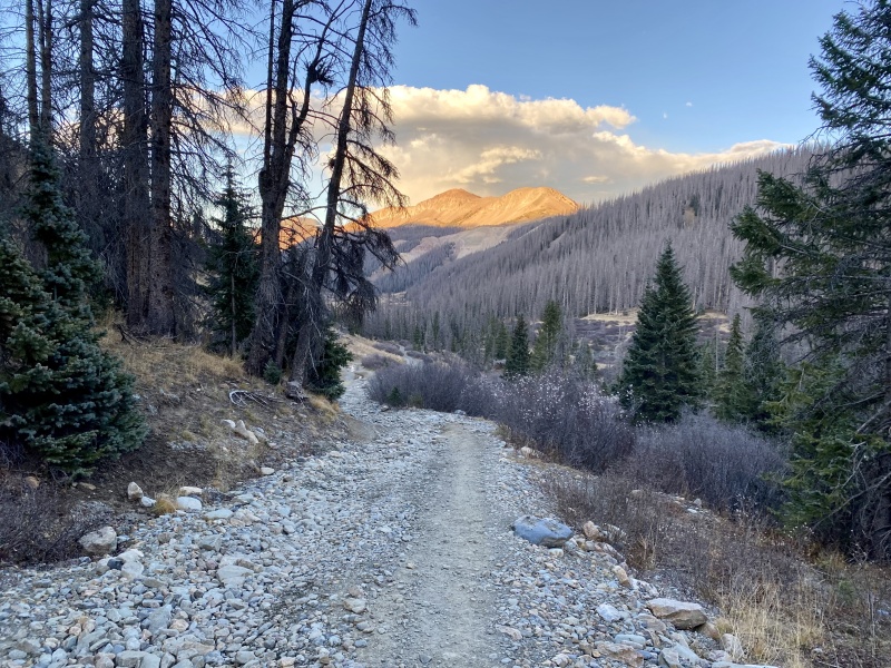
Elk Creek was an easy hop across this time of year and we were finally on good trail again. The trail sticks to the northern side of Elk Creek and for the first mile and a quarter has extremely impressive views of the massive walls and slabs of the peaks we'd just come from. 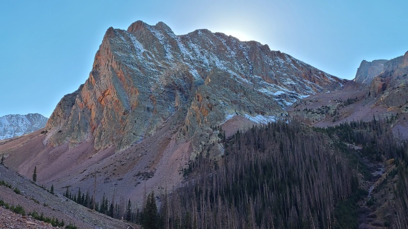
The trail miles were happier than basically everything since we'd left the trail earlier this morning (scrambling excepted, of course) and our tired feet and bodies were grateful. 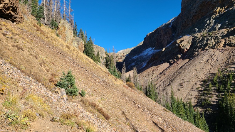
Our hike took us past all sorts of neat rock, and at one point even directly under a massive, cubic, overhanging slab. The trail disappeared up this short section but it was obvious we were supposed to go over it. Anywhere else would have been walking straight up the creek. 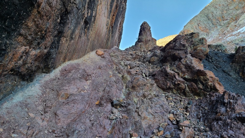
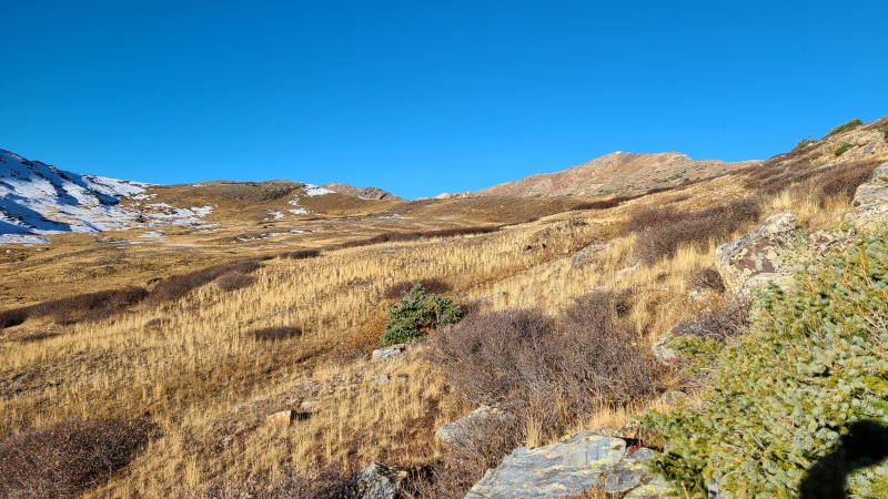
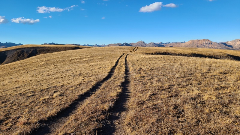
Eventually the trail opened up into a tundra field. The abrupt shift was a bit jarring, and everything was a yellow of a late fall flavor, which meant we were not far from the Divide. 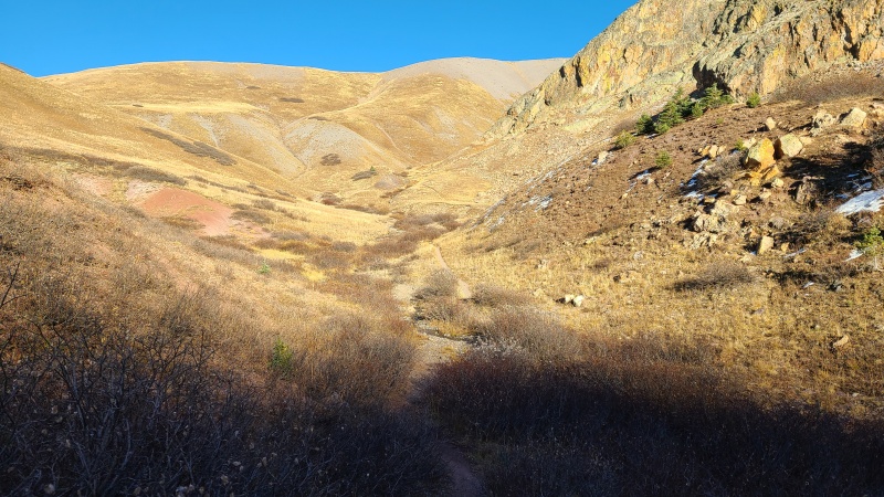
One last annoying section of about eleventy billion switchbacks, give or take a few, was all that stood between us and the Divide. We ground our way up them (I count 29 on my GPX) and were at last on top of the Divide. 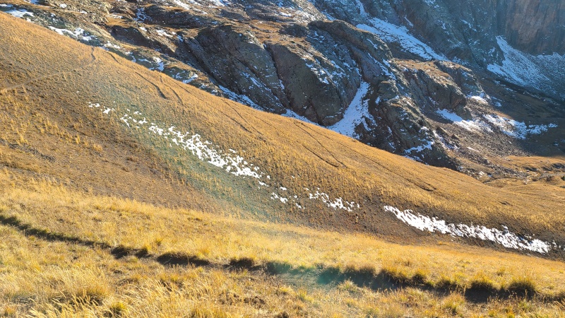

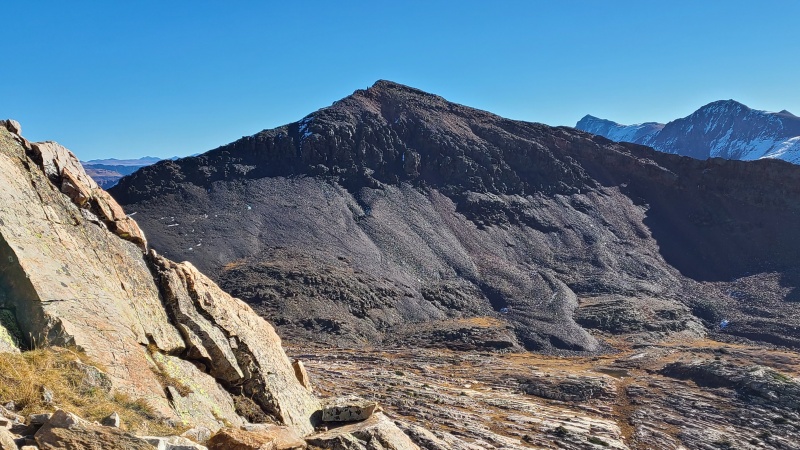
We traipsed over to the junction of the Colorado and Continental Divide trails, located in the saddle below Beartown Bald, and at this point Whiley and I split. She had a pounding headache and I still wanted to do Beartown Bald, which she'd done before. She began down the Continental Divide trail back to her truck and I continued up Beartown Bald, which at least was as simple and gentle as it could possibly be. 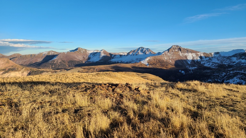
From Beartown Bald I decided to just go straight down towards the road instead of back to the trail. It was all grass anyway, and would be just that much faster and easier. I stayed west of a little knoll by Kite Lake and before I knew it I was back on the road and then back at camp. 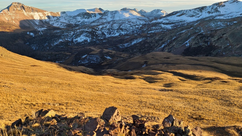
While it had been a huge day, and with ample mindnumbing terrain, we were both happy with how well it had gone and with how beautiful the area was. We just couldn't let a year go by without doing a single Weminuche peak. Success had been had. That's what we came for and that's what we got. I do wish we'd been able to scramble the full ridge between One and Three, but we made the best of the conditions we had. Here's to another great year of thirteeners. StatisticsClimbers: Ben Feinstein (myself), Whiley H. Total distance: 17.33 miles
Splits:
Thumbnails for uploaded photos (click to open slideshow): ")
")
")
")
")
")
")
")
")
")
")
")
")
")
")
")
")
")
")
")
")
")
")
")
")
")
")
")
")
")
")
")
")
")
")
")
")
")
")
")
")
")
")
")
")
")
")
")
")
")
")
")
")
")
")
")
")
")
")
")
")
")
")
")
")
")
")
")
")
")
")
")
")
")
|
| Comments or Questions | |||
|---|---|---|---|
|
Caution: The information contained in this report may not be accurate and should not be the only resource used in preparation for your climb. Failure to have the necessary experience, physical conditioning, supplies or equipment can result in injury or death. 14ers.com and the author(s) of this report provide no warranties, either express or implied, that the information provided is accurate or reliable. By using the information provided, you agree to indemnify and hold harmless 14ers.com and the report author(s) with respect to any claims and demands against them, including any attorney fees and expenses. Please read the 14ers.com Safety and Disclaimer pages for more information.
Please respect private property: 14ers.com supports the rights of private landowners to determine how and by whom their land will be used. In Colorado, it is your responsibility to determine if land is private and to obtain the appropriate permission before entering the property.


