Download Agreement, Release, and Acknowledgement of Risk:
You (the person requesting this file download) fully understand mountain climbing ("Activity") involves risks and dangers of serious bodily injury, including permanent disability, paralysis, and death ("Risks") and you fully accept and assume all such risks and all responsibility for losses, costs, and damages you incur as a result of your participation in this Activity.
You acknowledge that information in the file you have chosen to download may not be accurate and may contain errors. You agree to assume all risks when using this information and agree to release and discharge 14ers.com, 14ers Inc. and the author(s) of such information (collectively, the "Released Parties").
You hereby discharge the Released Parties from all damages, actions, claims and liabilities of any nature, specifically including, but not limited to, damages, actions, claims and liabilities arising from or related to the negligence of the Released Parties. You further agree to indemnify, hold harmless and defend 14ers.com, 14ers Inc. and each of the other Released Parties from and against any loss, damage, liability and expense, including costs and attorney fees, incurred by 14ers.com, 14ers Inc. or any of the other Released Parties as a result of you using information provided on the 14ers.com or 14ers Inc. websites.
You have read this agreement, fully understand its terms and intend it to be a complete and unconditional release of all liability to the greatest extent allowed by law and agree that if any portion of this agreement is held to be invalid the balance, notwithstanding, shall continue in full force and effect.
By clicking "OK" you agree to these terms. If you DO NOT agree, click "Cancel"...
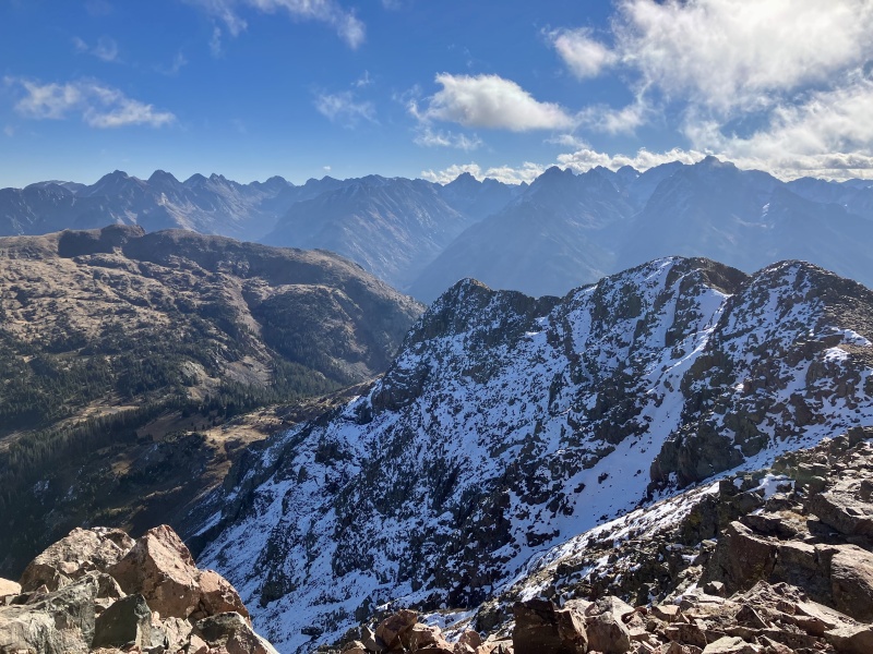
Twilight, SoTwi, unnamed 12er and West Needle from NoTwi
I moved from Breck to Durango back in July after finishing the Summit County 13ers (not the reason for the move, just a nice punctuation for my 12 years there). So now I've gone from the relatively accessible Eaglesnest Wilderness to the "Can I day trip at least a few of these peaks?!" Weminuche Wilderness. I quickly noticed that every time I drive north on 550 the Twilights are just there hanging out teasing the hobbyist mountaineer in me. I felt inclined to cut my 13er teeth in the Weminuche by bagging these before winter. Which would start the day after ascending these.
I had been trading messages with another forum member trying to peg down a date but it never worked out so I finally decided just to do them solo. I researched TRs (thanks bergsteigen, chicago transplant and furthermore) and found the beta to be kind of sparse - especially for autumn with light snow cover.
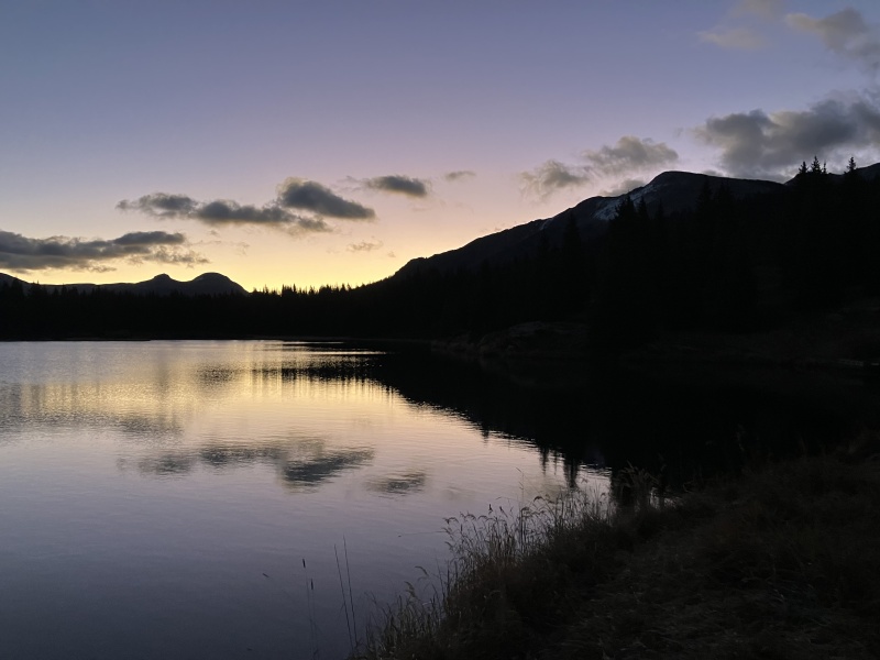
I arrived at the Andrews Lake TH after crushing 16oz of black coffee only to find the pit toilets closed for the season. WTF. I sulked into the trees, dug a dung hole with a rock and soiled the soil. Great start. Started running down the trail just after dawn with views of N Twilight much of the way.
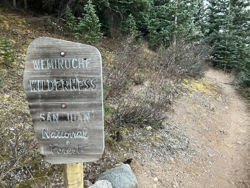
Dawn at Andrews LakeWilderness starts a little over a mile in.
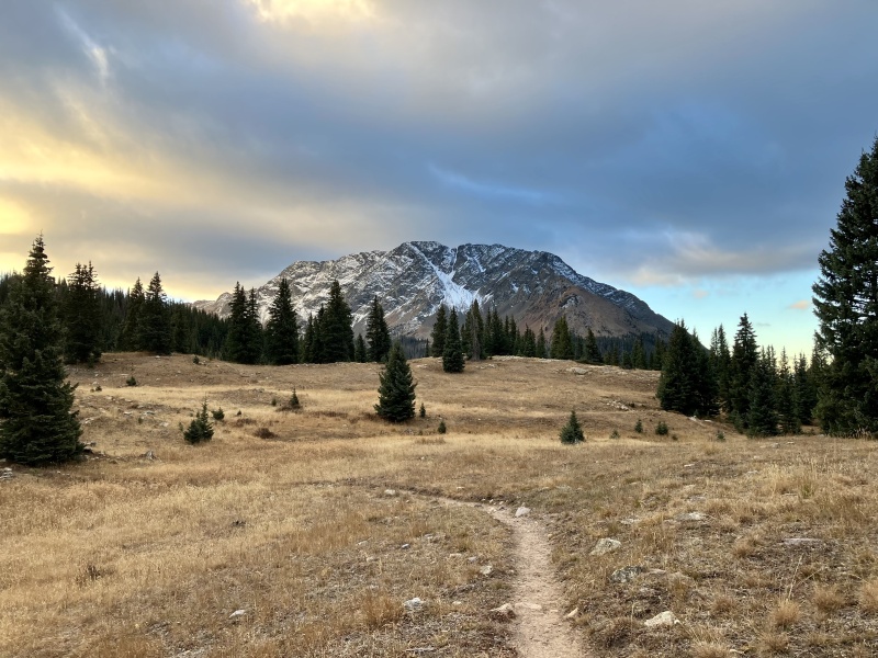
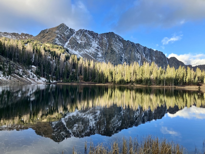
Literally it felt like it was mostly down. Wasn't looking forward to revisiting that on the return trip. After 5 miles I landed at Crater Lake where the well defined foot trail soon petered out into a social/climbers/game trail and finally ended in a thicket of Willows.
Crater Lake with North Twilight behind.
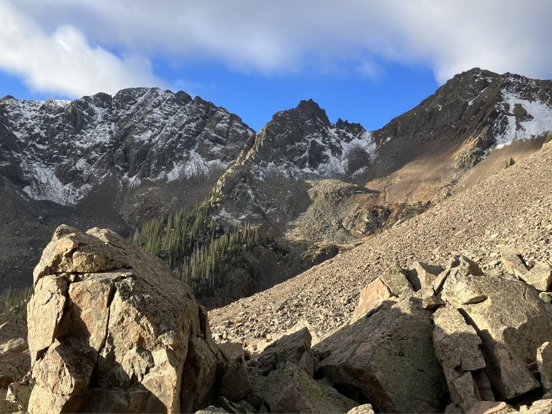
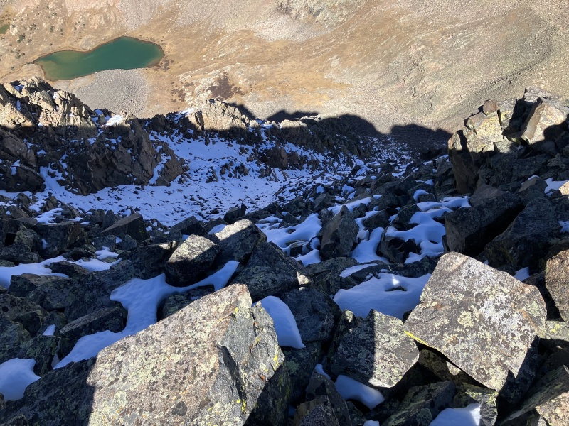
I had manually mapped a route in caltopo that took me into a broad gully between Twilight and N Twilight above an unnamed lake. But in an attempt to not lose elevation, I side-hilled a mile or so of loose scree ::MISTAKE 1:: After periodically cursing the shifty shale, I eventually reached the saddle and a bright white quartzite cairn leading to North Twilight (2:45). It proved to be an easy walkup and had amazing views of Engineer and the Mineral Basin beyond. As well as Twilight, SoTwi and West Needle behind.
Emerging from the willows onto a sea of scree. The rib above the lake center left.Looking NW on North Twilight
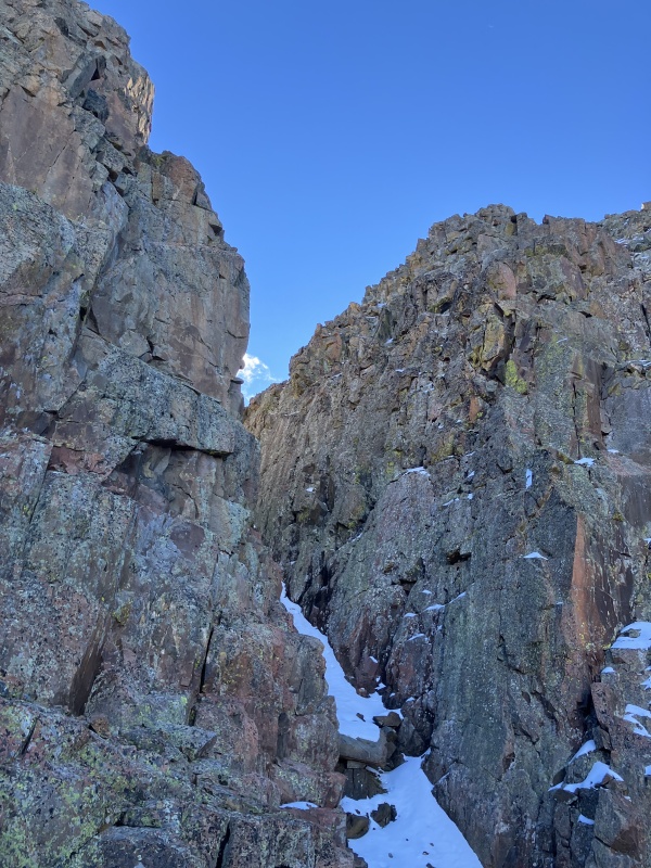
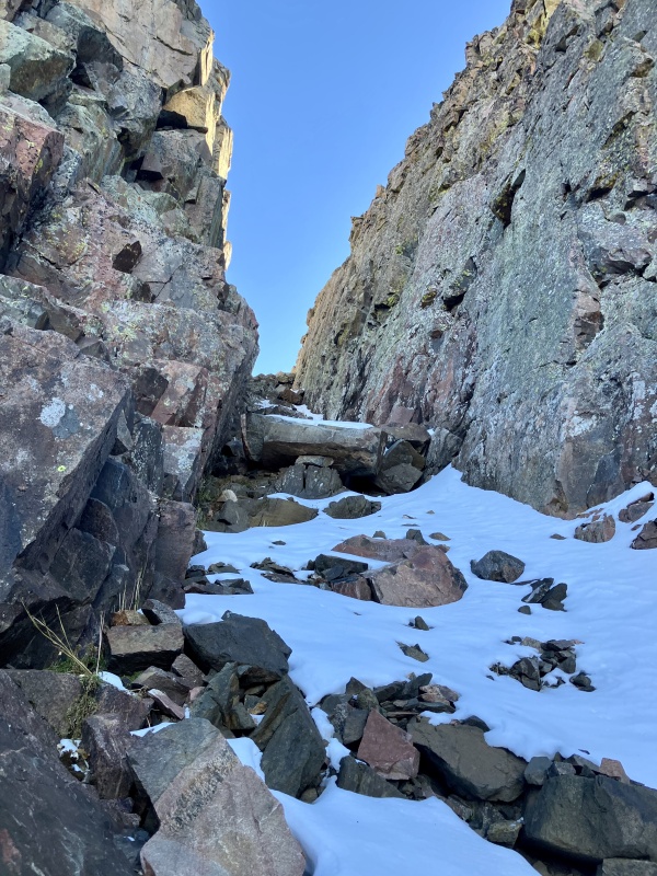
I ran back down North Twilight retracing my steps to the saddle and started toward Twilight. It looked doable in the shallow snow directly along the ridge but I soon encountered a deep cleave in the ridge. From above I could not identify a clean downclimb. I backtracked and traced a west bypass to the steep and deep gully at the bottom of the cleave. It normally would have been an easy ascent but it was mostly covered in deeper snow and had a giant chock blocking easy passage halfway up. I managed along the flank of the gully and found a scramble out of the gully and back to the north ridge of Twilight summiting in 3:25.
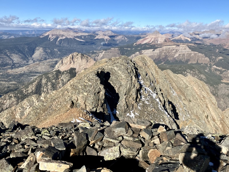
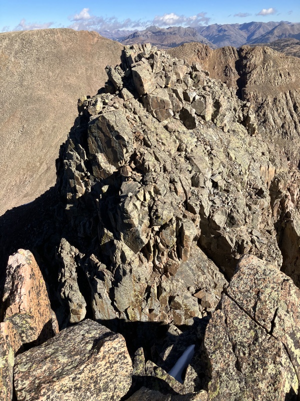
Twilight approach gullyGully chockstonethe ridge to Twilight's summitLooking east into the Wemi from Twilight. I really want to camp atop that island in the sky.South Twilight and Unnamed 12er from the Twilight-South saddle
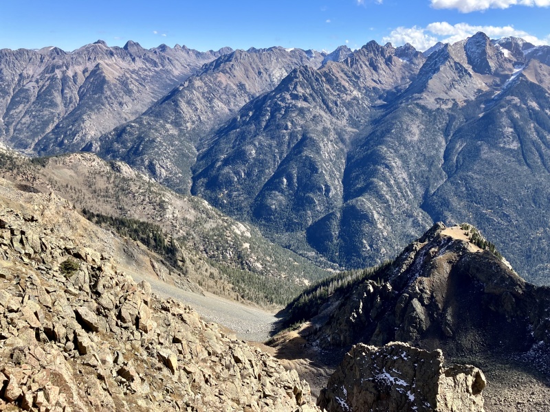
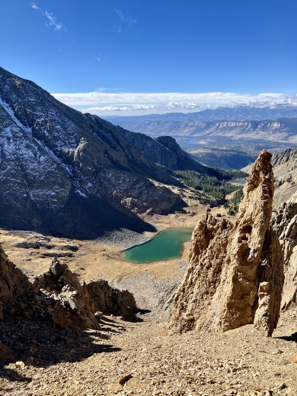
The down climb off to the south was straightforward. I traversed the ridge line bump that is South Twilight without stopping and started up a snowy, blocky wall on the northeast side of the unnamed 12er along the ridge ::MISTAKE 2:: I knew others had sidehilled past the 12er but I also knew there was a register up there (thanks Furthermore). I got greedy and just wanted the bonus peak. I'd done no research on routes. After about 15 ft of ascending from an exposed ledge I realized the route I was on became overhanging, still snowy and I couldn't identify where it topped out. I gingerly downclimbed and got the hell out of there. Around the corner, I was met by the sun and rewarding views of Twilight Lake and the north face of West Needle.
Twilight Lake with West Needle left
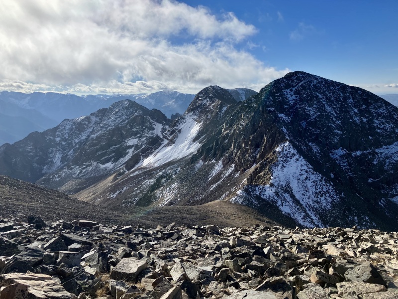
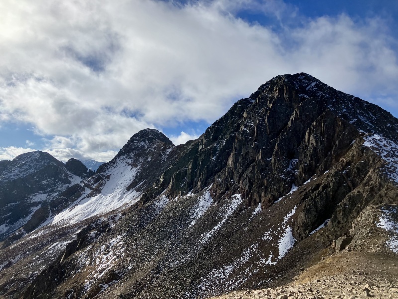
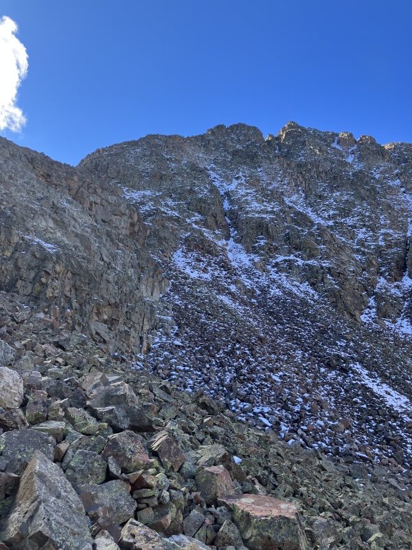
It was intimidating: caked in snow and covered in shadow. The couloirs looked impassable (I didn't bring traction anyway). I skirted the gendarmes to the west at the base of the ridge and just started climbing the snowy north face. I'd consider it sustained, mostly unexposed 3rd class for conditions that day until the summit block. The blocky, snowy wall had no obvious route.
Looking up at West Needle from the scree traverse
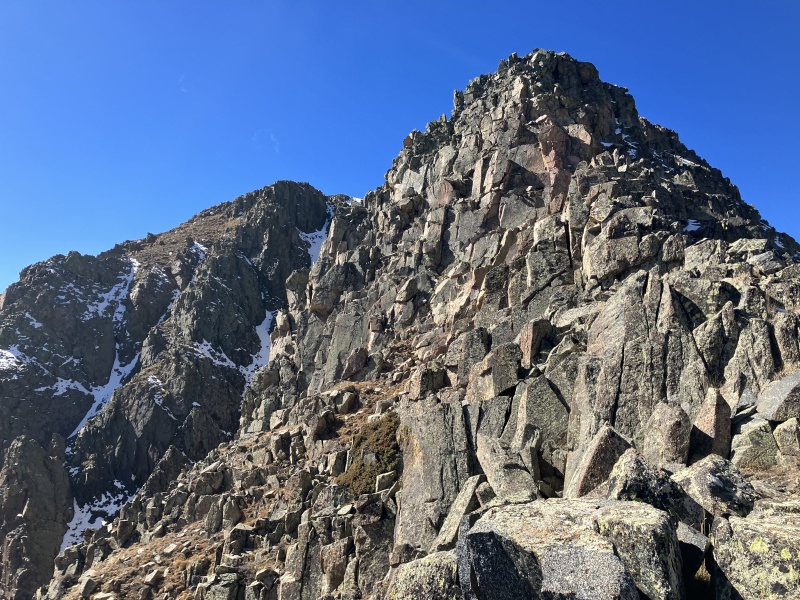
From the ridge, I could make out a dry couloir on the east side leading directly to the summit. So I traversed over and took the super highway to the top (5:30).
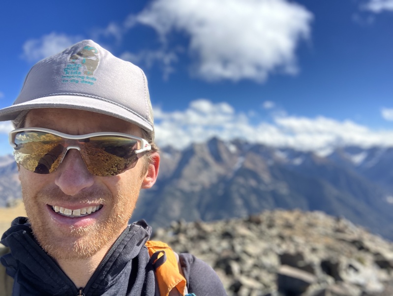
Traversing to West Needle's SE couloirCompulsory West Needle selfie
Milling around, debating whether the NE or SW summit was the highest point, I noticed a small cairn down ridge from the NE summit. I decided to follow it and started making my way down ridge proper. Soon the cairns disappeared and I made the decision to downclimb north off the ridge parallel to the route I had ascended ::MISTAKE 3:: Once again, I found myself on exposed snowy ledges, but descending instead of ascending this time. I made one exposed move starting down and quickly realized I was uncomfortable in the cliffy snowy terrain. I backtracked up to the ridgeline and just continued on, hoping to avoid being cliffed out. Luck was on my side. Apparently I had charged right past the 4th class climb on my way to the couloir.
West Needle's east ridgeLooking down at Twilight Lake from West Needle's east ridge
I rejoined my ascent route for the down climb and efficiently traversed talus over to the saddle between S Twilight and the 12er, even finding the faint trail that bergsteigen had followed. I descended the skiers right side of the rib hoping to hop over it near the bottom to rejoin my ascent route adjacent the unnamed lake. But I repeatedly emerged from trees atop cliffs ::MISTAKE 4:: and had to reenter the narrowing couloir. Eventually I resigned myself to descending to the base of the couloir hundreds of feet below the lake and regaining the vertical. It was tedious talus but straightforward. I finally emerged from the willows I had battled through earlier behind Crater Lake. The run out sucked as much as anticipated. I was feeling pretty worked and had to hike most of the low angle climbs back to the trailhead. I finally arrived back at my car at 1500.
Navigation & Communication
I preload my intended route in both Caltopo on my phone, as well as my Suunto Ambit 3 watch, for both redundancy and because the watch is more convenient while the phone is more detailed. I make sure I have the map downloaded on the phone for offline use, and then put the phone in airplane mode when I start. I've never run out of battery even on 18 hour days with that approach. GPS will still work in Caltopo in airplane mode. Once I've finished the last summit, if I'm doubling back on the route, I'll switch the watch navigation to "Track Back" so I can follow my old track. Sometimes it deviates from my planned route so I like to see that level of detail on the return trip.
Even though my phone is in airplane mode eliminating contact with the outside world, I always try to carry a SPOT transceiver. I share the link with at the least my wife and occasionally some friends. I always give her my estimated return time, a time when she should put SAR on standby, and a time she should call out for help. And I also tell her I'll call her when I've started my descent from the last summit. Putting SAR on standby gets a page out to team members to be on standby for a distressed hiker at your general location without formally dispatching them to the site. If you are in trouble, doing so can save minutes to hours in making resources available to reach you.
My GPS Tracks on Google Maps (made from a .GPX file upload):
If you haven't checked out Snowdon, the W Buttress to NE Ridge is a civilized scramble and a short morning from Durango via the same trailhead.
I hopped on W Needle last week by what's probably the shortest route from a road (Old Lime Creek) but it was heinous re: 0 trail. The NE summit won the LiDAR battle I think.
These were fun peaks, and definitely on the easier side of things access wise for the Weminuche! I'll second Snowdon as well, I think you can also day trip UN 13340 from Cave Basin and if you don't mind the LONG washboard of Missionary Ridge, there are day trip options on Lime Mesa (Overlook Pt and Aztec for sure, Valois a little more ambitously)
I thought the LaPlatas had some fun day trips for that area as well, if I lived in Durango I am sure I would repeat Babcock, Lavender and Moss all the time. Check those out! Babcock I did a TR, Lavender and Moss I did not but went up the Tomahawk Basin road for those and up Moss' south ridge. I want to go back someday and run the ridge between Babcock and Spiller.
Caution: The information contained in this report may not be accurate and should not be the only resource used in preparation for your climb. Failure to have the necessary experience, physical conditioning, supplies or equipment can result in injury or death. 14ers.com and the author(s) of this report provide no warranties, either express or implied, that the information provided is accurate or reliable. By using the information provided, you agree to indemnify and hold harmless 14ers.com and the report author(s) with respect to any claims and demands against them, including any attorney fees and expenses. Please read the 14ers.com Safety and Disclaimer pages for more information.
Please respect private property: 14ers.com supports the rights of private landowners to determine how and by whom their land will be used. In Colorado, it is your responsibility to determine if land is private and to obtain the appropriate permission before entering the property.
")
")
")
")
")
")
")
")
")
")
")
")
")
")
")
")
")
")
")
")
")
")
")
")
")
")


