| Report Type | Full |
| Peak(s) |
Unnamed 13039 - 13,039 feet Unnamed 13204 - 13,204 feet Williams Mountain South - 13,321 feet Williams Mountain - 13,390 feet Unnamed 13139 - 13,139 feet |
| Date Posted | 10/24/2022 |
| Date Climbed | 10/22/2022 |
| Author | yaktoleft13 |
| Williamseseseseses |
|---|
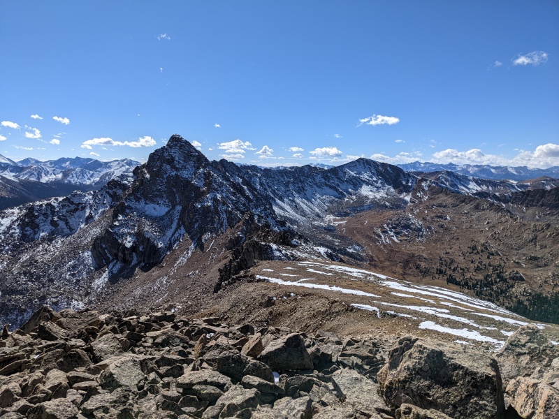
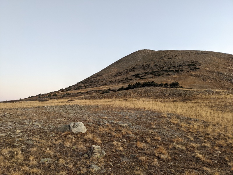
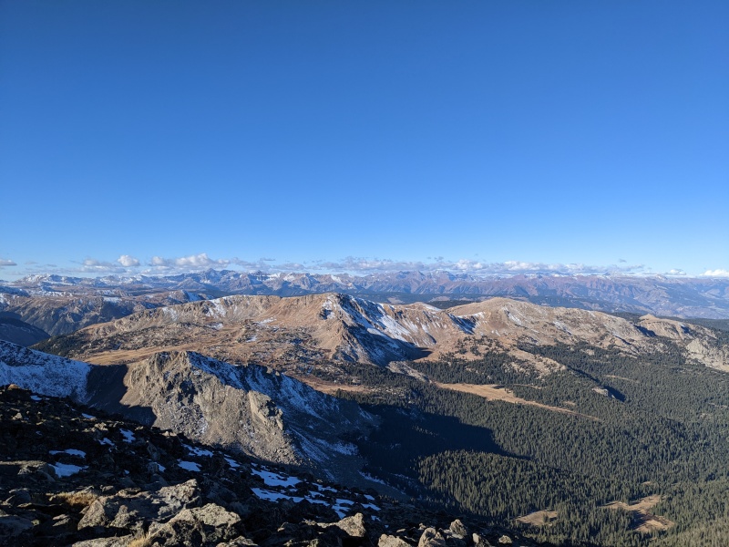
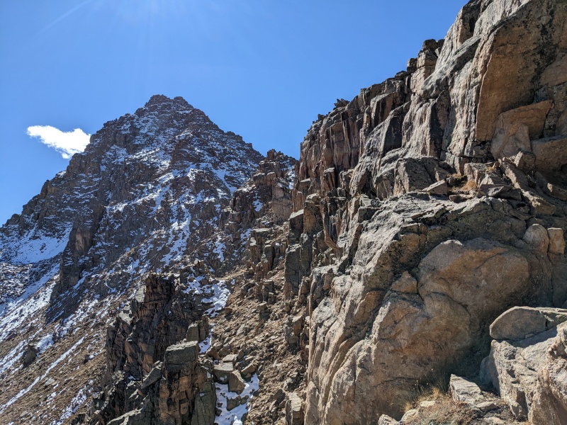
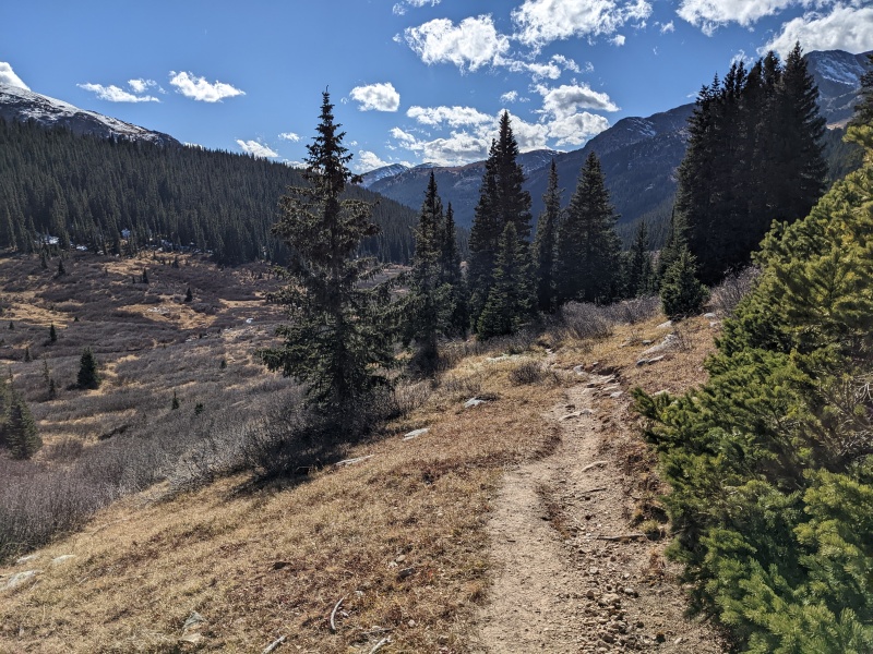
Length: 16 miles Gain: 6,000 ft (watch said 6,600, caltopo said 6k) Difficulty: 4th(ish) class Trailhead: Lost Man Reservoir I have wanted to do the Billy traverse for like five years, which is coincidentally the last time anyone wrote a report for these peaks. List chasing kept pushing them down the priority list, but this year I've been able to get out and do things just because they're there, not because they're on a list. Oddly enough, this route hadn't crossed my mind for this year for unknown reasons, but other than some snow the weekend of the Fall Gathering, we've been super dry up in the high country. Most routes are (well, were) still in largely summer conditions. A snowstorm arriving on Sunday the 23rd promised to change things, but I had a free day on Saturday and after tiring out the dogs (and the pads of their paws) on an easier day on Tuesday, I chose to give them a reluctant weekend off (reluctant on their part). I started looking for scrambles that weren't 10 million hours away, and boom, the Billy! I was curious to see whether the north-facing downclimbs off of the peaks would be snowy or dry, but figured I could bail at any point if anything was too sketch. I rolled into the Lost Man Reservoir trailhead at 6 AM Saturday morning and was on the trail shortly thereafter. I took a quick left onto the Midway trail and followed the gentle switchbacks up and up, popping out of the trees right as it got light enough to turn off the headlamp. I left the trail at the start of the obvious slope leading up to Williams South C, zigzagged through the wimpy-ass willows (they really were! be better, willows), and followed the slope to the false summit and glorious sunshine. It was a chilly morning; my fingers needed a thaw-out. Once on the false summit, a quick stroll took me to the top of South C, the first of five ranked peaks today (seriously, how often can you hit five ranked peaks in a row on a ridgeline with no BS in between?). 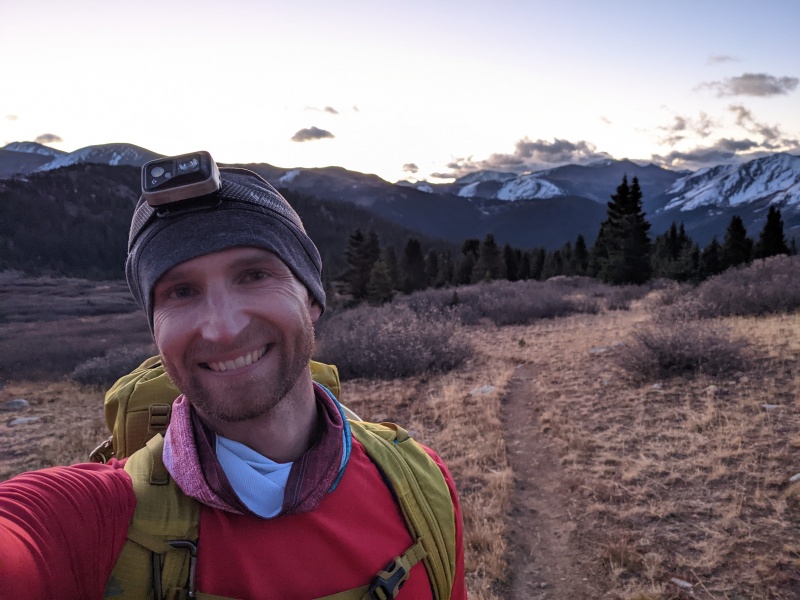
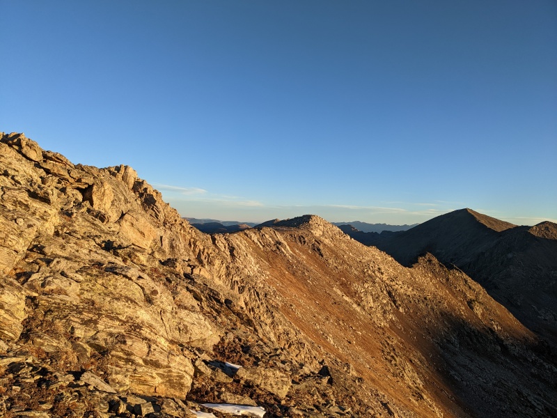
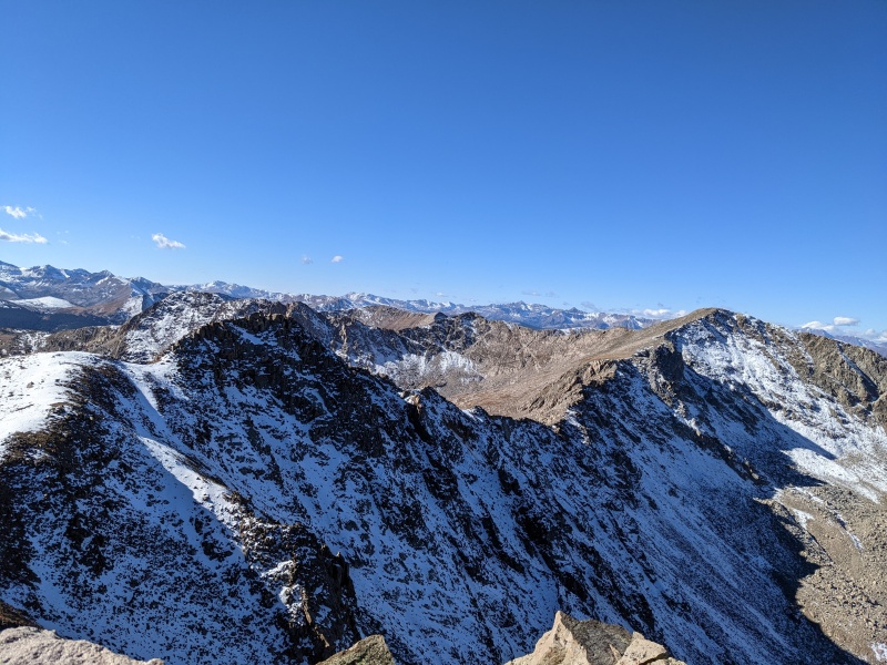
The info I'd seen did not make much mention of the ridge from South C to South A, other than to say it was 2nd class. I guess it was, but man it was a scrambly 2nd class! The whole ridge was narrow and talus-y. Oh, and it was LONG. My GPS had it at around 1.5 miles, and it felt every bit of that. There was nothing technically difficult, and at any point I could drop down to the east and just sidehill, but it was just as fast to stay ridge proper. 
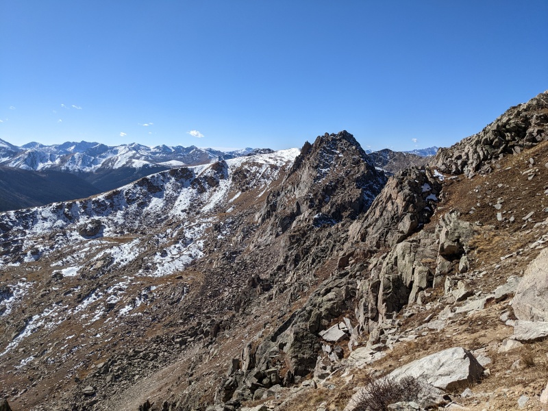
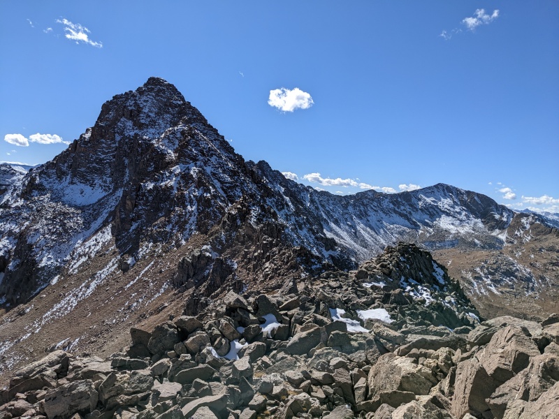
Once at the false summit, the ridge narrowed a bit, but it was still a talus-hop to the summit of South A, number 2 of 5 on the day! As some of the westernmost Sawatch peaks, the views of the Elk range were mind-blowing (which was not the only thing blowing....oh hey wind). Let me stop here, because even I got confused while writing this report. I have to point out something wildly bizarre about this traverse....the peak names. To begin with, everything is Williams Mountain, so that's not super helpful. But to make matters worse, the letters follow the elevation of the peaks, rather than the order. So while it would make sense to have the southernmost peak be Williams South C, then South B, then South A, the second peak from the south is actually taller than the third peak from the south, so the second peak is A and the third peak is B. The order of the peaks is South C (lowest), South A (second tallest), South B (second shortest of the south peaks), Williams (tallest and gets its own, non-derivative name), and North (whose elevation doesn't matter since it's the only one to the north). Makes sense but also no sense. Okay, moving on... 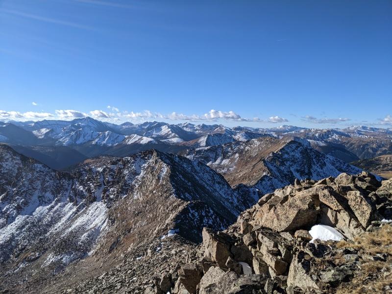
After a quick food break, it was time to skedaddle. I knew the section between South A, South B, and Williams holds the majority of the scrambling, and I wanted to get as much done before the wind got me too bad. I stayed on the rocky ridge as I descended down toward the saddle, still in class 2 terrain. Shortly before reaching the saddle, easy progress is blocked by a large gendarme on the ridge. Here's where I had to decide what kind of day I was going to have. Some days, you want all the smoke. Other days, just a little bit of smoke is all you desire. Today was a mild-to-moderate amount of smoke day, and as such, I dropped to the east off the ridge and traversed under the gendarme on sidehilling grass. Exciting? No, but nonetheless effective. Somedays that's all ya got. 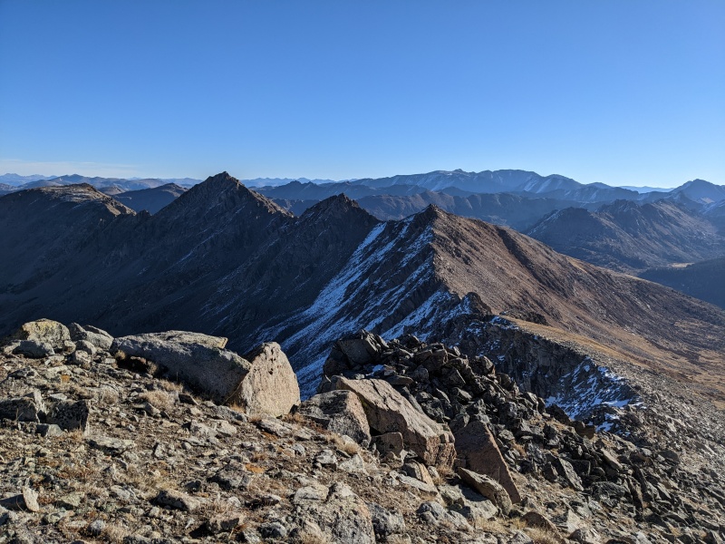
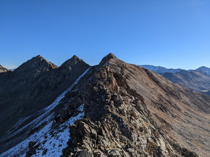
From the saddle, an easy scramble leads to the false summit of South B. Much of the ridge is class 2 with a few harder moves peppered in, but, as with much of the traverse, easier sidehilling lies to the east. I dispatched the false summit and descended the easy ridge to the saddle with the true summit of South B. 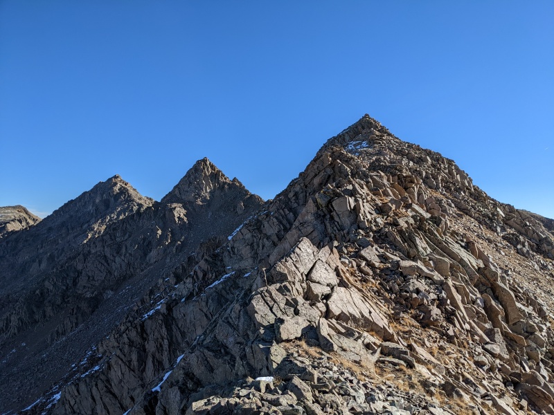
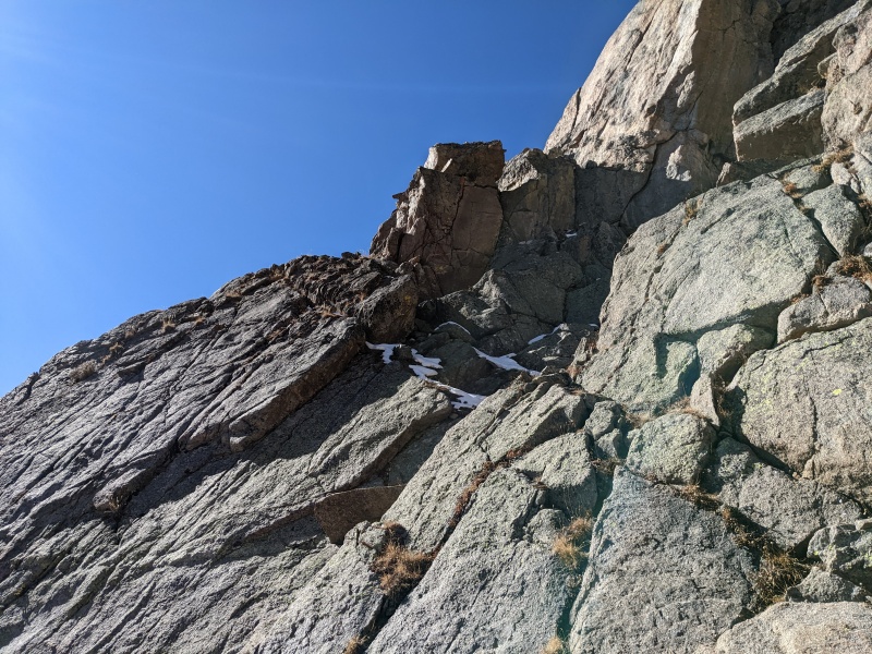
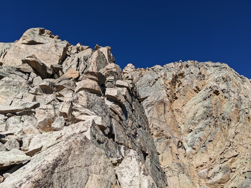
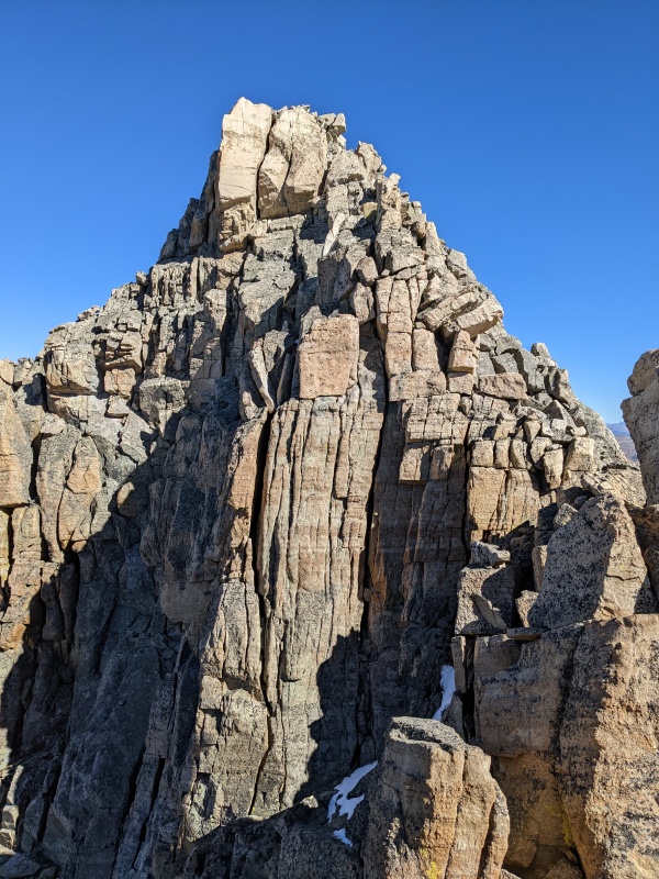
The ascent up to the true summit of South B held some confusing terrain, especially from a distance. I weaved through rocky outcroppings on dirt and rock, trending to the east side of the ridge, eventually coming to a steep rib guarding the summit. There were a few ways up, but to minimize looseness, I scrambled up some blocky 4th class terrain just to the right of a chimney with a chockstone over it, eventually stepping back across onto the chockstone and back to talus-y third class. A few moves later and I was at the summit, which held a register and was the southern of the two points, though they're about 30 seconds apart so just tag 'em both. Summit 3! 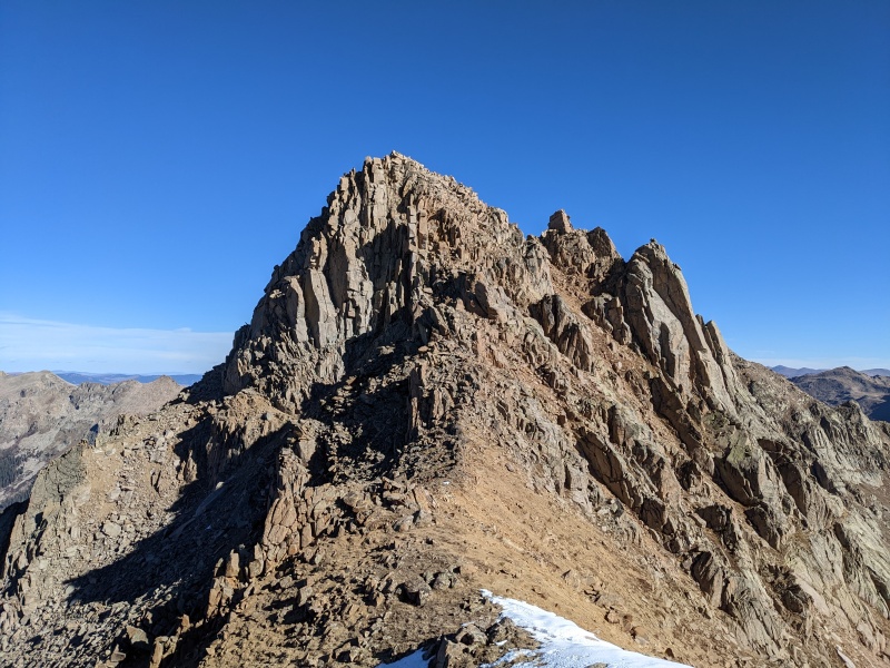
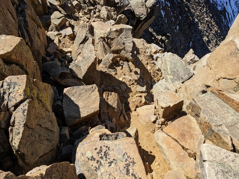
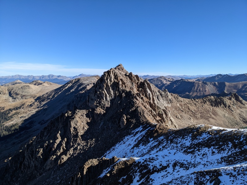
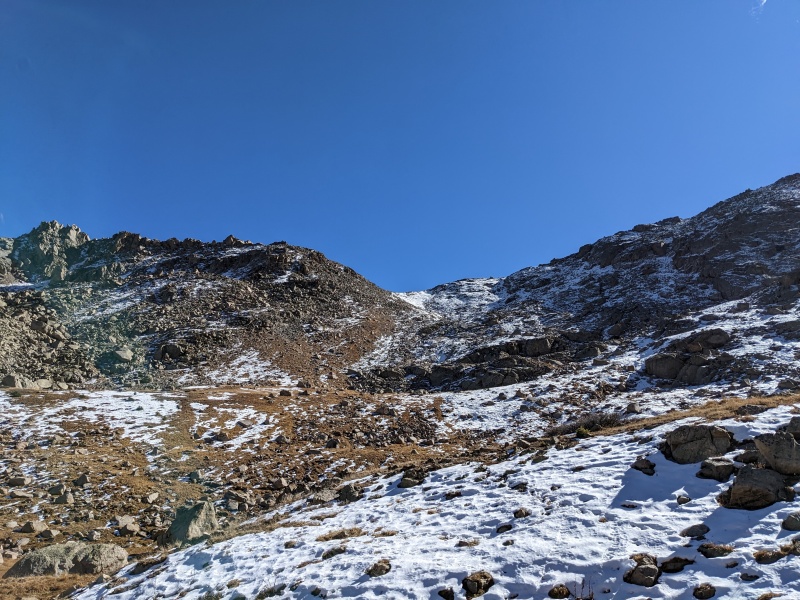
I'd read the descent off of South B is the crux of the route, and it surely did not disappoint. It appears there's multiple "slots" that go, but in essence, the way down is to find a slot off the east side of the summit ridge that drops down toward a notch on the main ridge, then complete a short traverse through one of two notches on an east/west ridge that grants access to a network of grassy slopes and slabs that lead down below the saddle. I found my route by following the summit ridge north, cutting 180 degrees back toward the south, then dropping down a series of 5' drops off of blocks to easier terrain. Once I was down, I discovered that a slot 15 feet further east of mine had a cairn at the bottom, but I saw nothing up top directing me that way. My way went just fine, but the cairned slot may be easier. Mine was stiff 4th class. The good news? The wind was blocked by the ridge from the summit of South B all the way to the summit of Williams. A much needed respite, to say the least 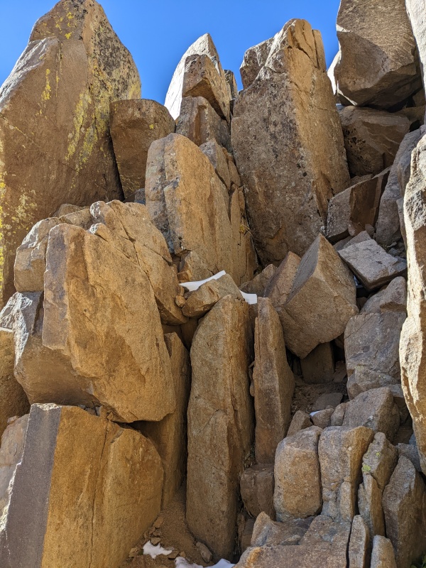
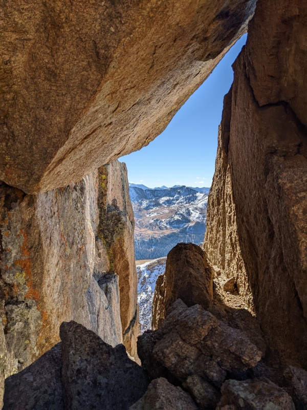
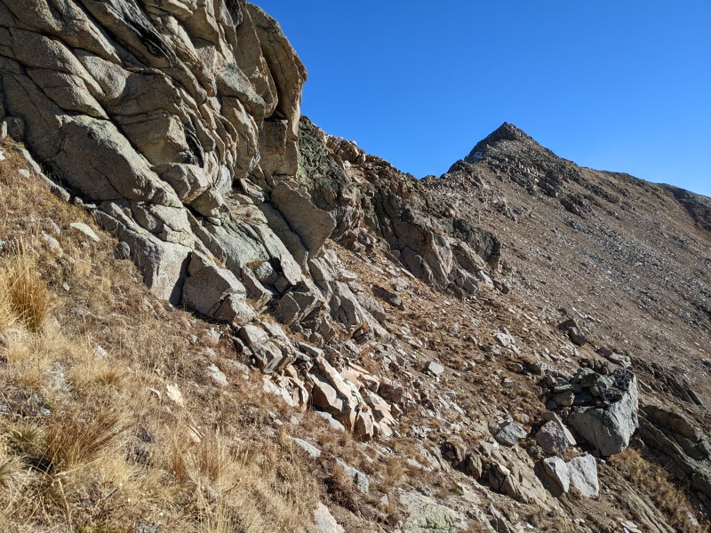
Once at the notch, 30 feet of snow-covered slopes yielded to steep-but-dry grass. Though there were interspersed rock slabs, I was able to stay on grass all the way until the cliffy section before the low point on my sidehilling traverse. I'd read that these grassy slopes all cliffed out, and thus one has to climb higher up before dropping down, but following the grassy slopes to their natural terminus brought me to an fairly easy downclimb/traverse which didn't exceed 3rd class and put me at the low point of the traverse. 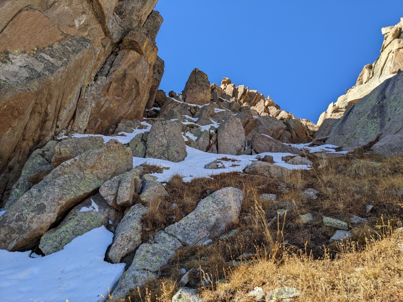
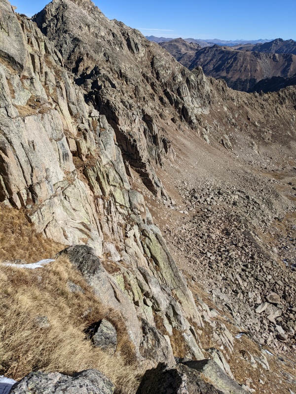
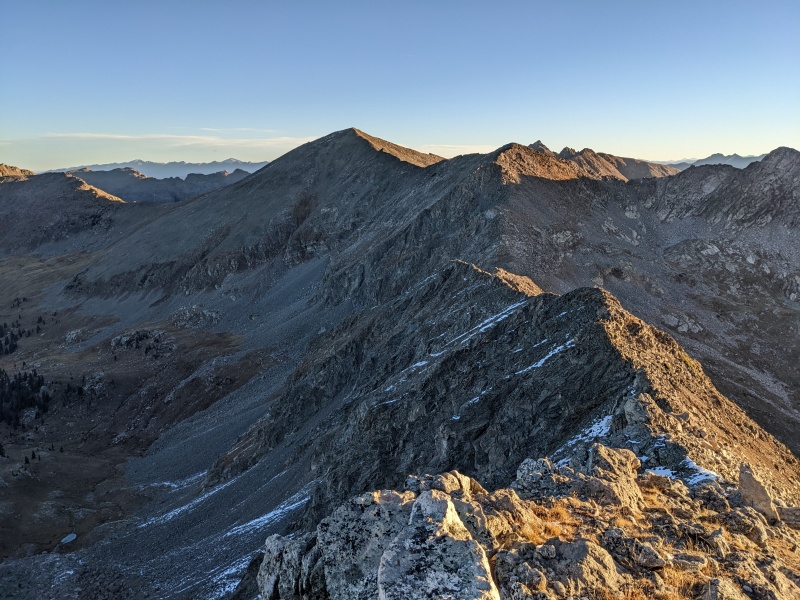
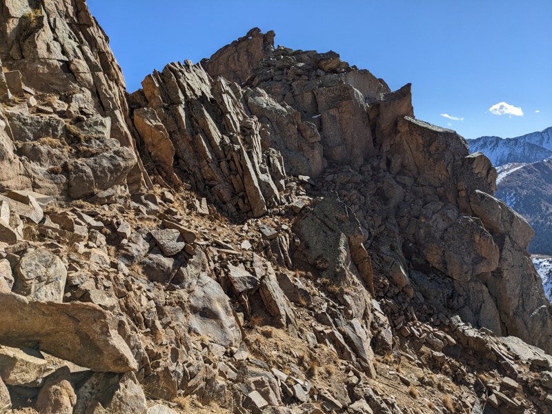
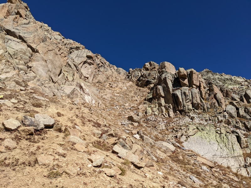
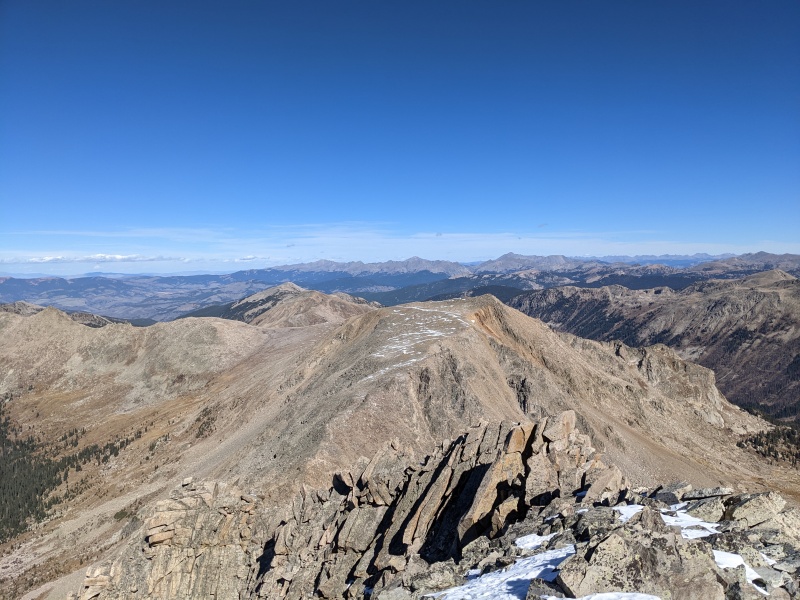
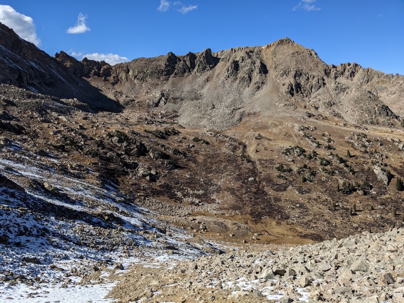
Once below the cliffs, I elected to continue my avoidance of all things difficult and avoid the major ridge gendarmes all the way to the east. The ridge proper does not go, and while there's likely a navigable high route somewhere around those gendarmes, it seemed contrived to climb up and look for it for no other reason than to say I did. So I stayed low, sidehilling underneath all the cliffs coming off the gendarmes, until the terrain opened up into a dirty/rocky/grassy/scree-y gully, which I headed up. In case you haven't noticed, there is a lot of sidehilling on this route, and almost all of it is downsloping to the right. The feet start to hurt after a while from being constantly wrenched the same direction. Oh well, the price we pay for five ranked thirteeners... 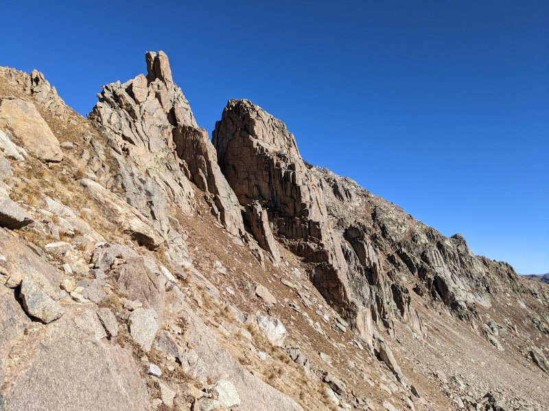
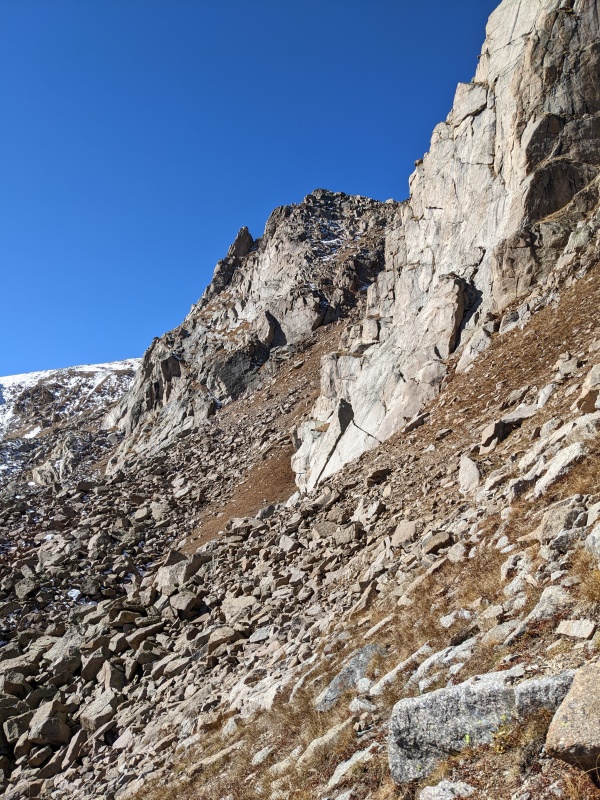
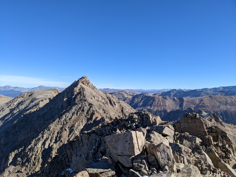
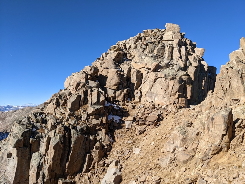
The gully was loose and sucky, but it was better than sidehilling more! I ascended until the gully ran into steep cliffs. I stepped left onto a blocky face and traversed until I found a reasonable way to go up, then scrambled up until I reached the false summit of Williams. 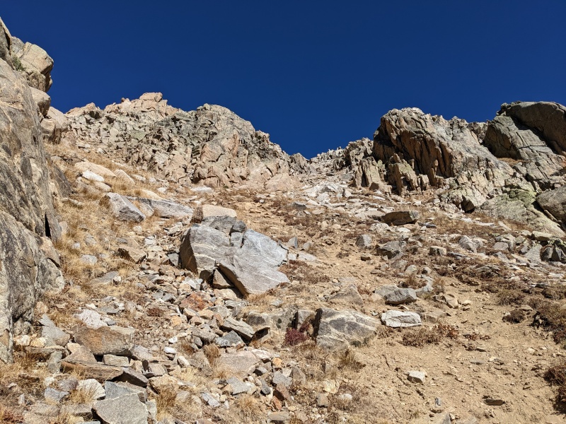

As I approached the top of the scrambling, I found myself on top of yet another false summit (seriously, does every one of the Williamseses have a false summit?). The true summit was perhaps 100 vertical feet away, but required some delicate scrambling. For possibly the only time on the entire traverse, I dropped to the west side briefly to get around a portion of the connecting ridge, then scrambled back to the east side to the base of the summit pitch. I stayed ridge proper or slightly east for most of the ascent, then slithered through a slot next to two large, parallel blocks just below the summit. A moment later and summit 4 of 5 was mine! 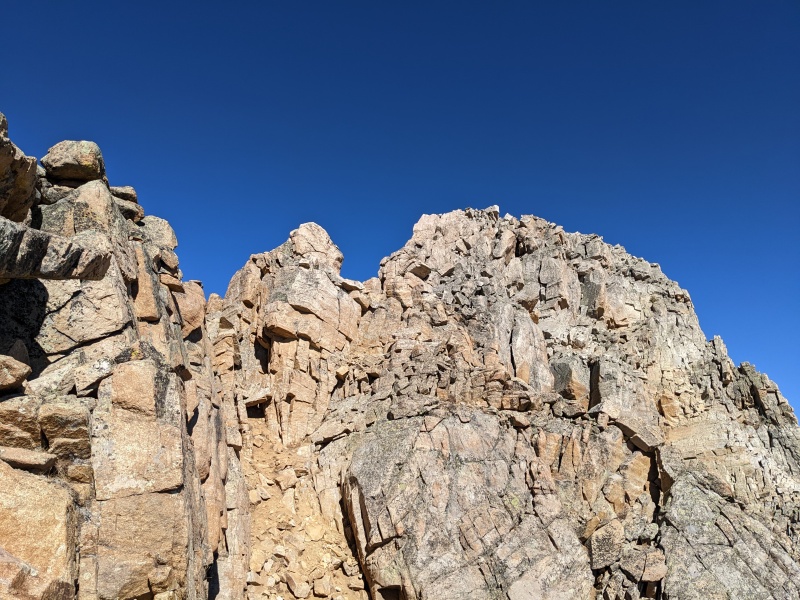

In my excitement to reach the summit of Williams, I forgot that the downclimb off of Williams toward North was not a cakewalk. To top it off, this was the only part of the route that was seriously impacted by lingering snow. I carefully scrambled down easy 3rd terrain, rock-hopping where possible, down a few hundred toward the saddle with North. But lo and behold, what blocks easy access to North? More gendarmes! Luckily, they were easily bypassed to the east of the ridge and after many hours traversing rocky ridges, I finally found easy class 2 terrain to the summit of North. Peak 5 baby! 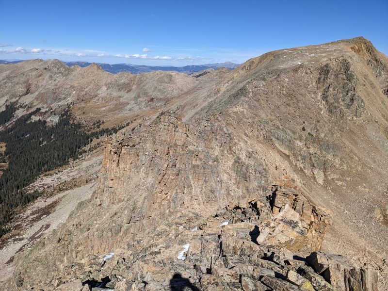
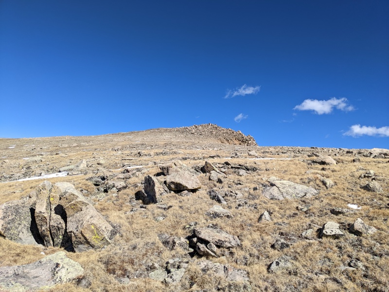
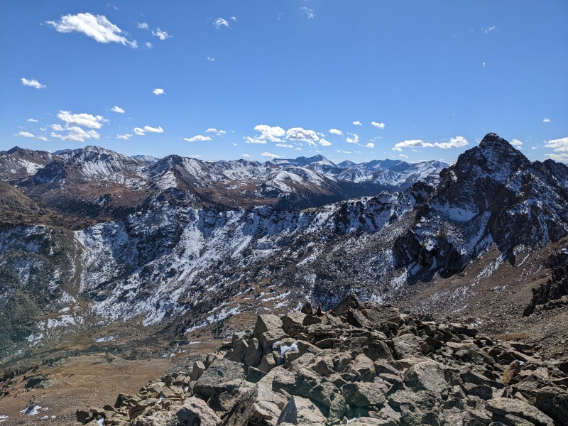
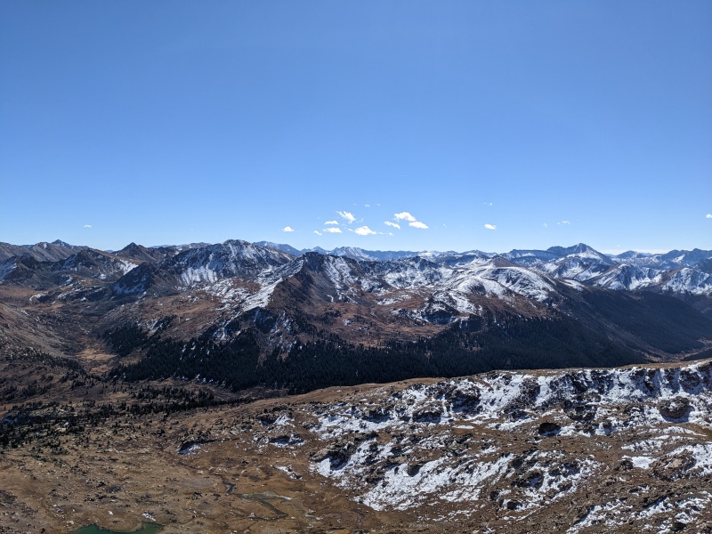
The Billy traverse does not relent without one last kick in the nards, however, as the best way into the correct drainage is to drop into the wrong drainage and climb up 600 brutal feet to a saddle. Wanting to get it over with quickly, I dropped off the first gully to the east heading back toward Williams and descended a mix of soft scree, hardpanned scree, grass, and talus into the basin. There's no good way to avoid giving up all the elevation, so I just took a direct route toward the bottom of the gully leading up to the pass. Once on the slopes below the pass, I mostly talus-hopped up, although there were occasional snowed-in trail segments that may provide an easier way when dry. An hour after leaving the summit of North, I topped the pass, finally marking the end of the day's uphill. 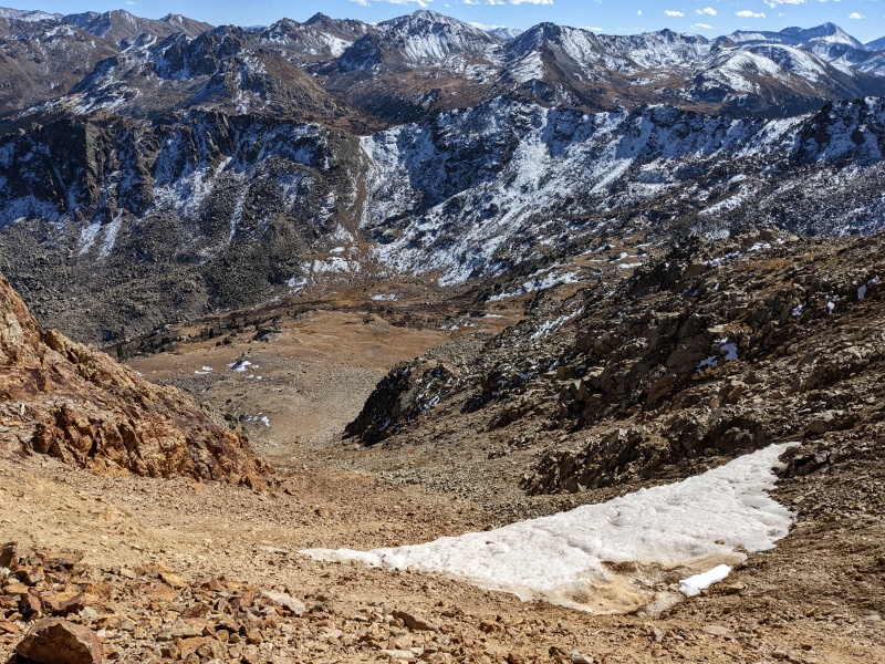
Once at the pass, I discovered that if I dropped directly down, I'd actually have to ascend another pass before permanently going downhill. Wanting to avoid that, I did a long but easy sidehilling (the other way finally, yay!) trailless traverse on grass until I met up with the trail beyond the top of the pass. I'd recommend this to avoid the regain. The terrain is easy and there's a smattering of game/use trails through it, allowing for speedy travel. Eventually, the large main trail appears, and the hard part is over; just gotta put one foot in front of the other until the car. 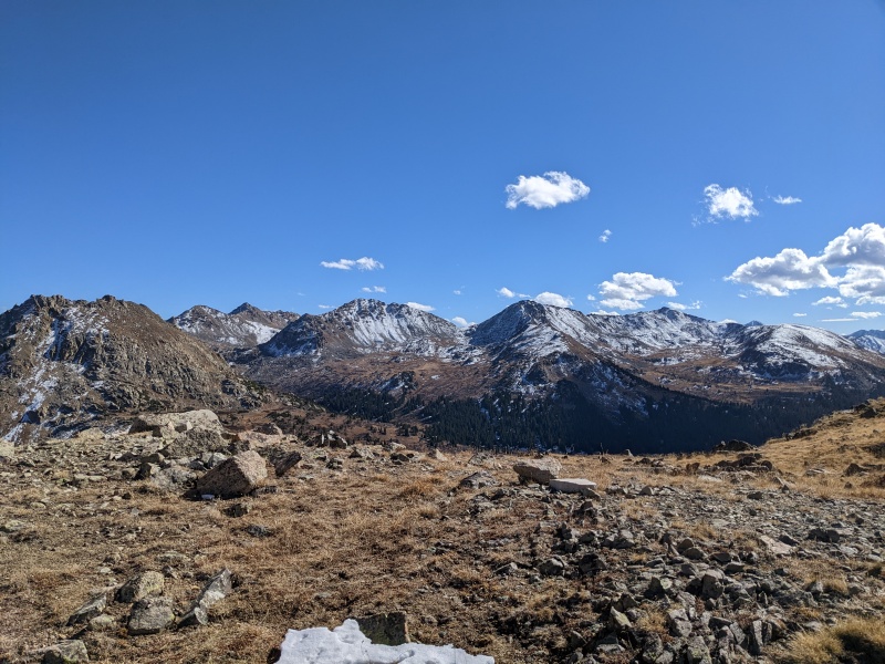

All in all, this route lived up to the hype. The mountains are AWESOME, the traverse is challenging (and can be made about as hard as you want if you so choose), and the physical effort is exhausting. But these peaks deserve more adoration than they get, and this route is undoubtedly one of my favorite of the year. Now, I just have to apologize to the dogs... Thumbnails for uploaded photos (click to open slideshow): ")
")
")
")
")
")
")
")
")
")
")
")
")
")
")
")
")
")
")
")
")
")
")
")
")
")
")
")
")
")
")
")
")
")
")
")
")
")
")
")
")
")
")
")
")
")
")
")
")
|
| Comments or Questions | ||||||||||||||||||||||||||||||
|---|---|---|---|---|---|---|---|---|---|---|---|---|---|---|---|---|---|---|---|---|---|---|---|---|---|---|---|---|---|---|
|
Caution: The information contained in this report may not be accurate and should not be the only resource used in preparation for your climb. Failure to have the necessary experience, physical conditioning, supplies or equipment can result in injury or death. 14ers.com and the author(s) of this report provide no warranties, either express or implied, that the information provided is accurate or reliable. By using the information provided, you agree to indemnify and hold harmless 14ers.com and the report author(s) with respect to any claims and demands against them, including any attorney fees and expenses. Please read the 14ers.com Safety and Disclaimer pages for more information.
Please respect private property: 14ers.com supports the rights of private landowners to determine how and by whom their land will be used. In Colorado, it is your responsibility to determine if land is private and to obtain the appropriate permission before entering the property.