| Report Type | Full |
| Peak(s) |
Unnamed 13251 - 13,251 feet Unnamed 13258 - 13,258 feet "West Apostle" - 13,597 feet |
| Date Posted | 10/16/2022 |
| Date Climbed | 10/15/2022 |
| Author | yaktoleft13 |
| I Took a WaAaAaAaAaAaAaAalk to Lake Ann |
|---|
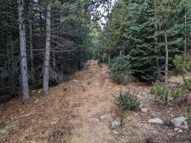
You know how when you're hiking, it always seems there's a song running through your head? I get that almost every time. Sometimes it's Between the Buried and Me, sometimes it's Taylor Swift, and sometimes, it's Lil Yachty. And today, it was little Mr. Small Boat Person and his dumb yet catchy banger. You might have to replay it a few times, since Mr. Yacht-man was leaning so hard he couldn't think of a second verse. Don't do drugs, kids. Anyway, stats: Length: 14ish miles Gain: 5300' Difficulty: easy 5th (most of ridge was 2nd/3rd) Time: 8 hours The last couple of outings, I'd been tagging peaks from the West Winfield trailhead. My last trip took me up the Virginia group con perros, but running the ridge to get my remaining Winfield peaks was out of their (and probably my) single day endurance abilities. Even adding the Points from the north side would have made for a painfully long day, so I left them, trusting my week-in-the-future self to have greater endurance. However, this left me with a weird grouping of peaks: the Points...13235, 13253, 13253 South, and, three miles down the ridge,......West Apostle? These peaks don't link up well. Regardless, any attempt for these four peaks would have to be sans perros. It was time for a wAaAaAaAaAaAalk! I couldn't find a ton of beta on the entire ridge in my 5 minutes of searching, but at the very least there didn't seem to be any massive cliffs blocking any sort of passage. I figured at worst, it would be a long and slow day, but that all four peaks would be gettable in a lengthy ridge run. Only one way to find out! I rolled up to the 4wd Huron/Lake Ann trailhead before the sun showed itself and set off on the Lake Ann trail under the glow of a headlamp. After a quarter of a mile or so, I took a right onto the CDT and followed it for maybe half a mile, primarily to make use of its lovely bridges over the creeks. At a very nondescript corner, a very faint trail veers off to the left. Surprisingly, GAIA shows it and lists it as Silver Basin Trail. However, GAIA shows it ending near 11.1k, very far from the basin it's supposed to enter. The trail...was more like an old mining road that someone 75 years ago started to build and create car-sized ledges, but then quit partway through. Then, 10 years ago, 3 lonely elk walked on it, and the tundra hasn't quite recovered yet. That's the trail. But there were sporadic cairns around and at least evidence that someone or something had walked there before, and even once GAIA said the trail stopped, it kept going with inconsistent vigor. There is no way to not occasionally lose the trail, but I just kept going to where I thought the trail should be and it always reappeared. The trail did eventually spit me out into Silver Basin. Much better than the two miles of bushwhacking I had mentally prepared to do. 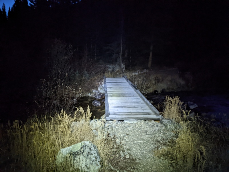
At this point, I didn't really have an exact ascent route up 13235 planned yet. I knew there were slopes off to the right that would go, but figured if something better presented itself, I'd see when I got there. Lo and behold, a NE ridge shooting right off the summit of 13235 caught my eye the whole way in. It looked rugged, at least for the start of it, but I figured it would go. And if it didn't, the south slopes would certainly be dry and I could bypass that way. Either way, it seemed a whole lot more fun that climbing boring and inevitably loose talus slopes to the summit. Let's give it a go! 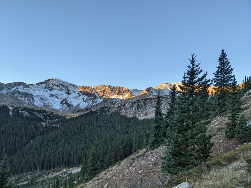
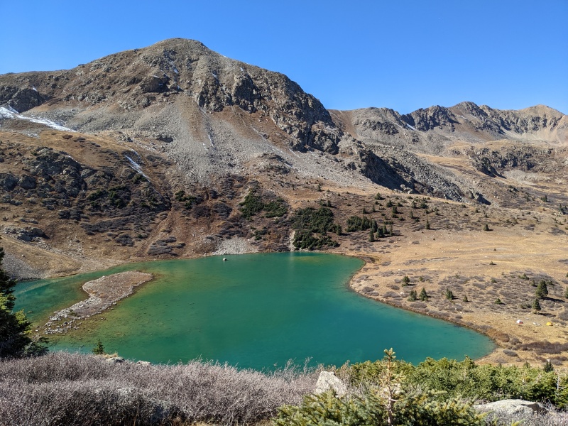
Once in the lower basin, I needed to gain the upper plateau. There were a few different options: under the cliffs to the left to a grassy slope, up the basin onto a talus field to the right, or a non-steep looking gully dead ahead. I opted gully. The gully was very low angle and mostly solid. A creek drains the lake above and had iced over some rocks, but they were easy to avoid. 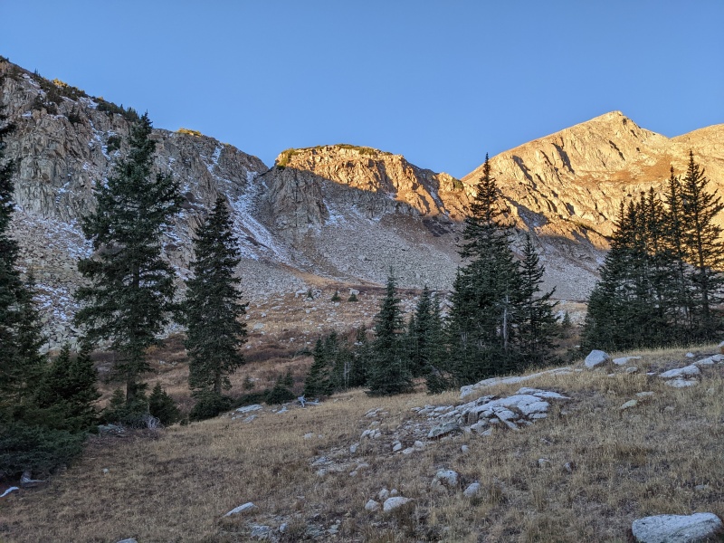

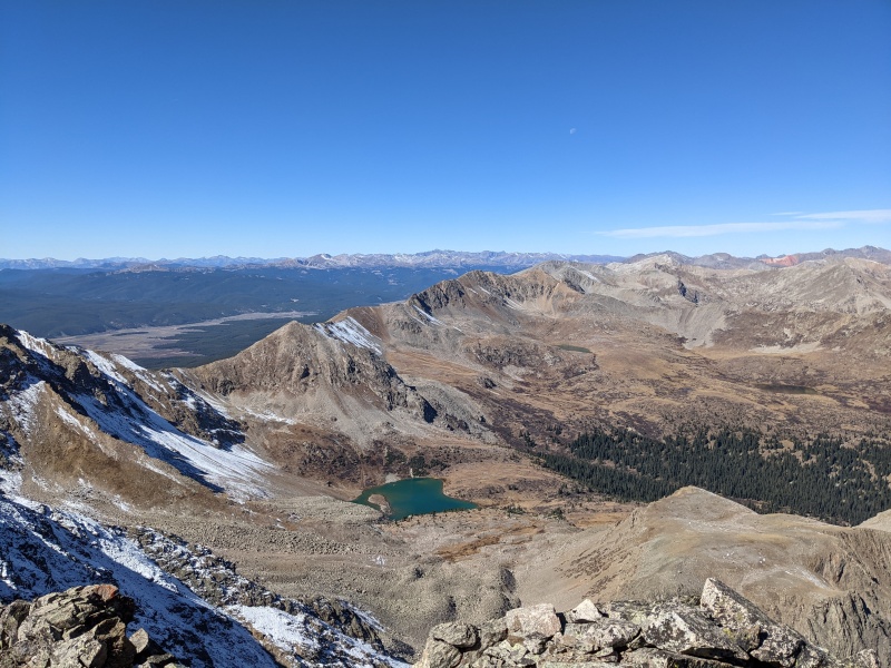
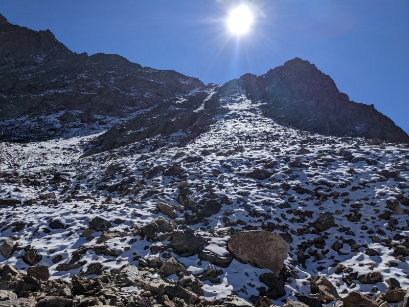
Once above the gully, I was in a vast basin with a lake below the peak. I got a clear view of my intended ascent ridge, and it certainly looked spicy for the first few hundred feet, then mellowed out before becoming a talus slog to the summit after all. I traversed over and hit it head on. 
I began the ridge by ascending a snow-dusted left-angling gully, but quickly found that powdery snow on loose scree sucks, so I bailed to the rocky arete to the right and climbed that to the top of the first point. From there, I followed the ridge crest up and over a few bumps, all in the 3rd class range. 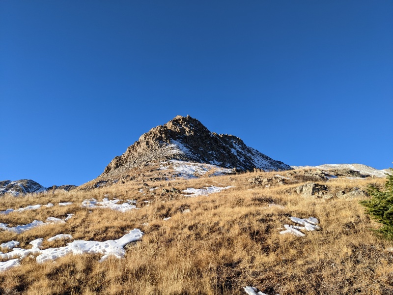
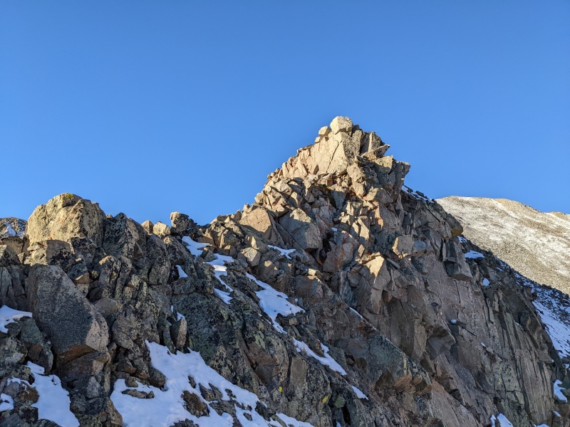
Eventually, I came to a notch with a steep downclimb and slabby climb out on the other side. It wasn't particularly deep, and the whole feature may have been avoidable by dropping down to the south, but where's the fun in that? I climbed down to the notch, then had a 5.easy, unexposed, two move wonder to reach more 3rd class terrain. It went without having to put my poles away, and after some more brief scrambling, Mr. Boat's Wild Ridge relented into easier terrain up to the summit of 13235. 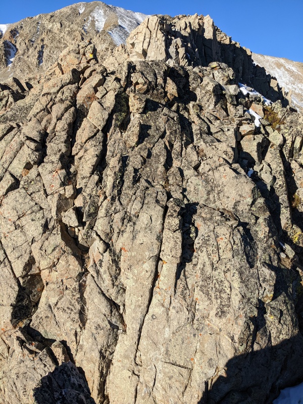
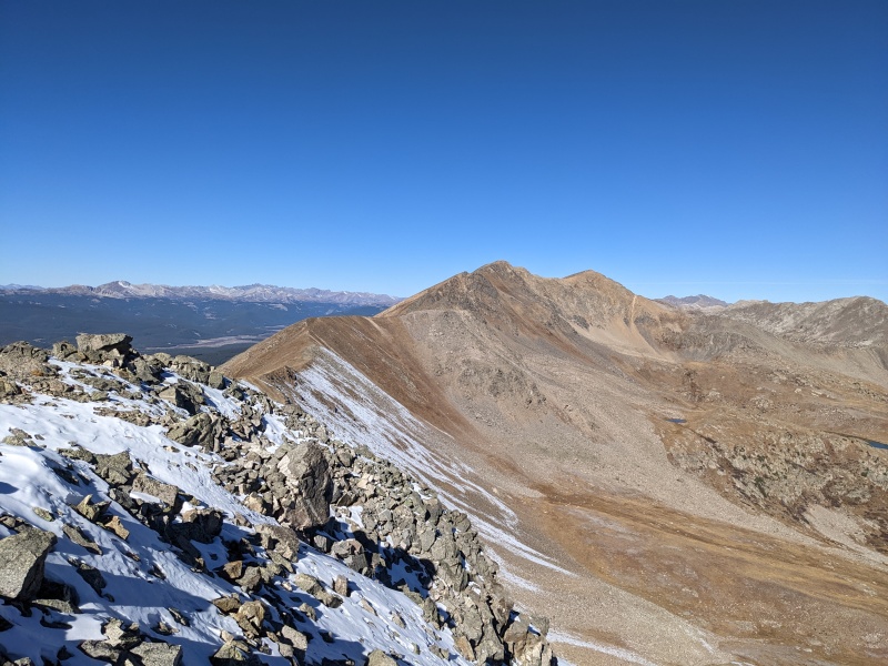
A quick climb and ridge walk to the right later, I was on the summit of 13235! Taylor Reservoir and its surrounding area was looking real good, and I got my first good view of the ridge that would take up the next 3+ hours of my life. 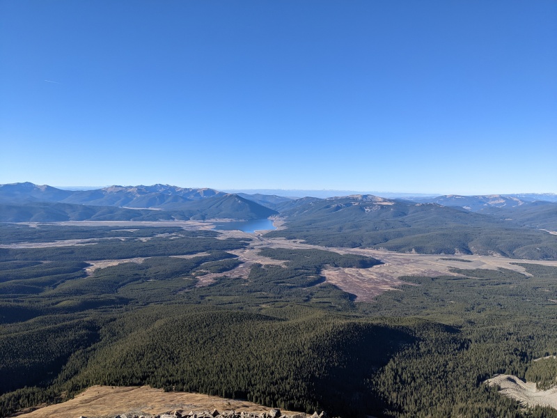
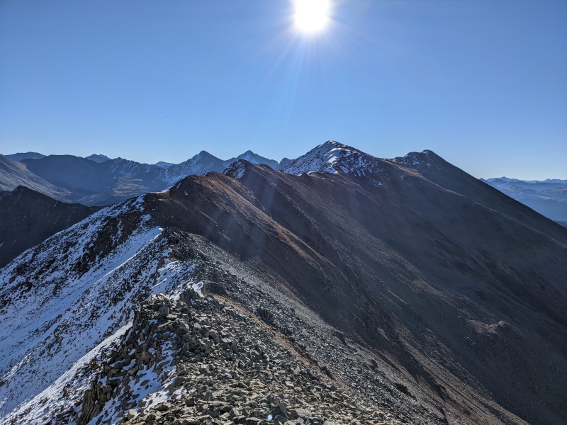
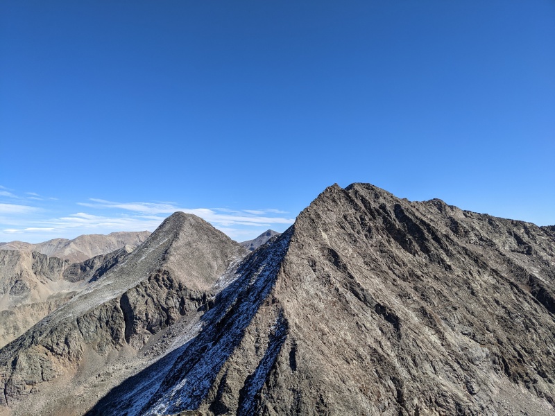
I quickly headed out, knowing there was a looooooot of ridge in front of me. Only the north sides of any of the peaks held snow, so it was easy to stay dry and talus-hop my way over to 13253. There was a brief bit of scrambling, but most of the ridge went as a hike rather than a climb. 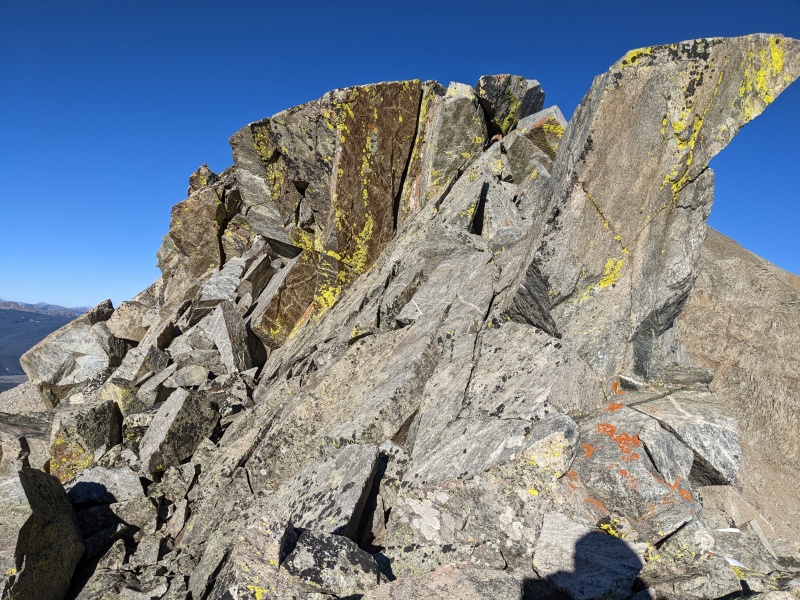
I took a short food break on the summit of 13253, then took off for 13253 South. The peaks are crazy close together and it took only about 15 minutes to get from one to the next. 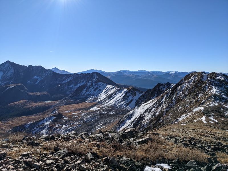
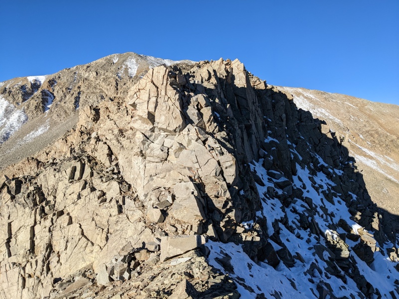
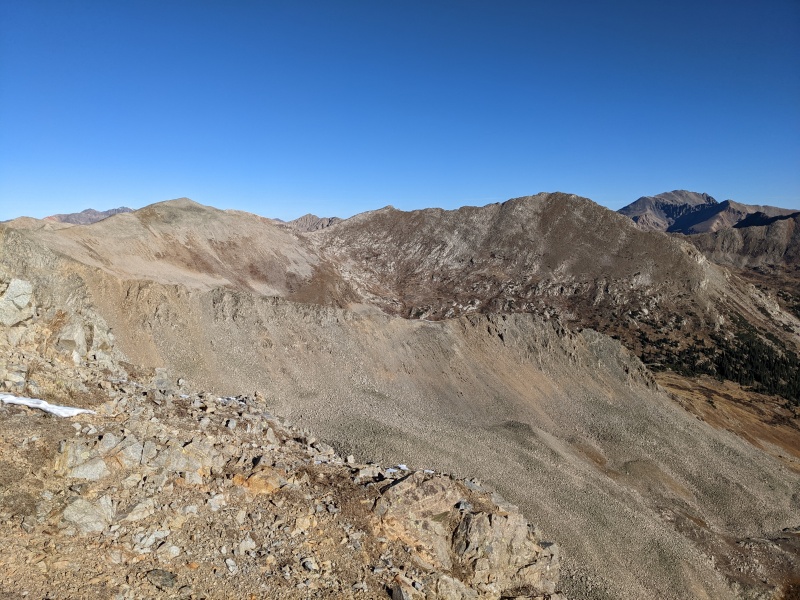
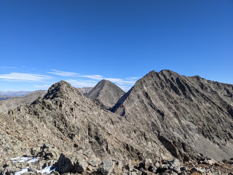
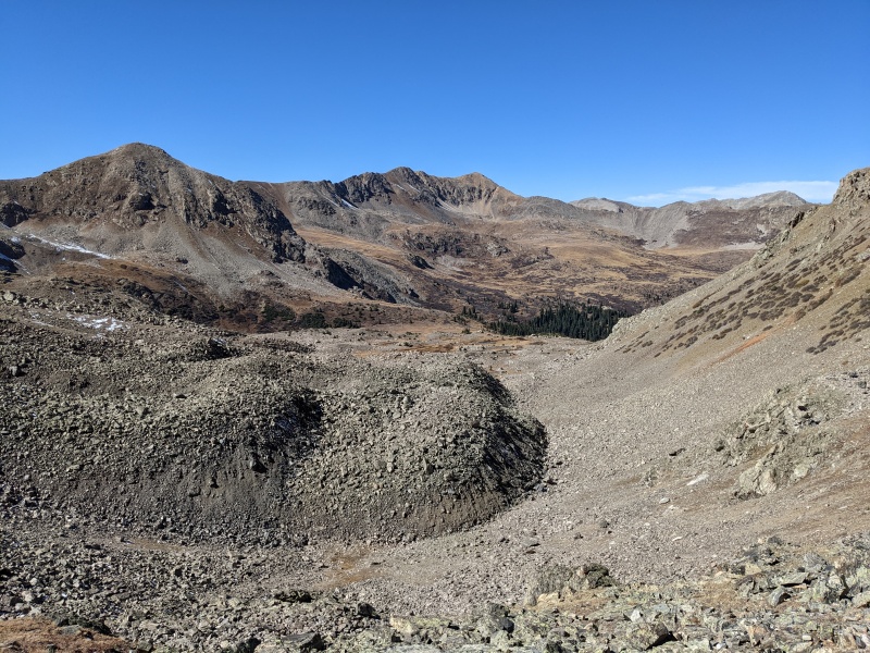
It's worth noting that if you're a wimp and don't want to take the ridge all the way to West Apostle, there's a bailout route that will get you there. Just return to 13253's summit, descend a bit off the NE ridge, then look for descendable slopes heading down toward a small lake. From there, you can drop down toward Lake Ann and either ascend the CDT to the pass and take that ridge up, or take the standard route for a standalone ascent of West Apostle (my descent route). Either way would work and would skip a fair amount of ridge, but would increase your gain and decrease your coolness points. But that ain't me. My plan was ridge, so I started down off of 13253 South, headed SE. As I descended, a couple of things became clear: one, much of the ridge could be bypassed by dropping 50-100 feet down to the south, and two, there was a few chossy, jagged teeth looming on the ridge, sure to ramp up the difficulty. As I approached them, however, I discovered that they are actually not part of the main connecting ridge, and instead are part of a small arete-like feature that drops into the basin. I smirked as I passed them on the grassy/talus-y main ridge, secretly (and I guess now not secretly) glad I didn't have to face them head-on. 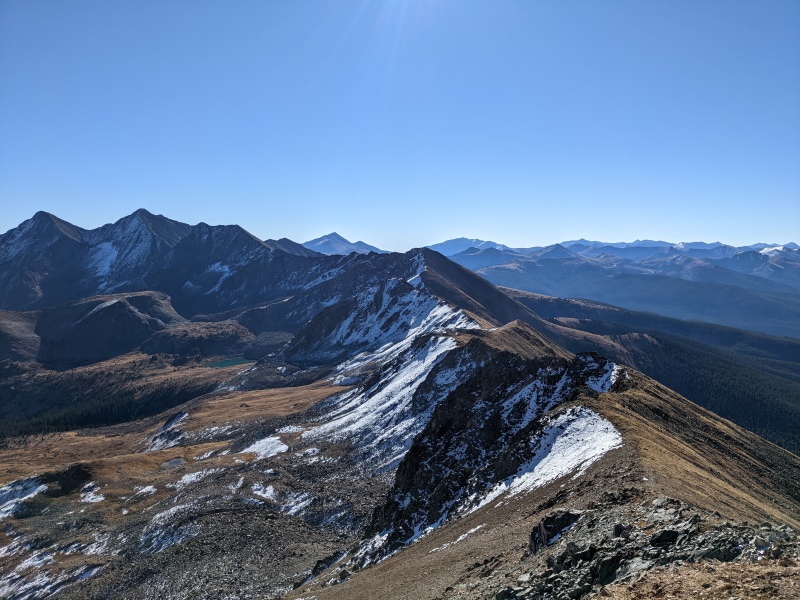

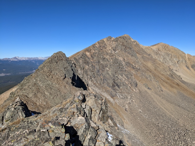
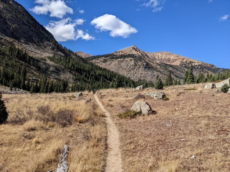
I was surprised at how easy the ridge was thus far. It was primarily 2nd class with bits of 3rd thrown in. Nothing (yet) really met my expectation of a long, scrambly ridge. As I approached the CDT pass above Lake Ann, much of the terrain became gentle and grassy. Throughout the day, I committed to sticking ridge proper to try to get the most out of it, but even that stayed fairly easy. 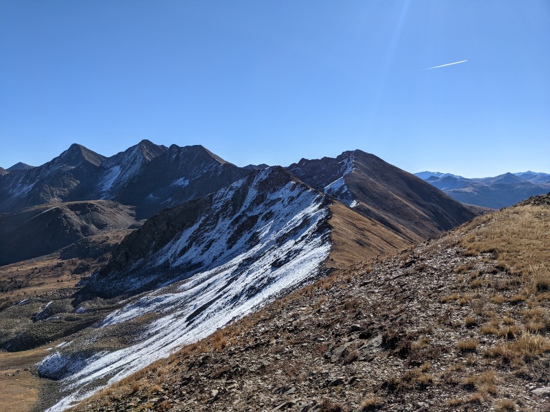
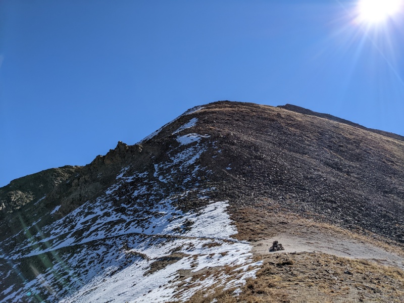
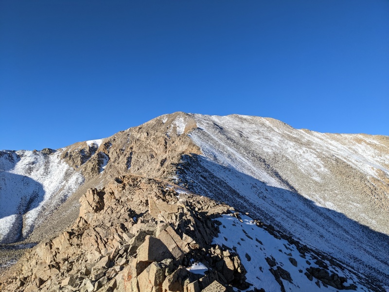
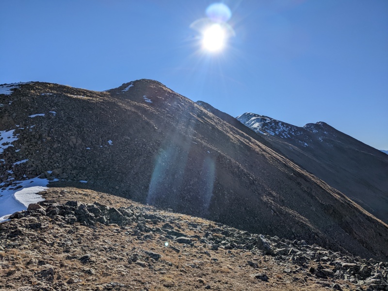
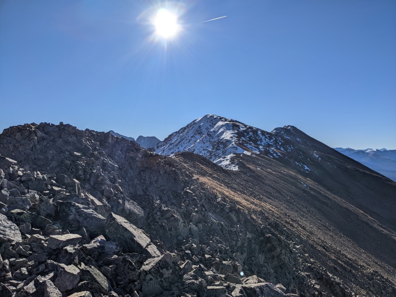
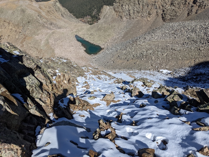
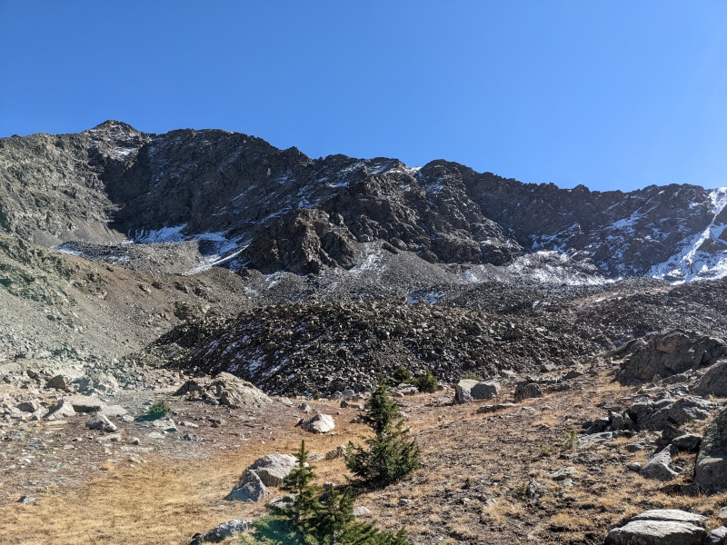
After what felt like forever, I reached the pass above Lake Ann. This marked the end of the descent and the start of finally climbing up to West Apostle. The initial climb up from the pass to a 13200 foot bump on the ridge to West Apostle was steep and long, but easy. It was a talus hop with occasional trail segments that were honestly worse to use than the talus. 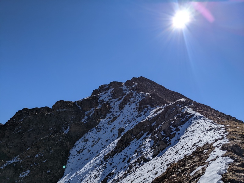
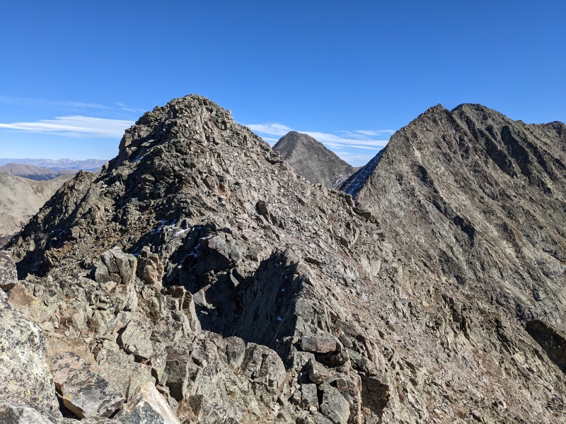
As I was ascending the 13200 bump, the final ascent and ridge to West Apostle were in sight. From my perspective, it seemed like directly off the 13200 foot bump, the ridge would go straight to the final push. Upon reaching the top of the bump, I was miffed to see another section of ridge, blocked from view by the bump, that added yet more distance to the ridge (as if it needed any more). 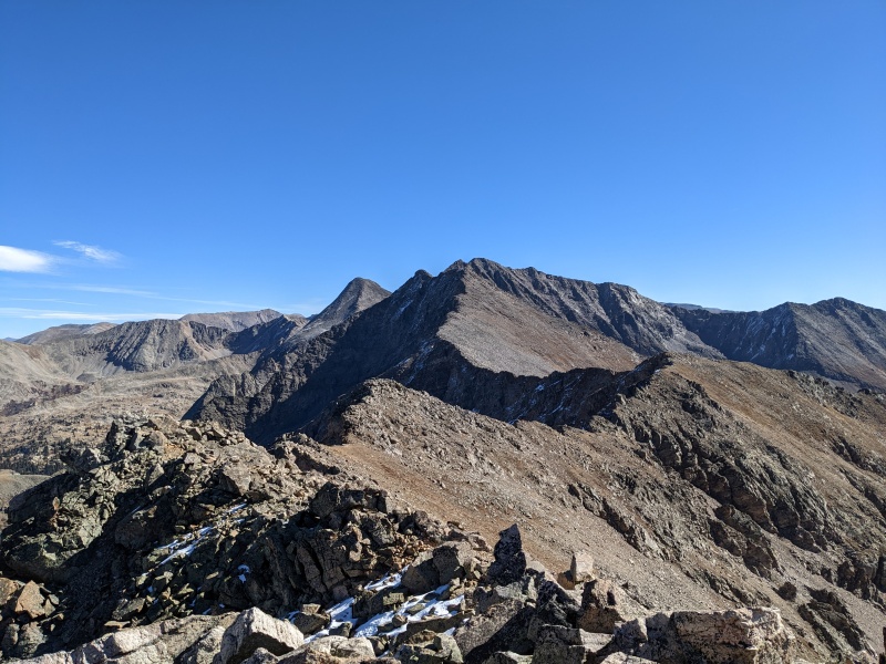
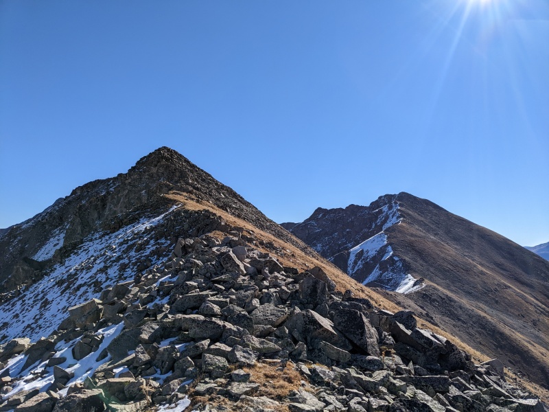
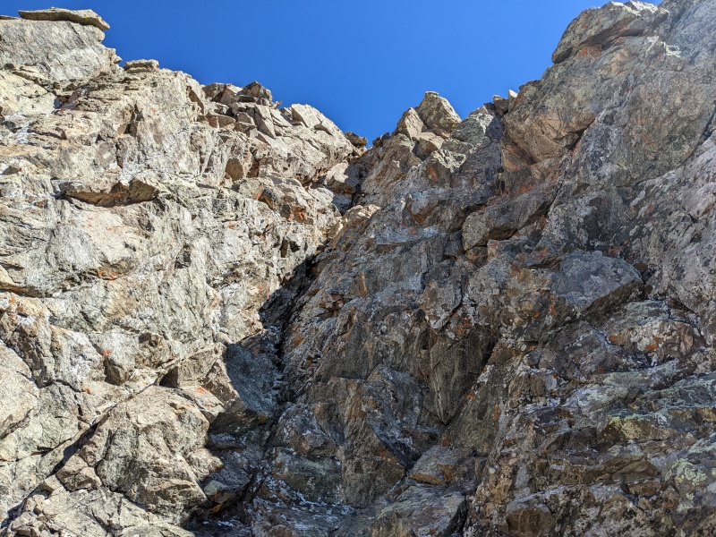
Here's what I didn't expect: As I descended toward the low point on the ridge, a notch appeared. Most things on this ridge had been quite gentle, so I anticipated the same here. But when I reached the notch, though the downclimb was easy 3rd class, the upclimb proved much more difficult. The initial rock on the ridge was overhung, and options further down the gully were steep as well. Eventually, I settled on a weakness that was near vertical and went at minimum stiff 4th class, possibly higher. It was about 30 feet of climbing before I popped out on more grassy ridge and had a quick walk to the next high point on the connecting ridge. 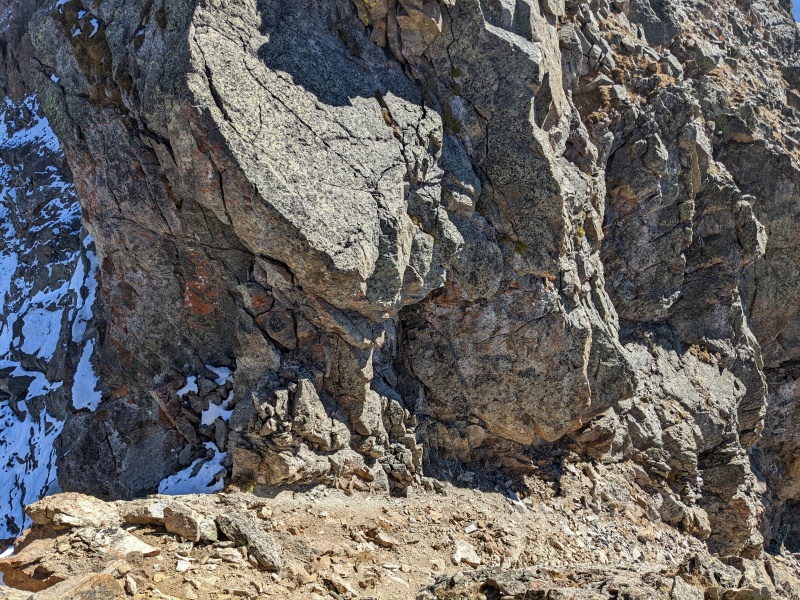
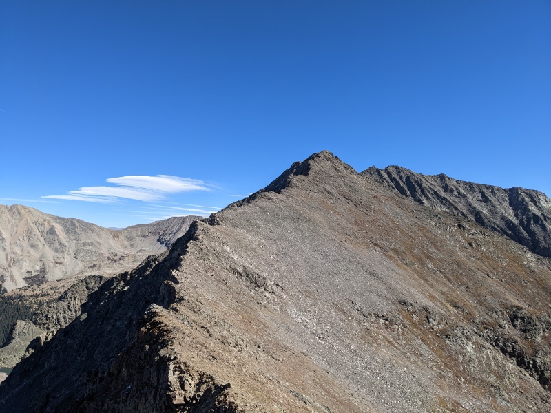
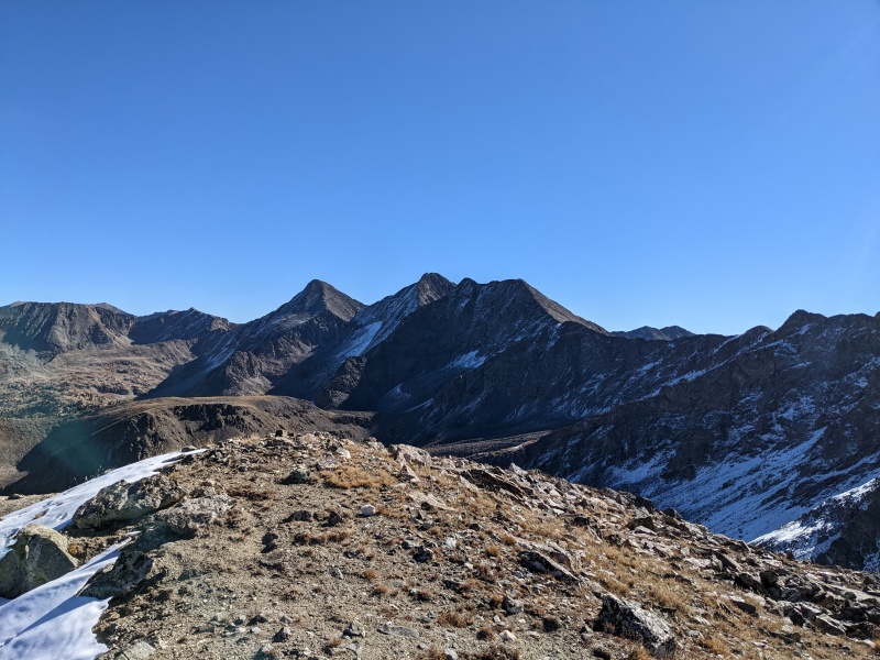
At long last the final section of ridge appeared. I was getting somewhat sick of artificially staying high on the ridge, plus my legs were starting to feel the talus and ridges they'd been on for hours, so I generally took the path of least resistance up. I passed a well-cairned saddle marking the descent route (and the standard route up). I mustered up the strength for a little last bit of scrambling to the false summit, then stayed on the ridge across a couple of easy but exposed sections to finally reach West Apostle, more than three hours after my first summit of the day and the start of the ridge traverse. Views of Ice and North Apostle made me wish those were on my list for today, as a grand traverse of the whole wall of mountains would be pretty awesome. But those were already done, and to be honest, so was I. 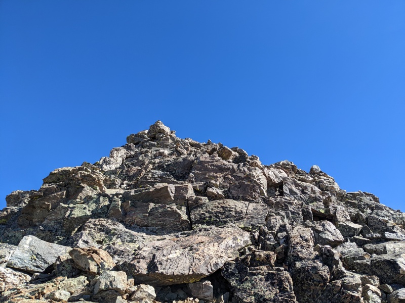
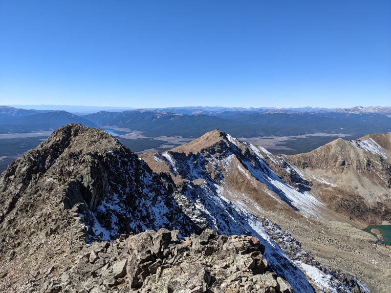
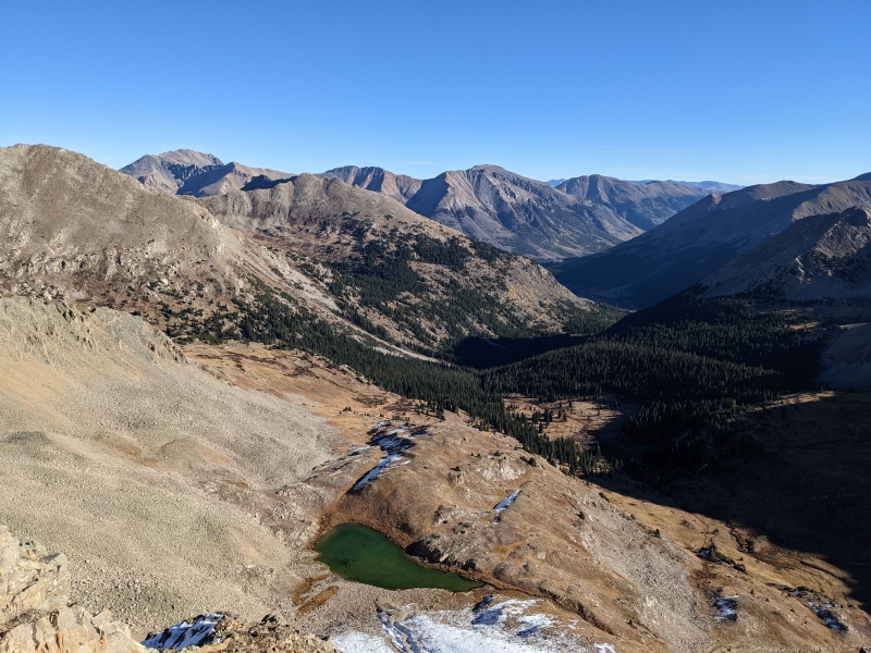
I took a little longer break on West, mowwing on some triscuits and trying to see if the Mariners game had started yet (it hadn't, but it never did for their offense anyway). I retraced my steps across the summit ridge and down the false summit until I reached the cairned saddle. From the cairned saddle, I traversed right on a faint trail across the ridge to the right, then dropped onto some snowy slopes. I followed the slopes down for a while until they annoyed me, then cut right into the gully, which swung me down and around to a rocky slope that dropped to a rock glacier. Once through there, rocks yielded to grass, and I made my way to the refreshing shores of Lake Ann. 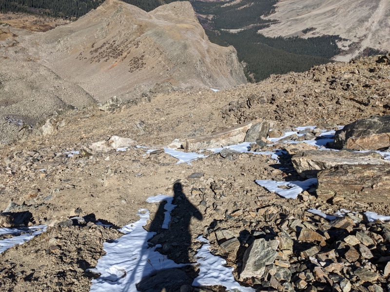
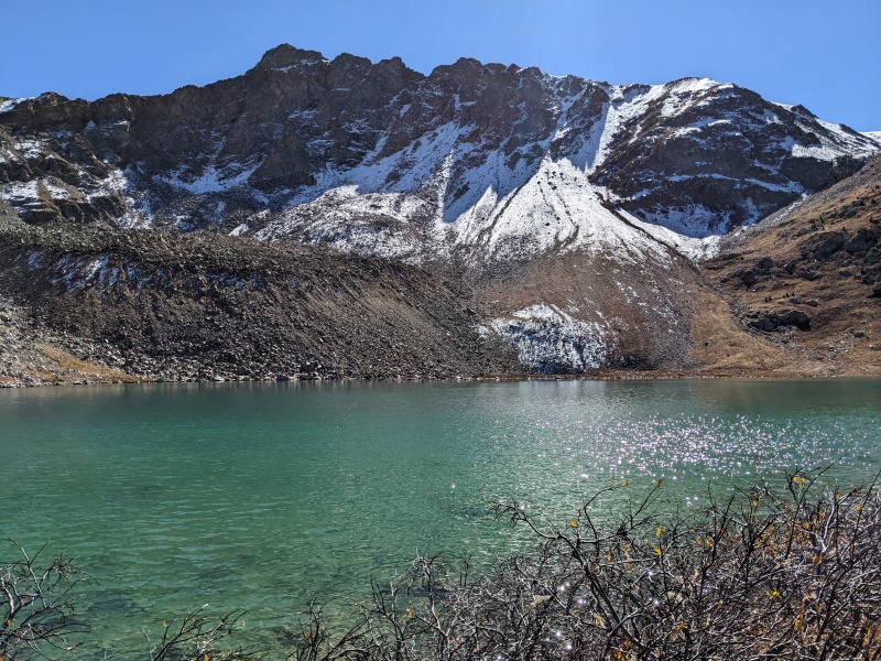
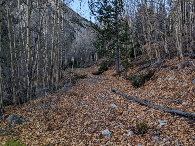
I took a break at Lake Ann to stash poles and adjust layers. A good trail leads back to the junction with the CDT/Lake Ann trail, and finally on easy terrain, I was able to jog back to the car save a few rocky spots. I made it to the car 50 minutes after departing Lake Ann, exhausted but pleased with the success of the day. 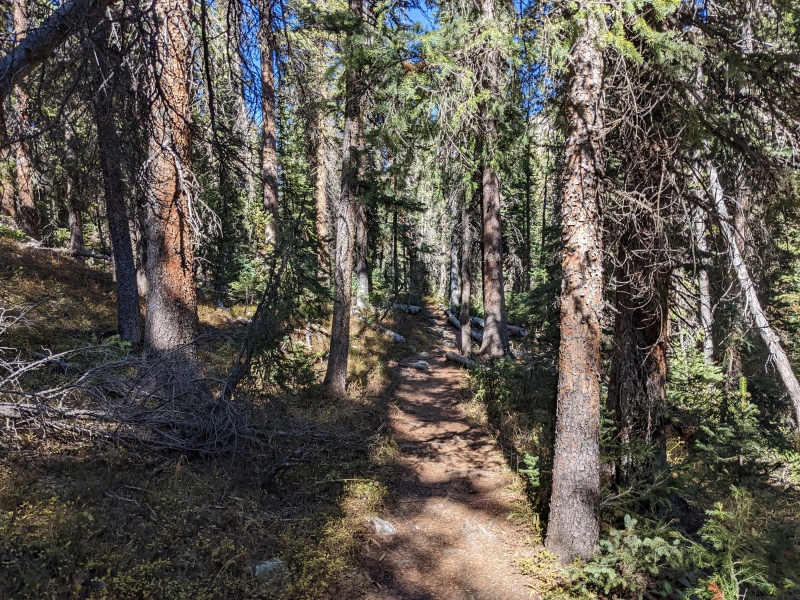
While certainly not a typically linked-up group of peaks, they went without too much difficulty and I had a great time doing them. It would be far easier to add on the Points to the Virginia group and tag West with the other Apostles, but if you're like me and didn't think things through properly when chasing Centennials, then here's your solution! 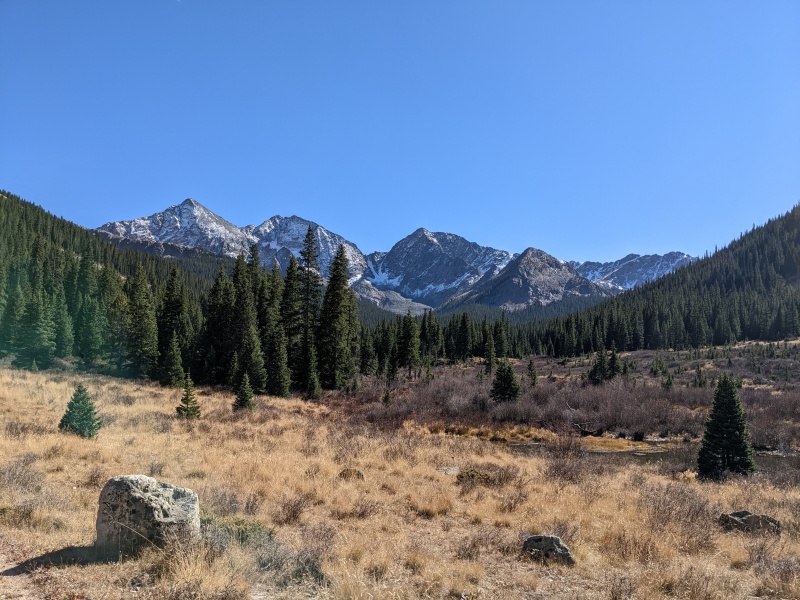
Thumbnails for uploaded photos (click to open slideshow): ")
")
")
")
")
")
")
")
")
")
")
")
")
")
")
")
")
")
")
")
")
")
")
")
")
")
")
")
")
")
")
")
")
")
")
")
")
")
")
")
")
")
")
")
")
")
")
")
")
|
| Comments or Questions | ||||||||||||
|---|---|---|---|---|---|---|---|---|---|---|---|---|
|
Caution: The information contained in this report may not be accurate and should not be the only resource used in preparation for your climb. Failure to have the necessary experience, physical conditioning, supplies or equipment can result in injury or death. 14ers.com and the author(s) of this report provide no warranties, either express or implied, that the information provided is accurate or reliable. By using the information provided, you agree to indemnify and hold harmless 14ers.com and the report author(s) with respect to any claims and demands against them, including any attorney fees and expenses. Please read the 14ers.com Safety and Disclaimer pages for more information.
Please respect private property: 14ers.com supports the rights of private landowners to determine how and by whom their land will be used. In Colorado, it is your responsibility to determine if land is private and to obtain the appropriate permission before entering the property.