| Report Type | Full |
| Peak(s) |
Epaulet Mountain - 13,524 feet "Epaulie" - 13,537 feet |
| Date Posted | 09/23/2022 |
| Date Climbed | 09/23/2022 |
| Author | Corey17 |
| Choosing the Scenic way on Epaulie |
|---|
|
Epaulie, ranked but not named, and Epaulet Mountain, named but not ranked, are a pair of oft overlooked bumps along the way in between Rosalie and Mt. Evans, laying deep in the heart of the Mt. Evans Wilderness. However, their proximity to the Mt. Evans highway leads to most people visiting these summits in a very short hike, leading to the gentle reputation they have. They constitute perhaps the easiest pair of 13ers in the state, when hiked from the road. Most people who seek to earn these summits choose to combine them with Rosalie - either again from the Mt. Evans road, or from Deer Creek. Even then, these two peaks are often just afterthoughts to take in after the main course of Rosalie. I found myself wanting to earn these summits - but after I missed them on my summit of Rosalie a few years back to threatening weather and not being interesting in the long winter slog for such an unimpressive pair of points, I sought a more creative solution. I found a route Derek briefly described in his book on Front Range 13ers, and decided that pairing that with a Tour d'Abyss style decent would make a lovely loop, even if it's long. I've not found a single report of this route being used online, so I wanted to write this up to perhaps bring others some inspiration! This was very much the scenic way to summit these peaks - but I very intentionally timed this climb with the changing colors this fall. I had read a few reports that the Abyss trail was leading the way this weekend, and decided to pull the trigger on the trip. Between the forecast for high winds in the morning and a bluebird day forecast, I felt no rush to roll out of bed - so much so that I turned off my alarm at 6:30 for another hour of sleep. This is why September is the best month - the weather is so courteous! I was on the road from my home in Littleton by the early hour of 8AM, and pulled up to the Abyss Trail. I found, of course, a full parking lot and happily parked on the road a few hundred feet from the parking lot. I guess word got out that the Abyss trail has some great stands of aspens. 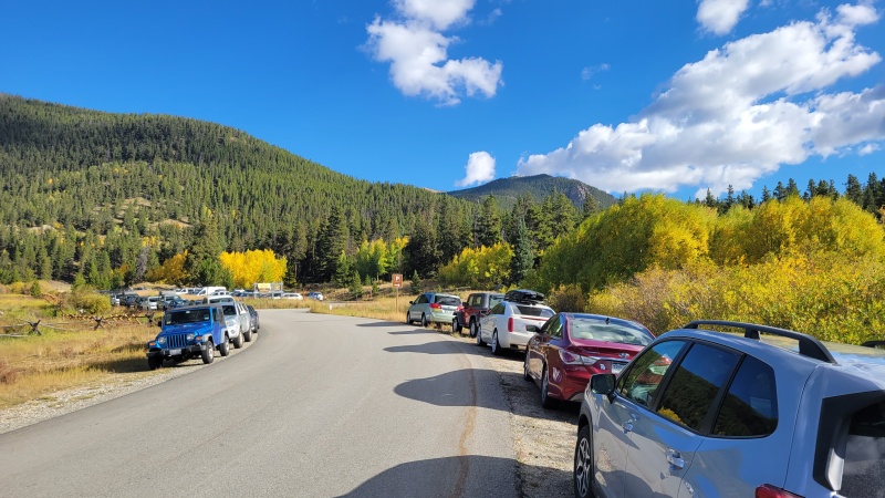
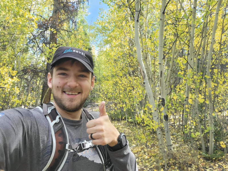
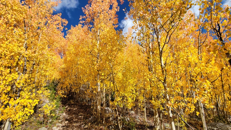
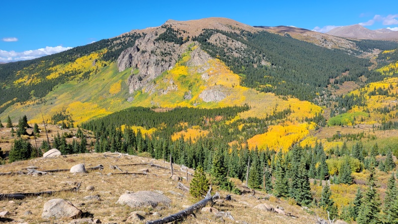
The first couple miles of the trail flew by - they are relatively flat, and I was able to run some of the downhills to bank some time. I had dinner plans, gotta move fast! All along the way in, views of Mt. Bierstadt and Epaulet tempted me to keep moving. After a while, I recognized the summit of Evans towering above the cirque. The distance between myself and the peaks was certainly humbling! Around 2 miles in, the Aspens start, and oh boy did they impress, completely distracting me from just how far away those peaks still are. I could write a lot of words about how stunning the aspens were today, so instead I'll just share a couple photos. 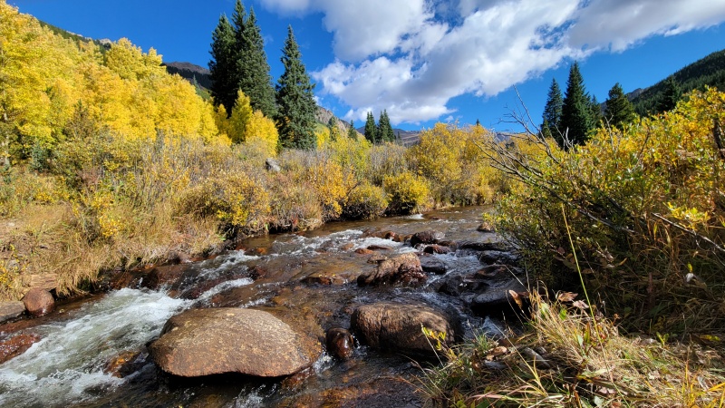

About 4.5 miles in, I hit two trail junctions in rapid succession, and took a right at both. The first to stay on the Abyss trail, and the second to join the Rosalie Trail. Once turning off on the Rosalie trail, I wouldn't see another person until I returned to the Abyss trail and Helm's Lake. Around that same point, the trail switched from going through the aspens to looking down on the aspens. Still stunning, but made it clear that the aspens on the trail itself were leading the way in changing. I followed this trail for about 2.5 miles to a broad saddle (next time, Kataka) and left the trail. 
On my way along, I noticed a named bump on Epaulie's ridge, Tahana. I don't think I've ever seen a less impressive summit - I tagged what I think was the summit, a pile of boulders at a kinda highpoint where my GPS indicated a summit. Tahana might just be the goofiest "summit" that I've ever gone out of my way (though not very much) to tag. Oh well, a summit's a summit, right? 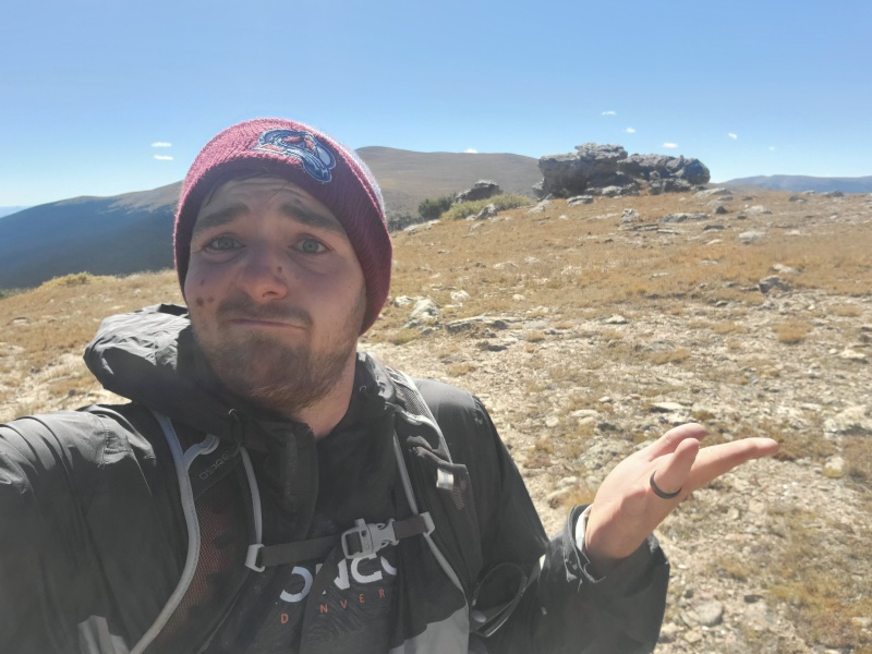
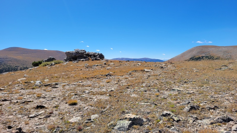
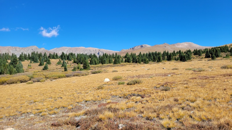
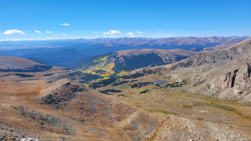
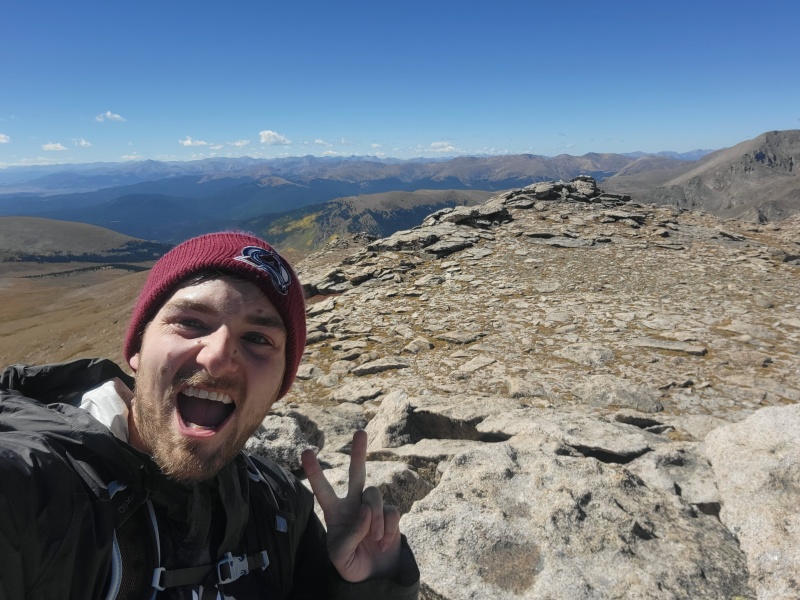
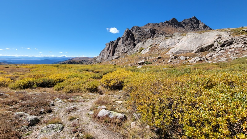
From Tahana, it's a really simple tundra walk up to both Epaulie and Epaulet. There really isn't much to write about here....walk uphill. There'll be some boulders. More as you climb higher. There's 2 highpoints. Hike them both. Epaulie (the right bump) affords better views of Rosalie, but Epaulet (the left bump) gives much better views of the interesting stuff! A lovely view of the sawtooth, a look back down the Abyss valley, and the ever-amazing view of the Mt. Evans road. At this moment, you might question why you hiked so many miles here. After all, those cars just across the way driving to and from Summit Lake look like they're having a great time. What would possess someone to take the 18 mile route...for Epaulie? With that milage, I coulda done Isolation in Wild Basin.....this hobby makes me make questionable decisions. But then you'll see the aspens you hiked through, and remember how great the hike as a whole was! Well worth the extra miles, if you ask me. 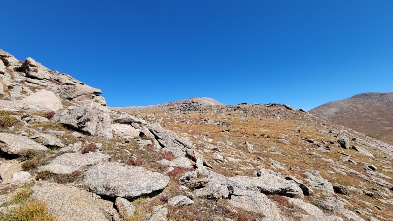
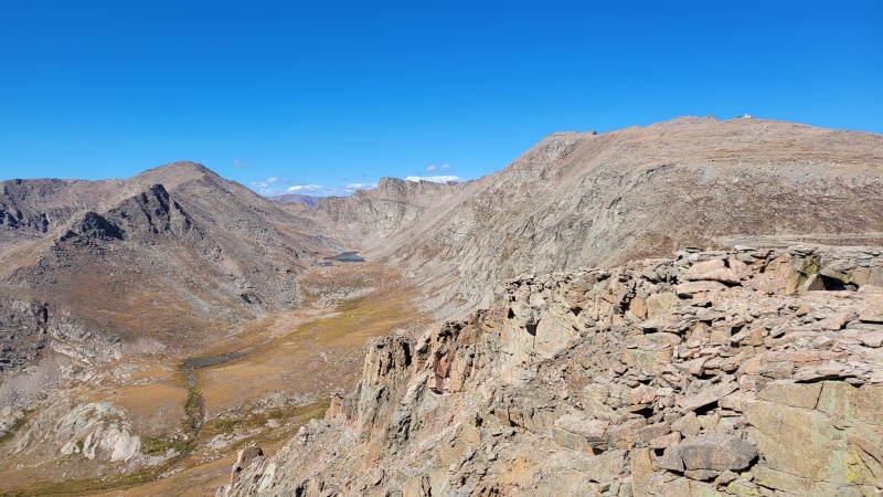
From here, the crux of this route arrives - gotta get back down to the Abyss trail. You could reverse your steps and get back the way you came of course, but that's boring. Everyone knows that loops are the best way to hike! Besides, you're already 10 miles into a hike...on Epaulet. You're here for the scenic route, not the efficient route. I headed down to the Epaulet-Evans saddle, and scoped my options to drop into the same gully used to access the Tour d'Abyss route. I did the tour in 2016 or so - meaning I had a good idea of what I was looking for. Best way I can describe it is to look for the singular very large gully cutting into the saddle. There are multiple small gully topping out the big gully - but you want the one closest to the Mt. Evans side of the saddle. I've found that the skiers right side of the gully is usually the best choice. It's a loose gully, but it isn't too long and before long I found myself jogging down the grass to where the Abyss trail obviously joins cuts through the terrain. 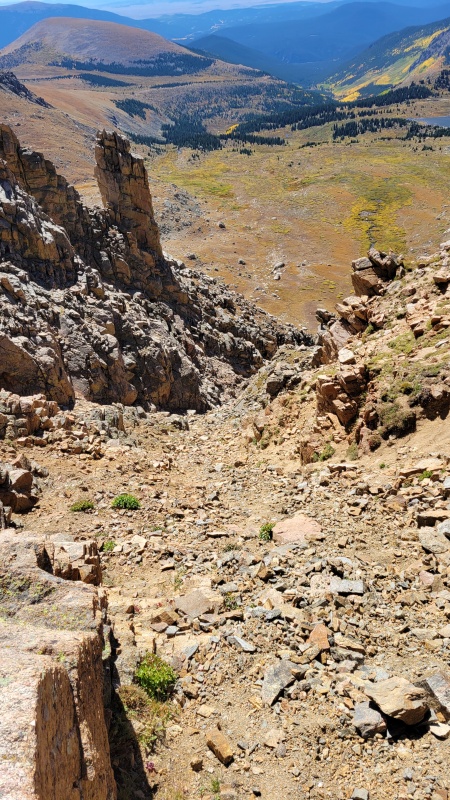


Once down the gully, I regained the Abyss trail and started the long run down. Well, run might be a generous phrase. More like a jog, but only on true downhills. On the numerous flat and slightly uphills, it was hiking time. Something I've learned about the Mt. Evans Wilderness is that treeline is home to Willows. Many, many willows. It doesn't matter if you're by Bierstadt, or here on the Abyss trail, or over by Kataka. This area is prone to really nasty willow swamps. That said, there willows weren't bad. I kept my feet mostly dry, and was able to avoid the mud fairly well in my haste. The miles went by really quickly and before I knew it, I was back at Helms Lake. Here, I got some food in my system, said hello to the first person I'd seen since turning off the Abyss trail many hours earlier, and got back on the move. A couple more miles, and I was back at the two trail junctions, following the Abyss trail all the way. The aspens were glorious again, and the miles really did fly by. The abyss trail is a mild one, not in a rush to go up or down, but meandering through the forest. Before I knew it, I was back at the car, with sore legs, looking back and appreciating those little bumps between Evans and Rosalie a whole lot more. This really is a lovely route, and I would heartily recommend it to anyone looking to earn these peaks and see their full character! These humble peaks have at least something to offer, and this route truly drives home how vast the Mt. Evans Wilderness is. Between Guanella Pass and the highway, it's easy for me to look at Evans as that overrun area close to home - but pick a different trailhead, go the extra mile, and you'll find a solitude in an astonishing place. The terrain in the Mt. Evans area is unique - with its exceedingly vast and gentle meadows, forests, and welcoming summits. I walked by many unoccupied campsites along my path along Scott Gomer Creek, and reflected on how nice a weekend backpacking here would be. If you need Epaulie and Epaulet, give this loop a thought! Though....it'll really help if it's late September and the aspens are peaking. Thanks for reading! Strava link below. Note that I don't trust the stats too much. My watch died about halfway up, and I started a second activity on my phone and spliced them together after the fact. https://www.strava.com/activities/7857103476 Thumbnails for uploaded photos (click to open slideshow): ")
")
")
")
")
")
")
")
")
")
")
")
")
")
")
")
")
")
")
")
")
")
")
")
|
| Comments or Questions | |||||||||
|---|---|---|---|---|---|---|---|---|---|
|
Caution: The information contained in this report may not be accurate and should not be the only resource used in preparation for your climb. Failure to have the necessary experience, physical conditioning, supplies or equipment can result in injury or death. 14ers.com and the author(s) of this report provide no warranties, either express or implied, that the information provided is accurate or reliable. By using the information provided, you agree to indemnify and hold harmless 14ers.com and the report author(s) with respect to any claims and demands against them, including any attorney fees and expenses. Please read the 14ers.com Safety and Disclaimer pages for more information.
Please respect private property: 14ers.com supports the rights of private landowners to determine how and by whom their land will be used. In Colorado, it is your responsibility to determine if land is private and to obtain the appropriate permission before entering the property.


