| Report Type | Full |
| Peak(s) |
Bushnell Peak - 13,112 feet Twin Sisters North - 13,009 feet |
| Date Posted | 09/22/2022 |
| Date Climbed | 09/20/2022 |
| Author | TaylorHolt |
| Two in the Bush(nell) |
|---|
|
A bird in hand is worth two in the bush...unless those two birds fly out of the bush as you're running by and scare the $hit out of you. Tuesday, September 20, 2022 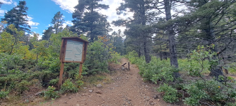

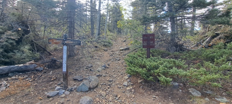
The route is reminiscent of just about every other route on the east side of the Sangre de Christo Range. You start by taking a trail uphill towards the Rainbow Trail. Once you intersect with the Rainbow Trail, either head north or south on the Rainbow trail until you reach your desired drainage or ridge. Leave the Rainbow Trail and head west up a steep trail towards your desired destination. In this case I headed south on the Rainbow Trail to the Bushnell Lakes Trail (#1402). Knowing that I was a little behind schedule, I decided to trail run a few of the flatter sections of the trail in an effort to make up some time. This was all good until I ran by a couple of grouses that were roosting right next to the trail. For those who don't know, grouses are very loud wing flappers, and they nearly gave me a heart attack as they flew up into a nearby tree. This isn't the first time this has happened to me on the Rainbow Trail. 
After about three miles I reached the intersection with the Bushnell Lakes Trail (#1402). This trail doesn't waste any time in gaining elevation; it's a steep journey from this point to reach Lower Bushnell Lake, but it's a worthwhile destination itself. The trail relents around 11,000ft just prior to the lake as the view opens up and you get a first sight of Bushnell and Twin Sisters South. 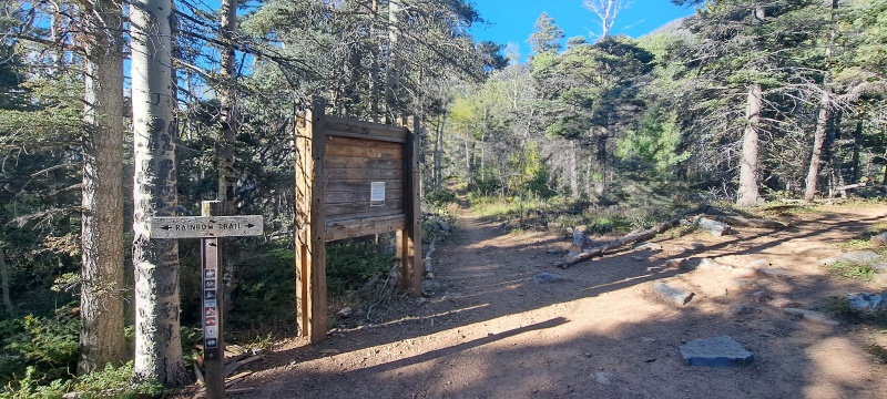
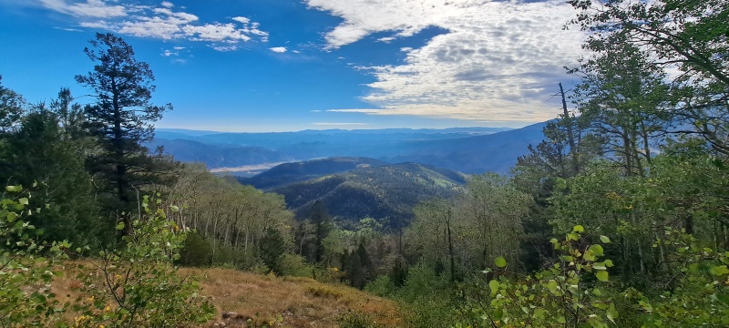
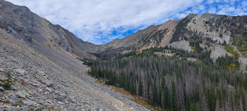
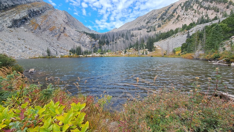
I stopped for about ten minutes to enjoy a snack, take in the view, and scout my next move. The waterfall above the lake was flowing, but not nearly as strong as tomcat's TR from a previous spring. This is where I varied slightly from tomcat's TR. Previous reports mention aiming for a white tower along the east ridge of Twin Sisters South. However, I saw a grassy slope (visible in the picture above) that looked like it would provide good access to the ridge prior to the white tower and not have as much loose scree to deal with. I worked my way easily around the lake, found the grassy patches, and started plodding up towards the ridge. 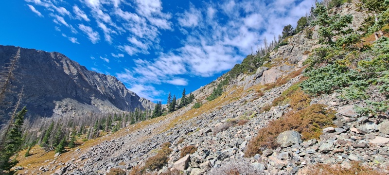
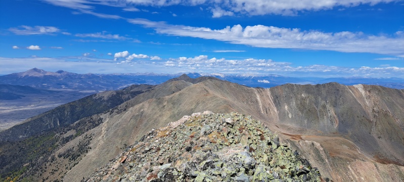
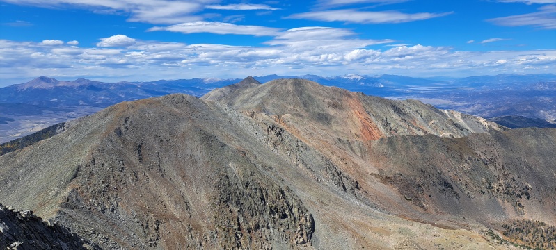
Once atop the ridge, I got my first view of Twin Sisters North and the Stout Lakes Basin. From here it was a very scenic and mellow ridge walk that can be kept at class 2. When I reached the white tower, I easily navigated around it to the south side of the ridge. 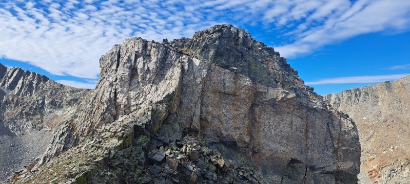
As I made my way across the ridge I was debating whether or not to summit Twin Sisters South first or skirt this summit and do Bushnell first as in tomcat's TR. This is another spot where I varied from tomcat, and I decided to summit TS South first. To me the route traversing around the west side of TS South on the way between Bushnell and TS North looked much easier than across the southeast face, so I headed straight up to the summit and enjoyed the view of my next two goals, one to the south and another to the north. 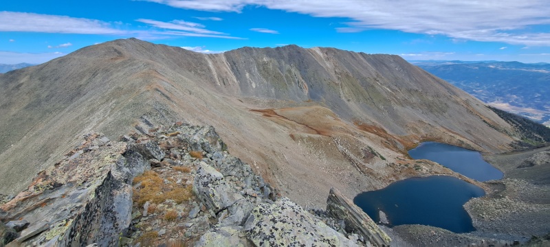
The trip over to Bushnell from TS South was quick and uneventful until I was a few feet below the summit and spotted a raven fearlessly guarding the summit. It eventually conceded though, and I was on my first 13er of the day with nice views to the south and the rest of the Sangres. As I looked north towards TS North, doubt crept into my mind as to whether the point to the right of the summit was actually higher than the summit shown on the map. The topo lines make it look very close as well, and I didn't do my research beforehand to see if the new LiDar data has affected these peaks. I luckily had cell service and was able to reach out to Ryan Richardson; he was able to confirm for me that the summit of TS North is the point along the main ridge at 13,012ft. Thanks Ryan! 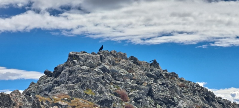
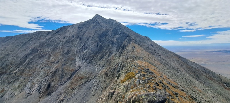
On my way down Bushnell and heading towards TS North, the view of the southeast face of TS South confirmed my thoughts that summitting TS South first was the right idea. It did not appear to be a fun traverse, and I'd suggest just summitting TS South (see pic below). 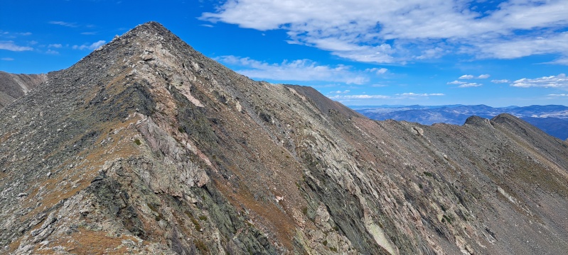
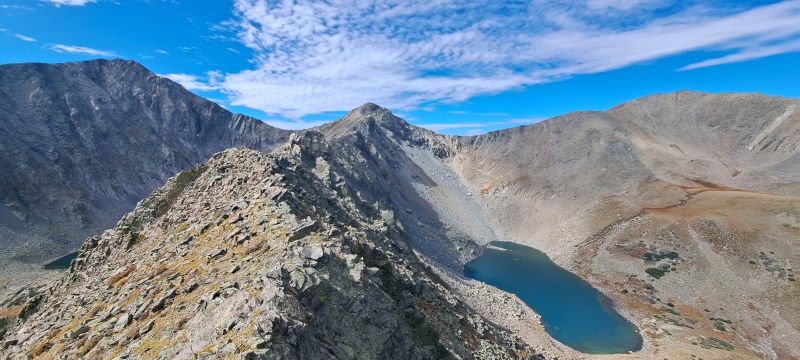
Side-hilling around the west side of TS South was pretty easy and the saddles on each side of TS South are at similar elevations, so I was pretty much able to go straight across. There was also get a nice view of the descent route when I got to the saddle between the Twin Sisters. The ridge up to TS North was a gradual tundra walk to the summit. 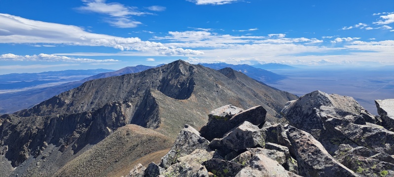
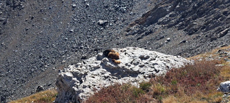
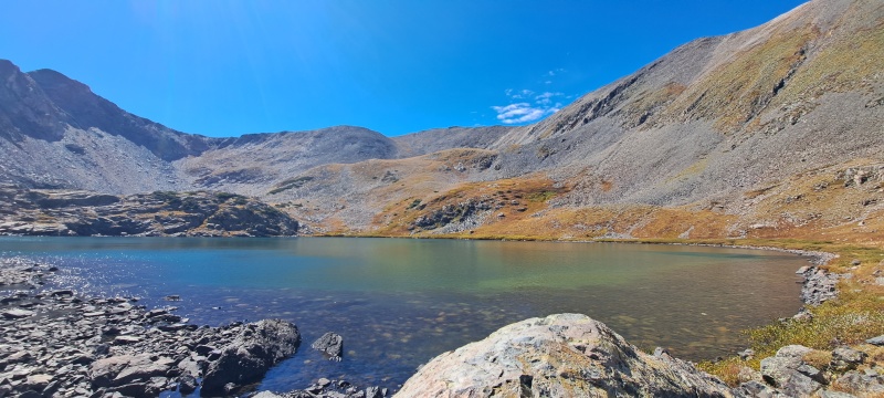
Finding the descent down to Stout Lakes is pretty obvious as well. I descended the slope of mixed tundra and scree until I reached a flat, open, area above the upper Stout Lake and found a marmot getting its tan on. Once I reached the lower lake, I located the trail around the lower lake that would eventually take me out of the basin and back to the rainbow trail. I took brief break at the lower lake to look back and take in the view one more time. I spotted a few cutthroat trout in the lake as well. 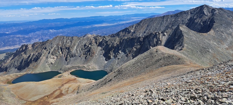
The trail out of the basin was pretty obvious below Stout Lakes. There was some deadfall between 10,000ft and 9,000ft to navigate, but otherwise, it's a nice trail. The fall colors were starting to show themselves in patches. Once I reached the Rainbow Trail, it was only a short trail segment to get back to the spur that leads to the trailhead. 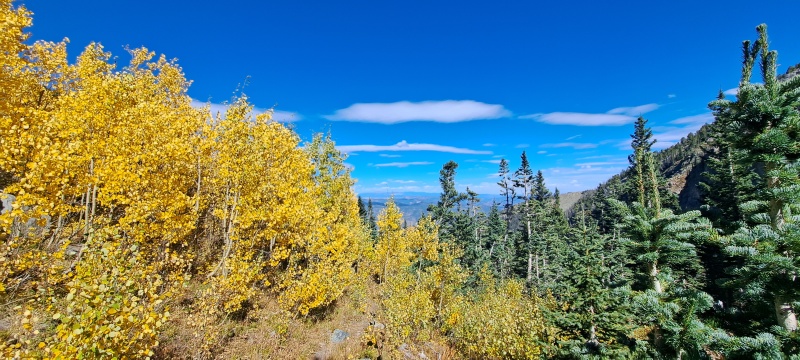
Considering how low these 13ers are, this was a bigger day than I anticipated. I returned to the car around 4pm for a total time of 8hrs. I don't have the exact stats because my GPS went a little haywire in a few spots, but I'd estimate at least 15 miles and 5000ft of elevation gain. It felt good to put in a relatively big day though after being near sea level for the past four months. Both the Bushnell Lakes and Stout Lakes basins were beautiful, and I didn't see another person the entire day. Thanks to tomcat32 for the inspiration on the route. I hope someone else reads this trip report and enjoys the route as well. (The gps ended up being two gpx files, and I could only upload one, so I uploaded the second one that shows the summits and descent.) Thumbnails for uploaded photos (click to open slideshow): ")
")
")
")
")
")
")
")
")
")
")
")
")
")
")
")
")
")
")
")
")
")
")
")
")
")
|
| Comments or Questions | |||||||||
|---|---|---|---|---|---|---|---|---|---|
|
Caution: The information contained in this report may not be accurate and should not be the only resource used in preparation for your climb. Failure to have the necessary experience, physical conditioning, supplies or equipment can result in injury or death. 14ers.com and the author(s) of this report provide no warranties, either express or implied, that the information provided is accurate or reliable. By using the information provided, you agree to indemnify and hold harmless 14ers.com and the report author(s) with respect to any claims and demands against them, including any attorney fees and expenses. Please read the 14ers.com Safety and Disclaimer pages for more information.
Please respect private property: 14ers.com supports the rights of private landowners to determine how and by whom their land will be used. In Colorado, it is your responsibility to determine if land is private and to obtain the appropriate permission before entering the property.


