Download Agreement, Release, and Acknowledgement of Risk:
You (the person requesting this file download) fully understand mountain climbing ("Activity") involves risks and dangers of serious bodily injury, including permanent disability, paralysis, and death ("Risks") and you fully accept and assume all such risks and all responsibility for losses, costs, and damages you incur as a result of your participation in this Activity.
You acknowledge that information in the file you have chosen to download may not be accurate and may contain errors. You agree to assume all risks when using this information and agree to release and discharge 14ers.com, 14ers Inc. and the author(s) of such information (collectively, the "Released Parties").
You hereby discharge the Released Parties from all damages, actions, claims and liabilities of any nature, specifically including, but not limited to, damages, actions, claims and liabilities arising from or related to the negligence of the Released Parties. You further agree to indemnify, hold harmless and defend 14ers.com, 14ers Inc. and each of the other Released Parties from and against any loss, damage, liability and expense, including costs and attorney fees, incurred by 14ers.com, 14ers Inc. or any of the other Released Parties as a result of you using information provided on the 14ers.com or 14ers Inc. websites.
You have read this agreement, fully understand its terms and intend it to be a complete and unconditional release of all liability to the greatest extent allowed by law and agree that if any portion of this agreement is held to be invalid the balance, notwithstanding, shall continue in full force and effect.
By clicking "OK" you agree to these terms. If you DO NOT agree, click "Cancel"...
....or something like that, I'm not great with letters. Except we didn't do O. But we did do Q, which looks basically like a modified O. Anyways....
Trailhead: N Rock Creek
Distance: Approximately 36 miles
Gain: Approximately 11.5k
Class: up to 5.easy if on-route
This trip originally was one of five backpacking trips this summer that either were rained out or sick-dogged out. Some of those trips were lost to the wind (well, rain), but the Gores are Natalie's mostest favoritest range in the world, and her desire to share her enthusiasm for them with the world (and, I guess, her proximity to finishing them for good) motivated her to reschedule for a hopefully more stable weather month. As I mentioned, they are her favorite mountains, so she wanted to make sure she had someone to share them with. Enter me, book-but-not-street educated on the suffering the Gores can inflict, ready for some first-hand experience on just how far Slate Creek is from anything.
We met up at N Rock Creek trailhead around 10:30 and departed shortly thereafter in the blazing late-morning sun. I didn't know much about this approach, other than there was significant regain on the way back, but after climbing the Trinities from Molas the prior weekend, I figured I was well acclimated to "uphill both ways" approaches, as Natalie aptly described it. Plus, that's a problem for future me, right?
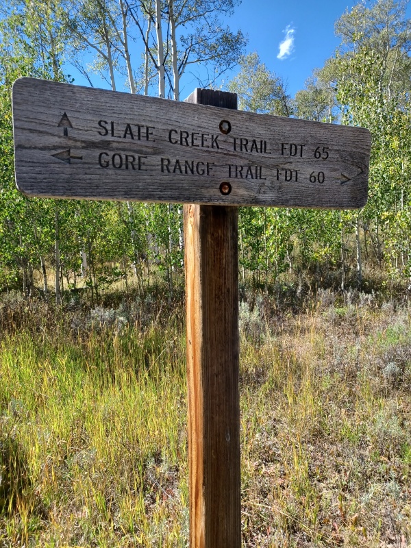
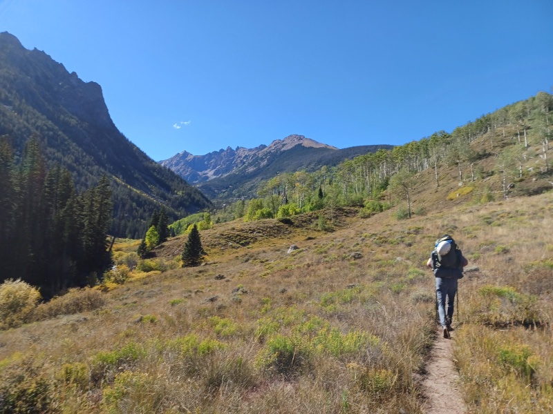
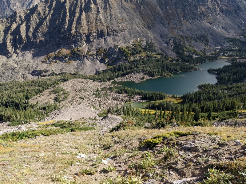
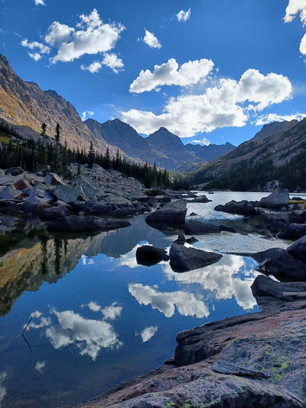
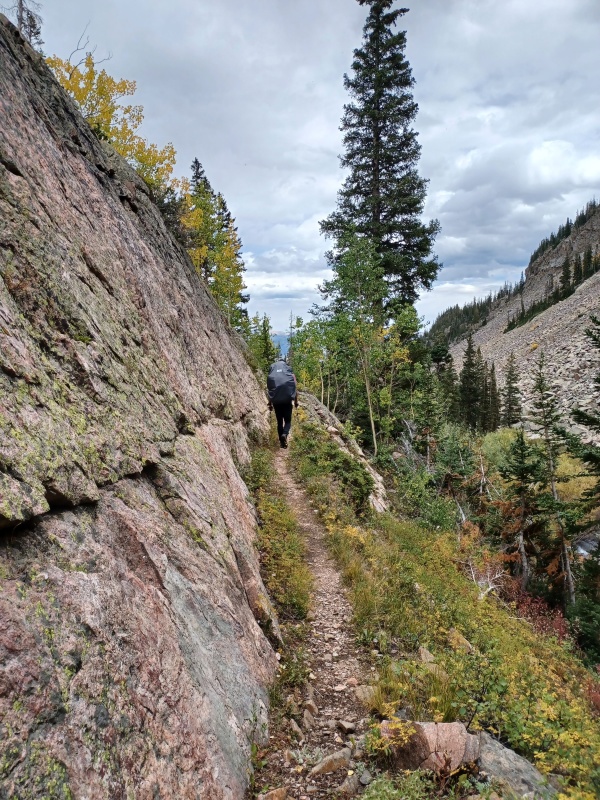
The approach is simple enough: leave the trailhead, hang a right onto Gore Creek trail, don't miss the left fork to stay on Gore Creek trail, swing a left up Slate Creek, and boom, you're there! Sadly, much harder in practice than in theory. We ran into a couple of groups of hunters, none of whom had any success yet, and we snuck by without being mistaken for deer. After turning onto Slate Creek trail, we were below the elevation of our car, and all of the gain is packed into the last two and a half miles of trail. We staggered our way onwards and upwards, arriving at Upper Slate Lake with just enough time to set up camp at the beautiful site right at the edge of the lake and eat before daylight waned.
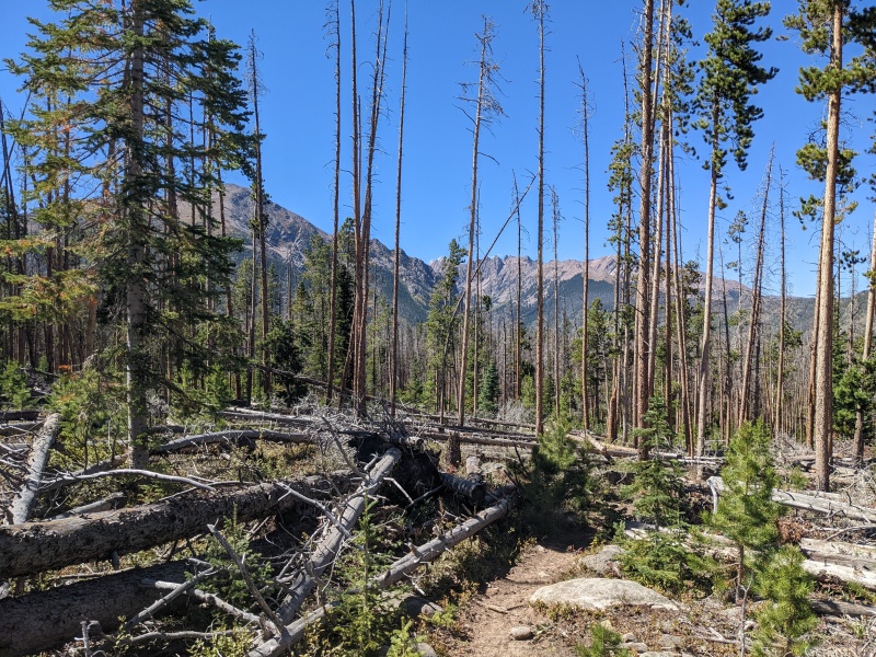
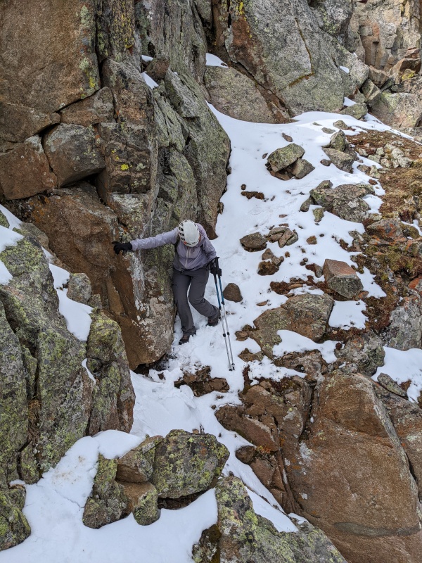
Thank God this part isn't a bushwhack...
skrrrrrrrrrrrt
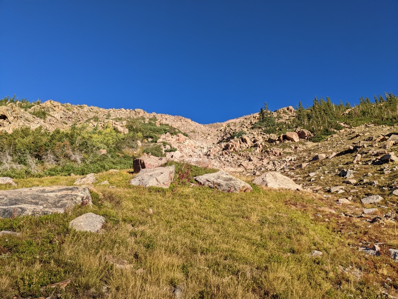
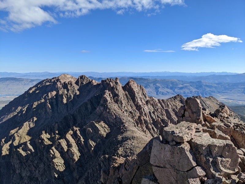
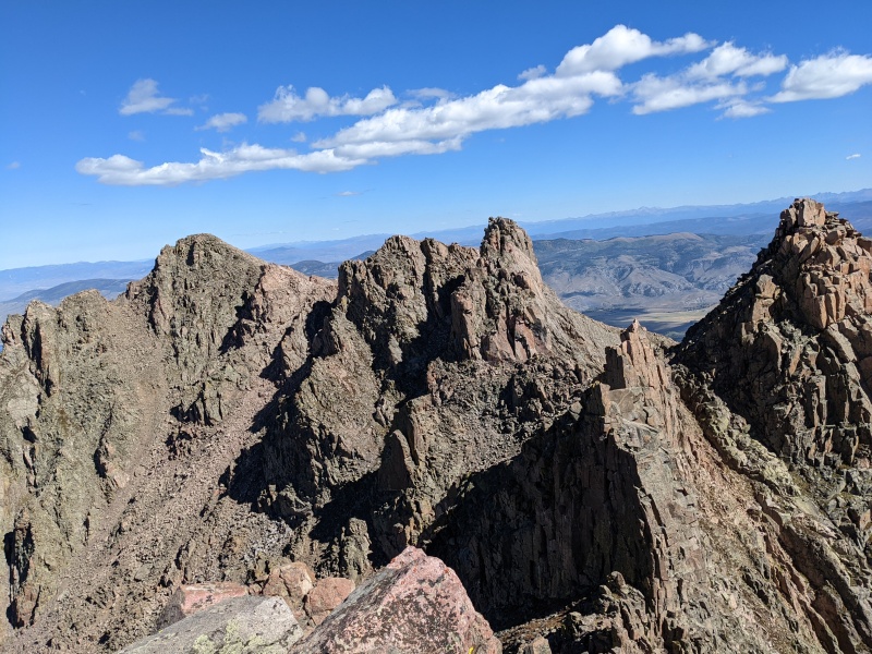
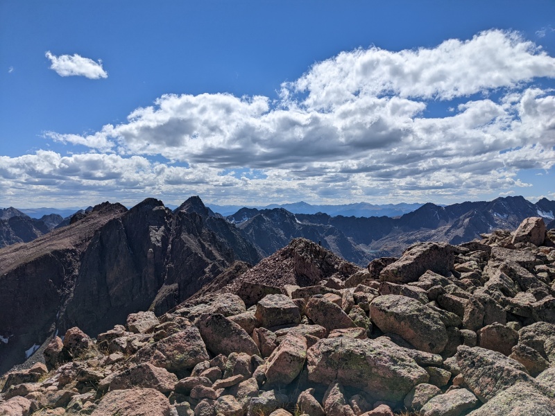
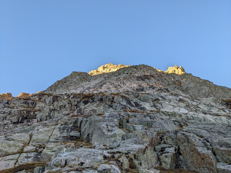
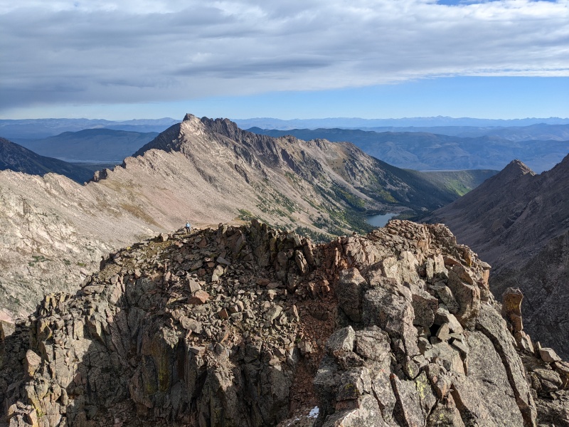
Day 1 ridge....still so far away
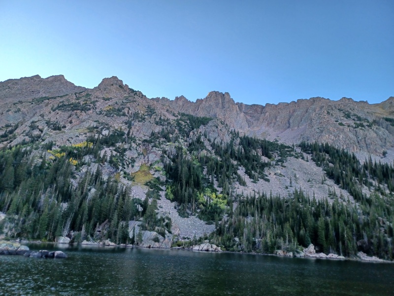
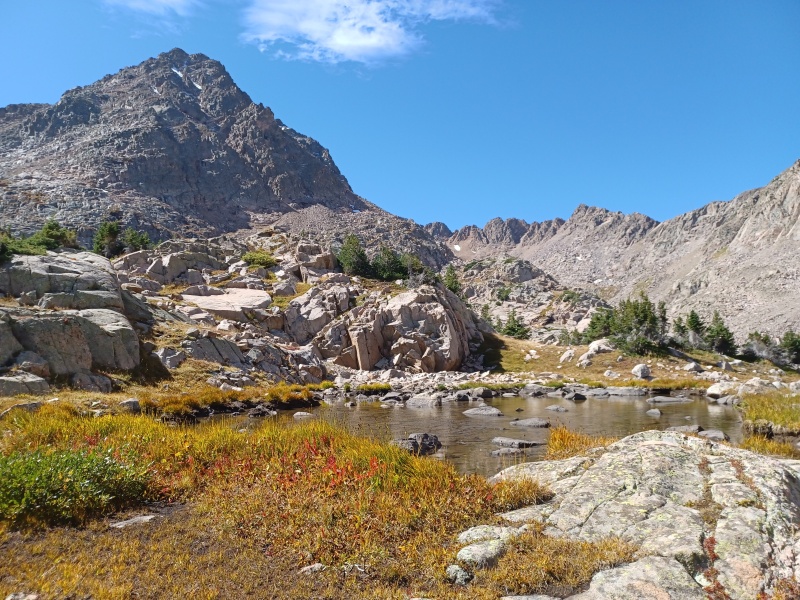
At the lake! Looking up on day 1's plan
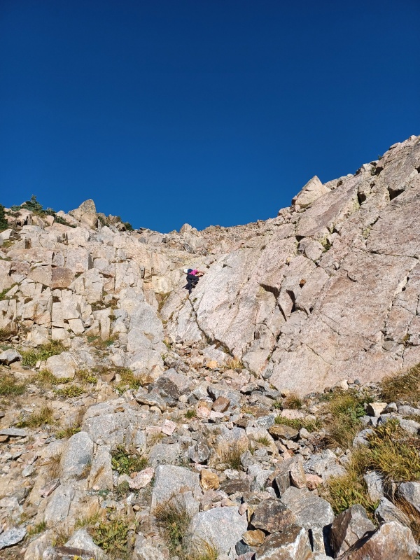
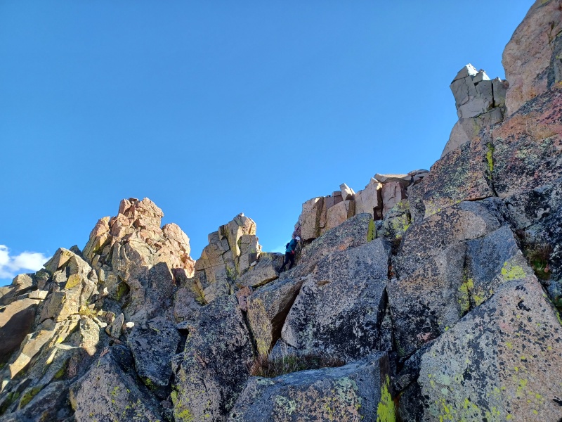
Up first: L, Gore Thumb, Guyselman, and N. We figured this would be the longer day, but with a perfect forecast we were in no rush to start early. Alarms went off at 6 and we hit the trail by 6:30, allowing us to navigate around the lake in the daylight. It wasn't too hard to follow, and we found a suitable place to cross the stream between the lake and the waterfall. Peak L lies 2100 feet straight above. We shot up an obvious gully leading to the upper reaches of the mountain. The gully requires no more than easy 3rd class moves, but Natalie has arguably the worse of the two types of crack addiction, so we found some splitters in slabby terrain to satisfy her cravings.
Up up up! Don't think too hard, just go up up up
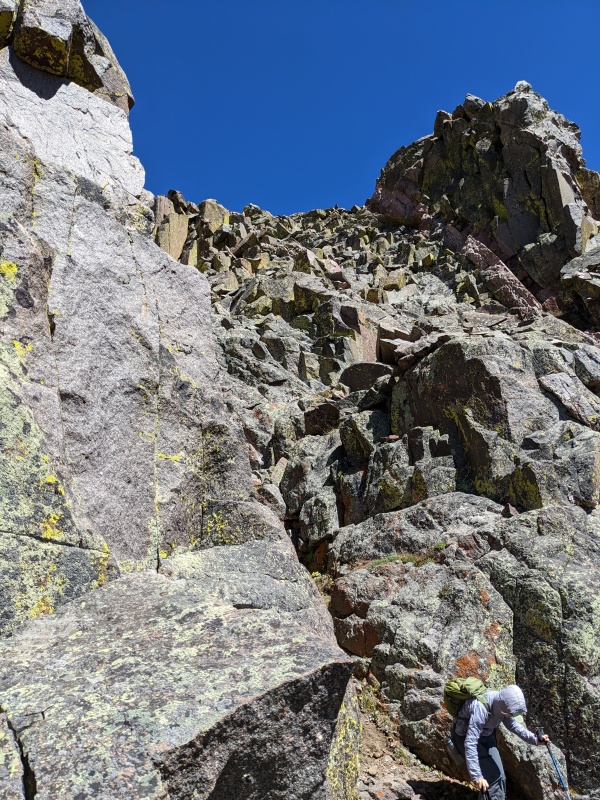
Unnecessary and egregious
twitch twitch ya'll got any more of that crack? twitch
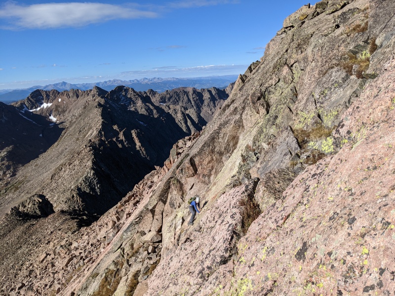
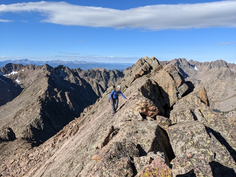
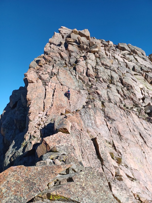
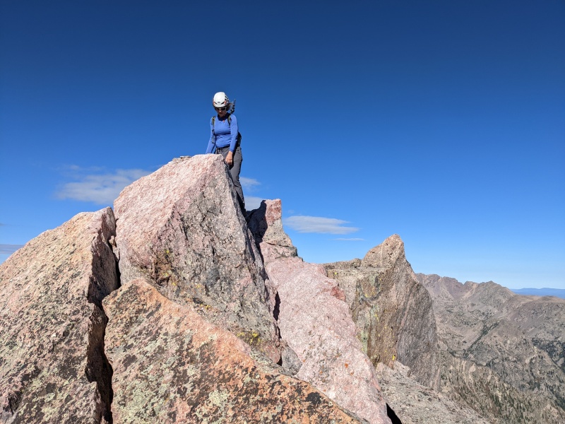
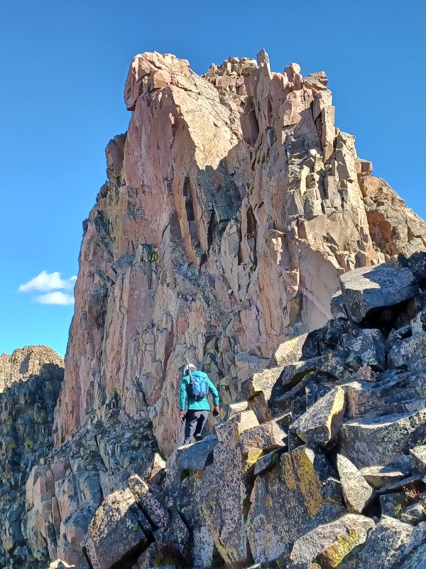
Peak L's false summit is guarded by steep slabs. We elected for a frontal assault on the false summit. Natalie found a gully bisecting the slabby face to her liking, while I opted for the slabs just to the right. Both options went at low 5th. The slabs were steep, knobby, and an absolute blast to climb. That took us directly to the knife edge ridge, which we traversed easily. The summit block followed, with me taking a difficult line to the left near the ridge and Natalie swinging to the right for a class 3/4 option. The summit was a small perch, large enough for just one person at a time, fitting for a peak of this caliber.
My route up, like a knobbier 2nd flatiron. Gloriously fun
Natalie working slabs in the gully. Give us more of this!
Traversing across the top of the slab to the knife's edge.
Summit block! Me making it harder that it needs to be (but more fun too!). Right way is underneath to the right, then up
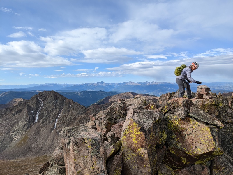
Summit perch! Natalie checking her balance
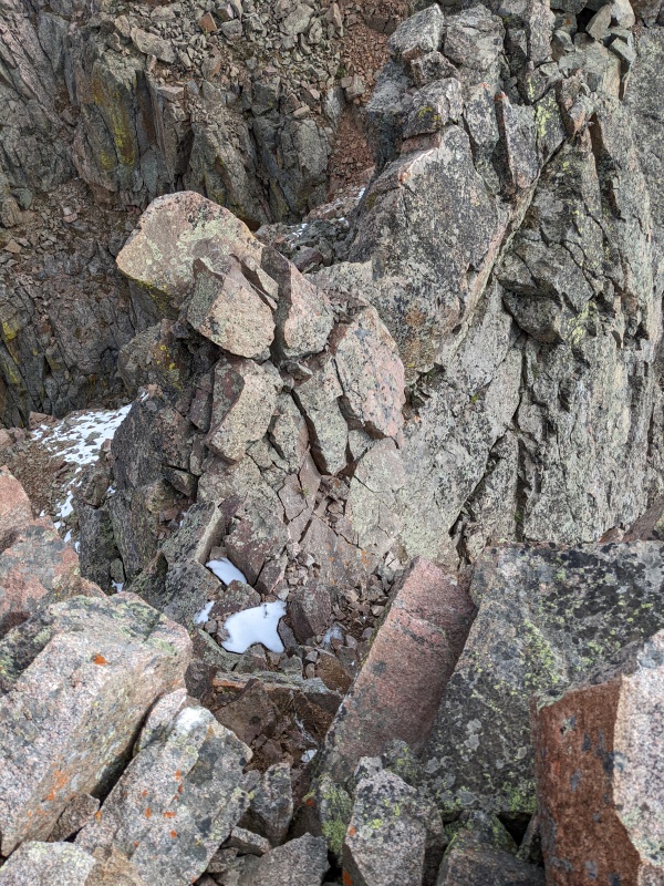
From L, we followed the ridge toward Gore Thumb. In hindsight, we probably should have descended Natalie's route and traversed under L's summit block to grassy terrain in between L and the subsequent towers, but one doesn't gain the power of hindsight until after a mistake is made. Instead, we downclimbed the ridge, which culminated in a 10 foot vertical offwidth. Natalie dispatched it using fundamental offwidth technique; I made it down by lowering myself into position, hanging off the ledge with my fingers, and dropping. Being tall is a skill, kids.
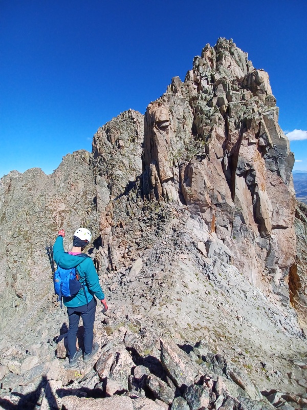
Many people report Gore Thumb an elusive target to identify. As Jorts pointed out in his report, it's the third tower on the ridge, and that piece of advice proved very helpful. It is also very easily identifiable and prominent from Guyselman. We skirted the first two towers mostly to the west (with a quick eastside detour, unsure if that was the best), then wrapped around to the far side of the Thumb and ascended a short ridge to the summit. For the record, the 14ers.com tag of Gore Thumb's summit is slightly off, so when you're up there it says it's further down the ridge. But it clearly isn't, as that tag isn't even on any sort of high point. Of note: while descending that short ridge on the N side of the Thumb, I had a hand and foot hold shift simultaneously....that was a powerful clencher, to say the least.
Hmm, wonder why it's hard to tell which one Gore Thumb is...
Ahhh, there it is! (I think...)
Scamper up to the ridge, then go right. Solid unless it's not
Thum(b)it! Looking back toward L
The future...none of these are Gore Thumb, so maybe that helps.
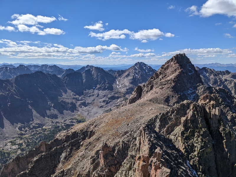
From Gore Thumb, Natalie and I took different routes down, up, and across gullies and ribs. I went lower, she stayed high. We eventually ascended a gully to a small saddle, went left, and reached a false summit of Guyselman. A short talus hop later brought us to Guyselman's true summit, which provided impressive views of the already-climbed ridge, and a sobering perspective of how far N was from anything.
"FIGHT THE POWER!....or go leftish I guess"
Summit of Guyselman. Natalie practicing her NWA album cover pose
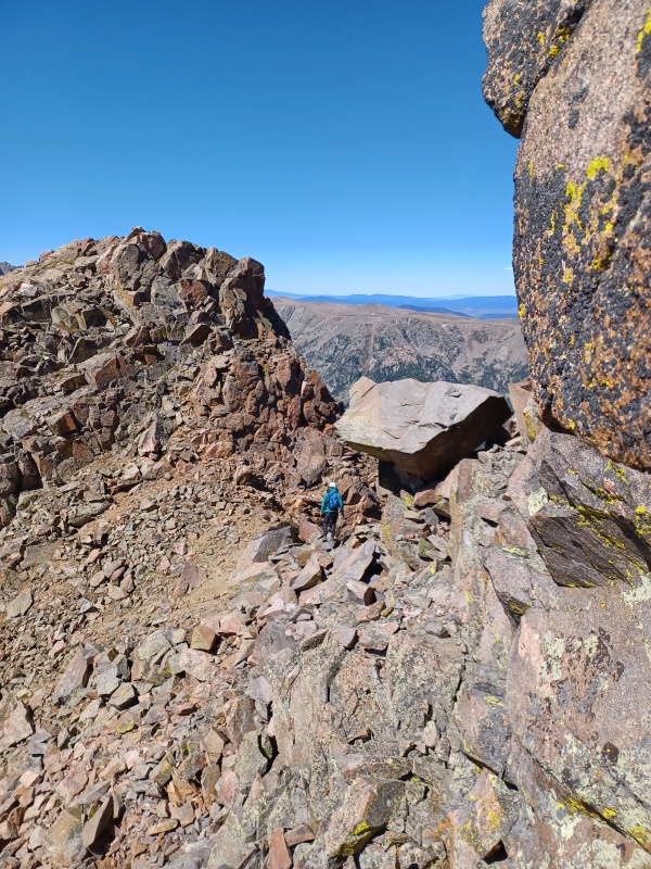
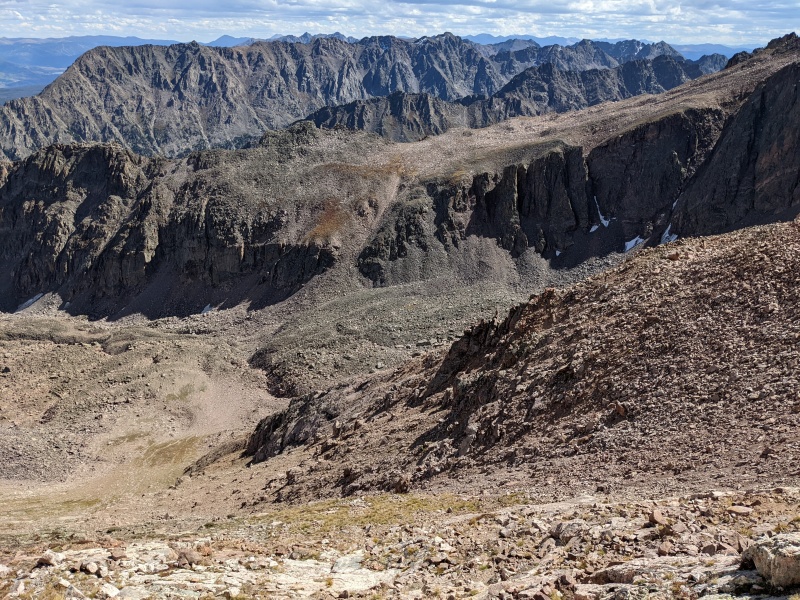
The ridge to N is impeded by a large cliff blocking easy access. This forced us to take a south facing gully located NW of Guyselman's summit to get under the rib that creates the cliff. Rather than descend the entire gully, look to the right and at the most convenient opportunity, climb up and over the rib. This spits you out near another saddle and saves you 100+ feet of elevation loss. This saddle drops off into a gully on the other side, which grants access to a grassy ledge leading to the ridge down to the saddle. Once at the saddle, we stayed east of the cliffs on the ridge and found relatively easy terrain leading to our 4th summit of the day (or second ranked, since that's all Natalie cares about). Somehow, none of the peaks we climbed this weekend had summit registers.
Heck of a view from gully downclimb
At the crossover, looking back up gully to Guyselman's summit ridge. If you miss this, you lose an extra 100+ feet....so don't miss it.
At crossover looking at saddle
From grassy ledge looking back up at saddle. The wall to the left is what prevents easy passage
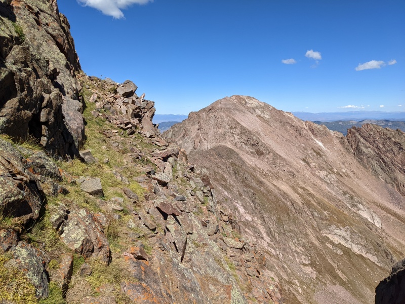
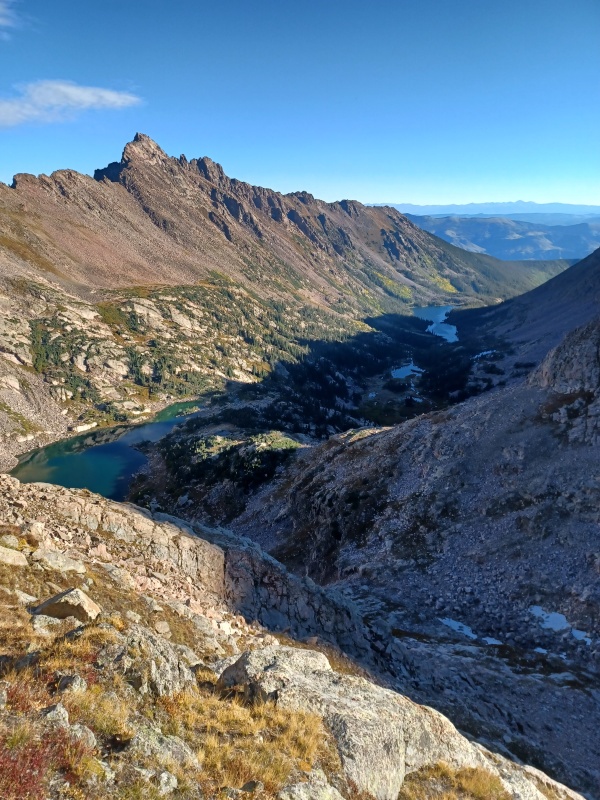
The grassy ledge, looking at N, approximately 50 miles away
Weaving our way to the saddle. Once there, N ain't too tough
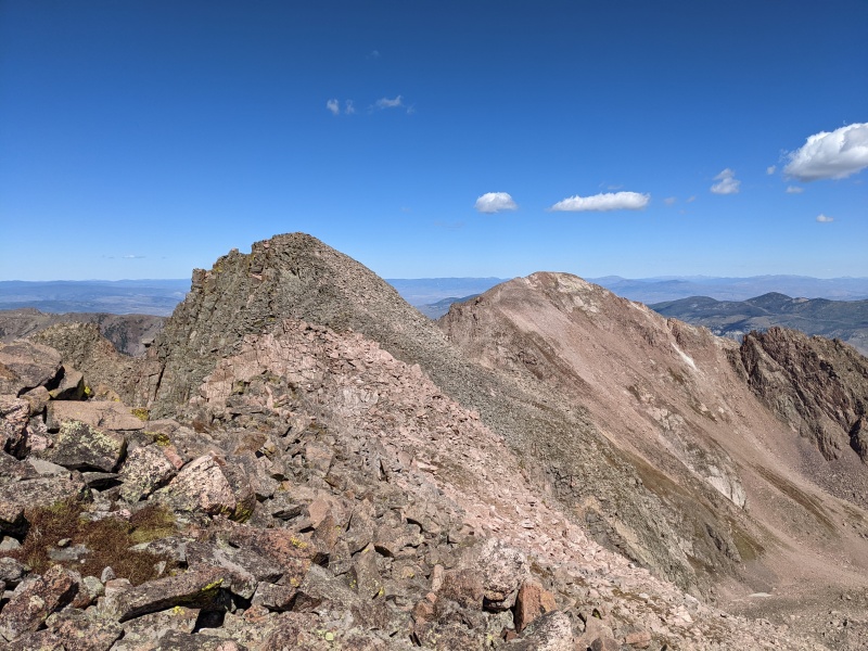
All in a day's work
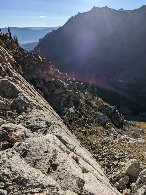
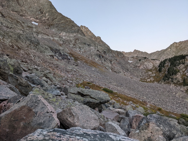
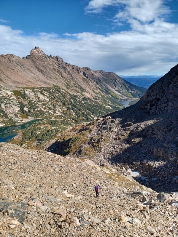
Now, to get back to Upper Slate Lake....Regain was the theme of the weekend, and this was no exception. We went to the low point just south of N's summit, then descended the mildly miserable gully to the basin. From there, we crossed the basin and ascended the one obvious break in the cliffs. We reached the crest of Guyselman's east ridge separating us from the Slate Creek drainage. We traversed across two rock ribs to reach an incredibly wide gully (no really, like a third of a mile across) featuring grass, scree, and ultimately talus. This went all the way back to the lake, and after hopping car-sized talus along the lake shore, we made it back to camp, where we ate, drank (water, duh), and fell asleep before it got dark.
Looking down the descent gully. The ascent on the other side is the rock glacier. Gotta get up to get down!
From the top of the reascent, looking back on N. The descent is the gully just to the left of the summit slabs of N's summit, angling down to the right
Look for this big ol' gully...then go down.
All the way down, no cliffs! Just a liiiiitle bit of talus.
Natalie's perfect photo composition shows why I used more of her pics than mine in this report. Also hi Q
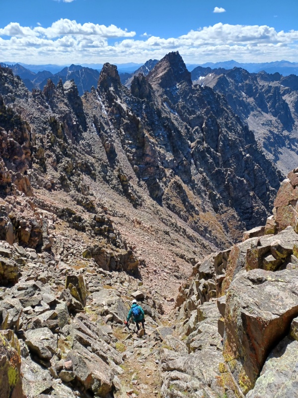
Day two: Peak Q, maybe R if time permits, then pack out, hopefully making it all the way to the car, as the following day had a 90% chance of rain. We figured an earlier start was warranted for this day, given the 50% chance of rain by noon. We quickly realized that we have very different definitions of "early" (I've started at 2 before, whereas Natalie thought our 6:30 departure time the day before qualified as "early"), so we settled for 5:30. We'd heard the bushwhack to even get to the base of Q is heinous, so we tried to walk the line between making progress in the dark and not just floundering around, lost, in the dark. As it turns out, we needn't have feared. We cruised a faint but very followable trail past our turnoff for L, up past the waterfall, and through the forest, all with headlamps. After that, we lost it momentarily, but fortuitously discovered that someone had made a network half-assed, one rock cairns, that led through the slabs and tree patches, up to the left to the talus slopes, and all the way to the grassy access gully to South America lake. They were mostly single rock cairns, so while not obvious, we could identify them because they looked just a little too perfectly placed or a little too prominent. Moral of the story: find these, and if you don't, stay high to the left in the talus.
Talus traverse to grassy ascent gully....look for low-effort cairns
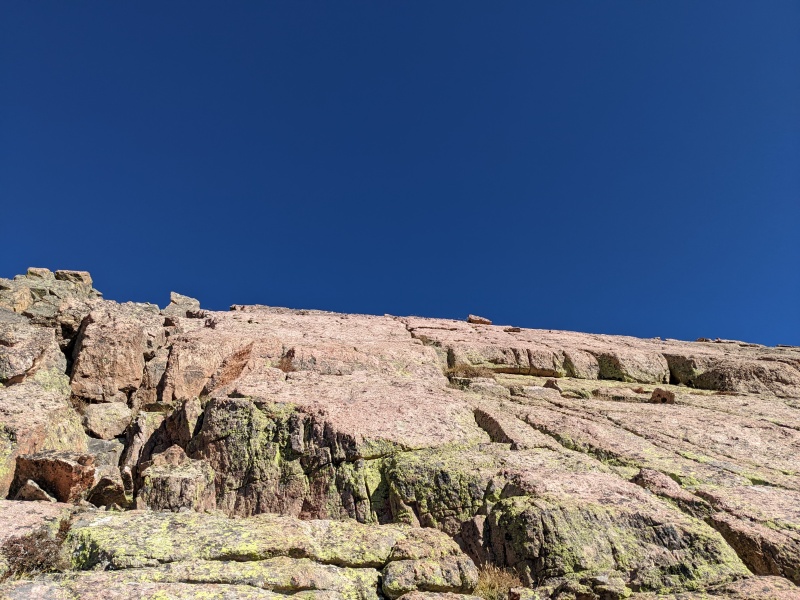
Once at the lake, a short and surprisingly solid gully led to the base of Q's east face. I scampered up some slabs to warm up the scrambling, while Natalie found grassy ledges in a concerted attempt to climb Q without ever stashing her poles (spoiler: it worked). A lot of the terrain on the face is loose scree, dirt and rocks, but I was able to link up enough scrambling on solid rock to progress without hating the experience. Natalie kept click-clacking her way up the mountain, able to keep the climb to primarily a hike until just a few hundred feet below the summit.
Somehow more solid than it looks
Starting up slabs...pick your route! It generally all goes at varying levels of fun, difficulty, and looseness
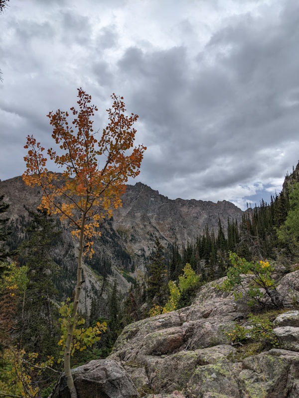
Higher up, L watching over us
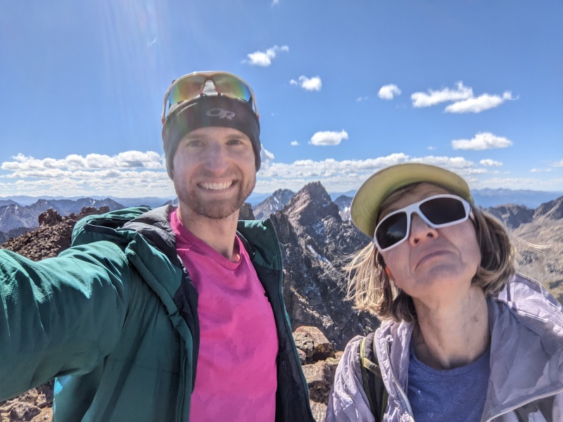
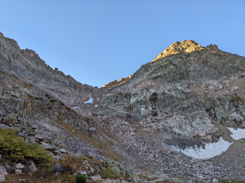
Once we approached the false summit, cairns appeared to guide us around toward the north face, which held some snow in the shady areas. This, uh, complicated the ledge traverse and subsequent chimney to reach the false summit, but I managed without taking out the poles (should have taken out the poles...). From the false summit, a quick jaunt on the south side, a short knife edge, and another chimney spit me out on the summit, number 5 of the trip. Natalie followed other cairns onto the snowy north face of the true summit and endured a frozen 5th class chimney to reach the summit, her 521st ranked 13er!
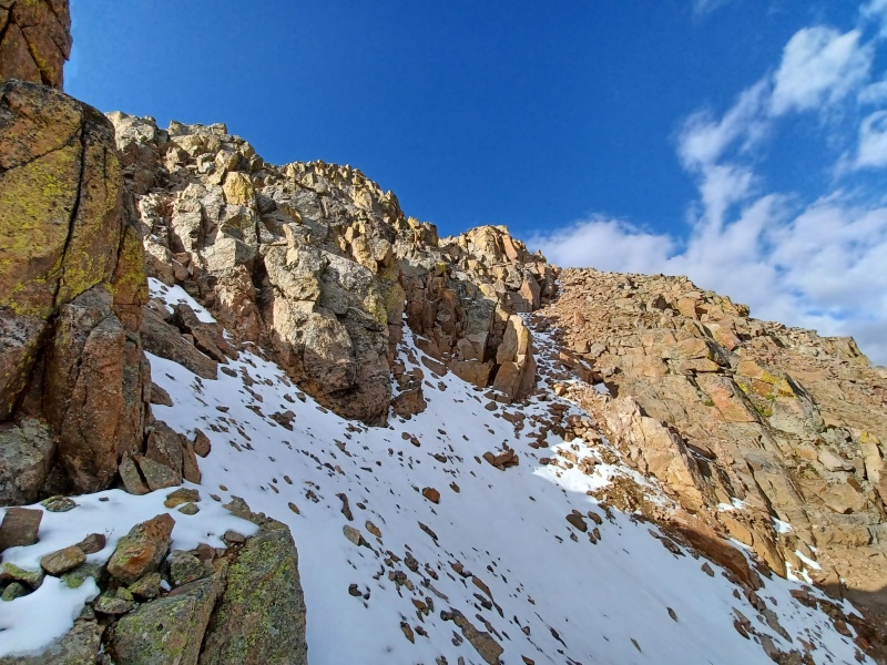
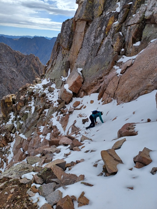
Snow-covered ledge traverse...a little extra spice today
Summit ridge. Me taking a picture of Natalie....
...taking a picture of me!
Looking down on 4th class knife edge and chimney on summit ridge
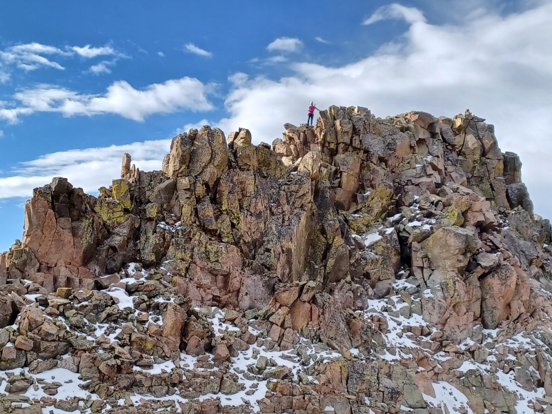
Natalie decorating summit cairn. Rain why you come so early?
Despite being 9:30, rain was just a short distance away, as Powell, Eagles Nest, and Ripsaw were getting dumped on. Deciding it would be better to be below the scrambling and the snowy moves when the rain came, we rushed off the summit (my way) and scrambled back down the chimneys and the snowy ledges. I finally had to get my poles out to descend 50 feet down a snowy gully before we ended up on the loose dirt that makes up so much of Q's eastern slopes. After some tedium, we got down to the moraine below and the blocky gully. Honestly, Peak Q was underwhelming with the amount of scrambling actually required. It could be kept to unpleasant 2nd class until the last 300 feet if one really wanted to (although why would you do that to yourself?), and the scrambling wasn't as sustained or interesting as L or the prior day's peaks. I guess it makes up for it by being so cool-looking...
Spidering across exposed snow ledge #1
Natalie working exposed snow ledge #2
Descending loose slope of crap, but at least L and Slate looks good!
Also, somehow the rain that was imminently threatening just a few minutes before somehow missed us to the north, and all other clouds in the sky disappeared. Even so, we decided that an attempt on R would preclude a backpack out that night, so we had to choose. We chose to pack out and forego R, praying to the LIDAR gods that it forever remains under 13k and therefore not a real mountain (please send any and all angry comments to @billmiddlebrook, since checklists on this site are the the determinant of whether something's actually a mountain or not).
As we were navigating back toward the lake and the grassy gully, we heard a plane above. We located a small plane with orange tips on its wings and watched it do a big horseshoe around the Slate Lake basin, then watched as it did another lap, sinking lower and lower until it was no more than 100 feet off the ground. It looped around us, flew over the lake, then took off. We tried to get a picture but neither of us were expecting pass #2, and my phone was too laggy to bring the camera up in time (thanks Pixel...still better than an iphone though). Not sure what it was doing, but based on its movement it surely spotted us and my aggressively pink/purple shirt, and that precipitated its second pass. It never came back, but we thought we heard it over in the next basin north a few minutes later. Also we thought that next time taking a seaplane to Upper Slate Lake or skydiving to camp may be better options than backpacking.
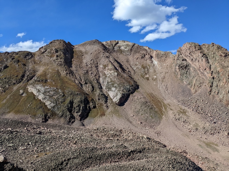
Q's a looker, no doubt
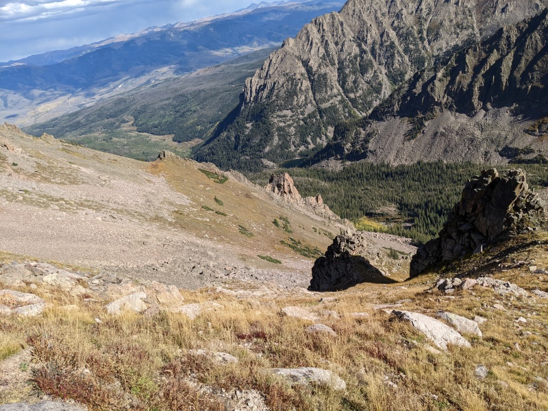
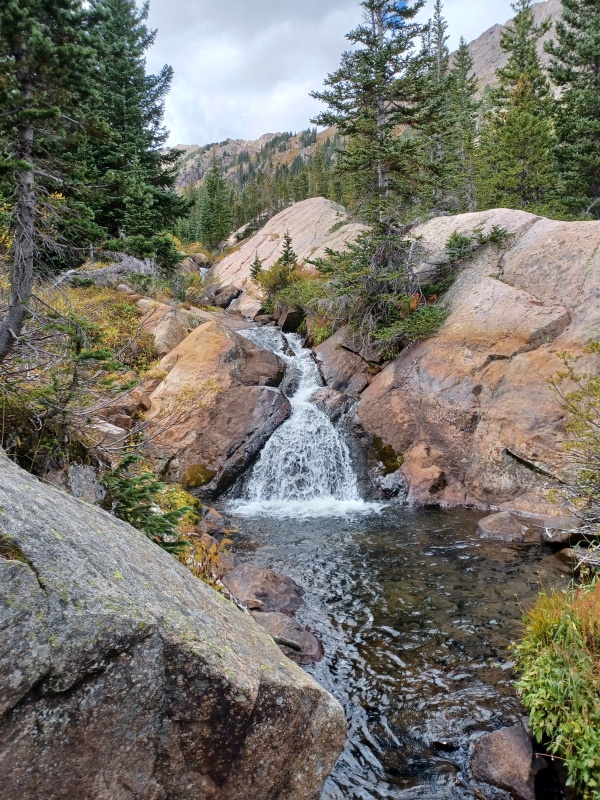
Waterfall
Our trip back to camp presented slightly more difficulty in finding the cairned route, but didn't delay our return too much. We quickly packed up camp, scarfed down some food, and began the trek out. The Slate Creek trail isn't even even quick on the descent, since it's so steep at points. We struggled our way down it, feeling the effort of the prior three days in every step.
On the long pack out...pack cover not required.
Once we got to the turnoff for the Gore Creek trail, Natalie sent me on my way, since I had a little more juice left in my legs for the uphill back to the car. I pushed on through the fatigue toward the car, dreaming of a 16 inch Which Wich in Silverthorne that night, all while hoping the rain would hold off and having imaginary arguments with imaginary people to pass the time. I hope I'm not the only one who does that...I guess as long as I win them I'm okay. I powered back to the car before headlamps became a necessity, very satisfied with the weekend. I began the drive out, only to find a gnarly accident had blocked highway 9, delaying me enough that Which Wich had closed and I was the last customer Chipotle allowed in that night.
I had a blast this trip. These peaks made us work for them, and I certainly got a lesson in the effort needed to infiltrate the inner reaches of this range, but the reward of topping some of the least visited peaks in the state made it well worth it. And I'm glad I got to share these peaks with Natalie, who's a positive, capable, and entertaining partner and a new friend I'm glad to have made this summer. Did we get Gored a bit this trip? Sure. But I wouldn't have had it any other way.
So long, Gores
My GPS Tracks on Google Maps (made from a .GPX file upload):
I laughed when I read your comment in the intro about how far Slate Lake is from everything. I was there about 10 days before you, ugh, what a slog, no? But beautiful for sure. Looks like a great trip, super pics.
@sbenfield and osprey: thank you! I had a great time. Natalie did too, even if she pretends it was horrible.
@marksilas: I actually think you nailed it! When it was over the water I thought I saw a small release of some liquid, but didn't get a good look. That very easily could have been a fish drop.
@tompierce: slog indeed! But as slogs go, this one at least had some payoff
Thank you for joining me on this sufferfest and providing the much needed motivation. Otherwise I'd still be debating with myself if I am ready for another gore-ing trip (and the truth is I am never ready because they always end up being harder than expected - not in terms of technical difficulty, but in the overall physical effort).
I am also very glad we pushed the trip by a month - given the swampy approach and leftover mosquitos, I simply cannot fathom the viability of this route as a summer backpacking destination.
Now I have a year to recover from this trip and then will look forward to the finale on XYZ!
What an adventure. I like the way you climb, unnecessary and egregious is my style too! I was on Mt Powell that day. The Gores are never easy, but I like it that way! And I'm sure you do too!
Yessir! Don't think too hard, just climb. The best way!
I'm sure you're in one of those pictures on top of Powell
Caution: The information contained in this report may not be accurate and should not be the only resource used in preparation for your climb. Failure to have the necessary experience, physical conditioning, supplies or equipment can result in injury or death. 14ers.com and the author(s) of this report provide no warranties, either express or implied, that the information provided is accurate or reliable. By using the information provided, you agree to indemnify and hold harmless 14ers.com and the report author(s) with respect to any claims and demands against them, including any attorney fees and expenses. Please read the 14ers.com Safety and Disclaimer pages for more information.
Please respect private property: 14ers.com supports the rights of private landowners to determine how and by whom their land will be used. In Colorado, it is your responsibility to determine if land is private and to obtain the appropriate permission before entering the property.

")
")
")
")
")
")
")
")
")
")
")
")
")
")
")
")
")
")
")
")
")
")
")
")
")
")
")
")
")
")
")
")
")
")
")
")
")
")
")
")
")
")
")
")
")
")
")


