Log In 
Report Type 
Full
Peak(s)  Peak Ten  -  13,494 feet
Peak Eight  -  13,252 feet
Date Posted  09/07/2022
Date Climbed   09/04/2022
Author  Furthermore
 Weminuche Walkabout   

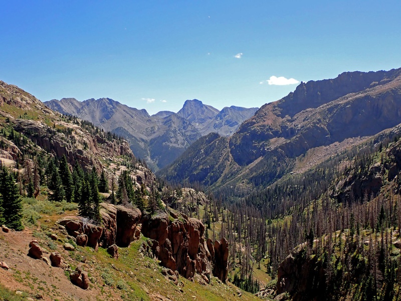
Peak Ten 13,494'

Peak Eight 13,252'


September 04, 2022

~22.9 miles, ~8,500 gain

TH: Hunchback Pass (4WD mandatory) ~6.5-7 hours from Denver

Max difficulty: Class 4


Finally, good splitter bluebird weather mixed with a semi-last minute decision had me driving off towards Creed Saturday mid-day. Minus a short winter excursion 5 years ago, it's been almost 10 years since I wandered around the heart of the Weminuche Wilderness in the summer – I was very excited to return. Despite the holiday weekend, traffic wasn't too terrible; however, I'm glad I wasn't trying to find a camping spot as most of them were taken.

The road was rough. I don't remember the 4WD road up and over Timber Hill from Rio Grand Reservoir being as rocky or parts of the upper portion of the Beartown 4WD road being as rough as they were. Maybe I was a little more conscious since I just had a sway bar bracket re-welded back on...... Also, the Rio Grande river crossing is much more mellow in September than my late June ford many moons ago. I arrived at the trailhead around 7 PM and had to park further up the road due to the limited parking being occupied. It took a little work to level the car out so I could sleep in it.

The alarm went off at 3:30 AM and I was strolling down the Kite Lake Road to the Hunchback Pass Trailhead by 3:50 AM. Knowing I had a long day ahead, I casually sauntered up and over Hunchback Pass. The beta I wrote down for locating the Stormy Gulch Trail was still excellent (https://www.14ers.com/php14ers/tripreport.php?trip=13123); however, the turn-off was challenging in the dark. I cursed and wandered around for 15 minutes bushwhacking, trying to locate the overgrown trail. Once on track on the trail, I made better progress up Stormy Gulch – not as nasty as some recently have made it sound. If a cup of coffee wasn't enough to wake me up, a lovely, super wet willow bushwhack completed the job. I was solidly soaked before I started up the alluvial talus field toward Silex Lake.

21893_01
NW Face of the Silex.


21893_02
Alpine Glow on Storm King


21893_03
Storm King's SE Ridge


21893_04
Trinities From the Peak Eight-Storm King saddle.


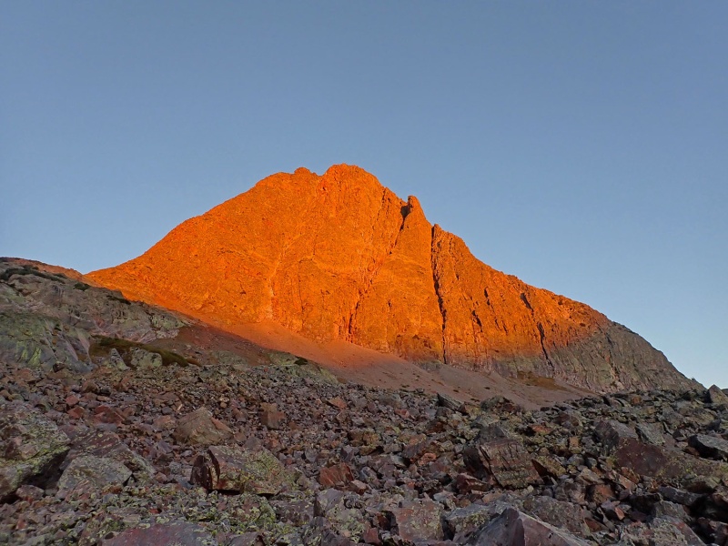
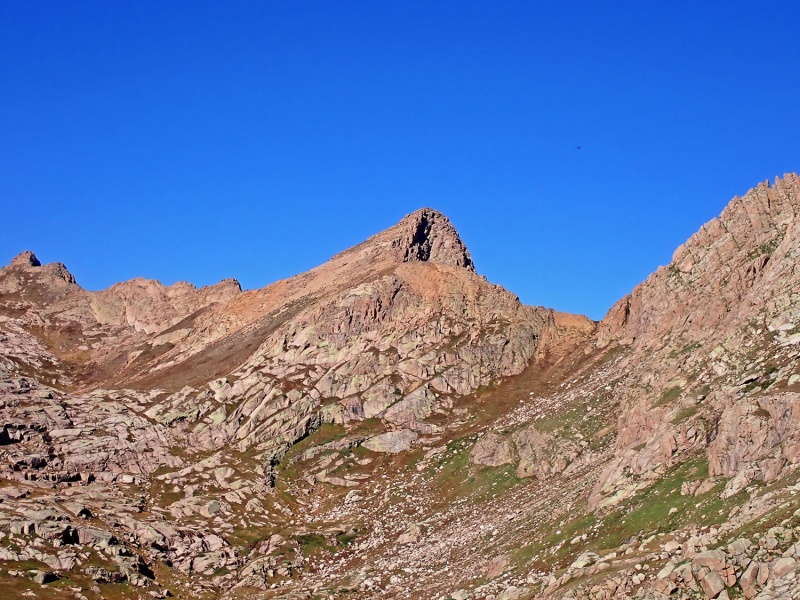
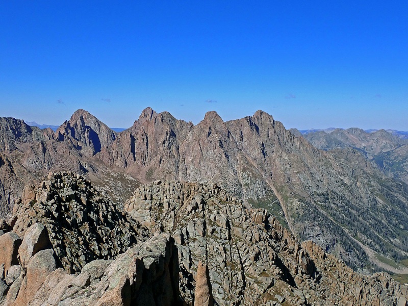
Before reaching Silex Lake proper, I stayed in the basin's northern, more mellow edge as I bounded along talus toward the Peak Nine/Peak Eight-Storm King saddle. The morning alpine glow on Storm King was fantastic. Once I reached the saddle, I traversed southwest towards a red talus-filled couloir on Peak Eight's north face. The rock in the couloir was loose, so instead, I scrambled up a rock rib on the right side of the couloir, minor class 3, with surprisingly sound rock.

I reached a notch at the top of the couloir and proceeded west up Peak Eight's east ridge proper. The scrambling was engaging with acceptable quality rock. At a false summit, I continued scrambling west along a surprisingly exposed ridge to the true western summit, where I arrived around 7:50 AM with fantastic views. I returned to the notch at the top of the couloir and then descended loose talus/scree south towards the sizable un-named lake south of Peak Eight. I skirted on loose talus around the lake's west side, saving on some extra elevation gain.

21893_05
Peak Eight's north couloir (red couloir)


21893_06
Good scrambling (class 3) on the right side of the red couloir.


21893_07
Peak Eight's east ridge (class 3).


21893_08
Exposed summit ridge to the western summit.


21893_09
Summit shadow of Peak Eight.


21893_10
Jagged from the summit of Peak Eight


21893_11
Peak Eight from the south.


21893_12
Jagged from the northern end of the Leviathan Cirque


21893_13
Leviathan's North Face


21893_14
Leviathan's North Face

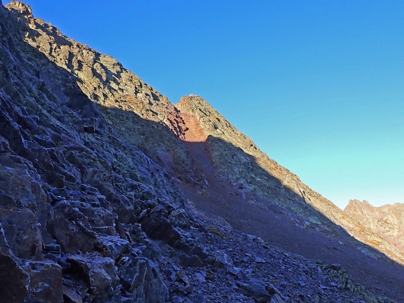
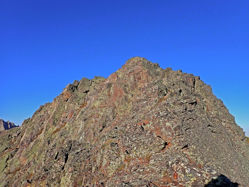
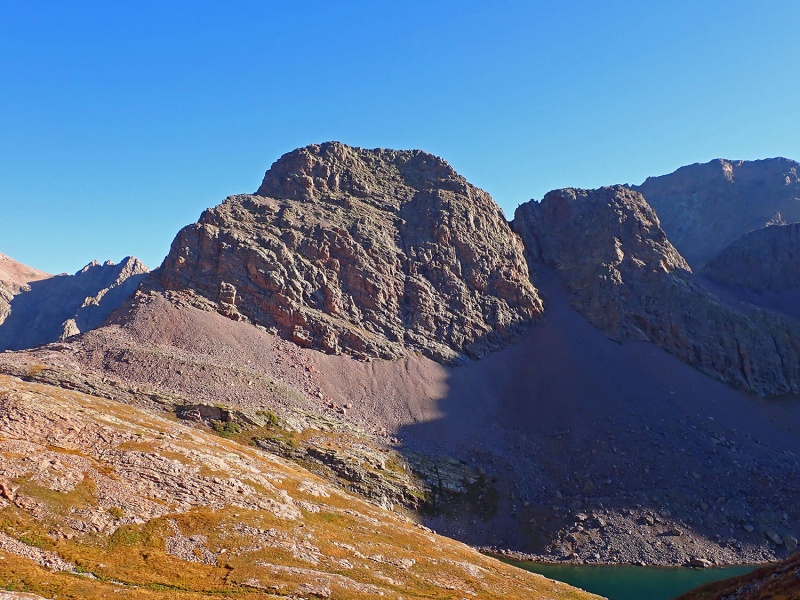
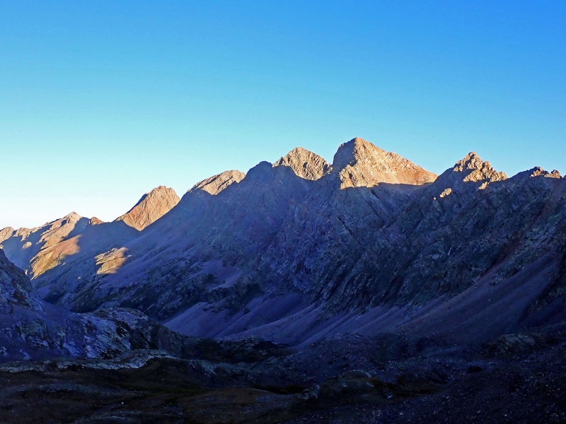
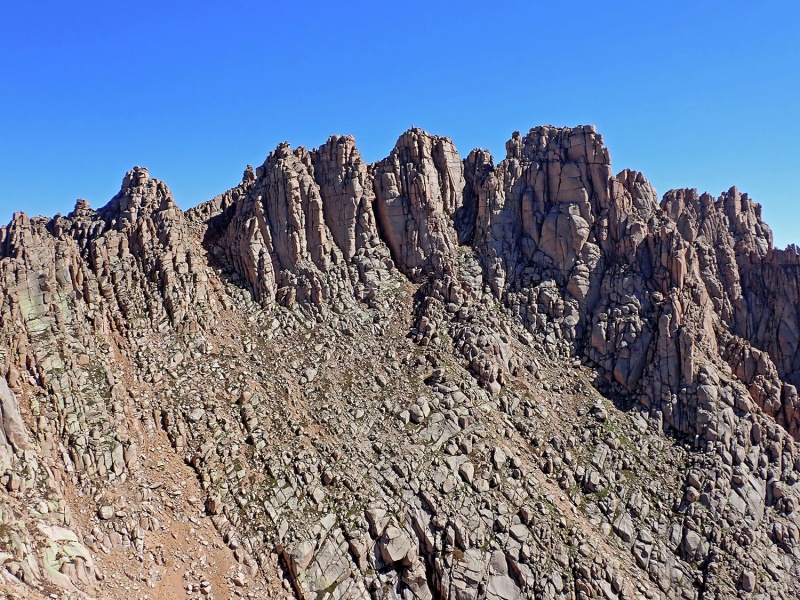
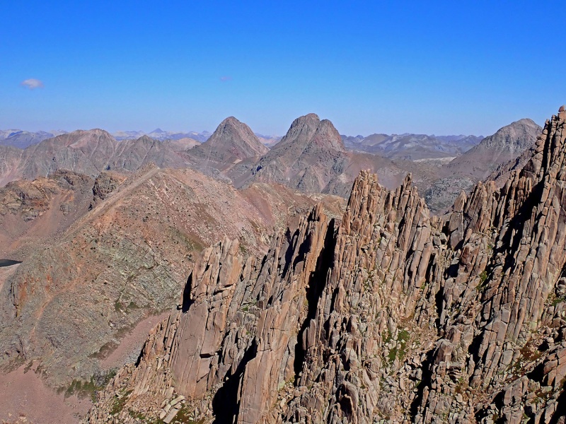
Grass mixed with talus guided me southward along the western edge of the Leviathan amphitheater. The more I proceeded south, the more of a disheartening talus hop my stroll became. Never-ending talus travel finally led me to the saddle west of Leviathan Peak where the views of Jagged are impressive. I was surprised I didn't see a Labor Day weekend party attempting Jagged.

After a quick break, I continued southward around Jagged's eastern flanks. Descending towards Sunlight Creek, I found perhaps one of the neatest perched lakes extruding from an alpine peninsula. Too bad I didn't get a better photo. Being stubborn, I didn't want to lose too much elevation heading toward Sunlight Creek and tried circumnavigating Jagged's southeast face cliffs westward. I found a sinuous path through exposed grass ledges and cliff bands (class 4). Not recommended and it would have been better if I just descended the extra 300 feet into the grassy valley below. Feeling a little tired, I hung my pack on a rock and started ascending Peak Ten's southeast face.

21893_15
Jagged.


21893_16
Goats


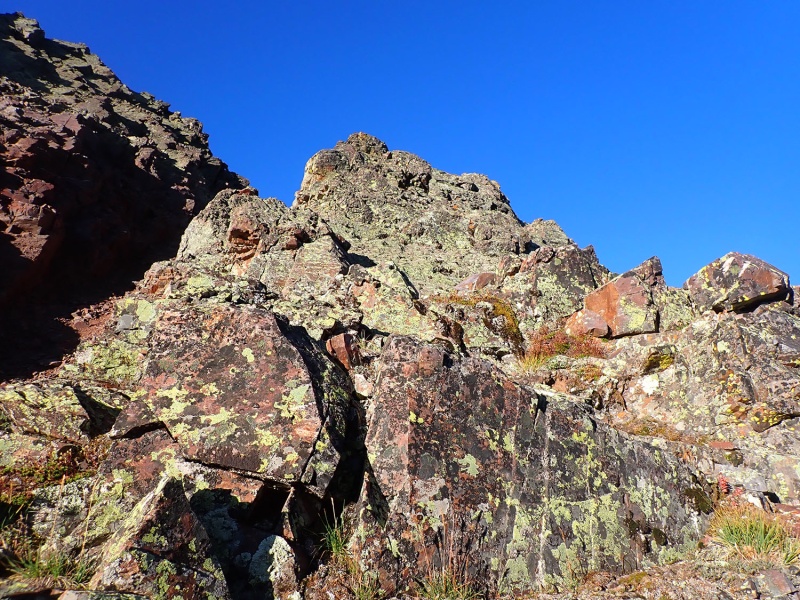
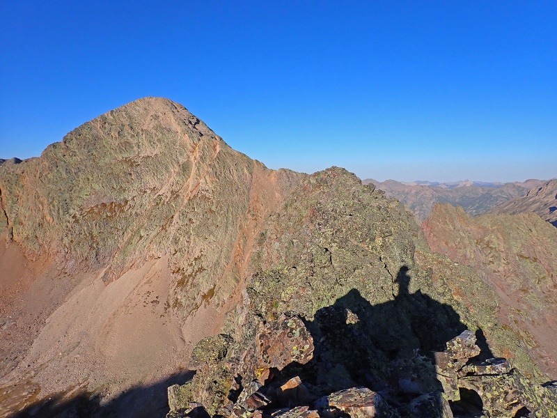
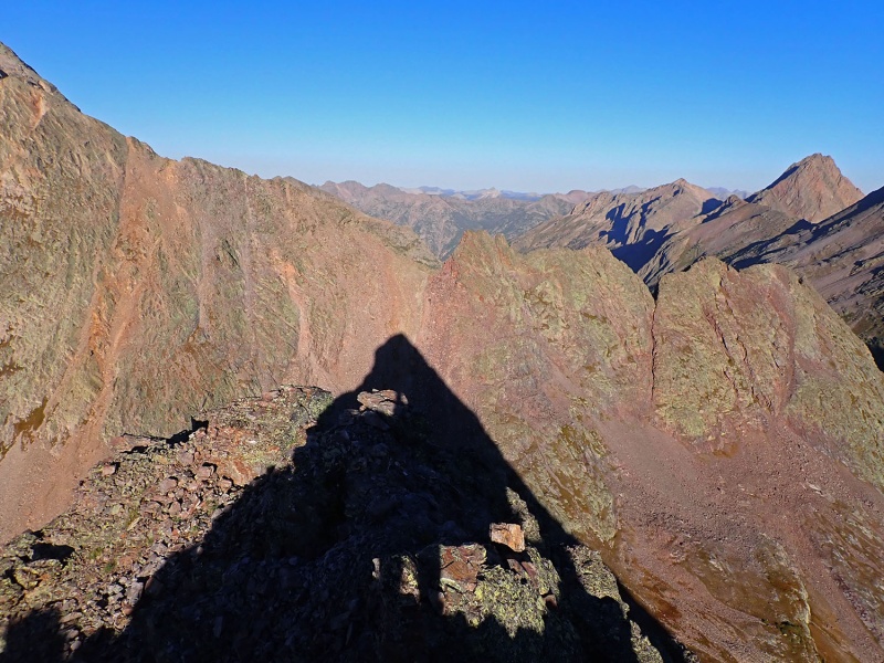
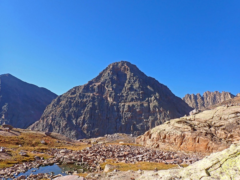
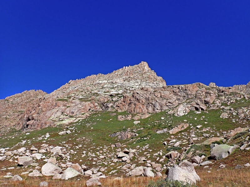
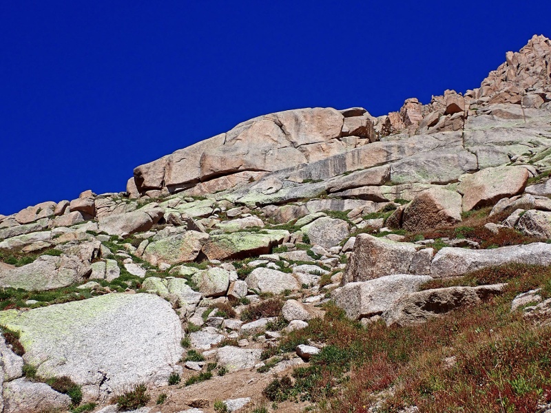
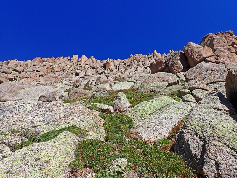
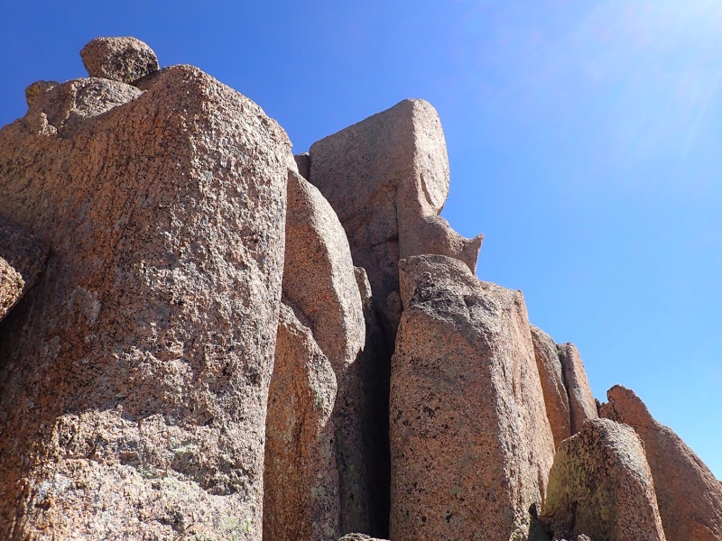
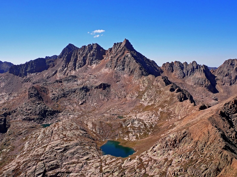
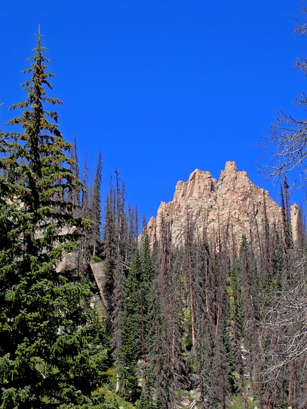
The first obstacle to Peak Ten was a sizable cliff band between ~11,800-12,000'. I found a weakness in a cliff band and proceeded up some chossy but short-lived class 3 scrambling. Previous reports indicate a key white rock. Some call it the "White Alligator" or "White Whale." To me, it looks more like a "White Wolf" head. Once at the White Wolf or Anteater's base, I passed below the left side of the rock (some are taking the right side up some pebble-covered slab which doesn't look as easy or enjoyable) and continued up terraced grass ledges mixed between white cliffs. Describing an exact route through this terrain would be nearly impossible to follow.

I kept the scrambling to a minimum to the summit ridge with just a few short sections of class 3 – and without a doubt, more challenging scrambling could be found – to the final summit block. I hadn't really read the beta for the easiest path up the summit block and ended up climbing the northeast side of the block, which was less exposed but had more challenging climbing. The easiest way up the summit block is along the exposed west ridge up a series of steps. I arrived on the exposed summit around 11:10 AM. The views of the Chicago Basin 14ers, Ruby Basin 13ers, and Jagged were phenomenal.

By far, the day's crux was the descent off Peak Ten. The route finding downward was undoubtedly more challenging than on my ascent. With some work, I discovered my way downward but continuously found more challenging scrambling. I should have observed key features on my climb a little better – either way, the climbing was still fun.

21893_17
Windom an Sunlight from the north.


21893_18
Knife Point


21893_19
Neat Lake. Photo does not do the position of the lake justice.


21893_20
Peak Ten


21893_21
Peak Ten's complicated southeast face.


21893_22
White Wolf?


21893_23
Mixed grass and rock up Peak Ten's southeast face.


21893_24
Peak Ten's summit block


21893_25
Jagged from the summit of Peak Ten


21893_26
Trinities from the summit of Peak Ten


21893_27
Ruby Basin peaks and Eolus.


21893_28
Rubin Basin 13ers.


21893_30
Trinities from Peak 10


21893_29
Windom and Sunlight from Peak Ten


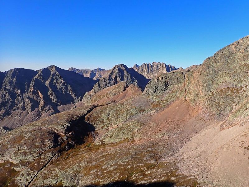
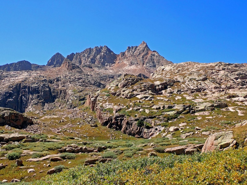
Once back on grassy terrain in the upper basin above Sunlight Creek, I strolled eastward and quickly located the surprisingly decent trail down the Sunlight Creek Basin. Knowing that the trail cuts significantly south before heading back north near Vallecito Creek, I departed the Sunlight Basin Trail and bushwhacked directly east. I crossed Vallecito Creek and intersected the Vallecito Trail; I wouldn't want to complete that river crossing in early summer. After intersecting the Vallecito Trail, I thoroughly enjoyed the graces of such a well-traveled path for the last 7.5 miles back to the car, especially after all the heinous off-trail talus travel. I'll admit, however, that the final 1,000 feet of gain back over Hunchback Pass had me questioning my decision to day trip these peaks.

A little tired, I arrived back at the car at 5:00 PM. The Weminuche never disappoints and these two new LiDAR 13ers are a fantastic addition to the list. After so many years, it's great to return to the heart of one of the finest places in Colorado.


21893_31
Jagged from upper Sunlight Creek Basin


21893_32
Windom and Sunlight from Sunlight Creek Basin


21893_33
Sunlight Creek Basin


21893_34
Jagged from Sunlight Creek Basin


My GPS Tracks on Google Maps (made from a .GPX file upload):


Thumbnails for uploaded photos (click to open slideshow):
1 2 3 4 5 6 7 8 9 10 11 12 13 14 15 16 17 18 19 20 21 22 23 24 25 26 27 28 29 30 31 32 33 34


Comments or Questions
Skimo95
User
Well hot diggity damn
9/7/2022 6:13pm
I had no idea this legend was still around. Thanks for everything you've done for the 13er community!!

Alec


mathguy
User
Nice.
9/8/2022 8:46am
Exceptional photos. Well done!


bdwyer
User
kudos
9/17/2022 1:15pm
I agree with the legend still being around. Thanks for this report. Maybe someday...


Marmot72
User
Of course
8/31/2023 9:08pm
Of course it was a wolf head! Enjoyed the report, as always!


   Not registered?


Caution: The information contained in this report may not be accurate and should not be the only resource used in preparation for your climb. Failure to have the necessary experience, physical conditioning, supplies or equipment can result in injury or death. 14ers.com and the author(s) of this report provide no warranties, either express or implied, that the information provided is accurate or reliable. By using the information provided, you agree to indemnify and hold harmless 14ers.com and the report author(s) with respect to any claims and demands against them, including any attorney fees and expenses. Please read the 14ers.com Safety and Disclaimer pages for more information.

Please respect private property: 14ers.com supports the rights of private landowners to determine how and by whom their land will be used. In Colorado, it is your responsibility to determine if land is private and to obtain the appropriate permission before entering the property.