| Report Type | Full |
| Peak(s) |
Pyramid Peak - 14,029 feet "Thunder Pyramid" - 13,944 feet "Lightning Pyramid" - 13,729 feet Unnamed 13642 - 13,642 feet PT 13820 |
| Date Posted | 09/05/2022 |
| Modified | 09/06/2022 |
| Date Climbed | 09/04/2022 |
| Author | Veory |
| Pyramidal Traverse |
|---|
|
I've never really considered posting a trip report before, I usually just do stuff and keep the pictures, but I decided to write about this one for 3 main reasons: 1) There aren't a ton of existing reports on this traverse 2) A fellow who worked at the Maroon Bells Shuttle Service (also in mountain rescue) said he'd see my trip report when I told him what I was doing 3) A lovely German couple that I met climbing up Pyramid has a cool photo of me starting the ridge, and I have one of them at the summit from the ridge, but we never exchanged contact info so I yelled at them to look this up. Hopefully they see this! 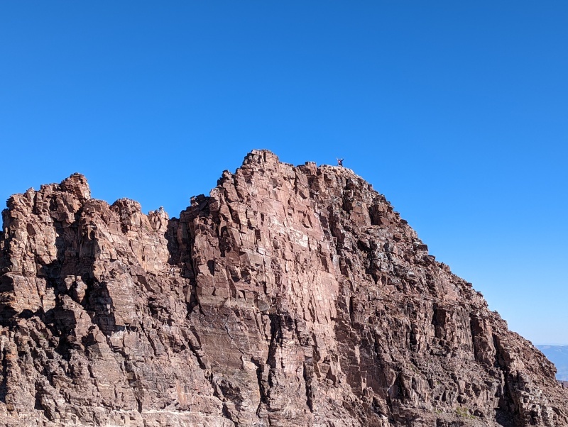
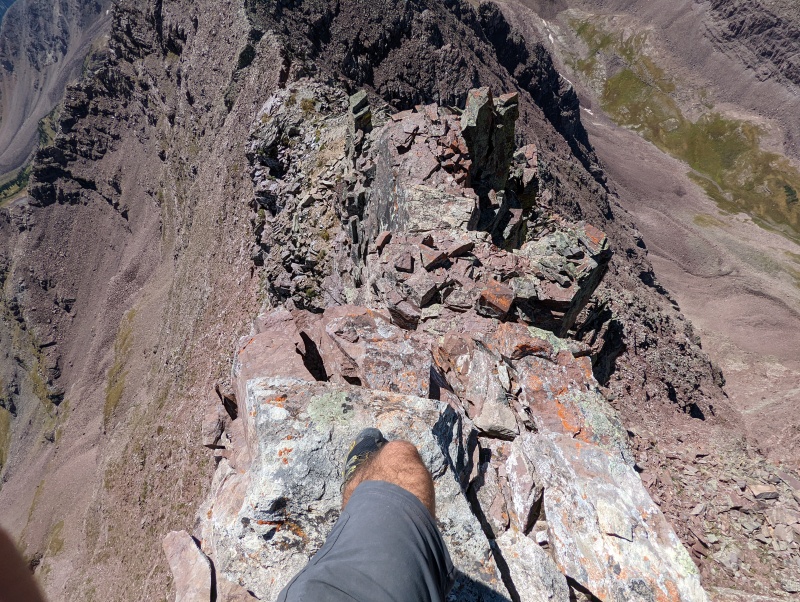
I'll say this at the beginning of the report to get it out of the way; I thought this was a rather dangerous traverse. This is not at all like any of the "great 14er traverses" that have been well trafficked for many years. The rock is MUCH looser, the climbing and routefinding is significantly harder, the exposure is very high, and these factors were all in play at once. If you're considering the route, you should know what you're getting into. I was often breaking off several layers of rock to get to solid handholds on class 5 terrain, and kicking cobbles off ledges for feet. There were few holds I could really trust throughout the entire day. That being said, it was nonetheless a great time with outstanding views. This route is a proud accomplishment I will carry with me, and I'm glad I did it. However, I do not think I could be convinced to go back and do it again :) Sorry if the trip report is a bit long, I want to share not only my experience of the route but also the cool pictures and stories that came with it. Route Overview The Pyramidal Traverse starts by climbing Pyramid peak, then continues along the ridge through Thunder Pyramid Peak, Lightning Pyramid Peak, and the colloquially named "Len Shoemaker Peak" (PT 13631). I descended the notch between Len Shoemaker and the next point on the ridge, making the traverse about 2.2 miles of straight line distance. The traverse is said to go at 5.4, but I often found myself making harder moves into the 5.6ish range, although this probably could have been avoided with less direct lines. Here is a screenshot of my gpx track: 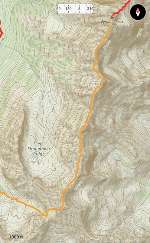
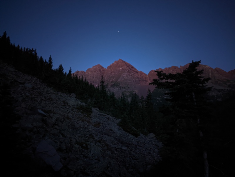
Pre-Pyramind I parked in Aspen and took my bike to Aspen Highlands to catch a shuttle up to the trailhead at 2:40pm Saturday, prepared to make use of the holiday weekend and perfect weather forcast. Backpacked up to Crater lake and was suprised to find an open campsite. In general I was really quite surpised at how few people there were there for a holiday weekend (although there were still many). I got lucky and found an available campsite with fantastic views, sitting in the shadow of North Maroon. 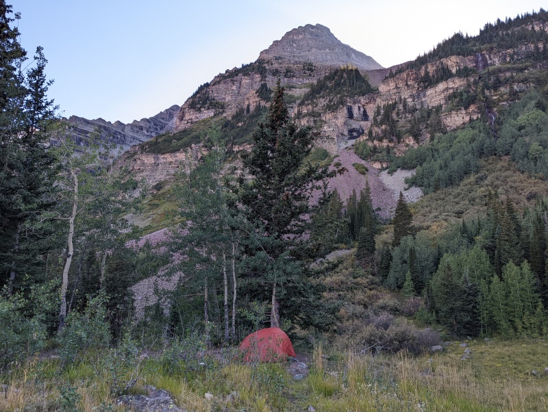
I set up near a group of 9 who were camping out for a few days and made friends with them for the rest of the trip. At sunset we went to skip rocks at Crater lake (one of them was really quite an impressive rock skipper). Two fellows came by at arond 6:00 pm and asked us if we knew anyone there named Derek. We all looked around and shook our heads 'no', then asked what was up. They said they talked to a stranger who was supposed to drive them down from the trailhead. They had no idea what he looked like or where/ when to meet him. Interesting. All we could really do was wish them well in their journey, and take away a great lesson: Don't trust random people from the internet to do important tasks for you with no plan. Anyways, more on that later... After returning, I admired the ridge I was going to climb the next day and promptly attempted to sleep, although this was unfruitful given my excitement for the next day and enticement to look at the stars in the middle of the night. Pyramid Peak I got up at 5 am, prepared for my jounrey, and left camp around 5:30. A little late to be starting such a long day perhaps, but I wasn't really feeling like doing any routefinding up Pyramid in the dark. I took the standard route up Pyramid so there isn't too much to report on, but enjoy these lovely photos. 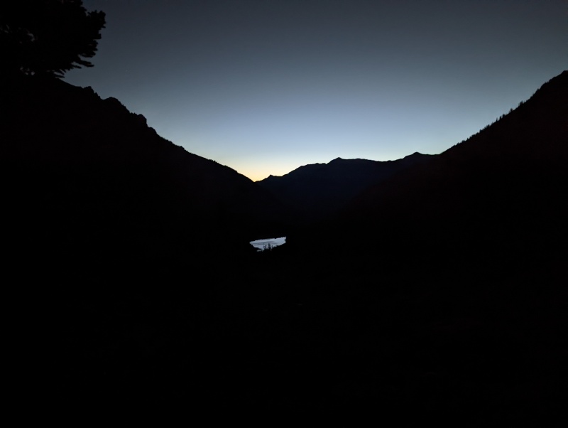
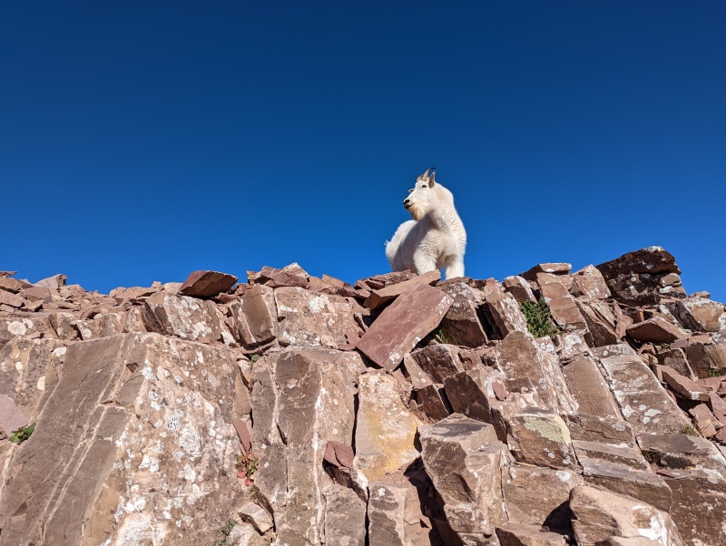
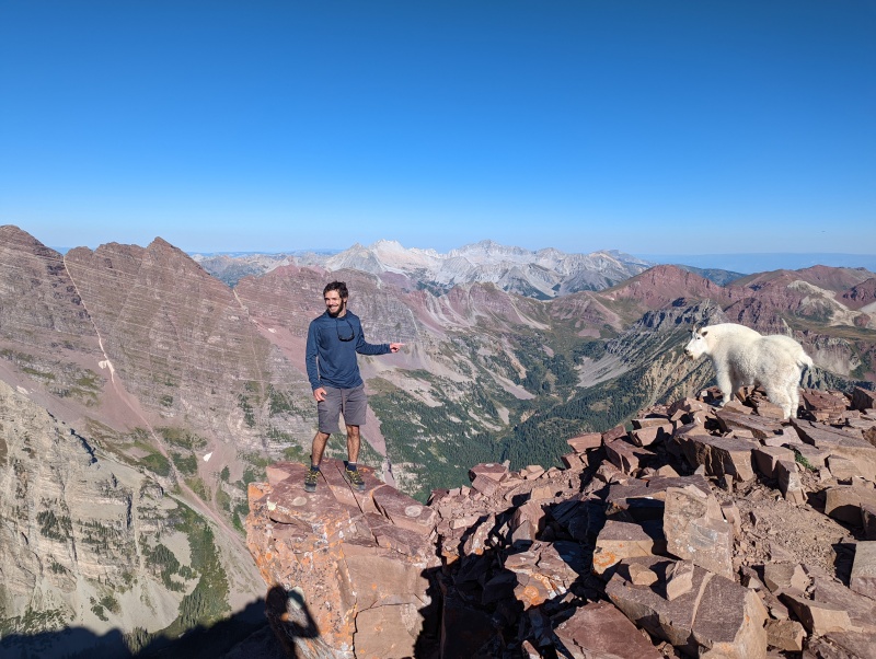
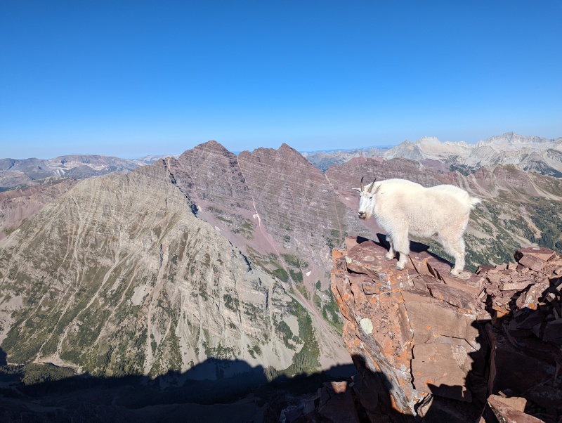
I met a herd of curious goats right where the ridge is gained. They would just walk up within 2-3 feet of me. 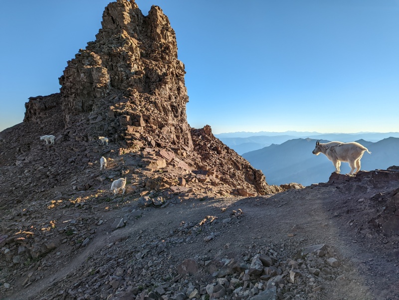
After the Green Wall, I decided to branch off the standard route a bit and climb more directly on the ridge overlooking the rock glacier. I found this to maintain easy class 4 with better views, and highly recommend to those comfortable with the exposure. I then got back on the face and made my way to the summit, 14er 33/58 climbed for me! 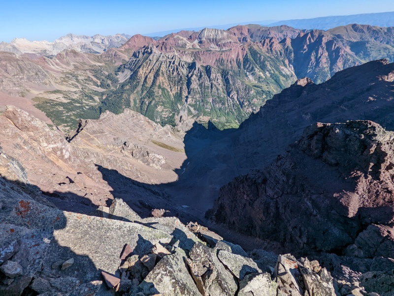
On the summit I met a group who just finished their 14er jounrey (Congratulations!). After chatting for a bit we exchanged names, and one of them was... Derek. I inquired about the situation from yesterday, and he said that while he did talk to some strangers about their weekend plans, he made no promises to drive anyone anywhere. I thought it was just funny coincidence to have met a Derek on my trek, except later when I returned to my camp friends told me they had seen the two wanderers again later that night and they said their Derek was indeed climbing Pyramid the next day! Perhaps I will never know if the Derek I met is the Derek of legend, but if not I think it's more fun to keep believing he was. Pyramid to Thunder Pyramid After hanging around for a bit and eating some breakfast, I looked at the true journey ahead. I knew the crux was shortly after leaving Pyramid, but I couldn't see it. Nonetheless, the ridgline looked both welcoming and daunting. It started off with some fun jumping on fairly solid blocks. I quickly got to a part I wasn't comfortable scooting off with my backpack on, and decided to downclimb on the side of the block with very high exposure for some reason. I was trying to do my best to stay ridge proper as long as I could for the most part, but I ended up deviating from this ideal many times throughout the trip. I reached a cliff band that appeared to be the crux downclimb I was expecting and went straight down. I thought it felt fairly stiff for 5.4, and after reaching the bottom I came to the conclusion that I should've wandered a little further skiers right. This bit was precariously loose with lethal exposure. Just the beginning of many hours of this to come. I had to cross a small gulley to get to the next part, in which sat a ~300 pound boulder. I gave it a little kick test before I stepped on, and it slowly began to creep its way down. It looked as if it was going to come to a stop... but it teetered just too far over a ledge and quickly began a destructive sprint down the mountain. I'm sure the folks at Pyramid could hear it well. Thank goodness there are no routes up the sides here; not that it would be reasonable. 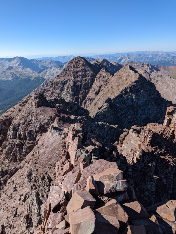
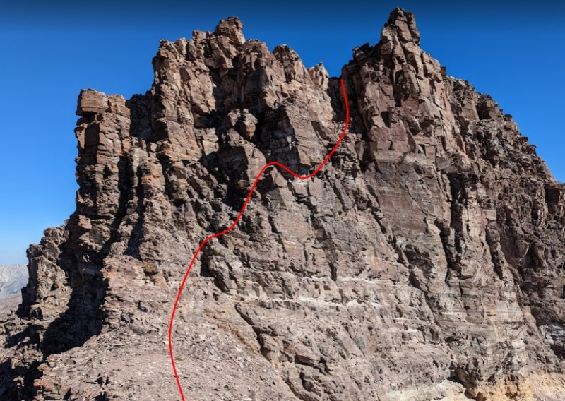
After this, the ridge eased up for a bit, and I was feeling good knowing the technical crux was behind me. For some reason I assumed the ridge would slowly mellow out as the day went on, which was a horrible misunderstanding as I found out in about 0.2 miles, when I encountered the cliffs above Thunder's key col at the top of PT 13820. I had heard about this from previous reports, and heard that skirting the side was the best option. However, in a moment of poor recollection, I decided to downclimb on the east, rather than the west, which quickly became the true crux of the day. Do not do this. At one point I had my foothold (a fairly large ledge) simply break off from the host rock, leaving me with roughly 80% of my body weight supported by my arms (on good "solid" holds at least) and the other 20% on a smear. Thankfully at this point I was past the lethal exposure, but a fall would not have been fun. Nonetheless, I was enjoying the slow careful movement and associated challenge. I might be the first person to downclimb fairly directly from PT 13820? 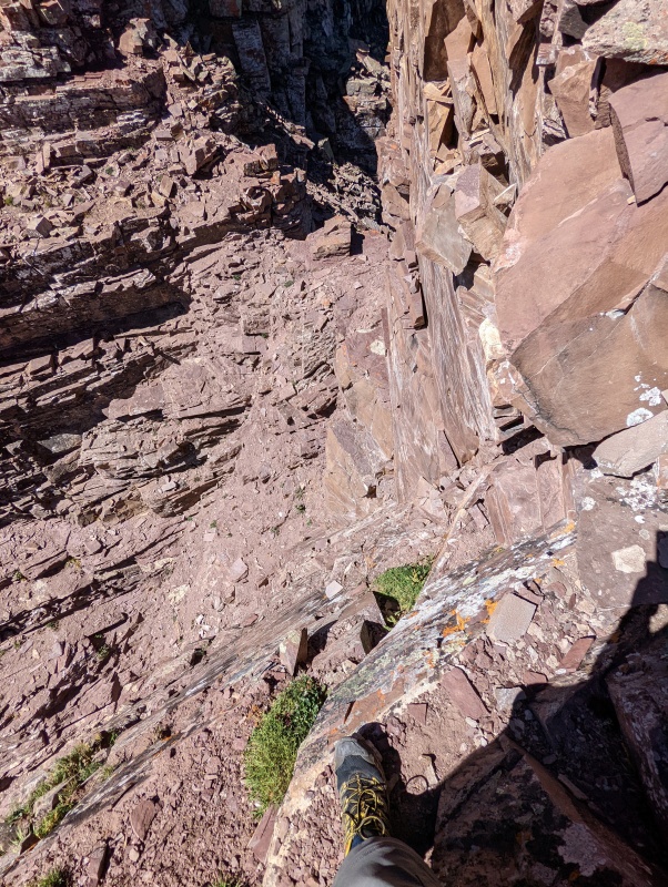
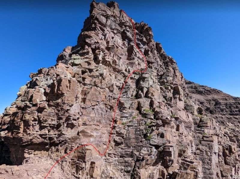
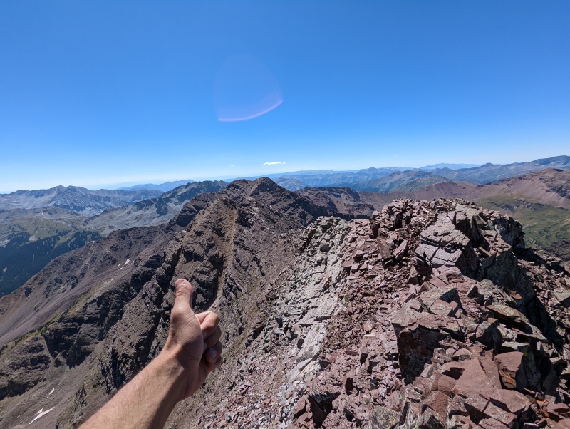
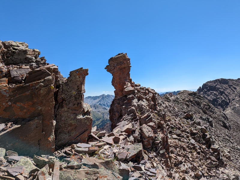
The remainder of the route to Thunder was fairly straightforward ledge walking, and included the only cairn I saw all day. Upon arriving at the base of the summit, a party of 4 was coming down and starting their traverse to Pyramid! I was as shocked as they were that somebody else was on the ridge, which is clearly sparsely travelled. It was good timing though; they told me to go around a bit before ascending and I warned them not to repeat my route on the cliff (although I do think routefinding would be much easier in the other direction). Thunder Pyramid to Lightning Pyramid I arrived at the summit of Thunder at approximately noon. The ridge from pyramid had taken me a lot longer than expected because of my climbing schenanigans and a stop for psuedo-lunch, but the sky remained crystal clear so I decided it was fine to continue. I personally thought the traverse between these two peaks was by far the highlight of the day. If one could get up to this part without climbing pure scree, this ridge traverse would be a Colorado classic. Really fun class 3/4 scrambling on fairly solid rock (for the area anyways) let my mind relax a bit after spending too long worried about my safety. This part had epic exposure on both sides, retaining the amazing views of the Bells, Snowmass, Capitol, and the surrounding valleys that I had been basking in all day. Not much needs to be said in terms of routefinding here, just follow the ridge as much as possible. 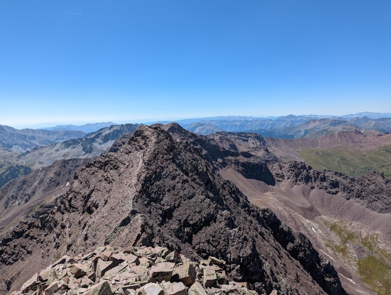
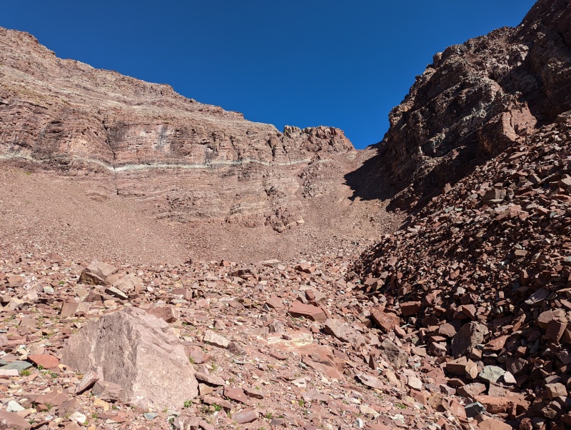
Lightning Pyramid to Len Shoemaker Peak (PT 13631) This is where things really started to get a little worse for me. For one I realized I was down to a liter of water. I knew this would last me until Len Shoemaker, but I was secretly hoping to continue on the ridge afterwards. Sadly this was not to be, but after this stretch I was definetly getting a little tired of the loose rock and was really quite happy to descend anyways. That brings me to my second point which is that this part definetly kinda sucked. I could see that taking the ridge directly would lead me up to a point I didn't particularly care to be at (the closer of the two peaks in the previous photo), which meant I had to traverse the face below it, which was fairly loose. The real kicker however was getting up to the unnamed point. I simply went straight up the orange gulley. This was perhaps the worst climbing of the day. It was no longer rock, but barely consolidated powder. The only way to move up was to move quickly enough that the powder didn't have time to start sliding much before I was off it. This was a lot of 1 step forward 0.9 steps back, which becomes quite exhausting, especially after being at altitude for several hours. Upon reaching the notch, I picked up a very thin piece of rock and started breaking off the edges in my hands, with each break uttering "The mountain loves me... the mountain loves me not...." On a more fun note, I got the great idea somewhere around here to start searching for the perfect skipping stones for my new friend down below, as the best stones at Crater lake are all surely underwater by now. I did indeed manage to find some perfectly curved, hefty but not large, smooth bottom stones to keep in my pocket. 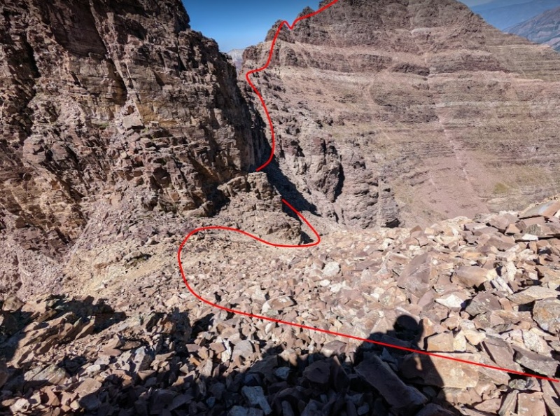
The looseness was not ready to let me go yet. The way I regained the ridge from here involved carefully stepping across the talus shown below. Each step was a mystery; either all the rock 10 feet above and below me would move a few inches, or it would move more than a few inches. Happy days. 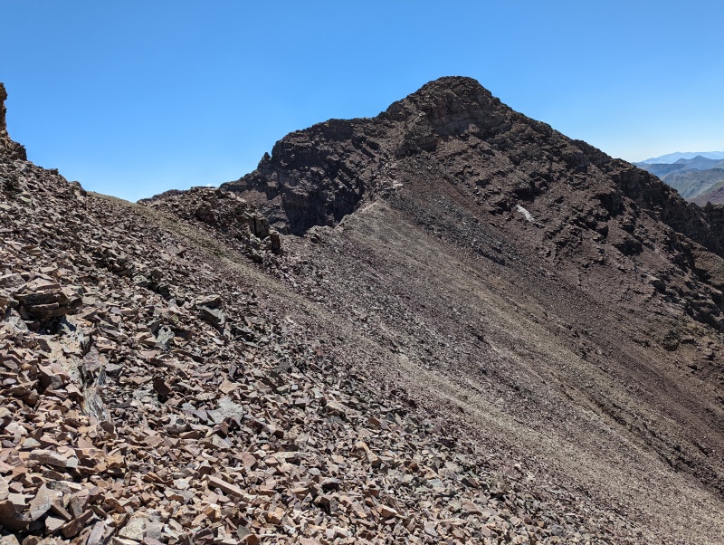
When ascending Len Shoemaker, I opted to climb directly up the ridge to avoid skirting around on even more loose rock. I feel like I may have made a cool 5.7 stemming move to gain it, but that was far preferable to sliding, except that it still felt like hands and feet could fracture off at any moment. We all have to choose our battles sometimes I guess. 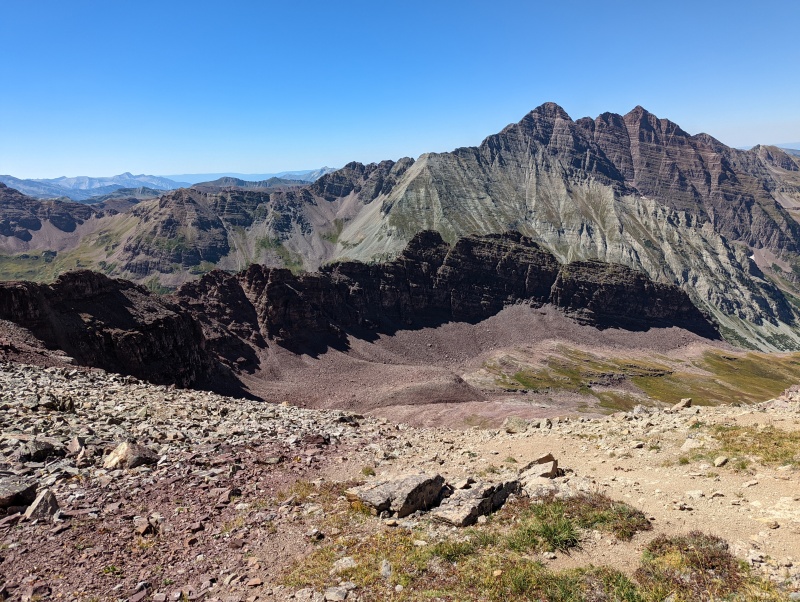
At some point, the ascent was finally complete, revealing a rather rewarding full view of the traverse. At this point, the Pyramidal traverse was properly complete! 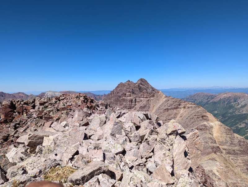
Descent As all good mountain climbers know, the climb is not over until you are back at the bottom. Upon seeing the ridge ahead and the sad sight of less than half a liter of water remaing (I had been rationing somewhat so I was also fairly thirsty), I decided it was time to call it quits. I didn't really make this decision fully until I had already started downclimbing to the next notch, so my descent option was effectively chosen for me. From the top of Len Shoemaker I could see that the gulley from the notch went all the way down without cliffing out, so I traversed over to it. Here the rock was more similar to mixed gravel and dirt, which meant I got to descend in the most graceful way, a ~400 foot butt slide / boot ski. 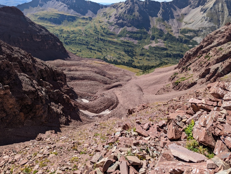
I reached a small patch of snow and immeditely took a hanful and stuffed it into my helmet, which felt amazing. At this point I had been on the ridge for perhaps 7 hours including the ridge up to Pyramid, so I was pretty sun baked. When I reached the edge of the grass, I filled up my water at the point the stream came out from under the rocks, drank an entire liter of water right there, and took at ~20 minute rest. I intended to sleep but the views were simply too alluring. 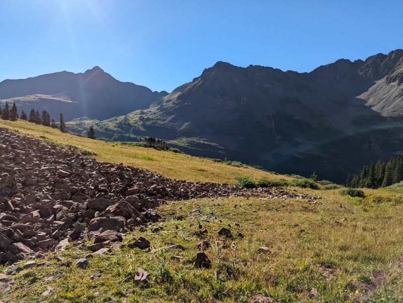
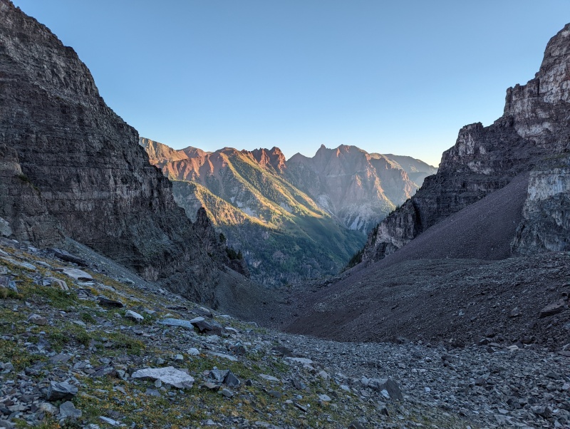
After some meandering and following game trails through the forest below I came out at a campsite, and found my way back to the trail. I came back to my camping friends all making dinner, delivered my rock skipping presents which were thrown quite well the next day, and to their amusement told them that I met The Derek. Round trip, all breaks included this ended up being about a 13 hour day. My speed felt limited not by my fitness or skill, simply my desire to move slowly as to not break what I was standing on, and perhaps my poor routefinding. All in all, even though not all of the traverse was exactly type 1 fun, it really made the ridge look much more beautiful to me when I saw it in the sunrise the next morning. 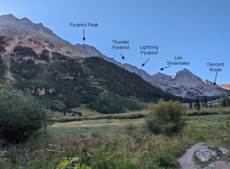
Thumbnails for uploaded photos (click to open slideshow): ")
")
")
")
")
")
")
")
")
")
")
")
")
")
")
")
")
")
")
")
")
")
")
")
")
")
")
")
")
")
")
|
| Comments or Questions | ||||||||||||
|---|---|---|---|---|---|---|---|---|---|---|---|---|
|
Caution: The information contained in this report may not be accurate and should not be the only resource used in preparation for your climb. Failure to have the necessary experience, physical conditioning, supplies or equipment can result in injury or death. 14ers.com and the author(s) of this report provide no warranties, either express or implied, that the information provided is accurate or reliable. By using the information provided, you agree to indemnify and hold harmless 14ers.com and the report author(s) with respect to any claims and demands against them, including any attorney fees and expenses. Please read the 14ers.com Safety and Disclaimer pages for more information.
Please respect private property: 14ers.com supports the rights of private landowners to determine how and by whom their land will be used. In Colorado, it is your responsibility to determine if land is private and to obtain the appropriate permission before entering the property.


