| Report Type | Full |
| Peak(s) |
Dallas Peak - 13,812 feet |
| Date Posted | 09/19/2022 |
| Date Climbed | 08/13/2022 |
| Author | Camden7 |
| Dreamy day on Dallas |
|---|
|
Sorry it has been so long since I have posted anything. School is a free-time vacuum. Dallas Peak Stats:
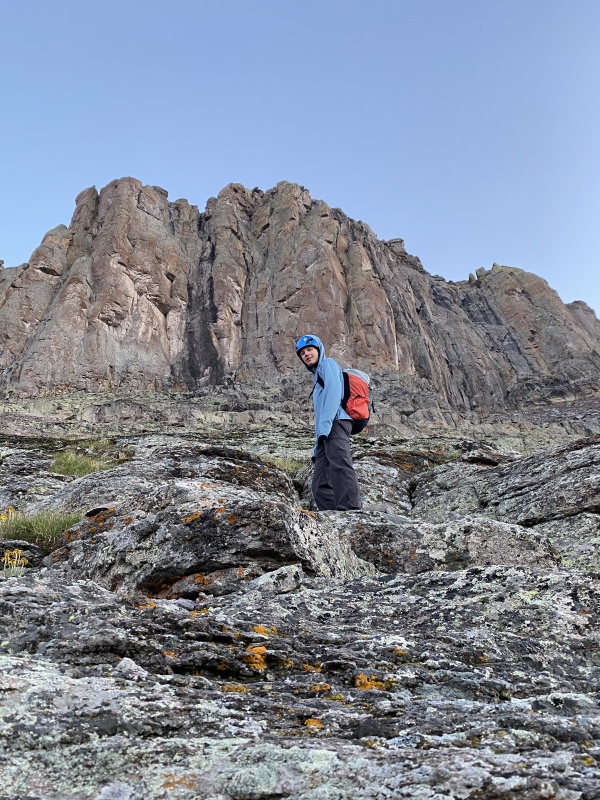
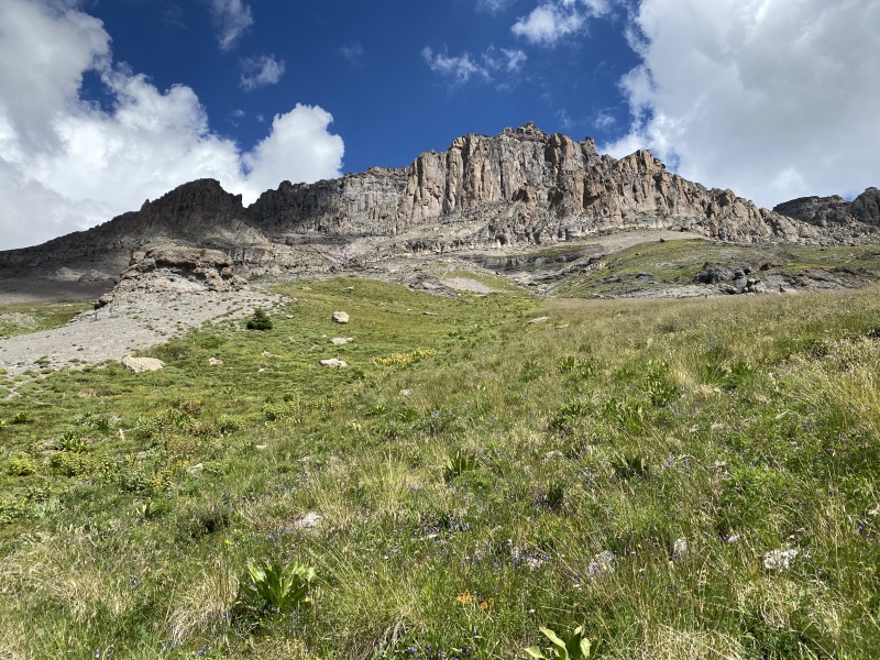
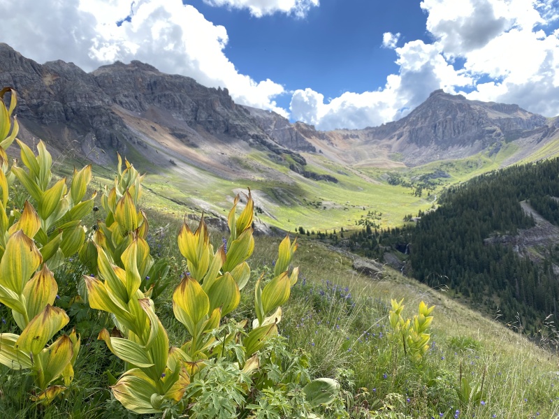
Climbed with: Dad and Mark Of all the Centennials, Dallas is easily the most fearsome in literature; "Dallas is one of Colorado's hardest peaks, and the hardest peak in this book. Climbing Dallas feels like climbing a displaced test-piece from the Canadian Rockies." It was a long time before I was able to disarm my fear of the peak. I climbed Half Peak when I was 7 years old, unwittingly ascending my first Centennial. Then Torreys when I was 8, my first 14er. Uncompahgre and Handies when I was 9. Quandary, Tabeguache, and Snowmass at 10. Then I caught the bug. When I was 11, 12, and 13, I climbed 47 more 14ers. Last year I finished my last 5 14ers, but I mostly focused on a new list that had come to my attention: The Centennials. I climbed several each month through winter, including a harrowing traverse from Fletcher to Quandary on the 31st of January and a miserable ascent of Mt. Buckskin with windchills near 40 below on the 28th of February. Spring held fantastic snow climbs with Grizzly couloir topping the list, all building up to Kautz Glacier on Rainier. Then countless peaks all through the summer, occasionally nabbing one of my remaining 14ers, but mostly focusing on this new list of more interesting, more remote, and less busy peaks. Ice Mountain. Little Bear. San Luis. North Maroon. It all built up to our 8 day San Juan trip, including Teakettle, Pigeon, Turret, Jagged, Trinity, Vestal, and Arrow, in addition to many other 13ers. Jagged, Teakettle, and Wham all felt easy. Still, Thunder Pyramid and Dallas gnawed at my conscience. Bad rock is dangerous. This spring Thunder Pyramid fell easily as a training climb for the summer's main event, a month long trip to the Cordillera Blanca of Peru with my dad. After 6 summits over 5,000 meters, including 20,218 foot Ranrapalca, we returned to the states exhausted and tired of hard, scary peaks. As we recovered and began to regain the 10 lbs we had each lost in the Cordillera, the last few Sawatch Cents fell. Then we headed off to the San Juans at the start of august. We had 3 weekends, two weeks to climb the final 9 Centennials in the San Juans. Except Dad had to work and could take no more than 4 days off. And the cherry on top? Heavy monsoons forecasted with 10 AM thunderstorms daily. And they really did come in at 10. It made for some early starts. The first few went well with Niagara and Jones on Sunday, UN 13,832 and 13,811 on Monday, and Rio Grande Pyramid combined with Fools Pyramid and UN 13,261 on Tuesday, my longest day ever, about 22 miles. We recovered and worked (me on summer homework) Thursday and Friday at our friend Mark's house, outside Durango. Then Saturday we headed in Vallacito for Jupiter (I will post a report on Jupiter, Grizzly Peak, McCauly Peak, and Aztec once I have the time).And came out triumphant Monday afternoon. On Wednesday we climbed Vermillion and Golden Horn, and tried Pilot Knob (will write a report...), then worked thursday and friday. Friday night, we left marks house, accompanied by Mark, and slept atop Lizard Head Pass. Dallas Peak: I couldn't really sleep. I hadn't ever really been nervous for a climb outside of Peru, but for some reason Dallas captures the imagination. Bad rock. Hard route finding. 5th lass. Displaced test-piece from the Canadian Rockies. Serious stuff. The alarm sounded at 2:30. After a quick breakfast we put down the 4-wheel camper and rolled to Mill Creek trailhead. Hiking at 3:25. Mind asleep. One foot in front of the other. Left at Deep creek trail. Right on Sneffels highline. Wet vegetation, wash outs on the trail. They have seen some rain. I worry about the summit pitch being wet. Mark sets a tough pace. After a five minute stop to reorganize my pack so it rides better, it takes me 30 minutes to catch the others, who didn't slow down. The short night's sleep is affecting me. I am worried about what is to come. We leave the trail after 1 hour 40 mins, not great time, but considering how early it was we weren't awake enough to move any faster. The slope from 11,300 to 12,300 is steep and annoying. It looks grassy but in reality ball-bearings abound. Mark began to flag a little here, a little less confident on the off-trail terrain, but still a more than worthy addition to the team. The route-finding is easy as everything on the face goes at class 2 and the cliffs at the sides shunt you towards where you need to be at the center of the face. At 12,600, a low angle cliff band blocks upwards progress. It is easily dealt with by directly tackling 3rd/easy 4th class moves on solid rock, or with loose class 2+/3- on worse rock to the left. There is an anchor above the the cliff, but I did not check its condition considering how pointless it seemed. 


Above the cliff there is a sloping ledge that connects the small cliff band you have just come through to the great upper east face. Climb 100 feet of class 2 hardpan with ball bearings above a cliff. This is easy but I thought the scariest part of the lower route. Once reaching the upper cliffs a cairned trail traverses right (east) towards a distinct shoulder. Once getting past a small cliff band, the trail climbs up 150 feet of very loose dirt to "13 corner", a point at ~13,075 with good views and level terrain. It is here that you leave the south face. We enjoyed a quick snack here before following the broad ledge up to another, even more distinct corner. Here, the views open up to the east and you can see much of the remaining route. Welcome to the upper east face. Unless you start at an ungodly hour, you will now be in the sun. A blessing on cold mornings, less so on warm ones. The route from here to the "Barrier cliff band" is easy class 2+. Follow the boot-beaten path up and northwest up a class 2 gully. From here the terrain is complex and the route is not obvious. Although it looks easiest to stay in the gully, it becomes very loose, and eventually forces you onto harder terrain. There are 3 cliff bands. There are many options for negotiating them, but these are the two that I deemed best. Option one stays in the ever looser class 2 gully, ascends the first band on rotten class 2+/3-, then the second on your choice of several very pleasant 4th class boulder problems on dreamy rock. Option 2 involves exiting the aforementioned gully on the right and following class 2+ ledges and hardpan closer to the ridge crest. This avoids all of the difficulty of the other route and gives you a sense of the north face's mounting exposure, although you don't yet get to see it. It then rejoins option 1 at the top of the 2nd cliff band. If you want the easy moves on good rock, #1 is fun, otherwise #2 is about 30 seconds faster. Dad and I chose #1, while Mark chose #2. Now options run out. Traverse left on the broad ledge beneath a decaying and exfoliating cliff band. The ledge ends with a view down in to the gully that you earlier ascended. Here lies the first mandatory section of "climbing". There seemed to be 3 options to bypass this, each balancing risk. The right option looked to be low 5th class dihedral with hardly any exposure. The left option appeared to be hard 3rd class face climbing, but with potential for a catastrophic or even deadly fall. We all chose the middle line, a fun 4th class problem on the rounded arete. It is low angle and the rock is good, but the holds consist of shallow pockets. Exposure is medium. Don't fall. But if you do, you'll live. Maybe. 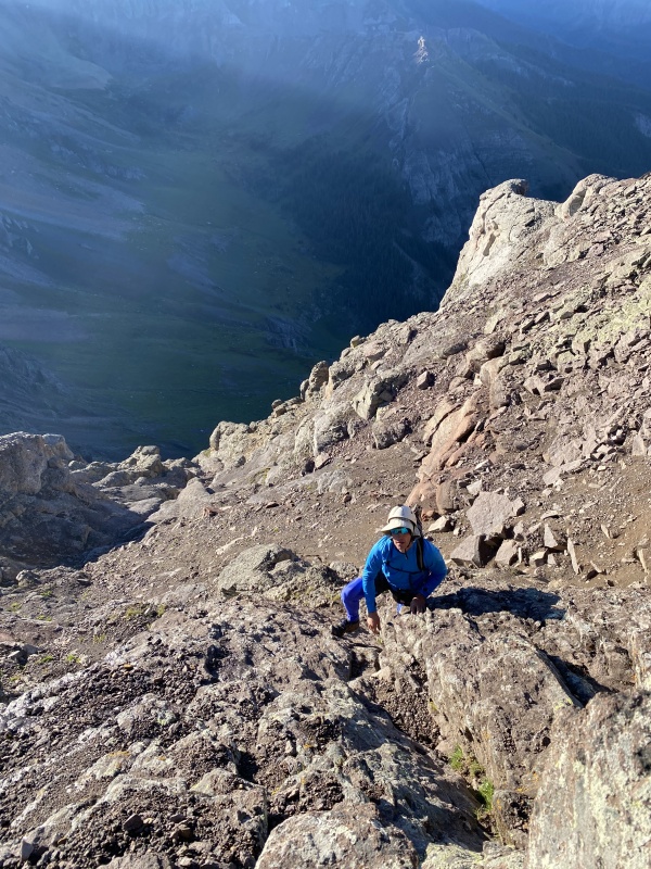
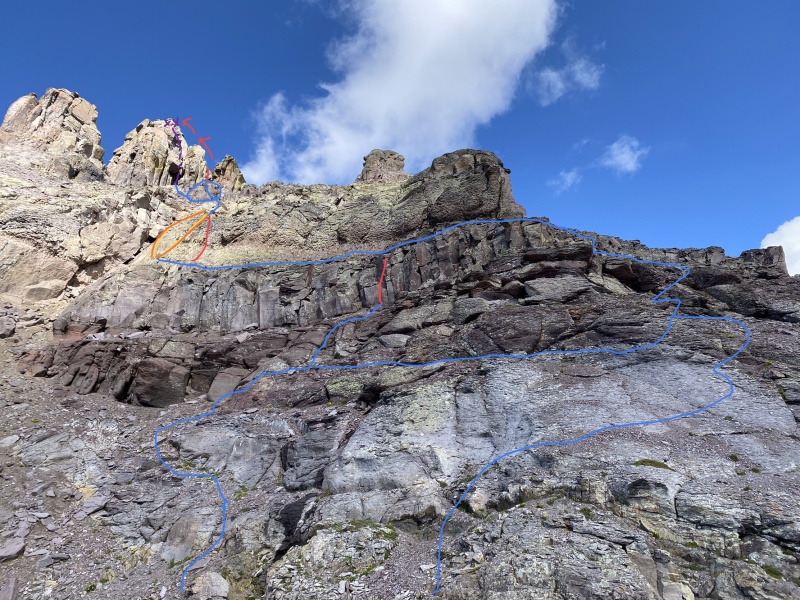
There is an anchor at the top. It was ok as of August 2022. Above this, the terrain relents to class 2 for ~100 feet. As Roach might say, the introduction is over. There is a nice level spot here to drop anything you don't want to carry on the climb. If you are roping up, you can put on your harness here if you don't want to do so on the more exposed (but sufficiently wide) belay ledge. The first small rock above you can be passed on either side on class 2+ hardpan. An obvious dihedral presents itself. If you see the car-sized chockstone and cave beneath it, you are too far west. Backtrack and find the correct dihedral. The dihedral is perhaps 20 to 30 feet tall, I don't recall exactly. I somehow managed to forget to take a picture. It is comprised of 3 boulder problems; 1) easy and secure class 3 on the right side, 2) also secure and on the right side, difficult 3rd/easy 4th. Here you reach a large block to stand on, large enough for 2 people, a nice rest. The third problem is much harder, in fact I would argue the crux of the route up Dallas. At the left side of the dihedral there is a shield like rock panel, about 5 feet tall. There are good feet below it, and decent hands left of it, but not much once you commit onto it. It is somewhat exposed. The hardest bit is stretching around to the right to find a hand jam. This is supposedly 4th class for tall people, 5th class for short ones. Mark is 6' 1", and he rated it 5.0-5.2. My dad is 5' 10" and he rated it difficult 4th, although he climbs outside a lot and is comfortable on 5.12 trad leads so he may not be tuned in to the nuances of easier climbing. I rate it 5.3 purely because of the awkward stretch it required, and the reach to the jam. I am 5' 6". The rest of the dihedral is class 2+. 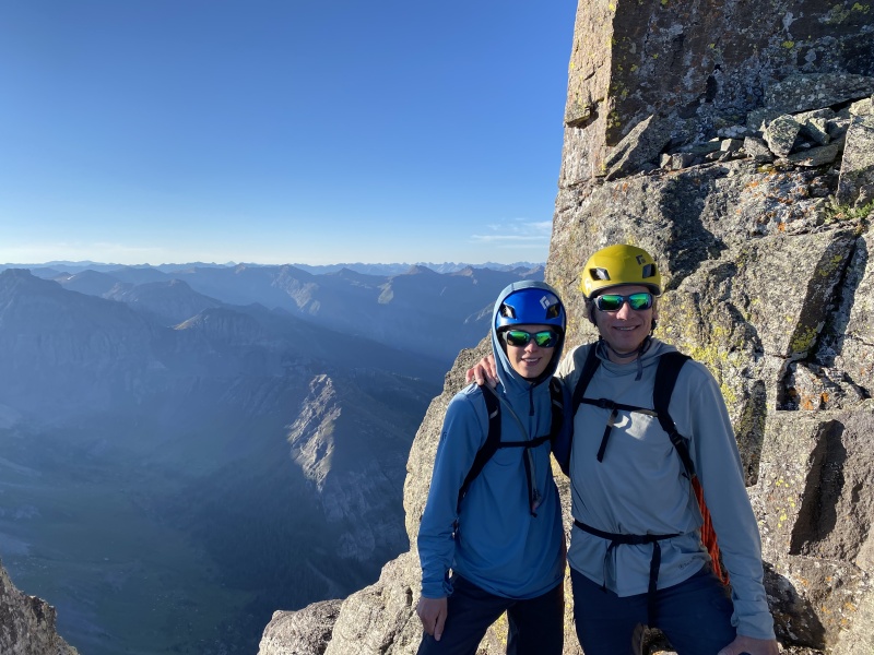
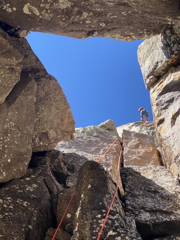
At the top of the dihedral there is a shady platform perfect for pictures and a break. There is also an anchor here (did not inspect). You can now peer down the north face. It is not as steep as Roach makes it sound, but it is tall enough that in terms of a fall it doesn't matter. Some easy 3rd class ledges lead up and right (west) onto the north face. After a couple narrow but easy steps, a large ramp is reached. It is 20 feet wide and quite comfortable for harnessing up and such if you choose to do so. The summit climb is very obvious from here, a large chimney about half way down the ramp. If you choose to belay, you will do so from a tiny platform on a second, higher ledge at the base of the climb. A well framed picture doesn't show the large ledge below and looks pretty cool. 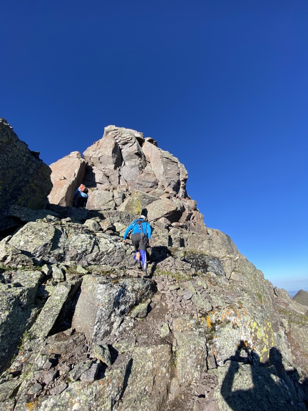
So, the dreaded climb. There are really just two sections. The 20 foot climbing portion, and the 50 foot don't kill your friends with rocks portion. The climbing follows the right side of the dihedral on difficult 4th class or maybe low 5th class face climbing, although there is a corner if you want to stem. The remainder of the pitch is class 2 talus ramps separated by isolated 4th class moves over blocks, save for the last move to the ridge , which I thought was the toughest of the summit pitch, a 5.0-5.2ish boulder problem. Exposure is minimal and the rock is solid. 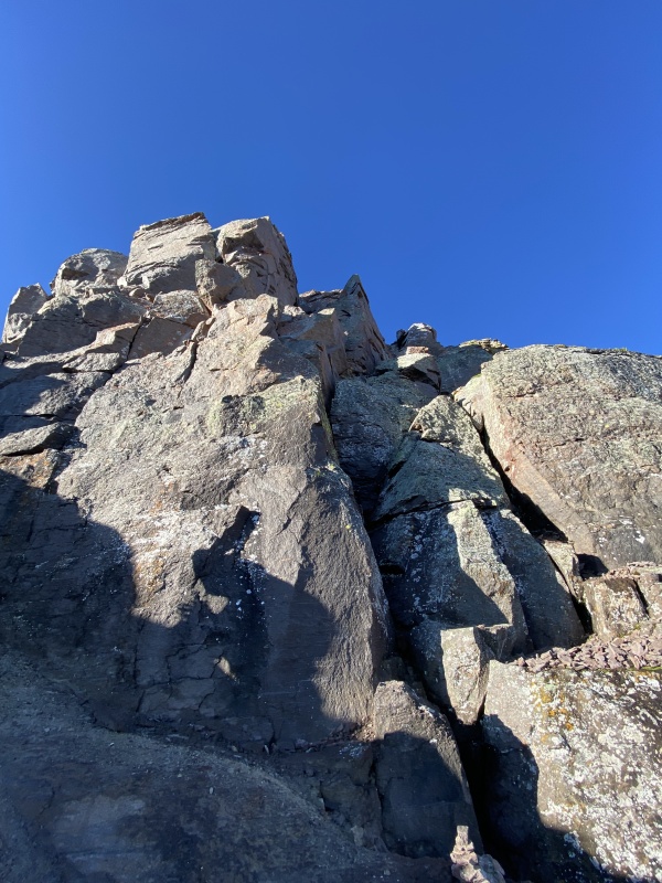
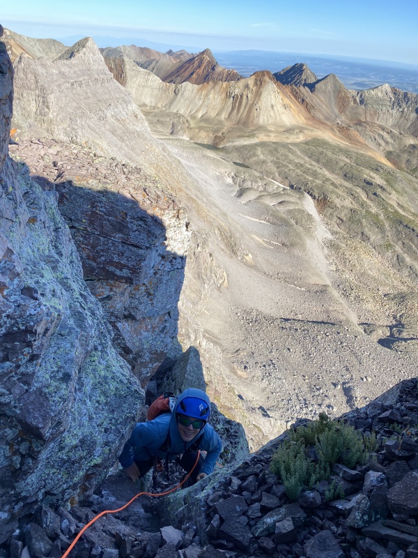

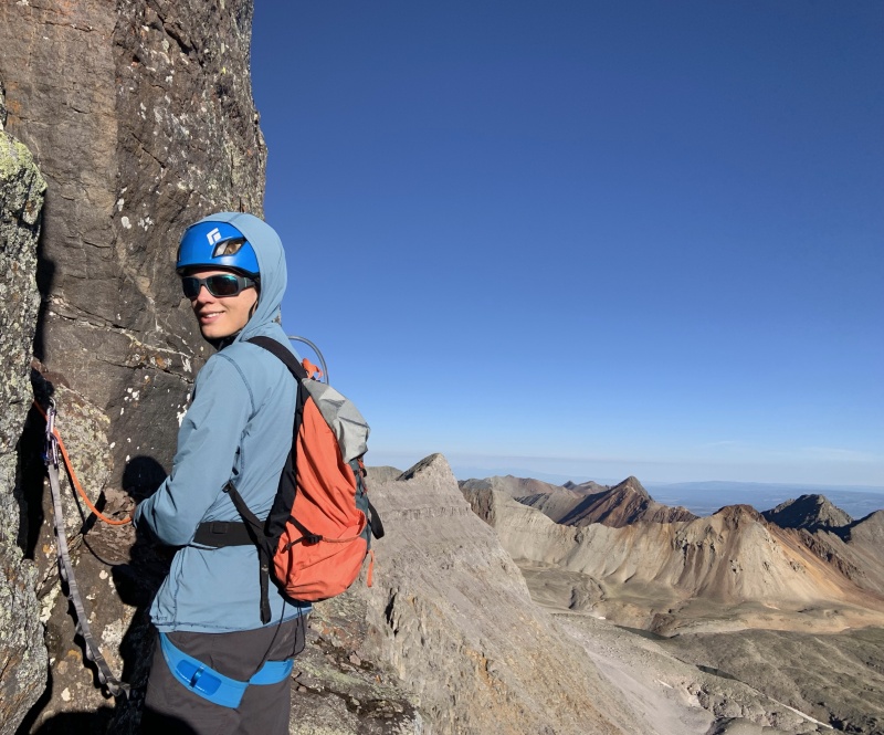
I put Dad on belay, and he started up. We placed a 0.5 cam at the belay to keep us attached to the mountain if he fell early. He didn't place any gear until above the actual climbing. Everything was too big. Carry a number 5 cam all the way up there? Doesn't seem likely. A not-very-solid #3 might have fit in a pocket on the left, but if you don't trust it, why take the time to place it? The lower bit doesn't protect well. There are spaces for a few more small to medium pieces on the rest of the route. Dad recommended a 0.5 cam, 2 0.75 cams, a number 1, and a number 2 if you wanted to sew it up a little more tightly. He placed a single 0.75. Then for the anchor he used a long piece of cordelette around a questionable block. I followed him up, then Mark last. Be careful of the rock on the upper part. The rope caught on a horn and when I tried to flip it the horn just broke off and hit me in the ribs. Not problematic, but certainly tender. From the anchor, it is five feet of class 2 on the ridge to the summit. 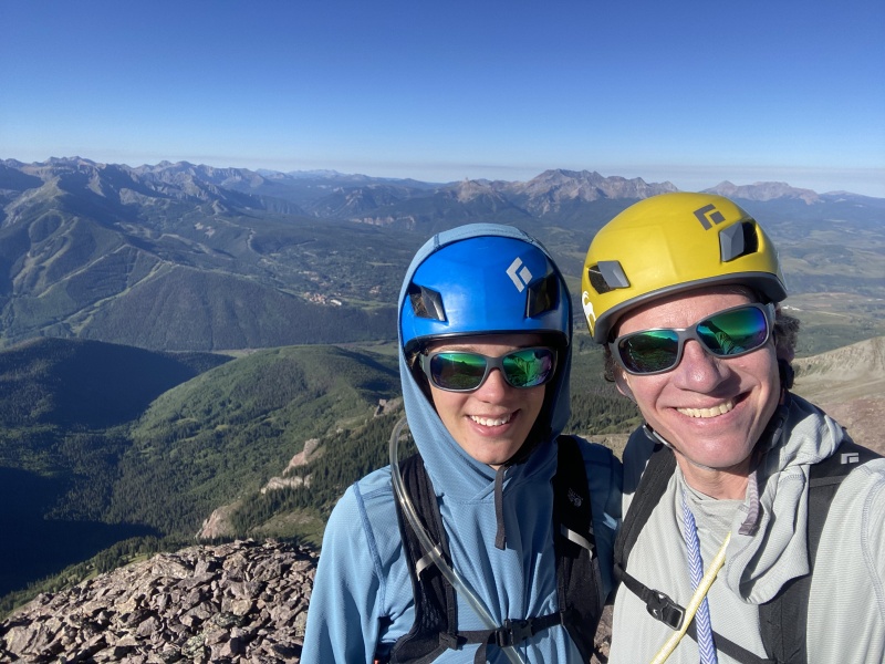
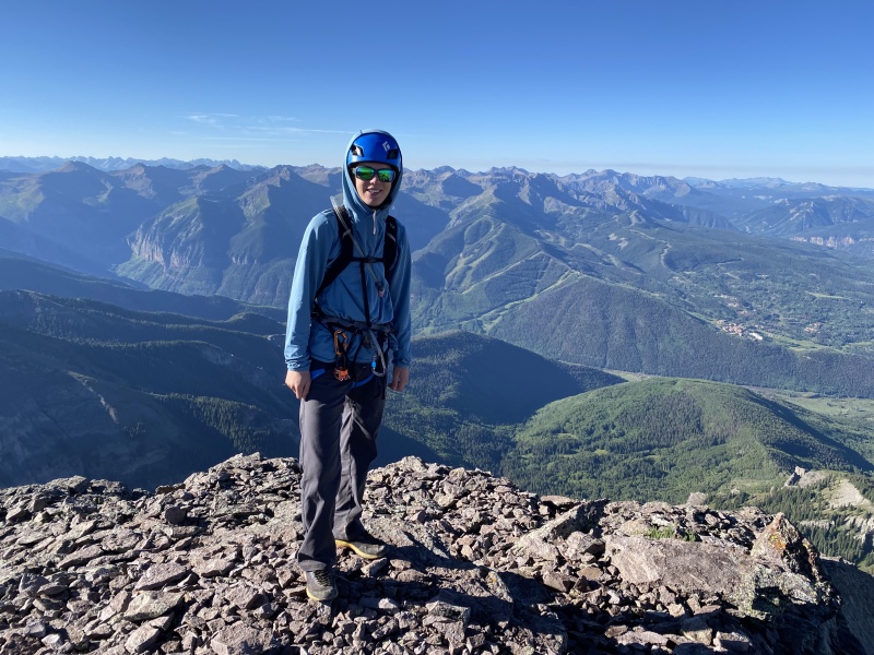
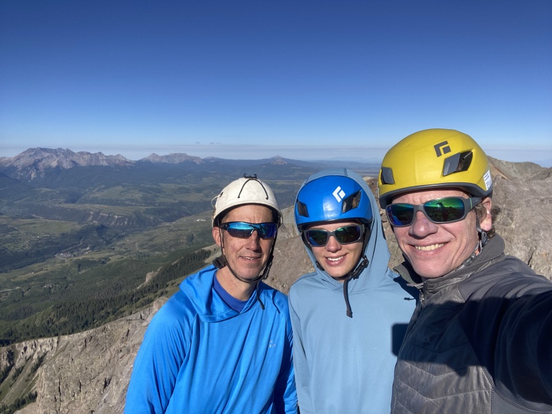
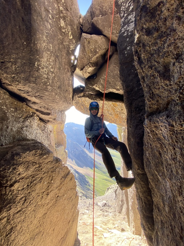
We lounged on the summit for half an hour. You only get to climb Centennial # 98 once, you know. If we were to do Dallas Peak again, I might solo up then rappel down. I do not free solo. There are too many mountains I want to climb to risk a fatal fall because I refused to use a rope. For those of you who do it, fantastic, I am impressed. Not my thing though. For some reason though, the moves on Dallas felt really easy to me. I need to be careful not to get overconfident and make a corpse of myself, but perhaps I am becoming more confident on unroped 4th and 5th class. Or Dallas Peak is a lot easier than everyone says. I certainly thought it was. Jagged is harder. Teakettle is easier. They are all great. The anchor is set off of a huge block on the summit's east side. I don't know that it will ever need replacing. A block the size of a small car has 5 pieces of solid webbing and 2 half in steel cables around it. I guess someone decided you could never be too safe. The rappel is very intimidating from the top, but not to bad. It is overhanging most of the way though. About 3/5 of the way down there is a ledge before you drop into the cave. The entire rappel could easily be reached with a 60, maybe even a 50, but I don't know. There is an intermediate anchor at the ledge and if you want to take the time to set a second rappel that I believe a 30 meter rope works, but it would be close and again, these are just estimations. 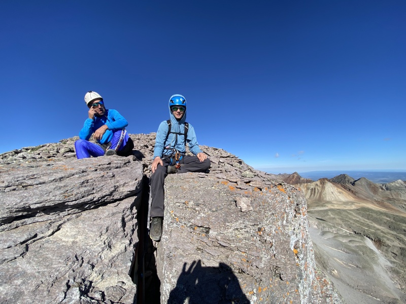
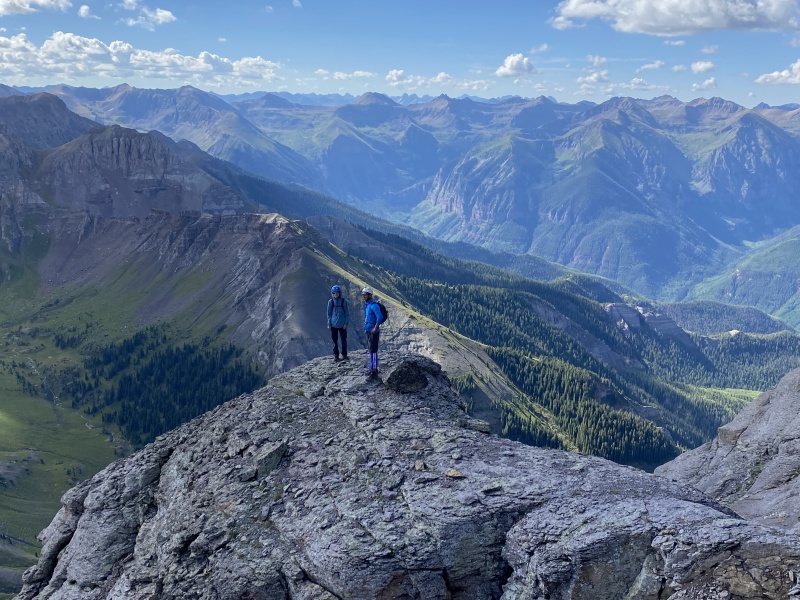
The descent went smoothly. Upon returning to the truck I felt that I could finally let out my breath. Safely up and down Dallas. 2 to go. It started raining. Gladstone Peak Stats:
Climbed with: Dad There are plenty of great TRs on this route, so I will keep it brief. We parked atop Lizard Head pass for a relaxing evening before Getting up early for climbing Gladstone, then rolling back to Golden. The forecast for the following day was glorious, they first dray day in weeks. We lay down for a nap. Before falling asleep we had a short conversation that went something like this: (Dad in bold, me not) "Should we set an alarm?" "No, we have 3 hours until we need to start dinner, we won't sleep half that long." "Ok, fair enough," *3 hours later* We woke at the same time to hammering rain, thunder so close it seemed to arrive before the lightning, dense fog... When the storm cleared 45 minutes later, Mt Wilson was painted white with hail, and not a wee dusting either. After dinner, we fell asleep to the sound of more rain. The alarm wrenched me from my cozy sleep at 4. It was raining heavily. Set an alarm for 5. Back to sleep we went. Torn from tranquil rest again. Still drizzling. We force down some cereal, grab our packs, and poke our heads out. The rain has finally stopped but the sky is still blotted by angry storm clouds. Some bluebird forecast, I thought, grouchily. We begin walking at 5:29. The cross mountain trail is thankfully very wide, so the wet vegetation didn't cause too much trouble. Stunning alpenglow illuminated Mt. Wilson, but being below treeline, we didn't get a clear photo until it had faded. 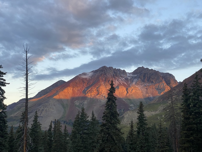
The clouds began to clear out. 
The drop across the basin is fast and easy, and the eats face is way faster than it looks. The cliff band can be navigated by a steep class 2+ gully on the south side of the face. Above the gully, a few moves of very soft 3rd reach the southeast ridge. Class 2+, traverse north to the northeast ridge class 2+... blah blah blah and done. Not a spectacular route, but the setting is hard to beat and it avoids the north ridge which is a win in my book, considering how bad it looked from the summit. 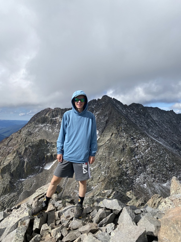
Despite angrier and angrier storm clouds we lingered fro 35 minutes on top. Even knowing it could get us real wet on the hike out, we had to enjoy Centennial #99. Not many of these left. The weather miraculously held on the hike out, and as we trudged down the trail I couldn't help but think '100 Centennials to climb, 100 centennials, take one down, pass it around ( I was too tired to put together any at all related lyrics here) 99 centennials. 99 Centennials to climb 99 centennials, take one down, pass it around...' and on and on until 2 centennials to climb, just 2 centennials, take one down, pass it around, only one centennial, only one centennial to climb only 1 centennial, take it down, pass it around, no more centennials to climb." My song trailed off in my thoughts, I wasn't there yet, but once I was I had some thinking to do. Of course, I had already done some thinking, and had started down the BiCentennial path, (122 at this time, I believe), set my sights on some cool alpine peaks, and paged through guidebooks on the north cascades, bugaboos, and Canadian rockies. I read Peter Croft's The good, the great, and the awesome cover to cover. I started going to the climbing gym more often. Got back into lead climbing. Settled in to wait for my last centennial while 6 honors classes slammed into my summer as ferociously as a rabid wolverine (My english teacher could tell you that that is a simile). Oh, and somehow dad contracted a little cough at the climbing gym. You may have heard of it. COVID or something? I guess it is kind of a big deal. Hagerman Peak would have to wait. Thumbnails for uploaded photos (click to open slideshow): ")
")
")
")
")
")
")
")
")
")
")
")
")
")
")
")
")
")
")
")
")
")
")
")
")
|
| Comments or Questions | |||||||||
|---|---|---|---|---|---|---|---|---|---|
|
Caution: The information contained in this report may not be accurate and should not be the only resource used in preparation for your climb. Failure to have the necessary experience, physical conditioning, supplies or equipment can result in injury or death. 14ers.com and the author(s) of this report provide no warranties, either express or implied, that the information provided is accurate or reliable. By using the information provided, you agree to indemnify and hold harmless 14ers.com and the report author(s) with respect to any claims and demands against them, including any attorney fees and expenses. Please read the 14ers.com Safety and Disclaimer pages for more information.
Please respect private property: 14ers.com supports the rights of private landowners to determine how and by whom their land will be used. In Colorado, it is your responsibility to determine if land is private and to obtain the appropriate permission before entering the property.


