| Report Type | Full |
| Peak(s) |
Jupiter Mountain - 13,838 feet Mt. Eolus - 14,087 feet North Eolus - 14,042 feet Turret Peak - 13,837 feet Pigeon Peak - 13,977 feet |
| Date Posted | 08/14/2022 |
| Modified | 07/06/2023 |
| Date Climbed | 07/06/2022 |
| Author | zootloopz |
| The Weminuche Wash-up |
|---|
|
The Weminuche Wash-up Jupiter Eolus & North Eolus Pigeon & Turret 25.5 miles 12,800’ gain 1,004’ gain per mile Participants: Ian (@roughlysomewhere) Zofia (@zofiaslens) Preamble I’ve been eager to get back into the Weminuche ever since an early Sept 2021 excursion involving Jagged, Peak 6 to 7, the Guardian, and Silex with my good buddy shattuck311. Over the winter I scoured trip reports and gpx files on gaia, endlessly weighing the options of different routes to grab Jupiter, Pigeon, and Turret in one trip in an effort to finish the centennials this season. I decided to draw my own gpx route with multiple options in caltopo based off a few choice trip reports (including Andrew Hamilton’s Weminuche wipeout link up) in addition to the use of slope angle shading to reveal possible points of access and retreat. The no brainer was starting with Chicago Basin and hitting Jupiter first, in order to utilize the nice trail up CB with full packs instead of trying to ascend to the steeper and more rugged Ruby Basin trail. Options from there included going from Chicago Basin over Twin Thumbs pass to Ruby Basin while accessing Peak 13. Or going over North Eolus from CB to the little finger saddle used to access Peak 15. From little finger it looked like you could either descend to Ruby or traverse under the cliffs in NY Basin to gain the Pigeon/Turret saddle. This further had the option of camping in Tie Creek aka North Pigeon Creek, which seemed intriguing. I love new territory. Ultimately my curiosity to explore NY Basin, Tie Creek Basin, and the route over North Eolus won out, although this was not necessarily decided until we were on route. The following includes a bit of a tale and some various details about our journey… Prep & Partner First off, when planning this I had no one necessarily in mind to hike with and intended to potentially go solo. But, by chance, I happened to meet a new awesome partner named Zofia who is pretty fucking badass and, despite not having much experience in this space, wanted to join me. She would be working in Durango as a wilderness therapist with a 2 week on / 2 week off schedule, so we had plenty of time to make it work. With both of us coming off some leg injuries, Zofia offered to buy us train tickets in order to avoid the hike in and out of Purgatory. I was initially reluctant but, having not experienced the train yet, combined with the thought of saving more time and energy to be used in the deeper parts of the Wemi, I relented. Zofia had only climbed Quandary’s standard route (as far as colorado 13er/14er experience goes) by the time we had met in March. Together we climbed Sherman in April to which she performed admirably despite high winds and freezing temps. In June we took on some early season 13ers in Grand Turk, Sultan, and Hesperus, and capped it off with climbing Sneffels class 3 SW Ridge with plenty of snow still left. Then in early July 4-5 days before this Wemi trip, she confidently rose up to the occasion of climbing Dallas Peak with my buddy Matt and I. She was ready to go for a multi day link up. Personally I was feeling great. My injured foot from the winter was feeling healed and I couldn’t be happier or more ready. I had crossed off some really cool hikes/climbs already in June with the Matterhorn to Wetterhorn traverse, Teakettle & Coffeepot, NW Pole & Pole Creek to Half, as well as Dallas, and I was ready to continue the mountain adventures with an ultralight peak bagging link up. Gear wise, I used to work for an ultralight gear company and have hiked the Colorado Trail and few other long distance things. Going light is one of my specialties. With my carrying the tent and cook set, our packs weighed no more than 20-22 pounds each fully loaded and ready for 5 days. Based on condition reports, I decided against any traction or ice axes for either of us. 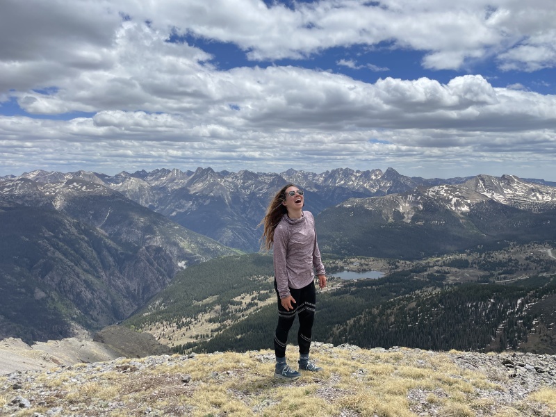
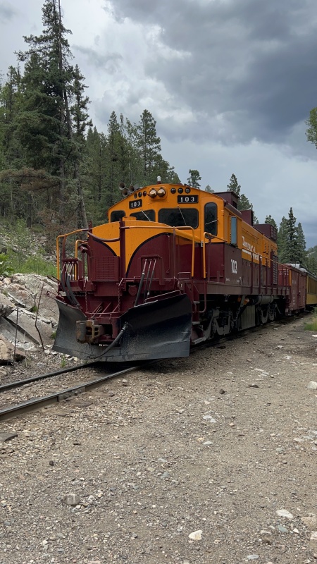
Day 1: Train & Chicago Basin We woke up early in Zofia’s little built out chevy van. I glanced at the trees swaying against an early morning sky through the sunroof, remarking somewhere in my mind about the beauty and the ballet of the leaves. Still high off the climb of Dallas Peak and the beautiful July 4th weekend in American Basin, we lifted off and started our brisk dance 1.5 miles to the train station from the long term parking we had secured. With full packs, walking across durango felt whimsical and easy, knowing we’d be swept away to the weminuche... except I left my melly aka my insulating layer. Guess I'll tough it out with my beanie/buff/gloves combo. Soon enough our gear is loaded in the pack cart and we found our seats on the 1st indoor car behind the engine. Eventually we engaged in conversation with Nick the lawyer, who we lamented and empathized with about his experience and thoughts on the recent Supreme Court rulings. He gave us some great insight, to which I can’t exactly recall at this moment, but I’m sure if I’m entered into a legal discussion some of it might come back to me. Personally, I didn’t pay much attention out the windows. I knew our views would be much better in the coming days. I was more interested in the riders, while I had the chance to converse with others. 10:30ish arrives and we hop off the train, secure our packs, and rush off to be some of the first people departing for the trail. We knew we had storms coming and we wanted to grab a choice campsite. After a brief conversation with some folks heading for Jagged about my time on Jagged (including a discussion about Dallas and it’s new LIDAR status which, let me tell you, I’m just going to do both new and old lists) we started at a determined pace. Zofia used to run in high school and works out regularly – she is strong, probably stronger than me. We caught up to 3 very fit and tall looking gentlemen, but they took off and left us in the dust. “Hey Zofia, we need to beat those fuckers. Not that they’re fuckers necessarily but ya know, we need a rabbit to chase.” “Roger that” Zofia says. The march up to Chicago Basin begins. We’re steady. Consistent. Solid. Eventually we catch back up to the boys. We call them Boys 1, because there’s another group of 3 guys just behind us, a couple of them lacking shirts. We call them Boys 2. We chat for a bit. They take back off while we take our time. On and on we go. But then clouds. Hail. We take a brief break for the 4 minutes it’s heavy, but as soon as it starts to let up we keep going. It turns to rain. We continue because why not. We pass boys 1 waiting under a tree. They look at us with what I assume was a bit of admiration, but was really likely just a contemplative glance. Who cares anyway, this race really doesn’t matter. Just a reason to get up there and get camp set up. We win though. We’re first. Although we’re heading to the Columbine pass trail, so boys 1 ends up getting the pristine campsite near the no camping sign on the way up to twin lakes. So whatever. Eventually the tent is set up next to a beautiful stream, we eat a delectable meal of double organic ramens, and we sleep deeply after watching a wonderful sunset over the beetle kill forest. 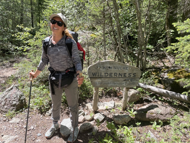

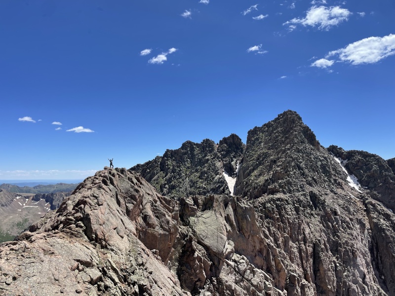
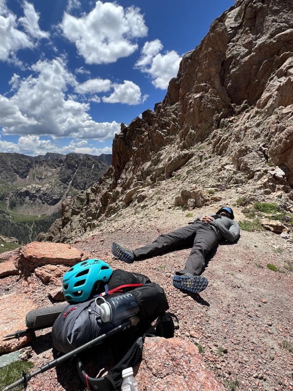
Day 2: Jupiter My alarm was set for like 5am today, but we didn’t get up until around 7. Lazy bones. Zofia’s knee hurts unfortunately, hurts to squat even. No bueno. I can empathize. She’s been dealing with this for a while, but today it’s a bit extreme and we don’t want to make it worse. Guess I’m going to hit Jupiter solo. No worries, she can enjoy some time alone to journal and check out a waterfall uphill from the campsite, and rest up for our day tomorrow. Which will surely be an event. I wait until about 9am to take off, a bit late surely, but I was feeling confident I’d be fine with storms. The forecast wasn’t too bad, maybe 30% chance on NOAA after noon. I take a big fanny pack I swing around to use as a lumber pack loaded with rain jacket, gloves, compression wrap, 2 small bottles of water, and some snacks and my phone. Off I go. The climb of Jupiter was pretty great. I took the columbine trail and immediately got my feet soaked. Then up the tundra filled south slopes of jupiter to the last couple hundred feet of half decent class 3-ish if you want it to be. Top out. Great views. Snap some photos. I decided the clouds looked fine enough to head down the ridge directly to Columbine Pass so I could get some different views and check the trail out. I was initially thinking about the possibility of adding Grizzly C and/or McCauley, but I decided that I’d rather return in the future to camp in the lake below them and make a whole trip out of it because the area looks *gorgeous* and relatively uninhabited. . I definitely got myself into some 4th / low 5th on the ridge in one of the gullys. You could probably avoid it. Otherwise the ridge went smoothly and I had some nice views of Upper and Lower Columbine lakes while making my way back to camp along a more graded descent. Back at camp, Zofia and I had a wonderful time making more dinner and conversing while the clouds cleared out a bit and made way for some excellent sunset cloud displays. Time faded as I drifted into unconsciousness with some music in one ear and what sounded like a babbling brook in the other. Overnight, we were visited by a marmot that chewed my helmet strap and Zofia’s trekking pole handles to bits. We had them in our enclosed fully zipped vestibules as close to the tent as possible, the helmet was literally resting near my low back. I should have known but let this be a warning to bring everything inside the tent with you, and don’t trust the Chicago Basin marmots. 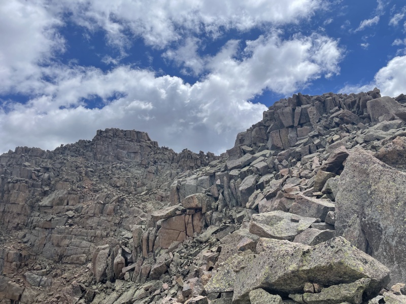
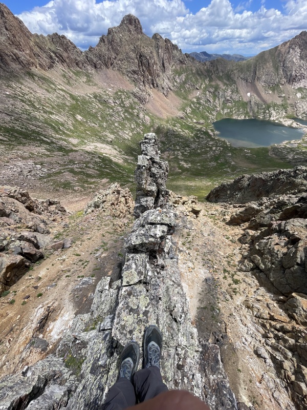
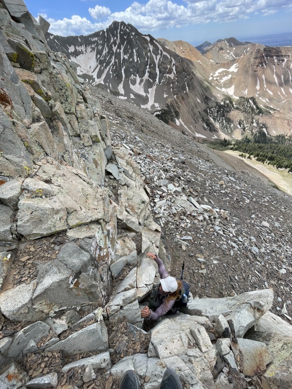
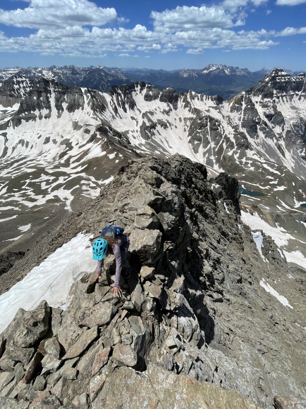
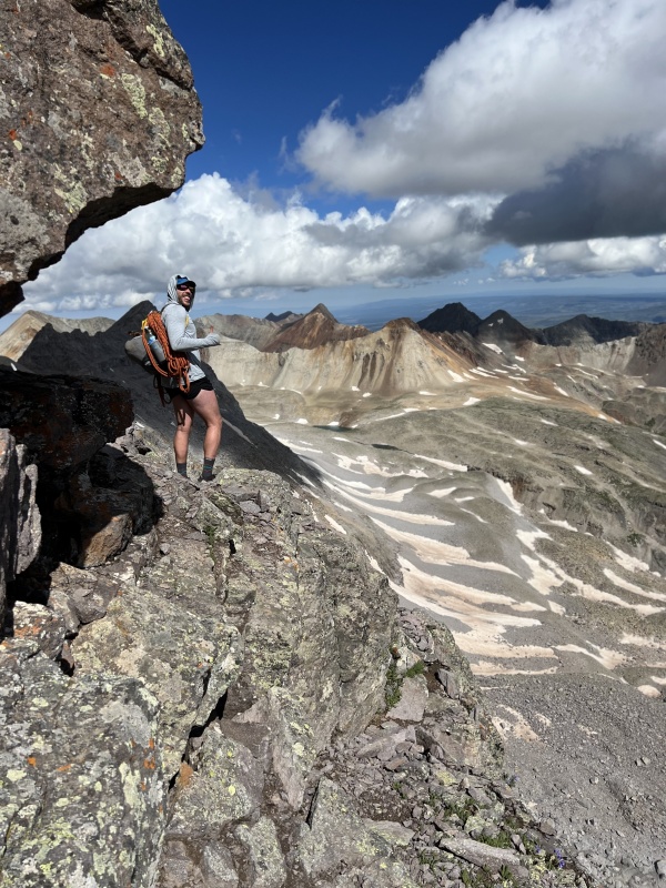
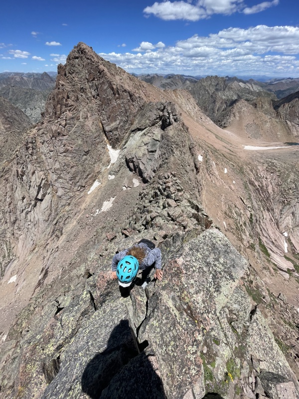
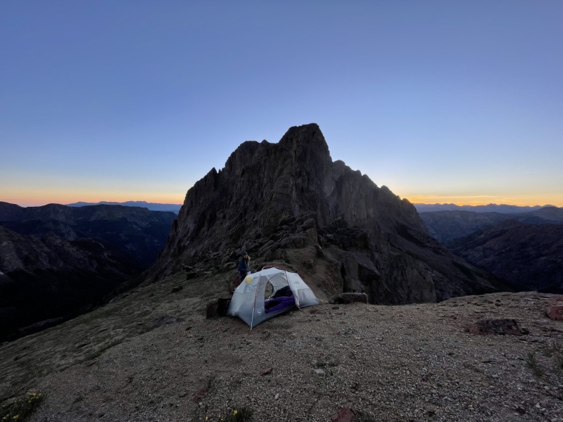
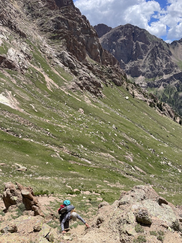
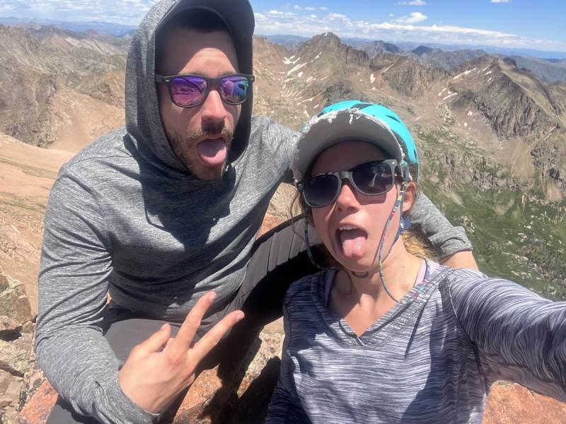
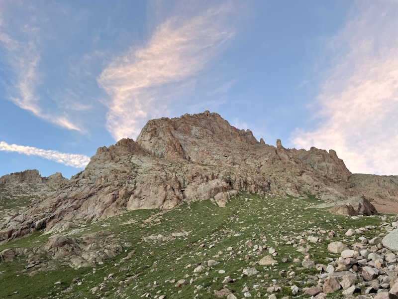
Day 3: Eolus, North Eolus, little finger camp @ 13,000’ I had originally pitched this to Zofia as a chill lake day going over twin thumbs in order to get ready for pigeon and turret via ruby basin. But something was calling me to go over North Eolus to the little finger saddle and to hit ridge direct on Eolus along the way. Especially since our forecast was looking amazing and Zofia had a full day of rest. All signs we’re pointing to the hardest and more unknown option being a go. We still ended up making this a chill lake day though. We packed up early and hiked up to Twin Lakes where we took ~90 minutes to soak in the sun and jump in the snow melt a couple of times. Goats surrounded us and flies hounded us for any hint of salt or mineral. The animals and insects are pretty aggressive around these parts. Time turned into us filtering some water and heading up the Eolus/North Eolus saddle with full packs. Once at the saddle, we did our best to hide our packs and secure them with some rocks while we tagged Eolus via ridge direct. I had been up the standard route before, but wanted to see what the ridge / winter route was all about. And it’s all pretty solid class 4. Highly enjoyable and recommended. Probably the most fun we had on the entire trip. We even felt good enough to return back directly down the ridge. Back at the saddle we secured our packs from a marmot that was finally getting close and headed up North Eolus. It was roughly 3pm at this point. There were basically no clouds within a few miles of us during monsoon season. This is great. We are so fortunate we had a weather window to complete this day as it is without incident or trouble. (NOAA had a 10% chance after noon) Once we were done celebrating Zofia’s 6th & 7th 14ers, we dipped off the top towards the relatively unknown with full packs. We brought some water but I knew it would be really helpful if we found some snowmelt on the north side of north eolus, especially if we were going to potentially dry camp. I did not do the best job of scouting the north side of north eolus. I chose to dip off the left/west into a high 4th / low 5th dihedra pretty quickly after leaving the summit. I handled it with ease but Zofia really did not enjoy this part while having to balance her full pack. I found a way to securely spot her down the most difficult part, but it definitely took us a bit to get down. There might be an easier way off/onto this ridge, but I did not necessarily scout it as it looked potentially even more convoluted, and I was more focused on what was ahead.. Once on the ridge, I underestimated how quick Zofia might be. Despite showing excellent skill on class 1 trail and 3rd/4th/5th class rock while ascending, she was still unlearned in the art of managing descents on loose 2nd class. The ridge itself is loose class 2 and maybe class 3 in spots and goes all the way to the little finger saddle, where we arrived just short around 4 hours later at 7pm, meaning we we're sleeping at 13,000’. Thankfully, along the way we were able to locate water from a large patch of snow. It took about 20 minutes to move enough rock and dirt around to create a clean flowing stream I was able to harvest, but we were able to grab enough to replenish about 2.5 liters each. Without this source, we surely would have been a bit dehydrated the next day. The sunset at 13,000’ from the saddle while viewing peak 16 and little finger was stunning. Top tier. Barely any clouds. We slept without a rain fly or a worry in the world about the weather. We couldn’t exactly find a perfect flat spot, but we found something close on a semi-exposed gravel patch where we cooked dinner and shot photos until the stars arrived to start their show. 
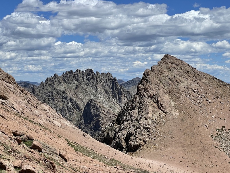
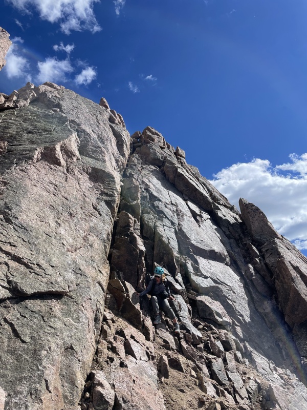
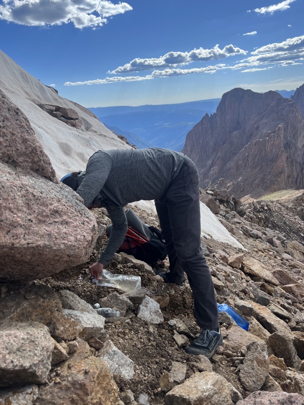
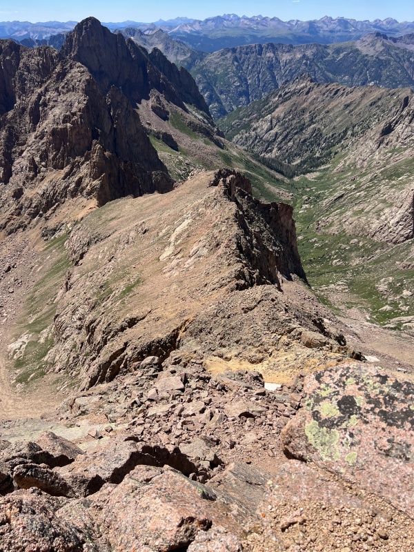
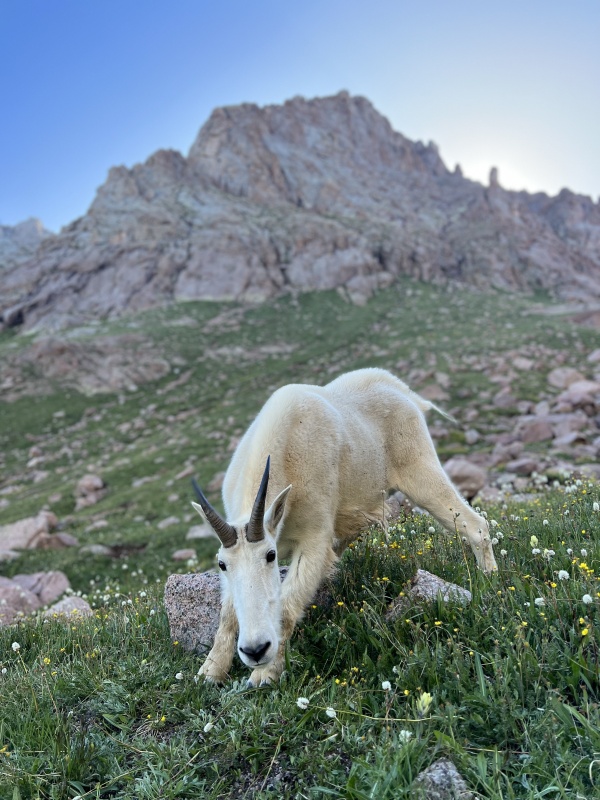
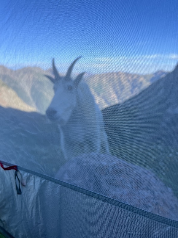
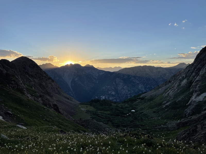
Day 4: Turret and Tie Creek Camp It was clear based on our campsite and available time that the best option would be the most direct option, aka going beneath the cliffs of Peak 15 in NY Basin to access the pigeon/turret saddle, tag turret, then camp in Tie Creek / North Pigeon Creek Basin in order to climb Pigeon early the following morning leaving enough time to hike out the unknown tie creek descent to the ruby trail in order to catch the train by 2pm. This would also avoid the descent and ascent needed to do the route from Ruby. We started our day with the final bit of down climb to the little finger saddle. There is a minor class 3 cliff band to navigate before the scree/tundra descent into NY Basin. Once in NY Basin, it is fun to marvel at the massive rock collapse of Eolus/West Eolus that littered this basin with school bus sized boulders. Flowers were out in force here and we took our time trying to smell a few while enjoying the morning light. Eventually we reach the Peak 15 junction and continue on our way under the cliffs. I fucked up navigating here a couple of times. There are multiple larger gullies you should just go down and under instead of trying to traverse through as you’ll just end up in loose steep bullshit. There is a goat/elk/use path through most of it which is helpful but it still led us into some trouble. Overall just plain tiring. Once past the gullies we had to gain the pigeon/turret saddle. I once again navigated a bit incorrectly and led us a bit more west than we needed to be near the top, which required a bit of a class 3/4 traverse through a rock band to gain the correct saddle. Sorry Zofia. It was at this point that I noted that it was pretty hot and I hadn’t eaten more than 400 calories all morning. I was in pain with almost every step. My stomach does not cooperate well with the heat I have learned, so I did my best to sip water and take in a snack. We dropped our full packs at the saddle and hid them with many rocks so they were harder to chew on. I wore the fanny with 500ml water bottle for the both of us (250 each) and a protein bar each for the summit. We brought rain jackets just incase, although I wasn’t worried. Plus mini first aid kit comprised of a compression wrap and gauze. The route to Turret from here is straightforward and I won’t go into it. Class 2. Beautiful summit views and Verizon LTE service on top. I managed to choke down my builders bar and 100ml of water to digest it. So glad most of the vertical gain is over for the day because I am suffering and moving slow. Zofia is strong and crushing. She almost likes the heat. We make our way back to the saddle, pick up our packs, and start descending into Tie Creek. I’m hoping to find a campsite as high as possible to eliminate unnecessary gain the next morning towards Pigeon. We manage to do so where a spring emerges around 12,100’ near a million blossoming flowers and even more black flies. The flies graciously don’t bite us, but they certainly like landing and crawling on everything possible. This is when we met George. Well, we named him George. He is the sole goat of Tie Creek Basin to our observations. I believe he was mentioned in blazintoes condition update from February when she was working on finishing the winter centennials. He behaved like a dog in ways. Laid down near us very casually and was digging from grubs and scratching behind his ear with his hind leg. Obviously he was hanging around for our electrolytes but this was really unique behavior I hadn’t seen in a goat before. He even appeared to be taking in the sunset with us for a while as we were shooting photos during golden hour. And let me tell you, the sunset views from Tie Creek Basin are dramatic. Certifiably even better than from 13,000’ the night before. The basin is relatively short/shallow so the descent into the valley is steep, meaning the view is jam packed with the peaks from across the animas, in addition to the lower cliffs of pigeon being lit up behind us. I had a special double ramen tonight and a few turkey jerky sticks in addition to plenty of snacks once I had cooled off a bit and set up the tent. Getting those calories in me was magnificent after only 700 calories all day up until camp. 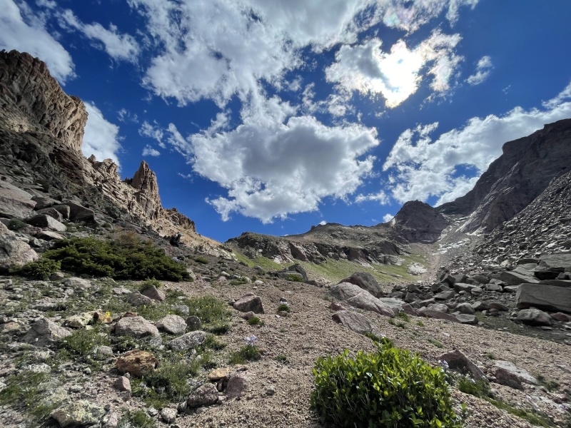


Day 5: Pigeon & hike out ruby basin trail to needleton I wake up early and hit it solo, big fanny loaded thick the night before. Zofia’s knee still isn’t 100% and we decide it’s best for her to be as fresh as possible for our descent down to the train because I knew it would be difficult and kind of fucked. She doesn’t care about lists anyway, just wants to be outside doing cool shit in gorgeous places. I decide I need to be back by 10am in order to have enough time to descend. Figure 3 hours or so from camp up and down. Starting off with a double packet of instant coffee, I fly up. Relative to yesterday my body is feeling amazing, guess I was running off ATP instead of fat stores.. I make quick work of the approach and gain the ridge. I tried playing around on the ridge direct but it was either 5.6+ or 3rd class. Nothing felt in-between. I ended up following cairns to the summit where I posted a conditions report and ate a bagel with peanut butter. Down I went back to camp. On the way I encountered a couple of gentlemen, the first folks we had seen since Eolus. Locals from Silverton. Chill dudes. Arrive back at camp at 9:40a. Perfect. Enough time to take a snack break and hang with George before the descent. Apparently he walked right up to the tent in the morning after I had left. We pack up and leave around 10:15am with a goal of making it to Needleton by 1:30pm. I have 2 gpx tracks on my gaia app, both from climb13ers.com. One stays high and intercepts the Ruby Basin trail around 10,350’, and the other one follows the stream down to intercept the ruby basin trail lower around 9,800’. I decide we should try staying high. Little did I know there is supposedly a north pigeon creek trail, but without that info I didn’t want to take a chance at endless bushwhacking and liked the idea of skirting the tree / talus edge as much as possible down to a forested ridge. It ended up taking us around 2 hours to find the Ruby Basin trail. This descent is completely off trail and involves quite a bit of navigation. I also had two gpx tracks for the ruby basin trail. The first one I tried to find was not correct, while the 2nd track I had was. But there was a good 15 minute delay while we located the trail once we made our way down to where it was supposed to be. I was a bit worried there for a minute but all was well in the end. Feel free to note the loopy bit on our gpx track. Once we found the Ruby Basin trail it was smooth sailing back to the train stop around 1:15pm. Just in time for us to lay out and stretch a bit and snack. On the train we chatted away again with the fellow riders and regaled a bit about our triumphs and tribulations. The food cart was completely out of all savory items so I toughed it out with another builders bar until town. When we arrived we grabbed our packs and hoofed it over to Carvers brewing for burgers, salads, and a drink. All in all, this trip was as good as it could have been. We were graced with excellent weather during monsoon season and had snow melt when we needed it most. We calculated our food well and managed to get back to the train on time, and relatively healthy at that. Zofia is a fucking champ and learned a good deal about navigating off trail in the backcountry above treeline on this trip. Props to her and I’m so glad we got to do this together. 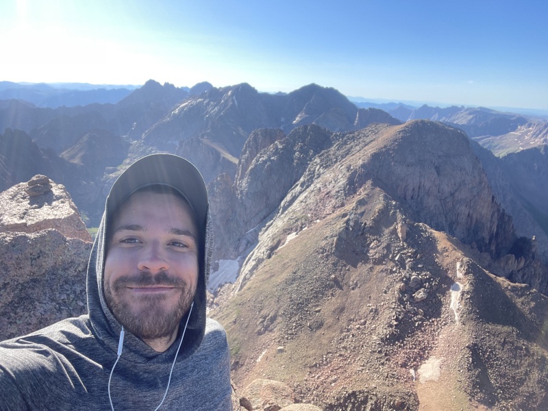
Thumbnails for uploaded photos (click to open slideshow): ")
")
")
")
")
")
")
")
")
")
")
")
")
")
")
")
")
")
")
")
")
")
")
")
")
")
")
")
")
|
| Comments or Questions |
|---|
|
|
Caution: The information contained in this report may not be accurate and should not be the only resource used in preparation for your climb. Failure to have the necessary experience, physical conditioning, supplies or equipment can result in injury or death. 14ers.com and the author(s) of this report provide no warranties, either express or implied, that the information provided is accurate or reliable. By using the information provided, you agree to indemnify and hold harmless 14ers.com and the report author(s) with respect to any claims and demands against them, including any attorney fees and expenses. Please read the 14ers.com Safety and Disclaimer pages for more information.
Please respect private property: 14ers.com supports the rights of private landowners to determine how and by whom their land will be used. In Colorado, it is your responsibility to determine if land is private and to obtain the appropriate permission before entering the property.

