Download Agreement, Release, and Acknowledgement of Risk:
You (the person requesting this file download) fully understand mountain climbing ("Activity") involves risks and dangers of serious bodily injury, including permanent disability, paralysis, and death ("Risks") and you fully accept and assume all such risks and all responsibility for losses, costs, and damages you incur as a result of your participation in this Activity.
You acknowledge that information in the file you have chosen to download may not be accurate and may contain errors. You agree to assume all risks when using this information and agree to release and discharge 14ers.com, 14ers Inc. and the author(s) of such information (collectively, the "Released Parties").
You hereby discharge the Released Parties from all damages, actions, claims and liabilities of any nature, specifically including, but not limited to, damages, actions, claims and liabilities arising from or related to the negligence of the Released Parties. You further agree to indemnify, hold harmless and defend 14ers.com, 14ers Inc. and each of the other Released Parties from and against any loss, damage, liability and expense, including costs and attorney fees, incurred by 14ers.com, 14ers Inc. or any of the other Released Parties as a result of you using information provided on the 14ers.com or 14ers Inc. websites.
You have read this agreement, fully understand its terms and intend it to be a complete and unconditional release of all liability to the greatest extent allowed by law and agree that if any portion of this agreement is held to be invalid the balance, notwithstanding, shall continue in full force and effect.
By clicking "OK" you agree to these terms. If you DO NOT agree, click "Cancel"...
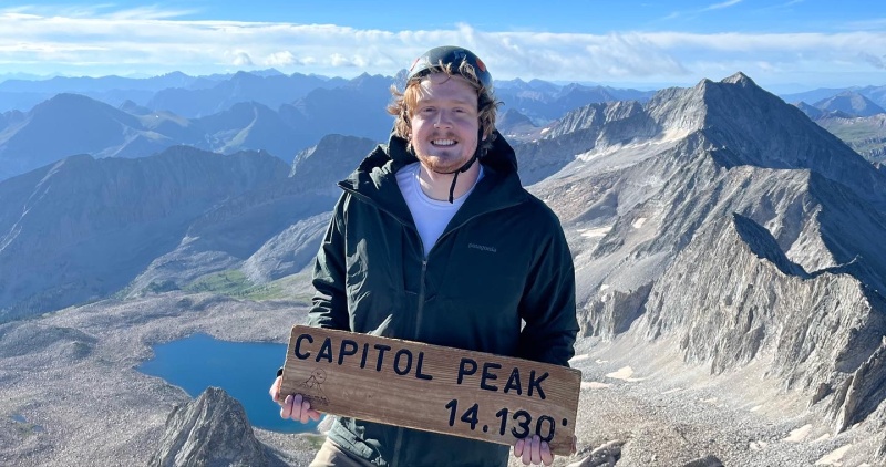
Capitol has been living rent free in my head since I started climbing 8 years ago. The famous knife edge, the notorious rock quality, and tedious route finding combine to create a irresistible challenge.
My fiancé’s job as a traveling physical therapist means that every 3 months we move to a new city somewhere in the country (rarely back in CO). Recently she got a contract in Glenwood Springs close to my family and I knew it was finally the right time to climb Capitol. Rent was due.
Saturday August 6th
My partner Austin and I left my brother’s house in Basalt for a quick drive over to the Capitol Creek trailhead. The parking lot had only a single space left at 11 AM. There probably isn’t a way to avoid this without climbing Capitol on a weekday (recommended) but something to keep in mind.
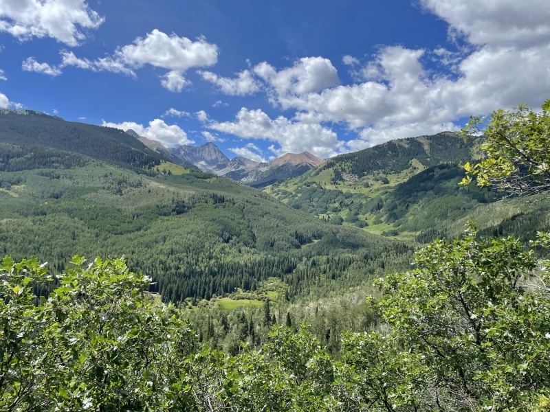
Immediately the target is in sight. After snapping a few pics we began the 6 mile approach into Capitol Lake. This has to be one of my all time favorite approaches to a 14er- the terrain is incredibly flat and your goal remains in site for a majority of the hike.
Great views the whole way inFlat flat flat
We arrived at the lake at 2:30 after stopping a few times to chat with folks coming the other way. We were worried about finding a camp site after hearing how full the basin can get but snagged Camp 3 without any fuss. By 3 PM all campsites were full and folks were spreading out in other semi-sites. We estimate about 30 people were camping in the basin but about half of these weren’t intending on attempting the climb.
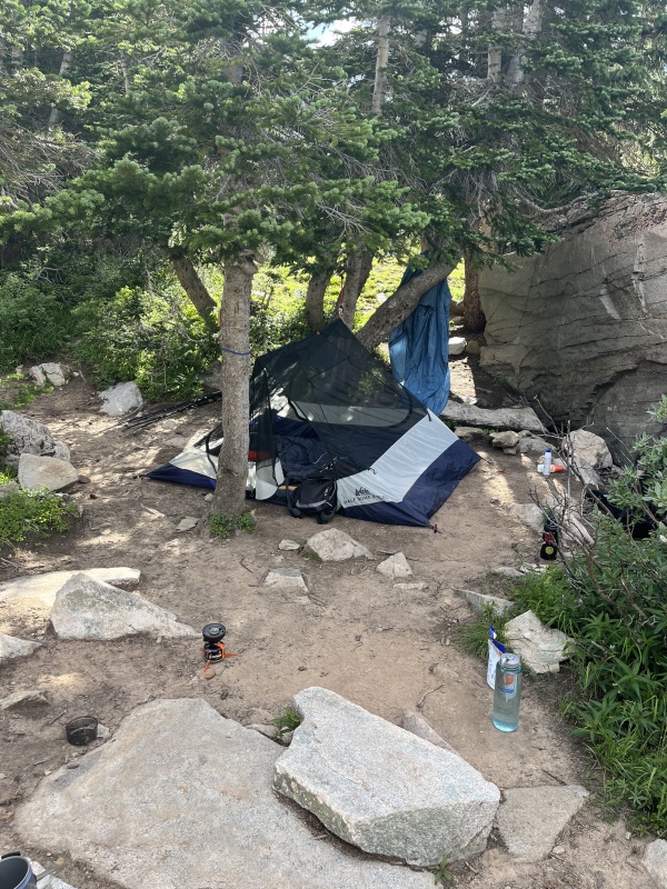
We started to set up camp when I realized a critical error- I forgot the tent poles.
Luckily I randomly had two bungie cords and camp 3 has two well spaced trees that allowed us to set up a camp. And my brother says he has the engineering mind!
Mcgyvering a shelter
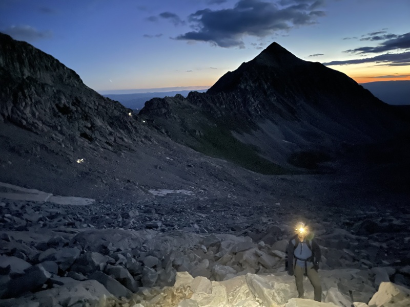
We spoke with the people in camp 2 and heard they were planning a midnight start. We ourselves planned a 3:45 start based on weather conditions. Would be curious to know how that ended up going for you guys! I am always too excited to sleep before a 14er so I went to bed early at 8.
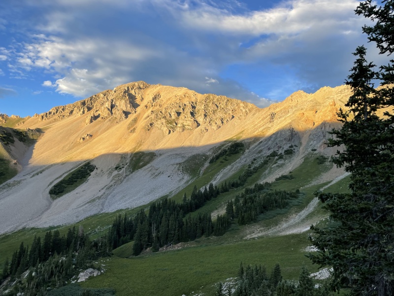
Alpenglow dreams
Sunday August 6th
The hike began with a Pepcid (thanks to the forum) and we were off. The climb to the top of the Daly-K2 Saddle was a nice warmup for the rest of the day. Once reaching the top we faced our initial decision: Do we go up higher to the ridge proper like we saw other groups doing or stay low below the rock bands? We opted for a mix of the two and crossed the first gully right where the trail ended. Hindsight 20/20 the right decision was likely to drop a little lower below the cliff bands but going midway worked fine; going up higher leads you to the ridge proper and sustained class 4 climbing. We saw several groups turn around when they realized their mistake.
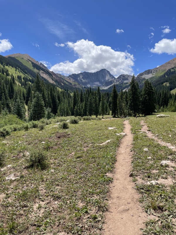
The GPX file is very helpful to guide yourself through the boulder field
Above is a picture of the Boulder field section of the hike. The furthest group back has just gained the saddle. You can see where people have crossed a snow patch after crossing below the rock outcrops. In about 100 feet we will turn climbers right up towards K2.
The climb up towards K2 was uneventful and a nice time to take in the very aesthetically pleasing Mt. Daly.
Boulder surfing
We opted to summit K2 and found the class 4 route to the top solid and clear. Sopris looks small down there in the distance!
Sopris looking goodSnowmass looking imposing as always
Down climbing off the West side of K2 proved a little tricky but soon we were face to face with the gal herself -
It may look like scree.... but it is boulders AND scree.
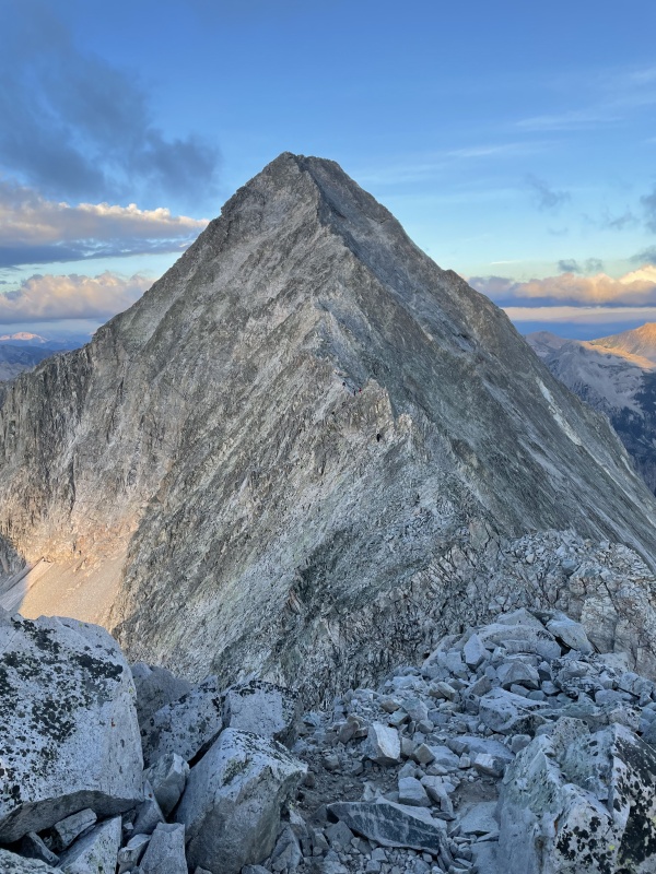
Capitol’s East face looked incredibly steep and full of scree from this vantage point.
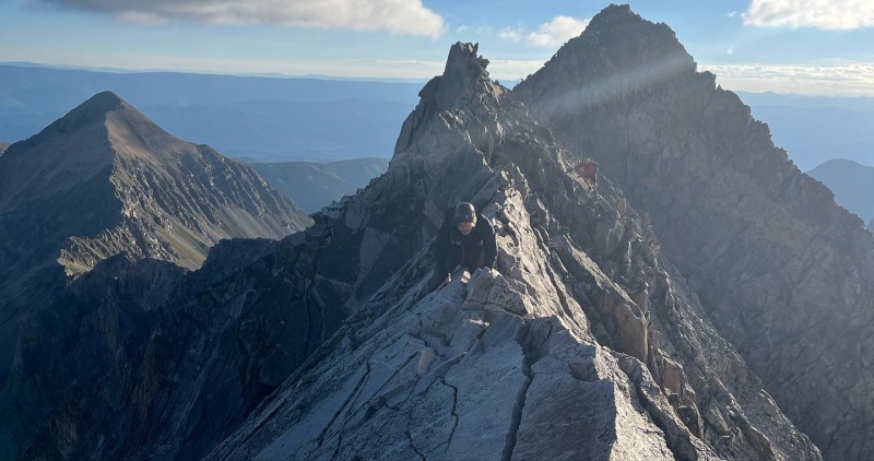
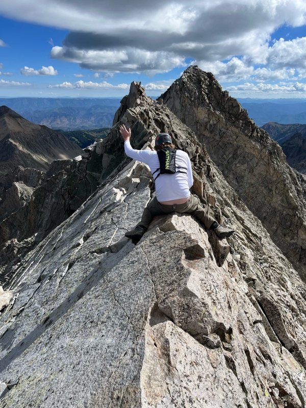
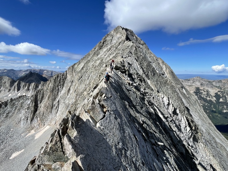
We crossed the mini knife edge without realizing it was the mini knife edge and then faced the true knife edge. I am getting married in less than 40 days and looking at this obstacle that has caused so many accidents gave me pause.
“Am I being selfish?” “Should I wait here for Austin?” “Is there ever going to be a right time?” “Why are my hands so sweaty”
I told Austin I was thinking of turning back.
Austin gave me some time to reflect and I felt a surge of commitment. I COULD do it. It wouldn’t be stylish but I would get across this ridge safely.
Not exactly a back hand spring across but safe.
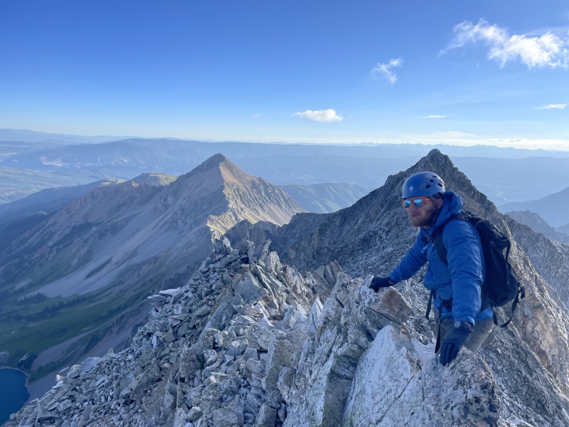
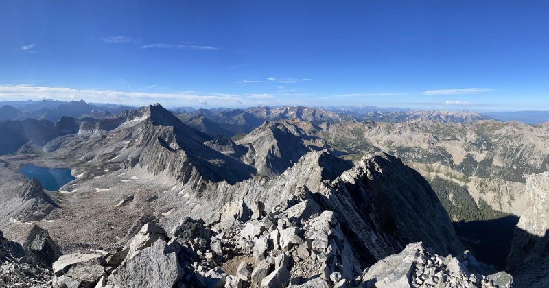
The rest of the ridge was a combination of staying on the ridge proper, staying to the left, and staying to the right. There are several ways to do the ridge after the knife edge and we didn’t feel like there was ever a problem route finding between the knife edge and the East Face. Below are pictures of the knife edge and the conditions on the rest of the ridge.
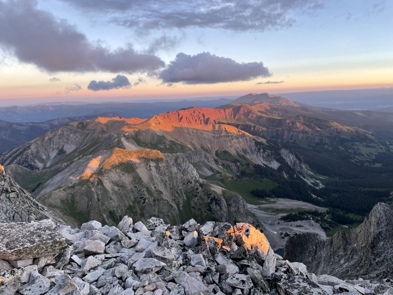
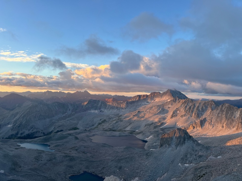
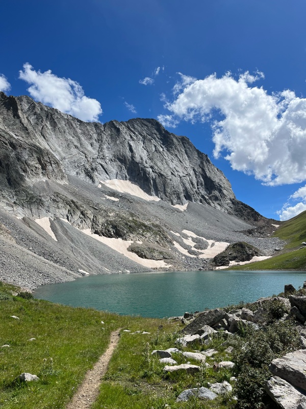
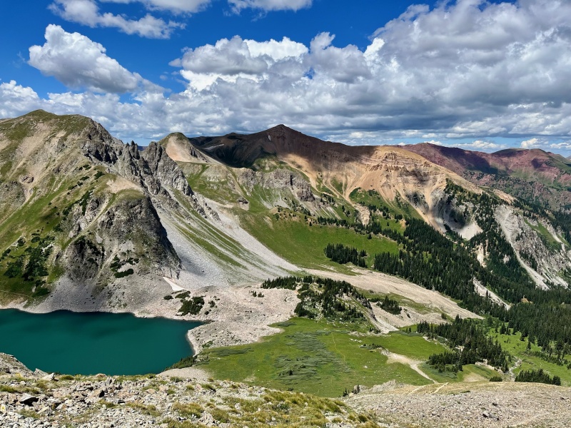
Great views overlooking Capitol Lake
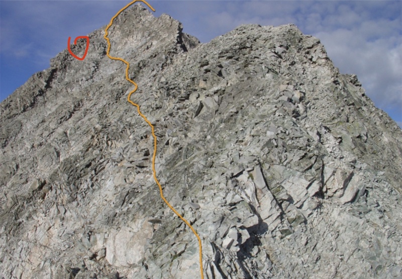
After crossing the ridge we followed cairns across the East face. Several other trip reports have mentioned staying high on the East face and I agree. We seemed to have followed the lower standard line across the face, across a gully with nice hand holds, and up to the ridge on the left side of the East face. Route finding took a long time and we ended up slightly below where we wanted to be.
Caption Here
We went around the ridge and ended up below the summit ridge by about 50 feet.
This required some unintended (but fun) class 4 climbing back up to the summit ridge proper and a nice scramble over to the summit.
Some Class 4 to the Summit BlockCaption HereSatans ridge over to Snowmass.. Not my cup of tea but more power to you!
We downclimbed the summit ridge proper. This picture gives a good idea of the exposure on this section of the climb.
Between the East Face and the main ridge you come across the gully I believe people have tried to take as a direct route back to Capitol lake. As many have said DO NOT DO THAT. By looking at Capitol from the lake you can see all of these cliff out at some point.
Those Gully's lead nowhere good
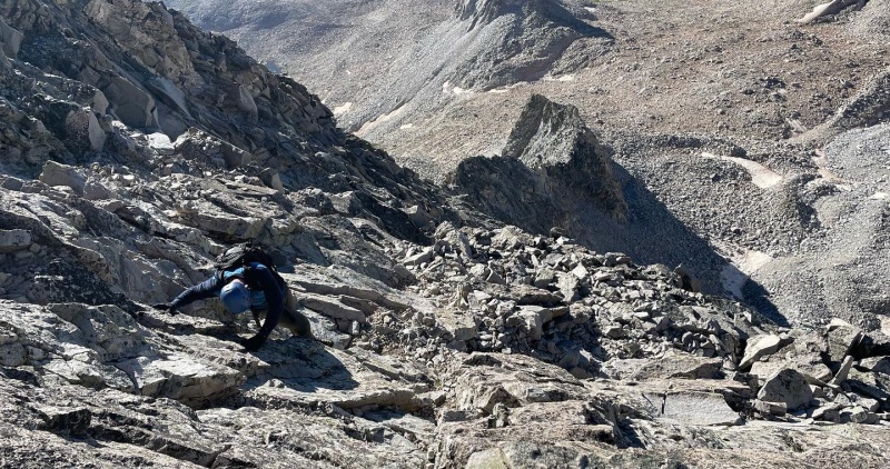
The downclimb back down to the main K2-Capitol was tedious but uneventful- we found the cairns, crossed the gully, and got to the ridge proper.
By staying either left, right, or center we were able to avoid any serious exposure on this section up until the main knife edge. Once I again I summoned some courage and crossed. Unfortunately halfway through my pants came undone at the clasp but I made it across: this time with a plumbers crack.
Giving the marmots a showAustin crossing with far more finesse.
Our final truly complicated obstacle was getting around K2. Because we summited K2 and dropped off the west side, we really had no idea how to get back around to the back side of K2 the standard way. After poking around a few different places on the climber's left side, we decided to simply climb back up K2 and downclimb the chimney we climbed to summit originally.
At this point we were tired and hungry but happy to have made it back to the boulders. The section between K2 and the Daly saddle was grind. I rolled my ankle twice and it everything seemed to go 10x slower than it did on the way up. The GPX file was very helpful to stay on track in the boulder field.
Finally we made it up and over the saddle and back to camp.
Paradise
We packed up quickly and landed back at the car by 3:30.
It took us a total of 9 hours from when we left camp until we got back to camp. This includes waiting for people to cross the knife edge, summit time, and a few water breaks but it goes to show just how tedious this route can be. I usually consider myself a fairly fast hiker but not today.
Final thoughts:
Weather weather weather. Like several reports have said, once you are on the ridge it can take several hours to get back to some semblance of cover. And even when you get past K2 the boulder field would take awhile to cross in the event of adverse weather. Plan for a very long window and start early. Most groups we met started around 3:30 from the camp sites.
Excellent route finding skills are a must. Several cairns I thought were rather misleading so having confidence in your own decision making is key.
Seasonal timing. This was a busy weekend on Capitol which means more rockfall than I would have liked. I have heard that a mid September climb can be advantageous due to fewer people but going midweek should accomplish this as well.
In 1 month I am climbing Mt. Marriage. Anyone got a route description for that?
Thumbnails for uploaded photos (click to open slideshow):
Mount Marriage Route Description 8/11/2022 10:48am
Nice trip report. Brought back some very good memories.
As for a route description of Mount Marriage, here are some reflections on what has worked in my 45+ years of marriage - Be kind to and gentle with each other. Let grace abound. Don't wait for the other one to be the first to say "I'm sorry." Forgive quickly and fully. Do not keep score with one another. Keeping score may be necessary in sports but it has no place in a marriage. Give each other grace and then more grace. Never let the day end with anger and never go to bed angry with each other. Talk and walk with each other. And more importantly, talk and walk with God. Relentlessly pursue grace with each other in the same way that God relentlessly pursues you with His grace.
Capitol route finding is a light warmup for Mt. Marriage. Exposure... insert pic of Honnold in Free Solo. Commitment.. is there a level past extreme? Jokes aside, if you keep up the will you showed on Capitol.. this one has the most glorious summit of all. Excellent trip report, thanks!
Caution: The information contained in this report may not be accurate and should not be the only resource used in preparation for your climb. Failure to have the necessary experience, physical conditioning, supplies or equipment can result in injury or death. 14ers.com and the author(s) of this report provide no warranties, either express or implied, that the information provided is accurate or reliable. By using the information provided, you agree to indemnify and hold harmless 14ers.com and the report author(s) with respect to any claims and demands against them, including any attorney fees and expenses. Please read the 14ers.com Safety and Disclaimer pages for more information.
Please respect private property: 14ers.com supports the rights of private landowners to determine how and by whom their land will be used. In Colorado, it is your responsibility to determine if land is private and to obtain the appropriate permission before entering the property.

")
")
")
")
")
")
")
")
")
")
")
")
")
")
")
")
")
")
")
")
")
")
")


