| Report Type | Full |
| Peak(s) |
Vestal Peak - 13,867 feet |
| Date Posted | 08/01/2022 |
| Modified | 08/05/2022 |
| Date Climbed | 07/22/2022 |
| Author | speth |
| Additional Members | Apple |
| Wham in the Weminuche |
|---|
Grenadier PeekabooVestal Peak, and specifically Wham Ridge, had been on my radar for the last few years. The remoteness and technical requirements for it had been appealing, but I'd be a liar if I didn't admit that the aesthetics of Wham Ridge itself isn't what really drew me in to wanting to climb it. Apple has had a bucketlist request the last few years to do some kind of touring through the Weminuche, and we checked at the end of June to find some places that would be fun to visit without too much effort. We found some reports online and decided to do a loop through Highland Mary just southeast of Silverton. I had looked at Whitehead Peak and Mt Rhoda in the past, and knew that we would have an awesome view of the Grenadiers from the summits, and we indeed had a great look into the northern edge of the wilderness area from both of these peaks. 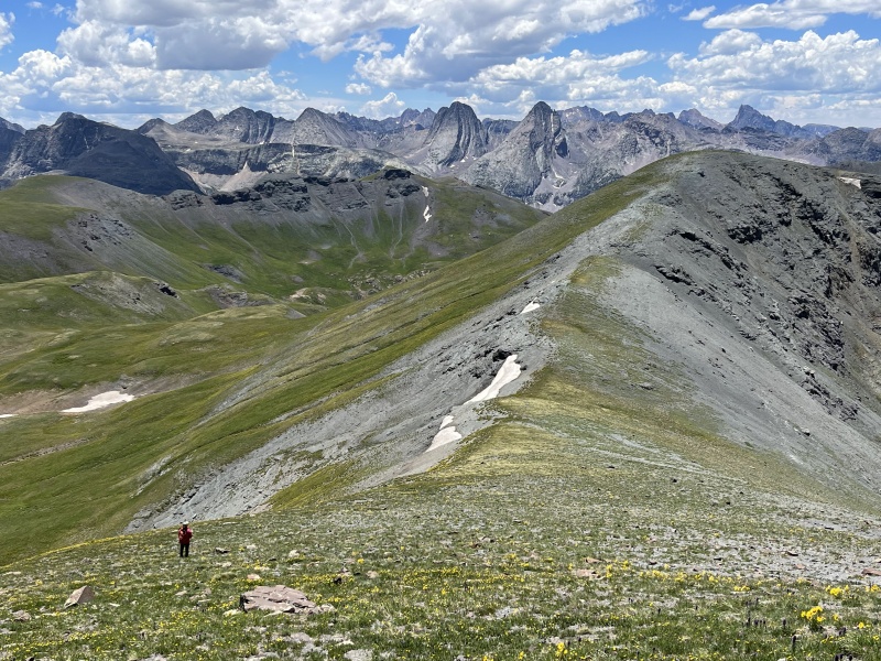
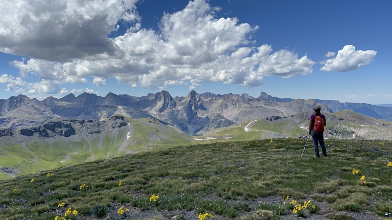
At the end of the trip, we were both convinced that we needed to visit nearby Vestal Basin in the near future. Apple thought it would be a fun backpack, but I convinced her that it would be reasonable for us to attempt the awesome north face that we had spent the weekend looking at from our Highland Mary camp. We made plans to hike into the area from Molas Pass sometime around July 21st, returning a few days later. We kept an eye on the weather, and decided at the last moment that we would drive down July 20th, hike into the basin on the 21st, and attempt the summit on July 22nd. Second Peak to the Right, and Straight on 'til MorningNot wanting to deal with the closures on US50 west of Gunnison, we decided to take I70 through Glenwood and to make our way down towards Ouray through Redstone and Delta. We made it as far as McClure Pass before calling it quits about 12:30am, and had a decent sleep in the back of the car until 7:30am. Traffic in the whole area can be bad at the moment, and we were held up at construction stops at Paonia Reservoir, Ridgway State Park, and just south of the stoplight in Ridgway. After getting coffee in Ouray, we finally pulled into the parking lot at Molas Pass around noon. We ate an entire loaf of milk bread that Apple bought the day before, finished packing and separating our camping and climbing gear, and were on the trail just before 1:00pm. Just a few minutes down the path, we ran into a worker from the Forest Service stationed in the area - she was letting everyone know that workers were on the Elk Creek trail removing avalanche debris that had accumulated in the previous years, and an explosives team from Wyoming were blasting to clear the path. This was news to us, but not a problem, and we continued on our way. 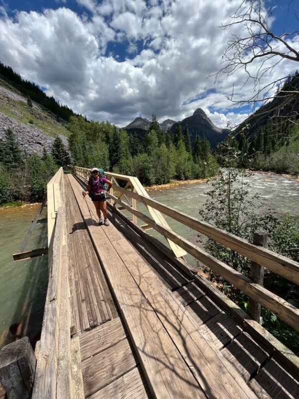
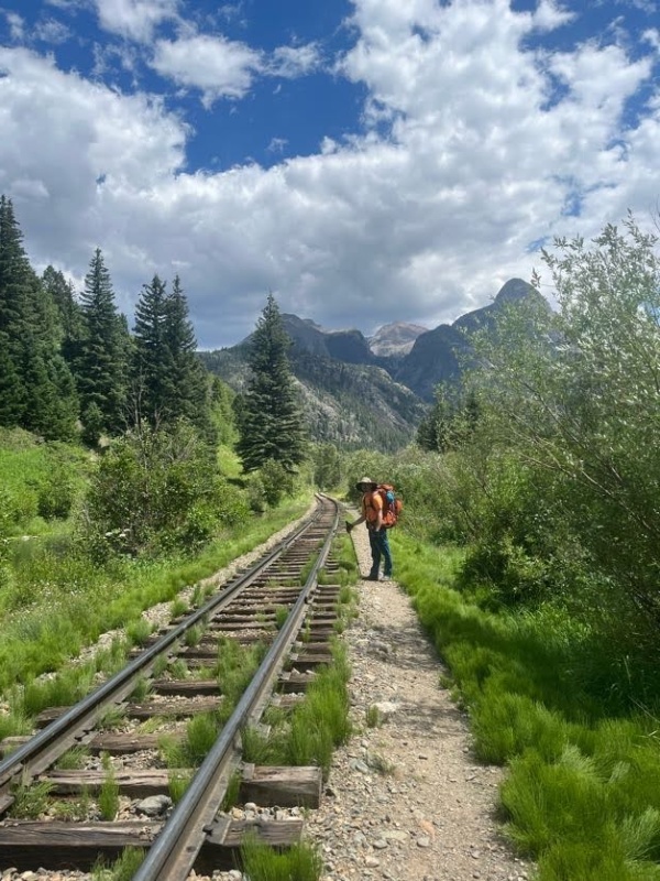
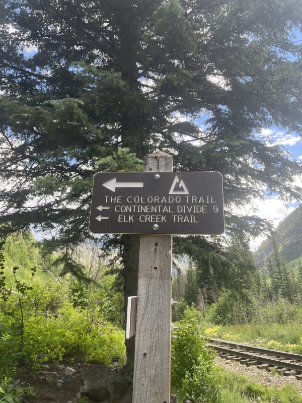
It took around two hours to get to the bottom of the trail and the footbridge that crosses the Animas River and the train track. From there, we rounded up the trail and into the Elk Creek drainage, and at the wilderness sign-in kiosk, another USFS worker was waiting. This time, we had to stop and wait for them to get a signal that the way was clear and safe for us to proceed as part of foot traffic control. I took off my pack and had the opportunity to get a small bite to eat, and chatted with the worker - mule teams had brought a lot of supplies down the trail to a base camp at the confluence of Elk Creek and the Animas, and each day workers and mules were hauling up explosives to the debris fields. I knew the answer was going to be obvious, but had to ask - Durango Silverton Narrow Gauge did not allow the USFS to transport explosives on the train itself. Eventually we were given permission to proceed, and we slung our packs back on and made our way farther up Elk Creek. Within another mile or so, we ran into another worker again blocking the trail, but this time it was to stop us from walking into an active blasting site. The worker communicated with the explosives team over a radio that everyone was in position, and then instructed us to cover our ears before the blasts occurred. This was definitely a unique outdoor experience, and certainly unexpected. If you get the chance to be around qualified professionals blowing stuff up in the wilderness, I'd recommend you take the opportunity.
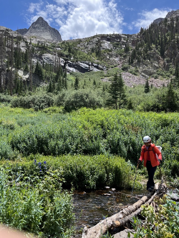
After a few more miles of hiking, we eventually arrived at the Beaver Ponds, which marks the turn off point from Elk Creek and the beginning of the slog up and into Vestal Basin. We stopped and filtered some water here, had another quick snack, and proceeded up the trail. There was a lot of deadfall in this area, and a lot of the hiking involved swinging over trees that are blocking the path, or walking wide and around a particularly messy area. After being in the sun for most of the day, and hiking down and back up the trail for a lot of elevation loss and gain, we started to lag here quite a bit and took frequent breaks to catch our breath. 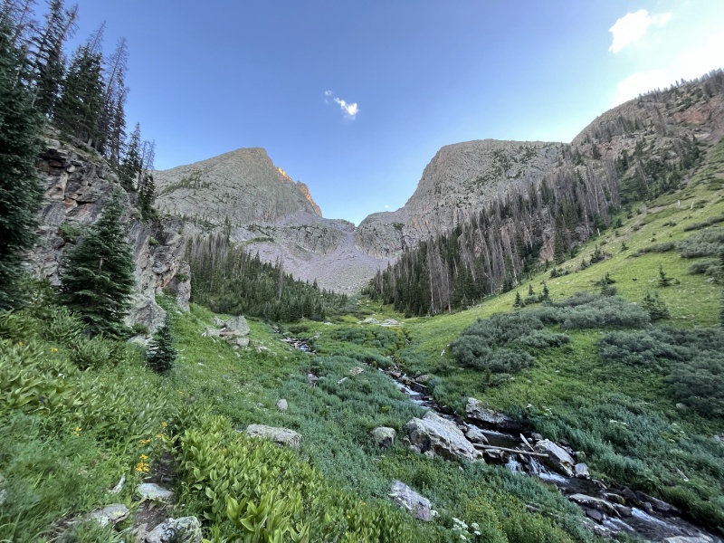
We finally rolled into camp shortly after 8:00pm. There were quite a few other parties set up, but we didn't have any trouble finding a spot for ourselves. We threw down the tent, Apple got the Jetboil going, and I went to fetch water. Our plan was to wake up at 4:00am, get a bit to eat, and get on the trail as the sun was coming up. The weather was predicted to be pretty normal for the summertime, with monsoon storms coming in some time in the afternoon. I had to no idea what to expect for climbing time given that we had a really short distance, but quite a bit of vertical ground to cover with gear, so I was planning for us to be back in the amphitheater that separates Vestal and Arrow some time around noon. 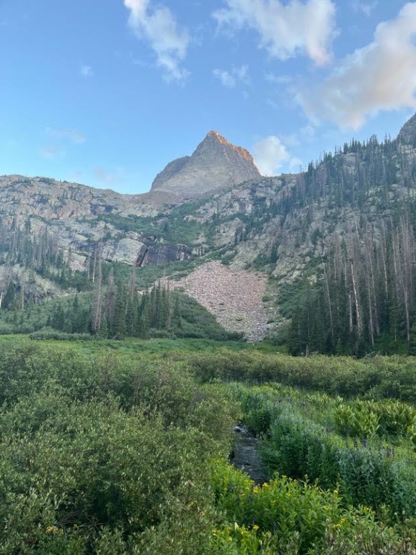
Wham Ridge, BabyThe alarm went off, and I got our Jetboil going to get some coffee and oatmeal ready for breakfast while I let Apple sleep for a while longer. Eating dinner, I was feeling slightly nauseous and I think I hadn't eaten enough throughout the day and bonked once we stopped and set up camp. Eating breakfast in the morning, I felt way better and fairly well-rested and was looking forward to the day. We finished packing up our daypacks, separating the climbing equipment between the two of us, and walked out of our camp site around 5:30am. The skies were clear and the temperature felt very pleasant and warm, and before long we both had our jackets off and were hiking in the sunshine. 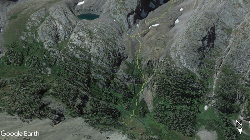
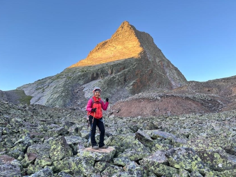
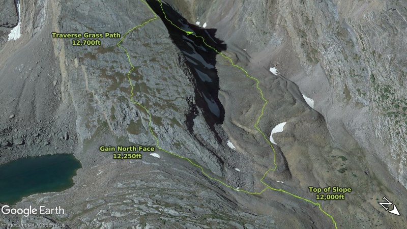
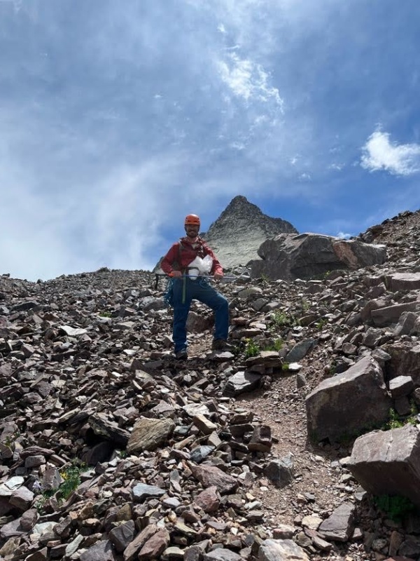
After hiking up the trail for a few hundred feet, we emerged out onto a small boulder field at 12,000ft. From here, you can see the saddle that separates Vestal and Arrow to the south, but Wham Ridge is accessed by turning southeast and aiming for a grassy hill that climbs towards the base of the peak. The path was easy to pick through, and we made it up the grassy ramp in just a few minutes. At this point, we started looking for paths that would lead us farther up and onto the north face of Vestal and towards Wham. Depending on your comfort level and climbing ability, you can turn up onto the slabby rock fairly soon, or wait for as long as possible until you're on the northeast corner of the face and closer to Vestal Lake. We found some large cracks in the slab at approximately 12,250ft and proceeded to hike up the face using the broken rock as steps. From there, it was a quick hike up intermittent grassy steps and ledgy rock faces until we encountered the Grass Path at 12,700ft. From there, we hiked up another 100 vertical feet across the face of the mountain until we reached Wham Ridge on the northwest edge around 12,800ft. 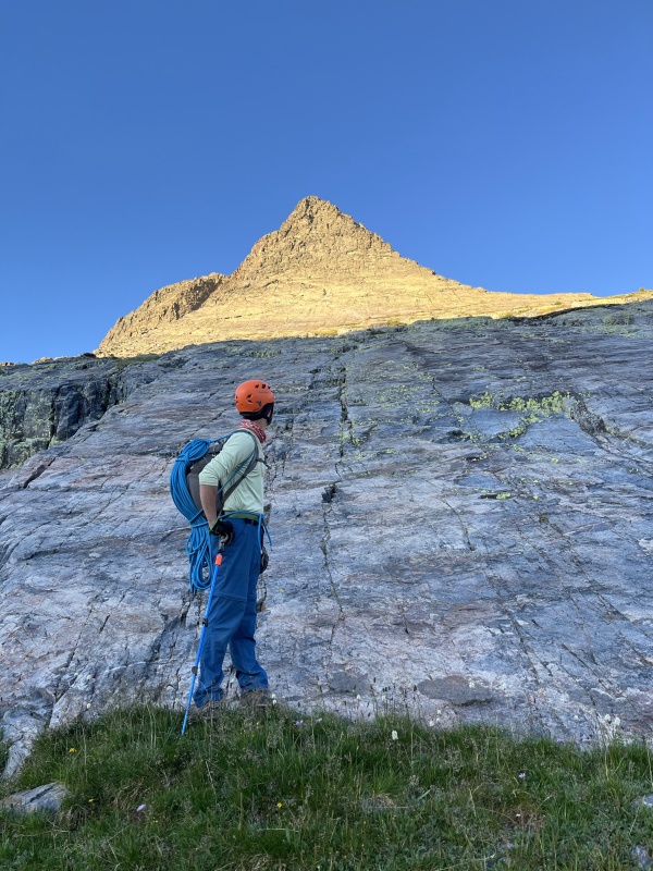
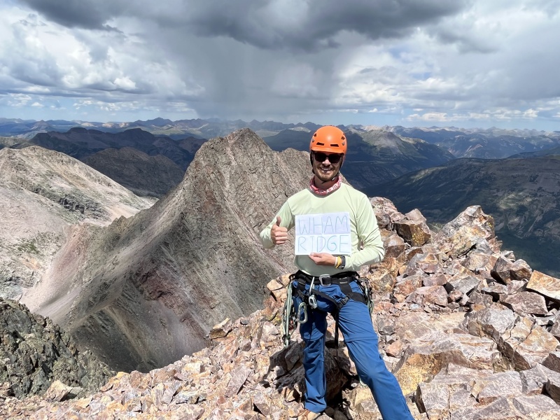
At the end of the Grass Path, we dumped all of our equipment out and started to assess how to proceed. We both felt comfortable and decided that we could continue to scramble up the ridgeline for at least a few hundred feet before breaking out the rope and gear, but we picked out a few spots to scramble to along the way, stop and check our comfort level, and then proceed on either scrambling or roping up. I had studied a few photos online, and came up with a general gameplan on where we would aim for along the route, more as confidence markers and to make sure we were staying where we were meant to be climbing and not off into no-man's-land on one side of the ridge or the other. In hindsight, this was overkill and most of the route is more obvious and straightforward than what I was anticipating, but better to be prepared, especially in a pretty remote area on a relatively committing route, than totally throwing caution to the wind. Our plan involved three basic places to look for along the way to the false summit. First, two large boulders sit on the face a few hundred feet up. Next, we'd look for a red triangle shaped rock outcropping that sat on the western side of the ridge, and we'd aim for the left side of it. Last, we'd look for a long ridgeline close to the top that catches a lot of sunshine coming from the east - it looked like there was something of a gully to the left of it, and we'd aim to climb the gully, and then start looking to go left and directly out on to the face to gain the false summit. Two Boulders. Triangle Rock. Sunshine Ridge. 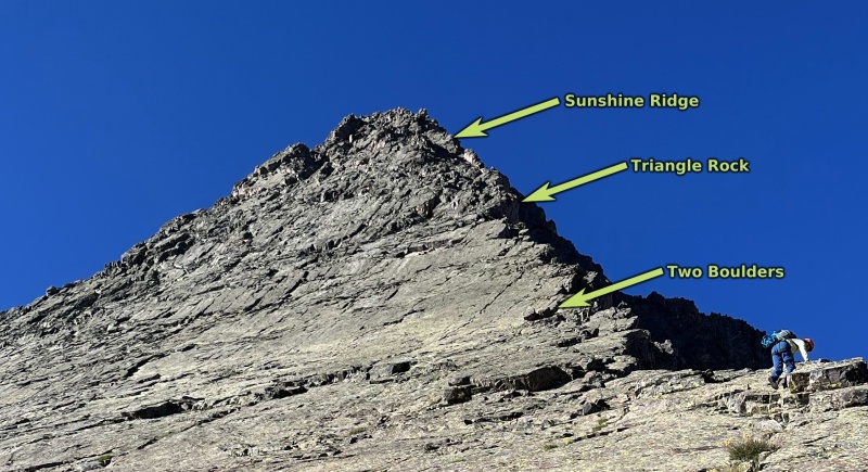
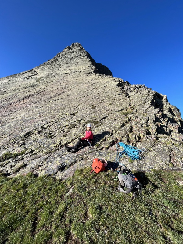
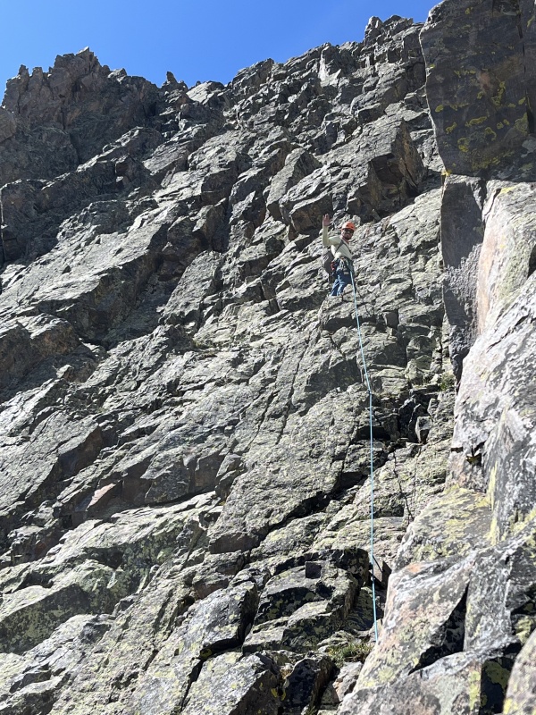
We scrambled our way up to Two Boulders and decided at that point, we'd get out the gear and start pitching the climb out - it was just before 8:00am and at almost exactly 13,000ft. We brought along a 50 meter Beal Opera 8.5mm rope, a set of BD stoppers, Cams 1-3, and Hex 9-10. I began the first pitch out on the face of the rock, and it was immediately evident that the rest of the climbing for the day was going to be fun, solid, and fairly easy. Lots of big cracks to step feet into, holds to counter-balance and always in place when needed, and plenty of places to put in gear if you felt uncomfortable. I made it up two pitches and brought Apple up to me - in my opinion, this first third was the most fun climbing of the day. 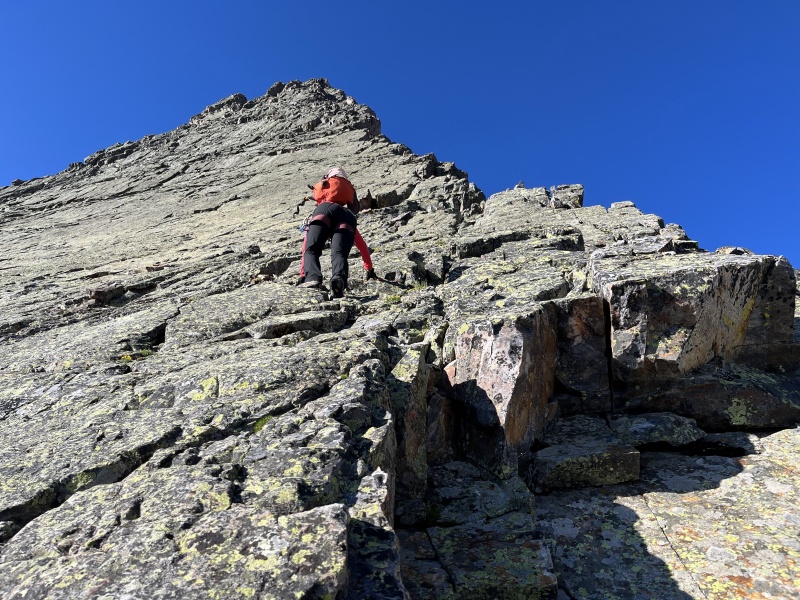
We kept at a steady pace, and went by Triangle Rock around 13,100ft on the way up. With the gear coming into play, our progress really started to grind to a slower pace, but we continued on at a good clip and didn't take long breaks and made transitions as quickly as we could. The route has a tendency to keep hinting at you to forge deeper into shaded territory around the corner to the right, but outside of a handful of moves and sequences, we stayed on or nearby the ridge-proper for the vast majority of the climb. To venture too far onto the western side of the peak looked to be a bad idea and led into pretty serious and unsavory territory very quickly. 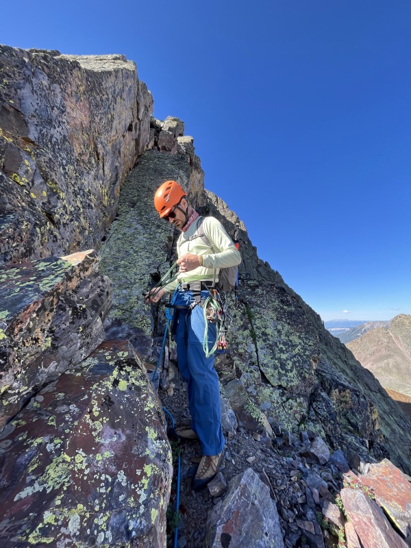
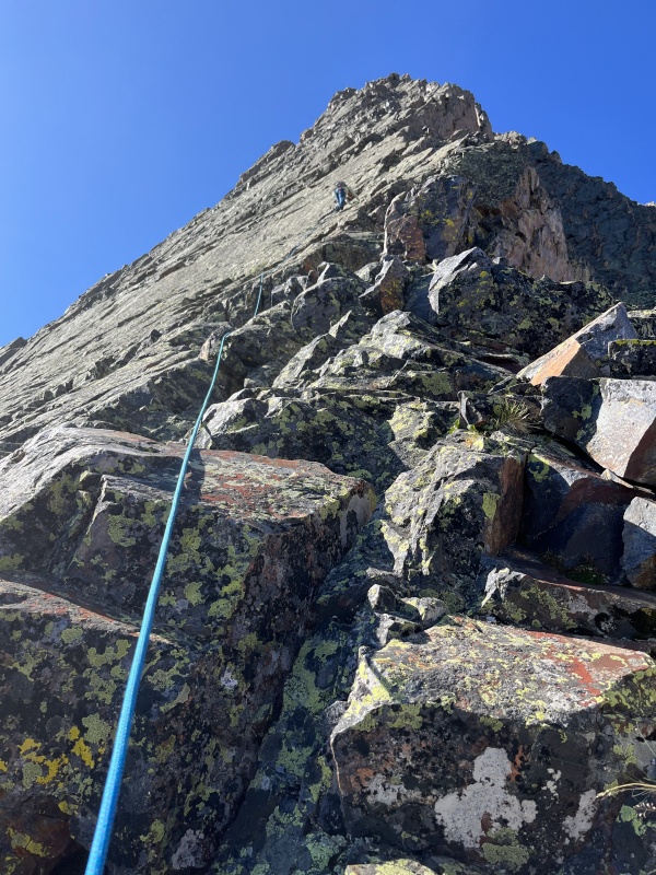
Up and up and up, one length of rope at a time. Eventually, we passed through the gully at Sunshine Ridge around 13,500ft, and began making our way left out on the face for the last push before the top. I was still having fun, but the climbing in the middle section of the ridge was very easy and exposure minimal, and pitching out over and over began to be a chore - it was taking longer to put together a small anchor each pitch than it took to actually climb the length of the rope. Clouds were starting to form on the horizon to the west over the Wilsons and the La Platas, and more was pushing up from the south on the Rio Grande side of the divide - I felt like we were getting squeezed, and I started to get nervous. At that point on the ridge, there was no way that retreating down would be faster (or safer) than just proceeding to the summit and descending, and I quickened up my climbing pace as much as I could to get us up and over to finish. We swung out onto the north face of Vestal for the final push to the summit, and this was an awesome and flowing climbing area. Everything felt safe and secured, and any loose rocks were obvious and sitting on ledges, easily avoided and ignored. This section felt technically easier than the slab climbing that started the day, but I was certainly glad to have a rope here - the bottom of the route has something close to a 35 degree angle, but the entire face of the mountain steepens considerably, maybe towards something like 50 or 60 degrees (I didn't measure the upper portion) near the summit push. 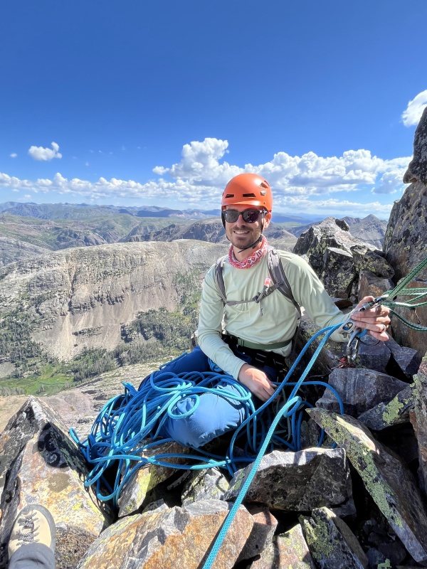
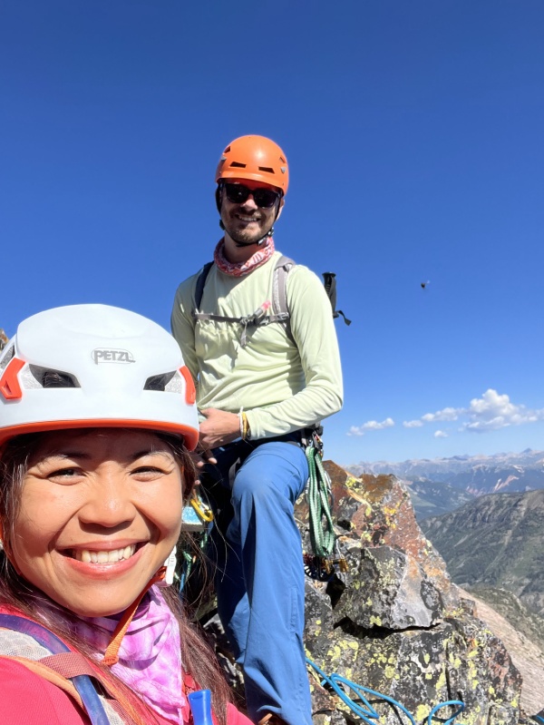
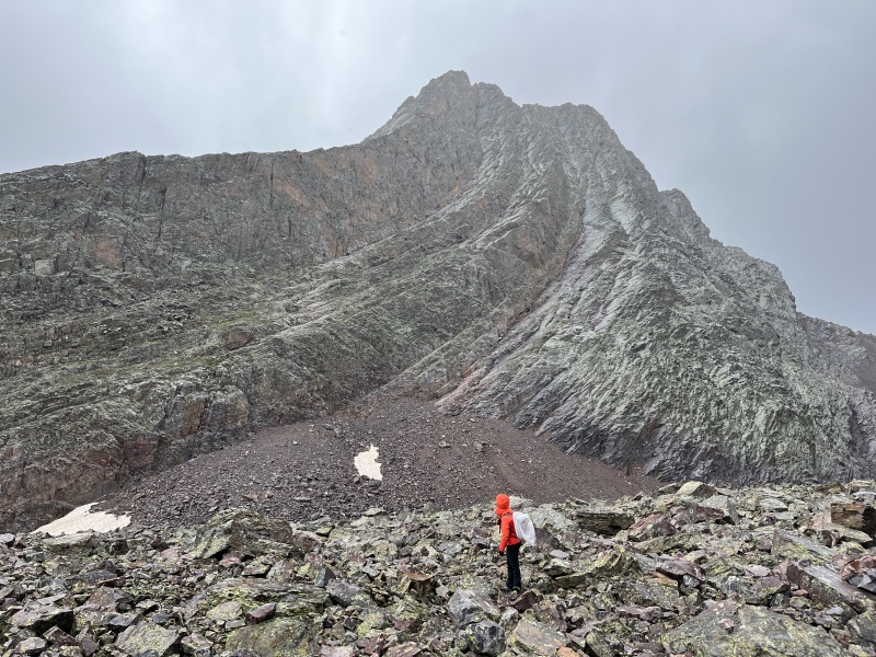
I finally pulled up and over the false summit just after 11:00am, and I could see that it was raining somewhere on the other side of Golden Horn and Pilot Knob to the west, and somewhere between Hesperus and Twilight to the southwest. I was pretty sure the system from the Wilson area would blow north, but I was worried about a southwesterly storm just smashing us in the alpine. Apple made her way to me, and I kiwi coiled and shortroped us the short distance across a small slope and up a notch that took us to the real summit around 11:25am. 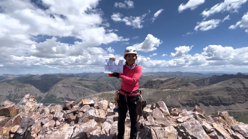
All Clear, Kid - Now Let's Blow This Thing And Go HomeWe cleaned up some of our equipment, grabbed a quick bite to eat, and made it off the summit in about ten minutes. This part could potentially be bad to get stuck in the rain, so we hurried to get down to the saddle of Vestal and Arrow as quickly as we could. There are two paths to exit the summit - one cuts to the southeast and down a gully towards Tenmile Creek before turning west and traversing to the saddle. The second drops directly off the summit towards the saddle, descending a south-southwest face. I would not recommend the second option - from the top and the bottom, it looked loose, steep and dangerous to descend. We chose the southeast gully, and it was tedious and rugged, but felt fairly safe and accessible, including a handful of cairns indicating other people had been there before. 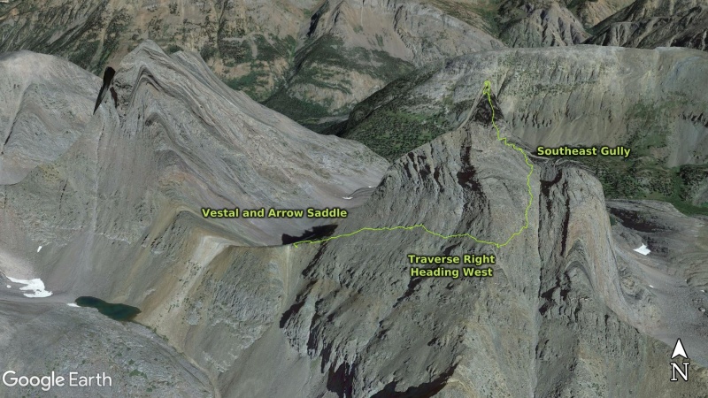
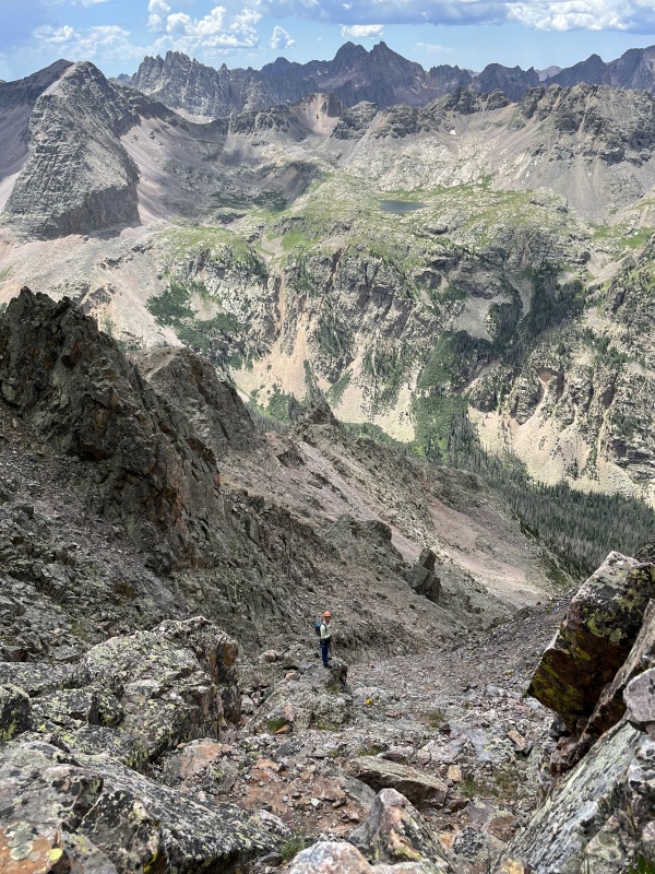
After we descended to 13,300ft, we made a right turn and started traversing west towards the saddle of Vestal and Arrow. We stayed fairly high to the right while in the gully, and looked to start going west as soon as possible - descending too far wouldn't have been the end of the world, but it would have been a serious pain in the neck to try and find a good way to the saddle from farther down the drainage. The terrain eased up considerably from there, and we sped up quite a bit, making it to the saddle in just a few minutes after exiting the gully. We couldn't find a good way to get down, and picked the first slope we could see that was close to Vestal, just as the clouds arrived and started to spit rain on us. This thing was a nightmare to descend, and we basically slid and rock-skied the entire way to the bottom of the slope - I have no idea if we missed something obvious farther west and closer to Arrow, but we didn't see any cairns or trail that would have made it easier. I have no idea how people ascend here at all. 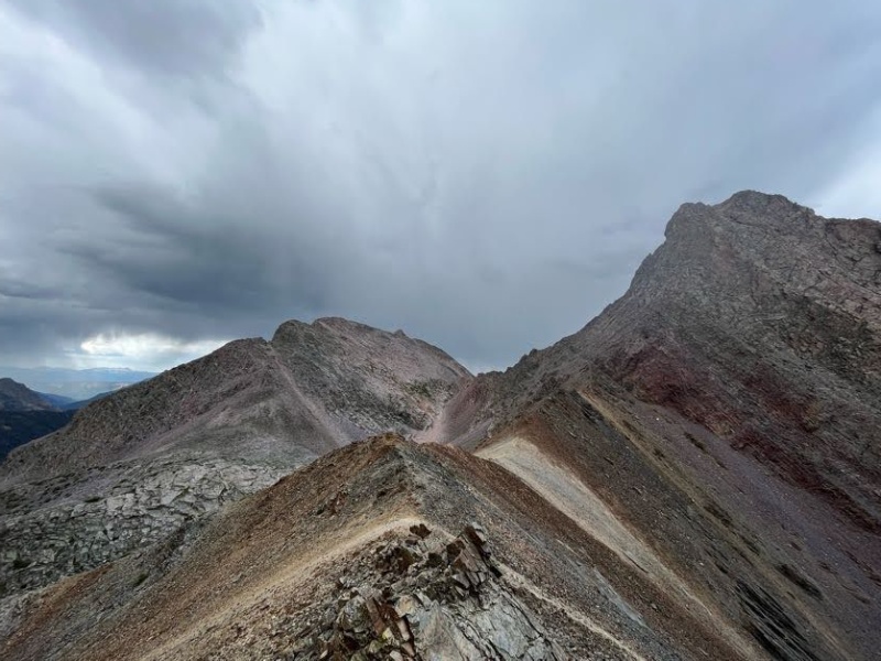
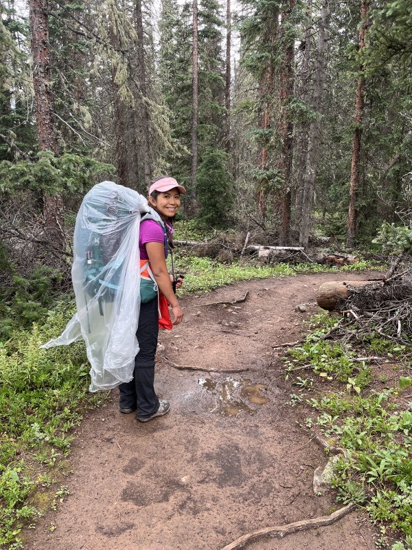
We took a breather once we were both in the amphitheater at the bottom of the saddle, and the rain picked up and it was a steady drizzle for a few minutes. We had brought a large plastic sheet to cover up any packs or gear that needed to be protected, and it worked pretty well. The hike out of the amphitheater and through the boulderfield back towards the center of the valley was easy and went by in a flash. The storm we were worried about rolling through turned out to be a rain shower and disintegrated within a few minutes - lucky for sure. By the time we got back to the creek crossing, we were in our short sleeves and sweating profusely in the beating sunshine. 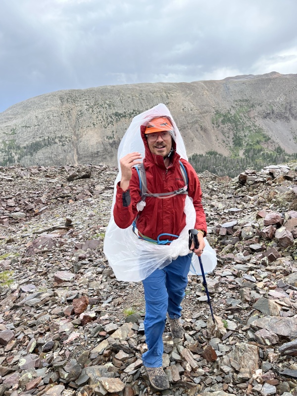
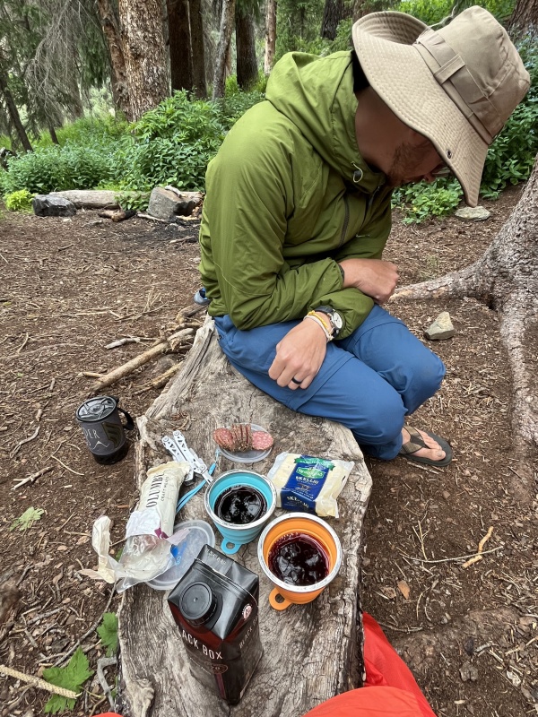
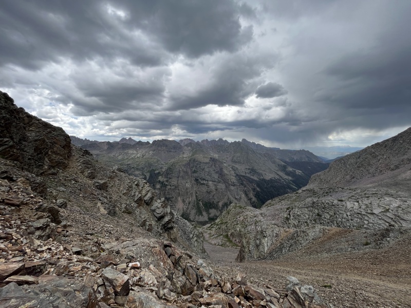
After we got back to camp we cleaned up in the creek, made something to eat, and shared some wine before calling it a day and hitting the sack. I was super glad that we had a successful climb, that we both were safe, and Apple and I both fell asleep at 7:30pm and didn't get out of bed until after 8:00am the next morning. Other Activity in Vestal Basin (And a Serious Note)On Friday, July 22 while we were climbing Vestal Peak, we saw a helicopter make repeated passes up and down the length of Vestal basin over the course of the day - enough times that we assumed that SAR must have been conducting a training operation because it was so meticulous and repetitious. On our descent of Vestal's south face early in the afternoon, Apple and I saw a helicopter fly within a few hundred feet of us heading west in Tenmile Creek, and even gave them a single wave to let them know we were moving and that we saw them. The next day, July 23, we hiked to the top of the basin to the foot of Trinity Peak to have lunch at the unnamed lake there. We spent a few hours on the way leisurely enjoying the scenery and snapping photos, and working out the stiff muscles we had from the last few days of hiking and climbing. Like the day before, we again saw a helicopter doing laps through the entire basin. We took a few videos of it circling around, and wondered what was going on. 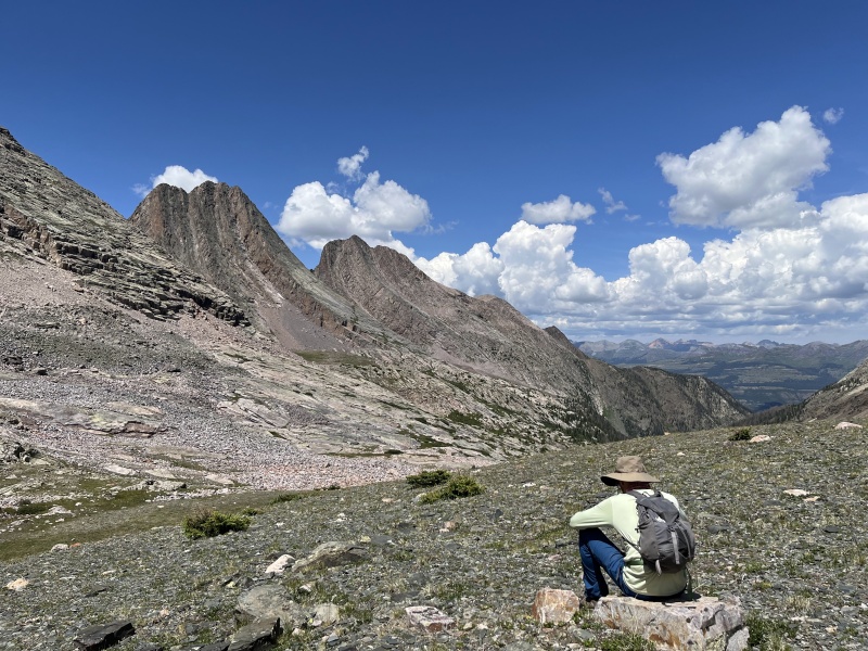
Eventually, the helicopter made an extremely low pass over us, probably within 50 feet or so, and we both gave them a wave. Our assumption at this point was that they were looking for someone injured or missing, and giving the SAR folks a simple acknowledgement without a sign of panic (something like jumping up and down, flailing arms overhead, etc), they'd understand we weren't in danger and would move away. The helicopter took another lap through the valley, and came back to our position a few minutes later, this time getting even closer and hovering over our heads. We were both kind of dumbstruck - "What in the world is going on?" This time however, the pilot opened the window and pointed with their hand several times in front of the helicopter and it finally sunk in - they wanted to park the thing, and we were in the way. Apple and I both grabbed our bags and jackets, and ran off the side of the small hill we were sitting on as quickly as we could. The helicopter came back for a final pass and eased itself down on the ground in front of us with the nose on top of the rock I was sitting on at lunch.
The pilot turned the engine off and got out to perform a few checks on the helicopter, and we walked up the slope to greet them. We asked what was going on, and she told us that there was a missing person, named Daniel (who we later found out was Daniel Lamthach), missing somewhere in the area. This was news to us, since the search had started after we had left the trailhead and no information had been shared between the people camping in the main area on Vestal Creek - no one even knew there was a missing person. The pilot said that suspicions were Daniel had climbed up the Trinities, and she had dropped off a SAR team that morning who had ascended the peak looking for him, and she was now back to pick them up and take the team back to Silverton. We told her we hadn't seen anyone matching Daniel's description, and in fact we hadn't seen a single person the entire time we had climbed Vestal the day before. She asked if we had been on the back side of the peak in the early afternoon, and we connected with each other that we had waved at them while descending the previous day - cool connection considering we didn't expect to ever actually meet the helicopter team we had seen. 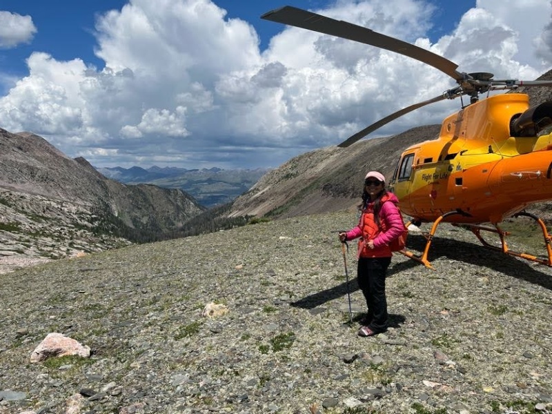
After a few minutes, we packed up and started to make our way back to camp - we'd check the area to see if there was any information we could gather to help in the search, but assumed we wouldn't find anything considering we had covered all of the trail once already on the way up, and weren't planning any other bushwacking travel or climbing the rest of our trip. Few things from this experience, as a wholly ignorant person when it comes to helicopters (I know everything I know about them from action movies and Hollywood and whatnot, and have no face to face experience dealing with them).
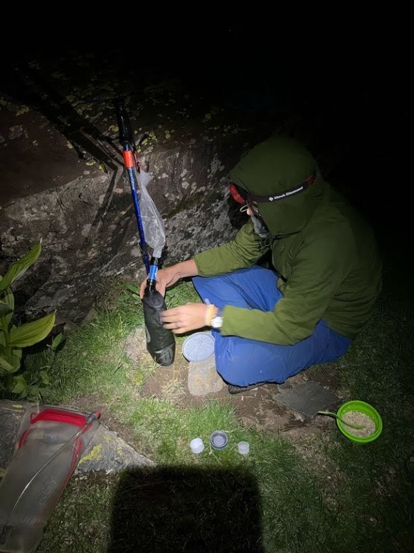
Once back in camp, we laid in our tent and enjoyed a few summer afternoon showers in the cooler weather - the bugs have been savage this entire summer, and Vestal Basin probably the worst that we've encountered. We made dinner and had a few drinks in the tent to avoid getting any more bites, playing a few games of dice and then domino before finally turning in, with plans to get up around 6:00am on Sunday, and head back towards the car after breakfast and coffee. A Long March Back to CivilizationAfter eating, filtering some water, and packing everything up, we said our last goodbyes to Vestal Basin and began the hike towards Molas Pass. We weren't looking forward to the ascent back up from the Animas, but we had all day to get it done, with no agenda afterwards other than getting a steak dinner in Durango whenever we made it back to civilization. The hike back down to Elk Creek was tedious and annoying, and we were glad to be back on a well-built and even trail when we made it. We stomped our way down to the Animas in a few hours and took a break underneath the bridge to get a bite to eat and soak our feet in the river for a few minutes. While we were relaxing, I heard the train coming in from Durango, and jumped up and ran to the trail junction to catch a glimpse of it.
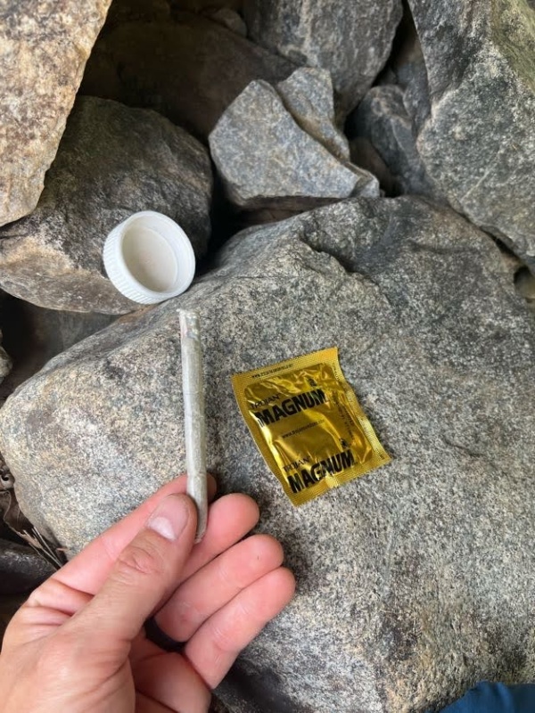
We celebrated our good luck of catching a shot of the train by eating one more package of beef jerkey and candy. We put on our boots and wrapped our packs in plastic before continuing on up the trail in the light, but pretty refreshing, rainfall. We also found a love letter stashed, location redacted, with some interesting contents. I hope there's a 14ers Missed Connections post coming to make sure these free souls meet again in the future. 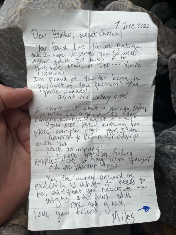

We pounded out the last few miles to the car, and were pretty beat on the way - we thought with the smaller elevation gain back to Molas we'd make great time, but we were tired from the activities over the last few days, and the trip had taken its toll. We got back to the car, plopped down on camp chairs in the parking lot, and proceeded to eat an entire bag of potato chips and a bag of grapes before we could be convinced to move. We eventually drove into Durango and had an awesome NY strip and a ribeye at 636 Main Ave. Highly recommended. 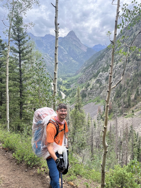
Thoughts on Wham RidgeRock Climbing Shoes - I think you could take or leave these, depending on your comfort level. I took a pair of super loose Sportiva Mythos and wore them for the majority of the day with no problems, but I would have balked at the idea of any kind of aggressive shoe meant for serious terrain. If you're competent scrambling in your boots or trail runners, I think you'd be fine leaving them at home. But I liked having mine. Simul Climbing - I think if you're comfortable with exposure and competent at the grade, a large portion of this route is fine for simul. I encountered a few very obvious loose rocks when travelling across choss benches and outcroppings, but otherwise all of the rock, especially at crux locations where it matters, is solid. I don't know if that's an innate quality of the rock in the area or if Wham has been climbed enough to be cleaned. I thought it was pretty delightful. Apple is not comfortable with a lot of exposure, and we pitched out 1,000 feet of climbing to keep her safe. Even at 50 or 60 meters a go, and me placing minimal gear while climbing before plugging in an anchor and her seconding, 1,000 feet is a lot of distance to cover one pitch at a time - keep that in mind if you're trying to beat the weather. Rope - If you're comfortable with slab climbing like you'd find in the Flatirons, I think you'll be pretty at home on Wham. With that being said, there were still several sections that I wouldn't trust my life to a casual slip of the foot or hand. Nearly any unroped fall on Wham would result in a fatality, and the few sections of honest class 5 climbing should probably involve some protection even for those comfortable at the grade. But don't let my advice get in the way of a good epic story - I'm just some guy on the internet who likes to drink beer and then sleep in my bed at the end of an outdoor trip, and I'm terrified at the idea of eating my meals out of a straw for the rest of my days, or having a serious brain or spinal injury... or worse. Such cowardice. Rack - I don't know, I just took stuff that I read about from other trip reports. I was never want for some magical perfect piece that I didn't have available. The route is pretty gear friendly, stances are solid and comfortable. Wham Ridge is something like a 5.4 if you're reading route descriptions, and I think this is probably pretty close to reality. It's not El Capitan or the Rupal Face. One set of nuts, Camalots 1, 2 and 3, and Hexentrics 9 and 10. More than enough. Skillset and Preparation - I had a really fun time on this trip, and if you're anywhere competent enough to do it, I'd recommend it for sure. You need to be able to backpack, camp, scramble, climb easy trad, and routefind. I wouldn't say this route should be underestimated or considered easy - the remoteness makes it somewhat of a serious endeavor, as evidenced by someone going missing in the area while we were there. But if you have the requisite skills and experience, I think it's a great objective and an absolutely worthwhile route to spend the time on. Thanks for reading - see you in the hills. Thumbnails for uploaded photos (click to open slideshow): ")
")
")
")
")
")
")
")
")
")
")
")
")
")
")
")
")
")
")
")
")
")
")
")
")
")
")
")
")
")
")
")
")
")
")
")
")
")
")
|
| Comments or Questions | ||||||||||||
|---|---|---|---|---|---|---|---|---|---|---|---|---|
|
Caution: The information contained in this report may not be accurate and should not be the only resource used in preparation for your climb. Failure to have the necessary experience, physical conditioning, supplies or equipment can result in injury or death. 14ers.com and the author(s) of this report provide no warranties, either express or implied, that the information provided is accurate or reliable. By using the information provided, you agree to indemnify and hold harmless 14ers.com and the report author(s) with respect to any claims and demands against them, including any attorney fees and expenses. Please read the 14ers.com Safety and Disclaimer pages for more information.
Please respect private property: 14ers.com supports the rights of private landowners to determine how and by whom their land will be used. In Colorado, it is your responsibility to determine if land is private and to obtain the appropriate permission before entering the property.


