| Report Type | Full |
| Peak(s) |
Santis 8200 |
| Date Posted | 07/25/2022 |
| Date Climbed | 06/29/2022 |
| Author | 434stonemill |
| Santis and the Switzerland Whiskytrek |
|---|
|
I generally don’t write trip reports, in fact I have only written one many years ago on my experience hiking the Schilthorn. The reason I don't write any reports is I rarely do anything that hasn’t been written up 30 times or more on this forum. I wrote the Schilthorn trip report, not because it was some epic adventure, but because it was something different that maybe someone would find enjoyable. Now I am back with my second trip report, again from a trek in Switzerland, on something different and maybe a few folks will find it enjoyable or get an idea. My climb up Säntis. Säntis is located in the northeastern part of Switzerland, in the Alpstein range. This range in the Appenzell region is underrated. It doesn’t have the altitude (Säntis tops out at only 8200 feet),or a string of large mountains (Säntis and Altmann are about it), or the glaciers of the Alps in the southern region of Switzerland. I don’t think it draws tourists like the Interlaken region of Switzerland or Zermatt. Heck, I think even the Swiss look down on this area. But it makes up for it with verticality and sheer beauty. I initially had “discovered” this area in a Trail Runner article 7 years ago. It stuck with me as a cool way to do a big trail run. Just run from mountain inn to mountain inn, thus being able to pack light. After doing some research before this trip I found an added plus: Whiskey. Appenzell, while more famous for its cheese, also makes a world class whiskey. The brewery in Appenzell distills a whiskey, ages it and then finishes it in a variety of different barrels at many of the mountain inns in the region. With the different barrels and different altitudes and climates of each inn, each inn serves a unique whiskey to taste. You can also buy a bottle and collect them all (whiskytreck.ch). I was planning a trip to Europe this summer with a friend and the main impetus was seeing Pearl Jam in Berlin. We would also spend time in Prague and Munich before going to Zurich. While looking at a map, I realized the train from Munich to Zurich would go right by the Appenzell region. I remembered the article and knew we had to make this happen. The whiskey thing was just icing on the cake. 
The plan: Take a train from Munich to Appenzell arriving on a Monday. Stay in Appenzell Monday night. Leave most of our luggage at the hotel we stayed at and packing relatively light head out for a 3 day/2 night hike staying at 2 different mountain inns. Then arrive back in Appenzell and stay Thursday night at the same hotel. I used my Endicott 45L backpack that I generally use as a day pack while hiking in Colorado. My friend had a slightly larger pack (guessing 55L). This would be a hike rather than a run for a few reasons, the biggest was when I was planning this trip I was not in shape for a run of this type and didn’t want that hovering over the trip. Appenzell is a relatively small village. Everything is within a 10 minute walk of center town square. (The town square hosts the only remaining in person voting in Switzerland. Everyone in the canton shows up once a year to vote by hand on issues.) We had a great dinner on Monday evening at our hotel, Gasthaus Hof. We went to bed Monday night to rain and thunder, but that ended by Tuesday morning. 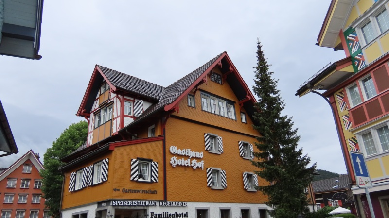
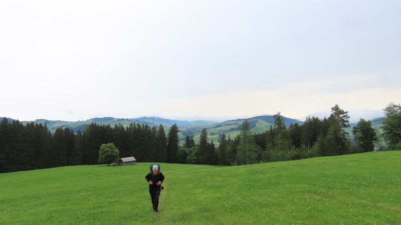
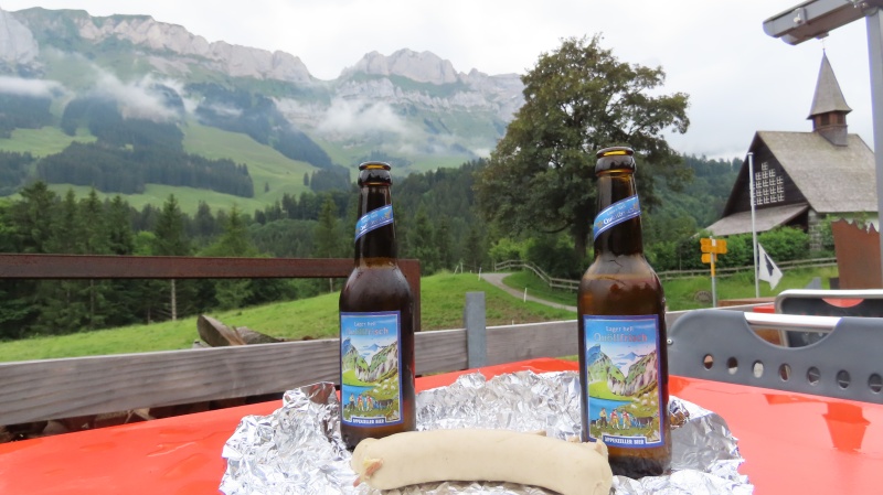
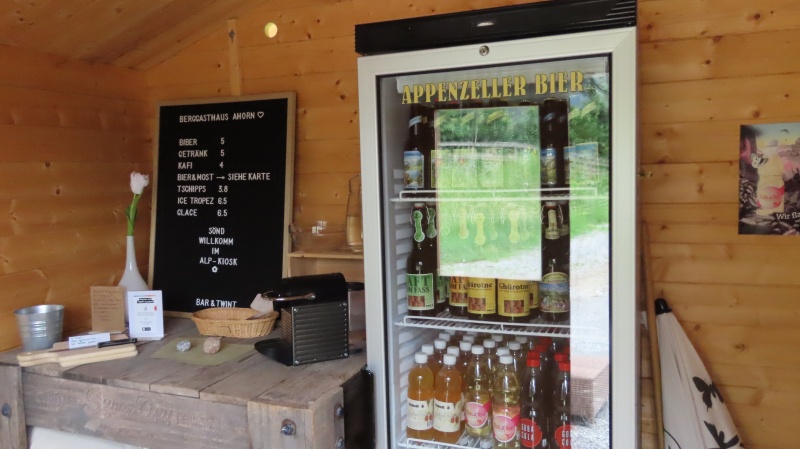
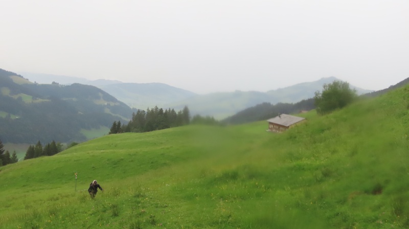
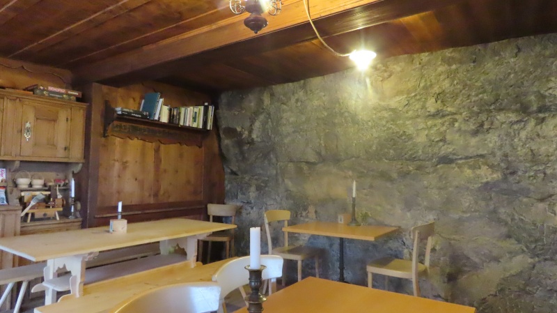
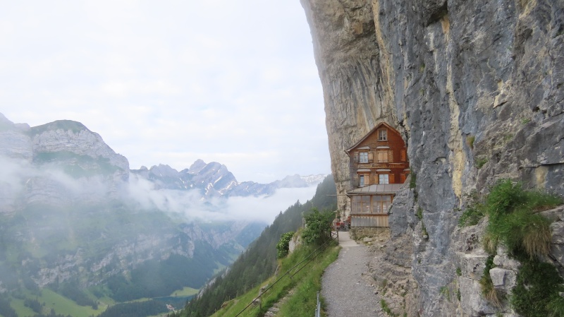
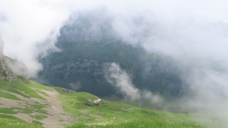
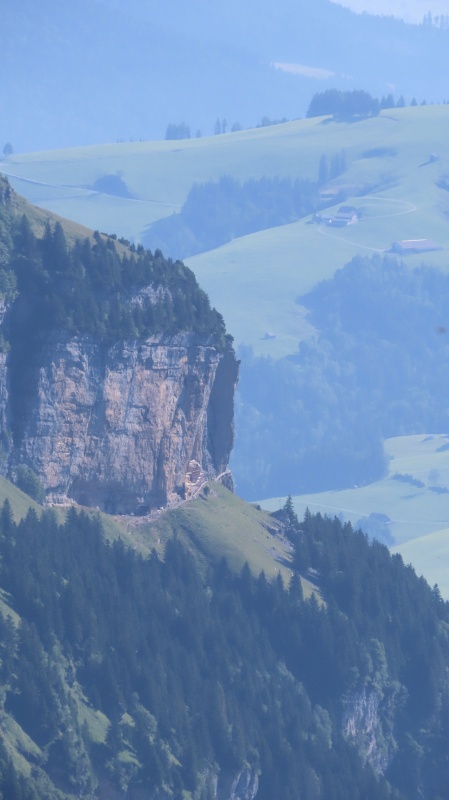
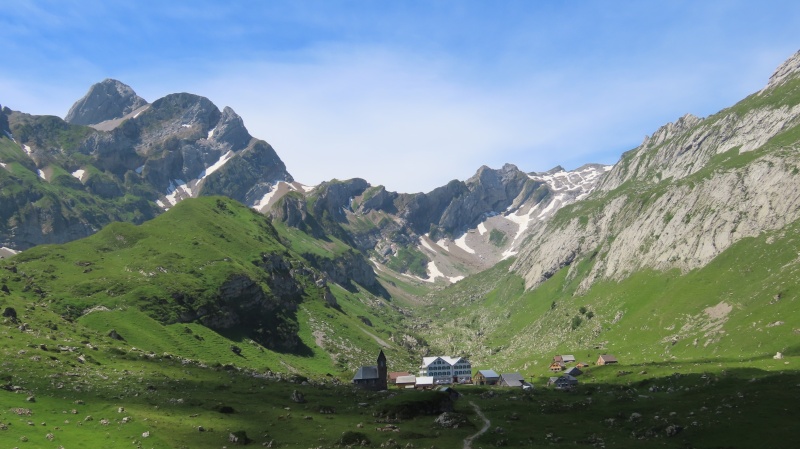
There were overcast skies but no rain. The first day’s hike was planned out to be around 10 miles and would take us through cow pastures for most of the day before finally climbing up to the ridgeline. We would pass by 5 mountain inns before arriving at our final destination for the night. The area has so many trails and inns, it really is like a choose your own adventure book. Unfortunately many inns are closed on Mondays & Tuesdays, so the first few we went by were closed. But that didn’t mean they weren’t useful. Berggasthaus Ahorn had a self-service, on your honor kiosk, that had snacks and a beer cooler. Won’t find that in too many places in Colorado. We lunched on the deck at Ahorn, enjoying the beer, sausage left over from last night's dinner, and of course, cheese & chocolate. This was a great pick me up in the middle of the day. The closed inns also meant we didn’t see a single hiker all day. The only folks we saw before reaching Berggasthaus Ebenalp near the end of the day, were a few farmers working in the fields. The overcast skies continued all day long, with clouds rolling in and out of the valleys. After a long day, we were happy to arrive at Berggasthaus Aescher-Wildkirchli. You may have seen pictures of this place. It's been featured in many magazines and travel shows. It is perched right along the cliff face, with the one wall of the inn actually being the mountain. Warmly greeted, we enjoyed beer, whiskey, an excellent dinner, scrumptious apple tart dessert and post dinner digestif. With the clouds around us, our view was a bit limited. Day 1: Roughly 10 miles. 9 hour day with roughly 7 hours of hiking time. 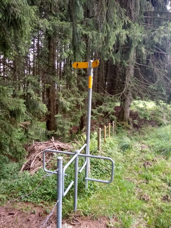
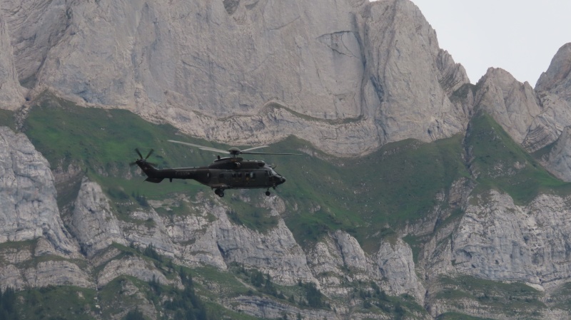
helicopter that buzzed us while we had lunch at Ahorn. 
We would stop for whiskey at Schafler on Day 2 and of course summit Santis on Day 2 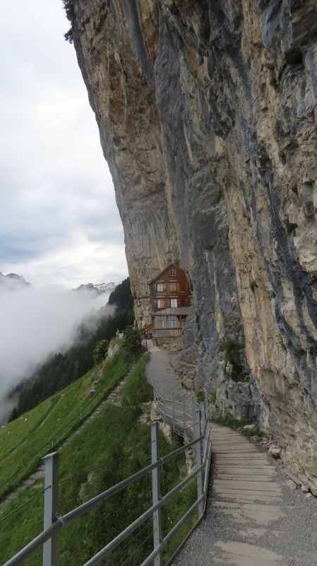
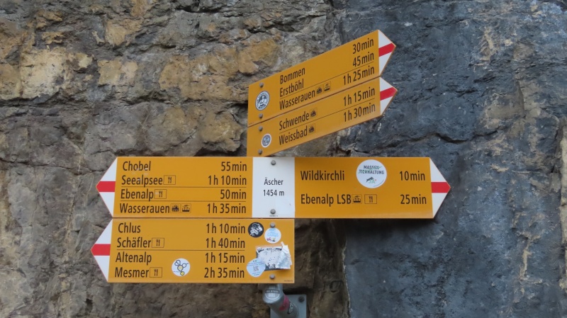
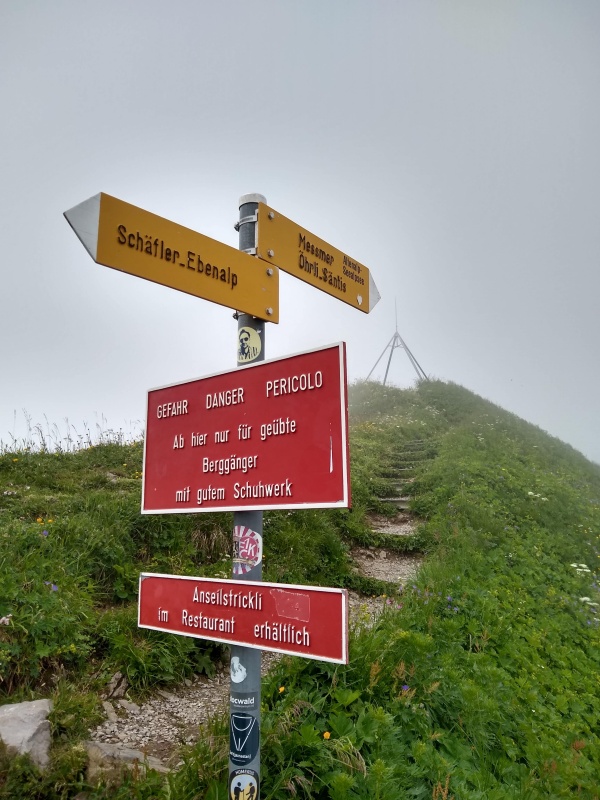
On Wednesday, we woke to a bit of a break in the clouds and could see our final destination for that day, Berggasthaus Rotsteinpass, way up on the ridgeline between Säntis and Altmann. Of course, we would have to climb Säntis first. After a lovely breakfast of cheese, meats, and fresh yogurt, seriously all hiking trips should be like this, we got on the trail. The clouds again rolled in and out all day long, and for the most part obscured our view of Säntis. The first hour to Berggasthaus Schäfler was easy going. This would be our third whiskey stop (we had been able to get a whiskey at Ebenalp before arriving at Aescher). From here the fun began. Up until this point, most of the hiking had been easy going, and even the sustained vertical parts were on trails through the woods. We began to get a taste of what we would deal with for the rest of the day. The Swiss do like to make hard things accessible, with steel cabling and stairs. I had encountered that on the Schilthorn. Soon after leaving Schäfler we encountered our first set of stairs and some cabling. As the day progressed, we went through sections of cabling with exposure, sections of rock scrambling, and sections of good singletrack trail. The one thing I didn’t have to worry about was route finding. Everything is well marked. Trail intersections all have signage with time to waypoint, not distance. Something I have loved since doing Schilthorn. It is amazingly accurate. The rocky sections were well marked, much like the route on Longs Peak passed the Keyhole. 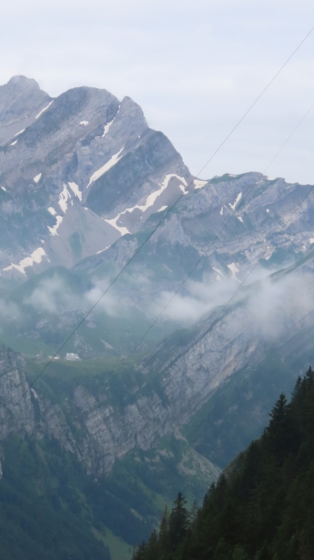
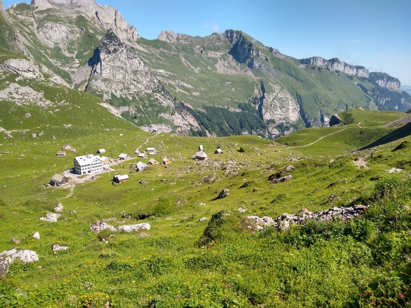
the little blip of a building. That is Berggasthaus Rotsteinpass. Our destination for day 2. 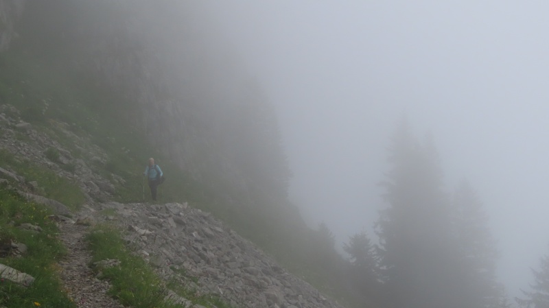
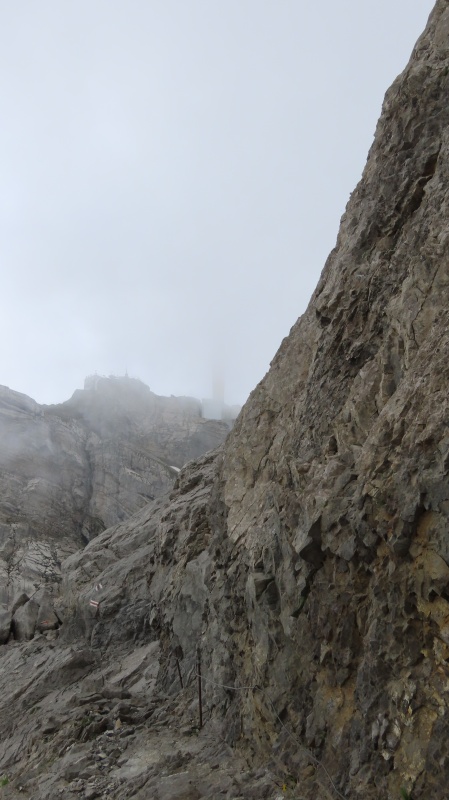
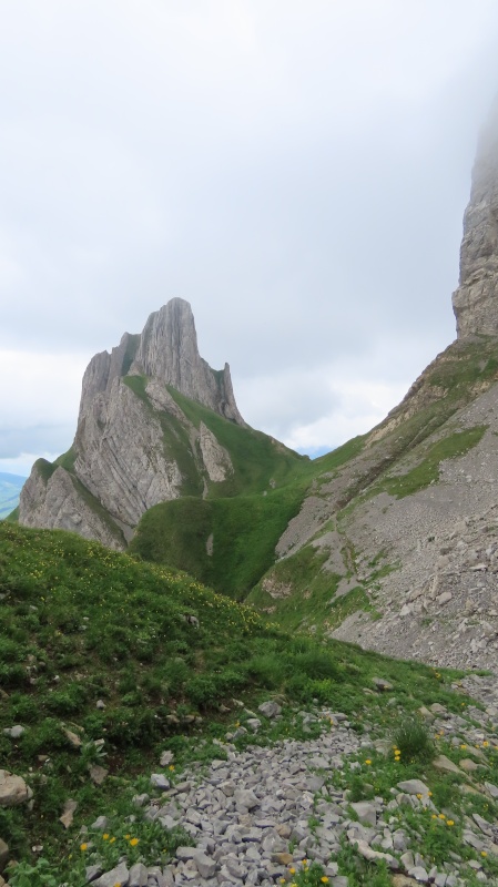
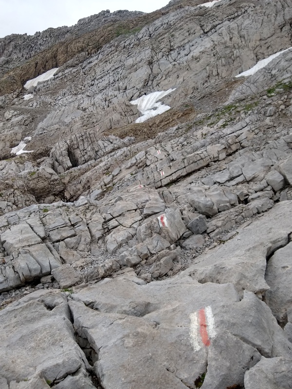
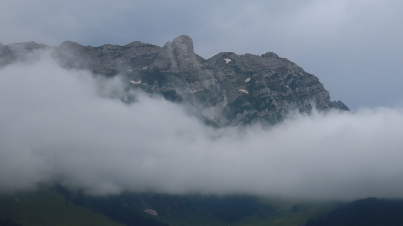
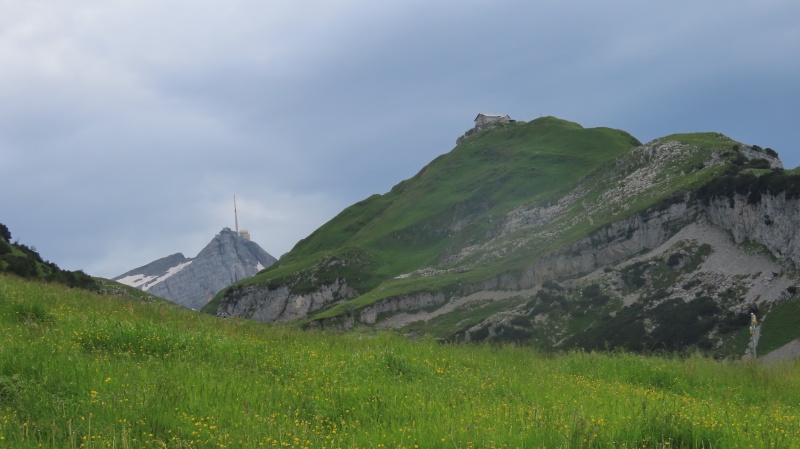
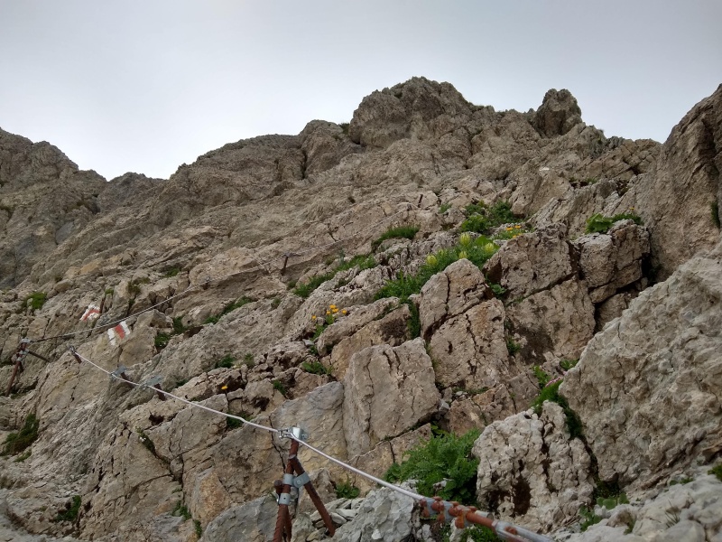
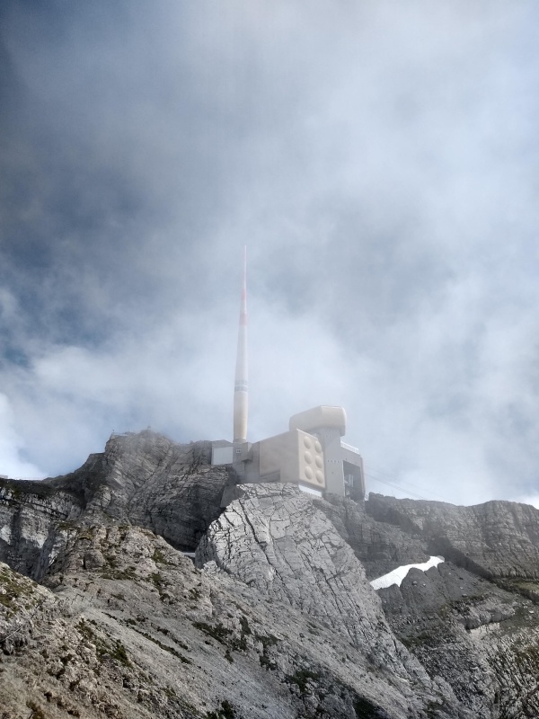
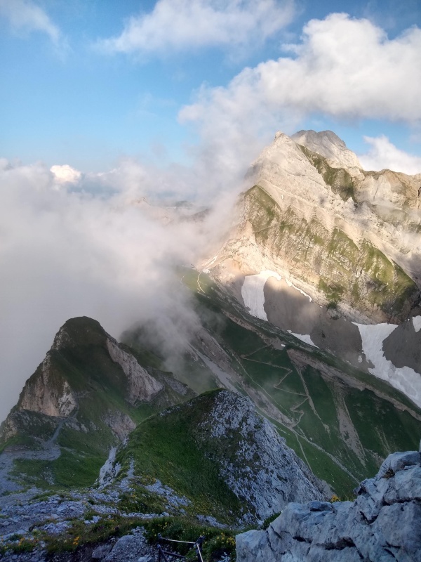
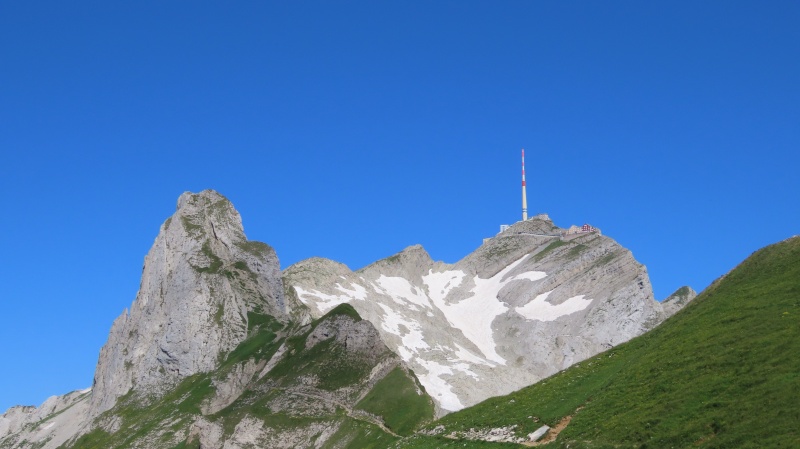
There were a few sustained steep climbs up to saddles along the ridge. One of those steep climbs brought us into the cirque below the summit of Säntis. The Swiss love to build things in hard places. Säntis is no exception. There is a large complex on the top of the peak that is accessible by cable car. The complex contains a restaurant, museum, and large antenna, for what I assume are meteorological purposes. Along with the large complex, the older, original mountain inn still exists, just below the larger complex. With the clouds rolling through, we had been unable to see the peak and the antenna for most of the day, but now it began to peak through and loom above us. In the cirque, we also had to deal with the first snowfield of the day. Arriving in the afternoon meant it was softening up. The trail initially traversed across the snowfield, which wasn’t bad, as it was fairly level and a distinct path had been established across it. After 100 yards or so, the trail turned straight up the snowfield into a gulley before exiting out onto some rocks. A rope that was tied off somewhere above in the rocks, lied down along the snow that you could hold as you climbed up. A Swiss family of 5, with all the kids under 10 years old, had passed us by a while back and thus must have gone up this, so surely it would be okay. Still it seemed a bit sketchy. My friend is not a big fan of exposure, and so we had moved slowly throughout the day in the sections with cabling. Still she never stopped, just moved gingerly through those spots. This part was testing her limits and even mine a bit. Since the snow was soft, I could kick step in the snow, so there were would be steps up the gully for her, and give me a greater sense of stability. With the kick steps, the rope, and along with our trekking poles, I felt pretty secure. Up until the exit off the snowfield out of the gully and into the rocks. The snow was thinning out here and a snow bridge between two boulders looked thin. I ended up breaking through and slipping down a few feet between the two boulders. Nothing serious, as I was anticipating it might happen as I stepped there, but I did end up breaking one of my trekking poles. After my friend helped extract me out of the little hole I was in, we got out of the gulley and into the real meat of the climb. There was more cabling, but here there also were small metal plates drilled into the rock, to use as steps. This small climb of 30-40 vertical feet led to a narrow ridge and then the big final climb to the top. I don’t know the angle of the rock face below the summit, but it seemed similar to say the second Flatiron. Here again there were metal plates drilled into the rock along with steel cables on both sides to hold onto. It climbs about 200 vertical feet to the base of the complex on the peak. With the steps (even though they are a bit haphazard) and especially with the cables to hold onto, this is fairly safe, but the exposure can make you feel a bit unsettled. I had been dealing with a bit of a head cold since arriving in Appenzell and felt a little bit fatigued going into the hike. After dealing with the snow, that section up the rock face to the summit really wiped me out. My friend was drained from the mental aspect of dealing with the exposure. We were happy to get to the top, without rain, but still had an hour and half of hiking before getting to our destination for the night. We were tired. We needed a whiskey. The restaurant in the complex was closed, so we headed to the older inn, Berggasthaus Säntis. This was a great call, as it was much more homey than the fancy restaurant. Here we were again warmly welcomed as we collapsed down at a table. The whiskey tasted soooo good. Well earned. We had a few snacks and rested for an hour before continuing on. 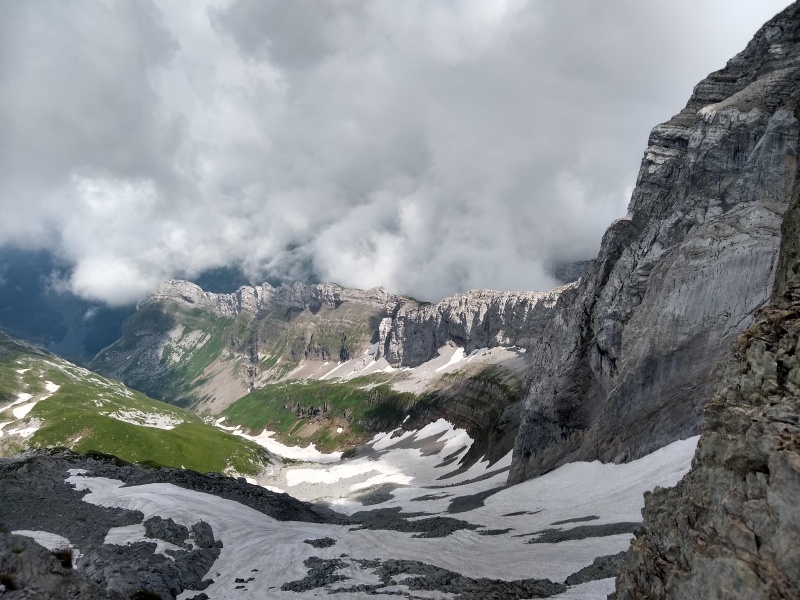
taunting us for hours as we hiked to it. Note the rock face below the peak (center of picture). We would ascend that face. 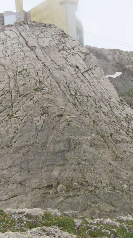
Those were small metal plates drilled into the rock to use as steps. And it wouldn’t necessarily get easier. We had to descend along the Lisengrat Ridge to get to Rotsteinpass. This included 3 more snowfields, but they were much shorter and tamer. But the exposure here in some places was significant, a bit like the ledges on Longs. But again there is steel cabling running along the rock face to hold onto. There were more stairs, metal plates, and in some places just pegs. With the clouds rolling in and out, we never got a sense of how much further we had to go, until near the end. A break in the clouds unveiled the inn, maybe a half mile away. There was much rejoicing (Yeahhh). We rolled in just in time to have a beer before dinner. They served a much simpler dinner here, but it was just what we needed after a very long day. It hit the spot. They also supplied crocs so you wouldn't walk around the inn in your hiking boots. This was a nice touch and I was very grateful as I hadn't packed my sandals. It felt good to get out of the boots and let the feet breathe. Day 2: Roughly 8 miles. 10.5 hour day with roughly 8 hours of hiking time. 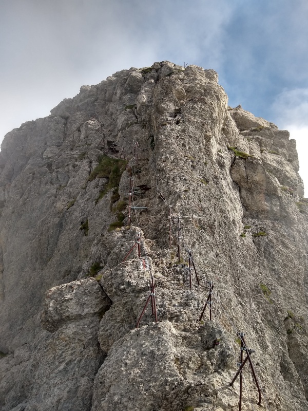
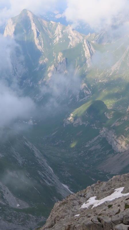
saddle (center of picture) peaking through the clouds. 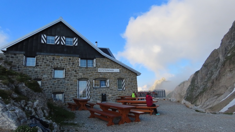
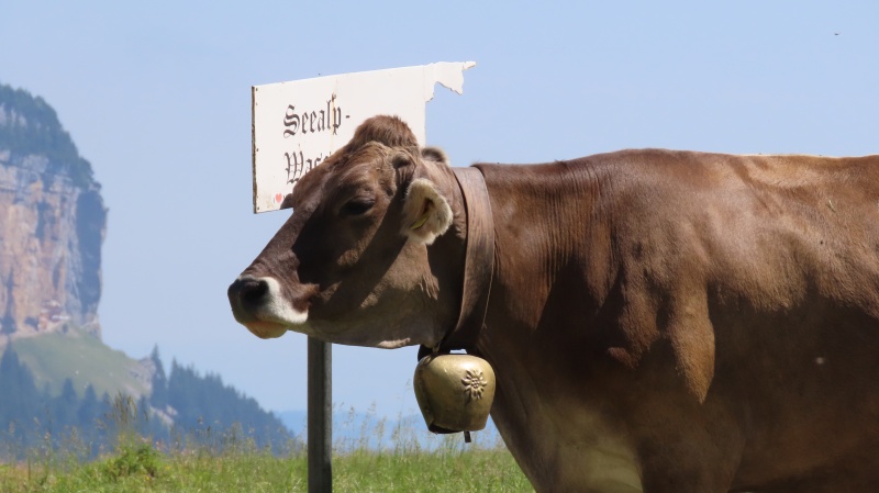
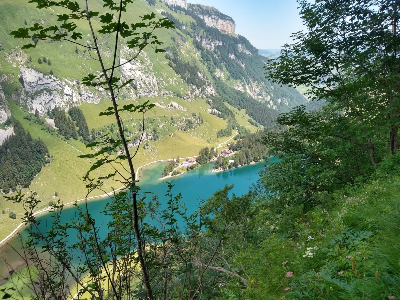
Thursday brought bluebird skies. Not to say the scenery hadn’t been amazing before today, but the view out our window was absolutely stunning. We had climbed 4000 vertical feet on day one and another 4000 feet on day two. Day 3 would be descending all that. After a simple but very satisfying breakfast, we headed out. There would be no exposure today. No mental thinking. Just head downhill on a safe trail. It was definitely warmer and we saw more folks today, as we first descended to Berggasthaus Meglisalp. Enjoyed a beer here with the folks hiking up, along with the cows milling around. Then we continued descending to Seealpsee, a lake in the valley below Säntis. Stopped at Berggasthause Seealpsee and enjoyed a whiskey on their deck overlooking the lake. At Seealpsee we came to a decision. My initial plan was to hike the complete 30ish mile loop I had mapped out, starting and ending in Appenzell. But there was the option to cut off the last 3 miles of day 3’s planned route and take a train back to Appenzell. I was feeling fatigued and wasn’t really looking forward to that last 3 miles. It just didn’t hold much enticement, which is weird as it would be way more beautiful than many of the final miles of Colorado hikes that feel like slogs. But it couldn’t compare to what we had done. My friend was dealing with cramping in her legs from all the descending. So we decided in Seealpsee to just do the last 1.5 miles to Wasserauen and take the train. Leaving Seealpsee, I am glad we had already made the call, because weirdly the worst part of the descent was here, a mile on an asphalt road with steep gradient. We had already descended 3300 feet over 5.5 miles and this 700 feet of descent in a mile, on asphalt, finished off our legs. It reminded me a bit of Pike’s Peak Marathon. The worst part of the descent in that race is Ruxton Ave and coming down that road after getting through the W’s was my worst feeling in that race. But one last whiskey awaited us. The Hotel Alpenrose is situated right by the train station. And as a late afternoon rain shower rolled in, we enjoyed the last whiskey of the hike. Day 3: Roughly 7.5 miles. 5.5 hour day with 4 hours of hiking. 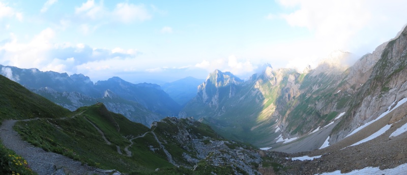
And the Lisengrat ridge which we descended along to reach Rotsteinpass. 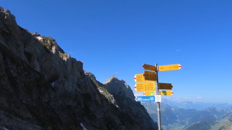
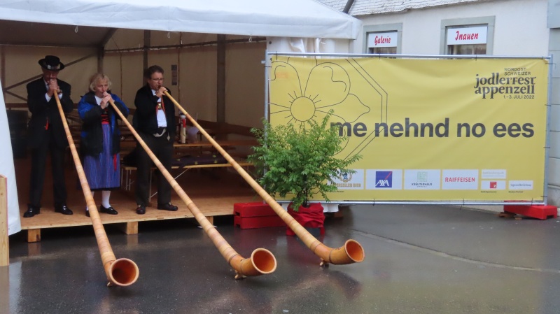
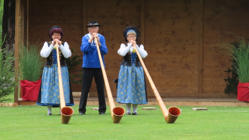
We hopped on the train to Appenzell, made the short walk from the train station to Gasthaus Hof, checked back in and enjoyed our showers before heading out for some beers. The village, which had been pretty quiet on Monday & Tuesday, was now filled with activity as the Northeast Switzerland Jodlerfest was scheduled to start on Friday. As we left on Friday, the village was filling up with folks in traditional Swiss garb. We did get a chance to see/hear some of the alphorn competitions before heading to Zurich. 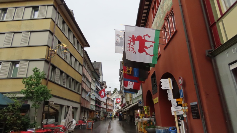

The whole experience was amazing. The mountain inns make for a totally different experience. And each inn has its own vibe and feel. The beauty of the Swiss mountains is just a whole different experience (except for wildflowers. Maybe we were a week or two early, and the flowers weren’t in their true glory, but as nice as they were, Colorado wildflowers can’t be beat). For anyone comfortable doing the easier Colorado 14ers, it is a very accessible adventure that you won’t forget. I would classify the trail and climb up to Säntis from Schäfler and then the descent on the Lisengrat Ridge to Rotsteinpass as class 3. The terrain is similiar to Long’s Peak. While it had narrow sections with exposure like the Narrows on Long’s, the cabling definitely made it more doable. Even my friend, who struggles with exposure like that and will freeze up, was able to complete this loop. Now it may have been a little slower and with a higher heart rate at times, but the ability to be able to hold onto something, allowed her to push through that mental barrier. Without the aids of stairs, metal plates and steel cables, it would probably be a hard class 3, with the one caveat of not knowing how to rank that final scramble up to the peak of Säntis. 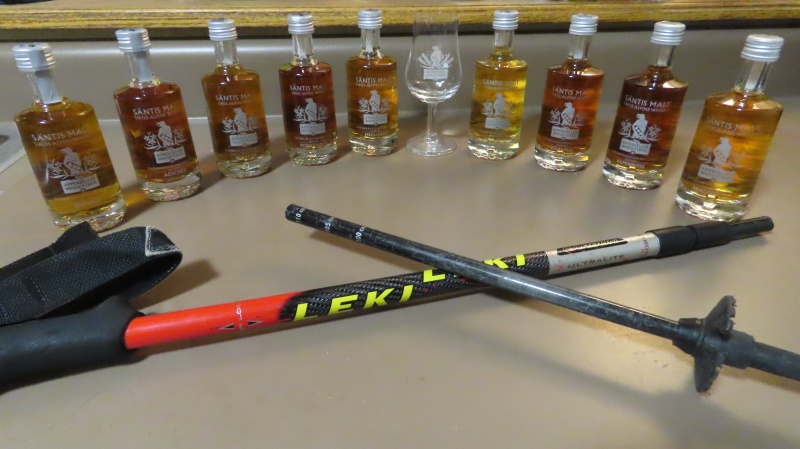
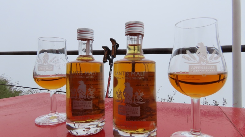
a variety of Santis Malt Whiskey.. Complete set of pictures from the three days can be found here: https://photos.app.goo.gl/fVk5XEtBxV2dXt4K6 Here is GPX track for day 2. (I can only upload one track). My watch had bit of an issue finding the right signal when we started. I am guessing its because we were on the side of a cliff face ;) Anyway it picks up the correct track as we got closer to Schäfler. Thumbnails for uploaded photos (click to open slideshow): ")
")
")
")
")
")
")
")
")
")
")
")
")
")
")
")
")
")
")
")
")
")
")
")
")
")
")
")
")
")
")
")
")
")
")
")
")
")
")
")
")
")
")
")
|
| Comments or Questions | ||||||
|---|---|---|---|---|---|---|
|
Caution: The information contained in this report may not be accurate and should not be the only resource used in preparation for your climb. Failure to have the necessary experience, physical conditioning, supplies or equipment can result in injury or death. 14ers.com and the author(s) of this report provide no warranties, either express or implied, that the information provided is accurate or reliable. By using the information provided, you agree to indemnify and hold harmless 14ers.com and the report author(s) with respect to any claims and demands against them, including any attorney fees and expenses. Please read the 14ers.com Safety and Disclaimer pages for more information.
Please respect private property: 14ers.com supports the rights of private landowners to determine how and by whom their land will be used. In Colorado, it is your responsibility to determine if land is private and to obtain the appropriate permission before entering the property.


