Download Agreement, Release, and Acknowledgement of Risk:
You (the person requesting this file download) fully understand mountain climbing ("Activity") involves risks and dangers of serious bodily injury, including permanent disability, paralysis, and death ("Risks") and you fully accept and assume all such risks and all responsibility for losses, costs, and damages you incur as a result of your participation in this Activity.
You acknowledge that information in the file you have chosen to download may not be accurate and may contain errors. You agree to assume all risks when using this information and agree to release and discharge 14ers.com, 14ers Inc. and the author(s) of such information (collectively, the "Released Parties").
You hereby discharge the Released Parties from all damages, actions, claims and liabilities of any nature, specifically including, but not limited to, damages, actions, claims and liabilities arising from or related to the negligence of the Released Parties. You further agree to indemnify, hold harmless and defend 14ers.com, 14ers Inc. and each of the other Released Parties from and against any loss, damage, liability and expense, including costs and attorney fees, incurred by 14ers.com, 14ers Inc. or any of the other Released Parties as a result of you using information provided on the 14ers.com or 14ers Inc. websites.
You have read this agreement, fully understand its terms and intend it to be a complete and unconditional release of all liability to the greatest extent allowed by law and agree that if any portion of this agreement is held to be invalid the balance, notwithstanding, shall continue in full force and effect.
By clicking "OK" you agree to these terms. If you DO NOT agree, click "Cancel"...
This is day 3 and 4 of a 4 day trip (day 1 + 2 here), but shows a bit on what it's like to scramble up Gash Ridge. I found this route exceptional - if it wasn't so hard to descend from, it would be a total classic. Being hard to finish where you started, it stays somewhat obscure although completely obvious.
I managed to loop it in a somewhat strange way by starting from Lake Como, and (yadda yadda) summiting California Peak, then dropping into the east side of the range by Lost Lake. From this subsidiary ridgeline off California to Lost Lake, the terrain is steep and loose but I guess doable (0 stars). See the GPX track embedded for some ideas.
I had in the past taken the "Class 4 sneak" off of the Blanca/Hamilton saddle to get to Lindsey when starting from Lake Como and the experience left me wanting - I don't suggest that route for anyone - really loose steep (and imo dangerous) gulley, then a real hike around the Winchell Lakes to get close to Lindsey. Plus, as I write, it's off-limits.
On that trip, I then ascended California Peak in a more direct manner (also don't suggest my line - seemed steeper than it needed to be). I've documented this in my Fastpacks from Hell, Sierra Blanca post.
Also having linked Blanca with Ellingwood Peak, there is a pitch on the north facing ridgeline off of Ellingwood that would more difficult (imo) than anything you'll find on Gash Ridge, so taking the ridge from Blanca down to California is also not an easy day (in case there are those trying to link up all the Centennials in the area).
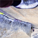
I found the quality of the rock on Gash quite good for the alpine and the scrambling fairly reasonable. I am a climber of reasonable technical level, so your experience may be different if you're not used to ledge-y steep terrain or slabby... slabs. Do be aware that Vaughn Fetzer lost his life on or near Gash Ridge a few months after I had visited the area.
My GPS Tracks on Google Maps (made from a .GPX file upload):
Fantastic route - way to go! Gash is such a striking line, especially when viewed from Lindsey. Way, WAY exposed too.
Caution: The information contained in this report may not be accurate and should not be the only resource used in preparation for your climb. Failure to have the necessary experience, physical conditioning, supplies or equipment can result in injury or death. 14ers.com and the author(s) of this report provide no warranties, either express or implied, that the information provided is accurate or reliable. By using the information provided, you agree to indemnify and hold harmless 14ers.com and the report author(s) with respect to any claims and demands against them, including any attorney fees and expenses. Please read the 14ers.com Safety and Disclaimer pages for more information.
Please respect private property: 14ers.com supports the rights of private landowners to determine how and by whom their land will be used. In Colorado, it is your responsibility to determine if land is private and to obtain the appropriate permission before entering the property.