| Report Type | Full |
| Peak(s) |
Pomeroy Mountain - 13,164 feet Unnamed 13082 - 13,082 feet Sewanee Peak - 13,139 feet Unnamed 13150 - 13,150 feet Monumental Peak - 13,375 feet "Van Wit" - 13,244 feet Van Wirt Mountain - 13,026 feet "Hancock Peak" - 13,111 feet |
| Date Posted | 07/09/2022 |
| Modified | 07/14/2022 |
| Date Climbed | 07/09/2022 |
| Author | VeraUndertow |
| Spirit of Sewanee Scramble Park, a Monumental Day |
|---|
|
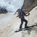
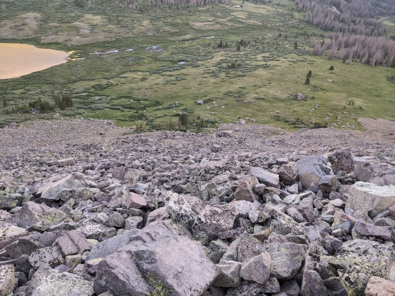
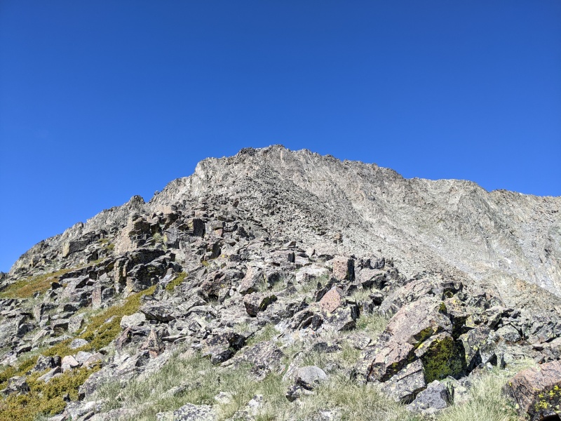
Spirit of Sewanee Scramble Park, a Monumental Day Like many of my favorite days, I wanted to do a bunch of peaks in one efficient loop. Many of the peaks in the Sawatch range have pretty straightforward class 2 talus routes, and while a lot of this day was class 2 talus, there were some interesting ridges and the "crux" of the day was unranked Sewanee peak as it presented some challenges in getting from the basin to the east/ridge to the north to it's summit efficiently. There are several options I had read about on here including a loose gully up UN13,147, of which there are plenty, or the class 4 and 5 north ridge of Sewanee which seemed like it could be fun on a smaller day when efficiency was less a priority, and I had a partner. Alternatively descending from the Pomeroy-Sewanee saddle down loose rock or tippy talus and back up to the Sewanee-UN13147 saddle on talus was a lower risk alternative, which seemed unpleasant and inefficient as well, so I am writing this to say there is a better and more direct way, which ended up being the highlight of my day. Unfortunately I am not great with remembering stuff and forgot to turn my GPS on in the morning, but the route is simple and I will explain my day as best I can with pictures. I drove up CR 295 which is mostly 2wd until Alpine Tunnel TH late at night and parked here to sleep, since the road gets much less pleasant heading up CR298 after the split and driving 4x4 roads in the dark while I'm tired is a least favorite hobby of mine. I slept really well in my truck as it was a perfect 40ish degrees for sleeping, and woke to my alarm at 5 AM. I got moving up 298 towards Hancock lake around 5:20 AM as the sky was starting to lighten up enough to illuminate the earth below. I drove about 2 miles up the road, parking half a mile before the parking area at the lake, I did this for several reasons, but mainly because I knew the first part of my route was up a steep, probably loose talus heap that connects Hancock Lake basin to the saddle between Pomeroy and Sewanee and I sometimes like to let my brain and legs get a little warm up before I get right into it. I also was hoping I would see a more obvious route up that I didn't see in photos, but that wasn't the case, so I reached the actual parking area about 10 minutes later and hiked across mostly dry, but slightly spongey tundra towards my talus slope, which is right under the end of the north ridge of Sewanee and is obvious. I found a nice spot with a small island to cross the stream as two easy steps, and reached the talus right at 6 AM. The bottom half of this slope was surprisingly stable which was unexpected and I made large switchbacks across it trying to follow natural ramps in the topography. About halfway up the rocks became smaller and less stable, this slowed my forward progress as each step had to be taken with care to avoid sending medium sized talus cascading down the slope or tipping over and potentially crushing my ankle. In about 45 minutes I made it to the top, which is not a record breaking pace by any means, but I had done it safely and that was what counted. 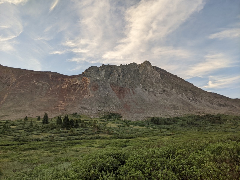
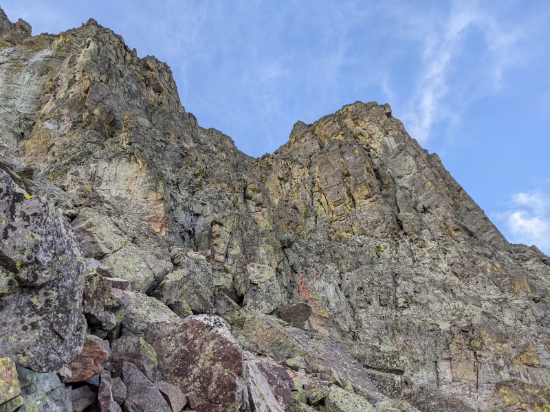
I had been eyeing the north ridge of Sewanee the whole way looking for a weakness and thought I saw a gully that had solid class 4 scrambling with less exposure than climbing ridge proper the whole way, but nothing that really called to me as "the way" so I decided to head to Pomeroy from the saddle, hoping I might see something I wanted to climb, instead of my other option which was to drop into the basin to the east and head towards Billings Lake and up UN13070 and scramble back towards the saddle via Pomeroy. The ascent of Pomeroy from here is mostly uneventful class 2 with one small tower I bypassed on the east, but as I went the views of the north face of UN13147 called me to come back and ski one of the couloirs, and the east ridge of Sewanee looked more and more tempting as a route up to the summit. But first, I had reached the summit of Pomeroy, and the ridge to UN13070 was looking pretty fun! 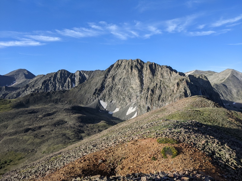
The ridge turns from class 2 to class 3 pretty quickly, I found all the towers that make up the ridge pretty easy to keep at class 3 by staying slightly right or left of termination of the tower, where as if you climb the nose it would easily get into some class 4, which might be really fun if heading the opposite direction and climbing up instead of down. Once I reached the low point in the saddle the good scrambling bits were basically over and I just had to finish ascending more class 2 talus up to the summit of UN13070, which went quickly and I reached the summit around 8:15 AM, and took a few pictures. 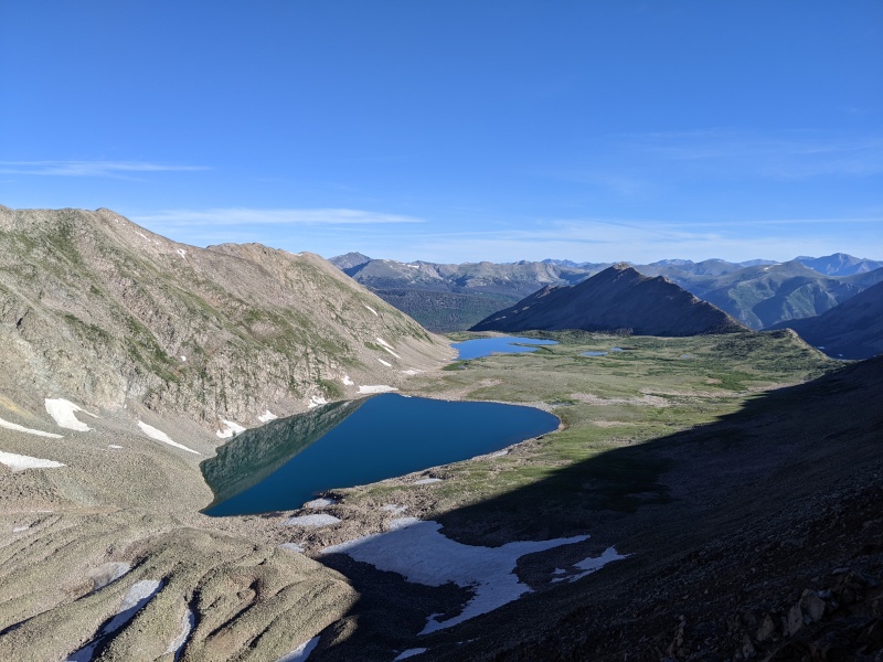
From here I headed further east, despite being the opposite direction of where I was headed, since there is a trail down towards Billings Lake that looked way nicer than any other descent option, other than reversing my route back over Pomeroy. About 2/3rd the way down the steepest part of the slope there appeared to be a slightly grassy ramp heading west that would take me below most of the talus and keep me above the willows so I could walk across the basin to the east ridge of Sewanee. This walk was mostly uneventful, filled with beautiful wildflowers and a few random mostly filled in mine pits on the way. 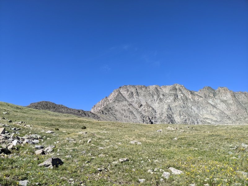
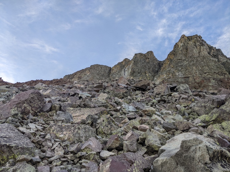
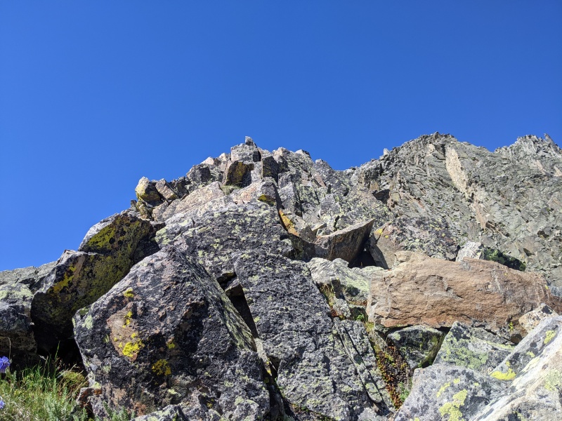
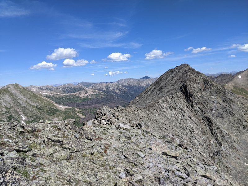
Right before the start of the east ridge of Sewanee was the only place I really had to willow bash, I am sure I could have found a better route either staying above the willows or weaving through them but I followed a short strip of rocks that led me most of the way through the thickest part, until just before I reached a stream which was totally surrounded by thick willows. I just pushed my way through and across the stream where I found a few game trails that led me back above the willows. From here I ascended on grassy slopes scattered with small to medium sized rocks up towards the first bump on the ridge where the rock turned into tippy talus again, which didn't seem too promising for the quality of the east ridge. However once above the first initial steep section, where the ridge flattens out, the rock became a very solid spine and I started to get excited at the prospect of some great class 3 scrambles on solid rock that looked like it would lead me almost directly to the summit of Sewanee. The ridge gets steeper as it rises and about 400 feet from the top was what I'd consider the most difficult pitch, which rose about 200 vertical feet of awesome class 3 with tons of holds, reminiscent of something in the Sangres instead of the Sawatch. Once above this steep pitch the ridge mellows out and quickly joins into the major north to south ridge that connects Sewanee to UN13147. From here I turned north and scrambled up a very brief class 3 section to the summit of Sewanee, stoked that the east ridge had worked out and been such pleasant rock! 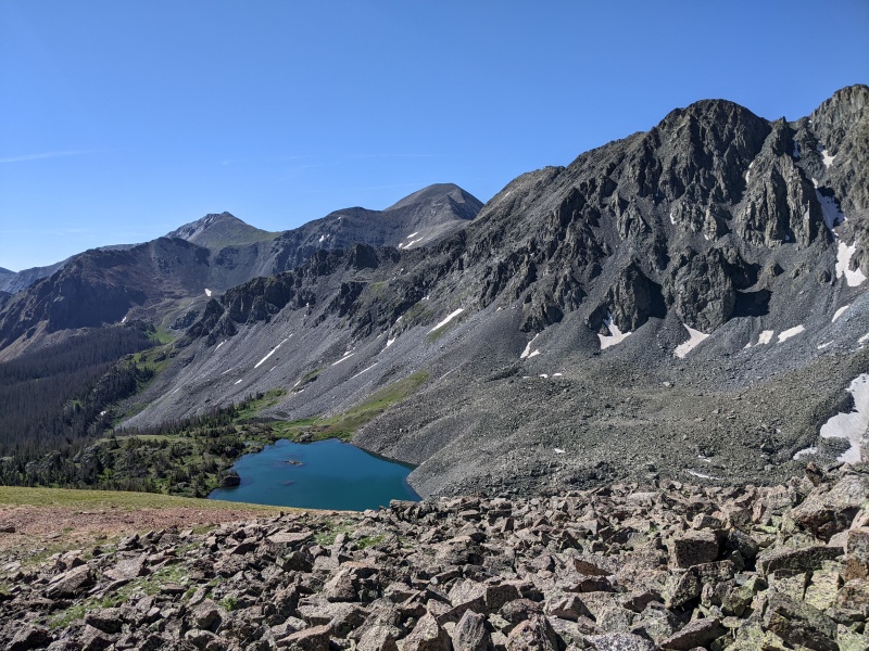

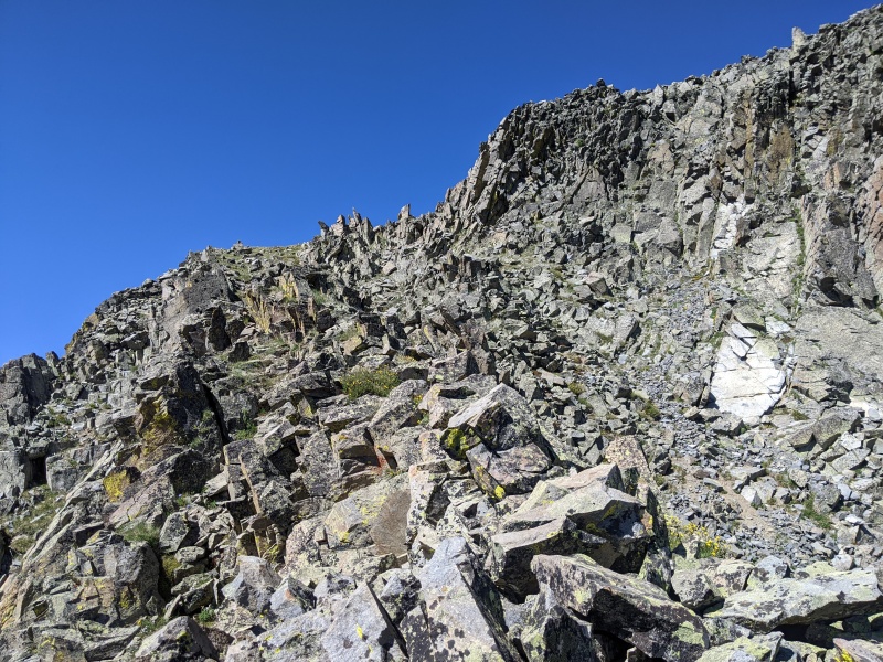
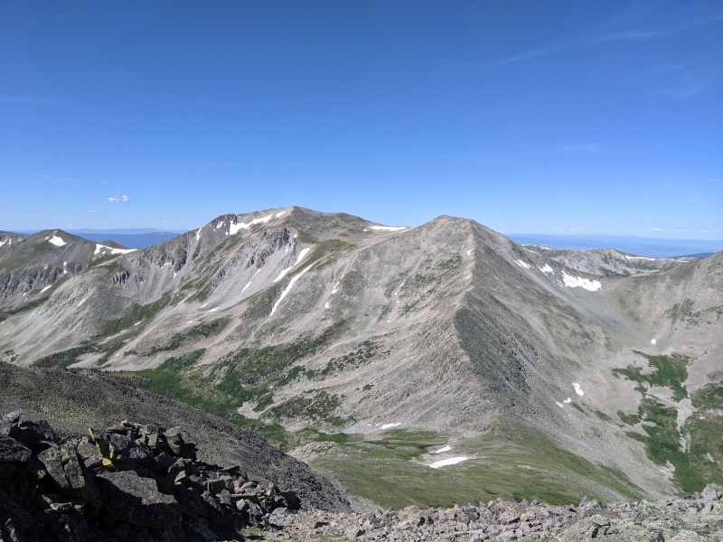
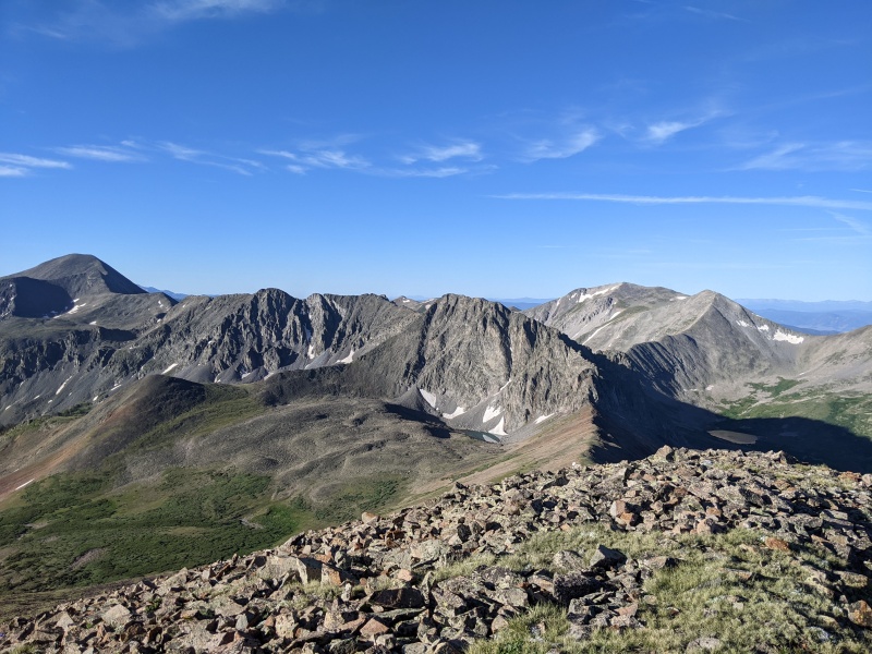
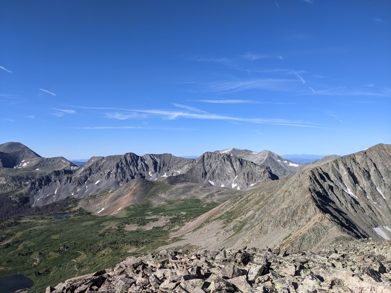
With the biggest unknown, and most of the hard part behind me I headed south toward UN13147, I stayed slightly west of the crest in class 2 talus till reaching the first scrambly bits after the low point in the ridge, from here I climbed directly to the top of the ridge and saw that the east side of the ridge would go at easy class 2 on grassy ledges and staying ridge proper would keep things fun class 3, so I stayed ridge proper as much as possible on the way up, till I reached the end of the scrambles. From here I traversed the north east face of the false summit to avoid extra elevation gain since it seemed like there was a climbers trail across this face that took you to the saddle on the other side of the false summit. It went quickly and before I knew it I was heading east up the easy class 2 talus, which stays pretty stable if you stay on the top of the ridge here. There is a very small dip in elevation before the true summit but it's worth staying on the crest for the stable rock. At this point it was 11 AM or so and the weather was still looking great as I stood on my 4th summit of the day and I was feeling strong, so I was excited to be able to head to the next ridge over and hopefully tag 4 more 13ers and properly clean out the Hancock lake area. 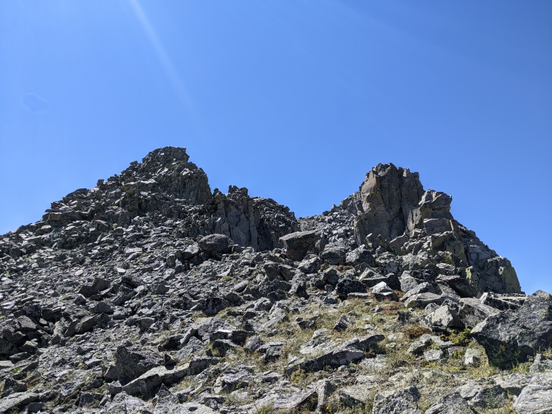
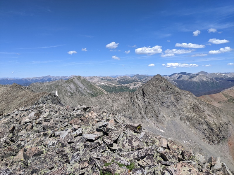
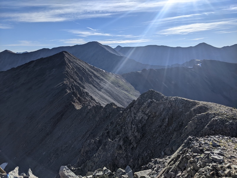
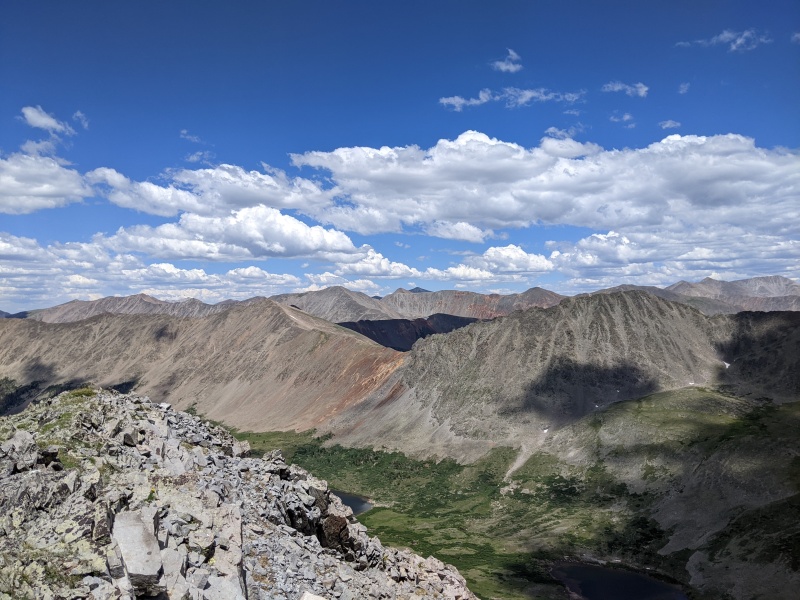
I reversed my route back past the last good scrambling of the day to the talus slope that heads to the top of the pass and connects to the east ridge of Van Wit. The CDT runs right across the top of the pass and at around 12,100 ft will be the lowest point in my path, before I start heading back up. But first I had to head down some slightly tedious but mostly stable talus heading west and losing 800 ft of elevation before hitting tundra again, which was welcome for the brief minutes I was on it. I thought about taking the CDT north to Upper Hancock Lake to quickly refill my water, since I only had .75 liters left at this point and still had 4 peaks to go, but sometimes I am just feeling too lazy for self care I guess and I was hoping to keep moving quickly across the next portion since it is a pretty simple and direct ridge and I was hoping I could make it back to water before it became a real issue. Heading up the east ridge towards Van Wit there was surprisingly some decent sections of slabby rock at class 2+ and I was having fun and getting lost in the Pink Floyd "Pulse Live" album during the Dark Side of the Moon part of the set, they play the whole album front to back and needless to say I love it. Anyways I didn't even notice two people climbing down the ridge towards me till one of them greeted me. I believe their names were Nathan and Chase (I probably forgot the second name and I apologize) we stopped and talked for a few minutes and it was a pleasure to chat and stop moving for a second. I took the opportunity to get the rocks out of my shoes, since I was stopped, funny how they are slightly annoying but I never bother to take them out unless they actively hurt. Anyways the two were potentially attempting the same 8 peaks but in opposite order and had already completed their first half as well, so we discussed routes for a minute before parting ways (hope you all had a safe and successful rest of your day if you read this). From where we stopped there wasn't much more good scrambling on this ridge but still about 1000 ft of vertical on mixed grassy and talusy terrain. The wildflowers were all time here and that made the slog up the rest of this ridge much more enjoyable, as I could feel my muscles start to scream at me a bit at this point, but I knew this was the biggest section of climbing left for the day, tho the saddle of Van Wit-Van Wirt was looking pretty deep as well from my current vantage point. Once I made it to the top of the east ridge, I turned left heading south towards the summit of Van Wit. I was enjoying my new perspective on what I had climbed earlier as well as what I could see of the Elks and La Garita range, and of course the super prominent Mt Ouray to the south of me. I quickly reached the summit of Van Wit but didn't even stop to take pictures since I would be coming back over here on my way to Van Wirt. I was glad this peak wasn't very prominent, being unranked, since it was the only summit I had to go over twice on my route. The rest of the way to Monumental was uneventful and I just stayed on the crest on class two talus, this area felt much more like the Sawatch range than Sewanee and I was glad I had saved the easier and more straightforward peaks for the second half of my day. I believe I summited Monumental peak at 1:15 PM and though the clouds were building at this point in the afternoon they didn't look threatening and I was grateful for that, since I knew it was still going to be a grind to reach Hancock peak 1.75 miles north of me as the crow flies, which unfortunately I am not. 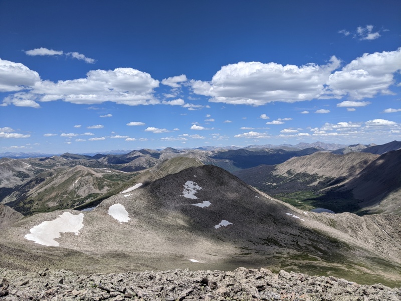
So I turned around and headed back to Van Wit which came quickly, probably 15 minutes or so, this time stopping to take a quick picture, before beginning a very tedious descent on tired legs to the low saddle with Van Wirt. From this saddle following the ridge had some steep and slightly scrambly class 2+ talus with many smaller loose stones and sand sections mixed in since it appears to be a common use trail for people climbing these peaks, it looks like you could stay further west and avoid a lot of the steeper section and stay on tundra tho I didn't try that since it was out of the way. I reached the summit of Van Wirt around 2:30 and signed the register before looking down at the saddle with Hancock and thinking to myself "I thought this peak was unranked but that looks like a deep saddle" so I checked the new Lidar data from LOJ and sure enough 290' of prominence, unranked but just barely. Luckily from the low point the ridge to Hancock rises pretty gradually to the summit since my legs were definitely starting to feel it now. 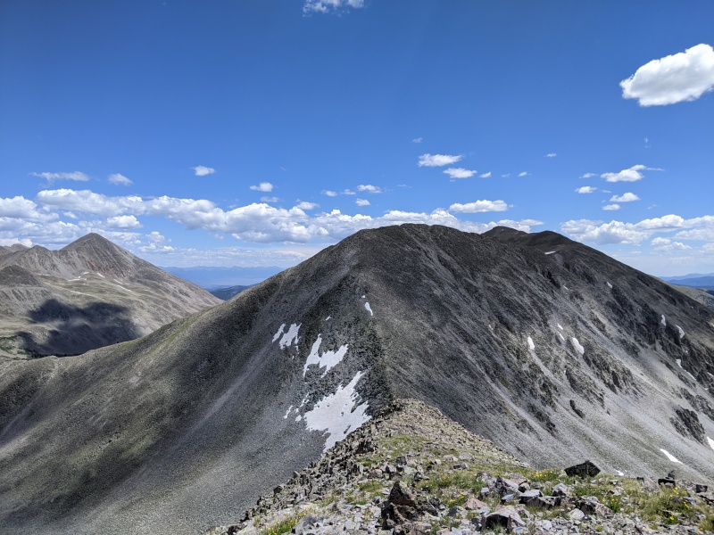
There are some sections in the early part of this ridge where it looks like you may have the option to scramble but once you get closer it seems more forced than it's worth and it's very easy to bypass on the west side of the ridge. Once past these sections the slope turns to a gentle grassy tundra and you quickly pass 2 very slight bumps in the ridge on the way to the true summit, which is the furthest north of the 3. I was stoked to have made it to my 8th summit on the day at 3:15 PM, tagging 5 ranked and 3 unranked summits in one big loop and only having to go back over one unranked peak a second time, efficiency is a 13er hikers favorite word I'm pretty sure. On the summit I drank my last bit of water I had, which was a bummer but I was glad that it lasted me this far, and began heading down the north ridge towards the road trying to make good time on this loose and at this point in the day very tedious terrain. Nothing was extremely challenging but my legs were tired and I wanted to get back to my truck so I could drink water and eat something besides the trail food I had been eating all day. The good news was I quickly reached the CR299 road and followed that down past one large hairpin to a little .8 mile long trail segment that would lead me back to the Hancock lake parking area. It was only during this section of walking that I regretted my decision to park further down the road early in the morning. I looked for a spot to refill my water, but since I wasn't carrying my filter and only had some tablets to sterilize my water I figured I would be at my truck before the 30 minutes was up. However I crossed by a great source with a perfect little waterfall and decided to grab some water, since the crisp cold snowmelt would probably be way cooler than the gallons of water in my truck, I'm sure this water was potable at the source since I could see the snowfield it was melting from, but with an abundance of caution I added the tablets and set my timer for 30 minutes, now in a race to be back at my truck in less time. Sure enough it only took me 18 minutes to go the 1.5 miles back to the truck, arriving at 4:25 PM and I was already driving down the road, having chugged a solid half liter of water by the time the alarm went off. I believe this day was just over 10.5 hours round trip. 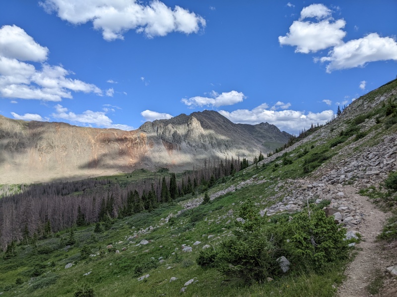
This was a really great day in the mountains, one free from the impending threat of thunder storms, which has been ever present this summer so far and I felt inspired to write a trip report mostly to share the east ridge of Sewanee beta with this community which has given me so much since I started my 14er and 13er journey 2.5 years ago. The day after this I climbed Stewart and Baldy Alto from Cebolla TH for my 146th ranked 13er (¼ of the way!) and 85th Centennial peak, which feels like a small landmark on the way to hiking all the 13ers. Hope this report has some value to you all, thanks and sorry again for the lack of gps data, as I wish I could share distance and total vert here. Thumbnails for uploaded photos (click to open slideshow): ")
")
")
")
")
")
")
")
")
")
")
")
")
")
")
")
")
")
")
")
")
")
")
")
")
")
")
")
")
")
")
|
| Comments or Questions | ||||||
|---|---|---|---|---|---|---|
|
Caution: The information contained in this report may not be accurate and should not be the only resource used in preparation for your climb. Failure to have the necessary experience, physical conditioning, supplies or equipment can result in injury or death. 14ers.com and the author(s) of this report provide no warranties, either express or implied, that the information provided is accurate or reliable. By using the information provided, you agree to indemnify and hold harmless 14ers.com and the report author(s) with respect to any claims and demands against them, including any attorney fees and expenses. Please read the 14ers.com Safety and Disclaimer pages for more information.
Please respect private property: 14ers.com supports the rights of private landowners to determine how and by whom their land will be used. In Colorado, it is your responsibility to determine if land is private and to obtain the appropriate permission before entering the property.