| Report Type | Full |
| Peak(s) |
Nevado Huascaran 22,205 |
| Date Posted | 07/12/2022 |
| Modified | 05/26/2023 |
| Date Climbed | 06/11/2022 |
| Author | Camden7 |
| Peru Part III: A Game of Lives |
|---|
|
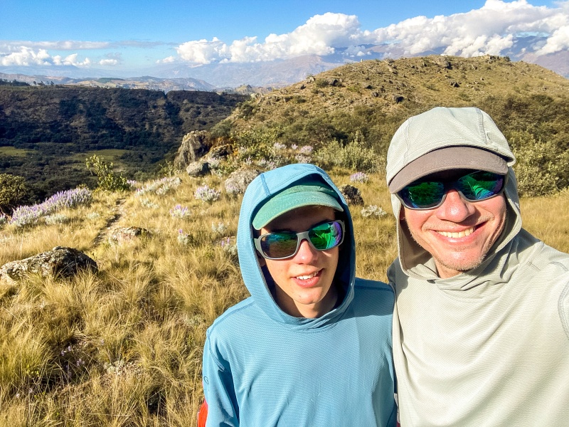
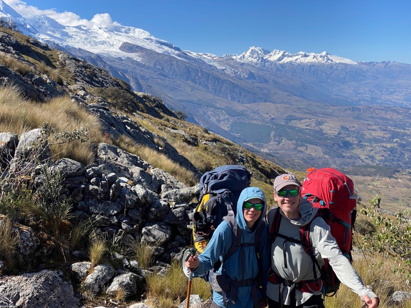
If you have not read Peru Part I and Peru Part II, I would recommend you do so, otherwise very little of this will make sense. If you pure goal is route info on Huascaran, you are in the right spot. Chapter 6: Half Way from River to Sky Friday, June 10th As I may have previously mentioned, the weather this year so far has been absolutely horrendous, with wet season storm patterns persisting into mid June, when they should stop some time in May. Huge amounts of snow (usually 2-5 inches) fell most days and heavy fog regularly enshrouded everything above 17,000 feet from 8 AM to 5 PM. Edgar said it was the worst weather he had ever seen, and blamed "global warm" for changing weather. Anyway, the heavy snowfall and dense cloud cover for most afternoons meant that everything had way more snow than usual, and south-facing routes were all but impossible. We had hoped to get on Chopi next, but we talked to other climbers and Edgar to other guides and all heard the same thing: no one has successfully summited yet this year. No party has made it above 19,800, still a thousand feet below the summit. With continued accumulation, conditions were not getting any better, and the mountain that drew us to the Cordillera in the first place was, regretfully, off the table. After much talking about what to do next, Edgar says, "I just heard a party was successful on Huascaran. That means the route is open." ... After a moment of silence, Dad and I look at each other with surprise. Huascaran is the highest peak in Peru at 22,205 feet, and we had planned on possibly considering it as our last peak, once we were fully acclimated on another 6000 meter. But every single other 6,000 meter was unclimbed this season. Tocllaraju still has its impassible mushroom from the last few years, Chopi is too unconsolidated since it is a south facing route (in southern hemisphere that is equivalent to north facing here), no one has even tried Artesonraju or Ranrapalca, and everything else is too hard or dangerous. Our options are limited to Huarapasca 17,757, or Urus and Ishinca, 17,495 and 18,143 respectively. And Huascaran. After much debate, we decided on the big one, despite having insufficient acclimation. Our highest peak as of yet was ~18,800. On Huascaran you sleep at 19,300 then go up another 3,000 feet from there. That is a completely different elevation range, and ideally another week or more should have been taken for acclimation. But we didn't have a week to spare, and besides, everything safe to climb was lower than what we had already been on. So we said this: "We'll acclimate as we go..." –Torsten Famous last words. We repacked our packs, much lighter this time thanks to some more efficient packing and more importantly Edgar wanted to bring a climbing porter. Saturday, June 11th We met outside Olaza's at 5:30 AM, and drove an hour and 45 minutes to our starting-off point. After climbing away from the Rio Santa Valley, the drive wove steeply through farmland, where people exist beautifully with nature, living on small plots and practicing sustenance polyculture. It seems so much more natural and healthy for the planet than the large scale monocropping and ranching in the US. It's just incredible to see cows, chickens, goats, pigs, mules, oxen, dogs, cats, and many other animals coexisting on small farms that each grow 30 different things... watermelon, cucumber, corn, potatoes, cabbage, and every other vegetable you could want. No wonder the food is so good in Huaraz, it is all fresh from the source. There are 2 primary ways to start an ascent of Huascaran, both with the starting goal of reaching the Refugio Huascaran at 15,200 feet. Both start in Musho at ~10,000 feet, higher if you get lucky with your taxi driver, although they might want extra pay to drive up the narrow and steep roads above Musho. For both trails, the highest roads end at about 10,600. The northern trail is slightly longer but less steep, and mules can carry your things to Base Camp at 13,800, but cannot go any further due to some 3rd class rock slabs that must be crossed. This is the most popular approach. The southern approach is shorter, steeper, and does not have any 3rd class rock, but you are not allowed to take mules as they want you to hire porters because they are more expensive and better stimulate the local economy. There is a Base Camp on this route, but because there is not always reliable water here, you may have to push all the way to the moraine camp, which means over 5000 vertical with full packs. This is why the other approach is more often used. What I did not realize until we arrived at the trailhead is that there is a third route, and we would not be taking either of the aforementioned options (so my information is just from research and talking with climbers that did do them). This 3rd route seems far better at first glance, but in reality it is only easier on paper. 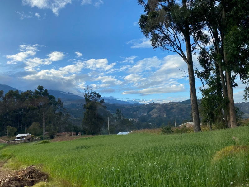
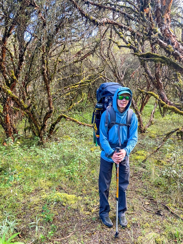
The trailhead is the pueblo of Armapampa at 11,250 feet. Again, a taxi can get a little higher – 11,600 – but not all drivers are willing. Where ever you start, leave the road to take an unmarked old road on the left, just past a water tank. This road starts out by crossing a swampy meadow that is muddy and has some ruts that are completely unrealistic for a car. Part way across the meadow there is a fork in the "road." Keep left. A few steps later there is another junction. Right this time. From here, the road steepens, becomes covered in loose rocks painfully reminiscent of Lake Como Road in Colorado, except much steeper. The saving grace of this section is that it crosses through a dense forest of planted Eucalyptus trees, which smell amazing.They were introduced to Peru because there was so much deforestation going on, and they grow very quickly and work well for firewood and cheap construction. The road crests an ancient lateral moraine at 11,850, and passes through a notch. An old wooden fence is there to control livestock, please close it behind you. The trail then crosses a tiny west-facing basin tucked into the ridge, before reaching a second small saddle, and descending 150 feet, effectively undoing all of your work thus far. Although it still follows the old road cut, it feels like single track through here. The tiny basin holds an awesome Quenual stand and also some moss covered stone walls that are supposedly "Pre-inca' and many thousand years old. Very neat. Once at the bottom of the descent, the trail passes through an even more impressive quenual stand, some more stone walls, then crosses a creek. This brings you into a small meadow with some cow poop, a couple flowers, many small creeks, and absolutely no trail. It is nice to have a guide through here. There is also a small area fenced in with razor-wire. I don't remember what was in it but it struck me as strange. After crossing the meadow, the trail reappears to pass through some more quenuals, cross two larger creeks right at their confluence, then enter another wildflower filled meadow with no trail (or a very, very faint one). At the end of this there is a final creek, much larger than the previous ones. It is colored by glacial silt and runs down a huge stone-filled riverbed, evidence of flooding events. the trail finally begins climbing again after crossing the creek. This section climbs through incredibly lush and dense forest with shocking biodiversity. The Quenuals through here are stunning. 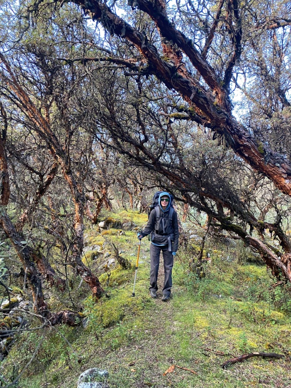
The trail perseveres up some steeper sections to reach a small saddle at 12,100 feet. It has spectacular views, impeccable sitting rocks, and astonishing wildflowers. It is worth taking a short break here just to enjoy where you are. 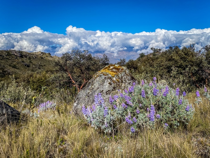
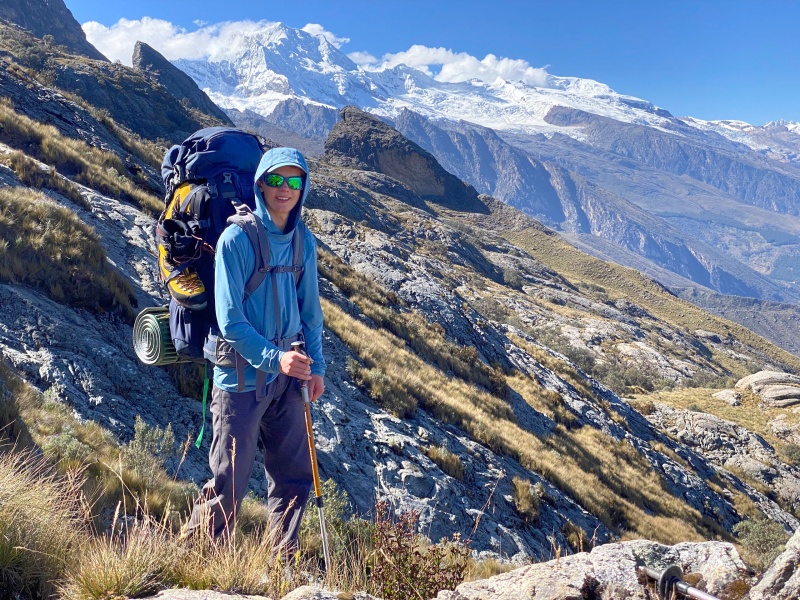
From this point, you are done with 1/3 of the mileage, but a meager 1/6 of the vertical from the turn off the road, even including the vertical that was regained after the small descent. The hike to here could be described as pleasant, pristine, beautiful, and even easy or relaxing (aside from the heavy packs). Although many of those thing hold true as you continue onwards, the last does not. The next half mile climbs 700 feet. And this isn't a trail from Rocky Mountain National Park with nice stone steps and water bars. It is steep, it is muddy, there are many creek crossings, and some sections of class 2 rock slabs. All acceptable, but slow with a full pack and still tired from the previous outings. Photo below shows the nature of many parts of the trail. Good views, questionable footing.
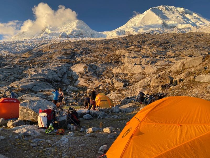
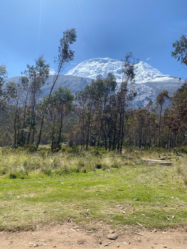
Then at 12,800, the nature of the trail changes. The next 400 vertical are gained along some rock slabs. The lower 3/4 of it is mostly class 2+ with sections of 3rd. There are bolts here if you want to treat it like a sport climb. Haha, is Huascaran the right place for you if a rope is needed on easy 3rd with no exposure? This slab concludes with an easy creek crossing at the top of the rock, a few steps of dirt, then comes the crux of the approach. A 20 foot rock wall that is ascended via a leftward slanting ramp. There is a fixed cable here, but it was beginning to decay, so I chose not to use it at risk of metal splinters. Using the cable it would not be too hard, without it it is a series of 2 boulder problems, 5.2, then 5.0, by my reckoning, connected by 3rd and 4th class moves. The hardest moves are right off the ground so there is no fall potential, but the upper moves are scarier because the rock is wet and a fall from there would suck because the exposure mounts as you traverse left. It isn't nearly as hard as I just made it sound. Much easier than getting into the lower saddle on Grand Teton for those of you who have done that. After that, the excitement is mostly over, with the trail still being steep and slick, but never hard as it climbs up and left across the face. Then, at 13,600 comes the last excitement of the approach, with two options. The way we came down is what I would recommend. Cross the rock gully, staying right and following the trail, do a couple moves of slipper class 3+, then follow a switchbacking trail up the next 250 feet, staying right of the gully. The way we went up was attacking the gully directly. This never had any moves as hard as the couple on option 1, but was 250 feet of class 2+ and easy 3rd where a fall might cause mild discomfort (if you consider a 200 foot long cheesegrater "mild"). Option 1 just felt less exposed and faster once you did the first bit. Neither are at all hard. Finally the use of hands is done, and everything left is just hiking... until you hit the glacier of course (duh). At 14,200 there is a small saddle between the main face and the "Gendarme" a 200 foot tall rock finger. It looks steep and rotten, but would be cool to climb anyway if a good route could be found on it. This saddle offers your first view of the Refugio. From here it is still over a mile and ~1,100 vertical to get there. It is easier terrain than the trail so far, steep at times, but mostly just traversing. At 14,800 you come around a corner and the Refugio looks close enough to touch. A final, tiny basin is the only thing separating you from it. Some large boulders and class 2 slabs make the going a little slow, but not bad at all. Then the last 100 feet kicks up a few switchbacks, which are quite painful because you know how close you are. The trail brings you into the eastern side of the Refugio, which was still closed up. We were the only people there and set up camp on the set of fantastic platforms north of the Refugio: Moraine Camp. There is very easy access to water, stone toilets a couple minutes' walk to the north, and spectacular views. Moraine Camp is definitely worth pushing to, and there aren't any places to camp along our approach anyway. Moraine camp is 7,000 feet above the Rio Santa down below, and more than 7,000 feet below the summit of Huascaran. It is halfway to the sky. 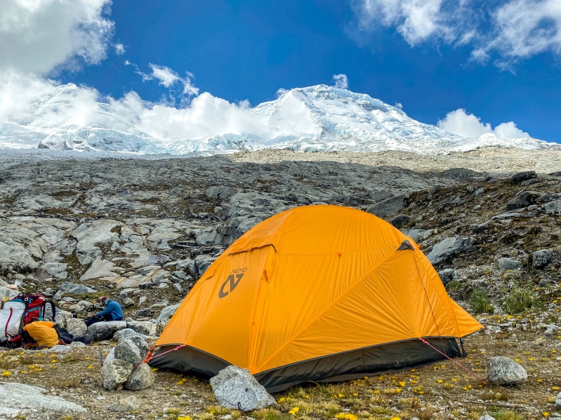
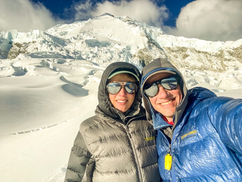
Tent set up at Moraine Camp with Huascaran Sur looking Huuuuuuge. Perhaps an hour after we arrived, two people came zipping up the trail. It was none other then John and Eric from Boulder, CO, the same team we has met on Pisco. We chatted a bit. They were nice enough but I thought a little proud if you know what I mean. High risk profile and happy to tell others about it. They were here to climb the Shield. We ate dinner, watched the sunset, then went to bed. 
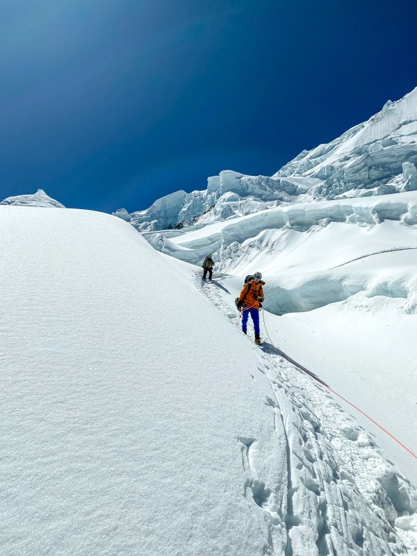
Chapter 7: You Can't Kill a Mountain Sunday, June 12th We had a relaxing morning and waited to pack up until the sun FINALLY crests over Huascaran at 10:00 AM so that our stuff could dry out from the heavy frost. We set off with our days goal to reach Campamente Uno. From Moraine camp, there are about 1000 feet of class 2 then 2+ rock slabs. They are not at all hard, but there is no trail really and I was wearing mountaineering boots since we would be hitting the glacier later, but the lack of ankle articulation was really tough on the slabs. It is worth bringing your approach shoes up to the glacier's edge. The slabs took us about an hour. There isn't much to the route finding as everything works, although we found it easiest to stay left on the upper portion. 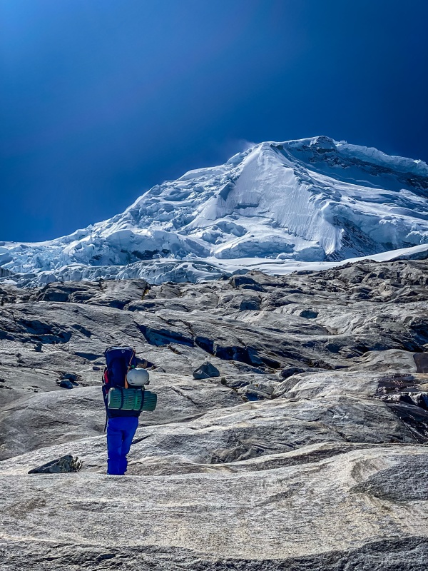
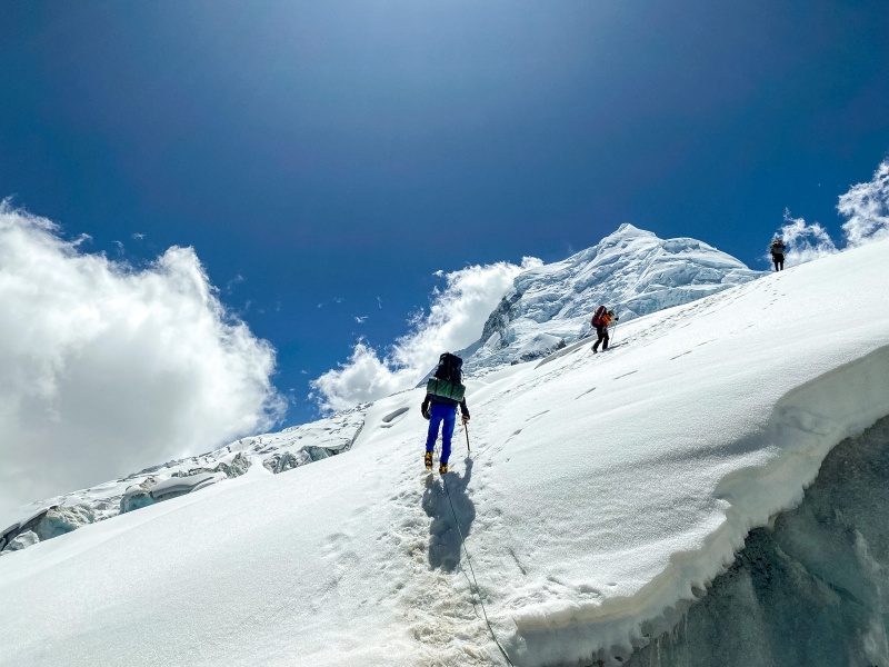
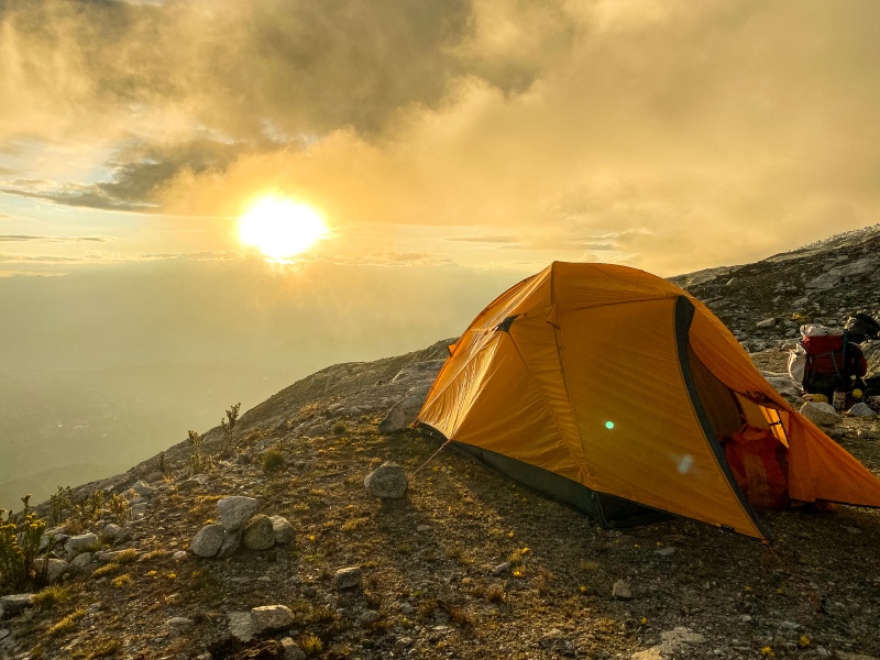
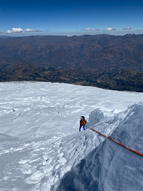
We then put on harnesses, crampons, pulled out a single tool, and roped up. After a few steeper steps to gain the glacier, it is easy walking the whole way. After about 50 feet on the glacier there is a small crevasse requiring a 8 inch step-across. Then there is a very long section of nearly flat glacier. The slope angle is negligible and it takes forever to gain any vertical. At least the views are mind blowing. Eventually, the trail reaches a small bench at 17,100. There is a 6 inch step-across just below this, the 2nd and final crevasse on the path to Camp 1. This bench would provide a safe and comfortable Early Camp One. A few minutes later, you pass by a large very flat area at 17,250 with room for perhaps 8 tents comfortably. This is what we called "Outfitter Camp" because as we saw on the way down a few days later, it s where all the large groups with porters, cooks, bathroom tents and all that expensive stuff stop. This is also very protected from the wind, so if that is a problem while you are there, you will want to stop here. From there, we pushed another 5-10 minutes to reach Camp One at 17,400, which is quite exposed to the wind (luckily there was none for us), has some crevasses within a few hundred feet, room for many tents (but not the most flat so you might really have to dig some of the platforms), and a damn good view. 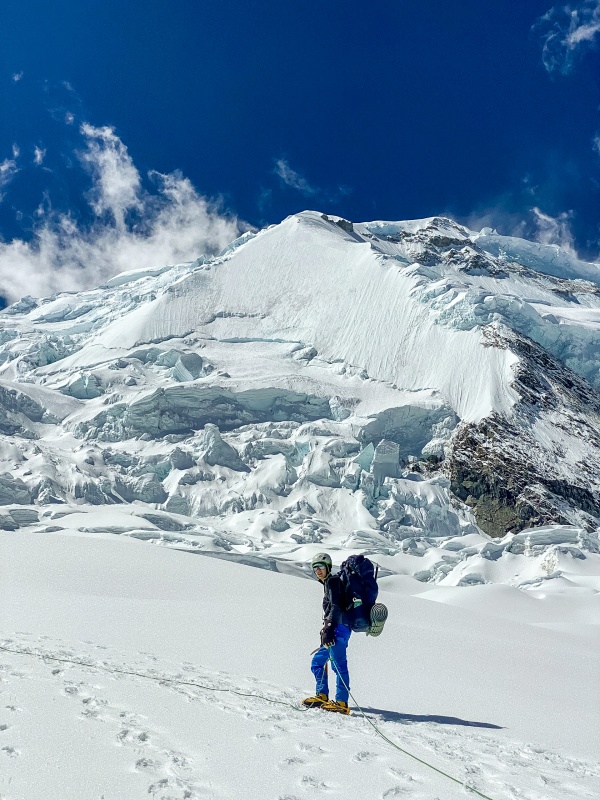
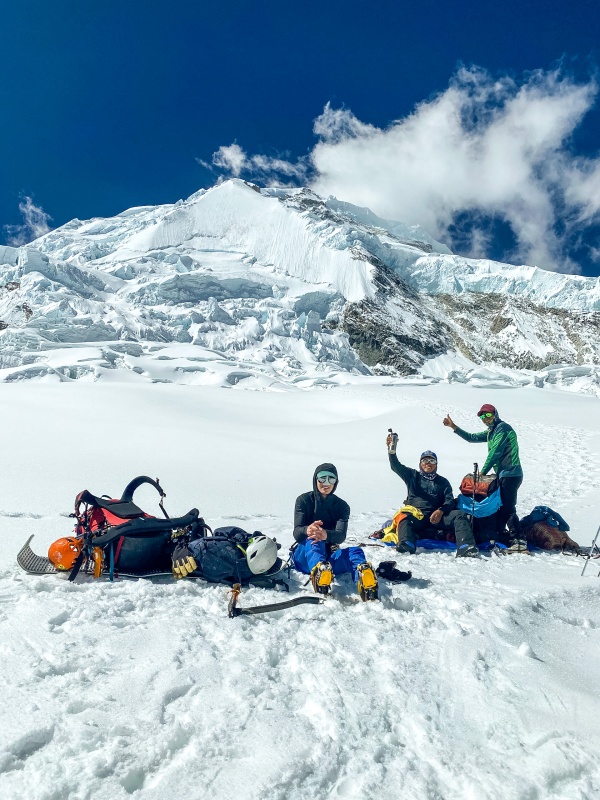
We took a nap, planned for the next day, looked at our route, relaxed more, took some pictures, ate dinner, enjoyed sunset, complained about excessive use of commas, then went to bed. 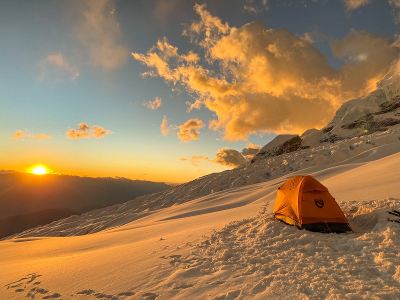
Monday, June 13th Communication is an important thing. Like telling your climbing partner that they are on bely. or agreeing what time to get up. Because when we say walking at 3:30, and Edgar thinks waking up at 3:30, that is a problem. We took down our tent. We we ready to go. Then we had to sit for 30 minutes. And it was about 5 degrees Fahrenheit (by our reckoning). So we got damn cold. By the time we started moving our hands were cold, but worse, our toes were just gone, and that is much harder to deal with. Hands can be put on your stomach if you need to. Feet cannot. Make sure to start warm out of camp. 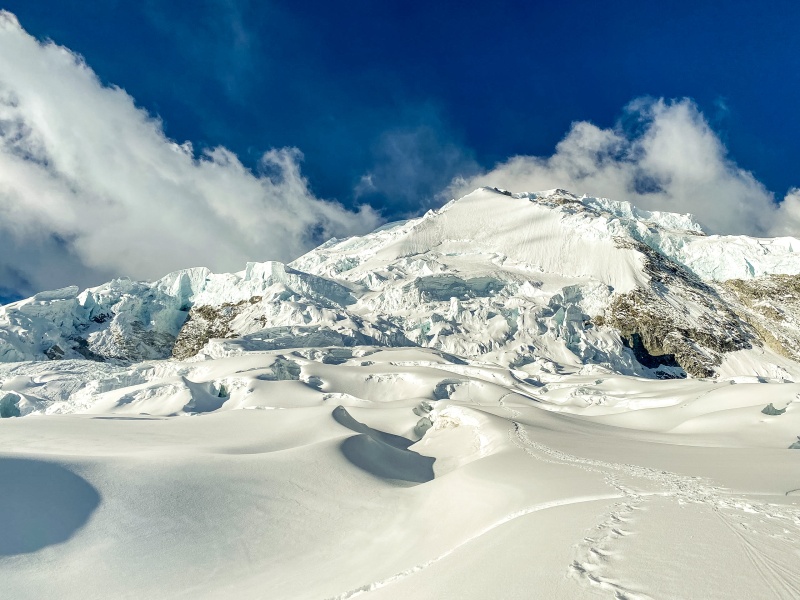
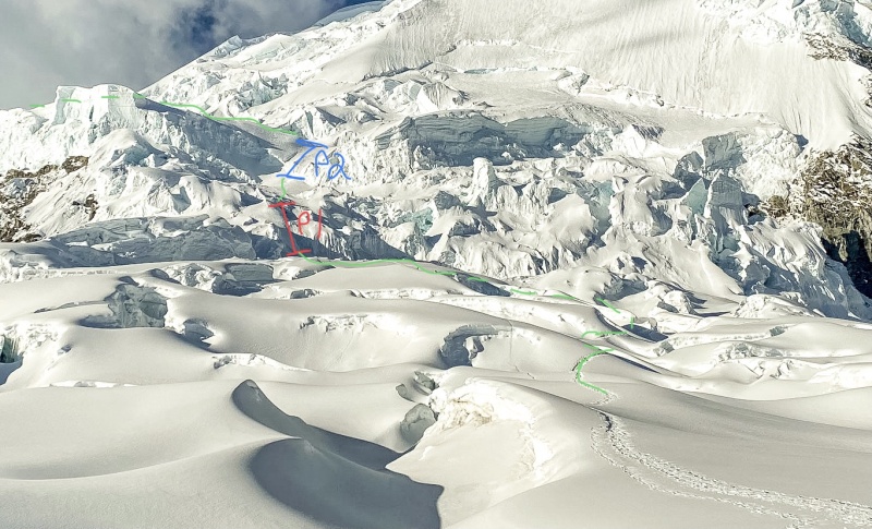
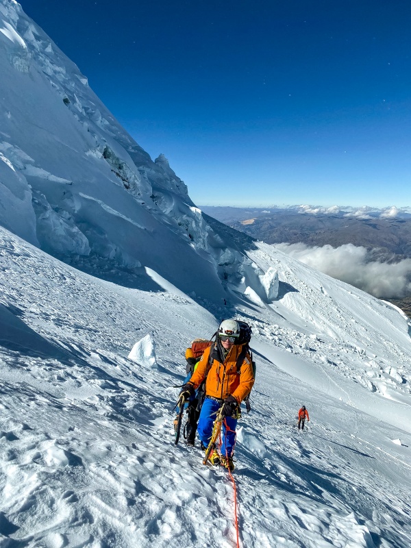
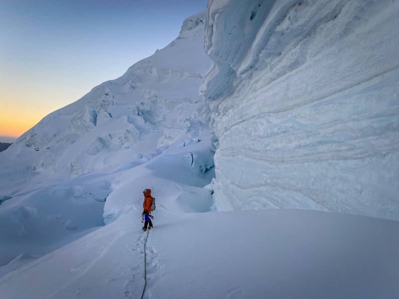
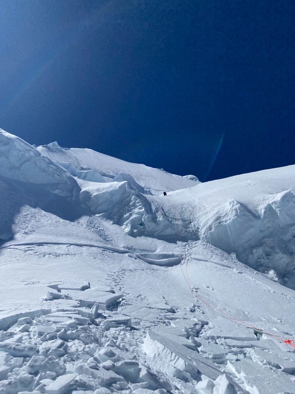
We set off up the initial slopes of the icefall. It is an incredible section of the route with very broken yet relatively safe glacier. It is hard to imagine the scale but the bottom of Pitch One is 700 feet and close to an hour above Camp One. This section has the highest crevasse danger of the lower route with several meaningful snow bridges and three 8-12 inch step-acrosses. Pitch one is fairly easy with 130 feet of 50 degree snow, then a 30 foot band of 60 degree hardpack, then 40 feet more of 50 degree snow. There was some great ice here for an anchor. This pitch really could be simulled but in the dark it was hard to tell. After pitch one there is 300 vertical up a 40 degree basin. It was unconsolidated and hard work. And it was full of avalanche debris, which was weird. There were also a handful of large step-acrosses, one over 2 feet wide. Then we came over a rise and standing there at the side of the chute were John and Eric. "Hello" a nervous voice called. "We were hoping you were coming up behind us." "We triggered the slide. I was leading. It ripped. I didn't know what happened, if I had fallen in a crevasse, or what. The world was suddenly spinning. Eric got to the side. I didn't. It carried my all the way down. I stopped maybe 3 feet from the cliff edge, maybe less." "I thought I was gonna die. It wasn't funny." – John There's a quote for ya. After more talking, we all went to the side and Edgar lead up an ice chute off to the right. It would have been much easier left, but was holding too much snow above John's crown. Edgar then belayed the rest of us up, and John and Eric continued to contemplate up or down. The second pitch was much harder than the first, and definitely warranted a belay. The easier line to the left would have as well. After crossing a series of spooky shrunds on 55 degree snow, there was a 15 foot step of glacier ice that was damn near to vertical. That means that it was too hard to get more than a millimeter of purchase on, and also to steep to lean in to the wall. To complicate matters, our porter, Ignacio, had only one tool and was weighting the rope (pulling down on me) to get through the crux. 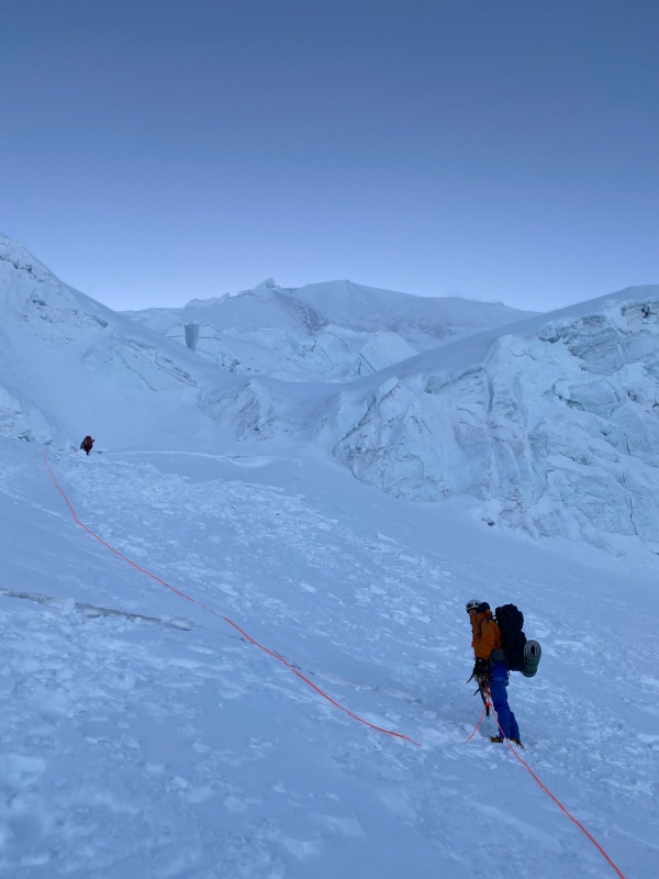
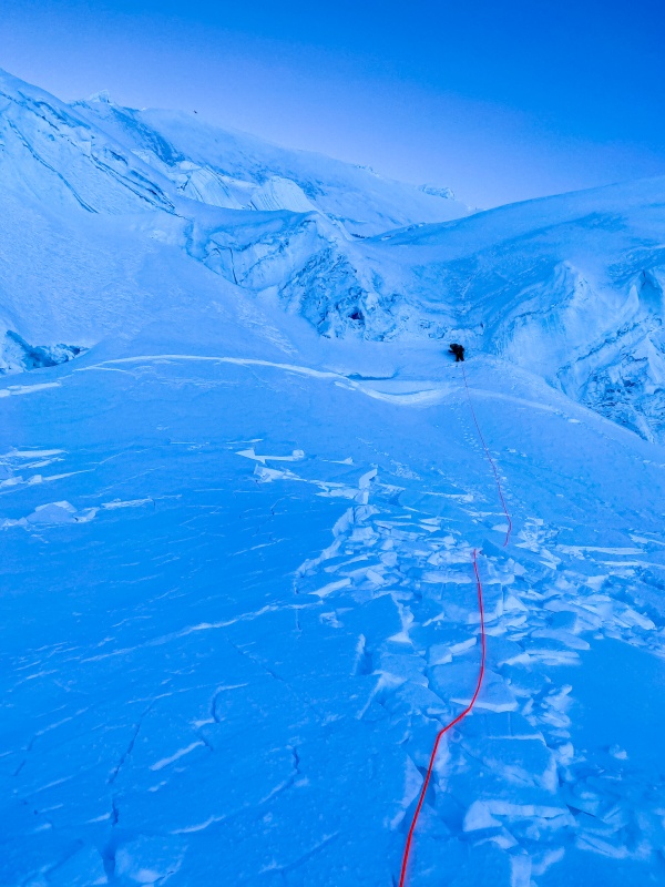
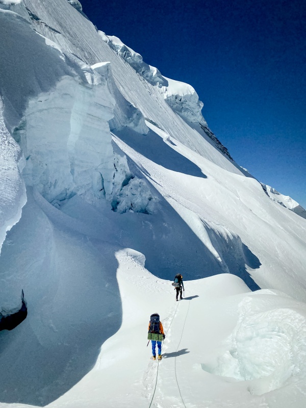
Above the ice step, there was another 80 feet of 60+ degree snow. Once we all regrouped at the top of the technical climbing, we started moving across the traverse. The traverse is a half mile long and under the threat of serac fall the entire time. Speed is of the essence, but the traverse flirts with the 19k contour, so you better be feeling good. From the top of the second pitch, 200 feet of 45 degree leftward slanting climbing start off the traverse. The first danger zone is crossed just beyond this. It is characterized by small to medium serac pieces that seem to fall with little frequency, probably the least dangerous pf the four. Soon after, the second gully is crossed. It is more of a slide path. It is not wide, and does not see a lot of serac fall (only a couple small pieces of debris were present), but it drains a huge bowl. This is the reason you might want avalanche beacons, probes, and shovels. Before the trip here is what Edgar said when we asked if we needed them. "No. If that thing slides there will be no one left to dig you out." – Edgar Chilling words. 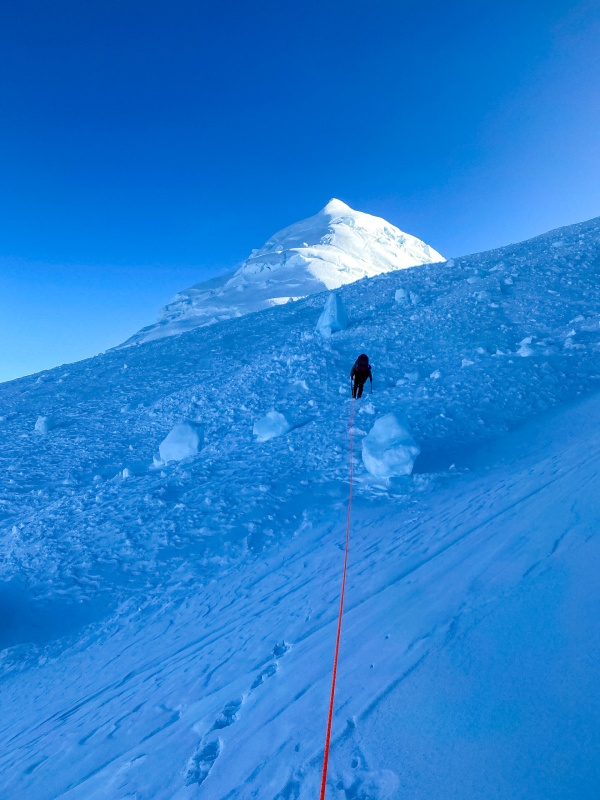
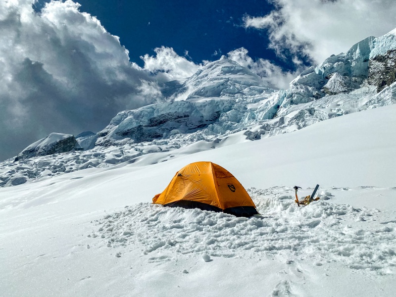
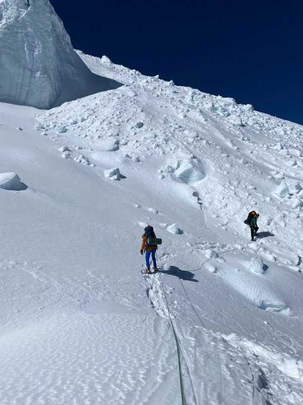
The trail proceeds next to the 3rd zone, and perhaps most dangerous. The path not only spends the most time in this gully (it descends about 100 feet down the chute before traversing out of it), but it is also the second most active area. Do not dally. The section following is not littered with debris, but is threatened by a huge, leaning serac. The fourth and final gully is the most active and deadly of all, with countless ambulance sized blocks scattered around the trail. While walking through the debris at dawn it is eerily beautiful, like a graveyard of frozen giants in their final resting places, memorialized by huge ice sculptures. Each and every one came from above with the power to end a life without a whisper of hesitation. This is a magical and powerful place, but life can only exist here hanging on by a single thread. A thread that might be snipped at any moment. Before attempting Huascaran we had not realized how dangerous it was. If I could make the decision again, even knowing we would be unhurt, I would have opted to stick with safer mountains. I cannot justify the risk, and I doubt most people could if they truly understood it. An ascent of Huascaran is a game of cards where the buy in is your life and the mountain deals the cards. It is a game of lives. You have no control. At the end of the day, you can't win against a mountain, you can't defeat it. All you can do is survive it. Its not like the mountain is going to get killed by a serac collapse or avalanche. Its not gonna get cerebral edema or freeze. Remember that. Wow that was like really serious. At the end of the traverse you need to climb 300 feet to reach a level corner with great views, finally some sunshine, and some old tent platforms from the group that had been up here earlier that week. And what was resting in their tent platform? A serac the size of a laundry machine. So we said fuck that. By descending 100 feet to the north then crossing a crevasse, traversing a ledge, then crossing another crevasse, you can reach a large island that is much safer from objective hazard. 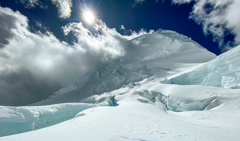
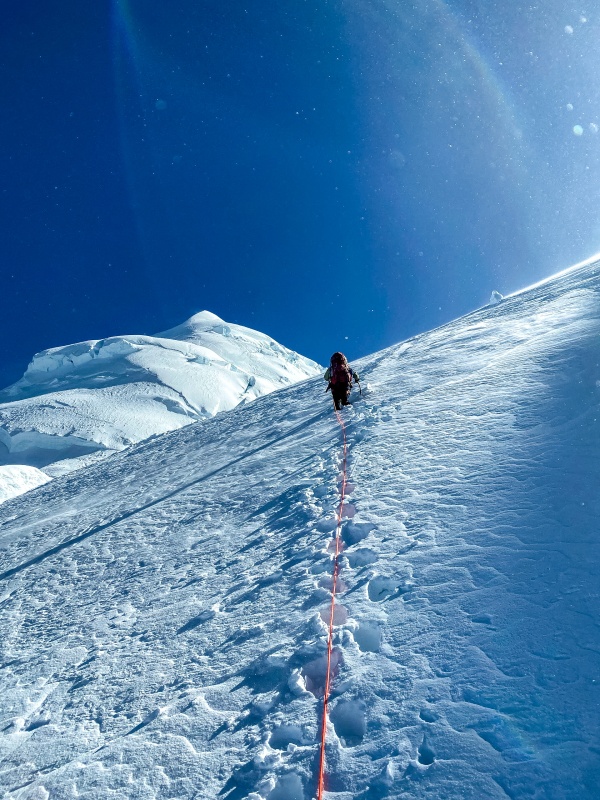
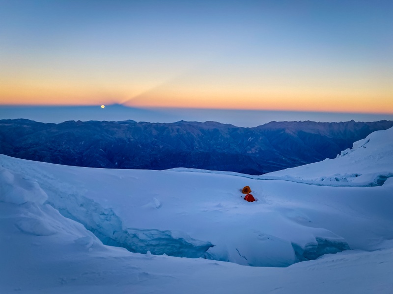
Setting up the tent was super sketchy because there were 40-50 mph winds but they died down to 15-20 after an hour or so. We climbed into the tent at 10:00 AM with our hands and feet still cripplingly numb. We proceded to sleep off and on for the next 6 hours. Then we made dinner. Then we went to bed. Then the alarm went off a little past 11. I did not feel well enough to eat, but I was very excited and motivated quickly, bundling all of my clothes on in the tent, putting on my harness and boots inside as well to stay warm, then stepped out, slapped on crampons, tied in, and we were off. Chapter 8: The Weakest Link Tuesday, June 14th The moon was full. The air was frigid, well below 0, but starting warm does wonderful things, and at least the snow was nice and firm.We reached the traditional camp 2 after 5 minutes. Then climbed 200 feet up easy slopes towards La Garganta (the giant saddle between the North and South summits. We were at 19,500 plodding along for a giant end run when something became obviously wrong. The rope behind me was tight. And dad was behind me. He is always faster than me. 'He must be adjusting his harness or something I thought' so I waited patiently for 30 seconds before beginning to walk again. After 5 steps the rope was once again tight. I looked back to see what was going on. Dad had paused walking to bend over with his hands on his knees and breathe. This concerning pattern continued as we post holed knee to thigh deep for the next hour as we did end run after giant end run to reach the saddle. The size of the saddle is insane, about 150 acres of level, heavily crevassed glacier. And it should have taken 45 minutes to reach the base of the climbing. But it took an hour and 15 minutes. Dad was pulling ever more on the rope. When we stopped for a sip of water I hollered back to him "What's going on?" "I really don't feel good, buddy. I feel like I have the flu. And like I might vomit. This is too high elevation for me." We talked some more. Edgar started climbing. The first 600 feet of climbing are about 50 degrees and trend left around a large serac to reach a gully that has a huge serac at the top and a cliff at the bottom. At the top of this gully is the crux of the upper route with 200 foot long narrow 60+ degree chute. We simulled all of it. Very slowly. Dad's pace continued to flag. Above the chute, we continues another 200 feet up 45 degree slopes. Edgar stopped to collect the gear because the climbing was over and we wouldn't need it until our descent. We were at almost 21,000 feet, above all the technicalities, a mere 1,300 feet of 30 degree snow plodding were all that remained. The fight was won. I have always been the weakest link in the mountains, the reason we turn around, the reason we have to take a break, or we get back after dark. And for perhaps the first time in 15 years together in the mountains, I felt strong enough to do anything, the altitude was lost on me, and I was not the Weakest Link. At 20,800 feet on the side of a mountain that rises 15,000 feet from the river below and 22,205 feet from the ocean 45 miles to the west, where the air was well below zero and not a single creature ventures other than the stupidest and proudest of all, Dad reached the belay station. He curled up in a ball. And he cried. In 15 years of fatherhood, losing a parent and several friends, and 40 years of mountaineering, I , nor anyone else, have seen him cry even once, aside from my parents wedding. And Huascaran made him cry. That alone is a testament to its unchecked ferocity. But he wasn't crying for himself. He was crying for his son. Because the next thing he did was the bravest thing I have ever seen anyone do. He admitted to his son that we was not strong enough. That he had vomited six times in the last thousand feet of climbing. That his body was shutting down, not keeping him warm, not wanting to live. If we continued up, he would be a liability, or worse, he might not come down at all. After a long silence he said 33 words. I will be able to hear them forever. "I don't care about this mountain. It doesn't mean shit to me. But it means the world to you, and I just killed your dream. That is gonna be hard to live with." – Torsten I could try to glorify my response but I won't. It went something like this: "Yeah, it sucks. I really did want this summit. But don't beat yourself up, it isn't really your fault. It isn't in your control how you feel. And you say you killed my dream. But that assumes that the dream is to stand on top of Huascaran. Which it wasn't. It was to come to Peru and spend time with you, to make these memories with you. What matters is that we get down safely and can laugh about it, cry about it, whatever we wanna do about it, later. Right now, lets get you down," Not pretty. Quite messy really. But it was sincere. And so we turned around. We downclimbed 200 feet. Then we did a 70m rappel. Then we downclimbed 600 feet more. We did the end-runs of forever. We dropped past the traditional camp II with the serac in the tent platform. And right as we arrived at camp, the world lit up and said good morning. I was very sleepy and my mind was on other things so my memory of it is not as clear as I wish it was, but it is one of those things that is beautiful beyond what any photo can capture, a level of wonder that most people will go their lives without seeing anything close to. I have been blessed with perhaps 3 or 4 of these experiences where the world just fractures into magic and color. We took two pictures. Then we climbed in our bags. Dad said "I am never going above 20 thousand feet again. Heck, I'm not going higher than 15 again." Then he fell asleep beneath the sunrise, and I soon followed. 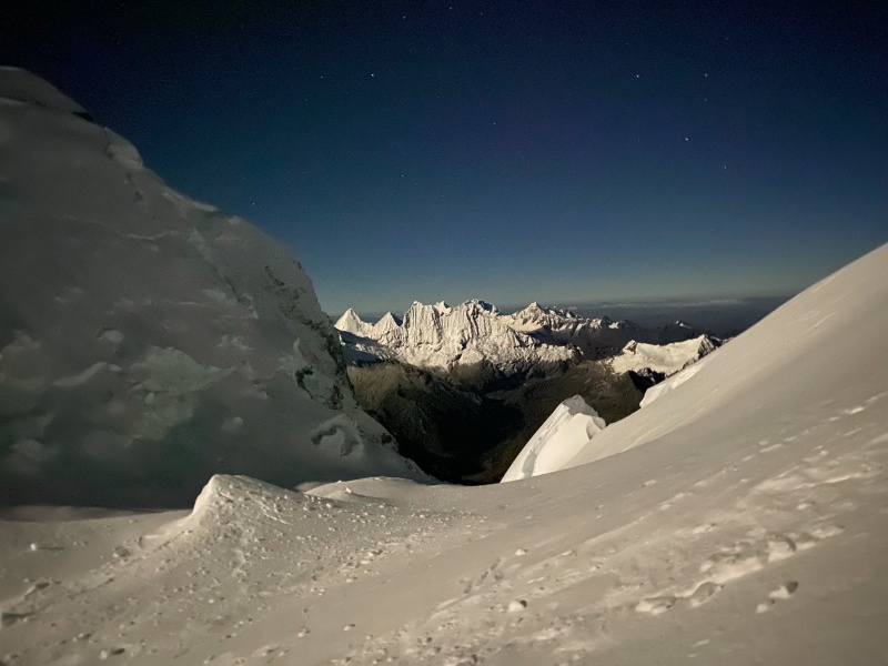
We both woke up around 8:30 AM as a large outfitted group arrived at OUR camp. As they started setting up, Edgar, Dad, and I talked extensively about options. Dad still felt awful. It was a little late to cross the icefall, but we needed to get him down. As soon as the giant outfitted party saw us packing up they began to push us off our tent platforms and fight among themselves about who would get them. tent platforms are a hot commodity at 19,300 where it takes 4 years off your life to dig one of the things. We were not in the best mood and there might have been some snapping involved. We eventaully set off down the icefall and were now able to better see everything, although it was stressful knowing how late we were crossing under the seracs. 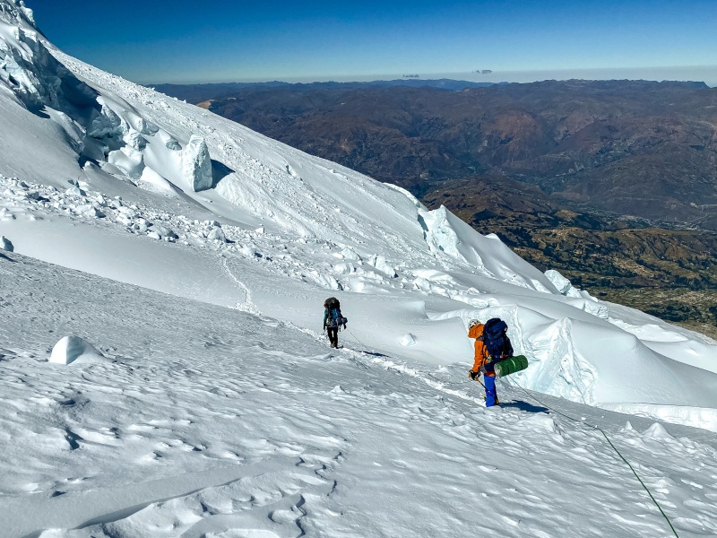
We then walked down the bowl which had been so much work on the way up but now had a nice established trail from the big guided group. They had 4 clients and 13 guides/porters by my count. That isn't the cheap way to do it, and it is easy to say they didn't even climb the thing at that point, but the same could be said about us, we used a porter, too. At the top of the second rap I looked down to untangle my daisy chain as Edgar was building a V-thread. When I saw him starting to do another one, I laughed to myself 'Ha, all that practice as a guide, and he still missed the V-thread, no judgement though, easy to do.' But I was totally wrong. In 90 seconds he set up a double V-thread equalized on a single piece of cordellette, backed up with an ice screw. Damn. I couldn't have done that in 10 minutes. The rest of our descent to Camp I was easy and uneventful, and we ate lunch there. 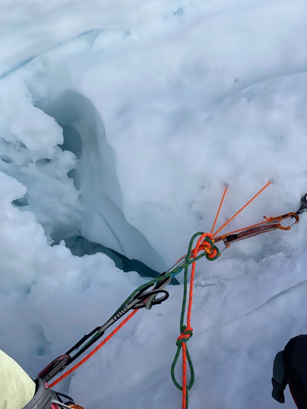

After lunch, Dad still didn't feel good, so we dropped another 2,200 feet to Moraine Camp, hoping that getting low enough would be the trick. We were the first to arrive in camp, but soon a group of seven very friendly and excited Poles joined us. They had brought food and equipment for 8 days and would move up and own the mountain in an expedition-style siege. It was painful seeing that the weather was perfect all day, the first and really the only day of the trip that we didn't have fog. Full moon, perfect weather, I felt so good. At least I can rest knowing that Huascaran was within my grasp, and in other circumstances I might have stood atop it. After enjoying sunset, we hit the pillows and fell fast asleep. Morning would arrive 14 hours later, and neither of us would wake even once during the entire night. It was without competition the best night of sleep I have ever had. 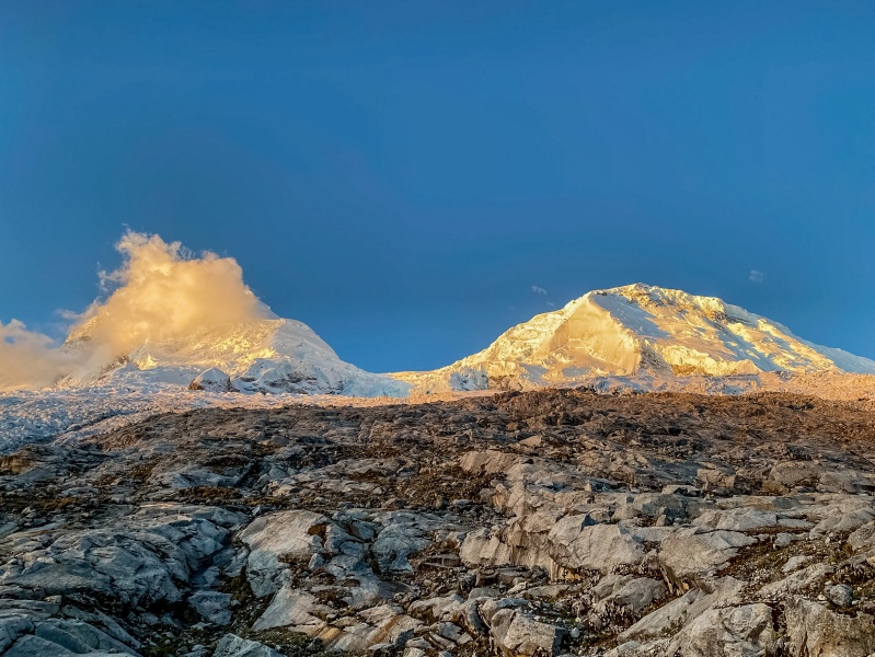
Wednesday, June 15th We had breakfast with the Poles, then they went up, and we went down, arriving at the trailhead 3.5 hours after setting out. 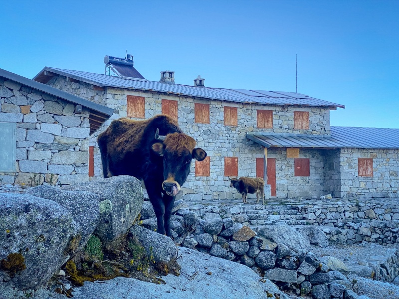
We taxied back to Huaraz, ate 3 entrees between the two of us, unpacked some stuff, looked at each other with clearly the same idea, then went and shared 3 more entrees, and followed it with 4 scoops of ice cream each. Solid recalorie-ing. Thursday, June 16th The next morning we enjoyed a relaxing day with lots of food including a stuffed fried Venzuelan sopapilla. I was ok with it. ;) 
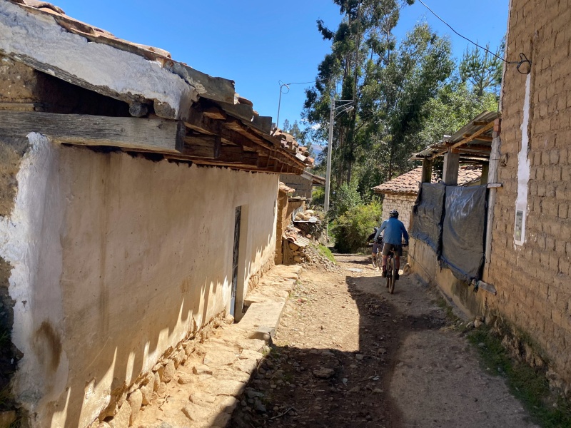
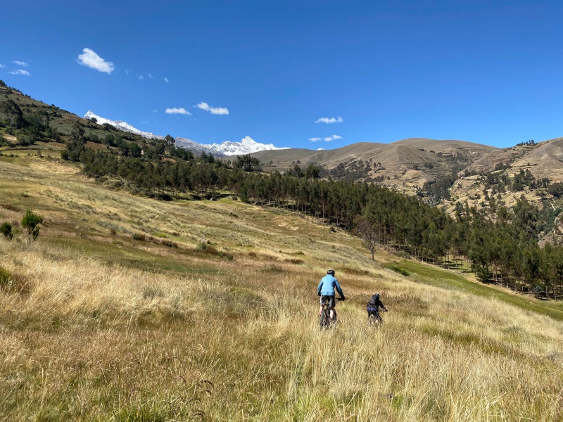
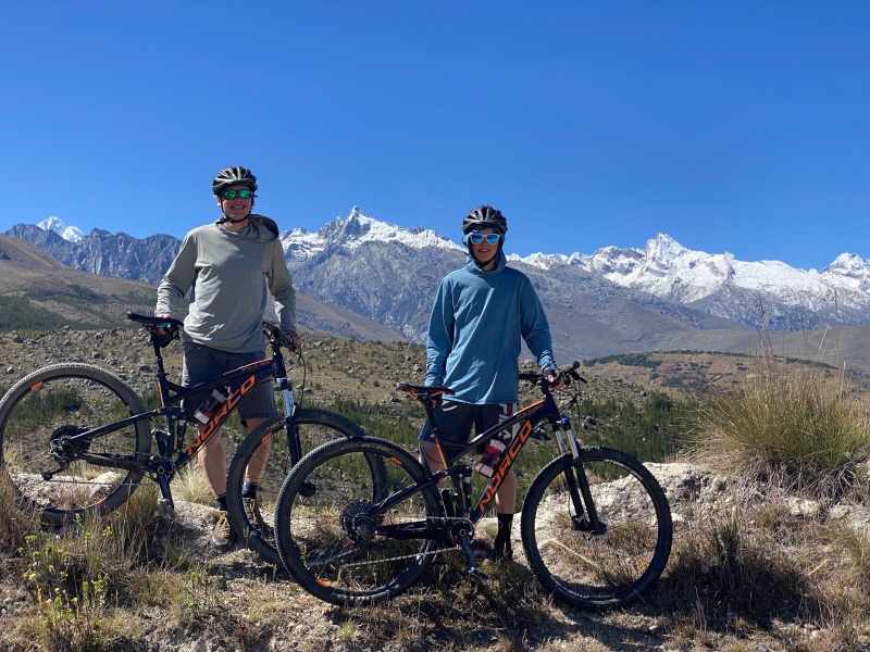
Later that day we met with Edgar to talk about a 3rd and final venture into the Cordillera. You know what the first thing he said was (after hola)? "Did you hear? There was an accident on Huascaran. The Poles." You can't just leave someone with that. The assumption is that all of the funny, energetic, occasionally gregarious Poles are dead. Trapped in ice, seven bodies on the glacier. Thankfully, this was not the case, in fact, by some bloody miracle, they were all alive. A large serac had collapsed, breaking into many smaller pieces as it fell. This occurred around 5 AM, when the Poles wee doing everything right (on the glacier before the sun...). Two climbers had received mild wounds (enough to end their climbing trip, but they could walk them selves out. One had been directly hit by a small serac (when I say small, I mean an elliptical "sphere" (if that makes sense) about 2 foot by 3 feet. It had fractured his right femur, something in his right arm, and shattered the right side of his rib cage. As of two days after they had him don to the Refugio, but not out yet. that was the last we heard of them, but I assume they got him down safely. It is important to remember that in the Cordillera Blanca, there is no helicopter coming for you. If your lucky you might get a group of trained guides.This really cemented my opinion of Huascaran being to dangerous for me to attempt again. It is truly a game of lives. Friday, June 16th Tito Olaza (owner of the hotel) has 6 brothers. One of them, Julio, operates a mountain biking tour service, so we decided to try it as a rest day, change it up a bit. He charged 60 dollars for the two of us to be shuttled up to about 12,300, rent bikes, and he guided us for a 3.5 hour ride. It was nothing like riding at home, being a mix of double-track, very skinny single-track, and occasionally no path at all. It was quite interesting, having to jump over aqueducts, outrun ferocious dogs (Julio taught is to skid our back tire at the dogs to scare them off), ride through 200 foot long bogs with mud 8 inches deep, follow abundant cliff edges, and plenty of other excitement. The views were really nice though. 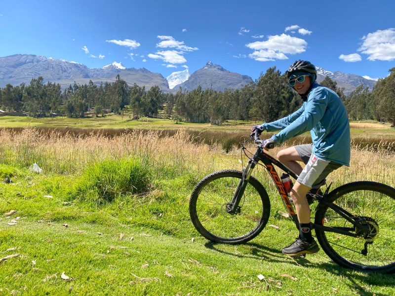
We concluded the day with lunch, ice cream, snacks, dinner, then bed, knowing we had a 7 AM taxi coming to take us to Collon, the trailhead for the Quebrada Ishinca. We hoped to try Urus, Ishinca, Ranrapalca, and Tocllaraju as our final Cordillera Blanca adventure. I don't quite know how I convinced dad to go to the high altitudes again, but he seemed quite eager to redeem himself. The Ishinca Valley is our last hope for a 6000 meterish peak (Tocllaraju is 5980 but I think that sort of counts). We can only hope that the terrible forecast doesn't come to fruition, Dad feels better, and out technical skills are up to a beast of a mountain like Ranrapalca. To continue reading see Peru Part IV about Nevados Urus 17,495 and Ishinca 18,143 in addition to the approach on Ranrapalca 20,218. Thumbnails for uploaded photos (click to open slideshow): ")
")
")
")
")
")
")
")
")
")
")
")
")
")
")
")
")
")
")
")
")
")
")
")
")
")
")
")
")
")
")
")
")
")
")
")
")
")
")
")
")
")
")
")
")
")
")
|
| Comments or Questions | |||
|---|---|---|---|
|
Caution: The information contained in this report may not be accurate and should not be the only resource used in preparation for your climb. Failure to have the necessary experience, physical conditioning, supplies or equipment can result in injury or death. 14ers.com and the author(s) of this report provide no warranties, either express or implied, that the information provided is accurate or reliable. By using the information provided, you agree to indemnify and hold harmless 14ers.com and the report author(s) with respect to any claims and demands against them, including any attorney fees and expenses. Please read the 14ers.com Safety and Disclaimer pages for more information.
Please respect private property: 14ers.com supports the rights of private landowners to determine how and by whom their land will be used. In Colorado, it is your responsibility to determine if land is private and to obtain the appropriate permission before entering the property.


