| Report Type | Full |
| Peak(s) |
Sunlight Peak - 14,061 feet Peak Eighteen - 13,474 feet Windom Peak - 14,089 feet Jupiter Mountain - 13,838 feet |
| Date Posted | 07/02/2022 |
| Date Climbed | 06/29/2022 |
| Author | daway8 |
| Additional Members | HikesInGeologicTime |
| Centerpiece of Chicago Basin |
|---|
|
This report will highlight an underappreciated but beautiful, fun little unranked 13er amazingly situated as the Centerpiece of the Chicago Basin: Peak Eighteen. I'll also touch on Sunlight's infamous summit block that my friend did with ropes (see backstory section for why guides were hired); a passing mention of Windom and a quick look at the route for Jupiter - the only centennial 13er in the basin. Team: HikesInGeologicTime (Geo for short); daway8 (aka: me, David); Kurt (the guide); Luke (the shadow guide) Trailhead: Needleton (after riding the train in) Base camp: Chicago Basin at ~11,170ft Conditions: After a weak snow year, this trip on June 28-30 had hardly any snow present unlike my late July 2019 trip which had lots of snow left due to a very big snow year that winter. Day 1: ride train to Needleton, hike in to Chicago Basin Day 2: Climb Sunlight (all); climb Peak Eighteen (David/Luke); climb Windom (all) Day 3: Start towards Eolus (all); abort just below Twin Lakes; climb Jupiter instead (David) Depending on what you're here for you can jump to any one of these sections headers if you're not interested in the full story:

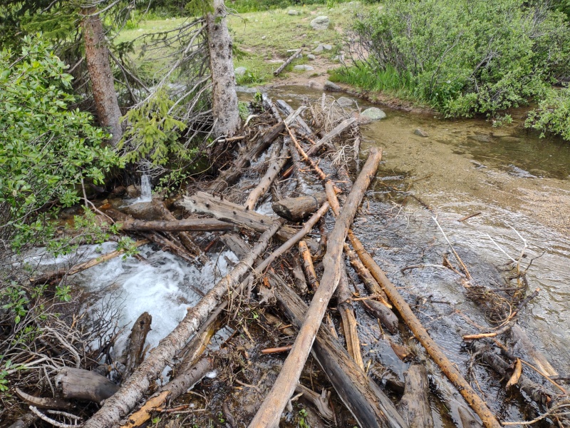
The Backstory If you're only interested in beta, you can skip to the next section header as this section will tell the tale of why a guide was hired for a group of peaks that most people (including myself, the last time I was here) solo and how I ended up being a part of this journey. My first encounter with Geo was back in February 2020 when I received a PM after Geo read my trip report of doing Sniktau, Cupid and Grizzly in winter and being disappointed that I didn't have enough gas to get over to Grays and Torreys and back. So Geo suggested we team up and do a carpool route from Loveland Pass to Grays summer trailhead at Bakerville. So we did and that was a very successful trip. Like other times I've occasionally teamed up with folks on the forum, we both parted with "let's do this again sometime" but sometime never really seemed to roll around. That is until October of that year when I got another PM from Geo asking if I'd be willing to redo Snowmass Mountain. At that point in time I wasn't too excited about repeating peaks but there were 3 effective lures that enticed me to say yes: 1) The suggested route was S-Ridge - a neat, challenging class 3 variation. 2) The road to get to the trailhead was Lead King Basin - a challenging 4WD drive road of the type for which I had purchased my Jeep Renegade Trailhawk. 3) There was a nearby 14er sub-summit (North Snowmass) which I hadn't done yet and which Geo was willing to wait on Snowmass while I went over and tagged it. After that long but successful day we started teaming up more often on various class 3 ridge scrambles, winter peaks, etc. Then came the fateful day of July 6, 2021. Geo had 10 14ers left and had gone out that day with a couple guys to try to take Pyramid Peak off that list. Things went well until the final section just below the summit, where the route can be kept class 3 if you pick the right lines up through the ledges below the summit... That afternoon me and another friend who had hiked together recently got the following text: "Guess who's not climbing any fourteeners until next summer!" followed shortly by the explanation: "I fell 50ft just below the summit. I obviously got really, really lucky that I'll recover fully, but I have a spinal fracture and a broken heel." Turns out Geo landed on a shockingly small ledge - had the fall not ended there it would have certainly been fatal. Over the year since then Geo has been on a long, slow, painful road to recovery. The broken heel would more accurately be described as completely shattered. Geo spent a long time barely able to get around at all. I joined in with some others in helping out during this time and as Geo slowly regained the ability to start doing short, simple hikes I decided to dial back my own 13er ambitions and accompany Geo on whatever short hike was feasible at a given point in time. Finally the time came when the healing was adequate and the snow was melted sufficiently to resume the quest to finish the final 10. With the San Juans melting the fastest, the Chicago Basin was chosen as the place to start. I wasn't originally planning to go until some changes at work created a window of opportunity. We had done a couple peaks together over the winter but this would be the first new 14er and first class 3/4 terrain Geo tackled since the fall. Thus the decision was made to hire a guide from the San Juan Mountain Guides who could short-rope Geo through the class 3 sections as needed and provide a belay up onto Sunlight's summit block. Chicago Basin and the Train Some people look down on doing the Chicago Basin this way but to me, the train ride in is such a neat and classic experience that I think everyone should do it at least once. Even once the train drops you at Needleton you still have to hike in 6 miles or so with around 2,800ft of gain with a full pack to setup camp, so it's not like taking the train turns it into a trivial hike by any means - it just spares you the 15 mile hike in from Purgatory (and the 15 mile hike out to Purgatory with 800ft elevation gain at the very end of that journey). As of late June 2022, there was some significant wash-out on the trail creating big ruts which would not be fun if you discovered them suddenly in the dark... 

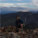
The views in the Chicago Basin are amazing - especially if you can score a campsite near the top of the basin like we did. 
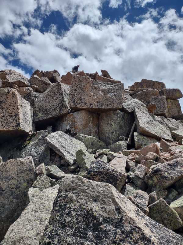
Sunlight Summit Block with Ropes As explained in the backstory, Geo's nearly fatal fall just under a year ago is what prompted hiring a guide to help with restarting the quest to finish the 14ers. Since some people wonder how someone would even make use of ropes for Sunlight's infamous summit block, I'll stick in a few photos here while leaving the more complete account for Geo to tell. 

Why do you need to be roped to climb class 3 terrain? Usually you don't, but if you had nearly died due to a 50ft fall and spent months learning how to walk again then you might find your confidence a little shaken too. You do what you have to do in order to accomplish your goals in life... 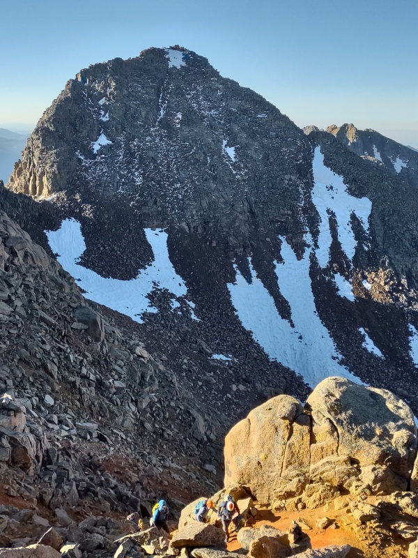

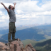
I believe the guides used some sort of anchor from the rock just below the summit rock but also were able to easily lean against the summit rock with feet securely planted at the top of the slab to be walked up. Meanwhile I had walked up just like last time on the rocks over to the right so as to get some action shots. After climbing up and standing on the summit I again did the "leap of faith" descent by stepping down to the rock just below the summit then jumping down to the small flat area on the rock below it (my profile pic is an action shot from the last time I did that). 

The slab section up to the summit is a low enough angle to simply walk up as Luke did but at the same time it's steep enough to make most people uncomfortable doing so without a rope. The alternative is stepping up the rocks to the right but it's tricky to do in reverse without resorting to the leap of faith. 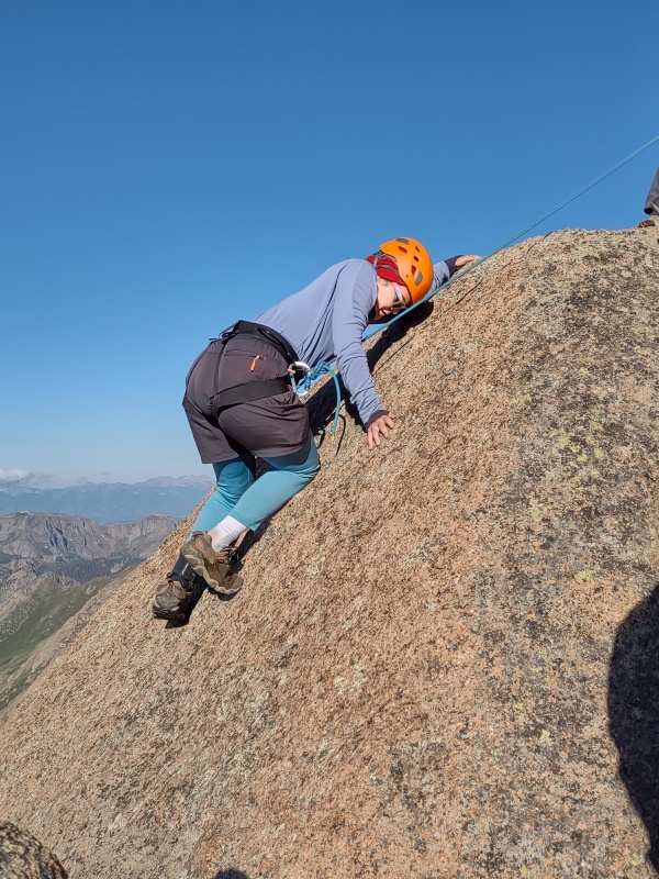
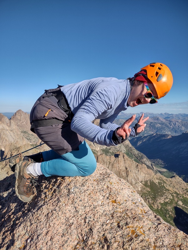
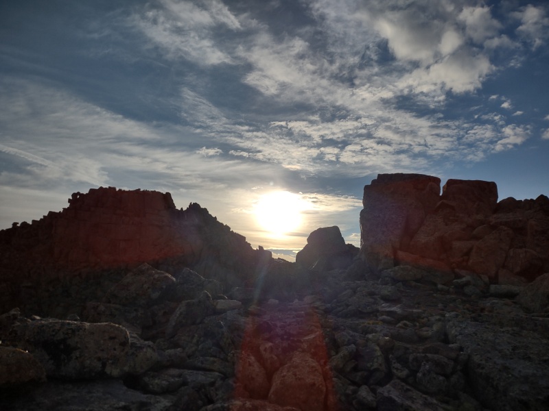
If you were roped going up then it's an easy rappel to get back down. 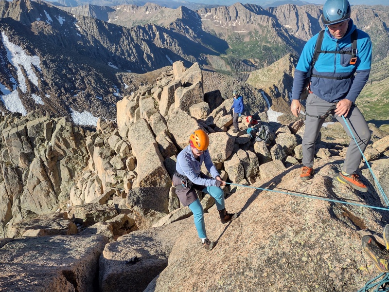
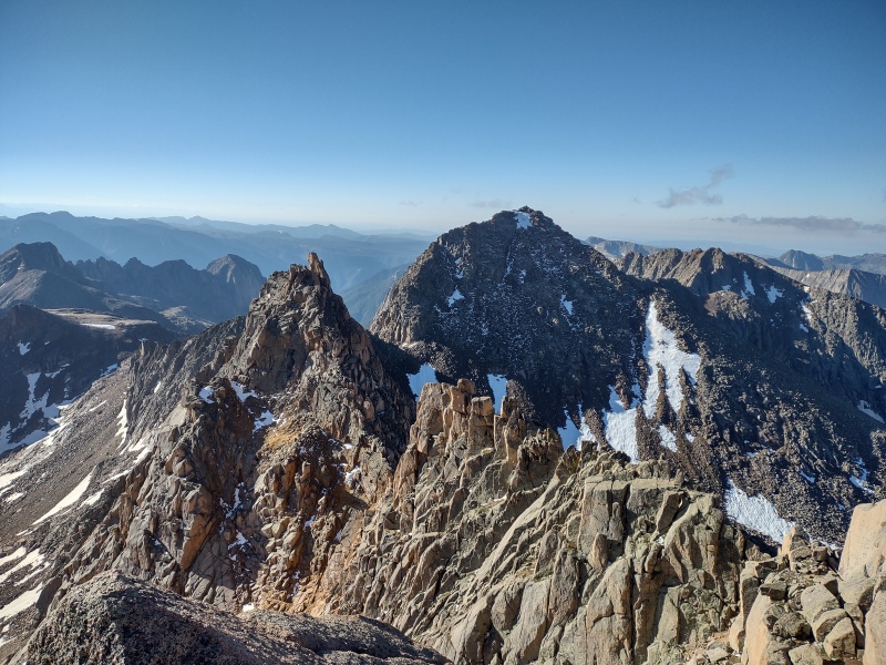
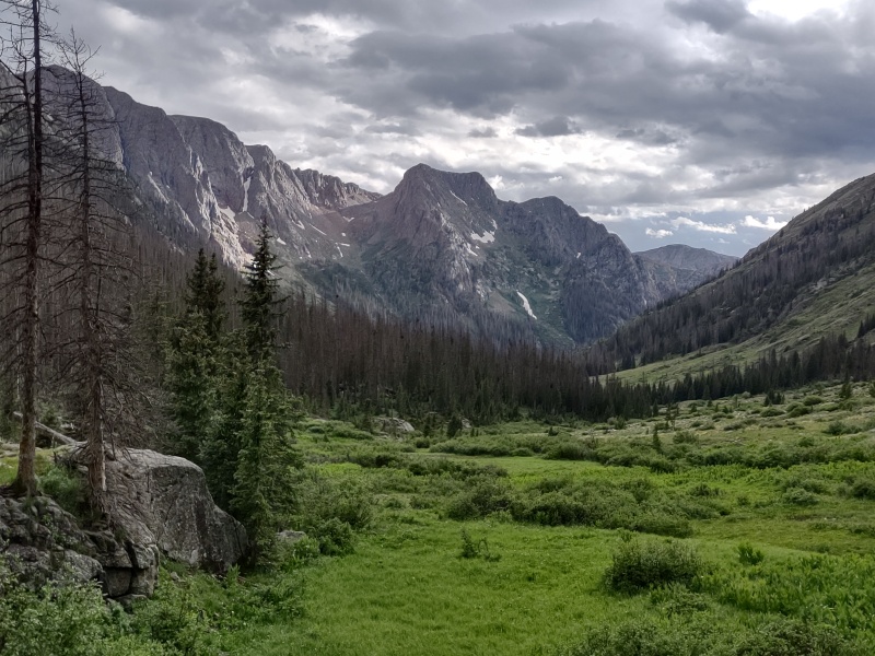
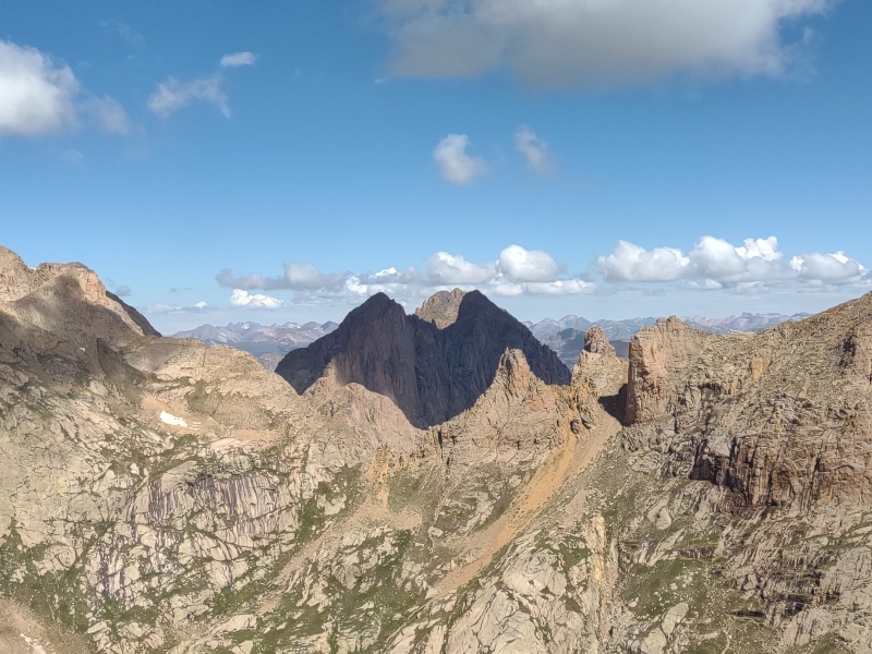
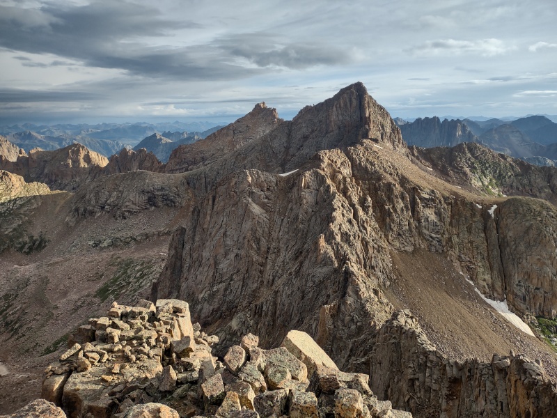
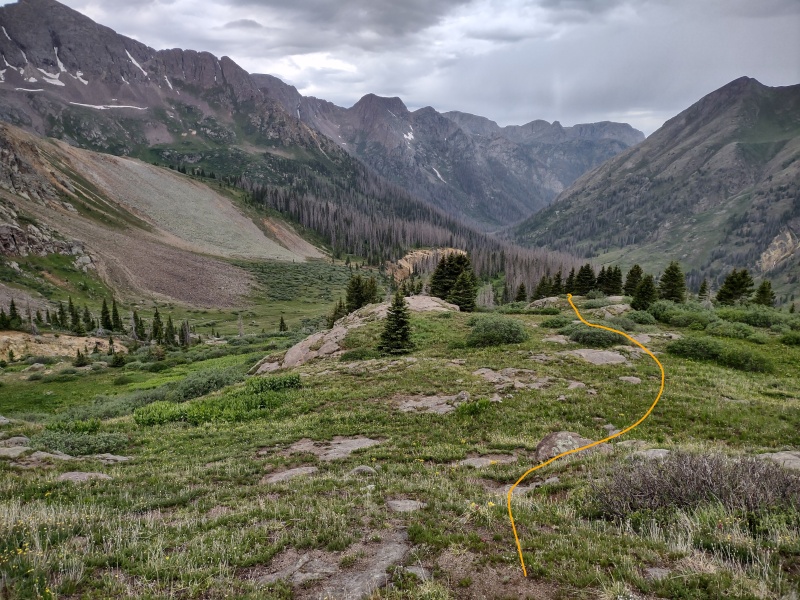
Peak Eighteen, Centerpiece of the Chicago Basin One thing which helped entice me to come back to the Chicago Basin, besides supporting my friend on this important step in a long comeback journey, was the fact that there were a number of 13ers in the region, some of which were not far off from the standard routes for the Basin's 14ers. The nearest of these opportunities was Peak Eighteen, which sits at the opposite end of the ridge from Windom Peak. Peak Eighteen stands out very prominently as you enter the basin and go up to Twin Lakes but since it's an unranked 13er most people don't give it much thought. 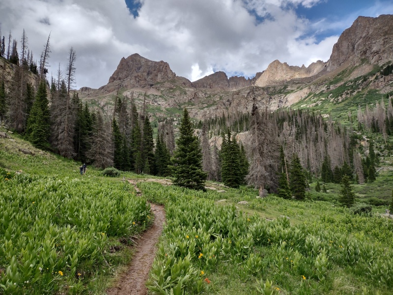
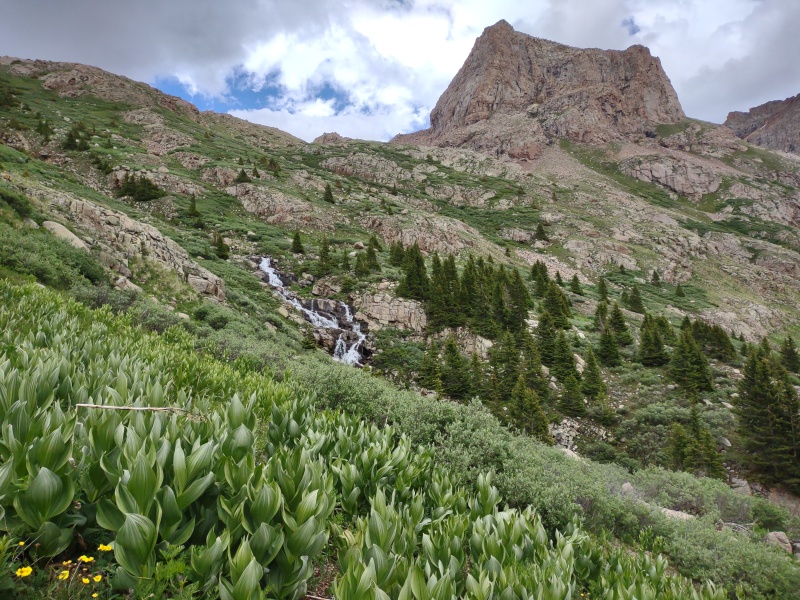

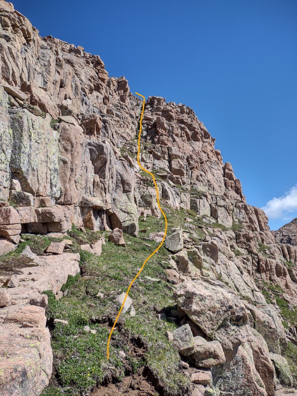
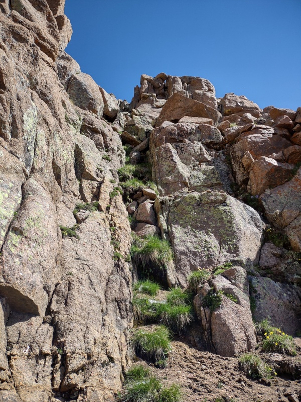
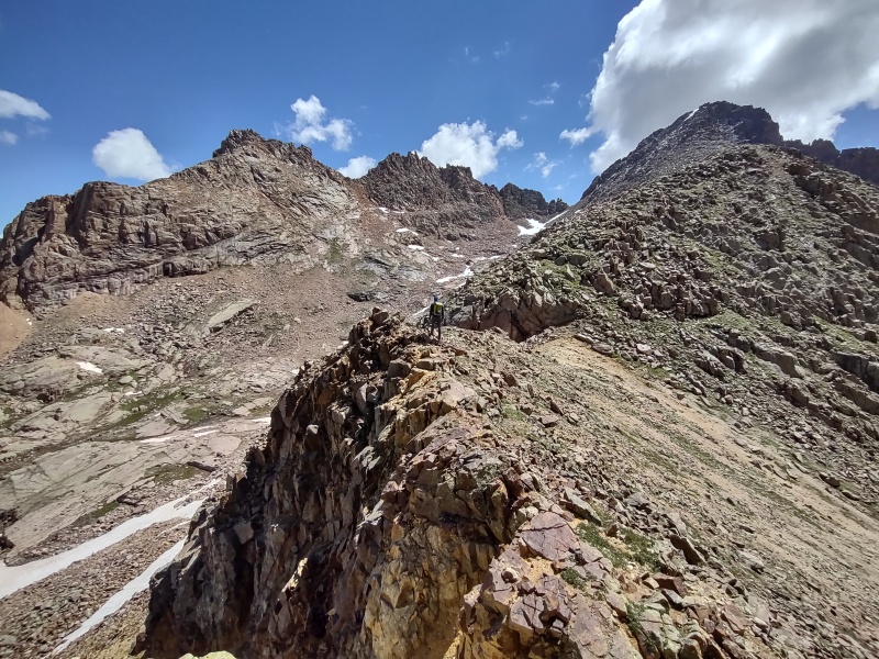
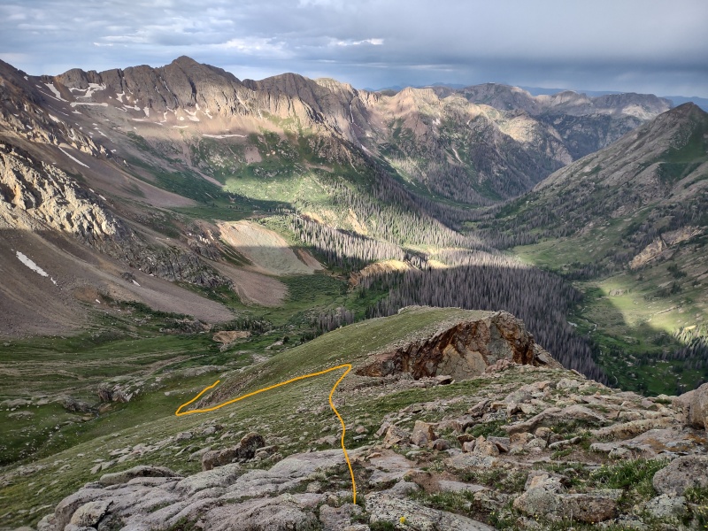
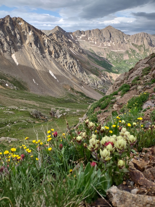
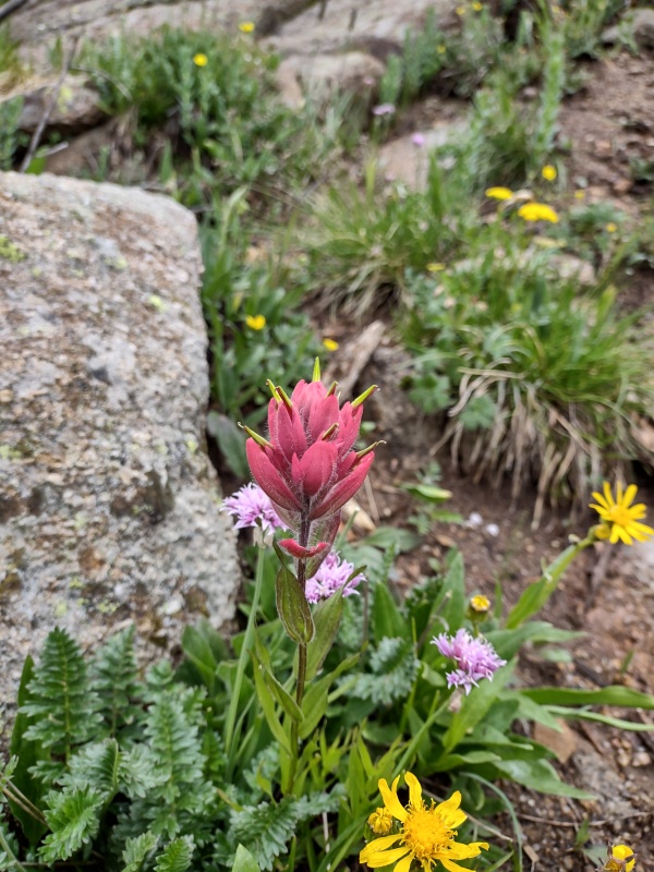
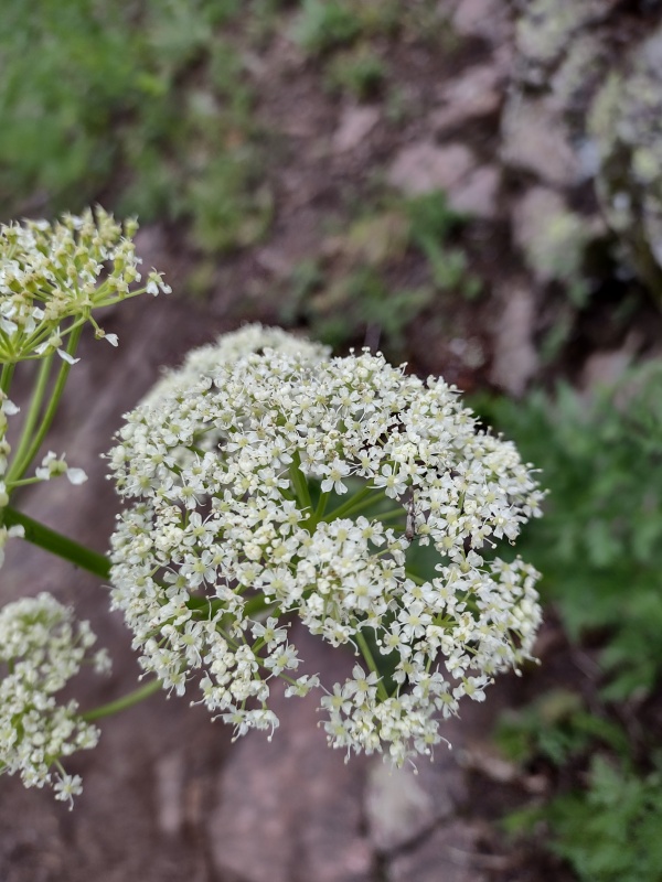
The easiest way to climb Peak Eighteen is to go up to the saddle with Windom, as if you were climbing that 14er, but then turn right at the saddle and follow the ridge over a small hump. After a drop you then start up to Peak Eighteen. I'm told and can easily believe that a ridge direct climb up Peak Eighteen would be class 4 and I wouldn't be surprised if some lines are likely even class 5. But it's fairly easy to keep this peak as class 3, if desired, by cutting to the left and travelling along some grass ledges that are filled with all sorts of beautiful wildflowers this time of year (you have to step carefully to avoid crushing any flowers). 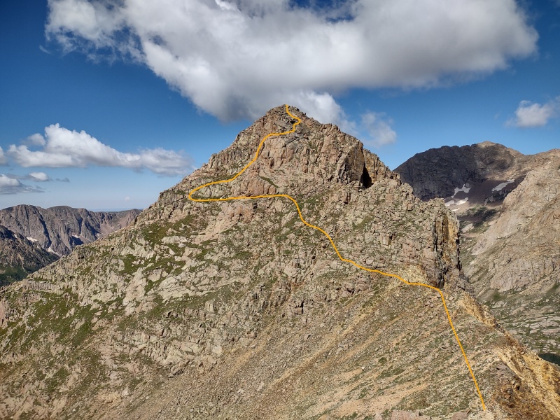
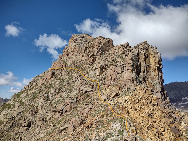
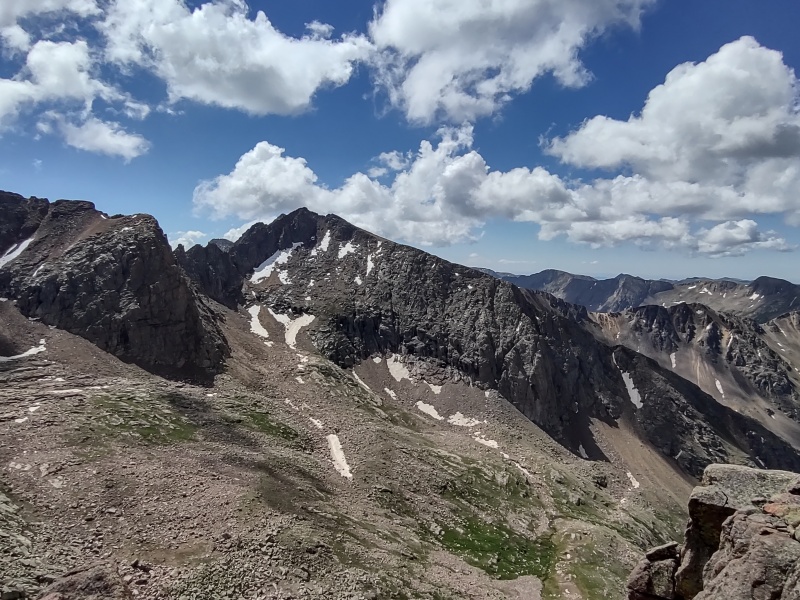
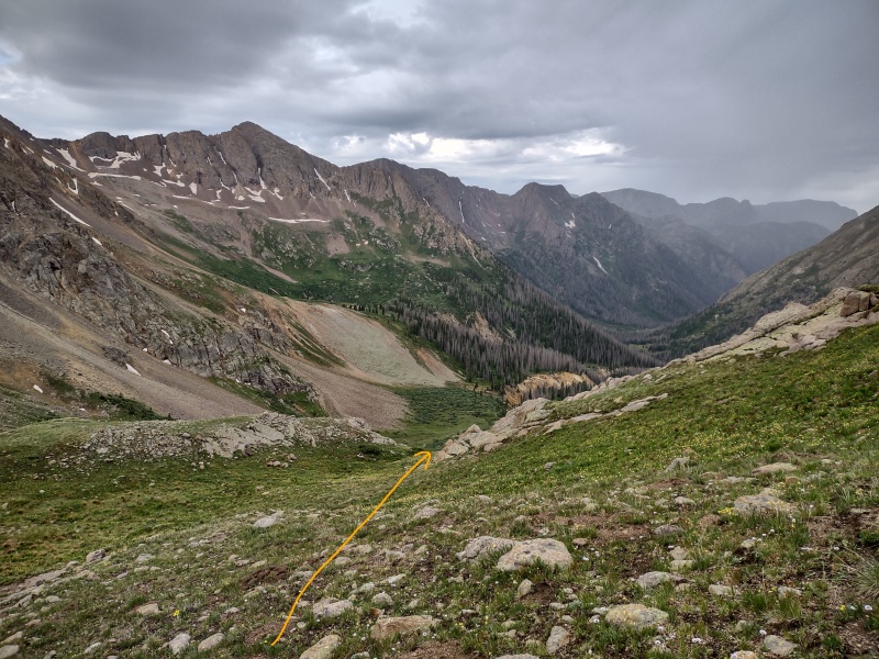
There are all sorts of options for getting to the top, especially if you don't mind class 4 or higher terrain, but you also have various options to keep it class 3. One of the easiest to identify is to pass underneath a large, slanted green ramp that can be seen clearly as you approach from Windom and during much of the time you're coming up onto the SE face. After you pass below that ramp, you get a great view of Chicago Basin and then can turn back and see a grass gully going a significant portion of the way to the summit. This is a simple class 3 gully with some easy class 3 rock scramble up to the summit from there. 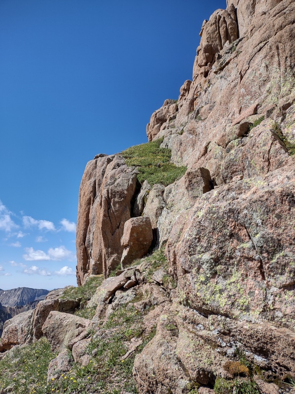
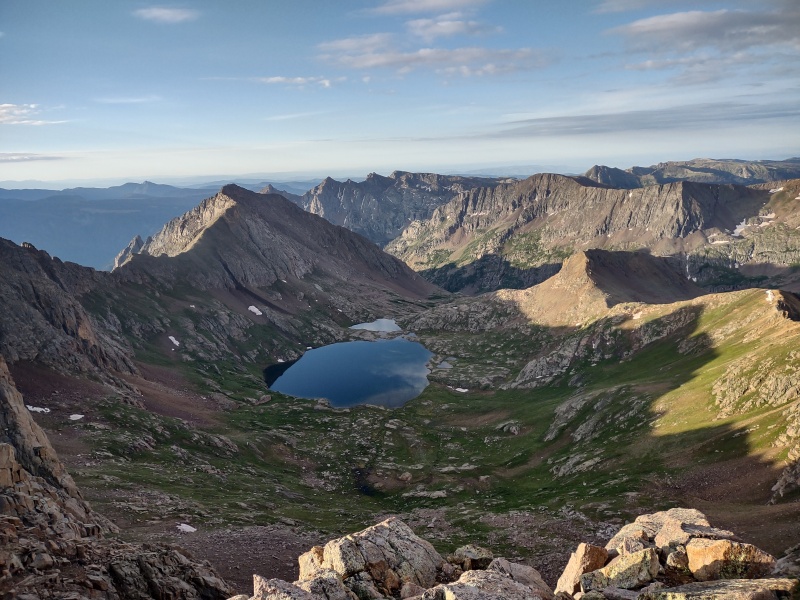
The views from the top of Peak Eighteen are spectacular - you are in the center of everything with all sorts of 13ers and 14ers in basically every direction. Luke and I sat at the top for a while just soaking it all in. 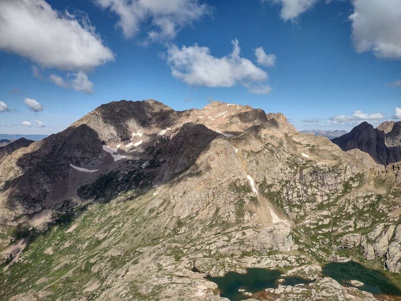


Going back down you can either retrace or pick any number of options depending on how interesting you want to make it. Then you have to regain a small hump if you want to go to Windom or drop to the left at a favorable spot to get back down to the valley between Sunlight and Windom. 
Windom I'll just mention this one in passing as it's recorded plentifully elsewhere. The route is described as difficult class 2 but it's also easy to find yourself on class 3 terrain - even potentially difficult class 3 terrain depending on what line you take. So take some care to carefully pick out the path of least resistance if that's what you prefer - otherwise just go play on whatever line strikes your fancy. On this trip, Luke and I were surprised that we had made such good time moving across the valley ahead of Kurt and Geo that we actually climbed Peak Eighteen and got back down to the saddle with Windom just shortly after they started up from there. So we went ahead and caught up and summitted with them. 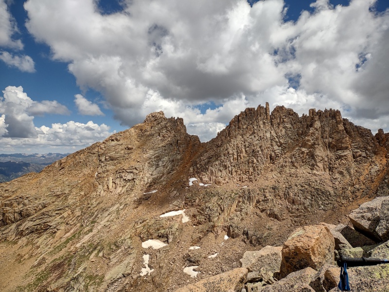
Jupiter, Centennial 13er On the morning of the third day we hit the trail a little before 2am with the hopes of tagging Eolus and North Eolus and getting back down in time to tear down camp and make it back to Needleton for the 3pm train. But these back to back days of exertion had Geo running out of steam a little below Twin Lakes at around 12,400ft - after ~1,200ft of elevation gain that morning. After waiting and resting for a while, Geo wasn't feeling well at all and decided that the Eolus peaks just weren't going to happen this trip. I had already done those peaks previously and was more interested in getting Jupiter. After a consultation with the guides, with Kurt giving me some verbal description of the route and confirming that I had gpx tracks loaded and that I felt confident doing the route alone (I knew I could probably move faster that way anyways), I headed off solo so that the guides could make sure Geo got back to camp ok. I will say that for anyone heading up this peak before sunrise it's a VERY good idea to have gpx tracks loaded since the trail, once it branches off from the main trail going to Columbine Pass, is very hit and miss and winds and weaves up through some rock bands. If I hadn't had the gpx tracks loaded I would have likely ended up waiting for sunrise to go up since some of those rock formation would likely be treacherous in the dark, but in daylight and/or with the gpx tracks it's much easier to figure out how to weave through them. 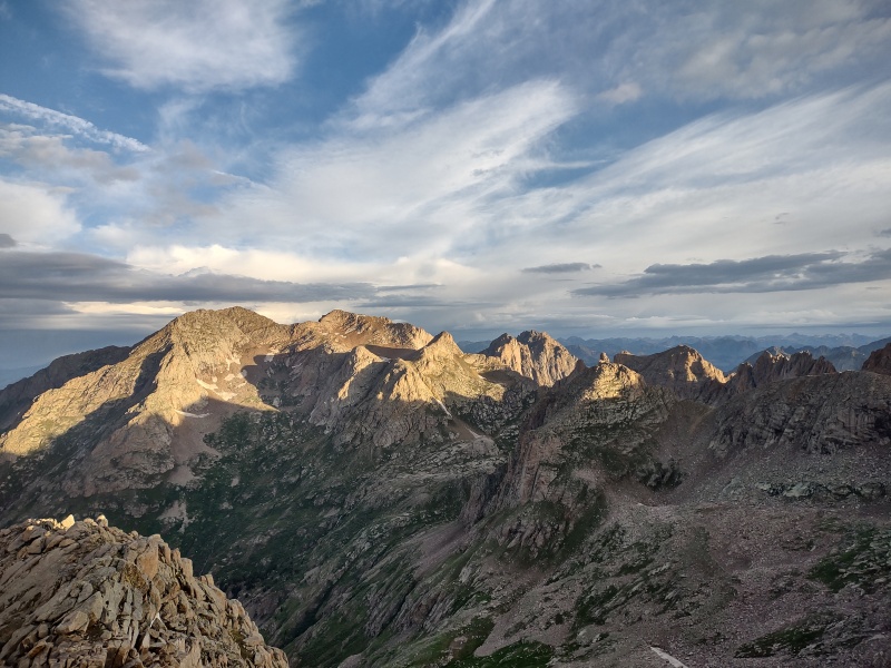


From Chicago Basin the route up follows a very solid trail to Columbine Pass. When doing the 14ers there's a sign indicating a left turn to go to Twin Lakes. Just go straight instead towards Columbine Pass. The trail was pretty wet/muddy when I did at for this late June trip. The turnoff for Jupiter at another stream crossing is not well defined but you'll eventually spot occasional good trail segments. 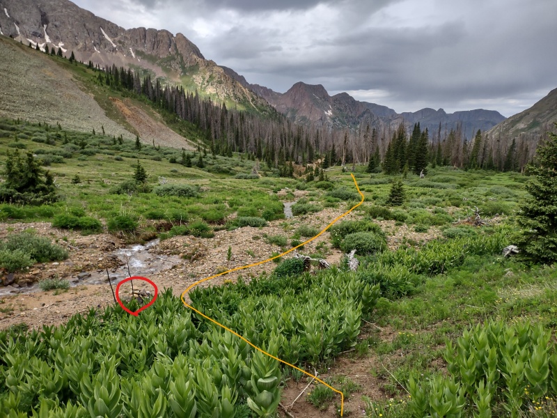
Concluding Thoughts Overall this was a very successful and enjoyable trip. Geo knocked two more 14ers off the list, including getting to the true top of Sunlight's summit block. It would have been nice to get the other two 14ers but considering everything that's happened over the last year this was still a very good accomplishment. Meanwhile I repeated Sunlight and Windom - once again jumping off the Sunlight summit block - and added on centennial Jupiter which I had wanted to get last time, plus had the unexpected surprise of discovering Peak Eighteen to be draped in wildflowers along fun class 3 grass ledges/ramps/gullies leading up to a summit with unbeatable views of everything in this region! I did however manage to draw blood with a scrap to the knee and another on my right thumb plus somehow shattered the ultrawide lens on my phone. Fortunately the other lenses were not damaged so I could still take normal photos but when I tried to take anything in ultrawide mode I got the funky frosted effect you see below. 
One final thought: if anyone else feels the need to have a guide help them with Sunlight's summit block and/or any of the other terrain in this basin (including Sunlight Spire or other challenging 13ers in the basin) then San Juan Mountain Guides is a fantastic service! Kurt has been leading half a dozen or so trips up in the basin every year for like 5 or 6 years and knows the entire basin by heart. He was ultra patient and helpful as Geo worked through both physical issues and some mental flashbacks upon reaching terrain reminiscent of Pyramid. He showed various techniques for walking/climbing/etc to help Geo deal with a still healing foot. Luke, who is an experienced guide who recently transferred from a different part of the state came along as a shadow guide to learn the region and was also extremely helpful the entire time. Both of them brought along extra snacks to share and packed in the stove/fuel so we didn't need to add that weight to our packs. If you're interested in that type of service check out https://mtnguide.net/ Meanwhile stayed tuned as HikesInGeologicTime has a rematch with Pyramid Peak coming soon... Thumbnails for uploaded photos (click to open slideshow): ")
")
")
")
")
")
")
")
")
")
")
")
")
")
")
")
")
")
")
")
")
")
")
")
")
")
")
")
")
")
")
")
")
")
")
")
")
")
")
")
")
")
")
")
")
")
")
")
")
")
|
| Comments or Questions | |||||||||||||||||||||
|---|---|---|---|---|---|---|---|---|---|---|---|---|---|---|---|---|---|---|---|---|---|
|
Caution: The information contained in this report may not be accurate and should not be the only resource used in preparation for your climb. Failure to have the necessary experience, physical conditioning, supplies or equipment can result in injury or death. 14ers.com and the author(s) of this report provide no warranties, either express or implied, that the information provided is accurate or reliable. By using the information provided, you agree to indemnify and hold harmless 14ers.com and the report author(s) with respect to any claims and demands against them, including any attorney fees and expenses. Please read the 14ers.com Safety and Disclaimer pages for more information.
Please respect private property: 14ers.com supports the rights of private landowners to determine how and by whom their land will be used. In Colorado, it is your responsibility to determine if land is private and to obtain the appropriate permission before entering the property.