Download Agreement, Release, and Acknowledgement of Risk:
You (the person requesting this file download) fully understand mountain climbing ("Activity") involves risks and dangers of serious bodily injury, including permanent disability, paralysis, and death ("Risks") and you fully accept and assume all such risks and all responsibility for losses, costs, and damages you incur as a result of your participation in this Activity.
You acknowledge that information in the file you have chosen to download may not be accurate and may contain errors. You agree to assume all risks when using this information and agree to release and discharge 14ers.com, 14ers Inc. and the author(s) of such information (collectively, the "Released Parties").
You hereby discharge the Released Parties from all damages, actions, claims and liabilities of any nature, specifically including, but not limited to, damages, actions, claims and liabilities arising from or related to the negligence of the Released Parties. You further agree to indemnify, hold harmless and defend 14ers.com, 14ers Inc. and each of the other Released Parties from and against any loss, damage, liability and expense, including costs and attorney fees, incurred by 14ers.com, 14ers Inc. or any of the other Released Parties as a result of you using information provided on the 14ers.com or 14ers Inc. websites.
You have read this agreement, fully understand its terms and intend it to be a complete and unconditional release of all liability to the greatest extent allowed by law and agree that if any portion of this agreement is held to be invalid the balance, notwithstanding, shall continue in full force and effect.
By clicking "OK" you agree to these terms. If you DO NOT agree, click "Cancel"...
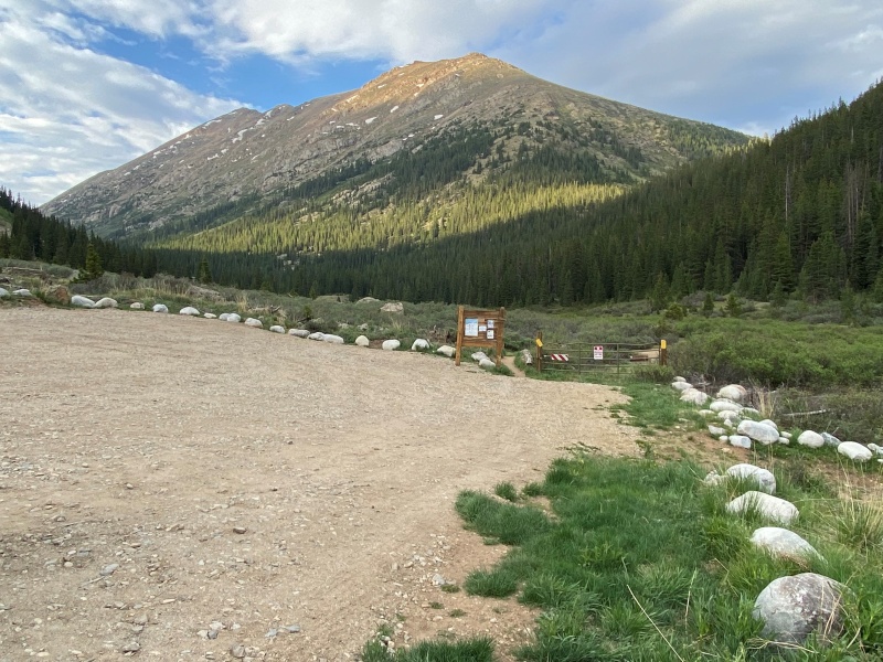
I was lucky enough to bug out of work a little early on Friday and arrived at the North Lake Creek TH, just off of the Independence Pass road at around 5:30 pm. I know it's early in the season and the 14er La Plata is just a few miles away but I was pleasantly surprised to find no one at the TH when I arrived.
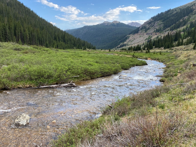
Good ol' Colorado. Everywhere in the mountains is one beautiful scene after another.
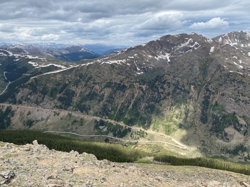
The TH is literally right off of Independence Pass road, which can be seen angling up and ultimately leading to Aspen.
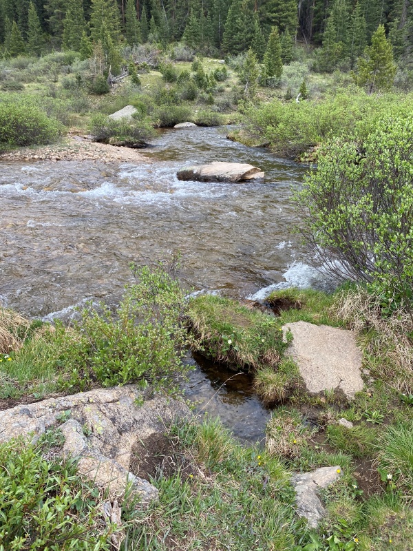
I was lucky enough to have been here two weeks prior to scope out the area. Knowing that the water was running strong I wanted to get a look at it before the morning. Below is where I crossed. The water was, well... invigorating, just over my knees and running fast. I used a nearby stick for balance, took my time and got across barefoot.
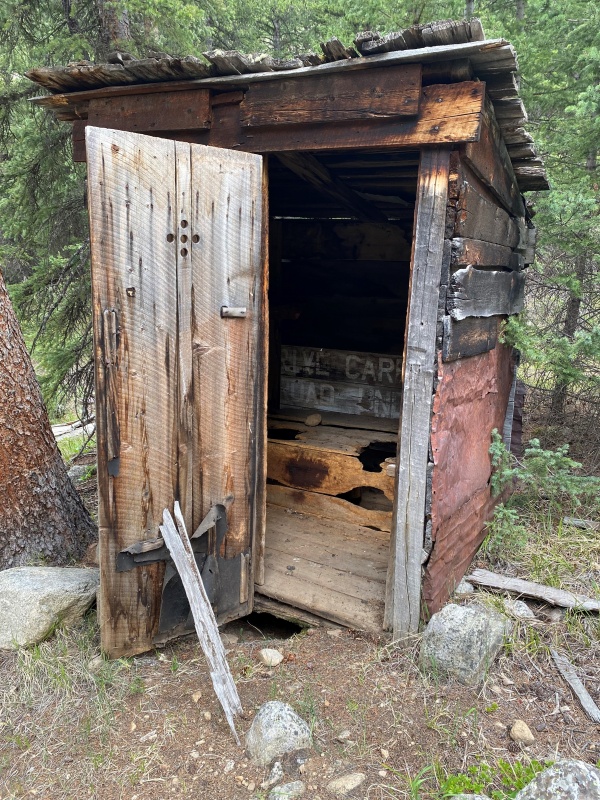
Just past the crossing you head up an old dirt road which is fairly over grown and reach a curiousity of this trail.
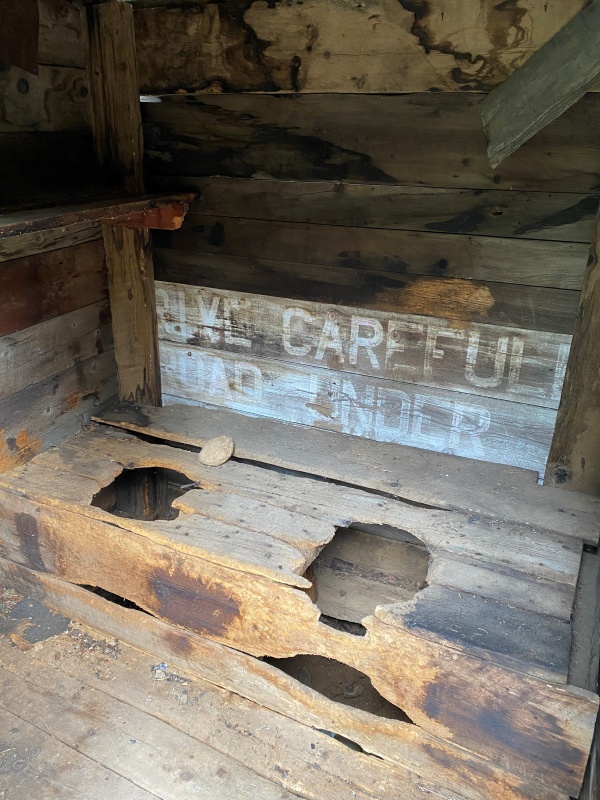
What's that? A double outhouse?Struggling to think of a situation where a double outhouse (as opposed to a single) would be preferable. Hmm...
Anyway, enough sight-seeing. It was time to grab a little dinner and start getting ready for an early check-out the following morning.
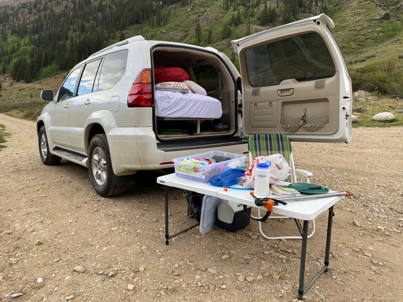
Be it ever so humble, there's no place like my mobile home.Goofing off a little after dinner.
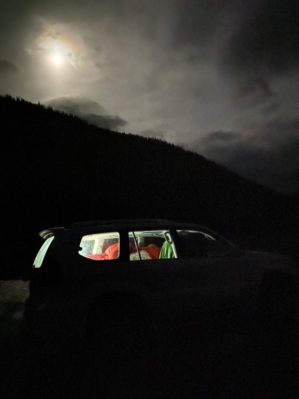
I wanted to get an early start the following morning so I could get my hiking in and get back home to watch Game 2 of the Avs vs. Tampa in the Stanley Cup Finals with the family. As it happened, early meant getting up even before the moon went to bed.
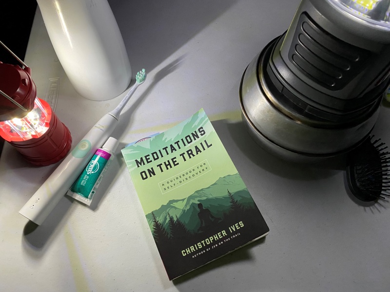
Getting my mind, body and spirit set for the day.
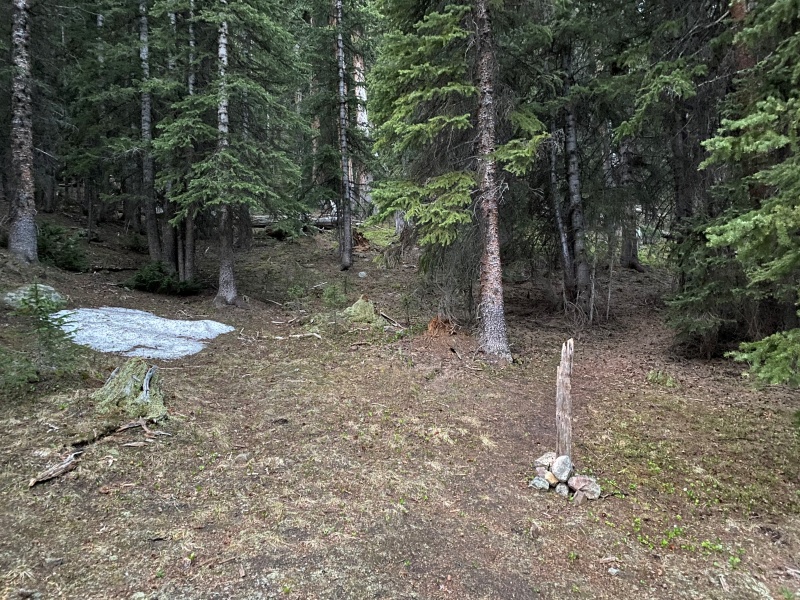
On the hike, after crossing the water and passing the outhouse(s) you come to a set of two old, abandoned cabins in the forest. PSA: If you're doing this hike I can't recommend enough checking out the route description that Bill's posted on this site. His information on getting through the forest section of the hike is spot on and I'd also recommend reviewing his topo map with indicators on the cabins, where you hit tree line, etc.
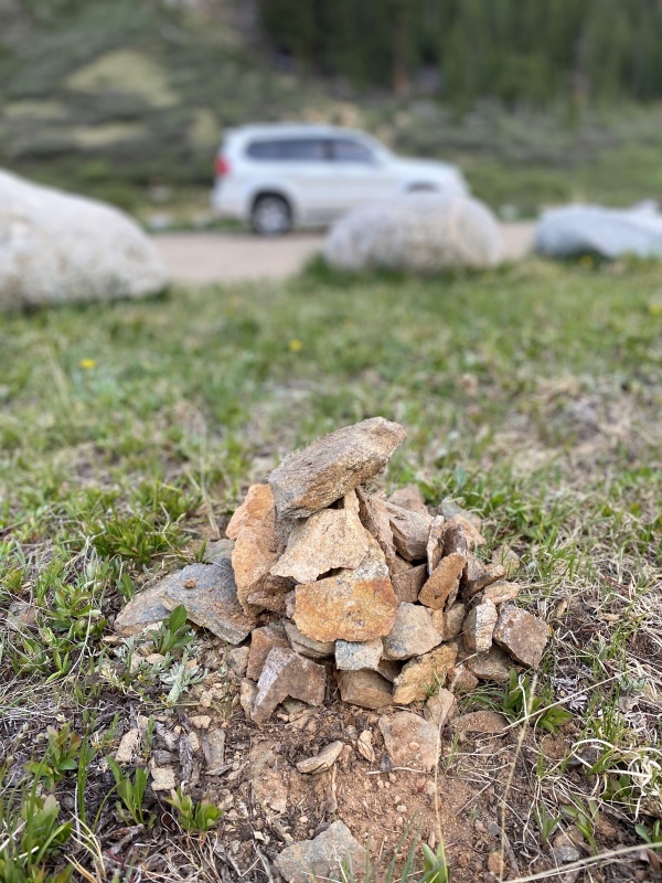
After leaving the second cabin you take a hard right and start on a trail through the forest. Some helpful souls have improved the trail over the years and you can't miss this junction due to the below cairn and post marking the turn-off.
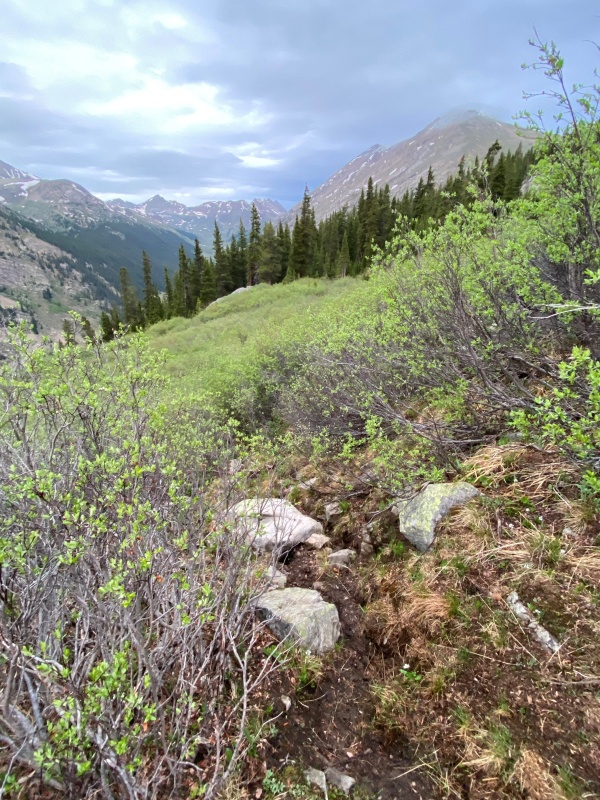
At a gully you make another hard right to again follow a faint trail through the forest which is essentially running parallel to the tree line above you. Bill talks about passing some ledges and then you pop out at tree line. I'd only add that after about 0.1 of a mile from the ledges you should look for an open space / trail that angles up and to the left to reach tree line. I kept going straight after the ledges and ended up in some willows. The willows weren't hard to navigate but you'll be better off if you can avoid them. I found the trail on the way down.
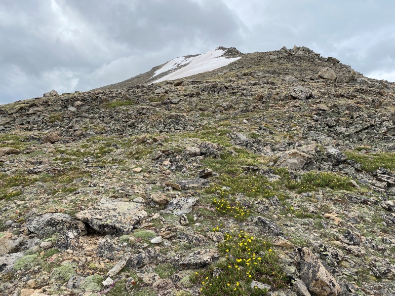
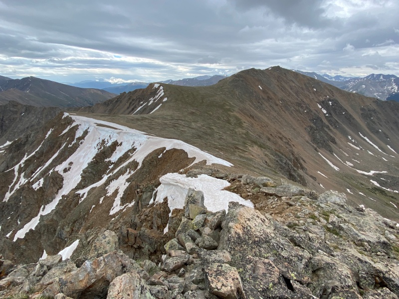
What can you say about the next 1,000' of elevation gain? Talus to your left looking up, a grassier section to the right and no trail to be seen anywhere. Really you just have to put your head down and go for it. Once you gain the ridge you get a view of point 13,660'. It was a little snowed in on the east side but staying on the ridge proper allowed me to keep my boots dry.
From the top of point 13,660' you get a look at the remaining route. You can just make out the summit block of Lackawanna - center right below.
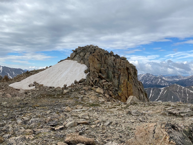
The summit block, again the snow is east facing.
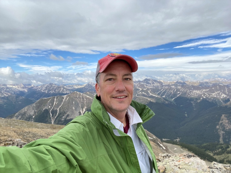
I left the TH at 5 am thinking I'd be on the summit by 8 am. However, here I am grabbing a summit pic at 9.
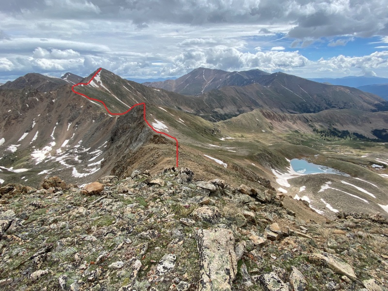
Sometimes I get all fired up heading into the mountains and come up with some grand plans. My thought was if I got to the top of Lackawanna early enough maybe I'd make a ridge run on nearby Casco Peak which I saw described in rambis_21's trip report. Having summited Lackawanna an hour later than I thought, the weather being a little questionable, frankly being a little tired and with a long drive to make before the Avs game I decided to take my time on the summit and just head back to the TH. Still here's a pic of the route you could take from the top of point 13,590' to Casco.
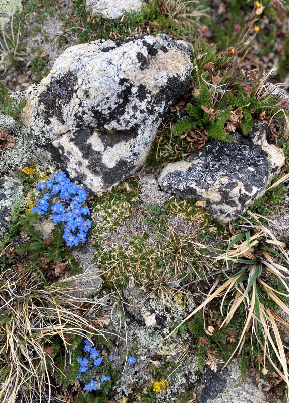
Going at a more leisurely pace allowed me to appreciate the flora.
All I had to do now was drop down from the ridge, navigate the forest section and get back to the TH and my car - which can almost be seen below.
Thumbnails for uploaded photos (click to open slideshow):
I saw that outhouse last year. My scout camp had this double seat wooden pit toilet, pretty similar, and they were in use for many, many years. One night I planted a tree in the hole, coinciding with a salmonella outbreak. Bad timing. Another configuration is pilot-to-bombardier, with back to back seats. Philmont had these.
Lackawanna is a mountain I very much enjoyed hiking as well. I also remember having some trouble finding the route on the forest but ended up finding it. It was a great day! Sometimes when one can see their car from the top, I wish I could be a bird to make it to the car a little bit faster!. And tomorrow game 5 for the Avs! I hope they win the Stanley Cup!.
...for the Avs wishes. My daughters and I went to the Ball Arena watch party for Game 6 to see them win it all. So exciting!
Caution: The information contained in this report may not be accurate and should not be the only resource used in preparation for your climb. Failure to have the necessary experience, physical conditioning, supplies or equipment can result in injury or death. 14ers.com and the author(s) of this report provide no warranties, either express or implied, that the information provided is accurate or reliable. By using the information provided, you agree to indemnify and hold harmless 14ers.com and the report author(s) with respect to any claims and demands against them, including any attorney fees and expenses. Please read the 14ers.com Safety and Disclaimer pages for more information.
Please respect private property: 14ers.com supports the rights of private landowners to determine how and by whom their land will be used. In Colorado, it is your responsibility to determine if land is private and to obtain the appropriate permission before entering the property.

")
")
")
")
")
")
")
")
")
")
")
")
")
")
")
")
")
")
")