| Report Type | Full |
| Peak(s) |
Mt. Oklahoma - 13,843 feet |
| Date Posted | 06/13/2022 |
| Date Climbed | 06/11/2022 |
| Author | jbealer |
| A Couloir named Cowboy |
|---|
|
This all started as a training trip to Cathedral Peak that my team vetoed late Thur night after our crevasse practice, no one wanted to drive 4hrs to Aspen Fri night. At 9:30pm Savage couloir was suggest as plan B. I know your wondering what any of this has to do with Oklahoma, hold on. I threw all my stuff together early Friday morning because i was the only one who had to go into an office and did not have all day to pack their gear, cleaned out the Element so Rachel and I could sleep in it and headed to work hoping i had all my shit. 5 of us met at 5pm at the PnR, grabbed dinner and drove to the Missouri Lakes TH where our friend from the springs would meet us. At 8pm we were met with this 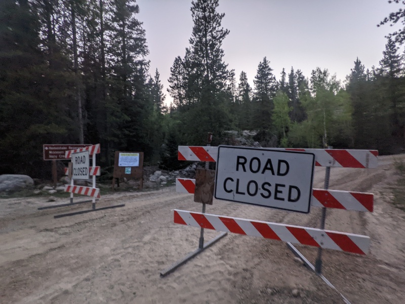
We wondered how much a fine would be if we moved the sign, after all we were starting at like 2am, and would be down early, we thought about driving up, dumping our sleeping gear, driving a car back down and having 1 person walk 3 miles up the road, we though about just walking the road. In the end there was no winning option. We decided to drive to Leadville and find a peak to hike and not get up early for a snow climb. Now to flag down Connor on the road to let him know the plan. About 7 cars later we find him and were now all on our way, by 10pm we had 2 hotel rooms and a plan to hike Mt. Oklahoma, a centennial peak. I was happy my team put a centennial back on the plan, my current check list i am working on. We got a late start by our standards, 6:40am, considering we were planning on a 2am start for Savage. My Element was stuck in a parking spot just past the rough start to the 4WD road and i spent the whole day hoping we would get her out. We were stuck wearing all our "snow" gear as that is what we had packed, mountaineering boots and all, since were training for Rainier we loaded our packs up to 30lbs with ropes and pickets, WAY over kill for anything in the area and followed the route info Bill posted. We still managed to lose the trail a little but it was an easy fix. 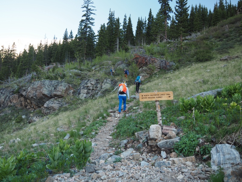
 We made our way to the high basin on Oklahoma's southeast slopes to look for the steep, grassy slope to our right, we were met with snow. the large wide snow field on the right is the path Bill speaks of, but what caught our eye is that X off to the left of this picture  We are all Avy trained, we all "know" better, its 10am, you do not climb couloirs at 10am... but the snow felt firm, there were no signs of slides, no rock fall, and if needed we could retreat to the rocks to the right. Guess its a good thing we kept all our gear in our packs because we found snow to climb!

lets go see how the snow feels
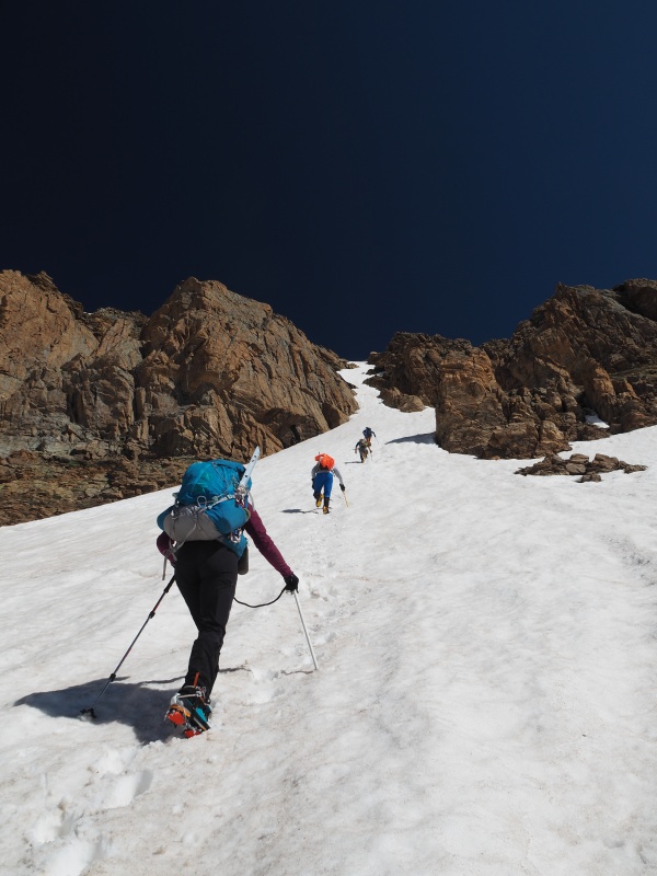
the slope got steep, it did not look that steep from below, we guessed around 40 degrees, there was a short section where a 2nd tool would have been nice but i made my pole work fine, the snow was soft enough  We took a breather at that middle rock section on the X. Had a good calf burn that last little part.  Rachel is all smiles


 We took the right branch exit out of the top of the X  We then had shitty loose rock to climb up, we exited a little left of the summit so had to shoot right to get back on track.   From Left to right, Jennifer, Connor, Michelle, Bill, Ryan and Rachel. 27 cents left to go! I could not find a summit register, i looked but not that hard.   We took the suggested grassy slope down, it was really a bunch of loose rock, sinking snow, and scree. 

we did get a fun Glissade in on the way down.

 Connor and Ryan checking out our morning tracks Connor and Ryan checking out our morning tracks Cowboy Couloir, until were told otherwise
 look at those pretty steps
 the people coming from Massive were a little shocked to see us.
 Jump!
 Well Oklahoma, for being option #3 you were full of surprises.
If you were wondering, we did get the E free, pretty easily with 5 people pushing.
we also did not break any speed records on this hike, took us 8hrs RT, (4h45min to summit) my watch clocked just over 7 miles and 3287ft gain but i think its closer to 3400ft.
Thumbnails for uploaded photos (click to open slideshow): ")
")
")
")
")
")
")
")
")
")
")
")
")
")
")
")
")
")
")
")
")
")
")
")
")
")
|
| Comments or Questions |
|---|
|
|
Caution: The information contained in this report may not be accurate and should not be the only resource used in preparation for your climb. Failure to have the necessary experience, physical conditioning, supplies or equipment can result in injury or death. 14ers.com and the author(s) of this report provide no warranties, either express or implied, that the information provided is accurate or reliable. By using the information provided, you agree to indemnify and hold harmless 14ers.com and the report author(s) with respect to any claims and demands against them, including any attorney fees and expenses. Please read the 14ers.com Safety and Disclaimer pages for more information.
Please respect private property: 14ers.com supports the rights of private landowners to determine how and by whom their land will be used. In Colorado, it is your responsibility to determine if land is private and to obtain the appropriate permission before entering the property.


