| Report Type | Full |
| Peak(s) |
Pecks Peak - 13,291 feet |
| Date Posted | 06/09/2022 |
| Date Climbed | 06/07/2022 |
| Author | Tony1 |
| Just Pecking the Ridge |
|---|
|
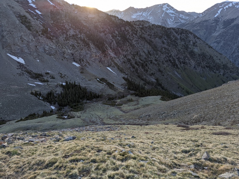
Pecks Peak (13,270') Tuesday, June 7, 2022 Party of 1: Tony Summer has arrived, and it's time to look for some weekday peak hikes. I pulled up the 14ers.com peak map and poked around for something to satisfy my mountain craving on this particular day. I'm looking for an evening hike, so it can't be too crazy. Unranked summits that are mere bumps on the ridges of larger mountains fit the bill pretty well, so I couldn't help but notice Pecks Peak beckoning. Quite a healthy amount of elevation gain...but easy on the distance, with the approach on a 14er trail. I can squeeze that in after work in June daylight if I get out the door at a reasonable time, I figured. There are no trip reports for Pecks Peak as its own independent little peaklet, so I'll go ahead and put one up to describe how I chose to hike it. I put together my daypack and left Leadville by 4:20 (tee-hee!). I made it through Chaffee CR 390 (don't even get me started) in my trusty Golf - slowly but surely - and arrived at the Missouri Gulch trailhead, setting off on the trail by 5:20. I set a turnaround time of 7:30. If I wasn't at the top or within a stone's throw of it, I'd humbly retreat and avoid hiking in the dark. Clear Creek was absolutely raging. I always forget just how large of an area it drains. It was loud, swift, and a sight to behold in an otherwise somewhat arid region. I hadn't hiked this trail since my first year of hiking the 14ers, which was in 2011...11 years ago. I remember the grueling steep grade and the switchbacks in the beginning portion, and how quickly the valley drops away, seen via glimpses through the trees. 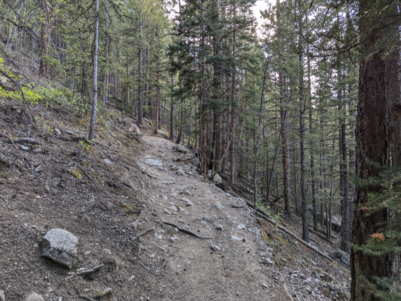
Then the trail rounded the corner, marking the end of the switchbacks. I remember that. I remember hiking along the river, up and up. 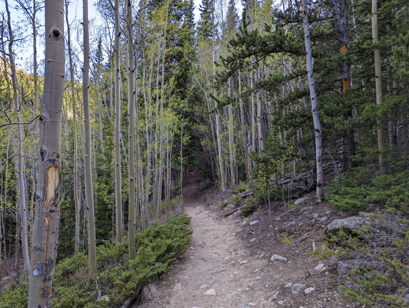
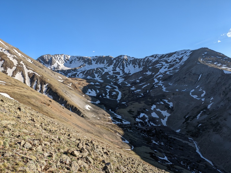
Then the trail crossed the Missouri Gulch creek and entered...a large avalanche clearing? I don't remember this. I spent the next 10 minutes trying to decipher whether this was new - I would assume from 2019 - or if it had always been there. The clearing was absolutely gigantic. At times, the trail seemed to be hundreds of yards from the creek, and still in the avalanche clearing, which was created by an avalanche that came down from the other side of the creek. 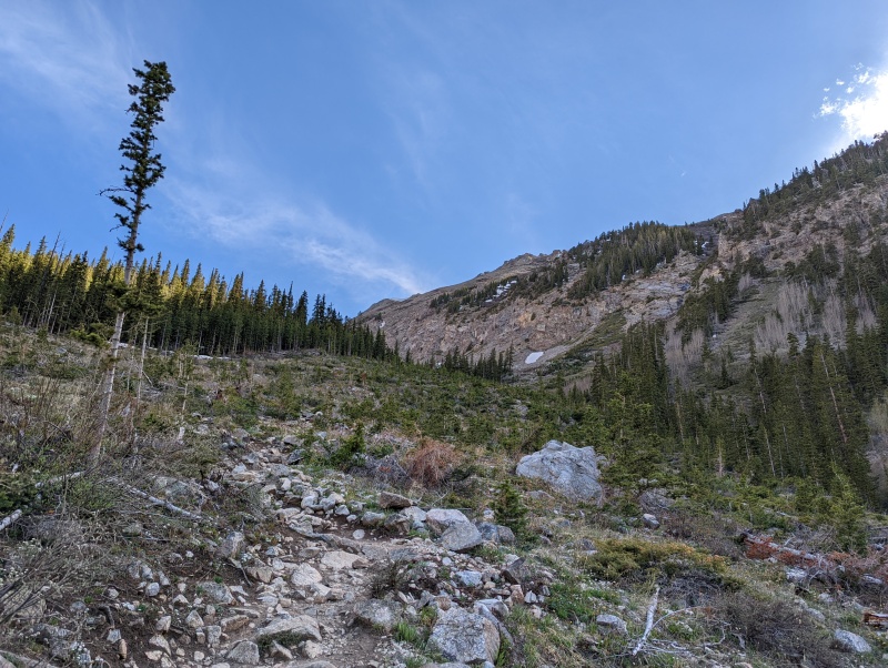

Soon enough, I entered the forest again and passed the cabin ruin. There were campers there, the only people I'd see on this hike. They were hanging out, but must have been tired, as they didn't even see me pass. Upon passing the cabin ruin and leaving the trees, I began to scout my route up the west slopes of Pecks Peak. The wind came, and it howled. I stayed on trail for a few more minutes, passing by a couple of clear access points, as I wanted to milk this good trail for as long as possible. 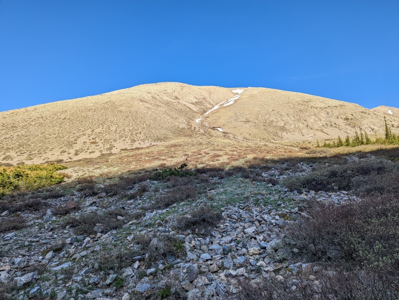
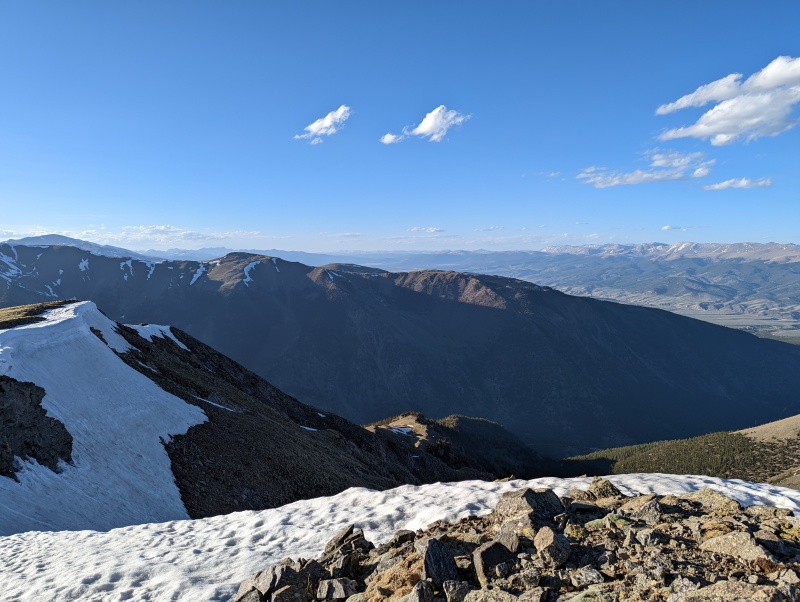
I stopped at around 11,450' in another good clearing at about 6:15. I consulted my map: a Caltopo PDF viewed in the Avenza Maps app, which is GPS enabled. I use the slope angle shading layer year-round; in summer, it helps with hiking peaks like this one. I could hike up the peak from here using the smooth ridge formed by the south side of the wide gully on Peck's west face. Or, I could continue to 11,700' and hike up the west slopes from there, the exact area of which was still hidden and I couldn't see it. The first option, in front of me, was definitely more consistently steep. The second option, farther up the trail, had a steep burst at the beginning followed by more mellow slopes. I made the decision to take the first option, since I knew I needed to keep moving and I could see what the terrain looked like. I knew for sure it was doable. The alluvial area at the base of the gully provided a nice warm-up for the stair stepper challenge that ensued. From 11,600' to 12,600', the grade was consistent and steep. Pretty dang steep. But, it was certainly hike-able without much trouble. Plenty of stable rocks to step on, plenty of grass, not too much dirt and scree. 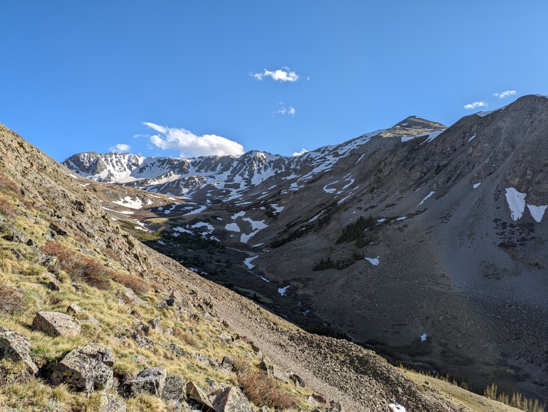
After 12,600' and bypassing a rock outcropping to climber's right, the slope relented slightly but was still consistently steep up until 13,000', when it noticeably let up. The wind gusts became less and less as the day started to come to a close. 

I reached the summit at 7:15 and took a few minutes for photos and rest. I really hauled my butt up here. Perhaps the next one of these I do should be a bit more chill. 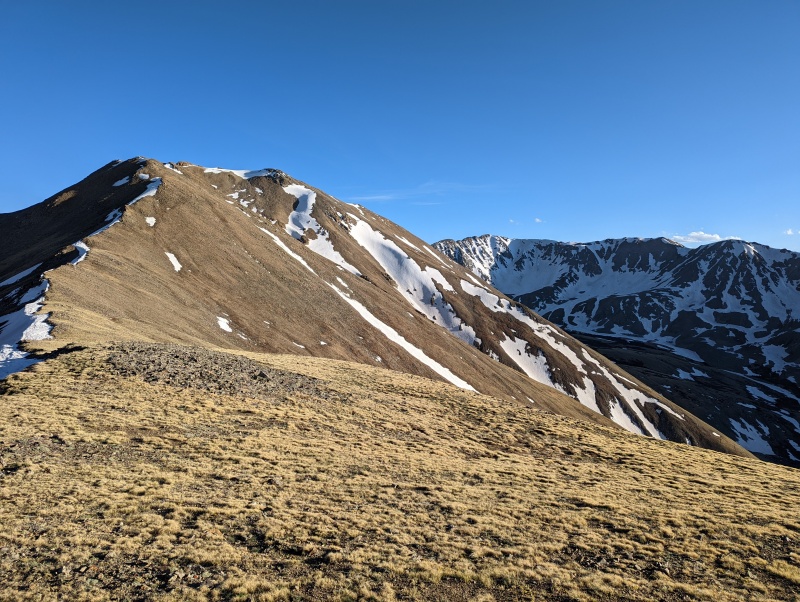
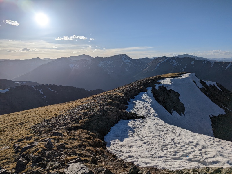
I debated descending the other way, but if Malamute Peak taught me anything, it's that you always descend the ascent route unless you purposefully planned a loop. I left the summit at 7:25 and started back down the way I came. I made deliberate, careful steps down the face of the mountain, checking the map periodically to make sure I was still on track. I'd say calling it "class 3 grass" is appropriate. 
On the descent, I managed to make use of a few game trails in between the side-stepping. Down and down I went, reaching the trail again at 8:05. It was around now that I realized how much huffing and puffing I did on the way up from pushing myself, as my lungs felt a bit sore. 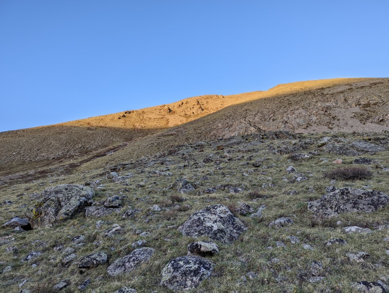
Luckily, descending is less energy intensive, so I proceeded to make quick work down the trail. I passed the cabin ruin and said hello to the campers. I continued down through the avalanche clearing, then along the creek, making it to the switchbacks by sunset. As darkness started to fall, I reached the base of the switchbacks. I managed to scare the absolute bajeezus out of myself when I thought a tree stump in the twilight was a bear. This is why I avoid solo hikes at night! 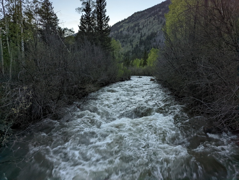
By 8:50, I reached the trailhead and the car. It hurt just a bit, but I got it. Mission success! Thumbnails for uploaded photos (click to open slideshow): ")
")
")
")
")
")
")
")
")
")
")
")
")
")
")
")
|
| Comments or Questions | |||
|---|---|---|---|
|
Caution: The information contained in this report may not be accurate and should not be the only resource used in preparation for your climb. Failure to have the necessary experience, physical conditioning, supplies or equipment can result in injury or death. 14ers.com and the author(s) of this report provide no warranties, either express or implied, that the information provided is accurate or reliable. By using the information provided, you agree to indemnify and hold harmless 14ers.com and the report author(s) with respect to any claims and demands against them, including any attorney fees and expenses. Please read the 14ers.com Safety and Disclaimer pages for more information.
Please respect private property: 14ers.com supports the rights of private landowners to determine how and by whom their land will be used. In Colorado, it is your responsibility to determine if land is private and to obtain the appropriate permission before entering the property.


