| Report Type | Full |
| Peak(s) |
Mt. Sneffels - 14,155 feet Gilpin Peak - 13,699 feet Mt. Emma - 13,592 feet San Joaquin Ridge - 13,480 feet |
| Date Posted | 05/22/2022 |
| Date Climbed | 05/13/2022 |
| Author | Jakomait |
| Path of most resistance |
|---|
|
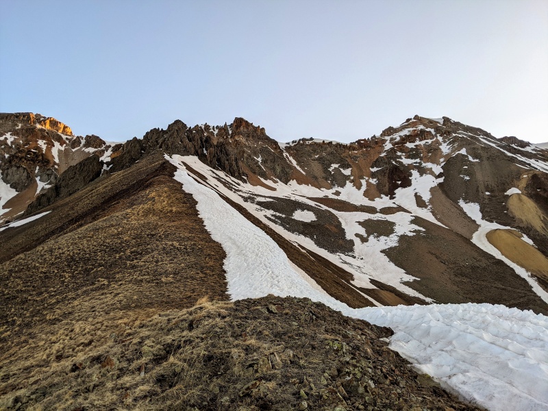
Have you ever seen a picture of San Juaquin Couloir? No? Well then go google an image of it, I'll wait here while you do that. Cool, huh? I'm not a bro-brah skier, or even a gapper Jerry for that matter but I do love me a good couloir climb and this had me drawn to it like a moth to a flame. I had a hard time justifying a 6 hour drive for just that but a stellar weather window and a well deserved vacation day came together for a 3 day San Juan Couloir Extravaganza. My first objective hazard was surmounted through dumb luck on my drive over to the San Juan's the evening before when I came upon the HWY 50 construction past the Blue Mesa Reservoir. Oblivious to their lengthily road closures throughout each day I arrived at 7:15pm to an alternating traffic stop that had me rolling through a few minutes later. What I didn't realize was after 7:30pm each night the road was fully closed until the next morning! Phew, that would have been a grumpy unplanned bivy if I had been just 15 minutes later! The next morning I awoke before dawn outside of Ouray and was on my feet before 5 to get in as much of my route on good cold snow. I tend to not plan my routes too well and just try and link peaks based on what I see in front of me. On this trip my goal over the next two days was Cirque, Gilpin and Emma and then figure out a way to link in the Snake Couloir. I cruised up Cirque Mountain by sunrise and had a great view of Teakettle and Coffeepot to the east. 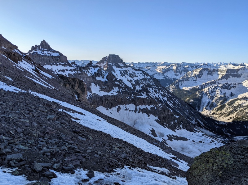
Next I scurried over to the ridge towards Sneffels and dropped down some random couloir to get access to the north side of Sneffels to find the mega classic Snake Couloir 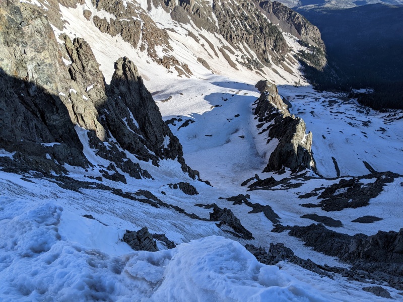
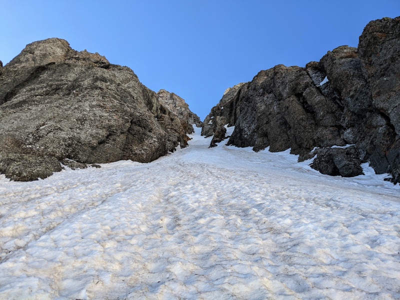
Conditions were great up the Snake Couloir and I trudged up to the top easy-peazy 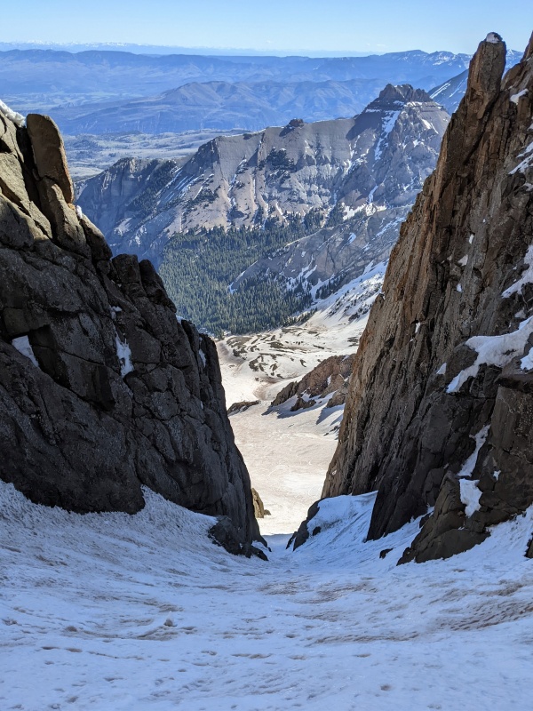
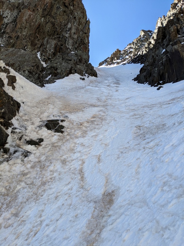
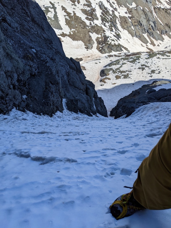
The couloir end just shy of the summit and deposited me in the sun for the first time in the day. A short scramble was necessary to reach the tippy top of Sneffels that ended up being a bit trickier than I expected in the softening snow. I was hoping for some ice to sink my axes into but it was all just mushy snow and loose rocks. 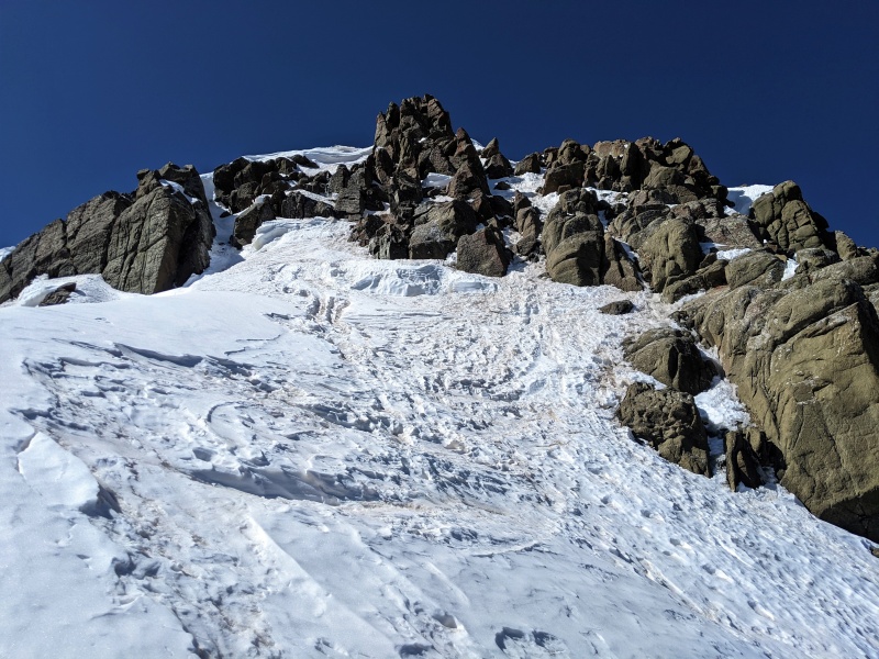
On the top, the view from the summit was awesome gazing over the snowy San Juan's and I lingered up there a while admiring all the rocky peaks and trying to recount how many of those piles of rocks I've stood on top of. When it was time to go down, my rough itinerary was originally set to wrap up head back to my truck but on the way down spied a happy little couloir up the north face of Gilpin. It was so inviting I figure I might as well go say hi right now! 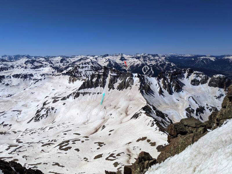
Taking a closer look, the top looked uncertain but I wasn't going to solve any of its riddles from the valley floor so I went up to take a closer look. 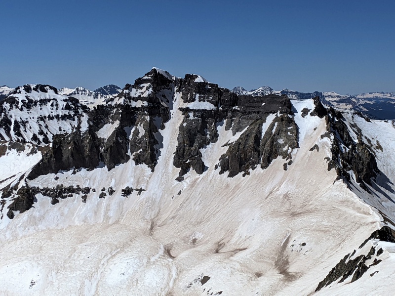
Getting all up in it's business, the bulk of the line was smooth sailing but as I expected, things got complicated at the top. I was most concerned with the oppressive cornice guarding the summit ridge but that turned out to the be easy part to deal with. The rock band below was almost vertical choss and the snow above it must have been bought at the dollar store. It was really thin and weak from the sun. There was nothing for the pick of my axe to grab and even driving my handle in to the deepest parts gave me as much confidence as my pet squirrel trying to file my taxes. I had to cower up underneath the cornice as high as I could to find the final scraps of snow that were left and I didn't dare try to tunnel like a mole through it for fear of cement like snow on the cornice breaking free and tackling me down to the valley floor. From there I had to dance left over the void below me and sneak past the cornice where it wasn't paying attention to my shenanigans. 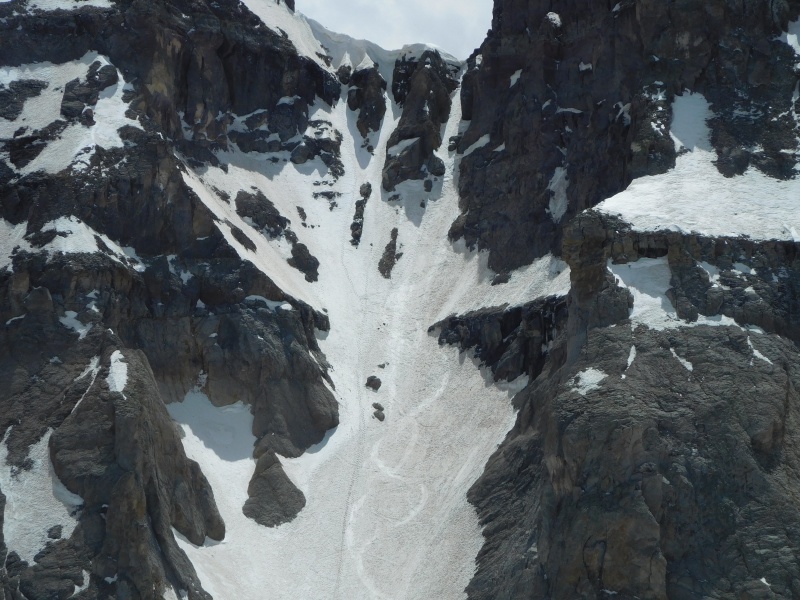
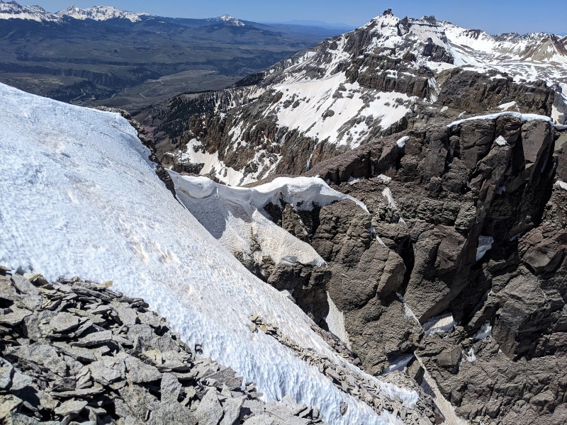
After the summit of Gilpin I followed the sketchy east ridge over to the first continuous patch of snow I could find to get the hell out of there. The ridge is a stack of rocks resembling an infinite pile of poker chips that slide out from underneath you every time you do so much as to blink. At least you have amazing views to look at while you are inching your way across this death trap. I actually planned these peaks in snow to hopefully avoid the crumbling rock but I probably missed that window by at least a month this year. 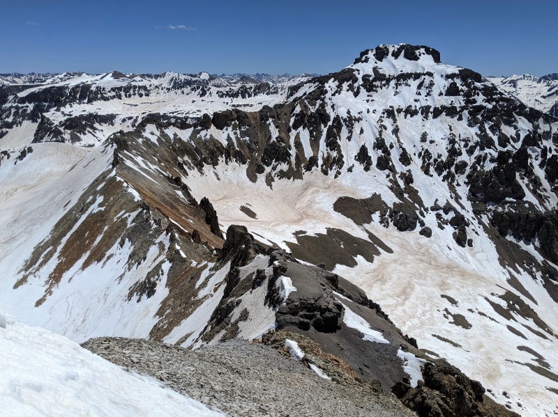
And off the ridge and back to the truck. That wraps up day one. 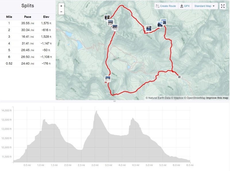
Day two I just zipped over to tag Emma then hung out on the summit until the security guard told me I was loitering and had to leave. 
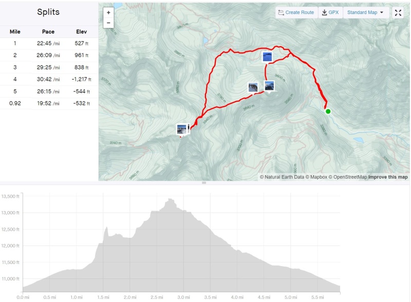
With the short day I did some mountain biking around Telluride and then scoped out the start of my Day 3 adventure in Ophir. Another 4am wakeup call had me wondering why I can't vacation like normal people. For a moment I was looking for an excuse to sleep in but I couldn't find one. Boots on and up, up and away! 
The approach straight up the south face of the San Joaquin Ridge was way more pleasant than I was expecting with wide open aspen forest non-bushwhacking and secure footing on tundra above that. The final rock band added some hotsauce to my burrito and after picking my way up and over I finally found the other side of the ridge into the Telluride ski area. Down into the basin, presto! the San Juaquin Couloir came into view. I was never able to find the epic vantage point you can google that brought me here in the first place but the route was everything I was hoping for. Long, steep and continuous! 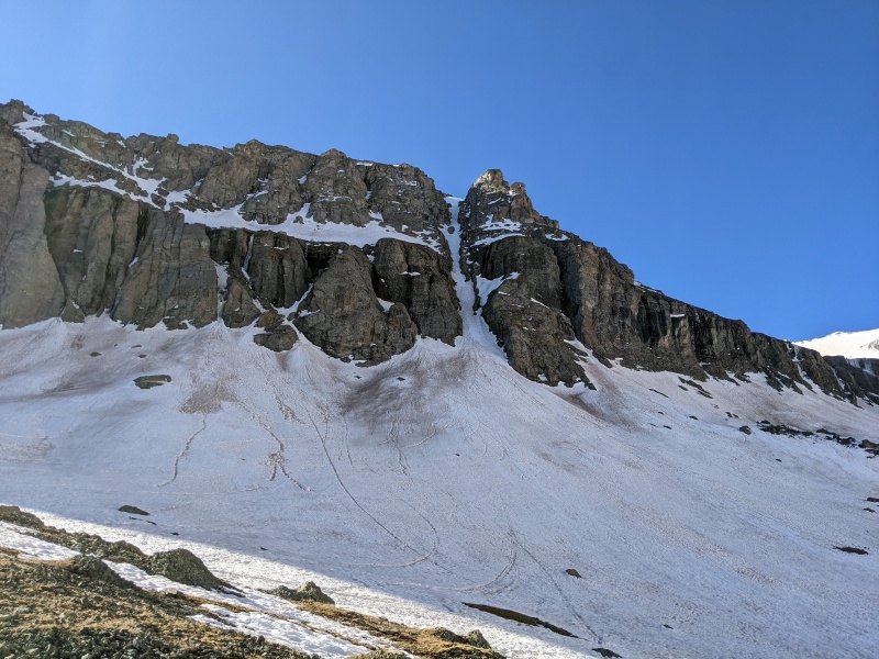
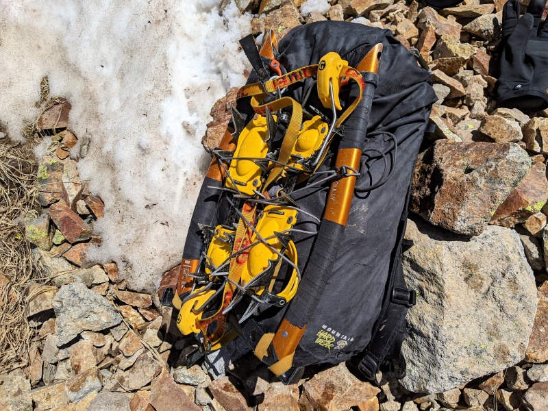
After topping out I was too lazy to take off my crampons to stay on the ridge proper and just plopped down another couloir and across the east side of the ridge. In hindsight, it was not a sweet navigation choice since the snow was a big deep plate of mash potatoes tipped very sideways. 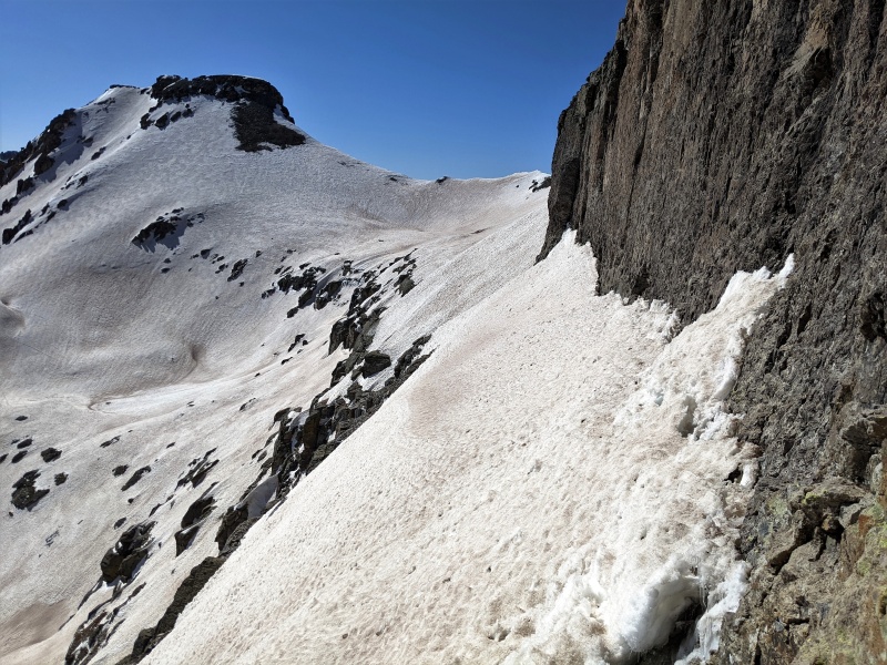
After swimming through some of the softer sections of snow I topped out on San Joaquin Ridge soaked in more amazing views and munched m&m's under another perfect sky. 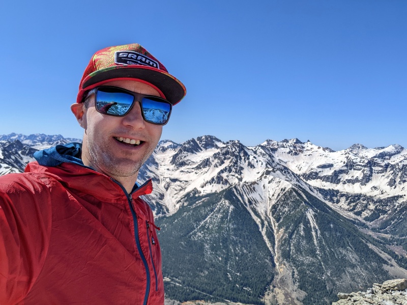
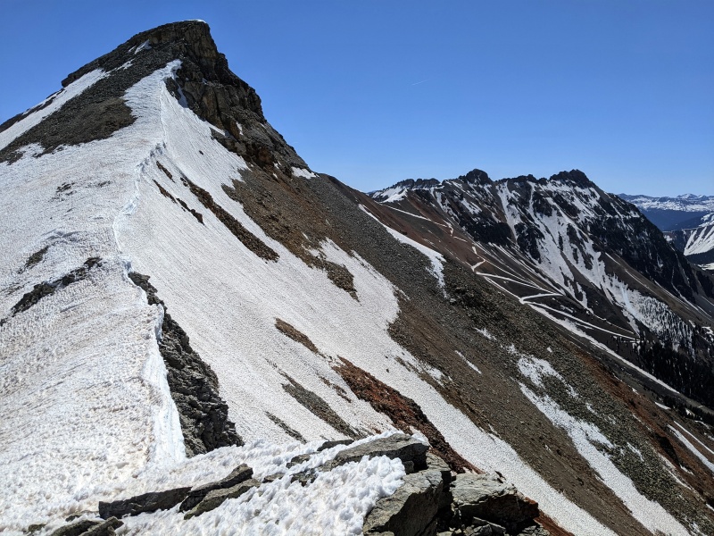
Wrapping up I traversed across the ridge until I found a good path of continuous snow and marched my way down to the trees. I stumbled across a big network of secret mining roads that were not on Caltopo, strolled passed some unmapped secret yurt residences and back to my vehicle. 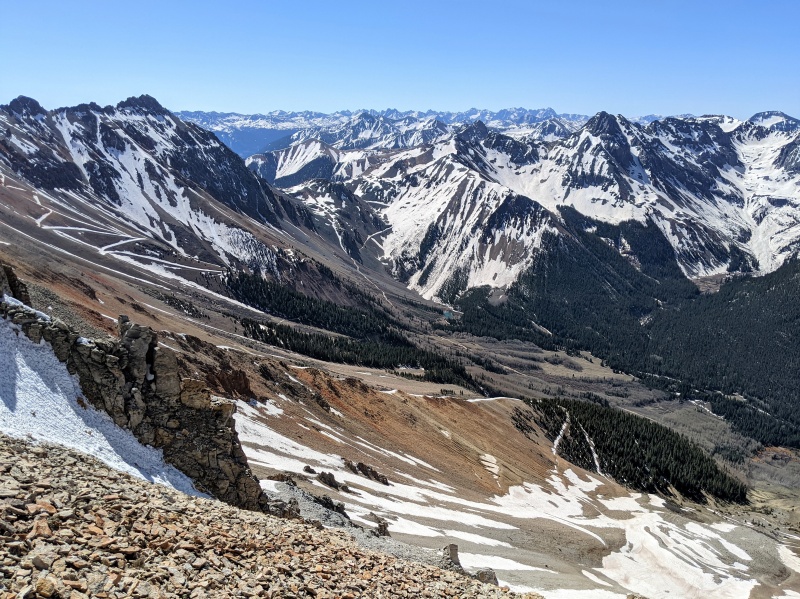
And that was that, a great trip with 6 peaks and 5 mega couloirs. That puts me at 163 peaks in the top 200 bicentennial list and feelin' stoked for more time up in the mountains. 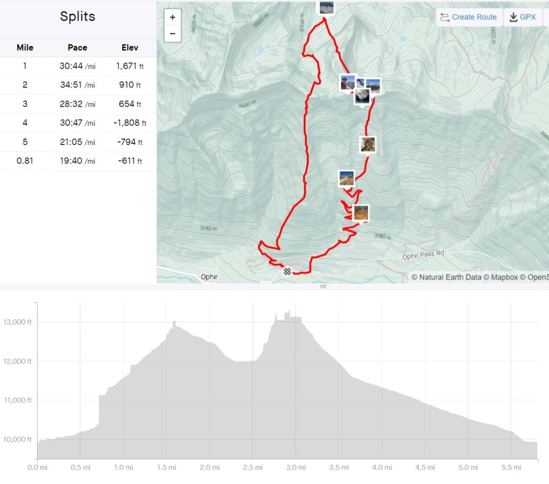
Thumbnails for uploaded photos (click to open slideshow): ")
")
")
")
")
")
")
")
")
")
")
")
")
")
")
")
")
")
")
")
")
")
")
")
")
")
|
| Comments or Questions | |||
|---|---|---|---|
|
Caution: The information contained in this report may not be accurate and should not be the only resource used in preparation for your climb. Failure to have the necessary experience, physical conditioning, supplies or equipment can result in injury or death. 14ers.com and the author(s) of this report provide no warranties, either express or implied, that the information provided is accurate or reliable. By using the information provided, you agree to indemnify and hold harmless 14ers.com and the report author(s) with respect to any claims and demands against them, including any attorney fees and expenses. Please read the 14ers.com Safety and Disclaimer pages for more information.
Please respect private property: 14ers.com supports the rights of private landowners to determine how and by whom their land will be used. In Colorado, it is your responsibility to determine if land is private and to obtain the appropriate permission before entering the property.


