Download Agreement, Release, and Acknowledgement of Risk:
You (the person requesting this file download) fully understand mountain climbing ("Activity") involves risks and dangers of serious bodily injury, including permanent disability, paralysis, and death ("Risks") and you fully accept and assume all such risks and all responsibility for losses, costs, and damages you incur as a result of your participation in this Activity.
You acknowledge that information in the file you have chosen to download may not be accurate and may contain errors. You agree to assume all risks when using this information and agree to release and discharge 14ers.com, 14ers Inc. and the author(s) of such information (collectively, the "Released Parties").
You hereby discharge the Released Parties from all damages, actions, claims and liabilities of any nature, specifically including, but not limited to, damages, actions, claims and liabilities arising from or related to the negligence of the Released Parties. You further agree to indemnify, hold harmless and defend 14ers.com, 14ers Inc. and each of the other Released Parties from and against any loss, damage, liability and expense, including costs and attorney fees, incurred by 14ers.com, 14ers Inc. or any of the other Released Parties as a result of you using information provided on the 14ers.com or 14ers Inc. websites.
You have read this agreement, fully understand its terms and intend it to be a complete and unconditional release of all liability to the greatest extent allowed by law and agree that if any portion of this agreement is held to be invalid the balance, notwithstanding, shall continue in full force and effect.
By clicking "OK" you agree to these terms. If you DO NOT agree, click "Cancel"...
The good news: this climb was fantastic. The bad news: there are no X-rated puns to be made, because Supra took them all.
One of my goals for 2022 was to write more trip reports, especially in winter. The amount of reports posted on this site becomes exceedingly low in the winter months, and each time one is posted I get a 10 minute distraction from work, so let's just say I appreciate each and every one of them. This winter, to contribute to the cause, I managed to write exactly zero reports.......room for improvement.
Literary failures aside, I've been wanting to climb this line on Sayres for three springs. Up until this year, trying to find a weekend in which weather, conditions, and my schedule align has proven exclusionary, so when all three looked good on Saturday (plus Brandon was around!), I had to expedite the plans.
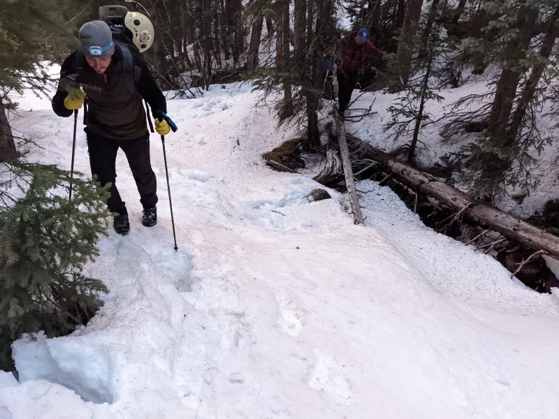
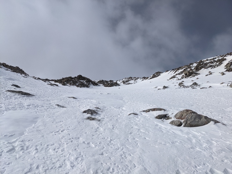
A relatively week freeze Friday night warranted an early start on Saturday morning, so naturally we left the La Plata trailhead 20 minutes after our intended start time of 4:30. We expertly dodged puddles on the road, then missed the turn for La Plata trail (but quickly realized our mistake and corrected it). The lower portion of the trail was a mix of snow patches and dry ground, making the occasionally exposed trail segments difficult to see with rapidly a rapidly dimming headlamp. Fortunately, the sun rose quickly, and the headlamps were off shortly after turning right to ascend into the gulch.
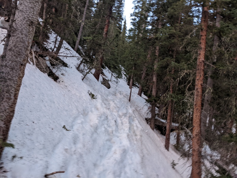
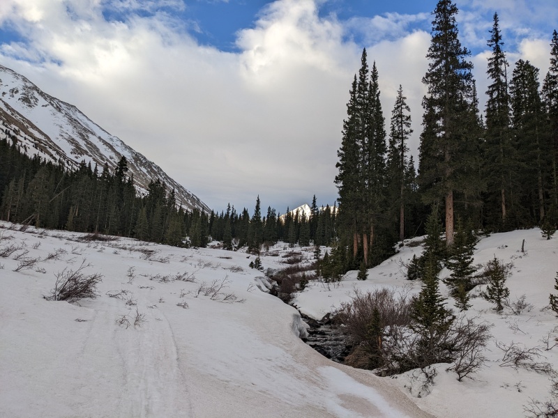
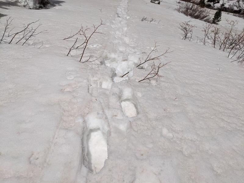
In the morning, snow conditions were solid enough to boot, and while there was evidence of future horrors, we fought through the sidehilling to reach the creek crossings.
Sidehilling through the forest
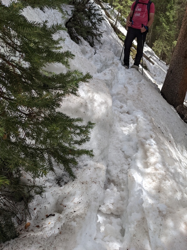
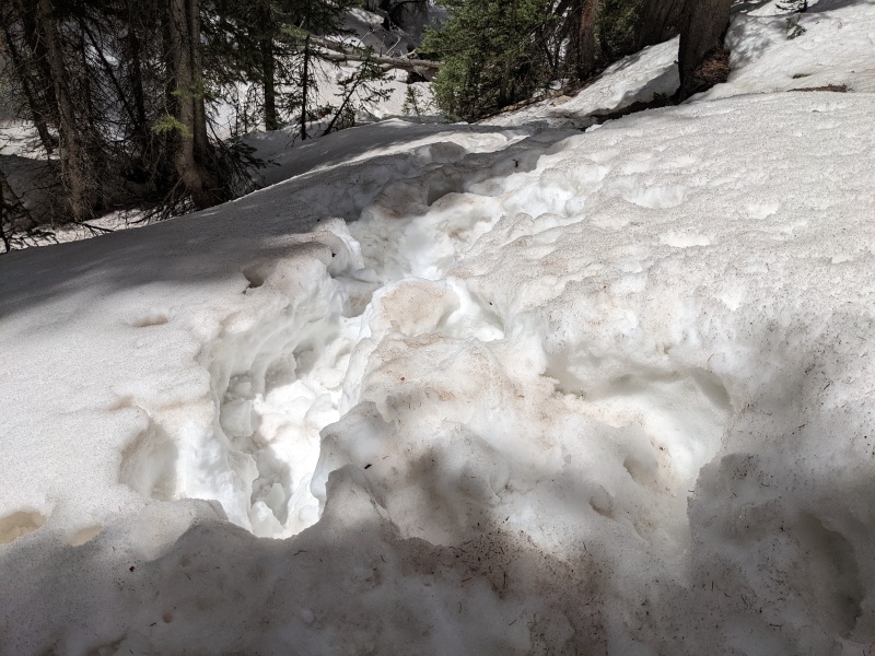
At the first creek crossing, there were some postholes, but nothing exceptionally deep. I cautiously stepped onto the bridge, and first step I sank to my waist, with my foot dangling into nothingness. Oops! I exerted serious effort to extract myself, rolled off the snow bridge back to the safety of land, and found a set of tracks that went upstream a bit. I followed them and found a much narrower and safer crossing. We crossed once, then crossed back a couple hundred feet later, and shortly thereafter put on snowshoes and crossed a third time.
Looking back on Brandon navigating the first creek crossing.Awesome view of La Plata.
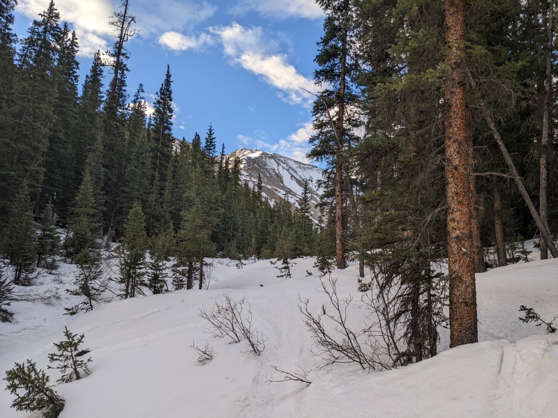
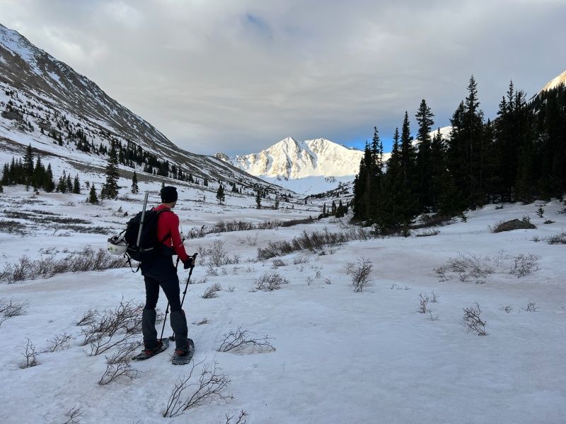
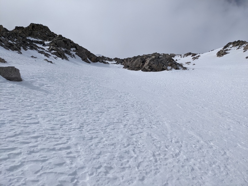
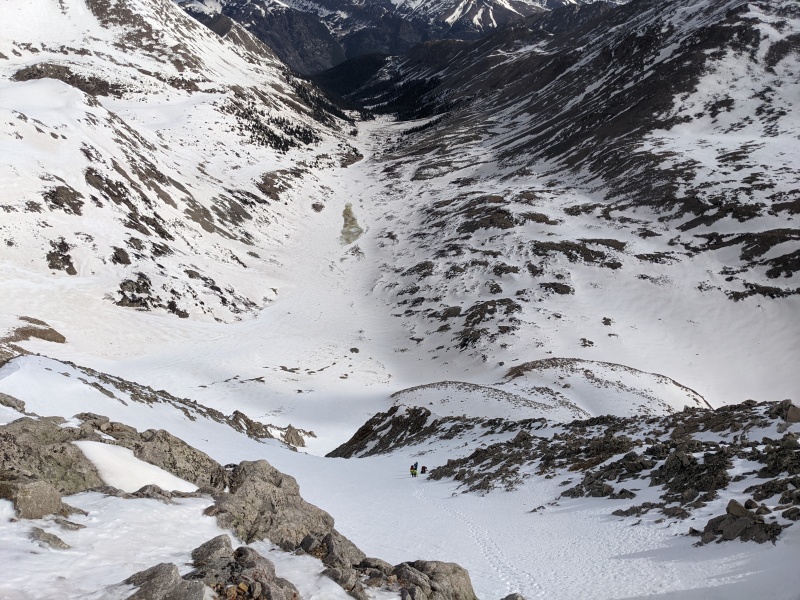
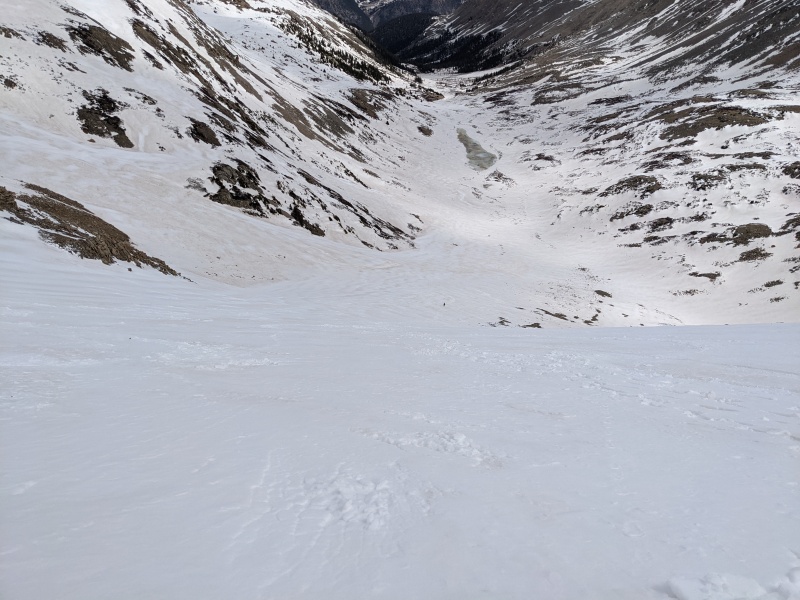
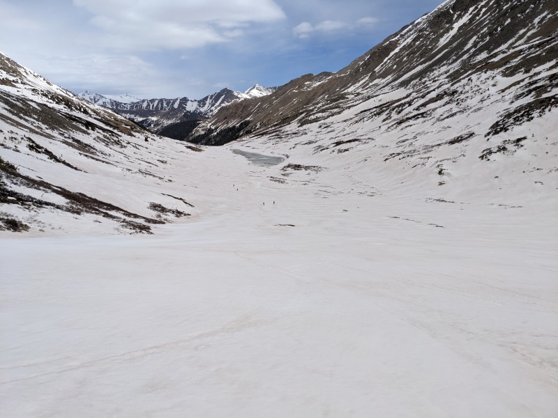
The last crossing took us onto the west side of the creek, which led to flatter terrain and a long, gentle valley that would lead to the base of X-rated. Snowshoes spared us from the mess of willows hidden just below the snow surface, and we made good time through this valley to the base of the mountain.
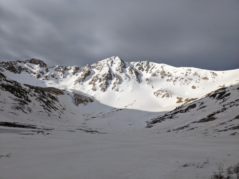
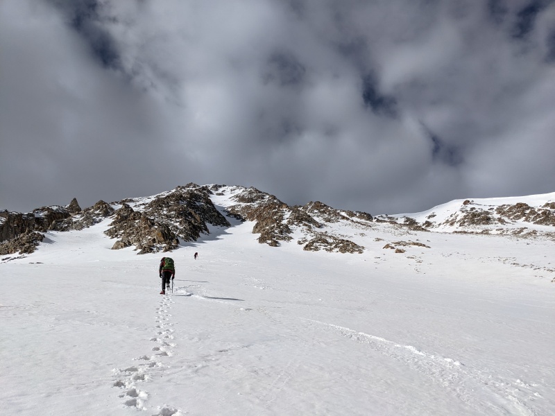
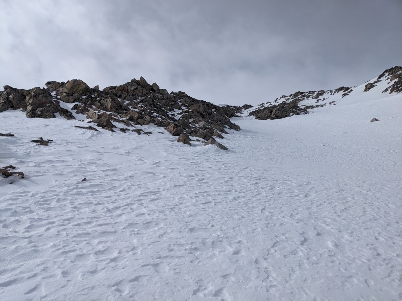
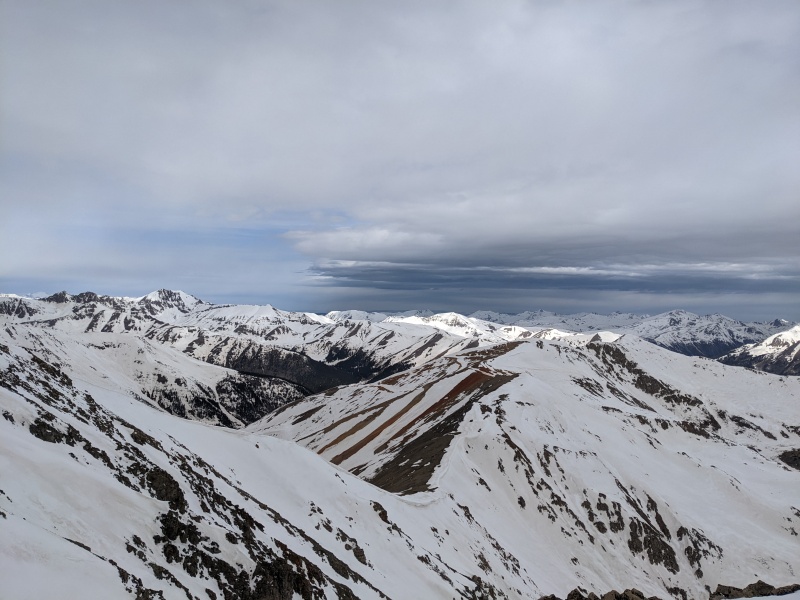
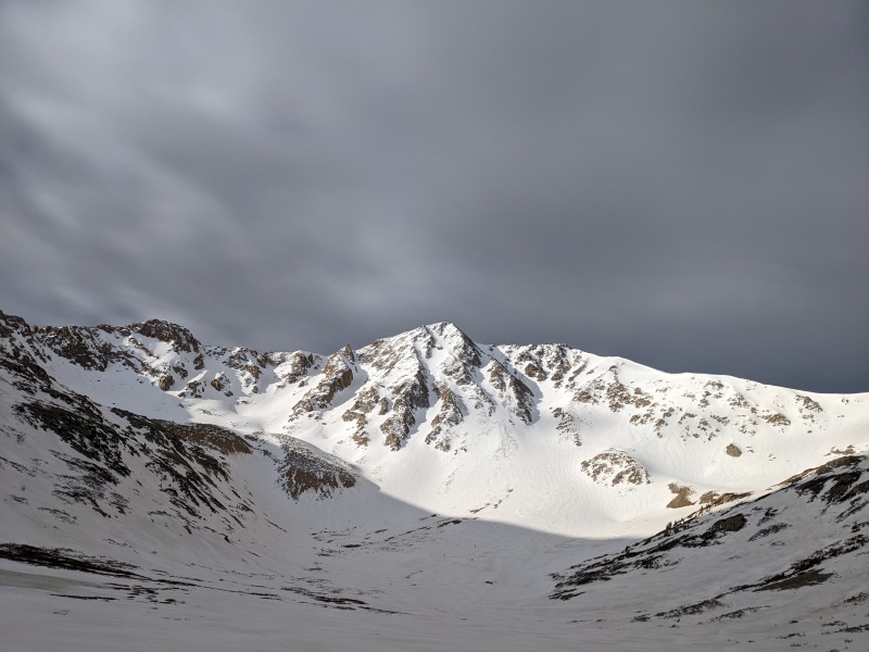
First view of Sayres peaking over the trees.Me staring down our first good view of Sayres.The line in full sight. Looking prime!
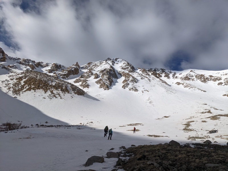
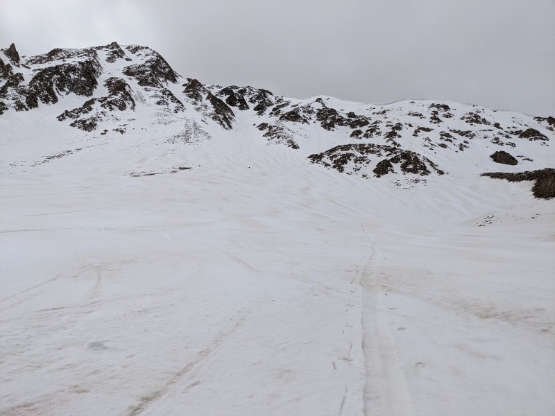
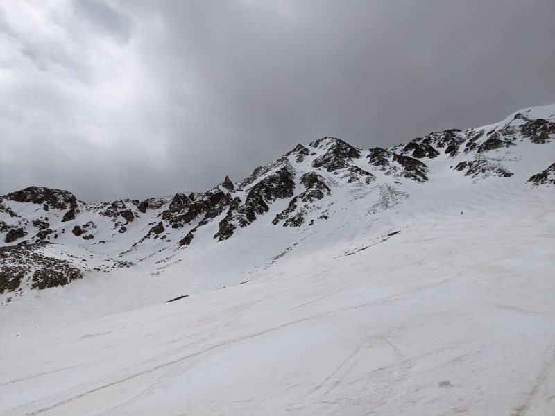
As we approached the mountain, we ran into a few other groups. Several groups of skiers were ascending Grand Central and skiing either that line or X-rated, but only one other group was looking to ascend X-rated. We met up with them as they were transitioning to crampons, and we linked up to put a bootpack up the couloir.
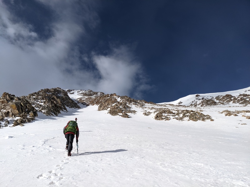
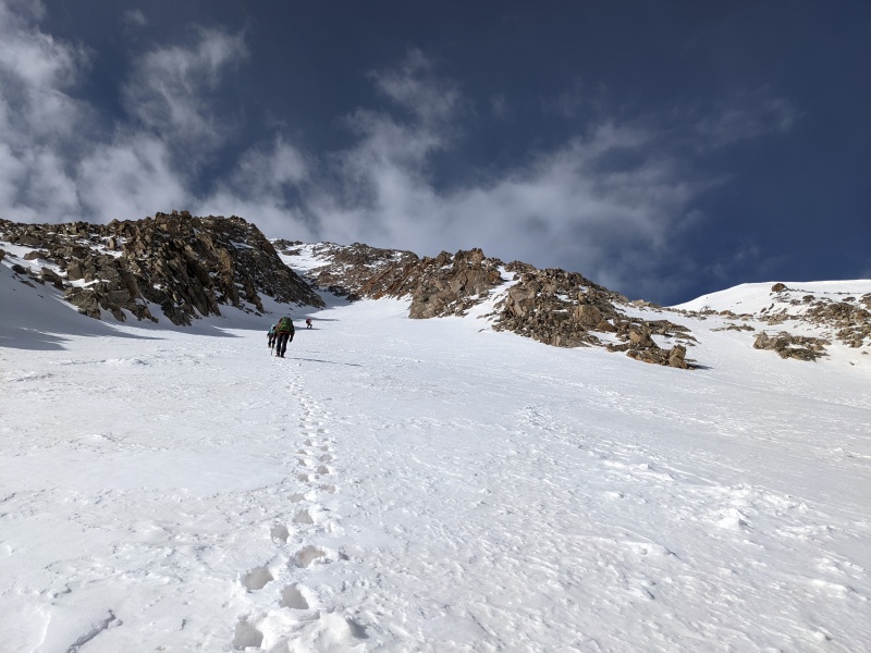
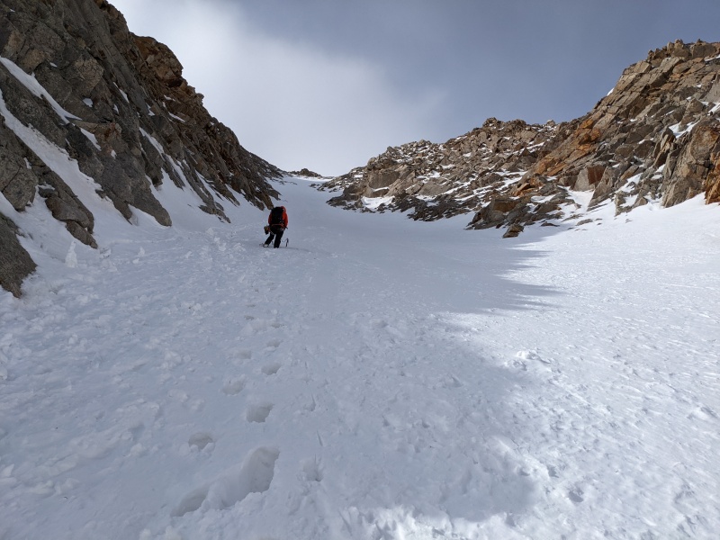
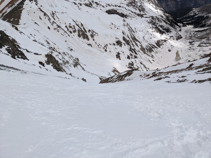
The group of three leaving the transition point.Starting up the apron toward the couloirApproaching the entrance
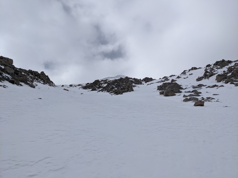
We began the ascent up the apron to the couloir at about 7:45. The snow in the apron was excellent: supportive, but not bulletproof. Unfortunately, given the sun was hitting it hard, we were concerned that it would be a little soft higher up. The other group put a booter up until the first rock step (which wasn't really a rock step currently, as there was decent snow coverage and minimal rock was exposed), which was most appreciated.
My ass as we ascended the apronMaking progress upward.
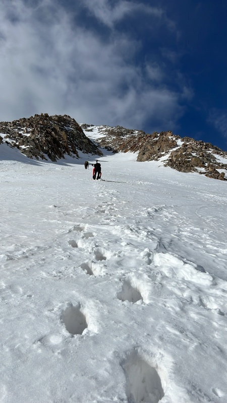
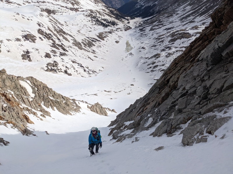
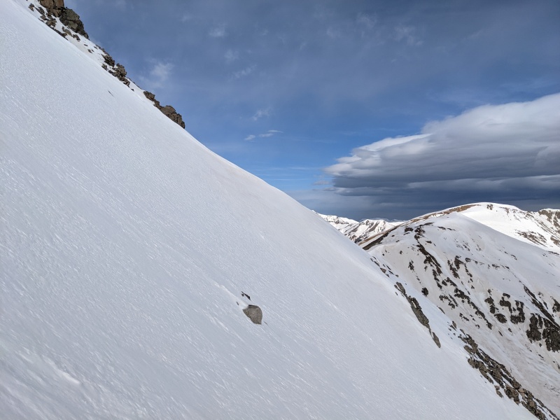
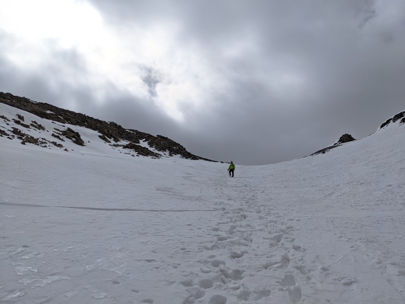
As the couloir angled to the left slightly, it steepened to 50 degrees. The snow conditions became more variable around this time, and we encountered some softer powder, some hard snow with 3 inches of powder on top, and some snow where we'd plunge our ax in and hit rocks 6 inches down. We managed to exhume our feet and axes from the snow to reach a bench and the first possible rest spot.
Approaching the first steep section and rock step.Our new friend blazing a trail up the steep snow (sorry I didn't catch your names!)Looking down just below the first bench.
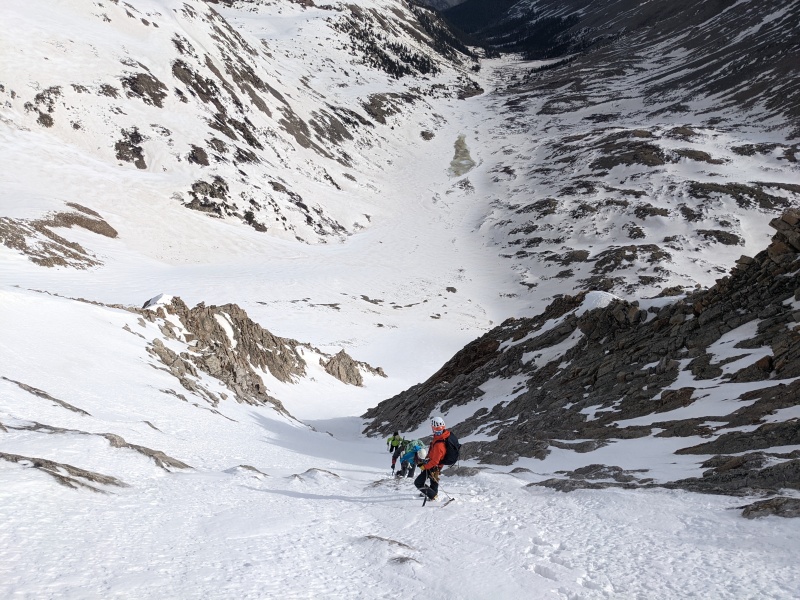
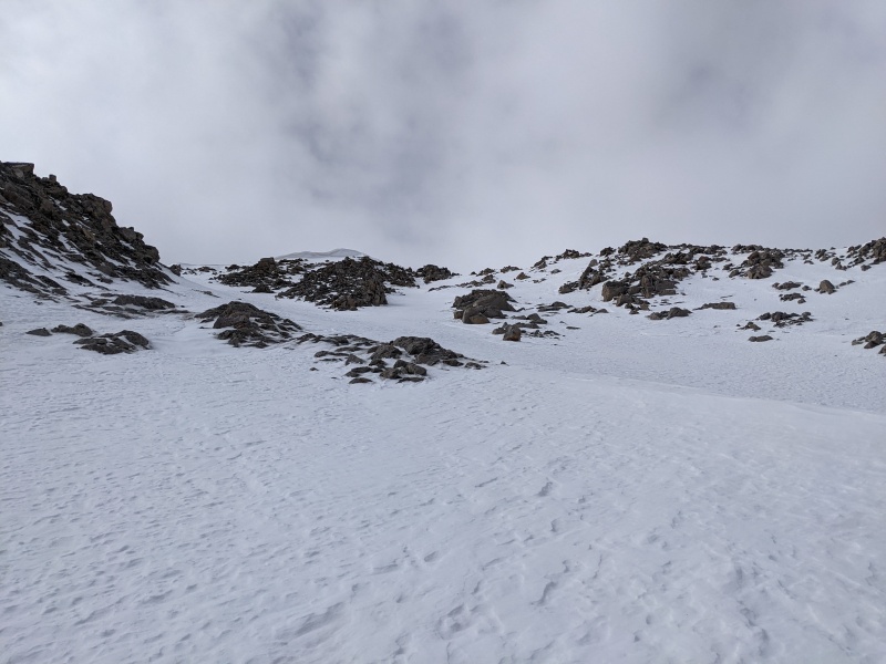
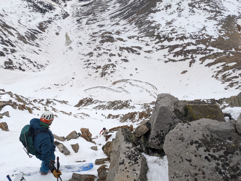
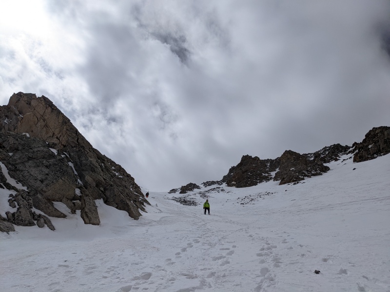
Once above the first bench, I took over trailbreaking duties. The terrain gets more confusing as you go up due to multiple rock ribs forming pathways, but I generally went as straight up as made sense. After a few hundred feet of climbing, we reached another rock step, this one requiring 2-3 moves of scrambling on exposed rock to ascend.
Above the first rock step, looking down.Upper terrain.Stayed right of the jumble of rocks on the left, went through the squeeze in the middle of the pic.Approaching the second rock step.Slope angle. I took one other reading in this area, which said 49 degrees.Above the second rock step, looking toward the summit.Looking down from the rock step at the booter. Rocks in foreground require mild scrambling.
As we approached the summit, the snow got worse, as we expected. Either each step was in soft snow that sunk to your knees, or there was hard slab that would only except (I know it's accept, but give this to me please) an inch or two of the crampons, regardless of how many times we kicked. The last 200 vertical was the hardest of the day. However, we all managed to make it, and the top out of the exceptional couloir was just a few steps away from the summit.
We went right of the jumble of rocks.From the top of the couloir, looking down. A skier waits for our group to clear a choke point to drop in.
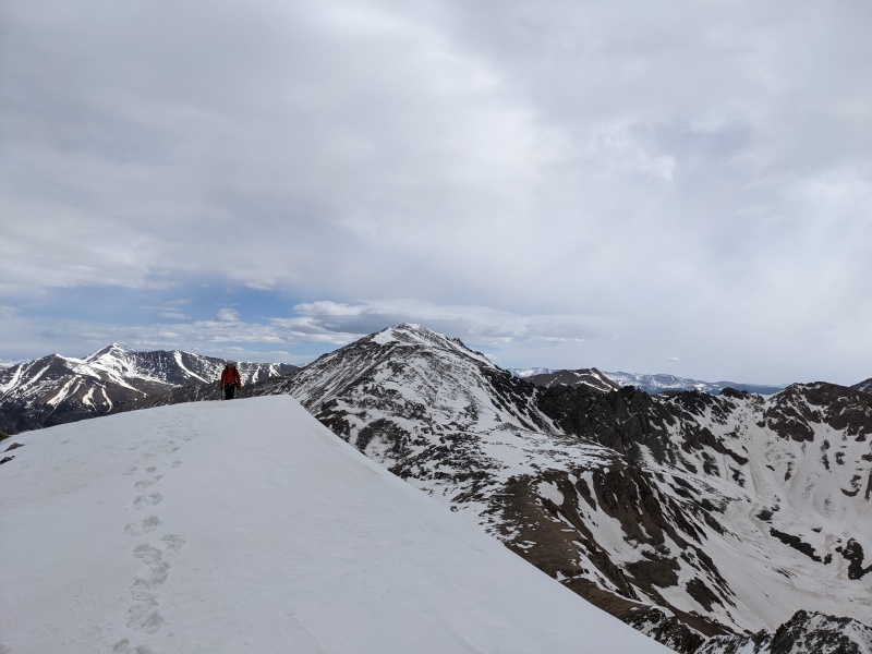
The summit was at times exceedingly windy, but it was intermittent enough to make it tolerable. I hung out while Brandon and the rest of the group summited and watched as the clouds slowly blew through, expecting there would be sunshine on the other side.
Summit!Summit viewsMore summit views.Summit views 3Brandon's face says it all.
After fueling with bars and endless amounts of peanut butter (if your Brandon), we contemplated our next steps. Originally, we intended on taking the ridge to the two thirteeners north of Sayres, then descending a SE rib of 13,300F back to our route in, or possibly dropping off the northwest side to the 399 road. But a variety of factors led us to eschewing those plans and instead descending Grand Central and hiking out the way we came in. We plunge stepped down the Grand until the angle relented slightly, passing a skier on his way up, and I glissaded from the couloir entrance to about 12,000.
In the Grand, plunge stepping down.Brandon heading on down.Minus one Brandon, plus one skier.Top of glissade.Bottom of glissade.Looking down on our route out.A look at X-rated, now with a booter and fresh ski tracks.
Our descent out was exactly what we feared: all of the supportive snow through the willows in the upper valley had become soft and a posthole nightmare. Extricating one from ones posthole took an extraordinary amount of effort, given the willows would lock on to the snowshoes at every opportunity. It took a similar amount of time to get down from the base of the mountain to the car as it did to go from the car up in the morning. The following pictures only tell a sliver of the story.
ughyuck
blaghargh
But we made it! And the climb was everything I'd hoped it would be. Excited for the next one!
Till next time.
My GPS Tracks on Google Maps (made from a .GPX file upload):
@skimo woof woof! I'm sure the call of the wild will get you out soon!
@brian solid day indeed! Ready for vestal part 2 this summer?
@supra for sure! Your report had me rolling.
@kevin nice running into you! Hope the snow stayed good for you on the way down
Caution: The information contained in this report may not be accurate and should not be the only resource used in preparation for your climb. Failure to have the necessary experience, physical conditioning, supplies or equipment can result in injury or death. 14ers.com and the author(s) of this report provide no warranties, either express or implied, that the information provided is accurate or reliable. By using the information provided, you agree to indemnify and hold harmless 14ers.com and the report author(s) with respect to any claims and demands against them, including any attorney fees and expenses. Please read the 14ers.com Safety and Disclaimer pages for more information.
Please respect private property: 14ers.com supports the rights of private landowners to determine how and by whom their land will be used. In Colorado, it is your responsibility to determine if land is private and to obtain the appropriate permission before entering the property.


")
")
")
")
")
")
")
")
")
")
")
")
")
")
")
")
")
")
")
")
")
")
")
")
")
")
")
")
")
")
")
")
")
")
")
")
")
")
")
")
")