Download Agreement, Release, and Acknowledgement of Risk:
You (the person requesting this file download) fully understand mountain climbing ("Activity") involves risks and dangers of serious bodily injury, including permanent disability, paralysis, and death ("Risks") and you fully accept and assume all such risks and all responsibility for losses, costs, and damages you incur as a result of your participation in this Activity.
You acknowledge that information in the file you have chosen to download may not be accurate and may contain errors. You agree to assume all risks when using this information and agree to release and discharge 14ers.com, 14ers Inc. and the author(s) of such information (collectively, the "Released Parties").
You hereby discharge the Released Parties from all damages, actions, claims and liabilities of any nature, specifically including, but not limited to, damages, actions, claims and liabilities arising from or related to the negligence of the Released Parties. You further agree to indemnify, hold harmless and defend 14ers.com, 14ers Inc. and each of the other Released Parties from and against any loss, damage, liability and expense, including costs and attorney fees, incurred by 14ers.com, 14ers Inc. or any of the other Released Parties as a result of you using information provided on the 14ers.com or 14ers Inc. websites.
You have read this agreement, fully understand its terms and intend it to be a complete and unconditional release of all liability to the greatest extent allowed by law and agree that if any portion of this agreement is held to be invalid the balance, notwithstanding, shall continue in full force and effect.
By clicking "OK" you agree to these terms. If you DO NOT agree, click "Cancel"...
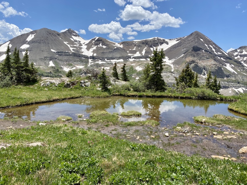
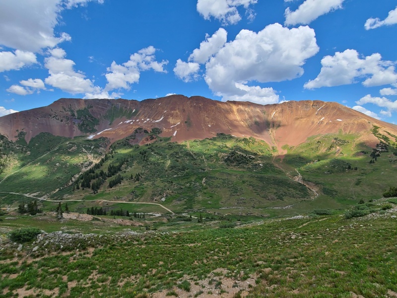
The Raggeds Wilderness is probably a little known and seldom visited wilderness area. With the Raggeds located in the Elk it's not hard to be overshadowed by the six Elk fourteeners and Maroon Bells-Snowmass Wilderness, and being situated in a remote corner by Crested Butte doesn't help. It's a long drive for most people, and most folks probably think of Crested Butte as a ski town first, and a hiking destination almost never. That said, there's spectacular hiking and climbing in Crested Butte and the western/southern Elk, including treasures like the Raggeds' two highest peaks, Treasure Mountain and Treasury Mountain. To reach the Treasure group from Crested Butte the easiest way is to take Forest Service Road 317 past Gothic Mountain to Schofield Pass, then FS 519 to Paradise Basin. The road is a narrow 2WD, high clearance dirt road and the drive into the Elk is jaw-dropping. Paradise Basin is surrounded by brightly colored, prominent peaks and deep, rugged valleys. For Whiley and I this was our first visit to the Raggeds, and we were blown away. I haven't gone back but it's high on my list.
We car camped at Paradise Basin, which was crawling with people, and woke up to a beautiful bluebird day.
Purple Mountain from Paradise Basin.
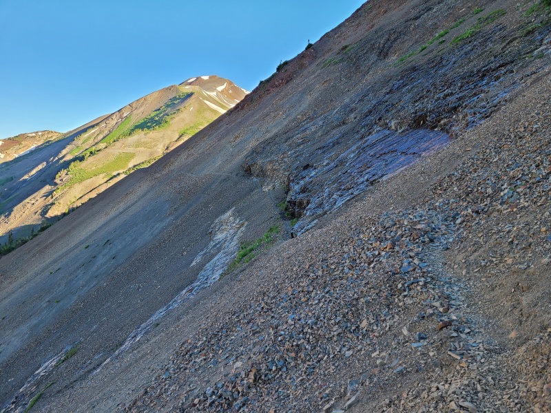
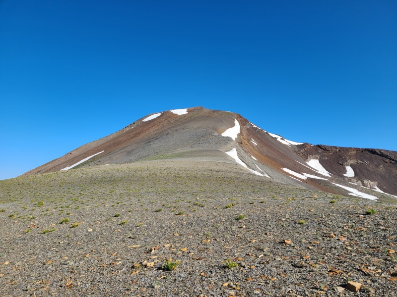
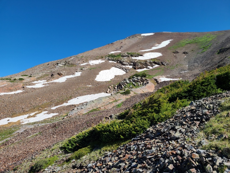
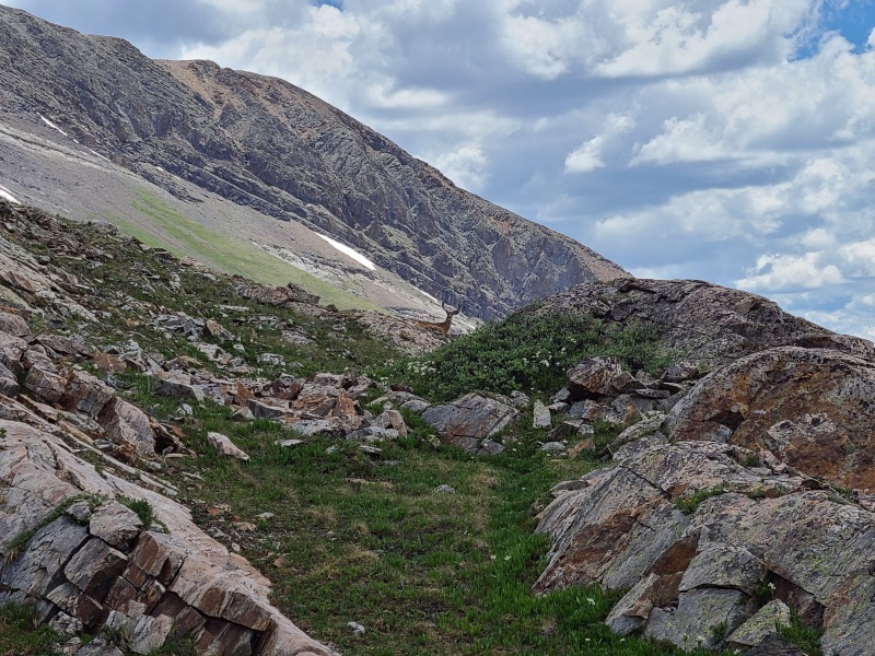
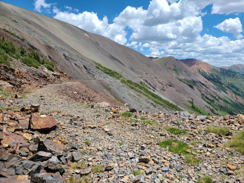
The trail from Yule Pass trailhead to Yule Pass itself is incredibly obvious - it snakes a couple miles across the west face of Cinnamon Mountain B and south slopes of Treasury Mountain, and it's so consistent in maintaining elevation across steep terrain that it's impossible to miss. It's kind of a trail on steroids and instantly became a favorite for both Whiley and I. It's just so cool that someone built something across such wild peaks!
The super neat Yule Pass Trail with Treasury Mountain behind. Relatively speaking the exposure is high for most of the trail but it's still a trail!An excellent trail through otherwise miserable terrain. Purple and Treasury on either side of Yule Pass. Photo: Whiley H.Trail through easier terrain, looking towards Treasury.Ptarmigan in summer dress.
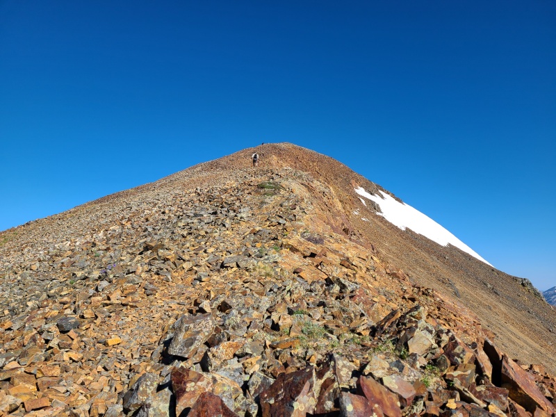
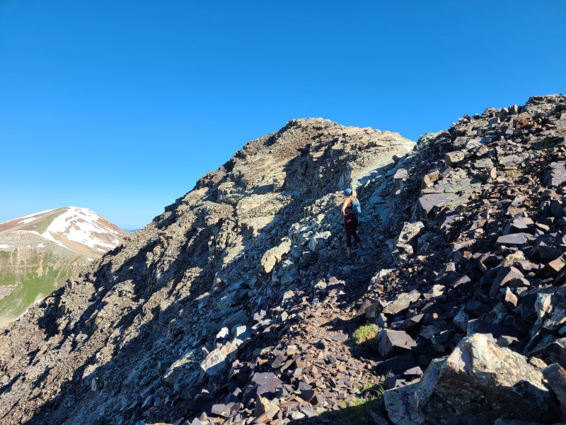
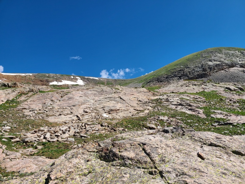
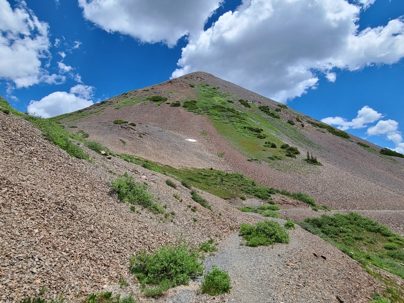
The trail took us to just below the Treasury/Cinnamon saddle, and we made the short ascent up grass and willows to the saddle. From our new vantage another blatant trail went up Treasury's southeast ridge. We followed the trail for what seemed like forever across grass-dotted scree, which eventually turned over to pure crushed talus.
Start of the trail up Treasury.Looking rather bloblike, but this isn't even close to the summit.Getting into more rugged terrain.
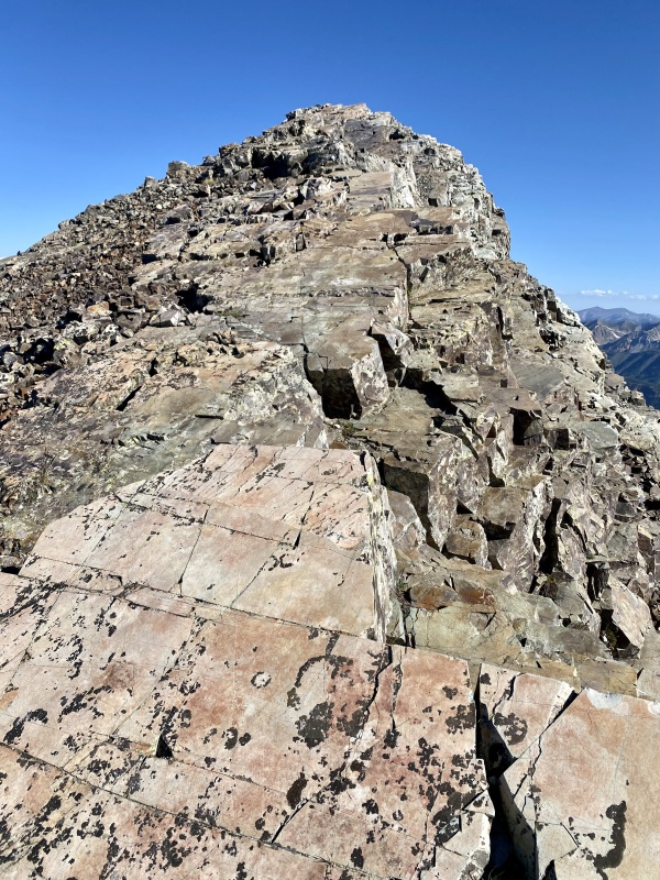
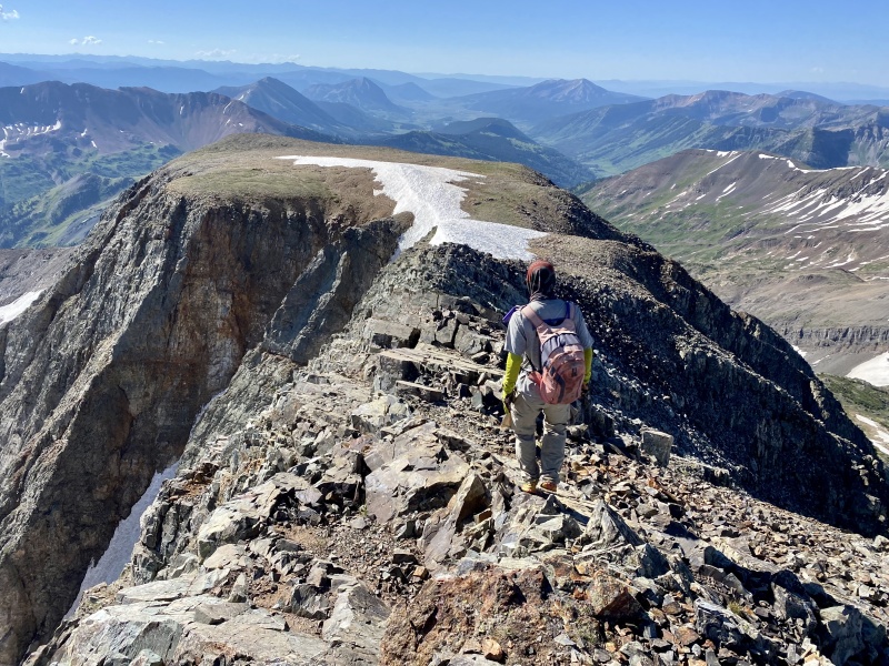
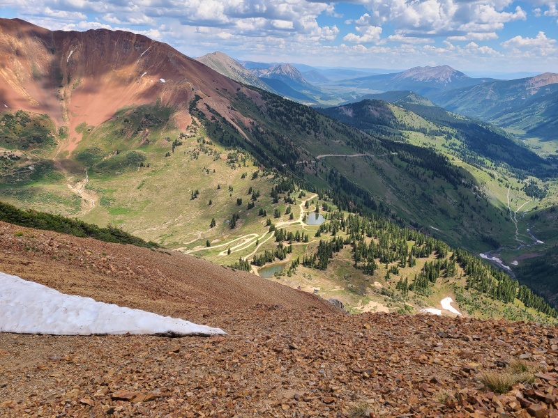
Each new bump of elevation revealed a new dimension to the mountain. The upper reaches morphed once again, becoming narrow, with slabs and ledges atop steep dropoffs.
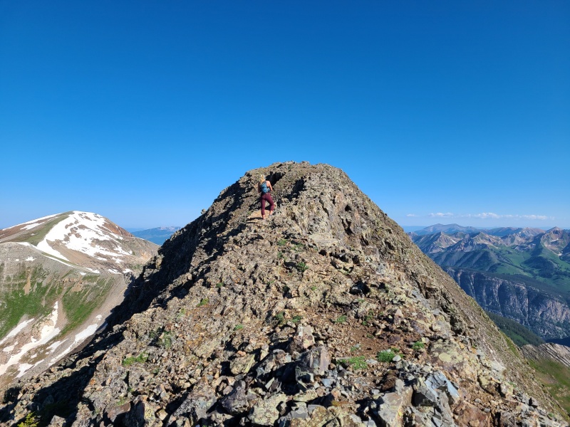
Sheer wall nearing Treasury's summit.Narrowing into something rather interesting.Ledges around the north side of the ridge.Blocky slab scrambling to the summit. Photo: Whiley H.Summit of Treasury, with Treasure to the left.
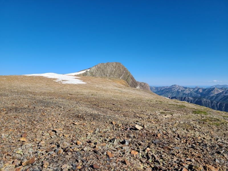
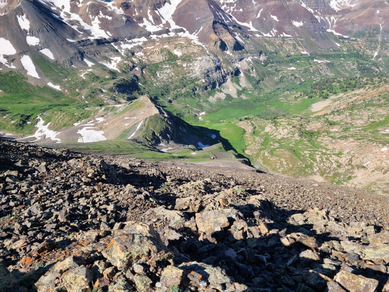
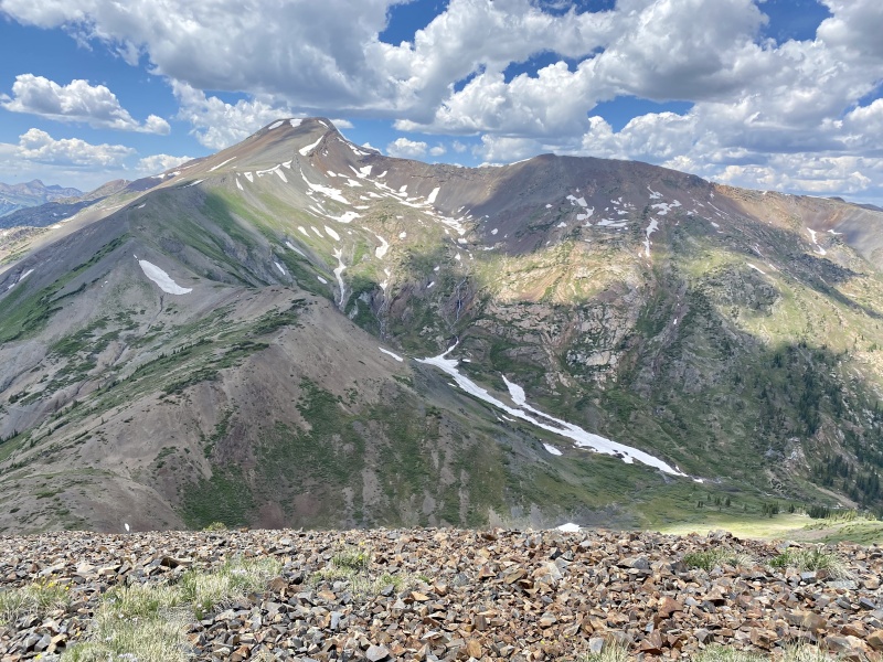
Treasury was super cool and a great introduction to the Raggeds. There wasn't anything difficult about it but it did give us an appreciation for the wilderness it's a part of. Next up was Treasure, which couldn't be connected directly via the ridge - too ragged, becoming technical at one point - but we knew from a trip report by Bryan Ludwig (RIP) and another by Acorn22 that we could drop down Treasury's southwest face, which would save us some backtracking. A single look down the face stopped us from doing that, not that we couldn't, just that it would have sucked immensely.
The nasty descent off Treasury. While shorter we skipped this mess.
We decided to backtrack along our ascent path and descend grass slopes towards Yule Pass instead. A bit longer, a lot easier. About nine tenths of the way back we found our grass and dropped down.
Returning down Treasury's southeast ridge, rugged raggedness surrounding. Photo: Whiley H.Capitol Peak, Snowmass Mountain, and Hagerman Mountain.Easier, grassy descent towards Yule Pass.
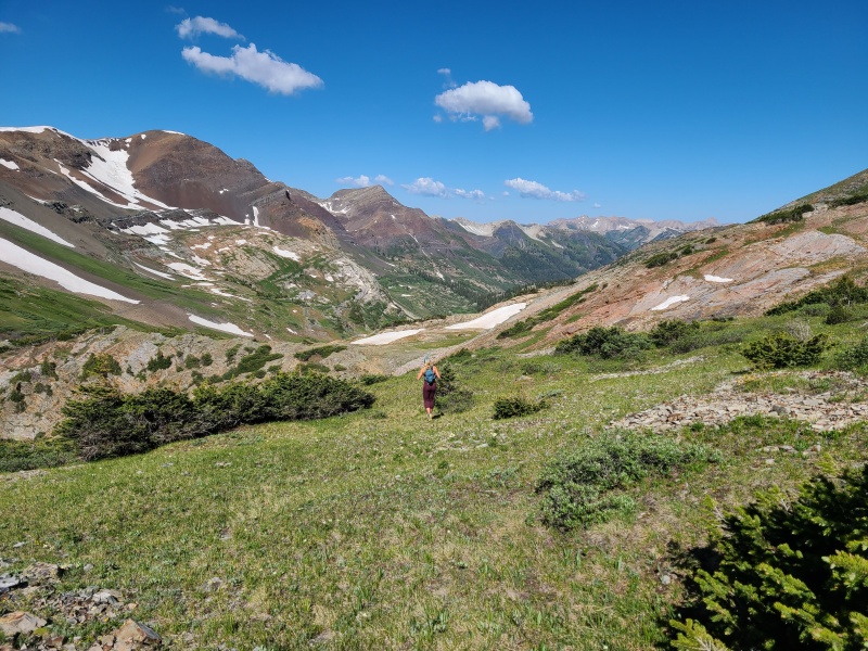
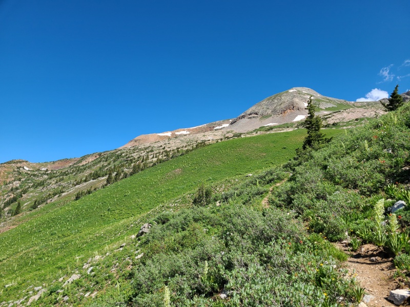
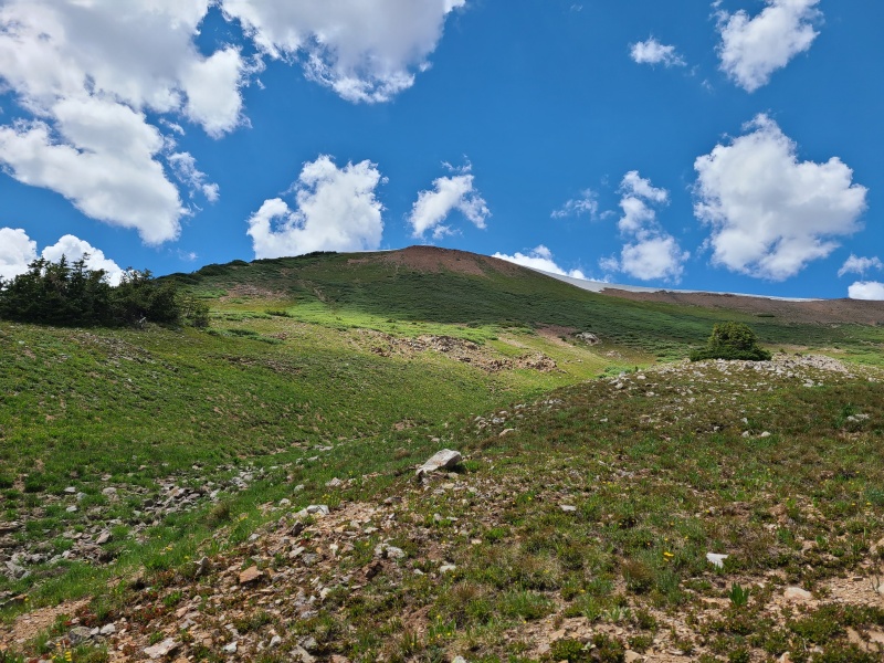
The terrain mellowed as we approached the pass, and we traversed northwest around a small knob above the trail. Eventually we dropped back to the trail, meeting it at about 11,300 feet.
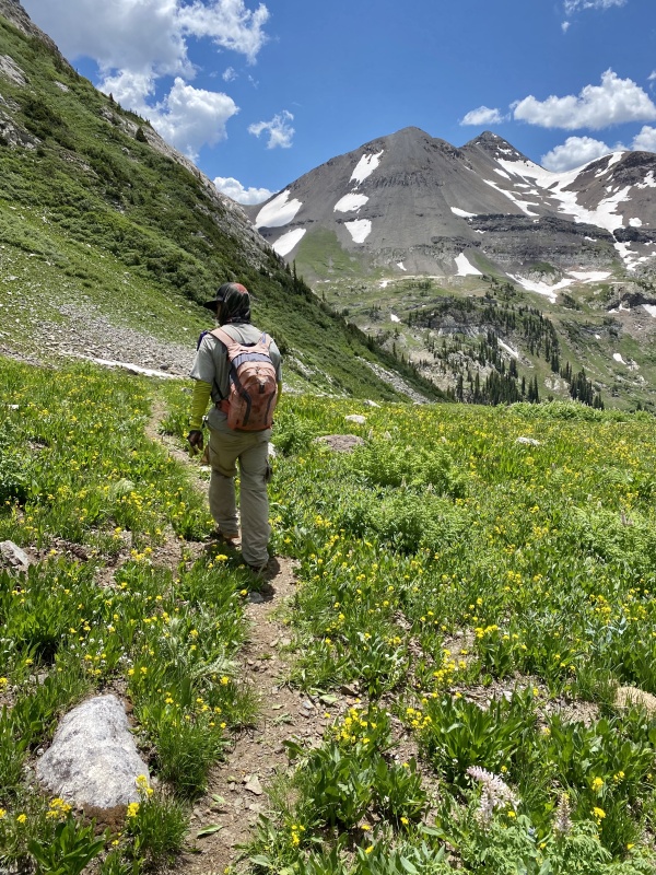
Heading towards Yule Pass. A bunch of unnamed 12ers span the opposite ridge.What a direct descent off Treasury would have entailed.Lush terrain heading up Treasure.Nice single track en route to Treasure.
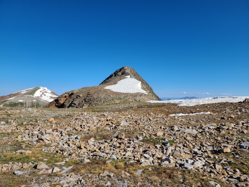
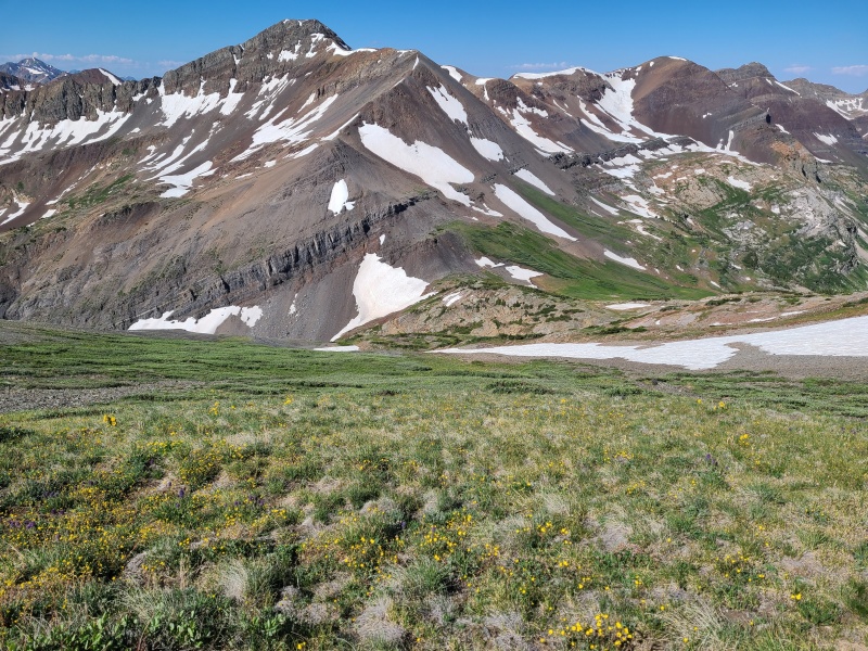
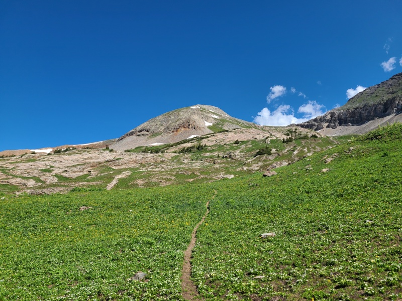
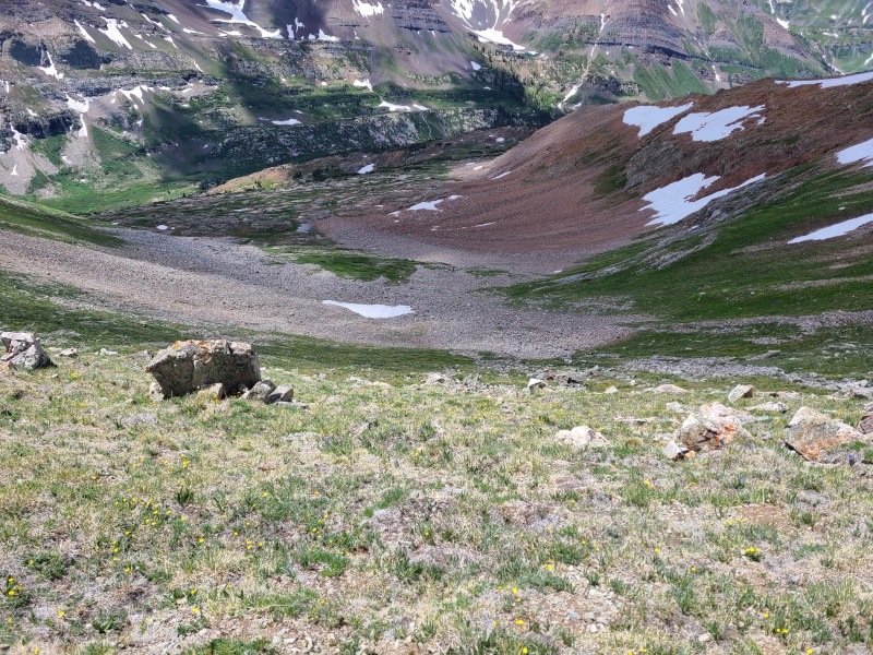
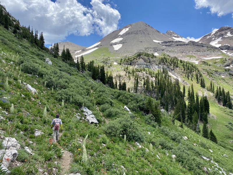
Narrowing into just a foot or so wide, the trail led through explosively green grass and aquatic plants, small waterfalls, and plentiful slabs. We met a few others along the trail, including a guided group of backpacking youngsters who seemed to really be enjoying themselves. We shared in their joy of the area, making our way towards a large bowl southeast of Treasure, which was reminiscent of a volcanic caldera. It seems likely that this area, being directly adjacent to the West Elk Wilderness, which has volcanic origins, would also be of similar nature. Route finding through the rock and alpine plants was a bit complicated, but of no technical difficulty. We simply aimed for the curvaceous bowl.
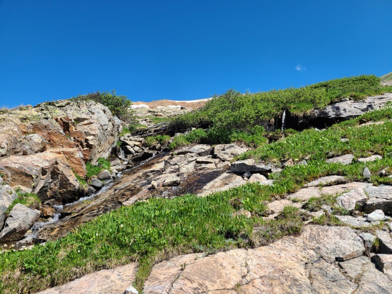
Lots of free flowing water in the Raggeds.Solid slabs dotting the approach to Treasure.
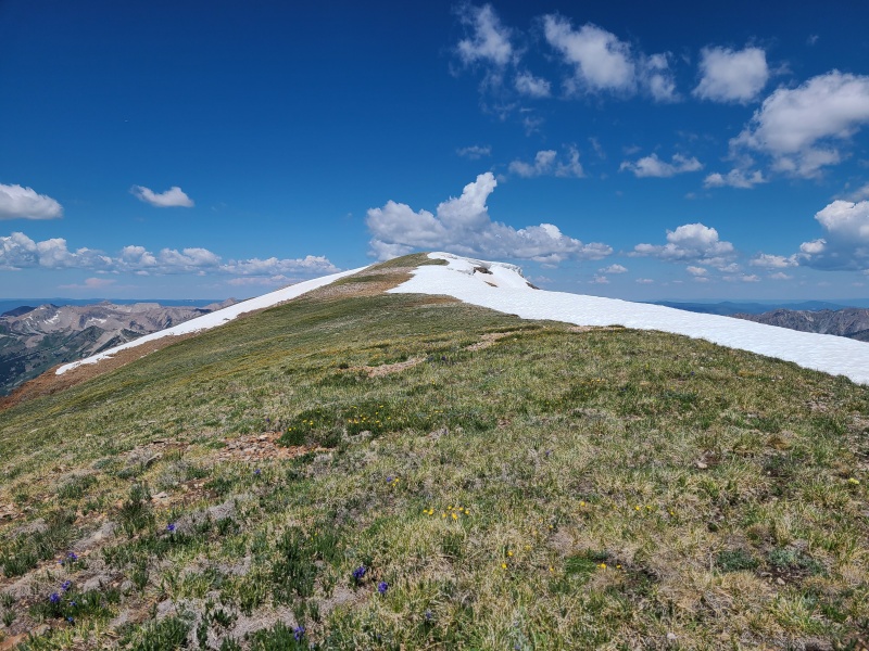
Once the taller plants disappeared the route became more obvious. We couldn't really take a direct line up the peak since it was just steep choss, nor go directly to the saddle, since it was blocked by cliffs, so we went up a bulbous formation along the ridge, staying on grass as much as we could. The talus was short lived and we were quickly on the ridge. From there it was a basic hike to the stunning summit.
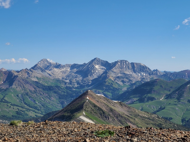
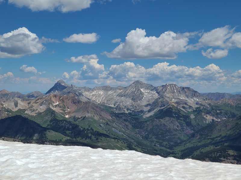
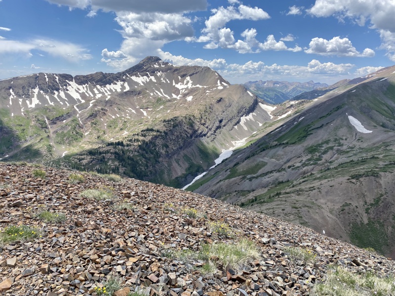
We tried to stick to grass as much as possible.Very caldera-like.Gentle summit of Treasure.Capitol-Snowmass group again.Treasury from Treasure. It's readily apparent from this angle why the descent off Treasury sucks.
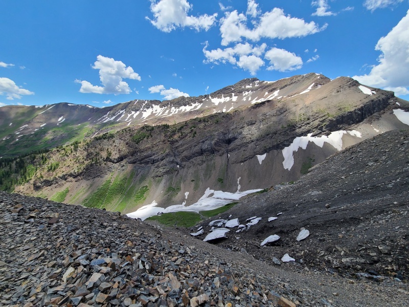
We spent a few minutes on the summit enjoying the ragged views of the Elk. This peak had truly been a treasure, and we were excited to do more climbing in the wilderness, the geology was just too cool. All good things must come to an end, and we wanted to do another peak or two before the afternoon storms arrived, so down we went. This time we didn't return all the way to our route up the bowl, opting to drop down steeper slopes right where the cliffs ended.
Back into Yule Basin.
We meandered back down the slabs, largely ignoring the upper trail. Along the way we made friends with a lone buck. What a home he has!
"Y helo thar." - A DeerPurple Mountain and Point 12,781. Photo: Whiley H.
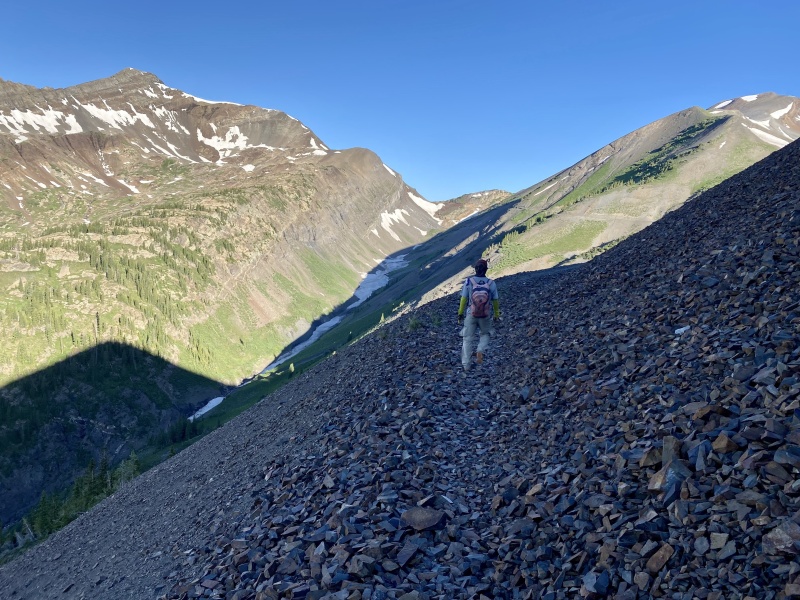
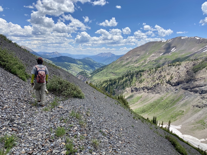
Once back where the main trail is we hiked back to Yule Pass, then followed the extremely level path along the steeps towards Paradise Basin.
Beautiful trail back to Yule Pass. Photo: Whiley H.This area is such a treasure. Photo: Whiley H.Treasure on the left, Treasury on the right.Yule Pass trail back to Paradise Basin. Humans are nuts.
We'd missed the "crazier" parts of this trail with our roundabout way up and down Treasury, and passed by a family of four, most of whom looked like they weren't quite ready for the trail. The dad though? His entire head was a smile.
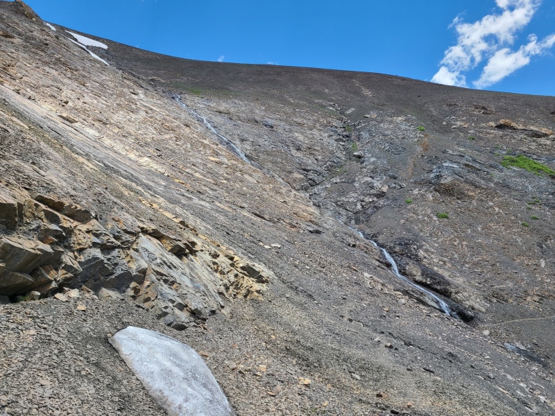
South with Gothic Mountain far left, Crested Butte looking tiny, Whetsone Mountain, and the ridge off Purple. Photo: Whiley H.Waterfall rushing down Treasury.Purple Mountain and its beautiful geology.
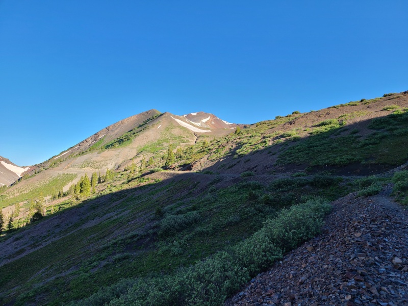
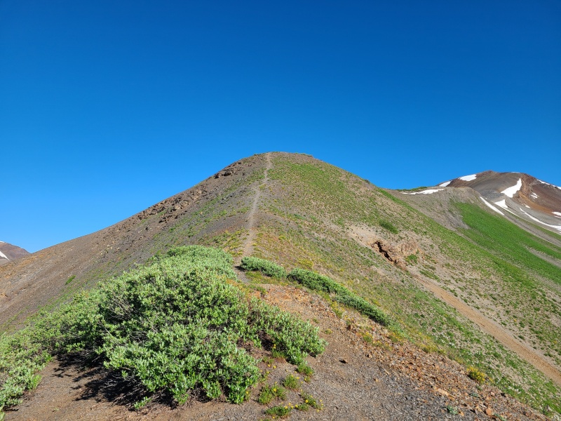
We traipsed along until we got back to the parking area, constantly exclaiming about the cool everything, and then made our way up nearby twelver Cinnamon Mountain B. You can guess by the name what color Cinnamon is, right?
Cinnamon Mountain B.
Cinnamon proved to be quite easy, though the terrain was steep and loose chiprock. It wasn't the most fun peak to ascend, but we had another old road to follow to its east slopes. Like its larger neighbors it had jaw-dropping views.
Easy terrain heading up Cinnamon.Purple Mountain and Yule Pass. The prominent peak way in the back right is 12er Chair Mountain. Photo: Whiley H.Treasury's long southeast ridge, with more interesting terrain off the northeast side. Photo: Whiley H.Paradise Basin.
The steep junk we had climbed up wasn't an appealing descent option so we went down the north ridge then made a sharp cut back south to Paradise Basin. From here I went back to Crested Butte while Whiley did one more 12er, Mount Baldy.
Mount Baldy. Should have named it Fire Peak.
Spectacular mountains, the Raggeds. The sights here are just something else, and though thirteeners have been my priority since, I plan to make the Raggeds one of my first stops when I've finished the thirteeners and begin working on the twelvers in earnest. Even a walk along the Yule Pass trail is worthy of being called out as spectacular. Add a few peaks and you've got yourself an experience to treasure for years to come.
Statistics
Climbers: Ben Feinstein (myself), Whiley H. Trailhead: Yule Pass
Total distance: 14.61 miles Total elevation gain: 6,261 feet Total time: 7:20:11 Peaks: Two ranked thirteeners, one ranked twelver
Treasury Mountain, 13,462'
Treasure Mountain A, 13,528'
Cinnamon Mountain B, 12,293
Splits:
Starting Location
Ending Location
Via Time (h:mm:ss)
Cumulative Time (h:mm:ss)
Rest Time (m:ss)
Yule Pass Trailhead
Treasury Mountain
1:31:18
1:31:18
6:10
Treasury Mountain
Treasure Mountain A
2:40:21
4:17:49
5:58
Treasure Mountain A
Yule Pass Trailhead
1:57:34
6:21:21
0:00
Yule Pass Trailhead
Cinnamon Mountain B
0:30:42
6:52:03
0:00
Cinnamon Mountain B
Yule Pass Trailhead
0:28:09
7:20:11
Trip End
Version history:
Date
Notes
October 26, 2022
Initial publication.
October 28, 2022
It's the descent off Treasury that sucks, not the descent off Treasure. Stupid Elk and having so many peaks with similar names right next to each other.
My GPS Tracks on Google Maps (made from a .GPX file upload):
It sure is a special place. I've got the Ruby traverse near the top of my list once I'm done with the 13ers. At that point I think working on the Raggeds and the Weminuche will keep me busy for quite some time.
I could totally see that. The trail is so close to perfectly level, much more than most trails in similar terrain. It'd be pretty neat if you could drive from Paradise Divide to Yule Pass, that's for sure.
A few years ago I did this duo from the Marble side. The next day a friend & I drove up Mosquito Pass and hiked London, Kuss, Mosquito, Treasurevault, & Evans B - thus "Hoarding All the Treasure" (as I titled my FB album). I'll agree with both you & Eddie - such a beautiful area! Did you manage to see down into any of the Yule Lakes? I've debated returning just to camp at one of them at some point in the future.
Hey Brad, nope, we didn't see any of the Yule Lakes. It looks like we could have seen some the eastern three of the four from the summit but we weren't really paying attention to what was below us, moreso the sea of peaks around us. I'll be sure to pay attention for these when I go back for the lower peaks in the wilderness!
Your choice of route up and down Treasure (I believe) is the better route.
We came down that way.
Love that area.
We have to go back for Crystal and Galena just to the north/NE to finish off that area.
And yes, Yule Pass used to be a road to Marble. Crazy on much of it has slid down the mountain.
If descending Treasury directly had been a nice scree ski we probably would have taken that but with this kind of roly poly ankle breaker talus and the ridge direct to Treasure apparently containing some fifth class on awful rock it was a no brainer to find a nice grass route instead. Marble must have some of the most interesting roads and mining history in the state. Between the roads to Lead King Basin and Yule Pass it was surprisingly well connected to some beautiful and rugged terrain!
To clarify... the usual route up Treasure in most of the TRs I've seen is up the steeper slope to the saddle between T&T. That's the way we went up.
You can see the 5th class section from the saddle... see my TR.
The slope directly off T would have taken you down to the Yule Lakes, we looked at that and decide that was a no-go like y'all did.
That gentle slope down was quick and easy.
I might have to go back and take a look at Mnt Justice.
This area continues to elude me, as the weather forecast and my free days never seem to coincide...but thanks for offering another reason for me to keep looking for the right window.
With my MTB and hike via North Pole then a rope solo up the secluded towers I felt the same as you and Wiley then immediately thought the Elks were overrated. Crested Butte, the Raggeds, Kebler Pass, Chair Mtn via Deep Ck Lake...I could go on forever. CB isn't a secret when it's listed in Men's Journal as the top destination for beers. bikes and bands but there are secrets left and adventure destinations aplenty. I wrote a TR called Low Hanging Fruit a while back when I climbed the Raggeds but took it down to respect the property issues.
Also, you're cute and all but could we please have more pictures of WileyH, HeatherMtnChicken and VeraUndertow b/c I'm sure they are much cuter than you!
That looks like a nice day, the slab section up Treasury looks like a cool area. I don't make it out to the Elks as often as I'd like, but it seems like I always enjoy it when I do.
@Joel: Ah, gotcha. That makes sense. It's definitely an area with many faces.
@Steve: Having done all three of the Raggeds' 13ers let me know if you ever go for the 12ers there. The Ruby traverse seems to be the premier Raggeds scramble. Whiley and I will hit you up if you don't first. ;)
@Amy: Text me some pics of the Chimneys! I saw that area on topo maps and am curious what it's like. Spectacular, I'm sure. I'll see if I can get some pics of Whiley and Vera for next time, we make an unbearably cute trio. ;)
@Andrew: The Raggeds are a real gem. I feel the same way as Amy - Raggeds > Elk at-large. I see you still have to hike the Raggeds' 13ers, enjoy them when you do! They're peaks to remember.
Beautiful view of the Elks on some lesser-known peaks. Thanks for posting!
Caution: The information contained in this report may not be accurate and should not be the only resource used in preparation for your climb. Failure to have the necessary experience, physical conditioning, supplies or equipment can result in injury or death. 14ers.com and the author(s) of this report provide no warranties, either express or implied, that the information provided is accurate or reliable. By using the information provided, you agree to indemnify and hold harmless 14ers.com and the report author(s) with respect to any claims and demands against them, including any attorney fees and expenses. Please read the 14ers.com Safety and Disclaimer pages for more information.
Please respect private property: 14ers.com supports the rights of private landowners to determine how and by whom their land will be used. In Colorado, it is your responsibility to determine if land is private and to obtain the appropriate permission before entering the property.


")
")
")
")
")
")
")
")
")
")
")
")
")
")
")
")
")
")
")
")
")
")
")
")
")
")
")
")
")
")
")
")
")
")
")
")
")
")
")
")
")
")
")
")


