Download Agreement, Release, and Acknowledgement of Risk:
You (the person requesting this file download) fully understand mountain climbing ("Activity") involves risks and dangers of serious bodily injury, including permanent disability, paralysis, and death ("Risks") and you fully accept and assume all such risks and all responsibility for losses, costs, and damages you incur as a result of your participation in this Activity.
You acknowledge that information in the file you have chosen to download may not be accurate and may contain errors. You agree to assume all risks when using this information and agree to release and discharge 14ers.com, 14ers Inc. and the author(s) of such information (collectively, the "Released Parties").
You hereby discharge the Released Parties from all damages, actions, claims and liabilities of any nature, specifically including, but not limited to, damages, actions, claims and liabilities arising from or related to the negligence of the Released Parties. You further agree to indemnify, hold harmless and defend 14ers.com, 14ers Inc. and each of the other Released Parties from and against any loss, damage, liability and expense, including costs and attorney fees, incurred by 14ers.com, 14ers Inc. or any of the other Released Parties as a result of you using information provided on the 14ers.com or 14ers Inc. websites.
You have read this agreement, fully understand its terms and intend it to be a complete and unconditional release of all liability to the greatest extent allowed by law and agree that if any portion of this agreement is held to be invalid the balance, notwithstanding, shall continue in full force and effect.
By clicking "OK" you agree to these terms. If you DO NOT agree, click "Cancel"...
Here comes another Little Bear trip report, I just can't help myself...
So, I had been wanting to do this particular route again, ever since stumbling upon it last year while doing the Little Bear-Blanca traverse. I had really enjoyed it that day and found it to be a good warm up for the traverse. I didn't have any willing partners this time though, but did find someone on the forum looking to team up with others for his 14er finisher. We chatted for a bit and agreed we'd meet up and take this alternate route with a bypass of the hourglass. A couple of his friends would join us as well.
I did this climb for my Dad. A few days prior he had passed away after a long battle with covid. He was not a mountain climber, but he enjoyed following my journeys and I know he would have loved Little Bear. Shine on Dad...
Day of Climb: September 18th, 2021
Trailhead: Como Road
Peaks: Little Bear Peak
Mileage and Elevation Gain: 9.5 miles with 4312 feet of gain
I arrived at my parking spot on Como Road around 1am early Saturday morning. I had reached my 4wd road tolerance level at about 9800 feet and parked in a pull-out. Unfortunately, I would only have about 2 hours to sleep with a 3am wake up time. Friday had been a busy day which gave me a very late start on my drive to Little Bear. I had worked until 4 and then played a pickleball tournament until after 8 that night in Loveland. 5 hour energy would be my new best friend until getting safely back to Fort Collins later in the day.
After waking from my short nap I readied myself and began walking up Como Road at a good pace. It was roughly 3 miles and 2000 feet of elevation gain to Como Lake from my parking spot. I was meeting the rest of my group at the lake where they had camped and probably got a good night's sleep. On the way I passed forum member Grisel on the road. I believe he did a solo LB-Blanca traverse that day.
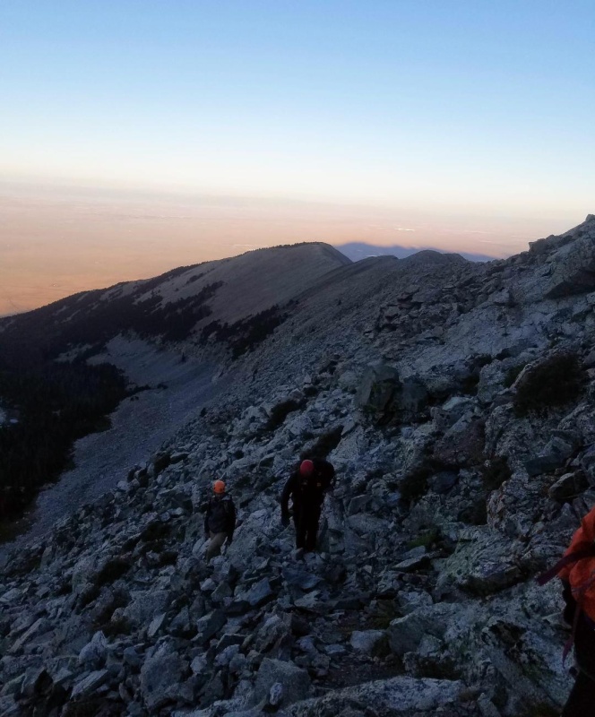
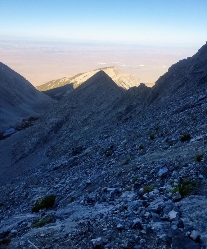
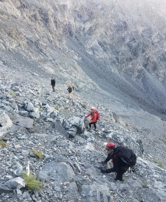
My group was waiting for me at their lake campsite and after a quick introduction we headed up the road. The spilt to Little Bear came quickly and we left the road and climbed the initial gully to the notch at 12,600 feet on the west ridge of Little Bear. We then climbed out of the notch and headed east on a faint trail following the standard route towards the hourglass.
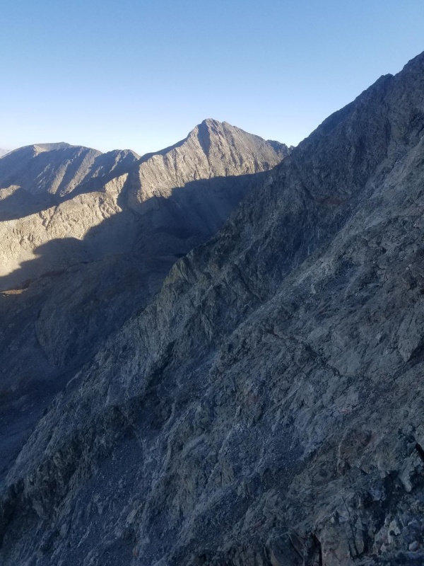
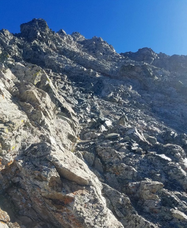
Climbing the west ridge from the notch.Looking back towards the notch.There's a faint trail somewhere in the talus.A little further along the ridge with the hourglass now in full view.
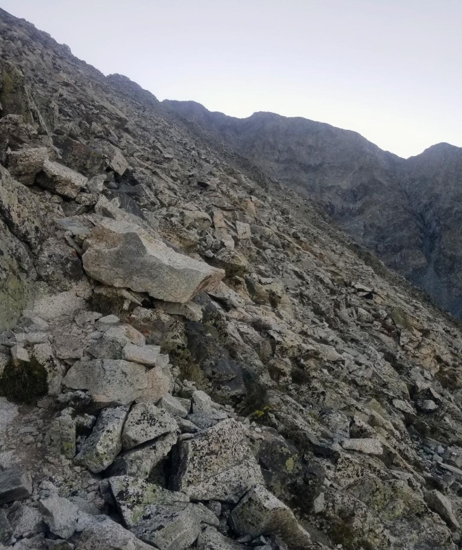
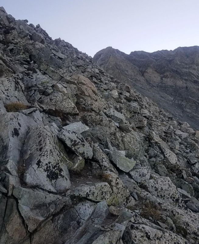
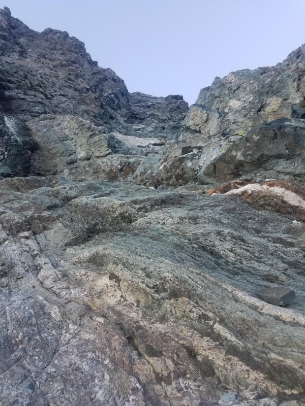
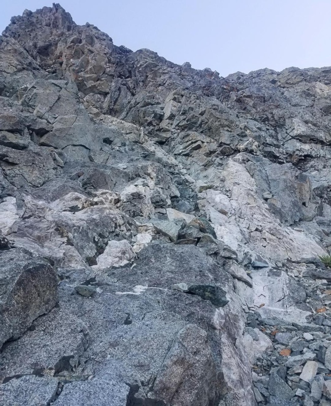
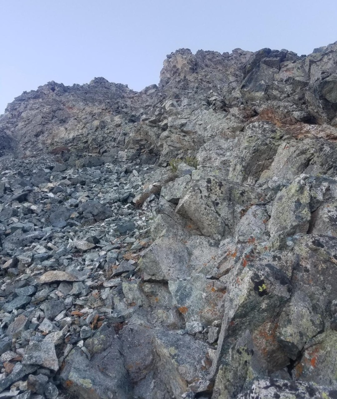
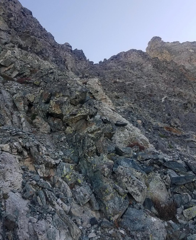
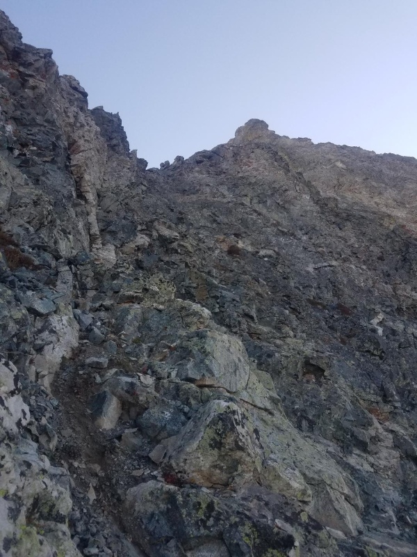
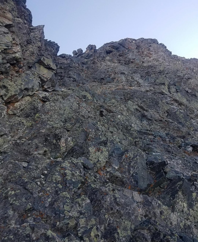
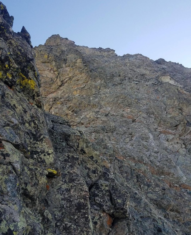
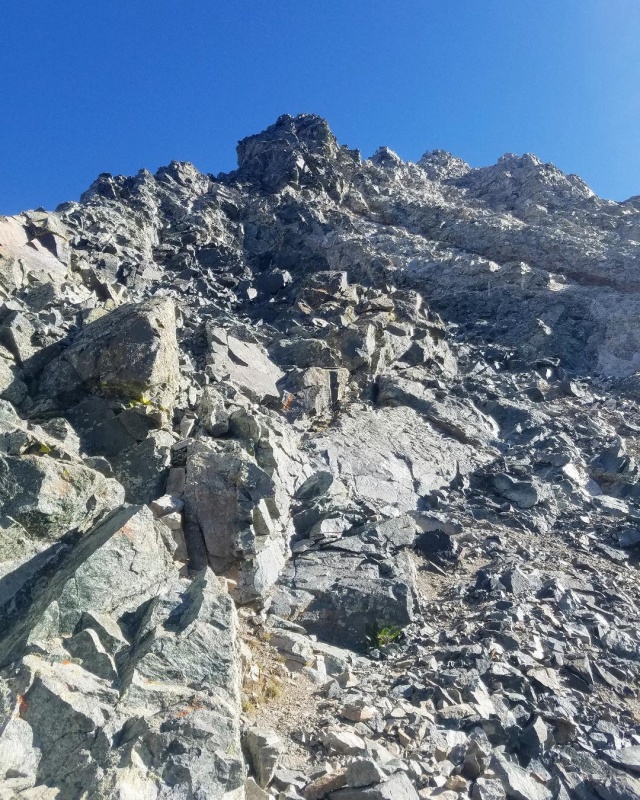
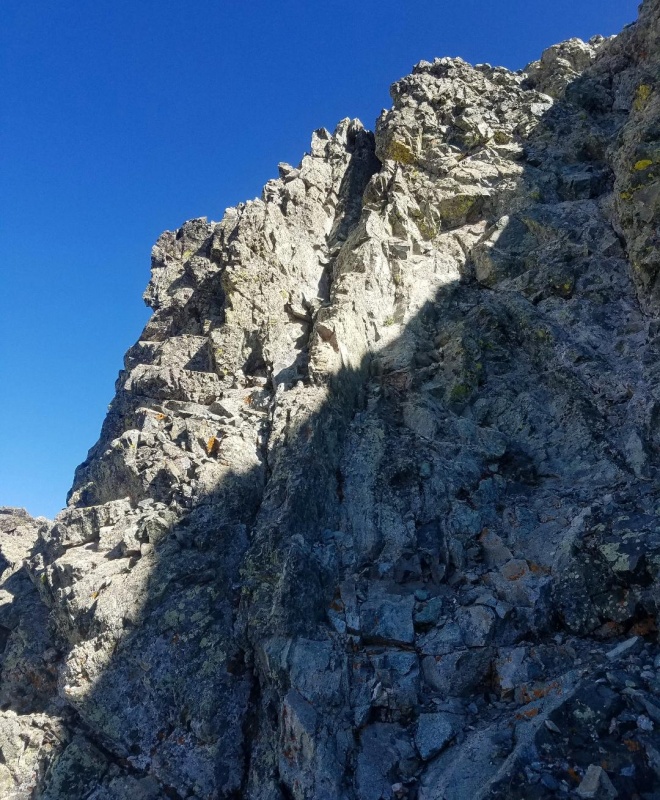
At about 13,000 feet we veered left leaving the standard route and headed northeast up a steep slope. Our goal was the crest of the west ridge at 13,500 feet which would take us around the hourglass. We basically just went straight up here with the climbing being a mix of 2+ and easy class 3, and it didn't take long to reach the ridge proper. We stayed left on the way up following a cliff band for what seemed to be the best and most efficient line to the ridge. We found the slope had more loose rock to contend with whenever we strayed right.
Leaving standard route and heading up towards the ridge.A quick look back.
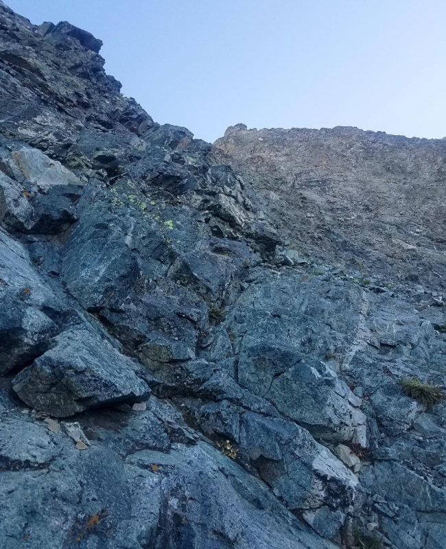
The next series of pics show the various sections on our climb to the ridge:
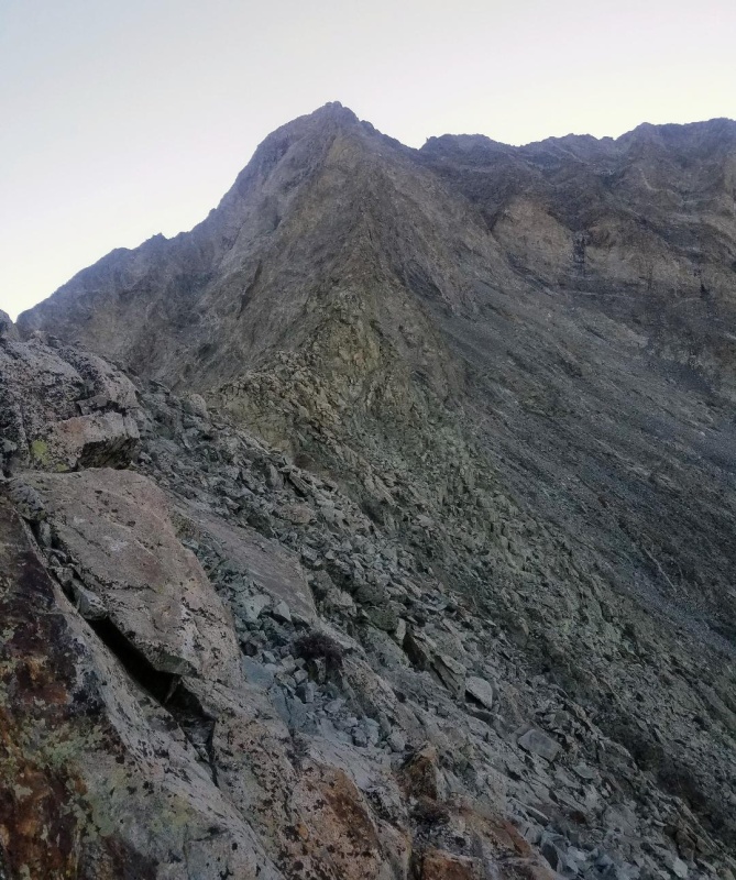
The team.Getting close.Almost there with the southwest ridge in the background.
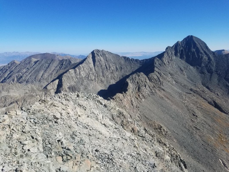
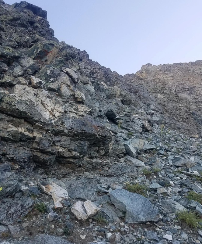
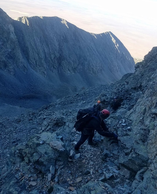
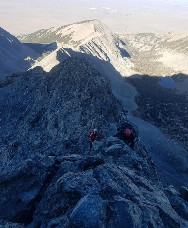
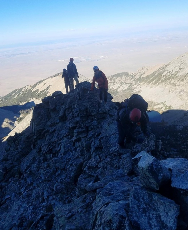
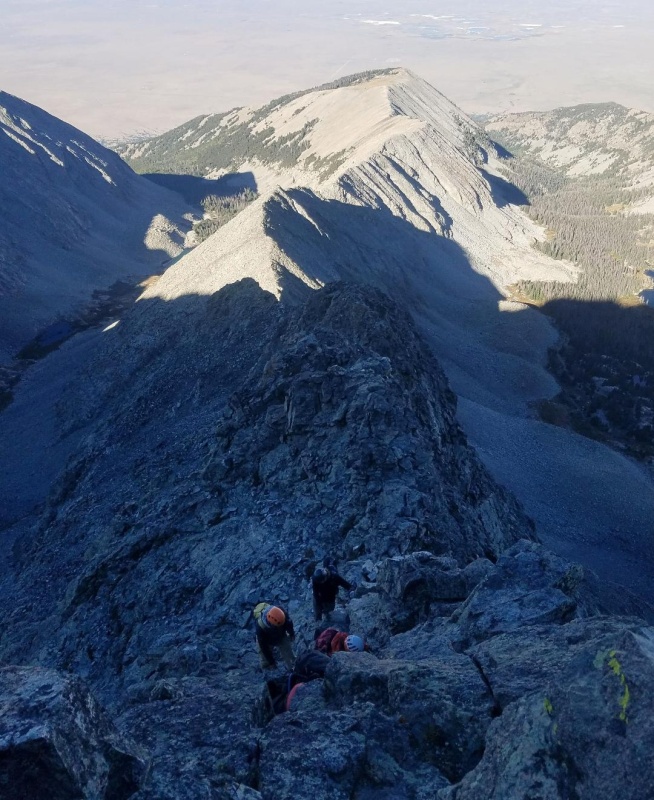
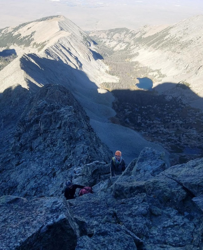
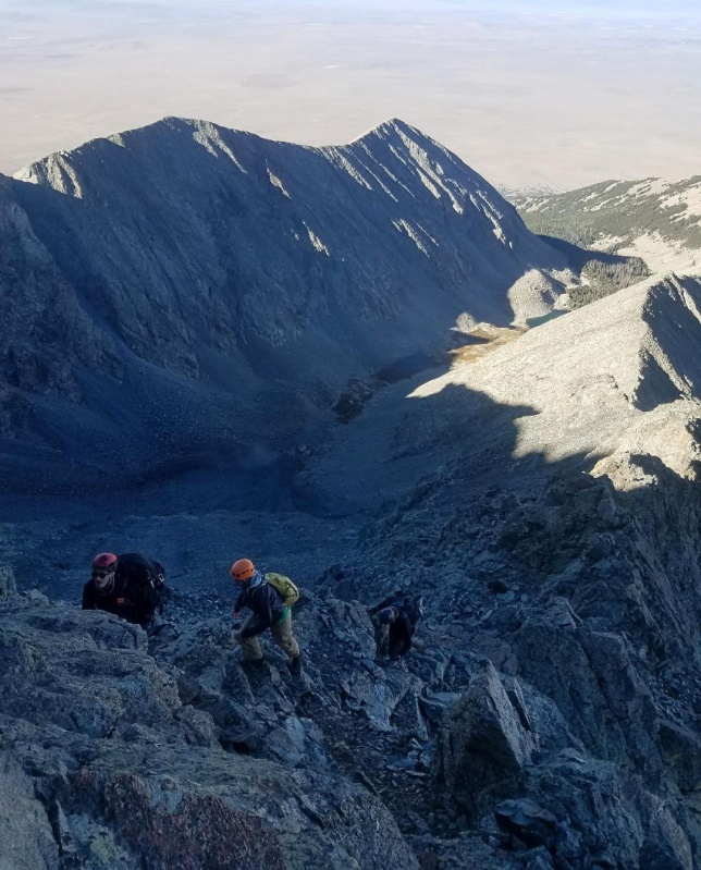
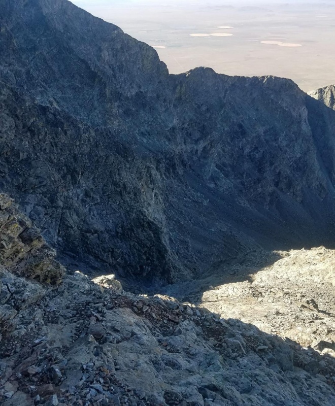
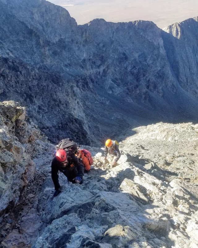
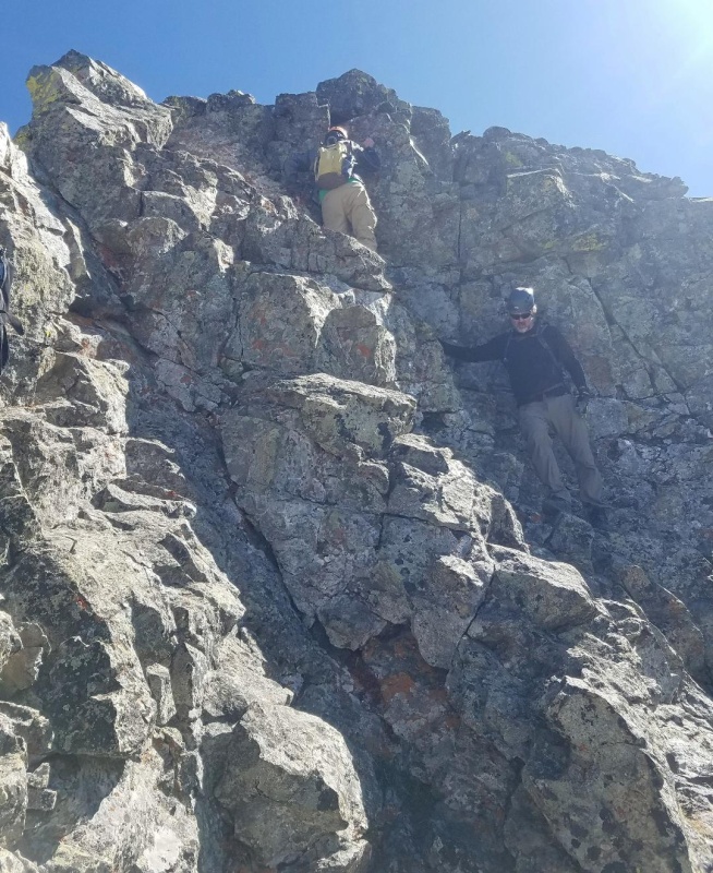
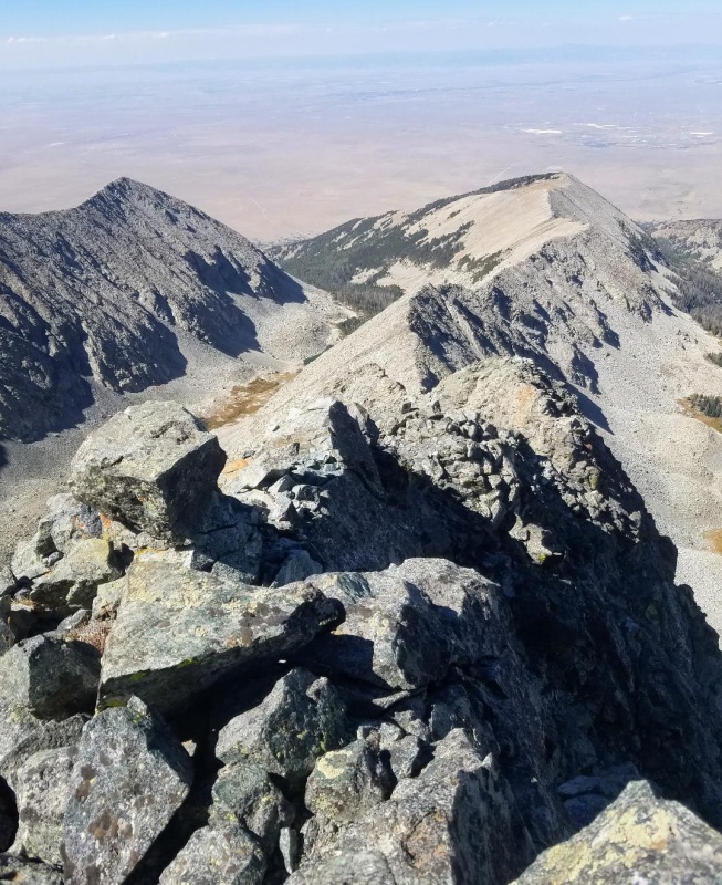
The ridge was gained without incident and we immediately felt the exposure. The initial ridge section was very narrow with a nearly straight drop a thousand feet or more to the left. The views of Ellingwood Point and Little Bear from this vantage were outstanding. The 5 of us (we picked up a stray along the way) carefully began climbing the ridge with the crux of the route not far ahead. This short section is very similar to parts of the LB-Blanca traverse and has maximum exposure. The climbing here was not particularly difficult though and the rock is very good.
West ridge proper.Ellingwood Point.Looking down the narrow west ridge.Looking up the ridge
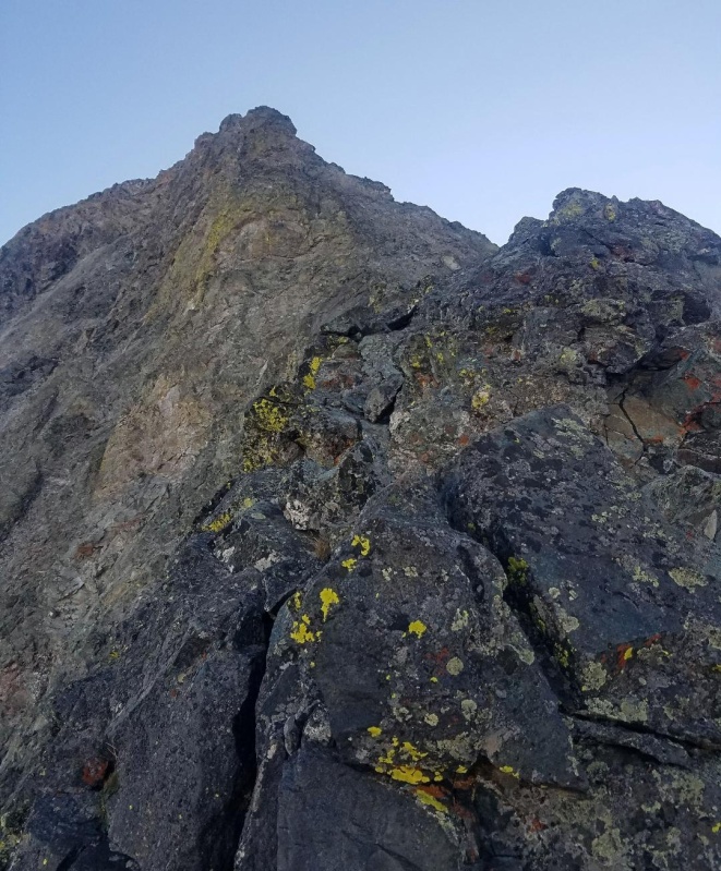
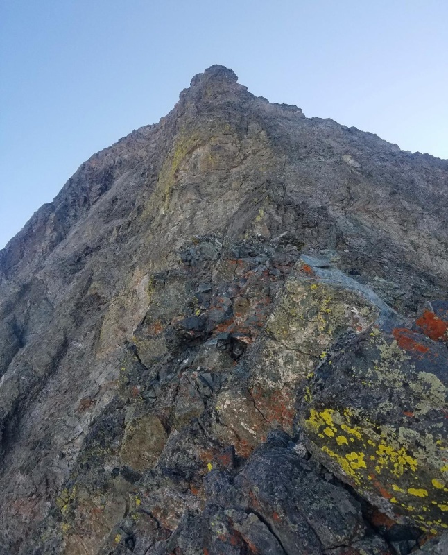
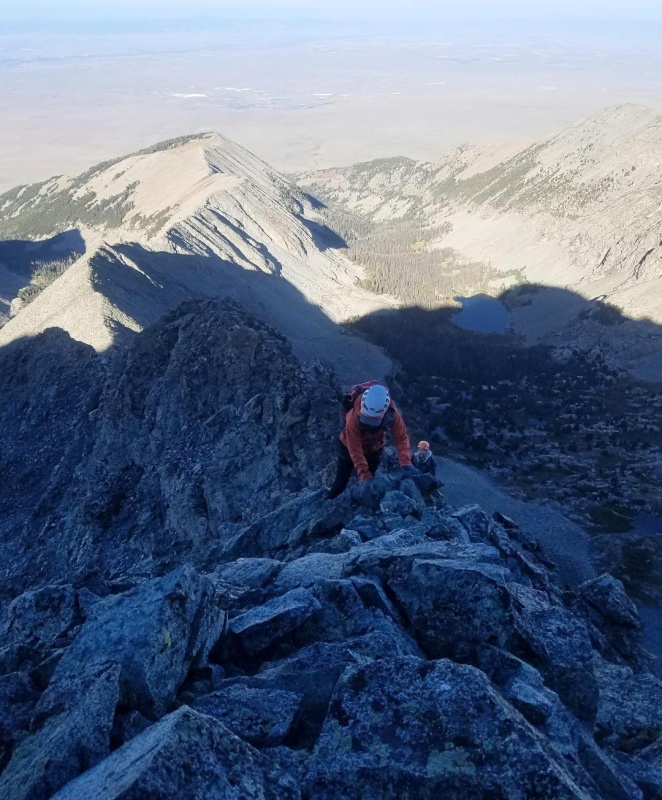
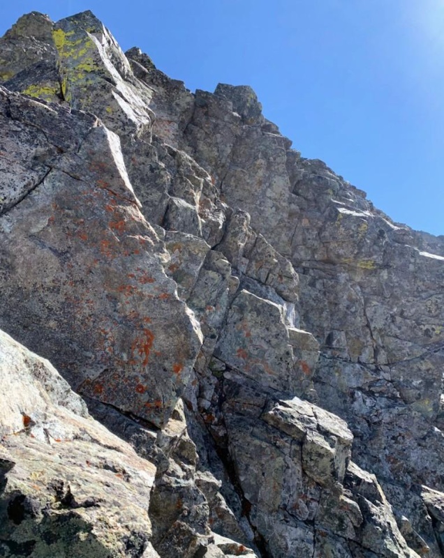
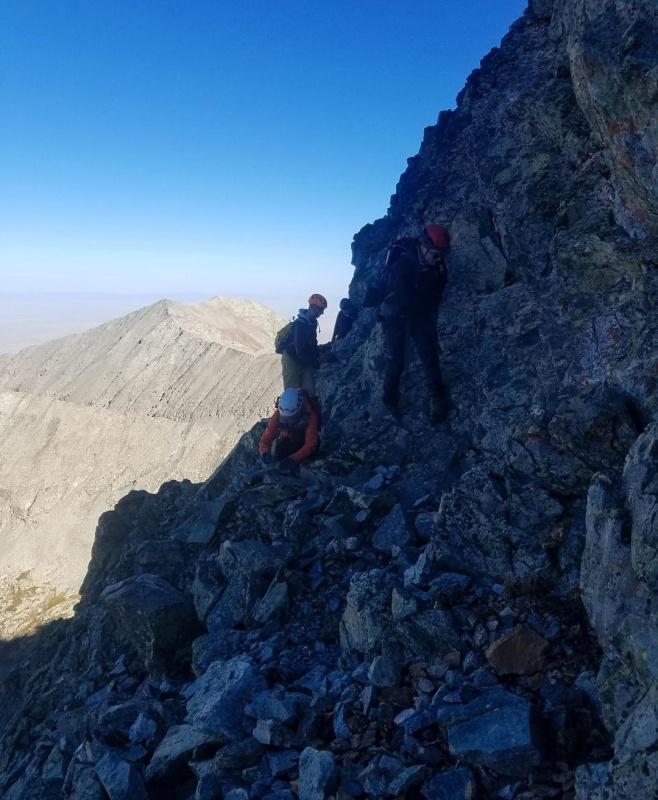
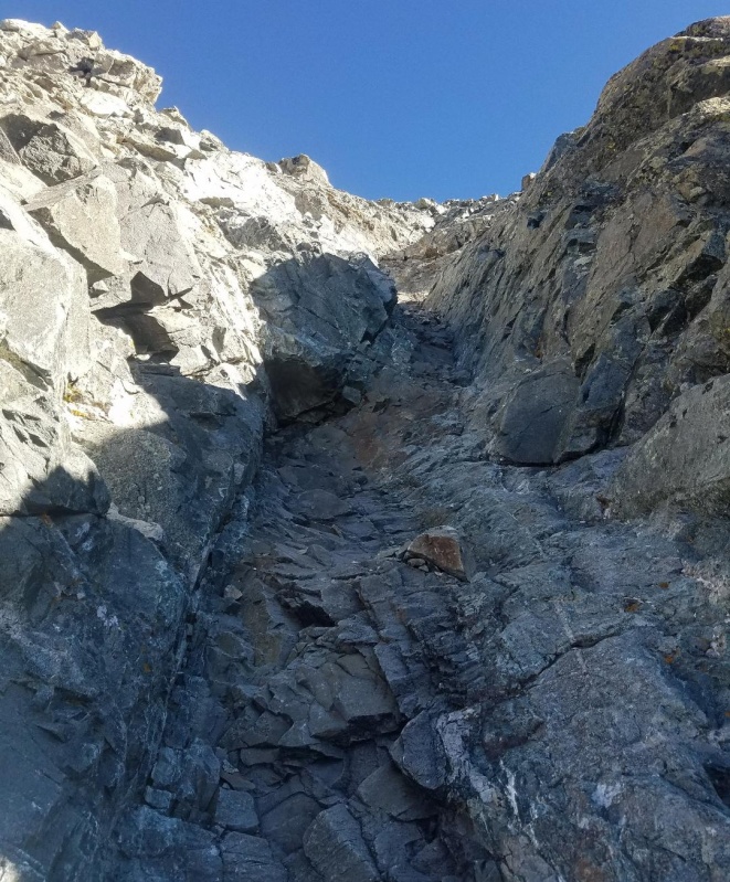
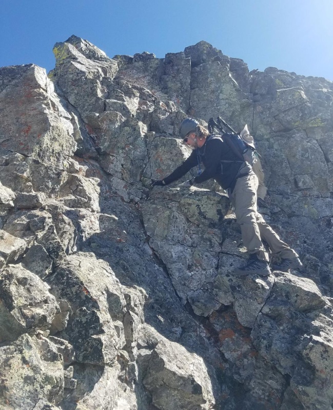
After not too long, we reached the exit off this narrow section and the crux of the route. There are 2 distinct choices here with the easier being to stay ridge proper. Alternatively, you can bypass the crux with a workaround below and to the right. I stayed ridge proper with the hardest move being an awkward climb over the rock in the pic below with the yellow splotches. I don't believe the move goes beyond class 3 but the exposure on both sides is off the charts. I pretty much just crawled up and over it. If you're tall (and not short legged like me) you might barely notice the difficulty. After this move there is a nice landing to chill before continuing on to the next section.
The rest of my group decided to go for the less exposed bypass of the crux and circled down below and around. This slight detour was definitely more difficult than the crux, but I guess with it being less exposed it was more appealing to the rest of the group. It was still not somewhere you'd want to fall though. I watched from above while they carefully went one at a time and joined me on the small landing. They collectively said it was class 4.
The crux - stay left on ridge proper here or go right across that ledge and up a narrow gully. Photo by Drew Harper.Working through the crux bypass.
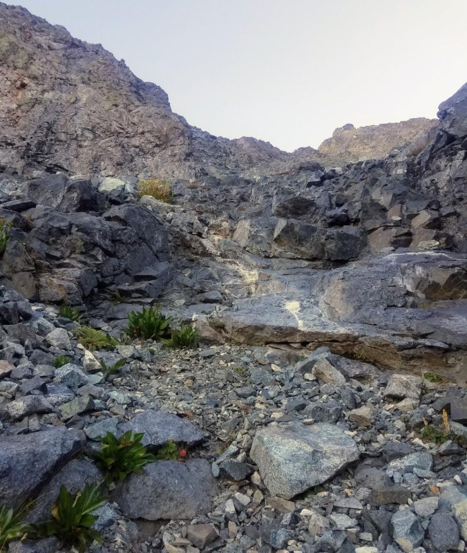
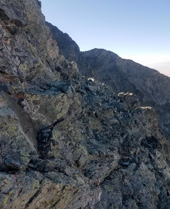
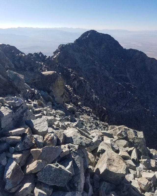
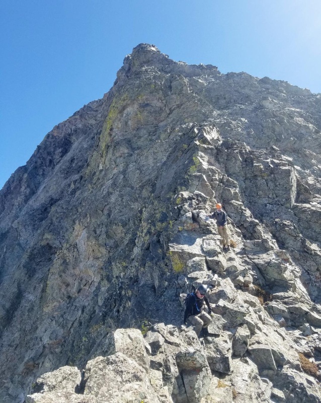
With the hardest part happily done, we continued up the west ridge towards the headwall area. The climbing in this section was mostly class 3 with minimal exposure. At the headwall there is a class 5 chimney that needs to be climbed if you want to continue up the ridge proper. We elected (as planned) to bypass this section and, instead, we followed a series of ledges that led around the headwall and dumped us out on the southwest face of Little Bear. This put us back onto the standard route and we could see the hourglass below.
Climbing to the headwall.Ledges to Southwest Face.Ledges
After crossing the ledges we were only a short distance from the summit and covered the ground quickly up the remainder of the southwest face. It maybe took us 10 minutes to summit from there over 2+ and easy class 3 terrain.
Southwest Face.Looking down at the Hourglass.A fun gully.
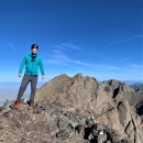
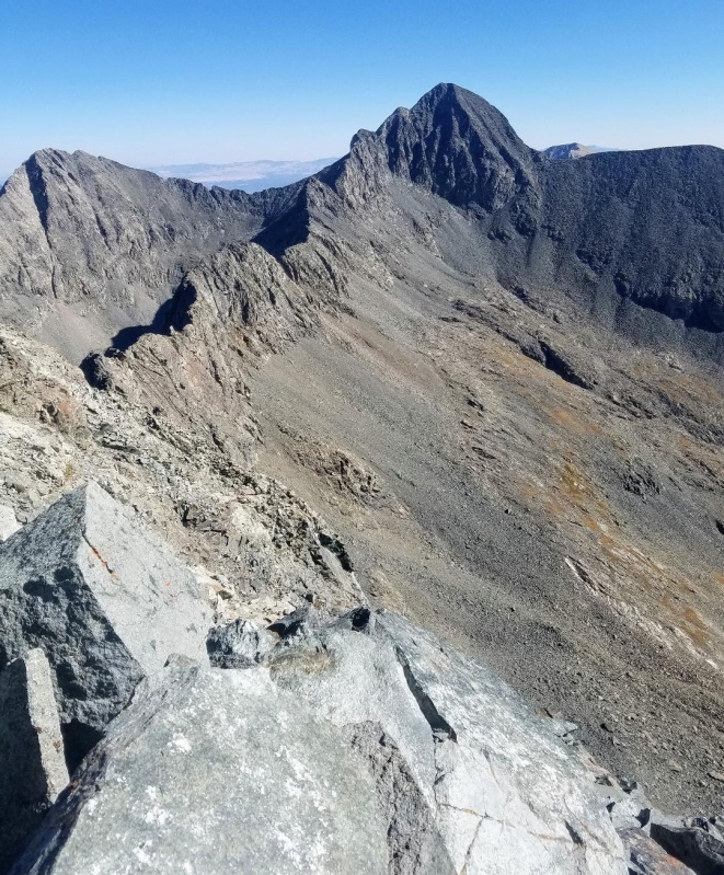
At the summit we celebrated Drew finishing the 14ers with style on Little Bear. Congrats buddy and thanks for joining me on this route! It was a great crew and a fun climb. The 3 others got their first Little Bear summits as well.
I then took a moment alone to remember my Dad the best way I could. I couldn't think of a better place to do this. Little Bear has always been a special place for me and now it is even more so.
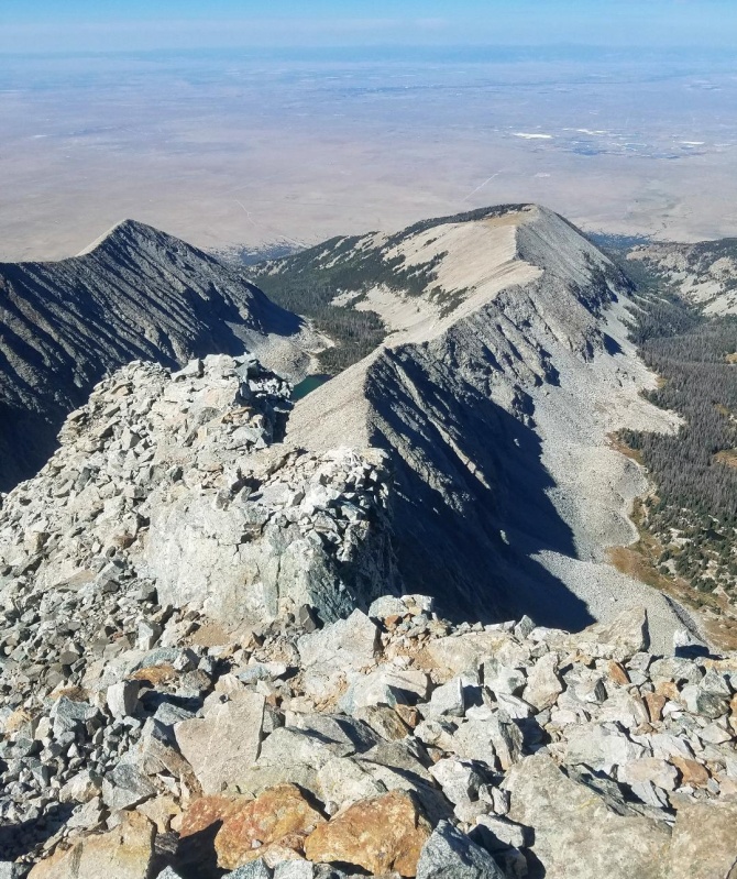
Summit and looking over at South Little Bear.Little Bear-Blanca traverse.Looking down the west ridge from the summit.
After a nice long summit stay with beautiful weather, we began our descent back down the way we came. We briefly considered the hourglass but decided to go with what we knew. We made good time to the crux which really was the only difficulty on the route. My group again decided to pass on the more exposed ridge proper route and took the class 4 bypass. I decided to go with them to check it out for myself. There were a couple of sketchy moves around a rock bulge making it more difficult than staying ridge proper. Having done both I would recommend staying ridge proper.
Headwall/Chimney that we bypassed with the ledges.Class 4 bypass of the crux.Climbing down from the crux area.West Ridge.
The rest of the descent went well and we made good time back to the campsite at Como Lake. My new friends packed up their gear and we all had an enjoyable walk down Como Road.
I think this alternate route is a decent choice if you want to avoid the hourglass. It's still a very dangerous route though, and it's probably not any easier than the standard route. I can't compare though since I've only done the hourglass with snow. I still believe the southwest ridge is the best way to climb Little Bear.
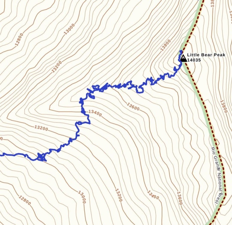
My GPS Tracks on Google Maps (made from a .GPX file upload):
So sorry for your loss. Glad you had this climb to dedicate to him, and I appreciate you including that deeply personal part of it.
About the climb and this account - been waiting for this ever since I read your first account of this route, thank you. Planning a run at LB in late August and I expect we'll probably have a go at following this. Maybe not exactly - that GPS track looks awful squiggly! You might hear from me by DM to pick your brain for more info and maybe see if you want to climb your favorite peak yet again.
Camden7 - Thank you! Yeah it was a great day and glad I could do that for my dad. Would definitely be good a good route when the hourglass is wet.
Fisching - I actually do enjoy that road and those peaks would be a zoo without it.
greenonion - Hope this reports helps! I think you'll enjoy the route. Thanks about my dad.
DeTour - Thank you! It was an emotional climb for sure and the best way I could think of to remember him. Yeah that Gaia track was very wonky for some reason. My first report on this route has a much cleaner track. Definitely hit me up to discuss the route more.
Thanks for sharing these details! After having a very close call descending the Hour Glass (climbers above sending rocks) after my first summit of LB a few years ago, I've been looking into alternate options since. I'll be headed back to do the LB->Blanca traverse later this summer and this looks much safer.
Just climbed LB (my #57) last week using your West Ridge variant route. Photos and .gpx tracks were of immense help. Left the normal route and gained the ridge exactly as your photos indicate. Climbed up and over the lichen-rock just like you and found the ledges to exit back to the normal route just below the headwall. I decided to return via the Hourglass because I knew there was no one above or below me, and of course found it wet. I was happily surprised at the solid hand/foothold and rock on the ridge. Exposure is definitely off the charts though for a lengthy portion of the route
My partner and I climbed this route on 6/29/24 and it goes as described in Judd's trip report. Thanks, Judd! We followed the photos and gpx track and didn't have any major route finding issues. We left the standard route around 13,100 ft and took the slope to the ridge. This section is a mix of class 2 and 3 and is pretty straightforward. There are numerous paths that will get you there. We just tried to stay on solid rock as much as possible and headed toward the visible notch. Once on the ridge, the exposure is big. I haven't done Capitol yet so can't compare to that, but the exposure is significantly bigger than the Wilson Traverse, Crestone Needle, Pyramid, and maybe even the Sunlight summit block, to name a few. The ridge section took us about 20 minutes, so it goes quickly. We thought the crux was class 4 and that the downclimb of the crux was especially tricky and over big air. The rest of the ridge is solidly class 3 and straightforward. The exit to the ledges on the right before the headwall is obvious and we even found some cairns there. We heard spontaneous rockfall in the hourglass twice when we were on the ridge, so we felt good about our route choice. All-in-in all, this seems like a good route if you can deal with some big (but relatively brief) exposure and a couple of tricky climbing moves.
Not sure you'll see this in time -- but I'm doing this on Sunday 7/7/24. Can you just stay on the west ridge the entire time? Meaning do you need to drop down on the south side only to climb back to the ridge later on?
You can but you'll encounter some class 5 moves in that beginning section. My route avoids all the class 5 stuff. Look for a trip report by daway for more info on the entire ridge. Good luck and let me know how it goes.
Caution: The information contained in this report may not be accurate and should not be the only resource used in preparation for your climb. Failure to have the necessary experience, physical conditioning, supplies or equipment can result in injury or death. 14ers.com and the author(s) of this report provide no warranties, either express or implied, that the information provided is accurate or reliable. By using the information provided, you agree to indemnify and hold harmless 14ers.com and the report author(s) with respect to any claims and demands against them, including any attorney fees and expenses. Please read the 14ers.com Safety and Disclaimer pages for more information.
Please respect private property: 14ers.com supports the rights of private landowners to determine how and by whom their land will be used. In Colorado, it is your responsibility to determine if land is private and to obtain the appropriate permission before entering the property.
")
")
")
")
")
")
")
")
")
")
")
")
")
")
")
")
")
")
")
")
")
")
")
")
")
")
")
")
")
")
")
")
")
")
")
")
")
")
")
")
")
")
")
")
")