Download Agreement, Release, and Acknowledgement of Risk:
You (the person requesting this file download) fully understand mountain climbing ("Activity") involves risks and dangers of serious bodily injury, including permanent disability, paralysis, and death ("Risks") and you fully accept and assume all such risks and all responsibility for losses, costs, and damages you incur as a result of your participation in this Activity.
You acknowledge that information in the file you have chosen to download may not be accurate and may contain errors. You agree to assume all risks when using this information and agree to release and discharge 14ers.com, 14ers Inc. and the author(s) of such information (collectively, the "Released Parties").
You hereby discharge the Released Parties from all damages, actions, claims and liabilities of any nature, specifically including, but not limited to, damages, actions, claims and liabilities arising from or related to the negligence of the Released Parties. You further agree to indemnify, hold harmless and defend 14ers.com, 14ers Inc. and each of the other Released Parties from and against any loss, damage, liability and expense, including costs and attorney fees, incurred by 14ers.com, 14ers Inc. or any of the other Released Parties as a result of you using information provided on the 14ers.com or 14ers Inc. websites.
You have read this agreement, fully understand its terms and intend it to be a complete and unconditional release of all liability to the greatest extent allowed by law and agree that if any portion of this agreement is held to be invalid the balance, notwithstanding, shall continue in full force and effect.
By clicking "OK" you agree to these terms. If you DO NOT agree, click "Cancel"...
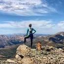
A few weeks prior to this we attempted Mt. Guyot. An 8 a.m. start was going to be a good start on a cold day. We hiked down the plowed road. I was impressed with the number of people still living in the houses along the gated-off road.
And, if you have hiked this peak, you might be asking... what houses?
Well, if you miss the left turn onto Little French Trail, you will eventually walk past several homes. Some closed for winter with snow drifts covering vehicles and front doors. Some homes had shoveled driveways and woodstoves puffing smoke.
lines...
Where was that left turn again? Once we figured out we missed it, we walked back to what we thought should be the turn, a county road. That was totally covered with snow and didn’t even look like a route, let alone a road. Instead of looking wider on the map to see the trail... back up the road looking for options. We walked to the end of the plowed part and could see the steep and rugged looking west slope. That was a no go. We could see people on the upper ridge. How did they get up there?
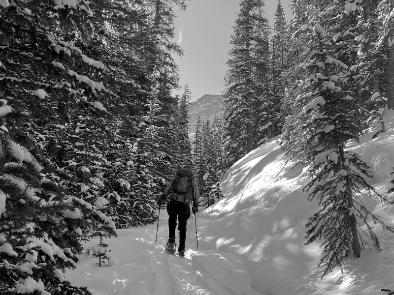
The great idea was to put on the snowshoes and start up and over the lower part of the NW ridge. We began breaking trail in the deep untouched snow in the trees. Derek led the way. I wasn’t prepared for this.
Sometime later... we were going up the spine of the ridge. But isn’t the trail just below us, maybe 50 to 100 feet to the left. The old adage of not losing elevation is BS. Slowly, up the spine in fresh snow.
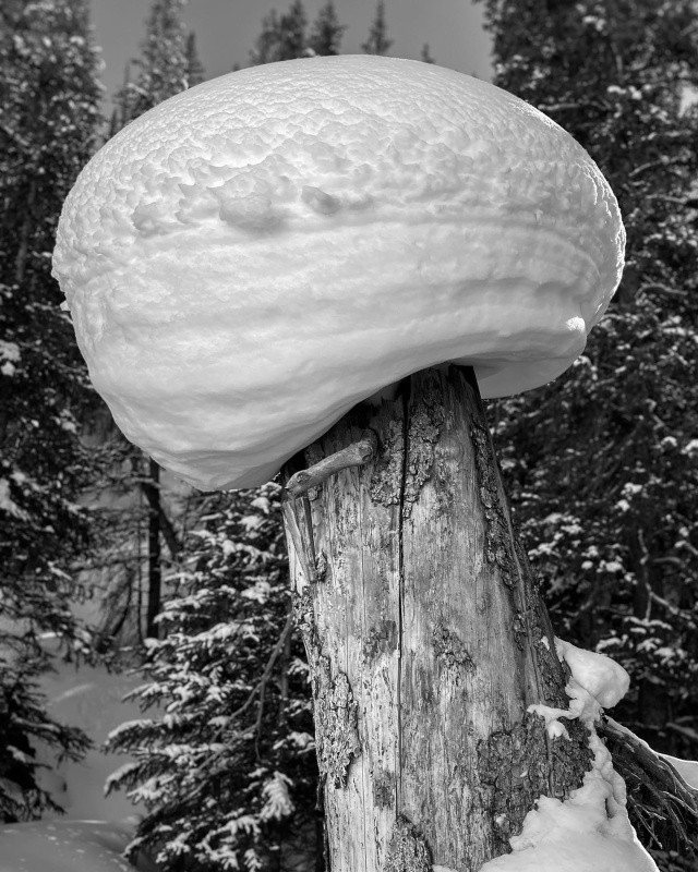
Tree stump with hat
Another 20 minutes of struggling and we decided to drop down. Guess what, a used trail.
Well, to shorten this part of the story... by the time we made it out of the trees, to the basin, and then back into the trees, I was done for the day.
We were 3.4 miles into a 3.5 mile hike, and we were barely half way with 2,000 feet to go.
I wasn’t feeling well. The snowshoeing kicked my butt. I knew I wasn’t going to make the summit. I called it. It wasn’t my day. I thought Derek and Nicco would continue on. They decided to call it a day too. At least we hiked down the main trail and found out where it turned from the road.
Second Attempt
Another 8 a.m. start on a beautiful day was just the call. Up the road Derek and I went. And guess what, we missed the @#$%^& turn again. It was hard not to laugh about it.
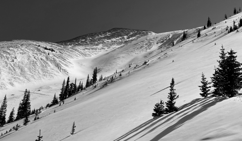
Near 11,000In the basinStart of the ridgeRidgeLower ridge still has some snow
We thought there would have been plenty of skiers making tracks to ski that slope on Saturday. But only one set of tracks were there. And they stopped before the basin. So once again, we broke trail, or should I say Derek did. He’s in better shape than me. I’ve been lazy this winter.
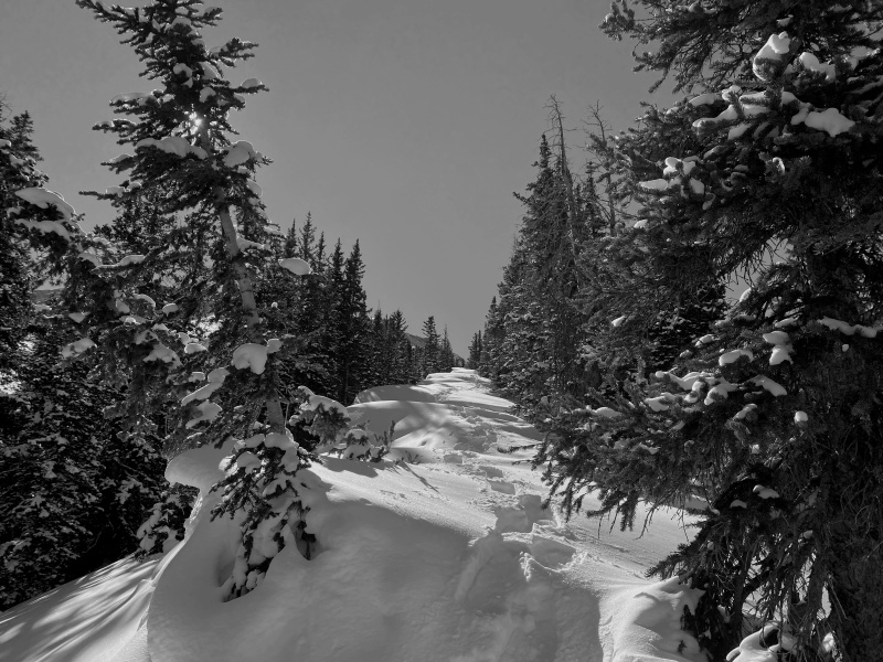
Up the slope a bit, until he found the previous trail that switchbacks through the trees up to the ridge. The route was solid under a few inches of fresh snow.
No one else had been in the basin since the latest snow a few days before.
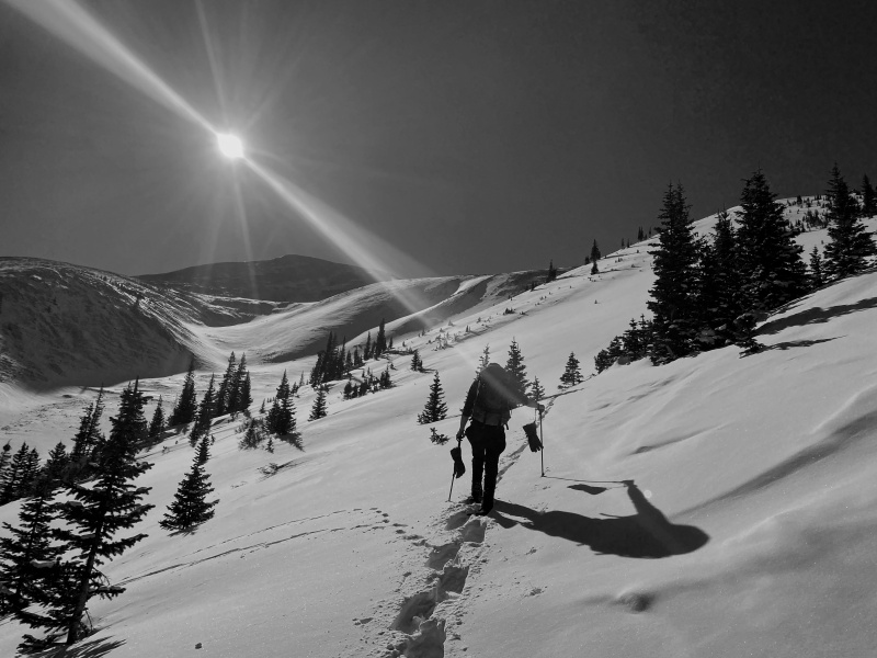
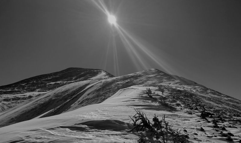
Two hours into the hike and we were on the ridge. It was time for sunscreen. The snow was only deep for a couple hundred yards. From there it was shallow or windblown. Rocks poked through.
We didn’t go over the bump in the ridge, but followed one of the many snow lines up and to the left. Near 12,400 we had a snack break. It was absolutely beautiful. No wind. Warm sun. (Don’t talk about the no hitter...)
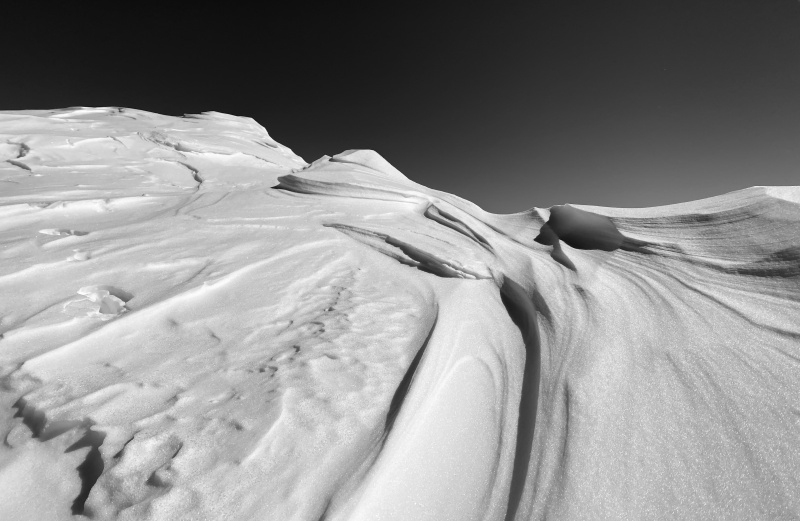
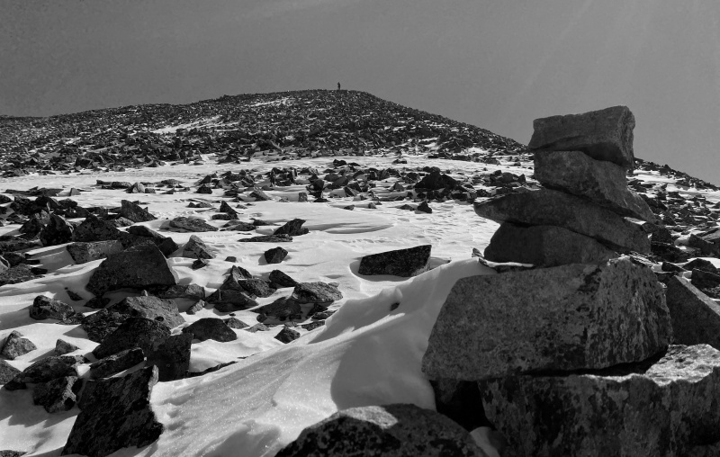
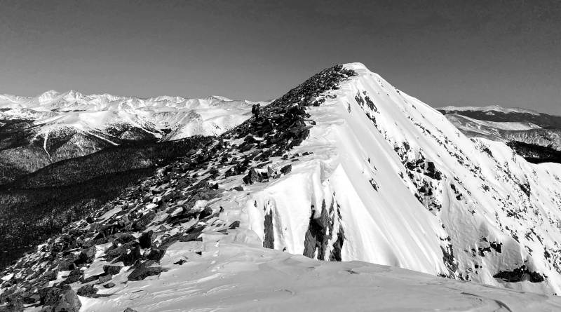
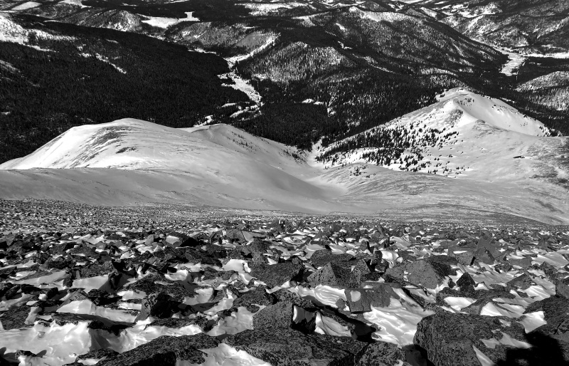
Summit in viewBaldyCairn near 13,000Upper ridge
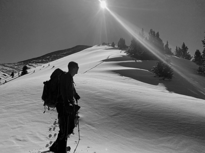
We moved up about 100 feet and took off the snowshoes and hiked up the rocky and snowy slope toward the summit ridge.
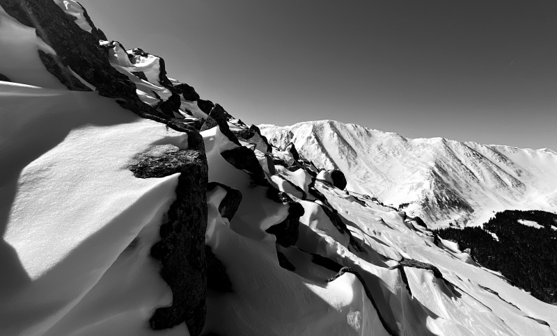
We hit 13,000 feet and the wind began. Not too bad at first. But once on the summit ridge, we added layers and the big gloves. We walked the ridge, staying close to the rocks on the left. That snow on the right was inviting, but we weren’t sure what was underneath it, if anything.
We only spent a few minutes on the summit. That wind.
It was a fairly quick decent back to 13,500 and the warm sun and windless slope. Snacks again.
Nearly back to the trees and we saw our first person of the hike. She had skinned up the slope for the first ski of the weekend. By the time we were back to the main trail at the beginning of the open basin, she was coming down.
The walk out was smooth and warm. We parted ways shortly before the TH as Derek had plans to summit Mineral Hill, a ranked 10er.
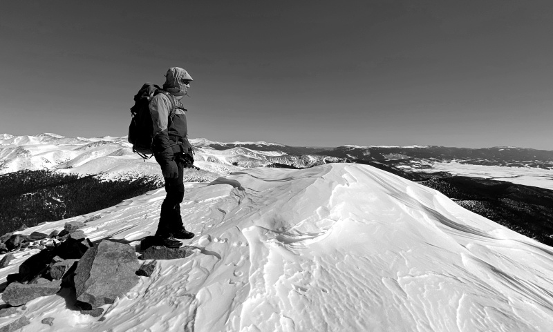
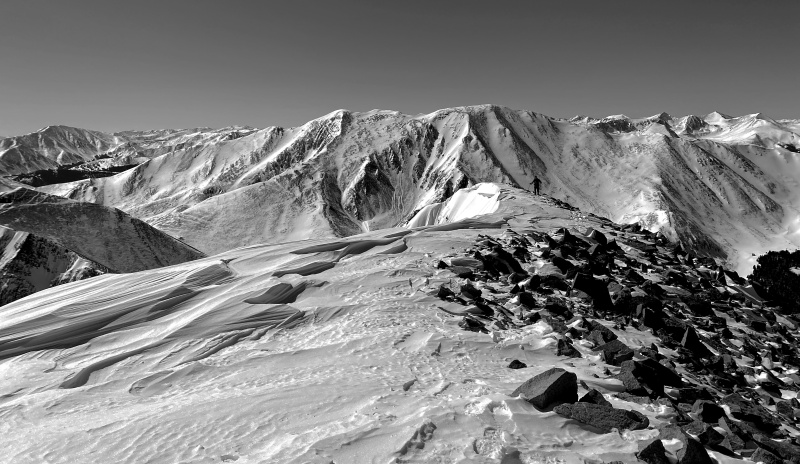
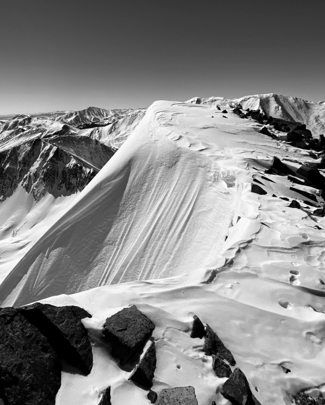
Summit ridgeSummitSummit ridgeSummit ridgeLooking down at the basin and approach
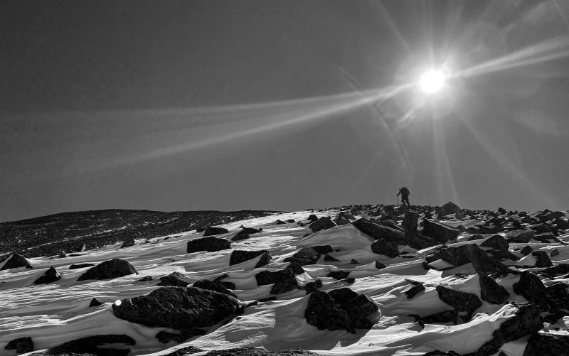
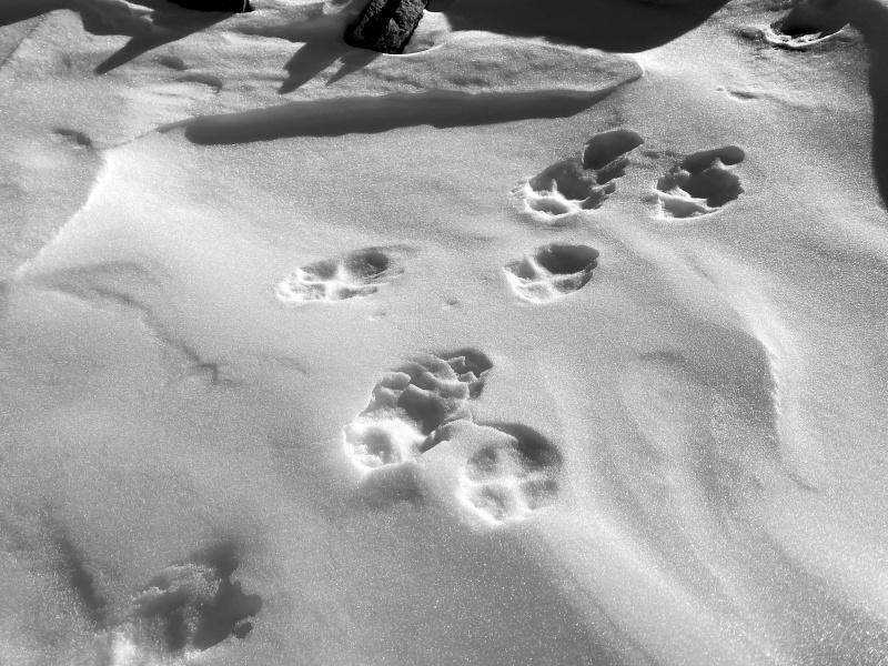
Paw Prints: Once we hit the ridge, there was a coyote track, thought they were big for a fox. The tracks went up and over the summit, following the previous packed trail. Always nice to see animals tracks up high. I’ve seen coyotes at elevation, but not this high in winter.
Paw prints near 13,000.
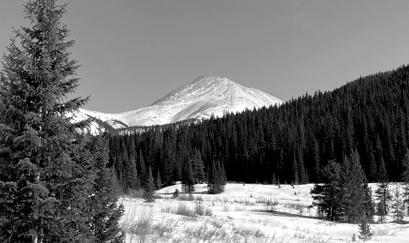
From the road near the turn offMt Guyot from the road on the hike out
My GPS Tracks on Google Maps (made from a .GPX file upload):
It's on the short list for calendar winter, (even got up one morning but looked at the winds and went back to bed).... This did provide me a bit of renewed motivation to get up there before the equinox.
Joel these photos are amazing. love to see B&W in a TR
Caution: The information contained in this report may not be accurate and should not be the only resource used in preparation for your climb. Failure to have the necessary experience, physical conditioning, supplies or equipment can result in injury or death. 14ers.com and the author(s) of this report provide no warranties, either express or implied, that the information provided is accurate or reliable. By using the information provided, you agree to indemnify and hold harmless 14ers.com and the report author(s) with respect to any claims and demands against them, including any attorney fees and expenses. Please read the 14ers.com Safety and Disclaimer pages for more information.
Please respect private property: 14ers.com supports the rights of private landowners to determine how and by whom their land will be used. In Colorado, it is your responsibility to determine if land is private and to obtain the appropriate permission before entering the property.


")
")
")
")
")
")
")
")
")
")
")
")
")
")
")
")
")
")
")
")
")