Download Agreement, Release, and Acknowledgement of Risk:
You (the person requesting this file download) fully understand mountain climbing ("Activity") involves risks and dangers of serious bodily injury, including permanent disability, paralysis, and death ("Risks") and you fully accept and assume all such risks and all responsibility for losses, costs, and damages you incur as a result of your participation in this Activity.
You acknowledge that information in the file you have chosen to download may not be accurate and may contain errors. You agree to assume all risks when using this information and agree to release and discharge 14ers.com, 14ers Inc. and the author(s) of such information (collectively, the "Released Parties").
You hereby discharge the Released Parties from all damages, actions, claims and liabilities of any nature, specifically including, but not limited to, damages, actions, claims and liabilities arising from or related to the negligence of the Released Parties. You further agree to indemnify, hold harmless and defend 14ers.com, 14ers Inc. and each of the other Released Parties from and against any loss, damage, liability and expense, including costs and attorney fees, incurred by 14ers.com, 14ers Inc. or any of the other Released Parties as a result of you using information provided on the 14ers.com or 14ers Inc. websites.
You have read this agreement, fully understand its terms and intend it to be a complete and unconditional release of all liability to the greatest extent allowed by law and agree that if any portion of this agreement is held to be invalid the balance, notwithstanding, shall continue in full force and effect.
By clicking "OK" you agree to these terms. If you DO NOT agree, click "Cancel"...
The Chicago Basin peaks were at the top of my priority list this winter, and actually were on my list of goals for the previous winter as well, but conditions just never made it possible. My hero Beard McQueen and I had been talking about teaming up to get Chi Basin for a bit before the start of winter, but he ended up getting down there sooner than I could get enough time off work to join him. A few weeks after his trip, I had a week off work and conditions ended up looking good for me to give it a shot. And thanks to the great trench provided by McQueen, Angry and Blazintoes, it would be a bit easier. I owe those 3 big time.
I drove down to Durango on Saturday 1/22 to stay the night and get an early start Sunday morning.
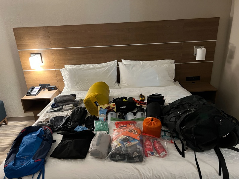
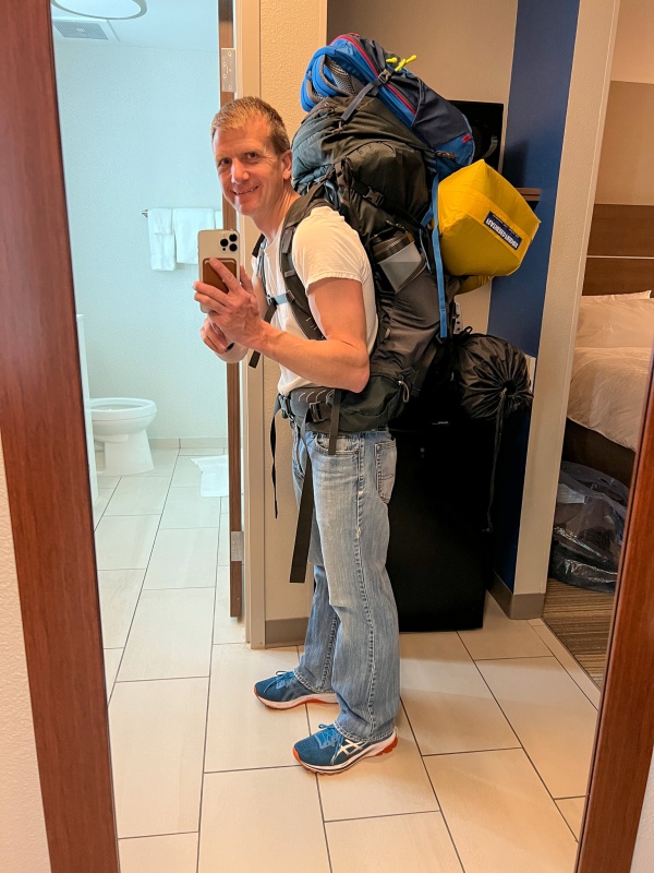
Everything I hoped I'd need for the trip. I took way too much food.I don't know what it weighed, but I'd guess 45 lbs.
Goal was to be hiking Sunday morning by 6 am, didn't quite make it. First mistake was trusting Google Maps to know where the Purgatory Trailhead was, it lead me down some residential area that I followed for a few miles before realizing I wasn't in the right place. Found the trailhead, but no parking around so I went across the highway and parked at the ski resort, adding about a half mile to the trip each way. I was hiking just before 7am.
Dark start to the day, but the initial hike was downhill and well packed. I had no way to attach my snowshoes to my pack, so first few miles down to the river I just carried them by hand.
Put snowshoes on just before this section.
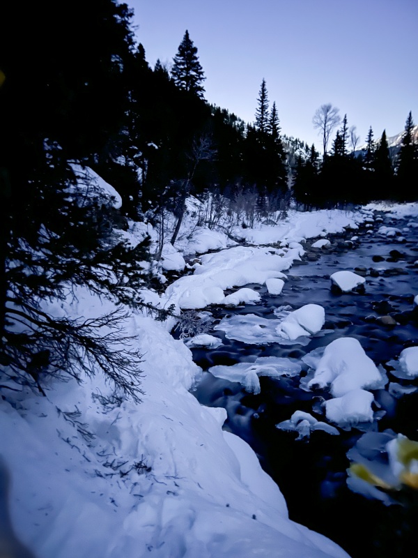
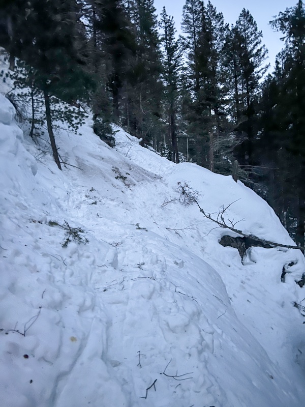
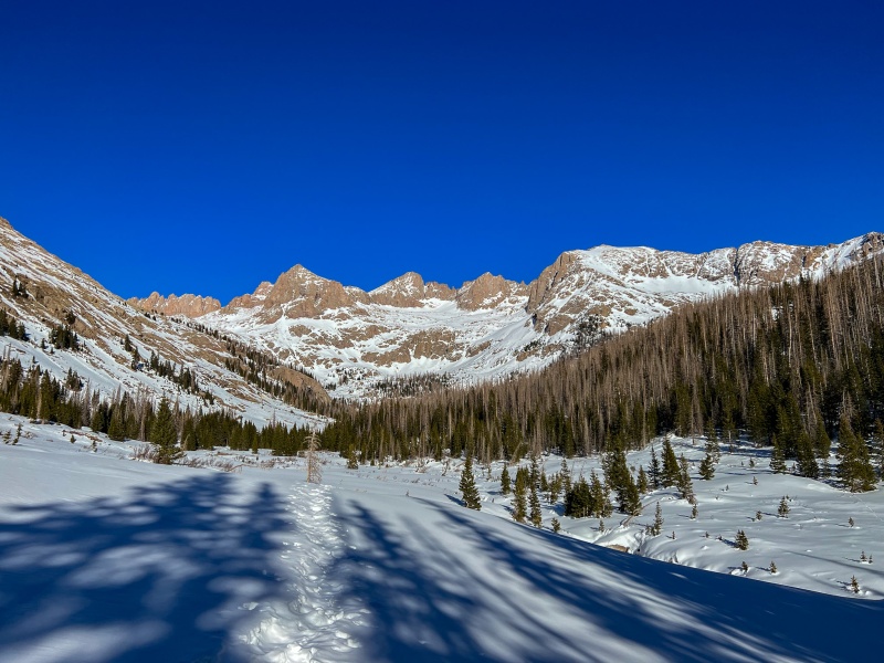
From the first part of the river I started climbing, there were 3 sections along this segment that had steep, stiff snow that you wouldn't want to slip on, you'd end up in the river.
Along the path up the river.
Everything was good so far, but I had a long day ahead of me. I really had no idea how long it would take me to get to the basin, I wasn't even sure I'd get there on day 1. Told my SAR crew I hoped to get there in a day, but might take until after dark. I had enough junk food, er, rations to last 5-6 days if needed.
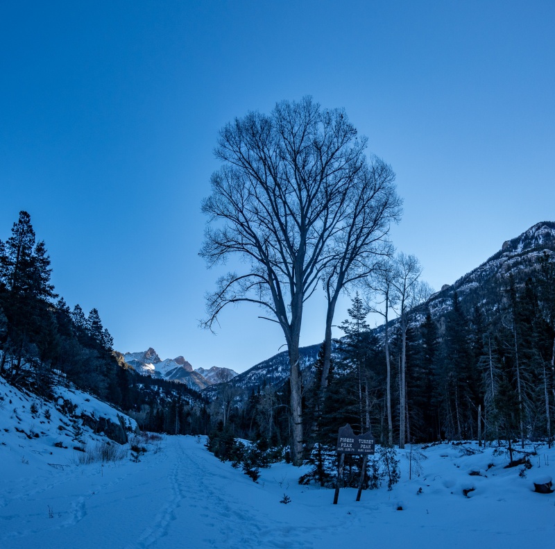
After reaching the Cascade train stop, I crossed the bridge and started following the train tracks, they were plowed for a few miles, I took off my snowshoes and carried them again.
End of the train track plowing.Along the train track walk.
After 5 or 6 miles on the tracks, I was finally at the Needleton bridge.
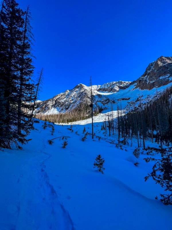
Took a break at the cabin to give my shoulders some relief and eat a bit, as I knew the toughest part of the day was about to start, a 6 mile, 3,000' elevation gain hike up to the basin. I was making much better time than expected, and was pretty excited at the possibility of setting up camp before dark.
Along the ascent past Needleton.Finally nearing the corner to camp.
I made it to camp right at 3:30, I never expected to make that kind of time, just under 9 hours from start. Apple and Garmin both agreed on distance for the day, a hair over 18 miles.
Beard had given me some great beta on a water source just above camp, so after setting everything up I put my snowshoes back on and took all my bottles up to find it. It was about a half mile away, and a complete lifesaver not having to melt snow. After filling all my bottles and getting back to camp, I ate some junk food and was in bed by 6pm. I set my alarm for 2:30 am, again unsure how long my day was going to be, but I really wanted to get all 4 peaks on Monday, as a cold front was moving in Tuesday and temps were forecasted to drop 10°-15°.
I barely slept Sunday night, maybe an hour. I wasn't cold, I think just anxious. I woke around 2am, and decided to just get the day started. Hardest part of getting ready was getting my boots on, they were pretty much frozen. Thermometer showed 15°. I was hiking by 2:30am.
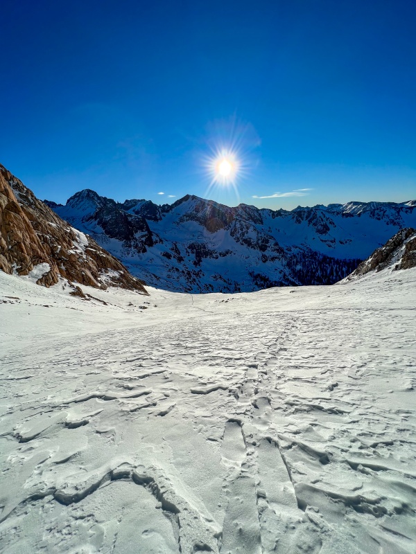
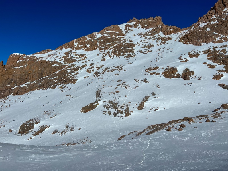
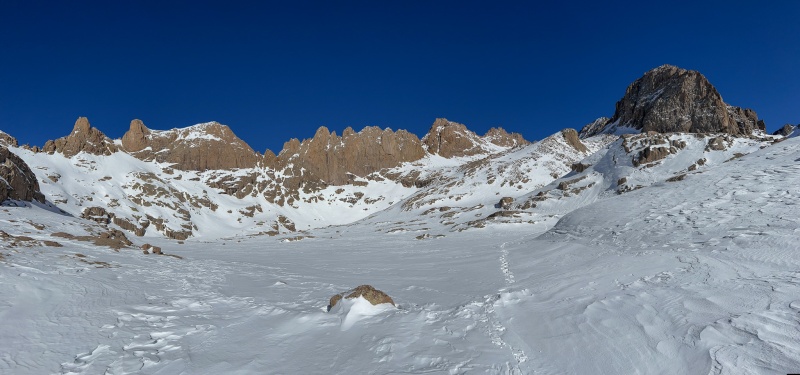
The trench was in place and easy to follow until reaching treeline, from there I found it and lost it a few times. My plan was to get Sunlight and Windom first, then go for Eolus. Plans don't always work out. As I was making my way up to Twin Lakes, it felt like I should have been at the lakes by now, I pulled out my phone and looked at my position. I had unknowingly started angling left towards Eolus, and was nearing 13,000'. I changed plans.
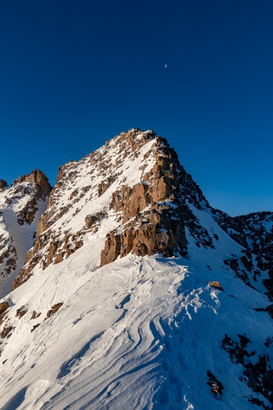
As I reached the ramp on Eolus' standard route, I was getting really great traction on the steep snow next to the ramps, so I went with it. Made it to the saddle between N. Eolus and Eolus and left my snowshoes. Normally I'd go up Eolus first and do North on return, but I was at least an hour from sunrise so went up North Eolus first.
Cold and Windy on N. Eolus, I didn't stay long.
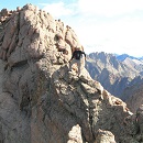
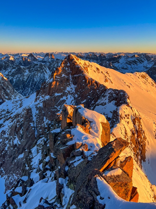
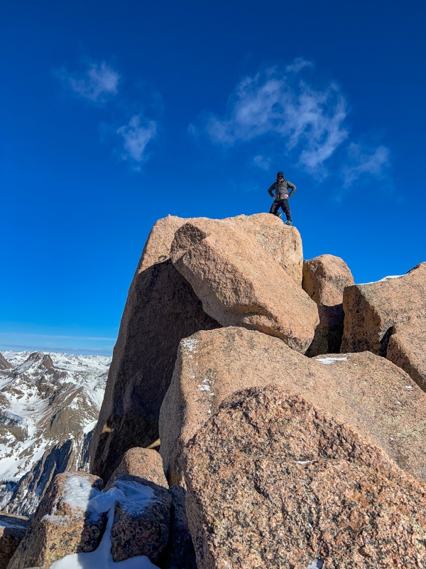
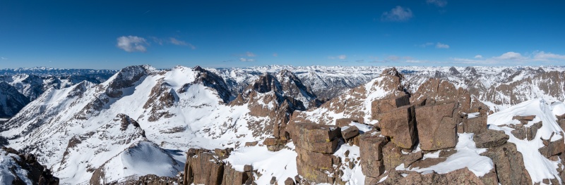
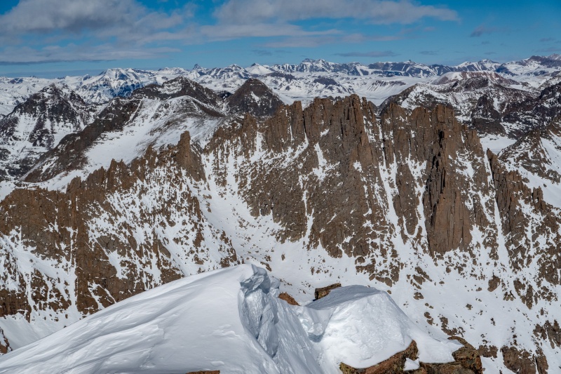
After getting back to the saddle, I put crampons on to ascend Eolus. The ridge to Eolus is a really fun section, I had done it this past summer so was fairly familiar with it. Far better than the standard route, which really isn't possible in winter anyway. Made it to Eolus' summit just as the sun began to rise, it was incredible. My favorite pictures this trip are from the summit of Eolus.
Spent plenty of time at summit snapping pictures, it was one of those once in a lifetime photographer's opportunities. Made my way down from Eolus, now feeling good that I'd likely be able to get all 4 peaks today.
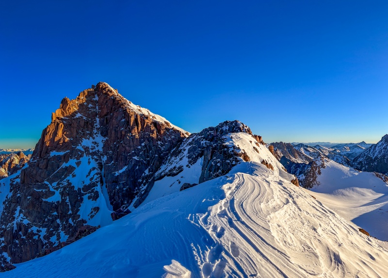
Start of the down climb off Eolus, its so much fun.Looking back at Eolus from the catwalk now that I had light.Looking at N. Eolus from the catwalk.Making my way back towards Twin Lakes.
Getting to Sunlight next wasn't terribly hard, but the snow had softened up just a bit in the morning sun. After reaching the top of the gully to Sunlight, I left my snowshoes and continued on.
Once reaching the top of Sunlight, I set up my tripod, and went about getting up to the summit block. Couldn't get traction on the big rock leading up to it as my boots were wet, so put crampons, which worked great. Fortunately not much wind today.
As close to standing up as I would venture.
A few more shots from Sunlight:
Zoomed in on Vestal and Arrow.
Retraced back to the base of the gully, ready to go straight across and get Windom next.
Between Sunlight and Windom.
Windom wasn't difficult, made good time up to the top, hung out for a bit as weather was good and I had 5G service.
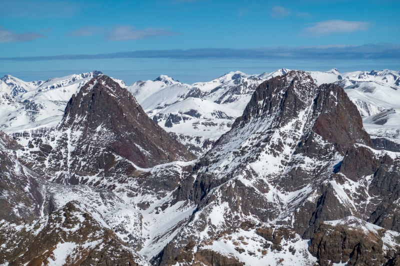
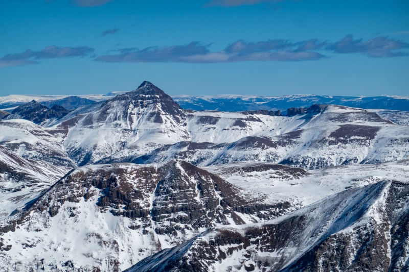
Summit of Windom.Zoomed in on Jagged from Windom.Zoomed in on Rio Grande Pyramid and the window from Windom.
No issues getting off Windom, was glad I'd be finishing in daylight so I could get some pics of what I missed in the morning darkness.
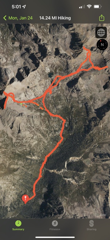
Twin LakesNear camp, around 11k' elevation. Water hole on the right.Summit day GPS track.
Made it back to camp just before dark, I was in bed by 6pm, completely thrilled and fulfilled that I was able to get all 4 peaks. Sent a message to my SAR friends that I'd be heading to the car whenever I woke up Tuesday.
I didn't sleep an ounce that night, but knew I needed to rest my legs before the next day, so I just laid in bed. I'm taking sleeping pills next time. At 3 am I got up and started packing, was on the trail hiking about 3:40.
Hardest part of the return trip was from camp to Needleton, the descending motion was murder on my shoulders from the pack weight. Beyond that the return was uneventful, though it took longer getting out than getting in. A few pictures from the return trip:
A few certificates of appreciation on my windshield when I got back to the car. Not sure what I did wrong, I wasn't blocking anybody, and there was another vehicle parked next to me. <shrug>
Trip stats by day.
Big thanks to Blazintoes, Beard McQueen and Angry for being the beta/trenchers for this trip, it would have taken me at least a day or 2 longer without the great trench. Thanks for reading.
Thumbnails for uploaded photos (click to open slideshow):
No one is sure how much it costs Chipotle to sponsor Will E. Coyote. No matter, they will continue to charge us $1.30 for a side of their avacadough and Will won't admit that eating one of their burritos in the dead of winter is like a microwaved meal; smoking hot on the outside, ice cold on the inside. This is the real reason he had so much food leftover and murdered his shoulders.
Will, this was a great report to read. Those photos of the beginning of the trail by the river look insane to go through. Your photos are wonderful and I think Purgatory should be cheering for you, since you went to heaven and came back in one day!. Did you ever find out where you would have been able to find a place to park your car?. Be well! Teresa
Thanks for the superb report! Outstanding example of fitness, individual determination, and mountaineering skill!
Caution: The information contained in this report may not be accurate and should not be the only resource used in preparation for your climb. Failure to have the necessary experience, physical conditioning, supplies or equipment can result in injury or death. 14ers.com and the author(s) of this report provide no warranties, either express or implied, that the information provided is accurate or reliable. By using the information provided, you agree to indemnify and hold harmless 14ers.com and the report author(s) with respect to any claims and demands against them, including any attorney fees and expenses. Please read the 14ers.com Safety and Disclaimer pages for more information.
Please respect private property: 14ers.com supports the rights of private landowners to determine how and by whom their land will be used. In Colorado, it is your responsibility to determine if land is private and to obtain the appropriate permission before entering the property.


")
")
")
")
")
")
")
")
")
")
")
")
")
")
")
")
")
")
")
")
")
")
")
")
")
")
")
")
")
")
")
")
")
")
")
")