Download Agreement, Release, and Acknowledgement of Risk:
You (the person requesting this file download) fully understand mountain climbing ("Activity") involves risks and dangers of serious bodily injury, including permanent disability, paralysis, and death ("Risks") and you fully accept and assume all such risks and all responsibility for losses, costs, and damages you incur as a result of your participation in this Activity.
You acknowledge that information in the file you have chosen to download may not be accurate and may contain errors. You agree to assume all risks when using this information and agree to release and discharge 14ers.com, 14ers Inc. and the author(s) of such information (collectively, the "Released Parties").
You hereby discharge the Released Parties from all damages, actions, claims and liabilities of any nature, specifically including, but not limited to, damages, actions, claims and liabilities arising from or related to the negligence of the Released Parties. You further agree to indemnify, hold harmless and defend 14ers.com, 14ers Inc. and each of the other Released Parties from and against any loss, damage, liability and expense, including costs and attorney fees, incurred by 14ers.com, 14ers Inc. or any of the other Released Parties as a result of you using information provided on the 14ers.com or 14ers Inc. websites.
You have read this agreement, fully understand its terms and intend it to be a complete and unconditional release of all liability to the greatest extent allowed by law and agree that if any portion of this agreement is held to be invalid the balance, notwithstanding, shall continue in full force and effect.
By clicking "OK" you agree to these terms. If you DO NOT agree, click "Cancel"...
This was my second visit to the city of Crestone this winter. The drive from Fort Collins took about 4 1/2 hours, and I arrived at the Cottonwood Creek trailhead very late and parked behind Ben's van in a pull-out. The road coming in had been dry and is for the most part 2WD friendly. A posted sign on the way in said I was passing through private property but no special permission was needed (like there is for Spanish Creek). It didn't take long to settle in and I was sleeping by midnight with a 3:30 wake up time. I was very excited about climbing Crestone Peak in the winter but maybe a little apprehensive too. I'd heard the approach can be difficult, and also, I was aware that climbing couloirs in winter can be tricky so a summit attempt might not be possible.
Day of Climb: January 13th, 2022
Trailhead: Cottonwood Creek
Peak: Crestone Peak
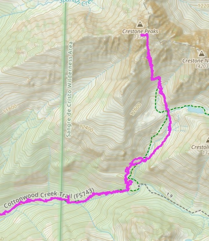
Mileage and Elevation Gain: 12.5 miles and 5409 feet of gain.
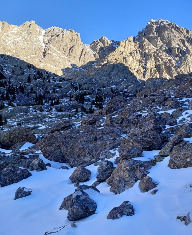
Our route.
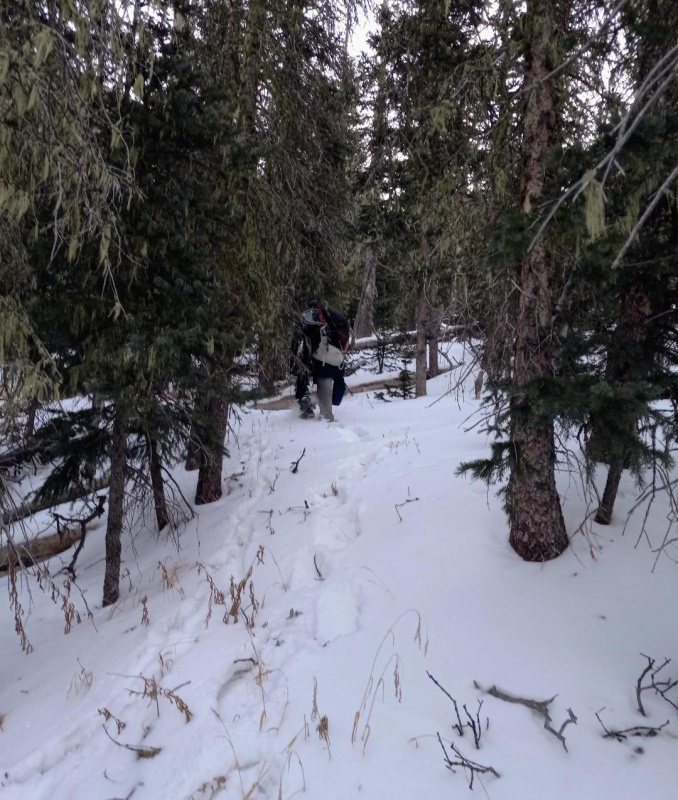
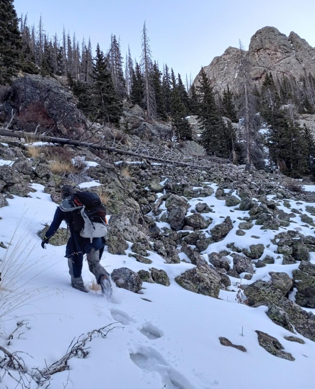
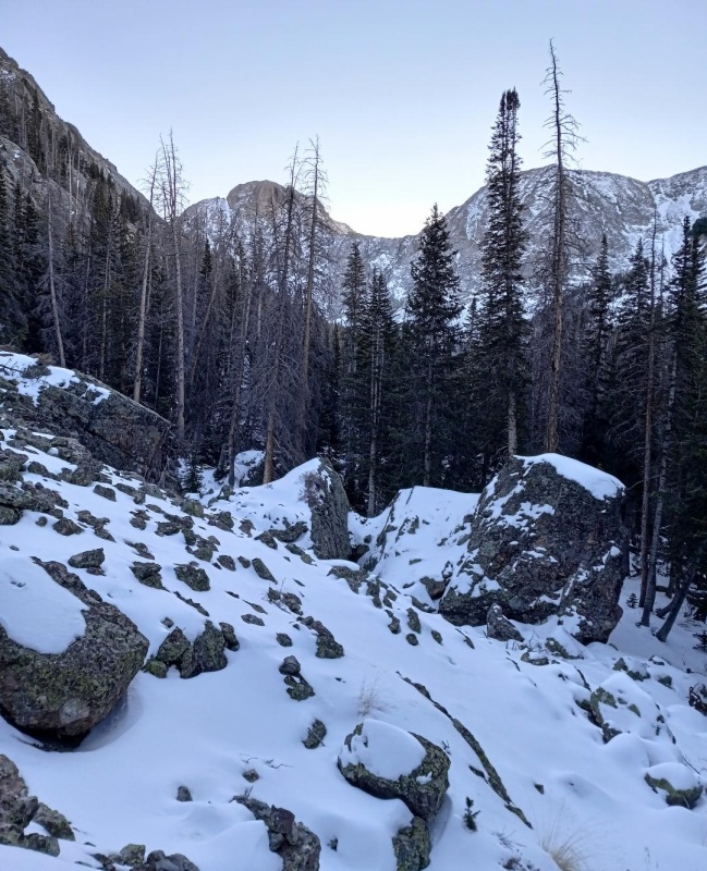
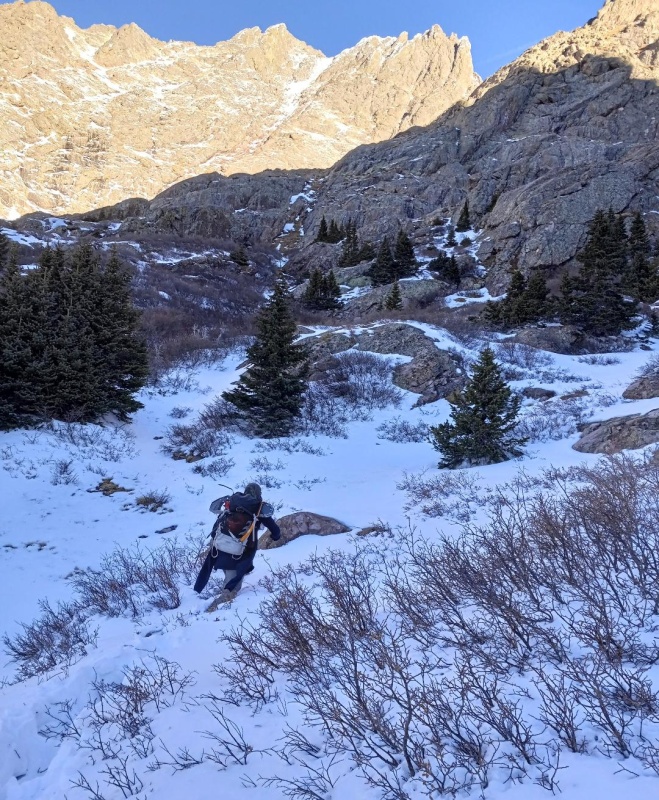
The next morning Ben and I were geared up and hiking before sunrise. The first mile or so went by quickly following a set of day old footsteps through the dark in ankle deep snow. When those petered out travel became more difficult and the trail was hard to discern in the dense forest with deepening snow. Plenty of deadfall added to the difficulty and we began to rely on animal tracks to stay on trail and/or we looked for cut trees. Still, we made good time and hit the slab section at around the 4 mile mark while still dark. Microspikes were put on here and navigating these without much light took extra care, but I don't believe the climbing ever went beyond class 2+. We exited the slab section by ascending a steep gully on the west side of the drainage. We then climbed a steep talus slope continuing north as we slowly angled back towards the creek.
Nearing the top of the slab section at first light.Following animal tracks.Talus slope.
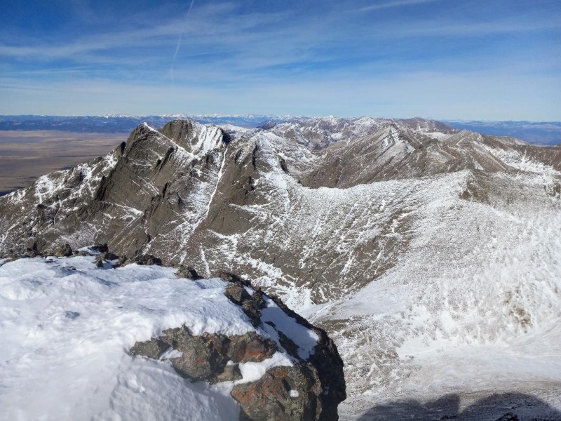
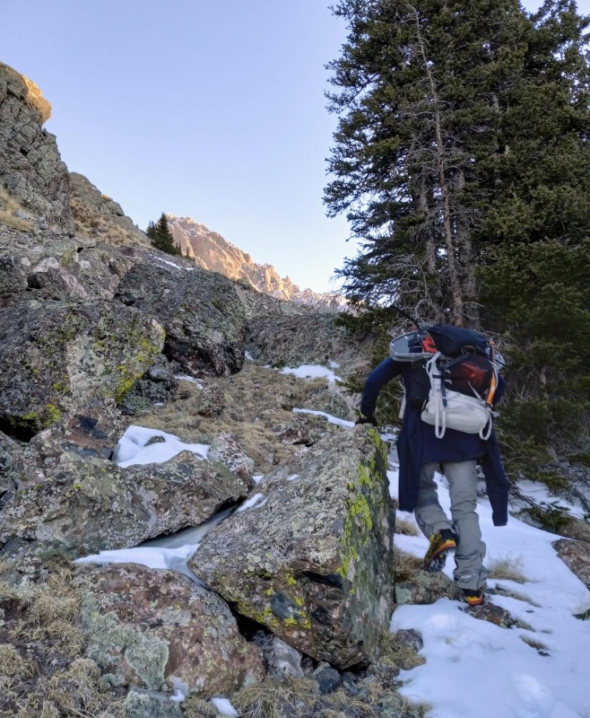
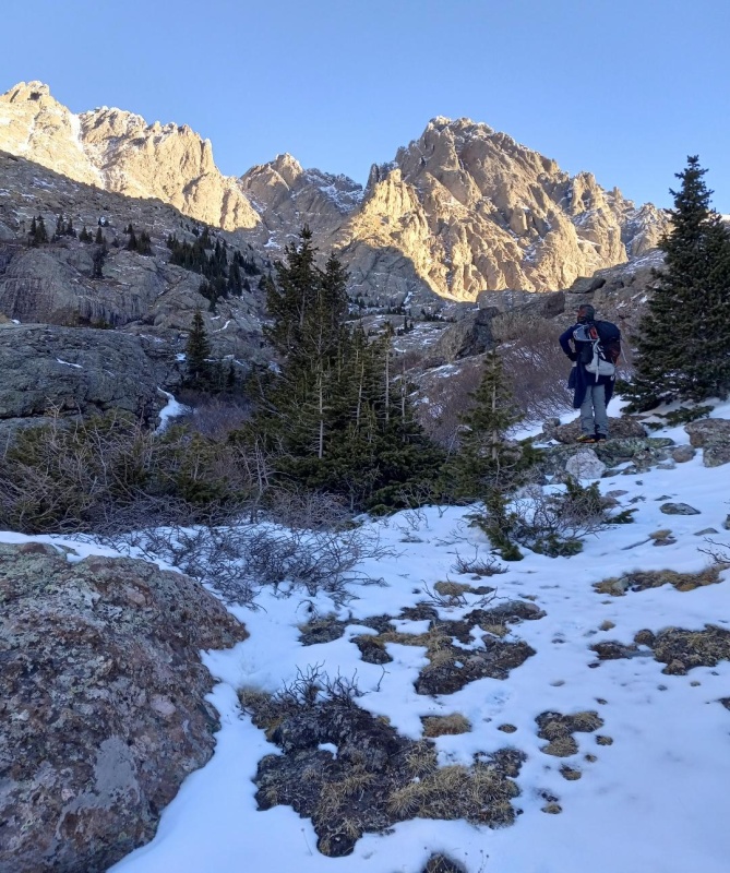
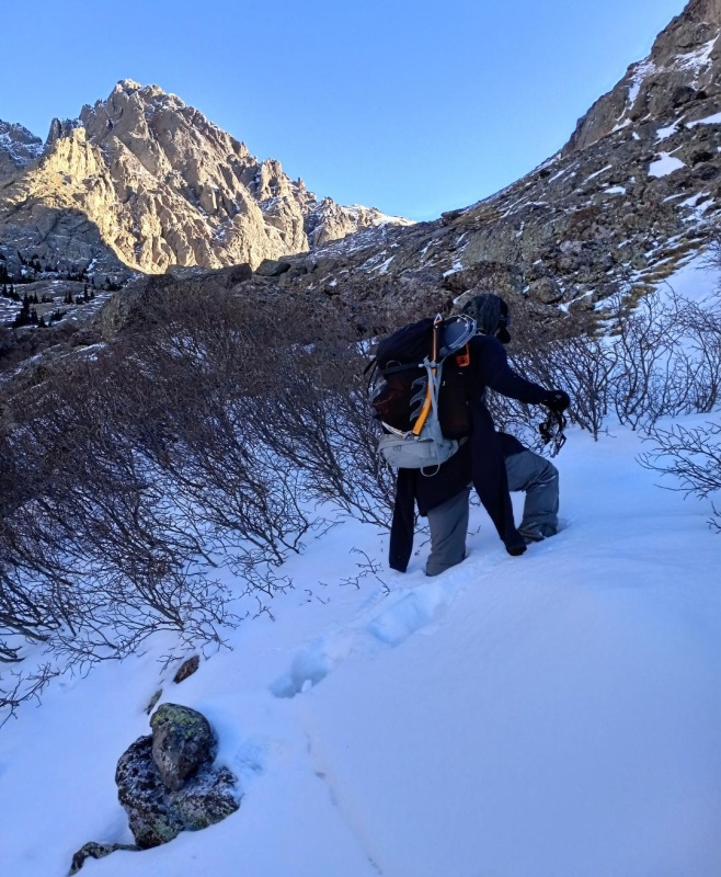
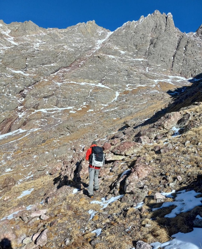
Next we passed through a boulder field and crossed back over the drainage and worked our way through the willow section. The Crestones were now in view and looked intimidating.The Red Gully looked steep as heck from this distance but the snow looked manageable and even thin in spots. Finally, it felt like we were getting somewhere and the fun approach was almost over.
Boulder field.More Boulders.Still on the west side of the drainage here with "Crestolita" on the right.Heading back down towards the creek.First good views of the Crestones.Trenching the willows.Bouldering
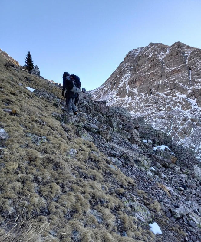
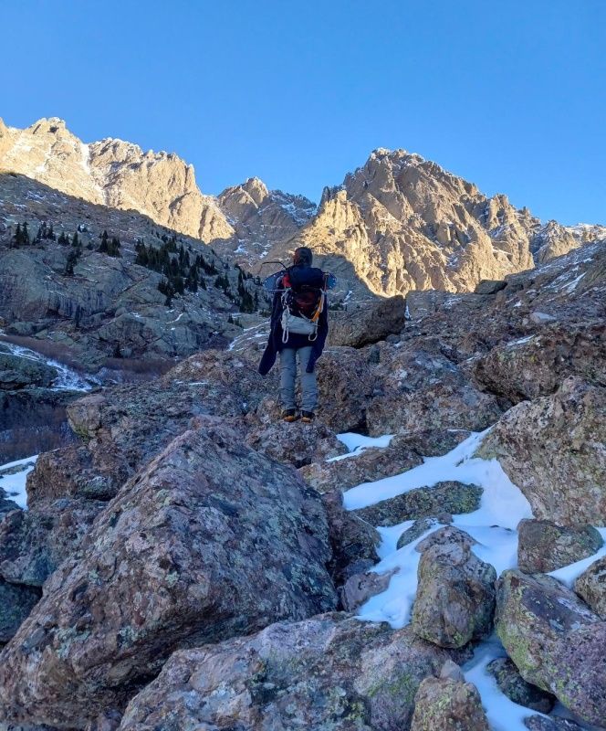
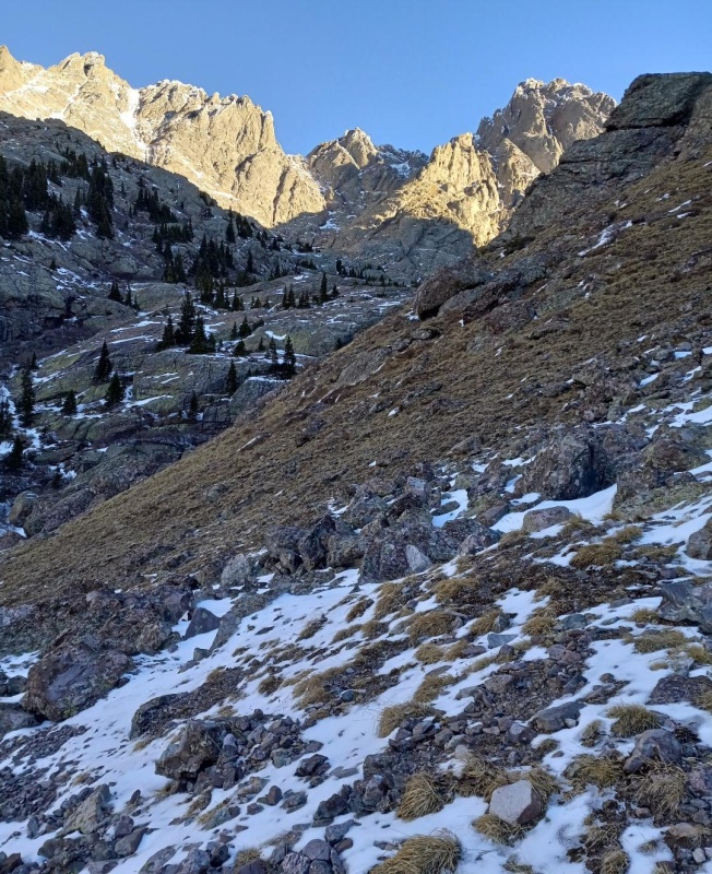
Once passed the willows we sidehilled across the base of "Crestolita" and entered the upper basin. We were now just west of Willow Lake and getting very close to the Red Gully.
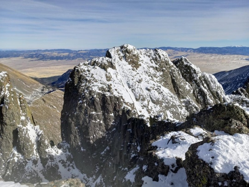
Sidehilling "Crestolita".Crestone Needle is on the right. Crestone Peak on left and a good view of the red gully.Upper Basin.
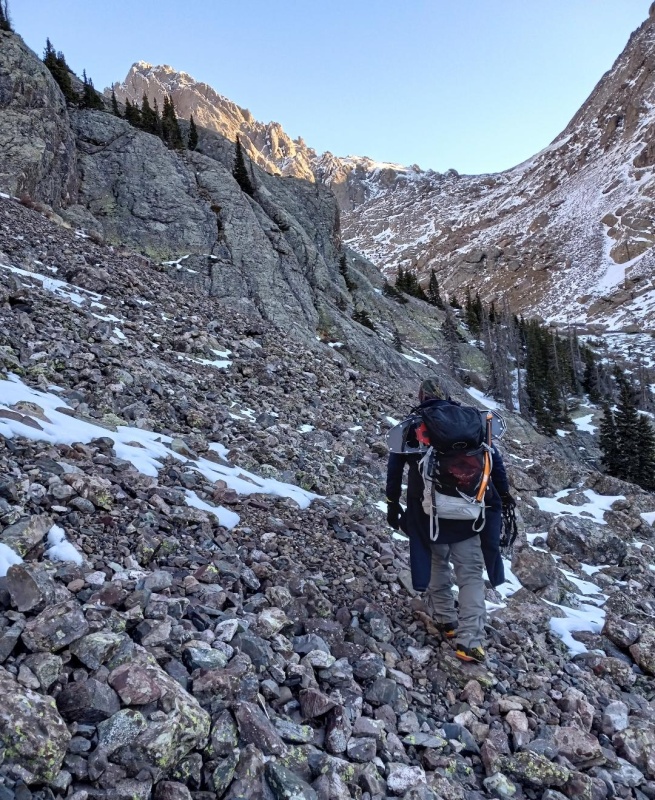
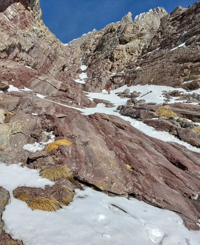
The final approach to the base of Crestone Peak was mostly dry. We finally decided to stash our snowshoes (which we never used) and continued on until we met up with the standard trail just east and a bit below the gully. The trail then took us around some steep rocks and across a snowy ramp where we found the gully entrance which we started climbing immediately.
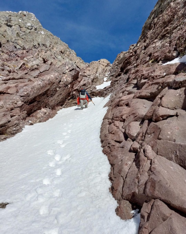
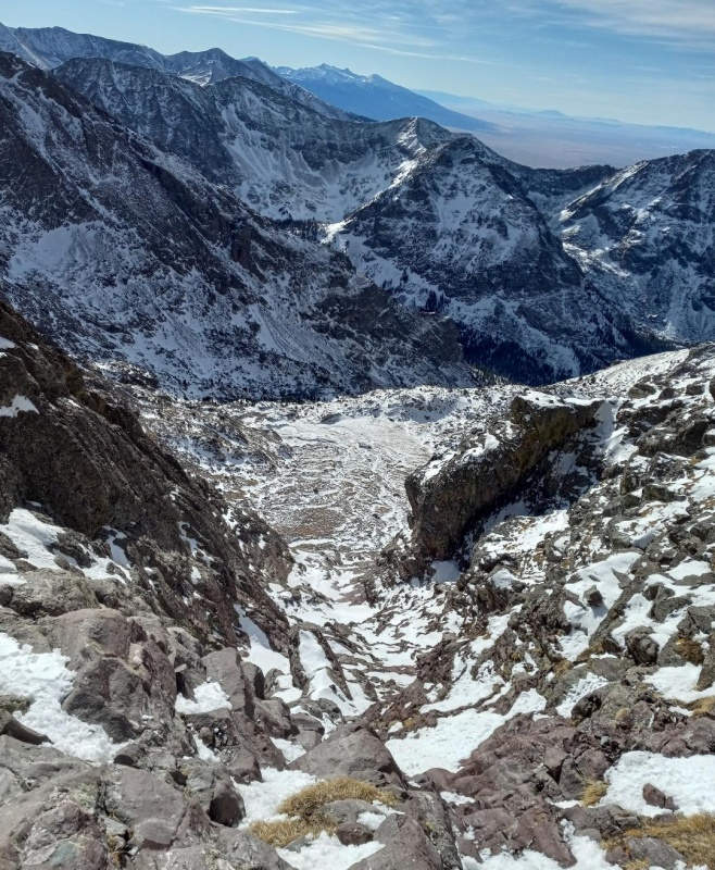
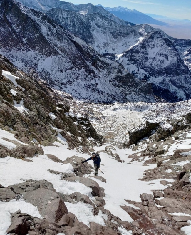
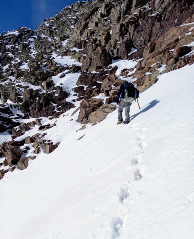
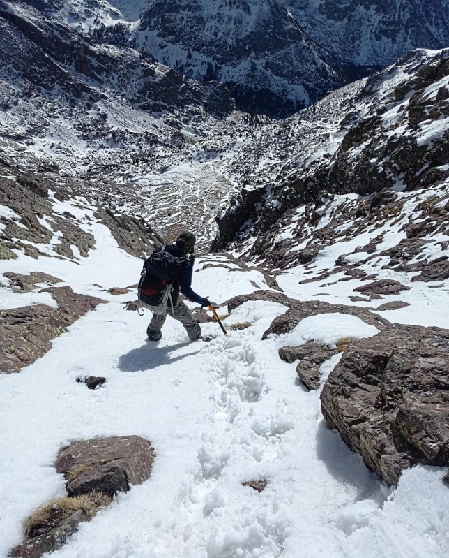
Full view of the Red Gully.Entering the red gully.
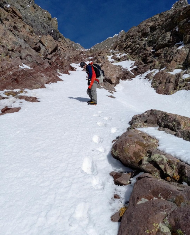
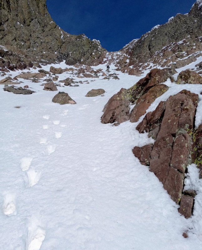
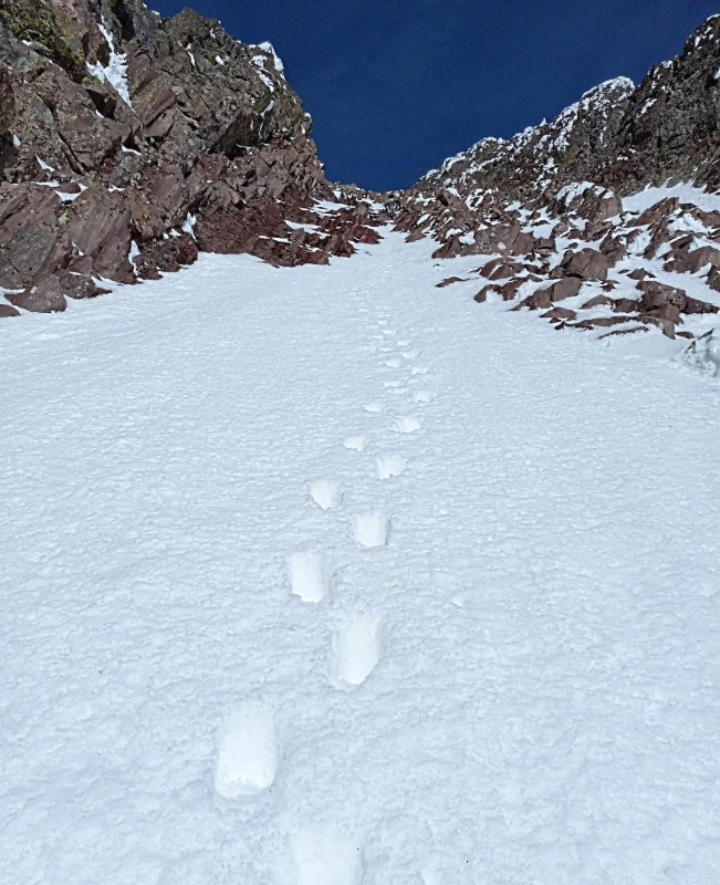
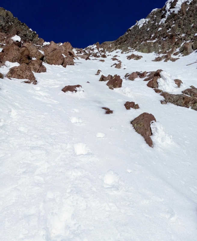
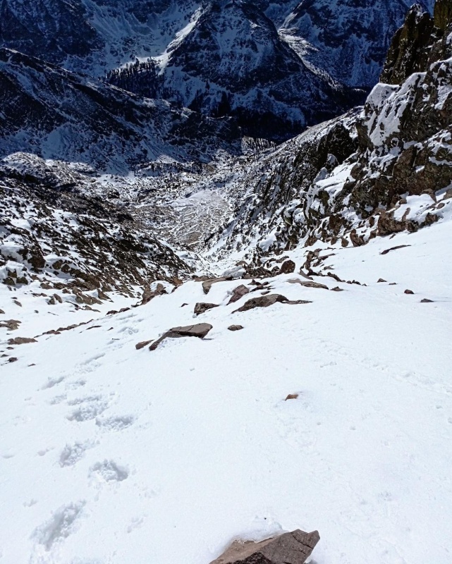
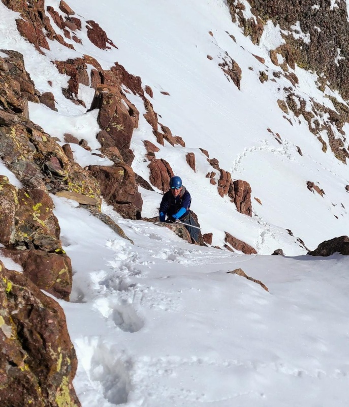
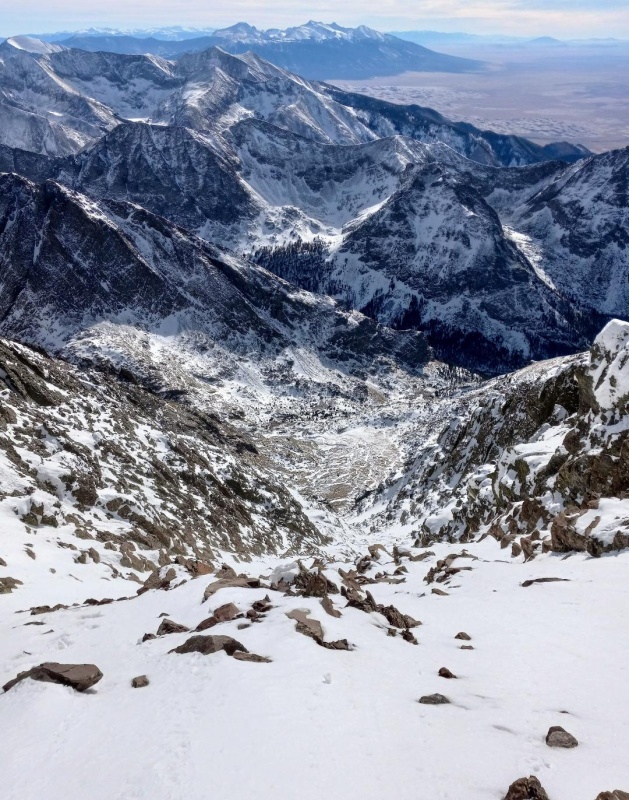
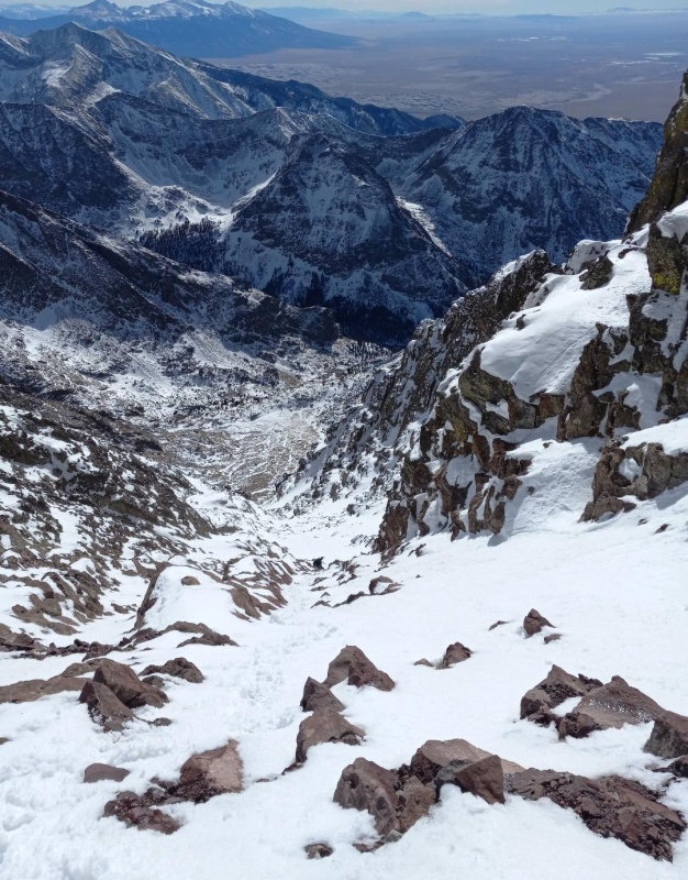
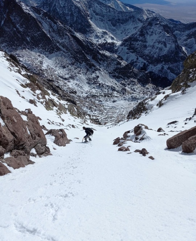
The lower section of the red gully was a mix of mushy snow climbing and short class 3 scrambles. As we progressed we found more and more snow and it seemed to firm up nicely the higher we went. Starting just below the halfway point there was continuous snow to the saddle and Ben switched into his crampons. I decided to stay in microspikes, but this was dumb, and I wouldn't recommend. As we climbed higher we passed through several steep sections with the steepest being the final bit. It never got crazy steep though and luckily, the snow stayed stable the whole way.
Lower in red gully.Class 3 scramble.Looking down at a lower section of the red gully.Midway up gully.Getting close to the steepest section.Nice tracks!Topping out near the saddle.
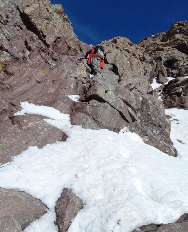
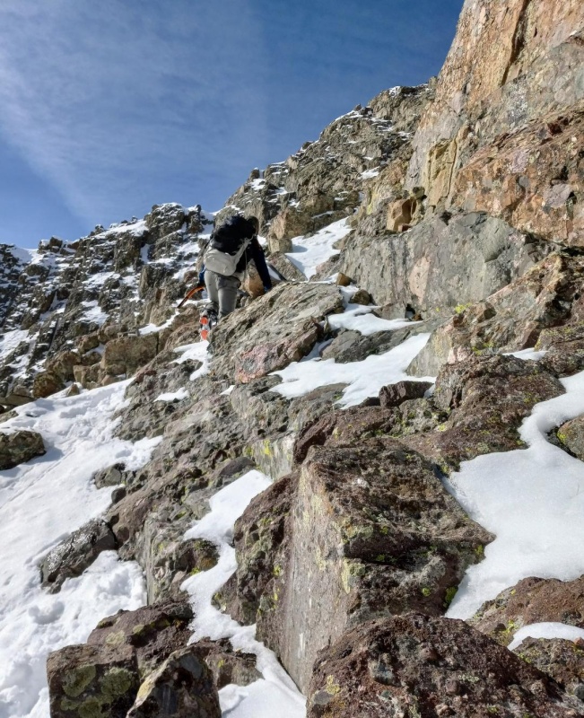
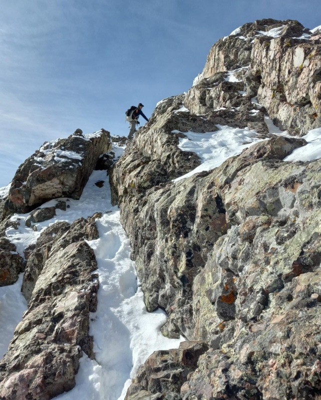
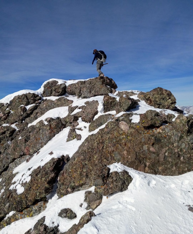
We stopped just short of the saddle with "East Crestone" and started climbing the ledges section. The ledges were partially covered in snow, but it was still a pretty easy class 3 scramble with the snow only slightly adding to the difficulty. The exposure was minimal and we quickly made our way up following the path of least resistance and summited before are noon target time.
Crossing the gully to the ledges.Quick look down the red gully.Me climbing the ledges. Photo credit: BenLedges.Getting close to the summit block.Ben on summit!Me summiting. Photo credit: BenSummit!"East Crestone"
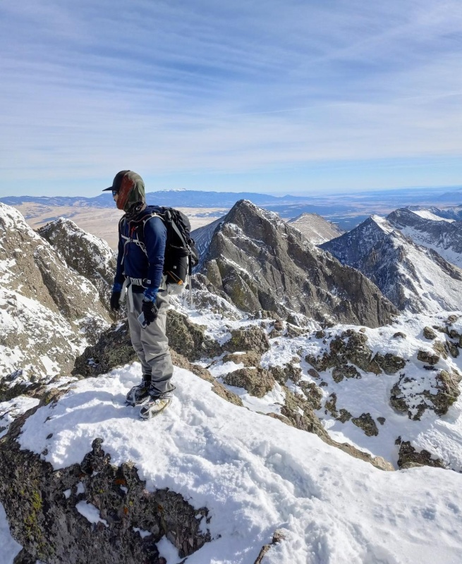
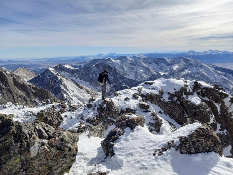
The summit was almost windless and the views as expected were amazing! We were super stoked to get a winter Crestone Peak. CP wasn't even on my radar for the year. It would have been nice though to savor it and hang for awhile, but we still had a long descent. Also, we were still contemplating an attempt at Crestone Needle so we departed quickly.
The descent off the ledges and down the red gully went without a hitch. However, we found that with warming temps the snow was becoming unsupportive and we decided against going for the Needle this afternoon. Instead, we picked up our stashed snowshoes and headed back down Cottonwood Creek and reached our vehicles just before dark.
Heading back down ledges.Getting ready to descend gully.
My GPS Tracks on Google Maps (made from a .GPX file upload):
Caution: The information contained in this report may not be accurate and should not be the only resource used in preparation for your climb. Failure to have the necessary experience, physical conditioning, supplies or equipment can result in injury or death. 14ers.com and the author(s) of this report provide no warranties, either express or implied, that the information provided is accurate or reliable. By using the information provided, you agree to indemnify and hold harmless 14ers.com and the report author(s) with respect to any claims and demands against them, including any attorney fees and expenses. Please read the 14ers.com Safety and Disclaimer pages for more information.
Please respect private property: 14ers.com supports the rights of private landowners to determine how and by whom their land will be used. In Colorado, it is your responsibility to determine if land is private and to obtain the appropriate permission before entering the property.


")
")
")
")
")
")
")
")
")
")
")
")
")
")
")
")
")
")
")
")
")
")
")
")
")
")
")
")
")
")
")
")
")
")
")
")
")
")
")
")
")
")


