| Report Type | Full |
| Peak(s) |
Unnamed 13076 - 13,076 feet Cuba Benchmark - 13,029 feet Unnamed 13003 - 13,003 feet PT 12654 |
| Date Posted | 01/12/2022 |
| Modified | 11/08/2023 |
| Date Climbed | 09/06/2020 |
| Author | Chicago Transplant |
| Minnie Gulch Peaks |
|---|
|
Minnie Gulch Peaks (Including a new LiDAR 13er) Cuba BM: 13019 PT 12990: 13003 per LiDAR, a new ranked 13er PT 13069 PT 12654 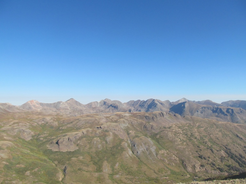
I hiked these peaks over Labor Day weekend 2020, however, the recent promotion of PT 12990 via LiDAR to an elevation of 13,003' makes it one of Colorado's newest 13ers and probably a peak not too many people have considered until now. Hopefully this information will be useful to people pursuing the 13ers list that now need to add this peak to their lists. It is a pleasant stroll, mostly on a good trail, through high rolling tundra with nice views of the surrounding area and distant views of the northern Weminuche Peaks such as Rio Grande Pyramid and Grenadiers. There are alternate routes such as combining with Half and 13164 from the east or the south from Pole Creek but this seems to be the shortest route if 12990 is your primary goal. All the trailheads to this peak involve rough roads, however, Minnie Gulch is probably the easiest of them and I had no problems in a 2012 Subaru Outback, any stock SUV should be good. There was one creek crossing that I got out to check out first, but it was easier than it looked. The trailhead parks about 3 or 4 cars, but shortly below it was a wide pullout in the talus that was flat, so I parked there and slept in the trunk. It was close enough that I just started my hike from the car in the morning. 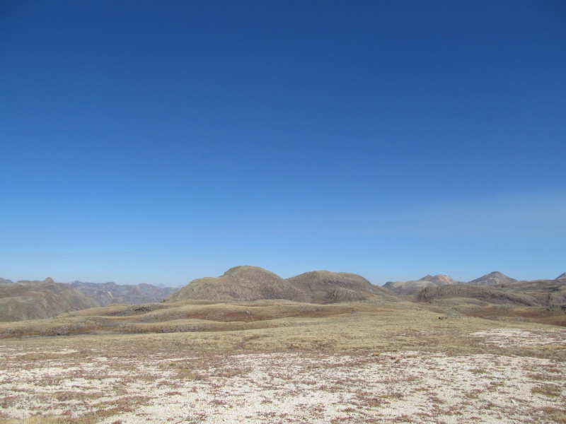
The trailhead is about 11,550' giving a nice high start considering the elevation of these peaks. 12990 was actually my primary objective this day as it is a Highest 700 peak and I had already been up 13069 from Maggie Gulch once before. As I followed the trail, it passed below Cuba Benchmark, an unranked 13er. The slopes leading to the saddle to its south looked reasonable and I left the trail early, but given the way the Colorado Trail/Continental Divide Trail runs through here, going all the way up Minnie Gulch to meet that trail would make more sense and avoid a short bit of loose rock I had to deal with. The trail split is about 1.6 miles from the trailhead at an elevation of about 12,700. The trail does an ascending traverse to the ridge crest south of Cuba BM around 12,900'. Easy rolling terrain leads the base of Cuba's rocky class 2 finish. 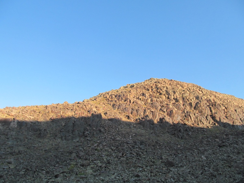
From here I returned to the base of the summit area and traversed generally southeast descending towards the CT/CDT which I soon picked up. The trail does not show up on the older maps, it stays north of the Continental Divide roughly paralleling it as it drops to about 12,500'. 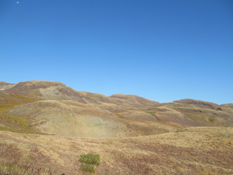
From this low point, it begins a climb through 12,700' saddle between 12990 and a large flat false summit to its southwest. Here I left the trail and went straight up the southwest ridge of 12990 for about 300' to its summit. 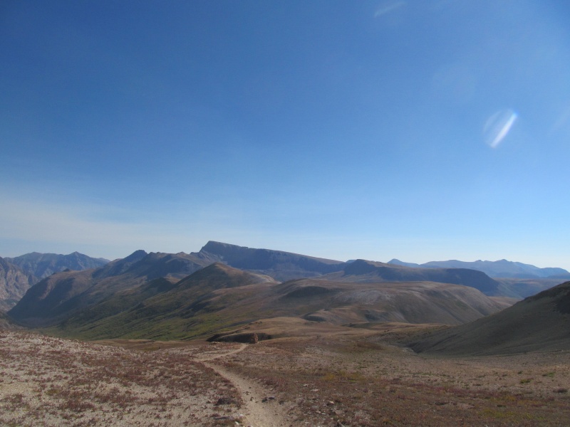
This ridge has a little bit of light gray talus right off the trail, then a gentle grassy finish. Great views all around, from the nearby Centennials like Half and Jones, to rolling high tundra of the Divide to distant views of Rio Grande Pyramid and the Grenadiers. It may not be tall or have a name, but it was a nice place to hang out and soak in the beautiful Labor Day weekend weather. 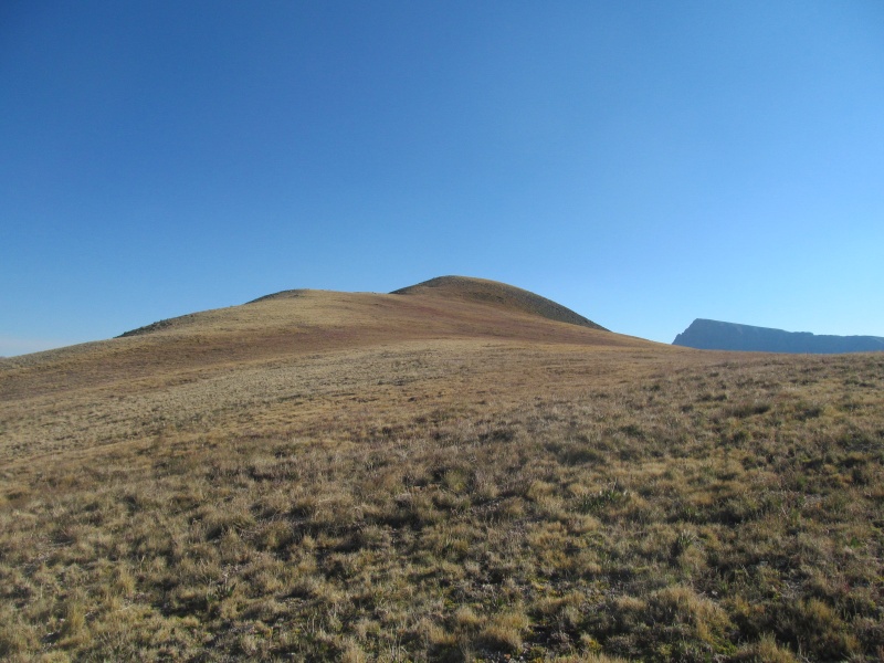
That clear weather and it only being about 9am had me looking at my map for ways to extend my day. I backtracked my route, this time staying on the trail all the way to the intersection with the Minnie Gulch trail, passing a cool beehive cairn along the way. 
From this intersection, the CT/CDT continues on to the south, where it rises to cross the ridge separating Minnie and Maggie Gulches. From a high point near 13000', I left the trail and headed north-north west up rolling tundra towards PT 13069. 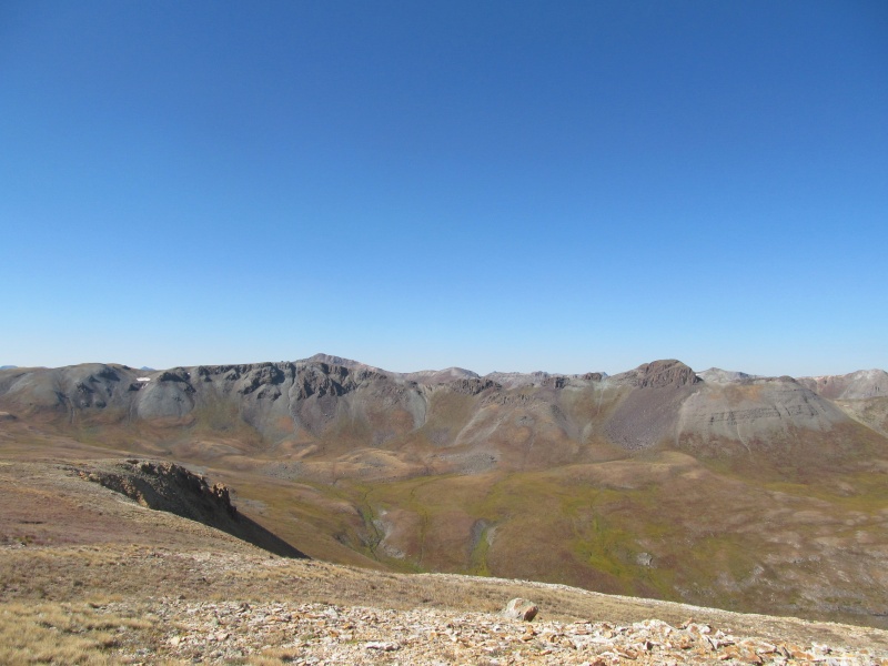
After a low point of about 12,900' the ridge narrows and rises a bit more sharply towards the small summit. Some steep cliffs below contrast with the gentle tundra that characterizes this area. 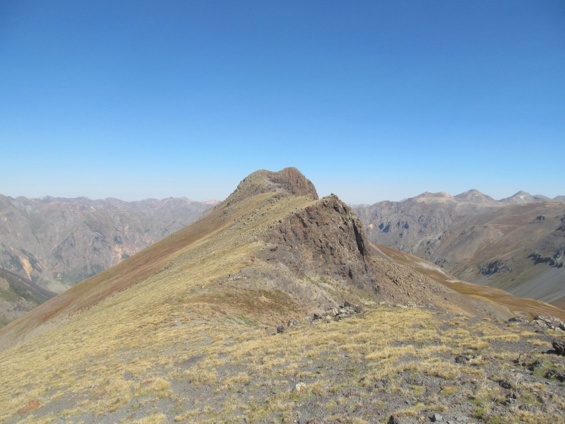
I enjoyed a nice summit break, but still wasn't ready to head down yet and made a plan to head for a long out and back to PT 12654. This peak lies a solid 2 miles east-south east of where the Minnie Gulch Trail meets the CT/CDT, and is lower than that saddle. I retraced my route back to the trail junction and headed east over the saddle and down the Middle Pole Creek Trail. There is a cluster of 3 small tarns at 12150' on the map to the south of the trail, and I picked my way on game trails around the west of them. There were some willows around here, but the game trails made easy work of them. Beyond, the remaining route was mostly just gentle grass, the last 250 feet steepening slightly just to make it feel a summit. 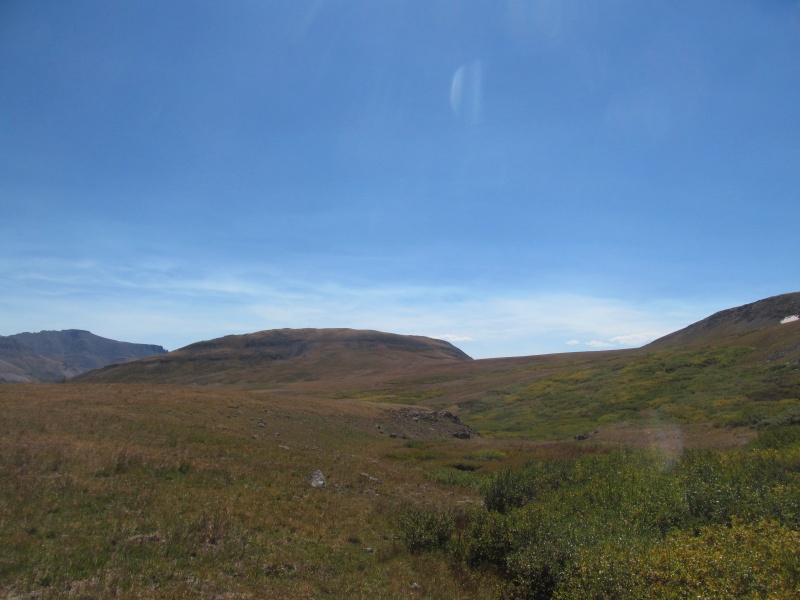
From the wide grassy summit 12990 looked far away, unfortunately so did the pass. The car was almost 4 miles away with a reclimb of nearly 600' so I started my return trek around 12.30pm. 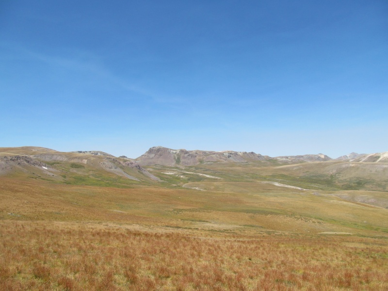
Back down the tundra slopes, through the willows on game trails and back to the Middle Pole Creek Trail. Now on trail, the reclimb went quickly and I crossed through the saddle and the CT/CDT junction. There were a good number of people throughout the day on CT/CDT. Some bike packing, some backpacking, some just on a day hike. 
I saw a couple of people on the Minnie Gulch Trail on the way out, but generally it was a quiet day and I had all 4 summits to myself. It was a great place to spend a day up high on the Continental Divide on a beautiful Labor Day Weekend. 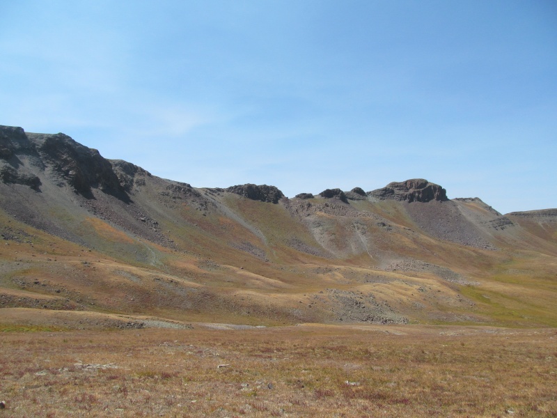
After I headed to Molas Pass area to one of my favorite campsite to enjoy the view of the Grenadiers as I made dinner and read. The next day the smoke from Montana fires rolled in and the Grenadiers were gone from view. I was glad to have had such a clear day up high the day before, I never take those for granted. 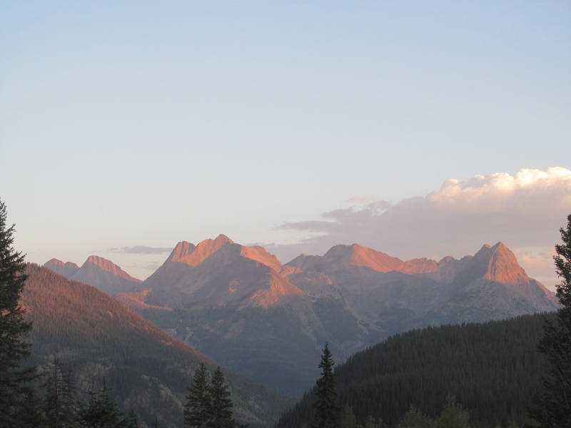
My stats: 14 miles and 4200' vertical If you just wanted Cuba and 12990: 8-1/2 miles 2400' vertical Map of my route: 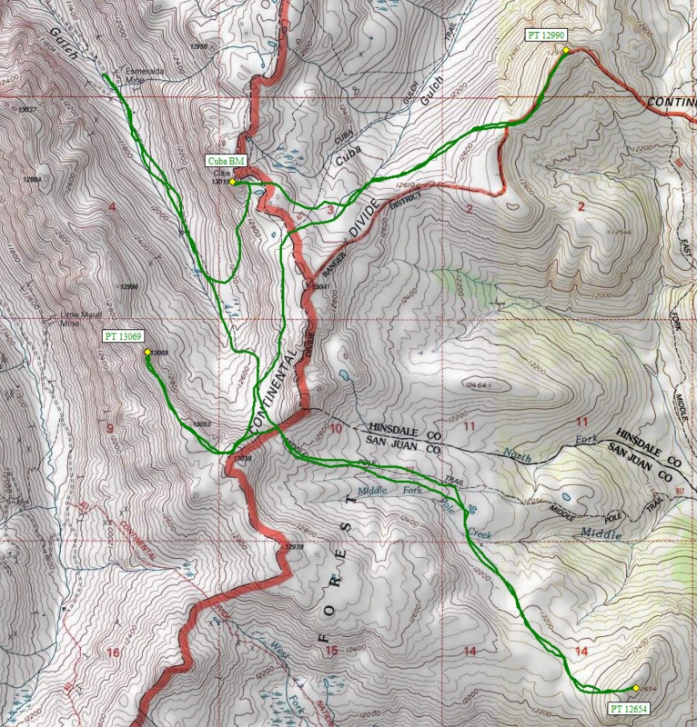
Thumbnails for uploaded photos (click to open slideshow): ")
")
")
")
")
")
")
")
")
")
")
")
")
")
")
|
| Comments or Questions | ||||||
|---|---|---|---|---|---|---|
|
Caution: The information contained in this report may not be accurate and should not be the only resource used in preparation for your climb. Failure to have the necessary experience, physical conditioning, supplies or equipment can result in injury or death. 14ers.com and the author(s) of this report provide no warranties, either express or implied, that the information provided is accurate or reliable. By using the information provided, you agree to indemnify and hold harmless 14ers.com and the report author(s) with respect to any claims and demands against them, including any attorney fees and expenses. Please read the 14ers.com Safety and Disclaimer pages for more information.
Please respect private property: 14ers.com supports the rights of private landowners to determine how and by whom their land will be used. In Colorado, it is your responsibility to determine if land is private and to obtain the appropriate permission before entering the property.


