| Report Type | Full |
| Peak(s) |
Mount Darline (11,306) Crater Peak (11,327) Mount Hatten (11,310) |
| Date Posted | 12/03/2021 |
| Date Climbed | 09/25/2021 |
| Author | IntrepidXJ |
| Highpoint of the Grand Mesa: Crater Peak |
|---|
|
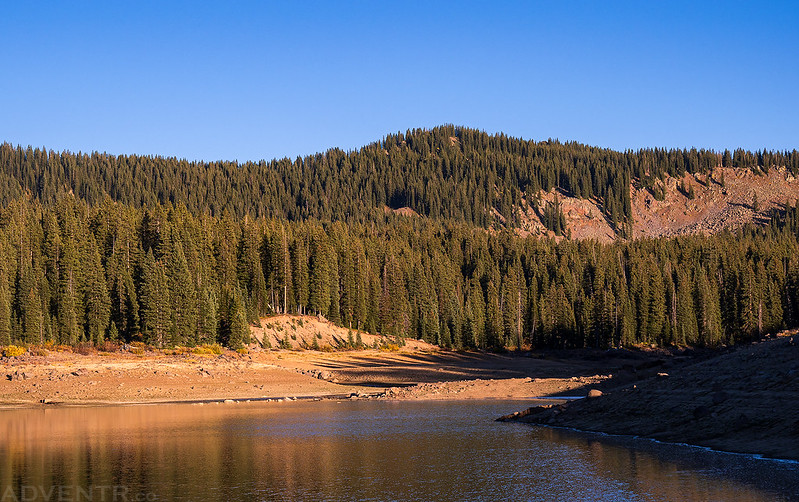
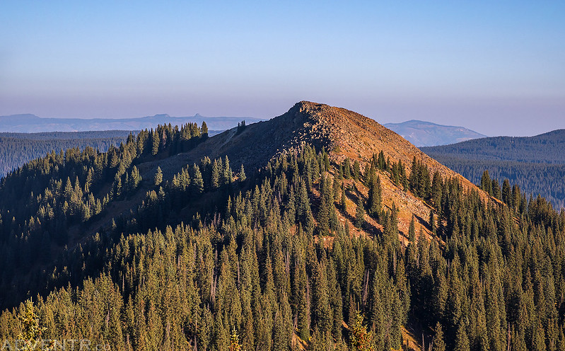
Goodenough Reservoir Peaks: Mount Darline & Mount Hatten After spending a few days on the Green River earlier in the week, I would be leaving for a full week of exploration on the Colorado Plateau this upcoming Friday, so this weekend would be my last opportunity to get into the high country for some peak-bagging to finish off the summer season. I needed this to be a quick trip near home so I could be back by Saturday afternoon to start preparing for the upcoming trip to southern Utah next week, so I thought this would be the perfect opportunity to hike to the highest point on the Grand Mesa. Although I have already hiked to the old fire lookout on Leon Peak (11,236), which is the highest point in Mesa County and located on the Grand Mesa, Crater Peak (11,327) in Delta County is actually the highest point on the Grand Mesa. I left after work on Friday afternoon, grabbed a quick dinner and then headed up onto the Grand Mesa via Delta and then followed the road up along Leroux Creek. The fall colors were on full display during the drive, even if it was a bit smoky out. I then turned right and followed the rough road up to Goodenough Reservoir where I could see all three peaks that I planned to climb on Saturday morning. There was already a hunter’s camp set up near the end of the road, so I drove back down a little way and found a different place to spend the night. This was my first view of Crater Peak when I made it to Goodenough Reservoir. As you can see, the reservoir is very low.
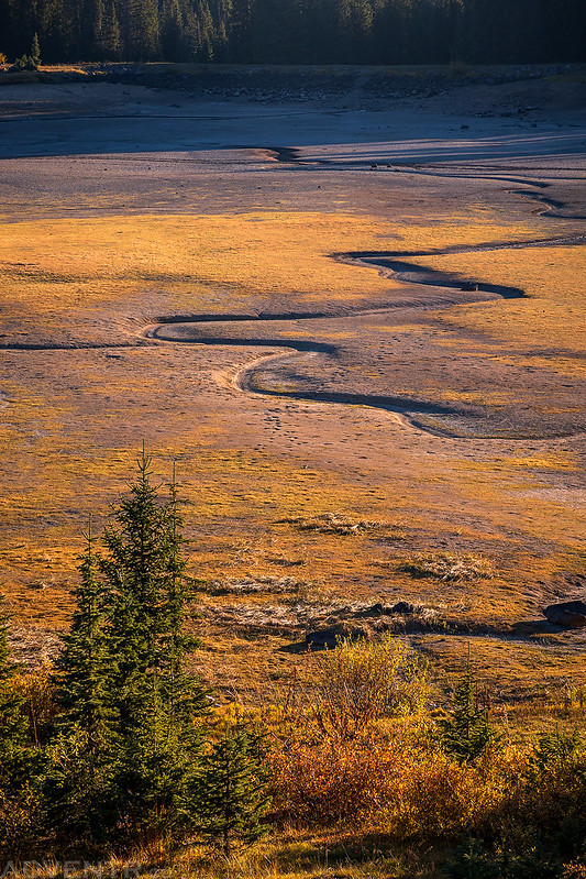
Dogfish Reservoir below was completely dried up.
Mount Darline (11,306) over Goodenough Reservoir
An eveing view of Mount Hatten (11,310) as I headed back down the road in search of a campsite.
I woke up before sunrise on Saturday morning and then drove back up to Goodenough Reservoir at the end of the road. It was about 33 degrees out and the puddles of water in the road had a thin layer of ice on top of them. The magenta color in the sky was looking nice during the early morning drive.
Just as the sun was coming up I started hiking around the reservoir on my way to the summit of Mount Darline first. Once I left the edge of the reservoir and started climbing the ridge to the summit the hike was mostly in the trees with a lot of deadfall and no trails to follow, plus there were a couple of boulder fields to cross. The remains of an old cabin or structure near the reservoir.
Mount Hatten at sunrise reflected on the low water of the reservoir.
Dogfish “Reservoir”
From the summit of Mount Darline I had a nice view of Crater Peak and Mount Hatten, my next two objectives for the morning.
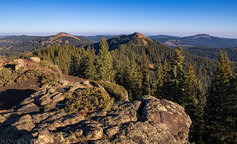
There was a smoky view of the West Elks in the other direction.
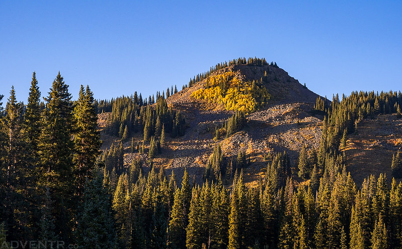
Crater Peak from Mount Darline
Mount Lamborn and Landsend Peak were visible to the south.
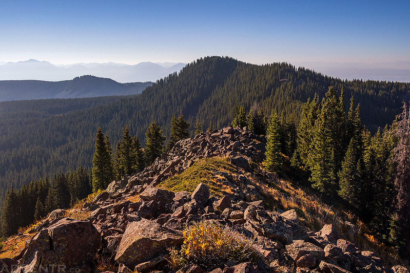
From the summit of Mount Darline I followed the ridge over to Crater Peak. Most of the hike was in the trees again, but it got a little more interesting as I neared the summit.
Looking back down the ridge to Mount Darline.
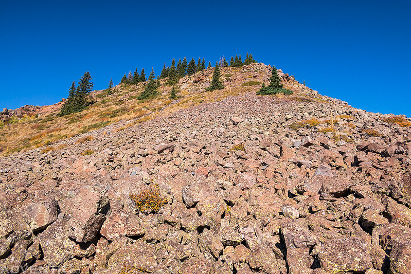
The final rocky climb to the summit Crater Peak reminded me a lot of Leon Peak. It was a choose-your-own-adventure up large boulders while trying to avoid the moving ones.
On the summit of Crater Peak, the highest point on the Grand Mesa.
Crater Peak Benchmark
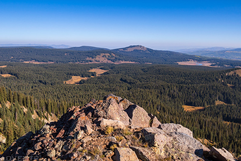
The view from Crater Peak to Goodenough and Dogfish Reservoirs below.
Looking the other direction to Chalk Mountain and Overland Reservoir, which also looked pretty dry.
Next I followed the ridge from Crater Peak to Mount Hatten, which was mostly in the trees again. At least this time I had an occasional game trail to follow, which made things a little easier.
I had to be careful on the final climb to the summit since it was pretty steep and loose.
On the summit of Mount Hatten.
The view from the summit over Elk Park.
I returned from the summit the same way I had climbed up and then hiked straight down the south face back to Goodenough Reservoir and my Jeep at the trailhead to create a loop.
It was a nice way to spend a brisk fall morning and to end my summer season in the high country! >> Crater Peak Photo Gallery |
| Comments or Questions |
|---|
|
|
Caution: The information contained in this report may not be accurate and should not be the only resource used in preparation for your climb. Failure to have the necessary experience, physical conditioning, supplies or equipment can result in injury or death. 14ers.com and the author(s) of this report provide no warranties, either express or implied, that the information provided is accurate or reliable. By using the information provided, you agree to indemnify and hold harmless 14ers.com and the report author(s) with respect to any claims and demands against them, including any attorney fees and expenses. Please read the 14ers.com Safety and Disclaimer pages for more information.
Please respect private property: 14ers.com supports the rights of private landowners to determine how and by whom their land will be used. In Colorado, it is your responsibility to determine if land is private and to obtain the appropriate permission before entering the property.