| Report Type | Full |
| Peak(s) |
Kings Peak (13,528) Wheeler (NV) (13,063) Boundary (13,143) White (14,252) Barcroft (13,040) Mt. Hope - 13,939 feet Quail Mountain - 13,465 feet Grays Peak - 14,275 feet Torreys Peak - 14,272 feet Gannett (13,804) |
| Date Posted | 12/03/2021 |
| Date Climbed | 07/10/2021 |
| Author | Ptglhs |
| Additional Members | Fireball14erpsyd |
| A year of high points (2 of 3) |
|---|
|
Continuing on from my winter adventures in the south and Midwest I moved into the later spring hiking season with an eye on higher mountains out west. Actual mountains. I had been wanting to do the north western high points but several of those I wasn't going to do without a partner close to my skill level: Granite, Gannett, and Rainier. The others I was pretty confident I could solo. As luck would have it I had started seeing someone who had recently discovered a love of the Alpine. She had hiked Bierstadt as her 1st 14er a few months before we met, and over the course of our early dates had done some alpine peaks with me: Almagre on a cold windy winter day in January, Quandary Easter Sunday in absolutely perfect weather conditions. When I told her about wanting to hike some mountains out of state she decided to use the leave she had accrued during the year of no vacations and join me in the southwest. Erin was newer to being up in the alpine in snow so I looked at out options: driving distance, keeping it below class 2, and mostly long day hikes. We settled on a trip to Kings Peak in UT, Wheeler as the highest ranked peak in NV, Boundary in NV, and then White Mountain in CA, since it was very close to Boundary and it would be a 14er neither of us had done before. We planned to leave mid may and be back just before memorial weekend, my busiest weekend of the year work wise. We booked a rental car, got care for kids and pets being left behind, were screwed over by dollar because we were 4 hours late picking up the small SUV we rented and had to settled for a gas guzzling, Brobdingnagian monstrosity of a suburban, and departed early on Monday, 17 May for Kings Peak in UT. I had hoped that given how low the snow pack was in UT in the Spring of 21 that Kings would be more of a hike and less of a snow excursion. Driving in from Wyoming on the dirt roads I started seeing patches of snow in north facing shady areas around 9k and I knew we were in for an adventure. We loaded up for 3 days with all the normal backpacking supplies, and ice axes, snowshoes, gaiters, and micro spikes. We left the TH about 1pm. I was hoping to get at least 8 of the 26+ miles of the 3rd longest US high point trail. 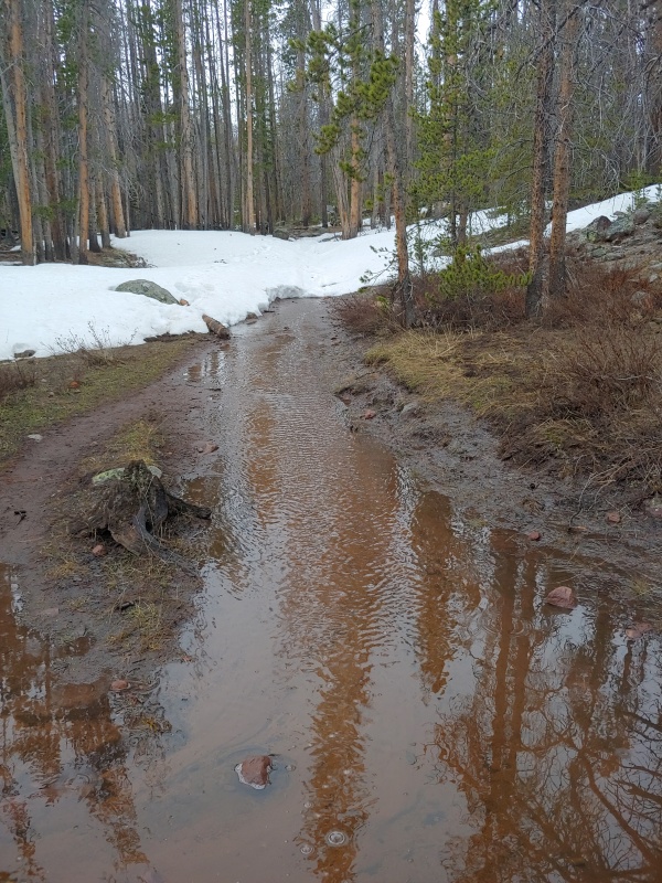
The route had more snow, much of it melting, than I was hoping for, but I had planned for it and we were well equipped. I had to rely on GPS a couple of times over 10k when the snowshoes were on and the trail was buried under a couple of feet of consolidated snow. We post-holed sporadically, due to the time of day (late afternoon). At one point, right before a wooden bridge crossing to get to the slope up to the flats above treeline we punched through the snow and both of our feet were soaked. We changed out our socks (wool, of course), put wet shoes back on, and kept pushing. It was early evening, overcast, with occasional snow flurries so we made the decision to set up camp about 6+ miles in. Water was a non-issue. We set up beside melt fed rivulets of water oozing out of the snowpack. I hung up my socks in a vain attempt to get them to dry. We cooked some mac and cheese and curled up to talk and read while it intermittently sleeted. We were both surprised at how late we slept the next morning. We were tired from waking up at 5am, driving, backpacking up in wet snow conditions. For Erin, the lack of children sounds and pet sounds, and the total lack of human sounds, meant a great night's sleep til 8am. Putting on socks that were cold and damp, and then trying to get them into my old hiking boots I discovered the boots, which were outside the tent, were frozen solid! I had to leave them unlaced and walk around in them to get my body heat to thaw them to the point where they could be tied. Adventures in May mountaineering. The trail up to Gunsite pass is beautiful. It's right at treeline and closer to the downhill slope the trail is in grasses and willows, affording unmatched views of the valley floor and the sandstone formations across the valley. There is a forest and water closer to the uphill side. Snowshoeing on thankfully supportive snow we made decent time and were soon at one of the alligator lakes. 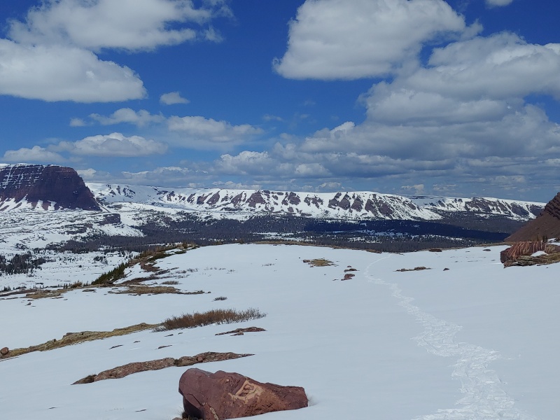
We slogged our way up Gunsight pass and once we got to the apex I looked at our options. We could try a 'short cut' which looked like a hellish mix of loose slopes and melting loose snow, so that was out. The main trail descended 400 vertical feet and curled around the more difficult obstacle which blocked easy access to the summit block. That added more than a mile each way. It was already about 1 and I knew it was going to be several more hours, and it would be 2600ft of gain to get the summit, and an additional 400ft to get back to where we were right now. I made the decision that due to the time of day, effort required to keep moving, and unstable snow pack, we were turning around. Erin was disappointed, I think more at herself for not moving faster. I was bummed as well. I reminded both of us that the mountain will always be there (unless it's Bartlett!) but we may not be if we don't concede. The only thing we have to do on hikes is get safely back home. Also, we knew that it would be a crap shoot given how early in the year we were in the Uintahs. In the last couple of miles back to camp we post holed a couple of times in the now sunny, lower 40s weather. I was glad we called it because we were both tired after we got back to the tent. Ramen for a late afternoon snack was followed up by backpacking meals 3 hours later, before we turned in for the night, warm and safe but a bit disappointed. The next day when we were hiking out I remarked that we hadn't seen anyone that whole time. It was kind of amazing to have a state high point be ours for 3 whole days. There wasn't even a car in the lot when we left it. The geology of kings Peak area is amazing. Broken sandstone rocks that look like mine craft buildings or tree rings. 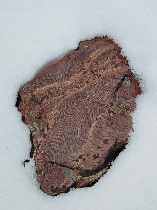
We were about 3 miles from the car when we ran into a group of guys hiking in. I was surprised at their, um, gearing choices: no traction or flotation, mostly cotton and flannel, and cheap sleeping bags. They asked about the summit. When we told them we needed snowshoes pretty much continuously from 10k on they seemed pretty defeated. They had driven in from Austin and taken a week off. We recommended they spend a couple of days at the lower lake that was a a couple hundred yards off the trail, since they had fishing poles. They seemed amenable to the idea. I hope they stayed warm enough! Back at the car before noon we started driving across Utah to get to our next mountain: Wheeler Peak, NV, in Great Basin National Park. First we decided to get some waterproof hiking boots for me, my others were only a couple of years old, but they had several dozen mountain summits on them. We also gorged ourselves on several thousand calories of non rehydrated Italian food! We turned off the interstate on to US 50 and quickly noticed how little there was out there. I had heard that Great Basin was very isolated, but driving several miles without seeing any sign of permanent human habitation really drove the point home. Our next mountain attempt would be on Wheeler Peak, NV, the state's only ranked 13er and 60 miles away from the closest town of over 1,000 people. Apparently the stretch of US 50 was so desolate it was renowned for its remoteness. NV state tourism board had made tourist draw out of getting stamps in a book as hardy travelers worked their way across the small communities located where what little water there was could be found. 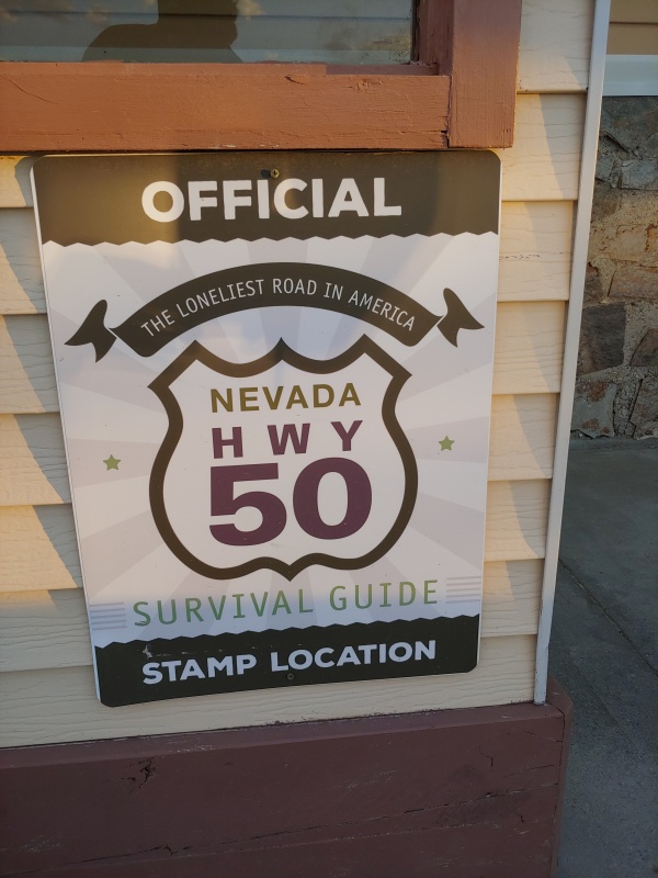
As distracted as I was by yet another list: stamps in a book, woo-hoo, the night sky in Great Basin absolutely blew that away. There was little to no light pollution. Also, because it was a national park there was little camping available, compounded by the fact that the upper campground was closed. We grabbed a spot in what I think was a parking lot for a side trail, but we were planning on being out at 1st light. 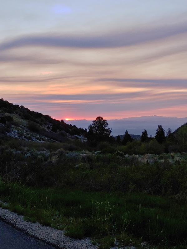
The next morning we drove up 3,000+ feet in elevation to get to the trailhead for Wheeler. It was chilly, but so far there was very little snow. We started just after sunrise and I was pleased to have most of my snow gear stay in my bag. 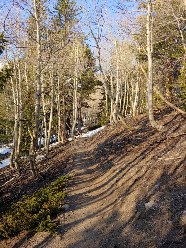
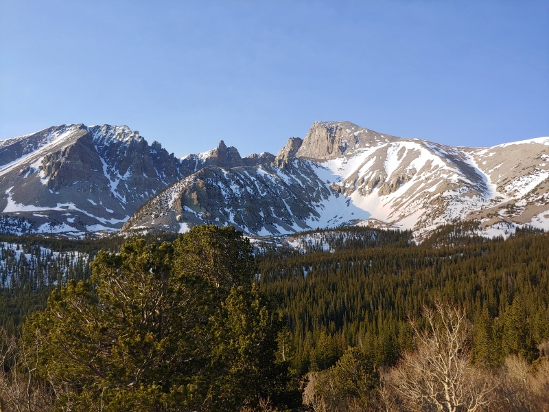
Hiking through the aspens groves which had yet to leaf out, stands on pine, green grasses above 10k feet, and enjoying the views of the morning sun on Wheeler's jagged face made me hopeful. Both for success at summitting, and for an easier set of conditions than Kings. The Parks informational signs talked about the isolated nature of the flora on Wheeler. It arrived in the last ice age and as temperatures warmed and the desert encroached the creatures which preferred a more temperate climate retreated up the mountain. The glaciers have receded and melted out of existence as the climate has warmed in the last 200 years, but evidence of their effect on geology is still evident in the park. We hiked towards a saddle between Wheeler and Bald mountain to the north and encountered our 1st significant snow. It was early and cold and the snow was blissfully firm. We had microspikes on and ice axes out but no flotation was needed. Our snowshoes remained strapped to our backs. The views of the surrounding Basin for which the park was named we stunning. Wheeler is so isolated that it's easy to see for hundreds of miles in most directions. 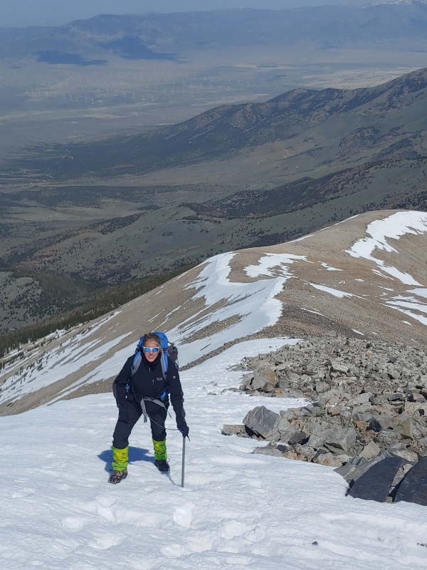
The trail was under some snow on the western side of the mountain, and visible on the eastern side of the ridge. We tried sticking to the trail as best we could, but Wheeler's steepness and the smaller talus chunks lead to a Mt Princeton looking series of possible trails. For the most part we stuck to the snow and soon were on our 1st summit of the trip! 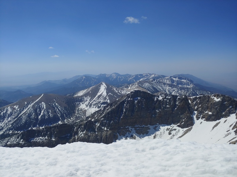
Wheeler and Great Basin are both worth the drive. The different climates were cool to see in such a short time and the trail is mostly a mellow hike, for those of us used to peak bagging in the alpine. We got back to the car and slowly rolled our way down the hill, out of the park, and back to 'the loneliest road in America.' Our plan had been to set out for boundary next, but the current weather forecast gave me pause. A spring snow storm was suppose to dump on the Sierra Nevadas and it wouldn't spare the white mountains much either. We had extra days built in for weather, rest, sightseeing, and visiting Erin's sister in Las Vegas. We spent the rest of the day driving across Nevada, collecting stamps for my new booklet (I'm a dork, I know), and rolled into Carson City late that night. The next day we briefly stopped at lake Tahoe, but it was so snowy that we couldn't see far enough to make a photo worth it. Imagine grey and blueish grey and white swirls all over the place, you'll get the idea. We dropped into CA. I was making up an itinerary as we went along, since we were improvising. I decided we could stay at horseshoe meadows campground, where I had started my trip up Whitney in '19. It was free, it was out of the desert heat, and there were towns nearby. Driving through a snowstorm in May isn't what most people think of when they envision California, but it is the 3rd largest state! 
We stopped for barbecue, walked around Manzanar, reading about the history of internment. The sober weather seemed to add gravitas to the signs detailing the experiences of people jailed for no other reason than their ancestral homeland. We started our drive up to Horsehoe meadows and watched the temperature gauge drop. It was 18F at the campground, which sits at nearly 10,000ft. 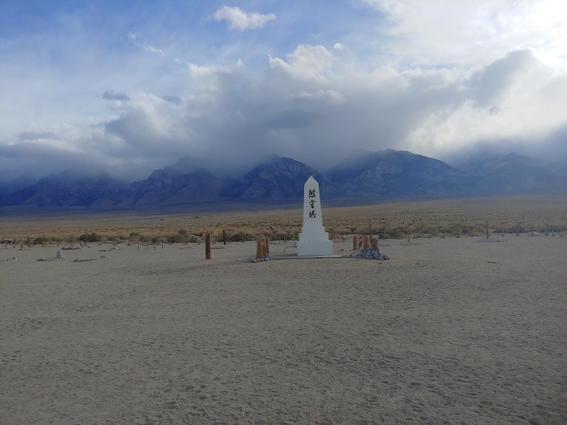
The next morning we quickly packed up and drove down in elevation until it was in the 40s. We had a breakfast and kept pushing over to Death Valley for some sight seeing in a 2nd national park. I enjoyed the juxtaposition of both heat and elevation. We started this morning well below freezing and before noon it was in the 80s. 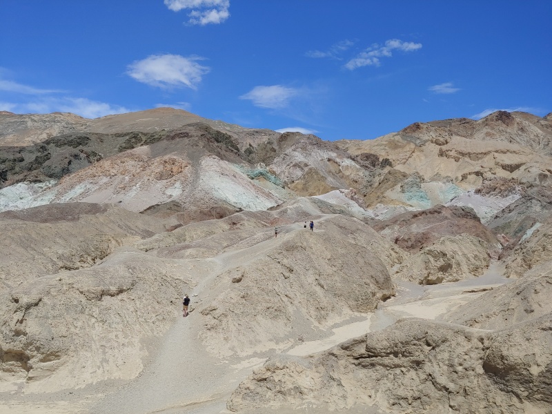
I decided I liked national parks with fresh water much better than Death Valley. We kept heading east and enjoyed a night in Vegas with Erin's sister. The next morning we started driving back west, Boundary Peak, NV's actual high point, was our next objective. As has been noted on a plethora of other sites, Boundary's most challenging move may be finding the TH and the trail. A desolate state highway has double tracks through the scrub going west every mile or so, most unsigned. We had to use a combination of google maps, which often didn't show a road, and all trails, which had roads as bike routes, written directions from Summitpost, and just heading uphill and hoping for the best. My plan had been to come from the NV side to the Queen's Mine TH. This one section of road was why we had rented an AWD car with decent clearance. A sedan could probably have made it to the TH on the Valley floor, but the road heading up was quite rough. It turns out a suburban was too heavy, or under-powered, or the driver (me) was too much of a novice. We got to within 200 vertical feet of the pass and couldn't make it further. Spinning the tires on the rental was just moving dirt away from the road. Erin helped me back very slowly to a spot were I was able to do a careful turn so the car was facing downhill. We packed our backpacks for an unplanned, very short, backpacking trip up the slope. Alone again, we got a decent night's sleep in preparation for boundary the next day. 
I chose the Queen's Mine TH because it was less elevation gain, and less time on a scrub desert floor slogging through a mixed use cow pasture. I knew both of the trails were unmaintained and subject to social fraying -people going off where they think the trail should lead which cause visible erosion, which causes more people to think the path is the best trail- but I was surprised to find the state high point be as trackless as a non centennial CO 13er. We set up a slope of sandy soil, occasional vegetation, and snow. We gained the 1st flatter area, and low rise with a gentle slope where feral horses have been living for the past couple of hundred years. Sure enough, we saw them on our return. 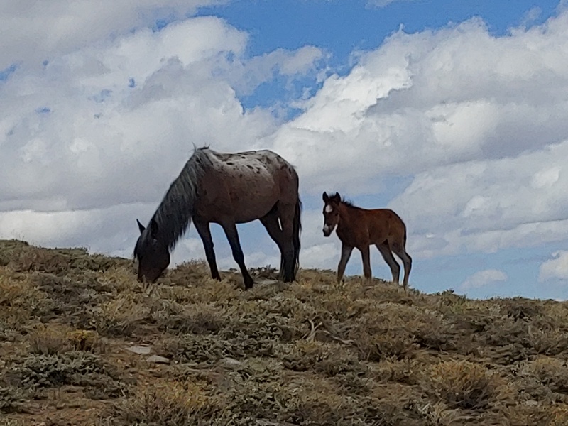
Coming around the bump of horse meadow brought Boundary peak into view. I had been feeling tired and just blah so I wasn't saying much. Erin remarked, 'um, we're climbing that?' 
The lack of vegetation made the peak look taller and further away, so more of a climbing undertaking than it was. According to alltrails we had just over 2k feet to gain to get to the summit. The slopes were loose, steeper than I would have liked at an average of 30% slope. I knew we had to ascend the ridge for a bit before cutting over in an ascending traverse to reach a notch. From there we traversed around the back of the bump we skirted and then joined up with the main trail. Calling it a trail was a misnomer. All I saw was a single line of boot tracks coming up the slope from the valley floor before breaking through a cornice and continuing up the path we were taking. 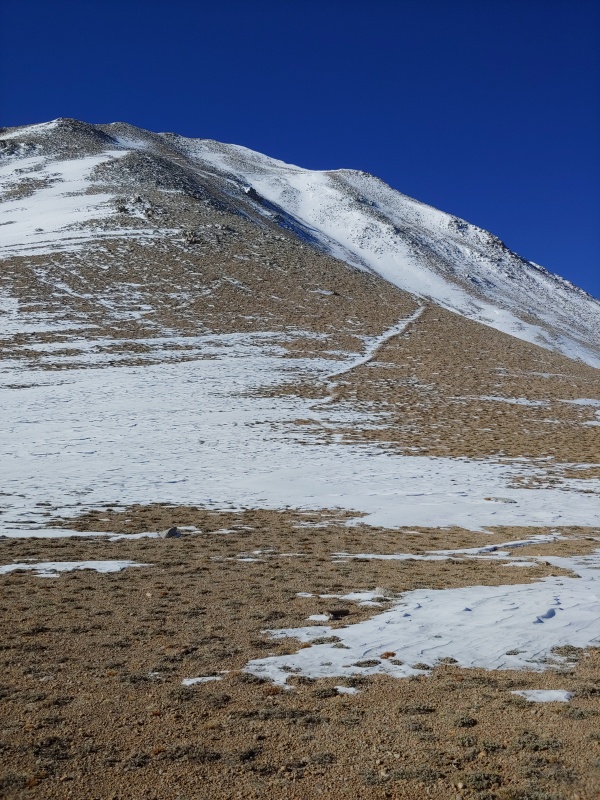
The final 1100 feet seemed to take forever. There was new powdery snow over uneven rocks. I'd rate the route as class 2+, maybe a couple of easy class 3 move, though that may have been due to my zeal to stay to the ridge proper. I mostly stuck to the ridge crest until the slope eased and I was able to cut right towards the true summit. The final 30ft were under a lot of wind drifted snow. Blazing a path up that was exhausting. 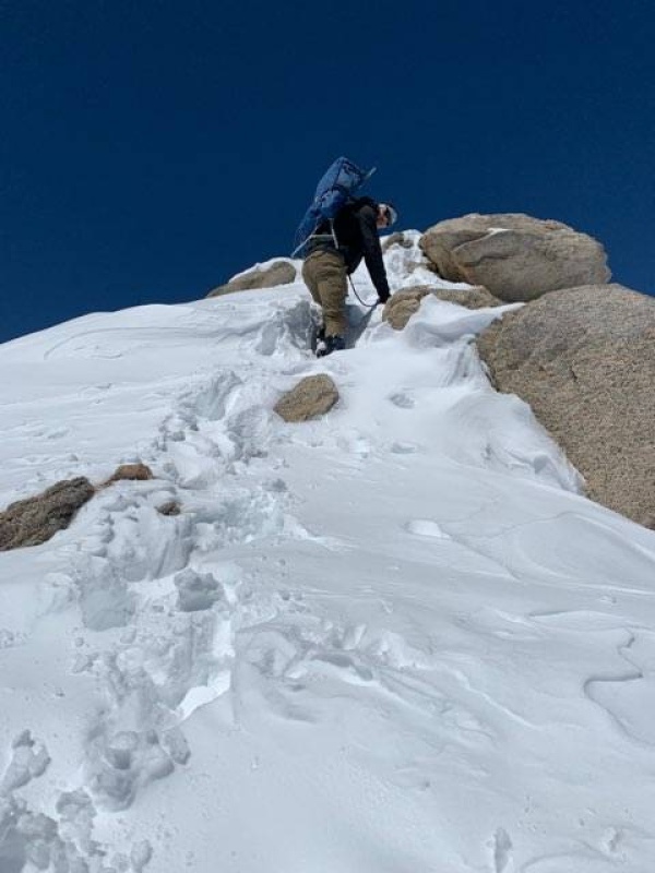
On the top we could see Montegomery in CA, this unranked highpoint's parent peak. We were both tired but feeling accomplished. It was our 1st state highpoint together, and it was the hardest hike of the trip, despite our turning around on Kings. 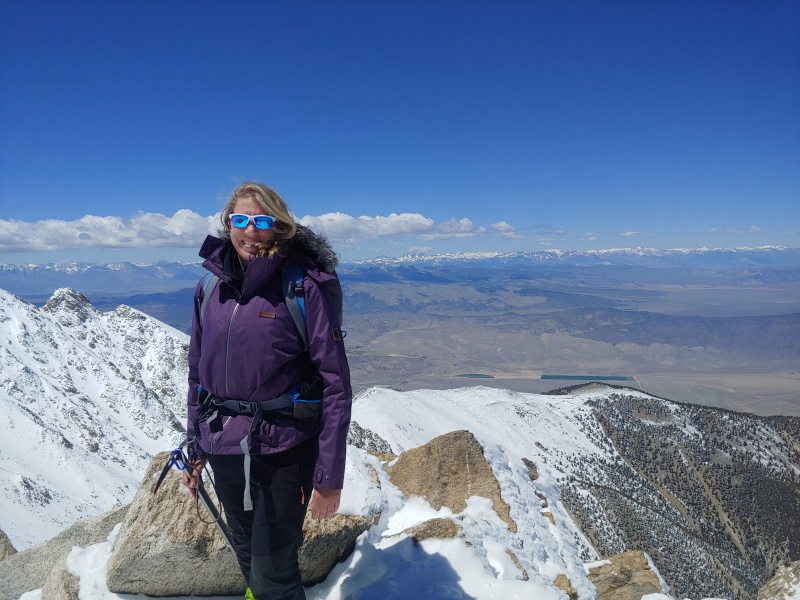
The patterns of center pivot irrigation were easily visible from the summit of Boundary. Looking down into Nevada I could see green circles surrounded by a kind of desolate tan. I wondered how much water was beign drained to produce that effect. The sky concerned me more than the distant ground at that time. I had been watching the clouds form and start to have patchy shadows over the valleys. I didn't know how long it would take to get down, or if the weather would look like a CO monsoon storm, but I wanted to be lower before we found out. We tried to keep moving at a consistent pace back down, following our tracks in the new snow. 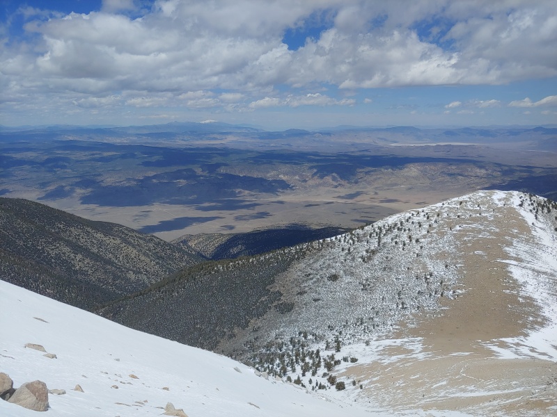
We were at about 12k when we saw someone still moving up, looking like they were making a good pace. We gave him what Beta we had and kept moving. He was traveling very light, maybe why he was moving faster than us! We were both pretty spent when we got back to our tent. We flopped down for a bit, just recovering. While we were packing up our stuff the same guy came back down to his truck near our site. He had come from the CA side and apparently his Tacoma did what a suburban couldn't. He asked about Boundary vs Montgomery, wanting to confirm he had stood atop Nevada's high point. I was impressed with his pace. he mentioned he was doing a few highpoints, that he already had Rainier, Hood, and Borah under his belt, since he was from Seattle but relocating that month to Colorado. Impulsively I asked after his interest in Gannett since it was on my to do list. He said he wanted to get that one too and we exchanged numbers. The only person we saw all day was on the same quest as me and was interested in teaming up for the 2nd longest high point. What were the odds? We drove into Bishop, CA and sprung for a room for the night. The next day was a rest day before our longest hike and tallest mountain of the trip: White Mountain. The next day we tried stopping by the forest service outpost, but only to find it still closed. We drove up to the bristlecone pine forest, drove all the way to the trailhead for White, and then backtracked looking for camping. We found a mostly deserted parking lot around 11k feet near a walking path through a bristlecone pine grove. If CA wants people to be better about where they camp, maybe have better signage or don't furlough your rangers? 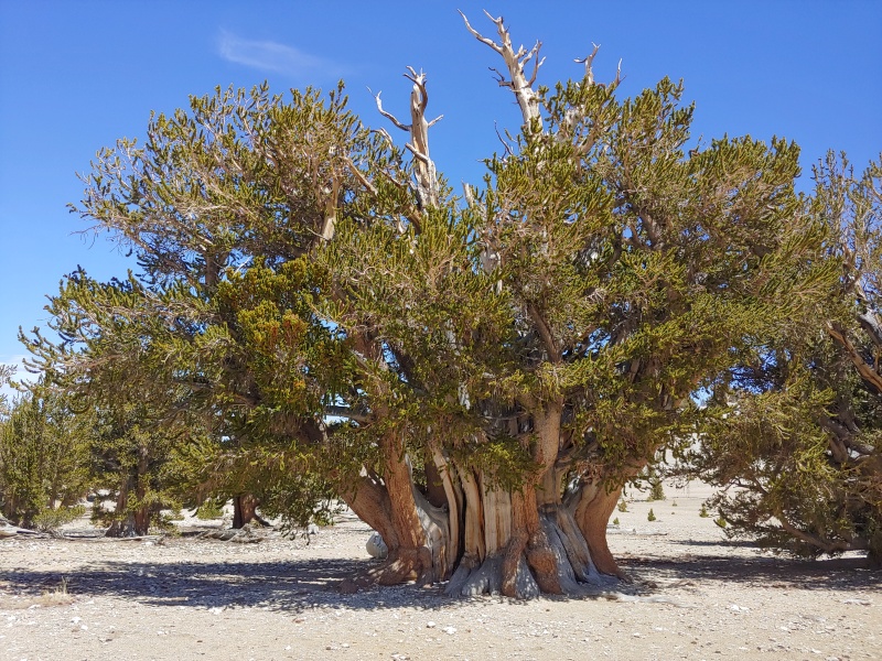
That night there was due to be a lunar eclipse. I knew we would see it as our alarms were going off at 430. Totality was due to be in the middle of the night. I decided sleep was more important so I didn't set an alarm. As it turns out I didn't need to! Thanks to Erin's worse than usual snoring I was able to see a full moon on the light colored soil and snow, the red moon and is passed through the penumbra, and the stars shining magnificently during totality. All of this almost made me forget about how tired I was and my faint desire to smother Erin with a pillow. Of course I didn't, but man, I needed more sleep that night! 
The hike up White mountain is ridiculously easy, even 3 days after a May snowstorm. There is a usually abandoned research station a mile or two up a good quality road. The road is locked far enough back to be annoying, but a car could pretty easily drive to almost 13k, with an old mining road heading up to the summit. Walking up on the research station in the cold early morning air there was a real 'Resident Evil' boss fight feel to the place. We looked around as we walked but didn't linger. 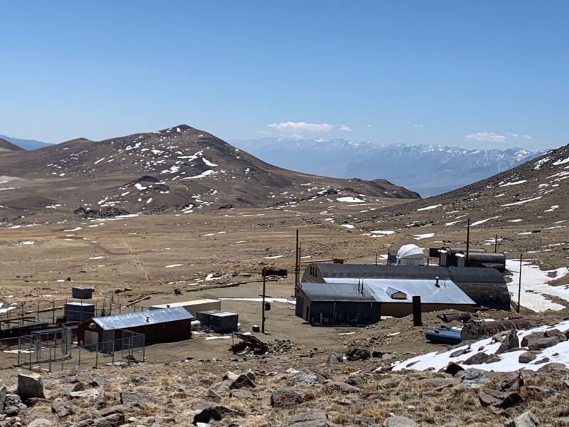
White mountain came into view as we cleared the rise. The road snaked around and lost some elevation, which was disappointing to see, and the gained the sub peak on the right before dropping once again and then the final push to White's summit. 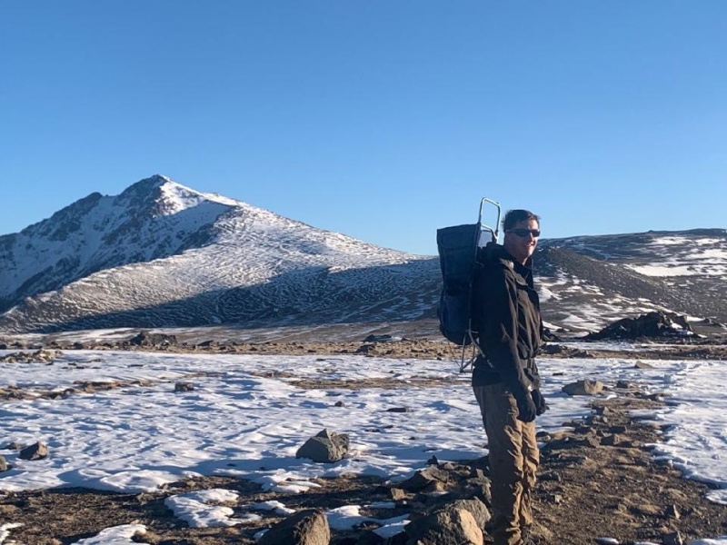
We were actually making very good time, even better than Wheeler. I credit the several days above 10k to acclimate, and the gentle slope of the mountain, the lack of much snow, and a road. The last bit to the top was still tiring, we were, after all, over 14k, and had logged a lot of gain over the past week. We made the summit about 930, 4 hours after we started. The Sierras in the west were beautiful, and the White Mountains stretching north and south provided a contrast. It was amazing to me how the tallest peak was so surrounded by slopes gentle enough to have a road to nearly its summit, when a peak 1100 feet lower was so much harder to gain. We enjoyed cloudless skies, calm weather, and feeling of accomplishment. It was Erin's 3rd 14er, my 60th. 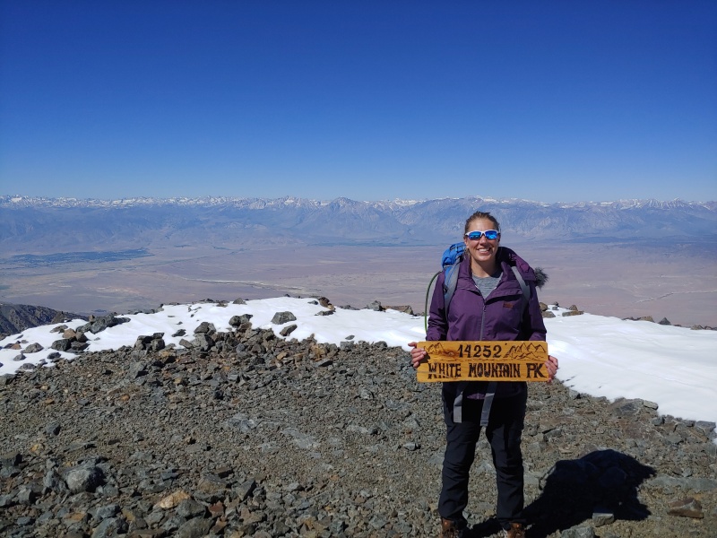
On the way back I wanted to tag Barcroft Mountain, a ranked 13er. Erin said she wasn't feeling it but as we were on a road, and had cell service, and had seen a half dozen other people she encouraged me to go for it and we'd meet back at or before the car. I pushed to make the summit of Barcroft as quickly as I could, it took maybe 20 minutes from the rise over the research station to the summit. I then struck out south in the direction where the road would curve back to along an easier slope than due east to rejoin it, and saving time by not retracing my steps. I saw the only liquid water of the day while walking back along this route. The white mountains are not a place I would care to venture in July or August! 
We were nearly back to our car when we spotted a marmot! We had been on the lookout for them on the other mountains. We surmised Kings was too snowy for them to be out and boundary to dry for them to be living there. We enjoyed seeing one as we were almost done with our trip. 3 out of 4 mountains hiked, everyone safe, 3100 miles of driving, 55 miles of hiking (give or take). 
Shortly after returning from our may trip, and after Memorial Weekend's work, I reached out to the guy I met on Boundary. Travis was a bit younger than I, enthusiastic about the mountains, and coming from the Seattle area he had been up Rainier, Baker, Hood, and a few other glaciated peaks. We originally set our sights on the weekend of the 4th for Gannett, but family commitments pushed that back a week for him. I was a bit worried about the snow bridge but hoped it was still early enough to be intact. Between the two trips I resolved not to let my elevation gaining or pack carrying abilities lapse. I did Hope Mtn A and Quail in early June, and Erin and I tagged Grays and Torreys on July 5th. Between that and running for a living I felt good about my fitness for Gannett. 
On the 8th of July I met a near stranger at a parking garage in downtown Denver, moved my car into his space, my stuff into his Tacoma, and we pushed north! Thankfully the mountains are a great source of conversation, for enthusiasts of them at least. I was worried about our personalities clashing but we confined ourselves to mainly mountain talk. Travis said he mostly did day hiking and was accustomed to long days, alpine starts, and 20+ miles. He was less accustomed to backpacking but was confident we'd be fine. We had settled on the Glacier trail approach from the North, Dubois side and had elected to leave ropes behind. We each had stiff boots, crampons, an ice axe, and helmet but we would be operating without other protection crossing the bergschrund. Glacier trail would mean more hiking, with more up and down over arrow pass, but it would also allow for an easier summit day. Initially we had given ourselves 5 days for the hike: 2 to hike in, summit on day 3, 2 to hike out. At the beginning of the trip Travis said he needed to be out for a conference call 9am Monday. We were going to try to push out the day after summiting. I knew it would be rough, but I had done 20+ mile days before at the end of a backpacking trip. in 2018 I did Eolus, Nth Eolus, and hiked out to purgatory flats in a day. Of course I wasn't on a glacier... Hiking Gannett peak allows one to take in a variety of different scenery and environs. The Glacier trail starts in at prairie's edge: sagebrush, long grasses, occasional cactus further from the stream. It's low enough in elevation for cottonwoods to grow near the river, though they are mixed in with aspens. Very shortly after starting up the trail, sweating in the early afternoon heat at 7,600ft, we crossed a bridge over a rushing Torrey creek. I may have been letting my eagerness get the best of me but I swear the water had hints of glacial silt. 
The trail would weave through Wyoming grass and scrub brush and be relatively flat for a while (while still gaining), then it would switchback up the sides of sub peaks. At 10,000ft on the slopes of arrow mountain we were still nearly 14 miles, as the crow flies, from Gannett's apex. When we would pop out of the trees and see how much further the next high point was from us I knew this was a real backpacking adventure. I was breathing well and enjoying being higher up in the cooler air. Travis, for all that he was a strong hiker who probably had more endurance than I, said he wasn't used to such a heavy pack and was feeling the weight. 
The flat area near 10.8 known as arrow pass was a profusion of color from wildflowers. There were so many that I could smell the floral scent in the air, without leaning down. Se stopped for a break and I realized my choice of footwear, hybrid crampon compatible boots with no backup, was going to cause problems. I felt the tell tail pinches and twinges of developing blisters. 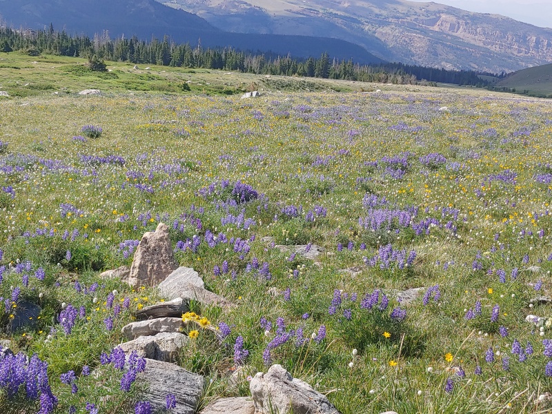
We dropped over the pass and into an area known as burro flat, a seemingly unending alpine zone, slowly dipping to the forest and glacial carved lakes on the eastern side of the mountains. 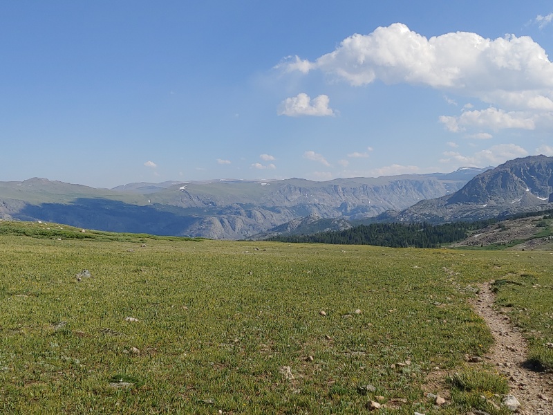
Hiking downhill there were several different paths, all side by side. It reminded me of bierstadt, which was surprising, we had only seen maybe 6 other hikers, not all of whom went this far. Given the south facing and gentle angle of the slope I surmised this place must be a sucking quagmire early in heavy snow years. The erosion was doubtless due to hikers trying to avoid rocky ground, or mud and water. We picked the most trodden line and enjoyed the grey granite views of the Winds to our right, and the plateaus near our own elevation across the drainage. I had to stop to wrap my feet in an attempt to alleviate a developing pain. 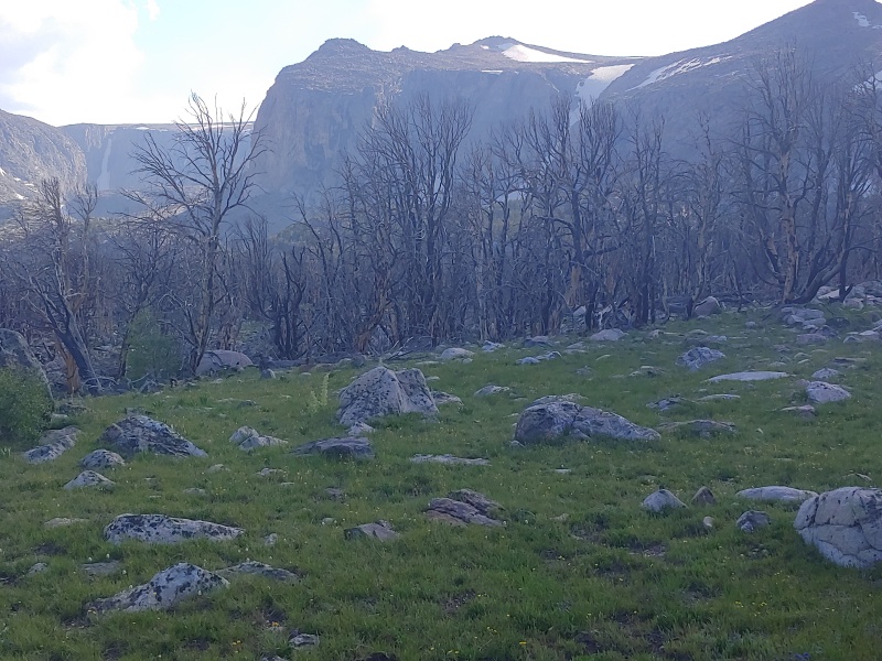
Descending into a burned zone we kept looking on the slopes away from us for evidence of active glaciers. I surmised we were still too low in elevation and pushed on. We arrived at the edges of Double lake, a popular spot for camping in the winds. We met a group of 3 friends who were hanging there for a few days. They didn't plan to push further, just fish and do some casual day hiking. I noticed they seemed to have a lot of creature comforts and wondered how they brought all of that into a wilderness when I met the creatures responsible for carrying said comforts. 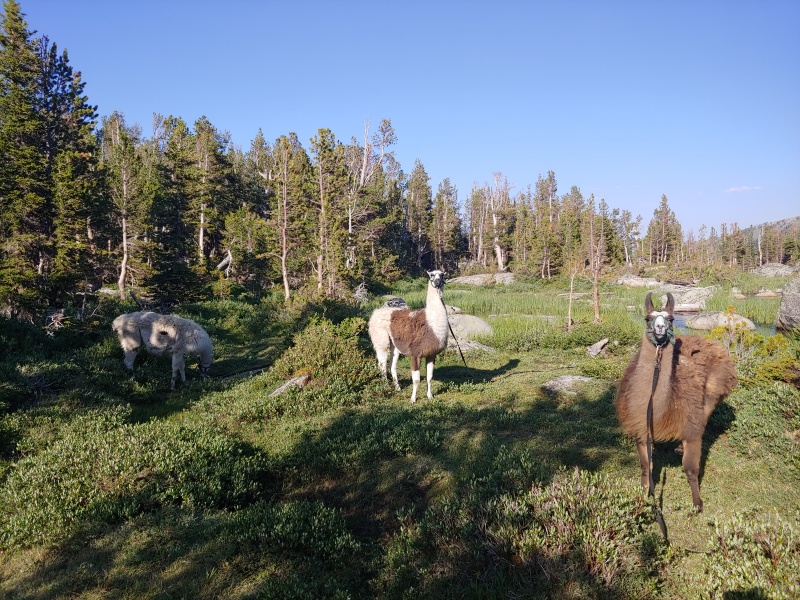
Apparently one can rent a llama, it's a dollar a day a pound, llamas carry 75lbs, and these guys were out a week, and there were 3 of them, doing the math in my head lead me to conclude they were on a much larger budget than I. llamas can eat a lot of the plants which grow in the winds, supplemented by feed pellets, and they also tend to frighten predators away. Considering we were in grizzly country I thought setting up camp near this group was a good idea. I also wondered why a creature which routinely kills elk, deer, moose, and bison would be skittish around a llama, but was too enthralled with my surroundings to ponder further. 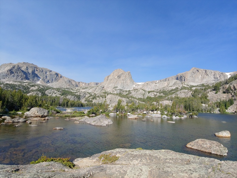
People have said the mosquitoes in the Winds are awful. I'm not sure why. Maybe we get spoiled in Colorado because most of our alpine adventures are outside of mosquito habitats? I would rate them, at least the 1st 2 days, as annoying but not awful. Travis and I cooked dinner on our respective campstoves and turned in as it was gloaming. We did just under 10 miles our 1st afternoon. The next day we had 300 feet to gain and then 1200 to lose before we started gaining again. My feet were really feeling it, already. On our descent to Dinwoody creek we passed 2 people and 5 horses. The rider of one was another highpointer. She had wrenched her knee and was being given a ride out by the people who manned a backcountry camp for people coming in from the Wind River reservation. We wished them well and hoped to have better luck on our ascent. We had yet to talk to anyone who had actually summited and we were curious about the bergschrund and its snow bridge. 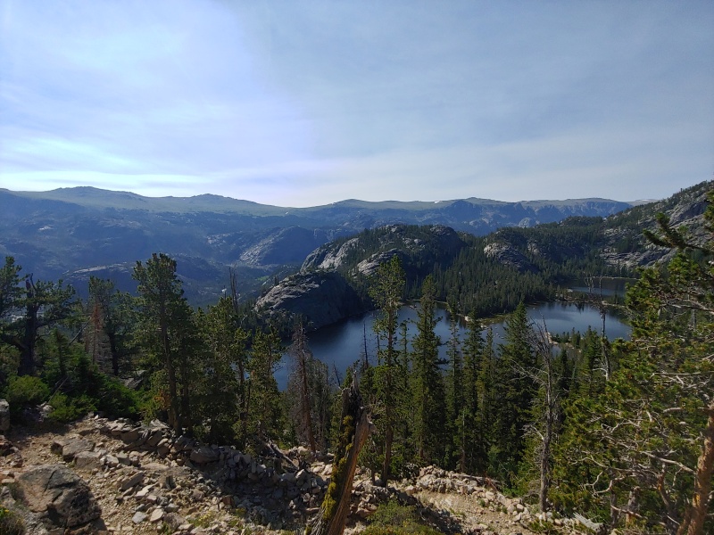
At 9.2k, on the rock edge of the creek the water had a definite light blue tint to it. I had seen it before, up on the slopes of mt Baker in Washington. The glacier moves as its weight is dragged down the slopes, freezing and thawing, growing and melting over the course of hundreds of years. The rocks it moves, through the force of its mass or frozen inside it, are slowly pulverized to silt, finer than beach sand. The sediments in the water diffused blue light and made the stream appear cloudy. We kept moving and started gain. From our low point mid hike of 9.2k and about 13 miles in we had to gain 4.5k and go at least again as far. Midway through the 2nd day we approached a burned bridge set low enough in the water to make me wonder how it ever caught fire. It was the bridge over downs fork. Where the fork and Dinwoody creek meet was not a well defined confluence but little rivulets and pools everywhere. I tested the bridge, went across, and quickly started stepping from log to log to rock in an effort to avoid getting my blistering feet soaked. 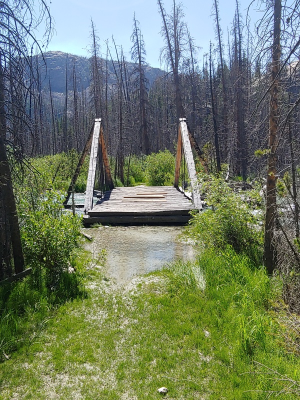
In a meadow before the horse camp we found the soil to be so light colored and sandy it felt more like somewhere in North Carolina than Wyoming. There was a trail close to the lake and another at the edge of the forest. The nearer trail, which we took at 1st, had some fairly sizable creek fords so we bushwhacked across the meadow of mud and puddle pockets to the trail at forest's edge. We later figured the middle trail must be equine only. 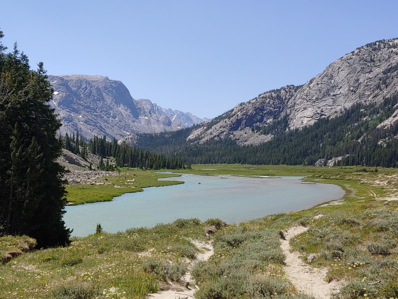
After almost 20 miles of hiking we got our 1st glimpses of the mountain we had come to climb. 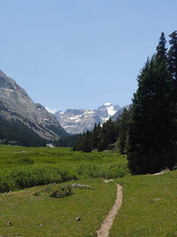
More small streams, fed by summer's melt, were crossed as we started gaining ground in earnest. We popped over treeline in the early evening. We were at about 10.7k, lower than our highest point the day prior, on the hike in. We debated about going further up but decided camping on tundra was preferable to the rock of the terminal moraine. We also encountered a guide from an outfitting service who had been up the day before, scouting for a client. He told us the snow bridge was still in but getting ready to go. We chose to be optimistic about the news. I bathed in the stream and made some dinner. We had agreed to start about 0300 the next morning, or, rather, the middle of the night. The 1st 3 hours of the hike the next day were by far the hardest. We were rock hopping up the moraine, going over one uneven boulder after another. We were route finding by a mix of going up hill, going in the direction to get around a large formation we had seen in photos to the slopes which led to the glacier, and using GPS. Even so, we got briefly off route and wound up at an unoccupied high camp in the moraine. We dropped 50' or so while traversing south. 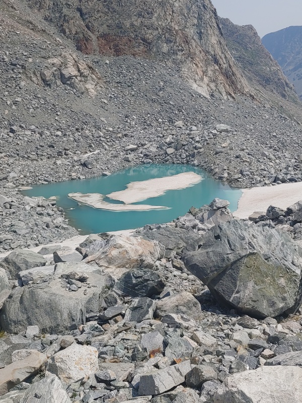
We found some trail segments, or perhaps just the path of least resistance, which brought us to a steep scree slope southeast of Gannett peak and below the Gooseneck Glacier. We carefully worked our way up and were finally on a consistent snow field. 
The snow was gently sloping at 1st and then increasing in steepness. We put on our crampons for the 1st time of the day and gained a couple of hundred feet. 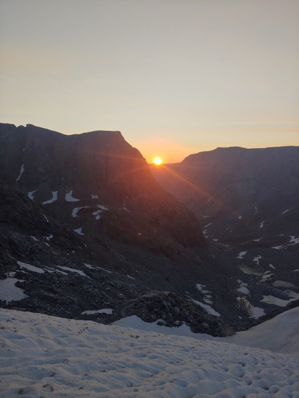
After we gained the top of that sub-rise we noticed the rock up to climbers left was very easy, class 2 slabs with a couple of uneven steps. In higher snow years crapom usage may be continuous but we put our crampons on 3 or 4 times on the way up, and took them off 2 or 3 times. That was a bit tedious. It was gentle snow slopes and then easy talus and then snow walking as we swung underneath a more sheer face towards the bergschrund which had been occupying our thoughts intermittently since we started the hike. 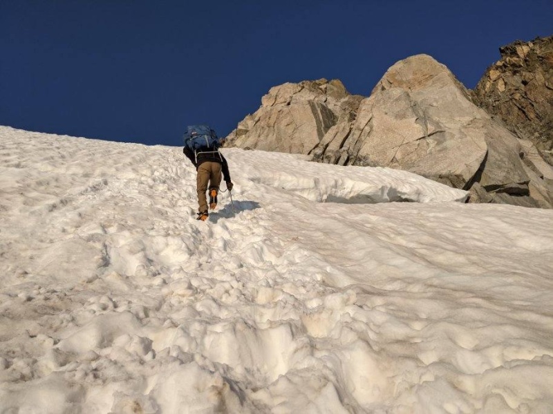
It was steeper than anything we previously hiked, but I don't know that the grade was ever 60%. It reminded me in steepness of the notch variation on Snowmass. There were enough scoops in the snow from sun sculpting and prior hikers that I never felt unsteady. I did not stop on the bridge to take a bergschrund photo, so pardon the pic of my ass as I ascended the last of the glacier. Above that the crampons came off and we didn't put them back on until about 13.5k and the last of the snowy crown atop Gannett's summit plateau. The last couple hundred feet of gain was gentle and easy. If someone were to slip and not stop themselves they would go over an edge but, in my opinion, someone would have to work at doing nothing not to be arrested. We made the summit just after 8 and it was breathtaking. I looked around at the other peaks in the wind rivers, some with visible glaciers cracking their way down the sides. The air seemed hazy so I assumed a fire was to blame. I had cell service for the 1st time in 2 days so I let Erin and my folks know we had made it. 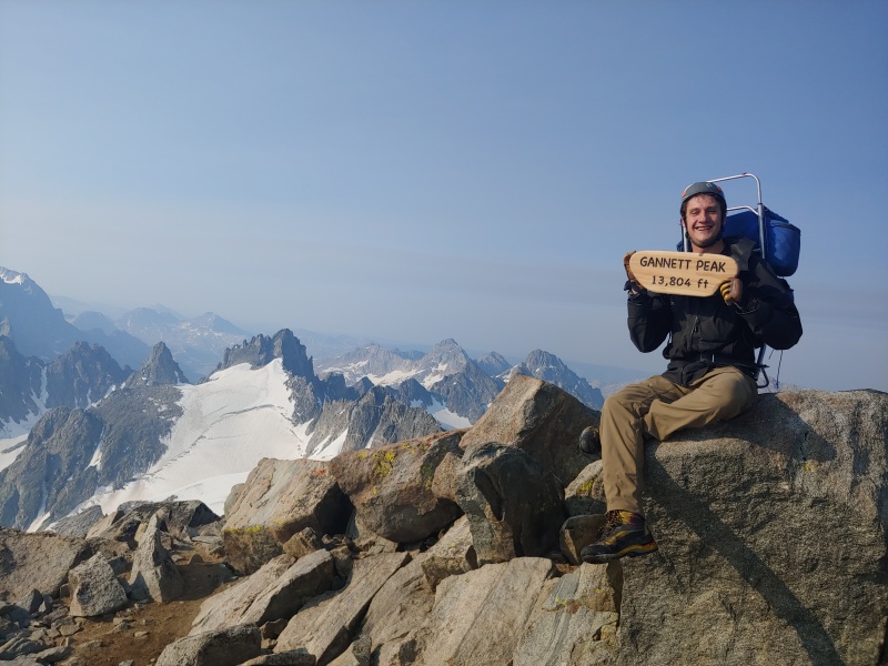
The Winds were so much more jagged than anything we have in Colorado that I have yet to climb. For all their impressive visuals, the trip up Gannett was not too difficult. I would have rated it as a difficult class 2 peak. Ropes weren't required when we went. I think microspikes and an ice axe would have been sufficient. Travis, who had done much more climbing on much more glaciated mountains, agreed. This was a long state high point requiring a lot of effort, a bit of luck, but nothing technical. We started back down, realizing we were only halfway done, wanted to be out by the end of the day tomorrow, and my feet weren't doing so hot. 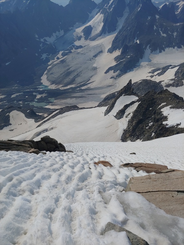
On the way down I took a painkiller, my 2nd of the trip. I was trying to avoid showing how much my feet were hurting. I concentrated on not slipping, on following the same route, and how I was getting more thirsty. We had both finished our water about 1000ft above where we recalled seeing a small stream trickling, so we were trying to get back there. At one point Travis thought we should descend skiers left. I told him that was the formation we hiked around in the early twilight, because it cliffed out. He walked a bit further on his chosen path, and then came back and agreed it did. I think I was better at route finding, but he was better at glacier travel, so our skill complimented each other. We passed what was either old glacial ice covered by rock, or dirt that just look liked ice. There was a boulder which must have weighed hundreds of tons sticking precariously to its side. We were glad to be across a small gully from it, and slightly above it in elevation. When that thing finally goes, everyone on the trail will hear it. 30 minutes later we were back at the stream we had seen. We both filtered and drank a liter when we finally got there, we also noticed a better, almost trail than the one we came up on. I took one last photo of this world of sky and ice and rock before we trudged out the terminal edge and back to where there was dirt and grass. 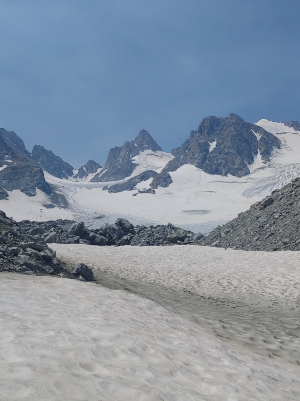
I was hurting when we got back to camp. Travis was concerned because of his work commitments. We discussed leaving me at the tent and him staying Sunday night in Dubois, coming back Monday afternoon to pick me up on our original exit day. I said to give me an hour to air my feet, let the 2nd percocet of the day kick in, and get some food. An hour later I was strapping on my bag, feeling not 100% but ready to grind out some distance. We debated trying to get to the lowest point, or to stop at the horse camp. having been up since before 2 I was tired and elected for the later, though I think Travis wanted to push on. I made mac and cheese and set my alarm for 5. We had another 18+ miles to hike and another 2000ft to gain. The next day we pushed hard, and my feet, despite blister pads, athletic tape, and trying different combinations of socks were quite painful. As an added bonus the mosquitoes were thicker than they were on days 1, 2, or 3. Despite being warm at 9.2k I left my shell layer on and started sweating up 1100ft of gain to get back to double lake. When we stopped for food there, less than 10 miles from the car, I took my shoes and socks off. Travis took one look and said "damn dude! No wonder you're struggling." I took another painkiller and after eating some ramen we pushed on. The air was incredibly thick with smoke and hazy up on arrow pass. I barely had a shadow despite there being not a cloud in the sky. I wasn't smelling smoke, or breathing any in, so the fire must have been very far away, and huge. When we got to the split for a trail to the old down's fork bridge vs the new one, we decided to add a mile, or more, to get over the river without water issues. The astute reader will notice this as foreshadowing. The trail on our side of the river was not very apparent and we started to wonder if we missed the bridge. We saw a large tree fallen over the river and decided to try to cross there. I don't recall which of us was stupid enough to suggest it and which was stupid enough not to protest, but it didn't end well. 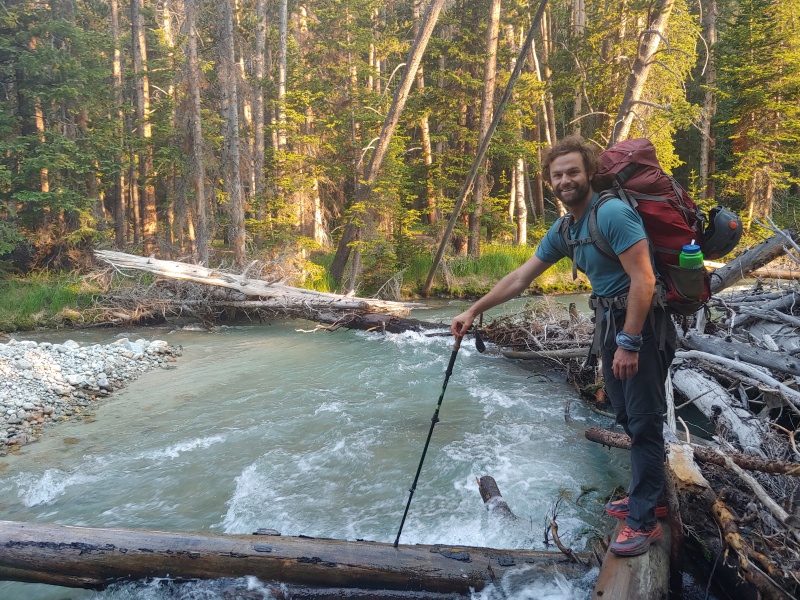
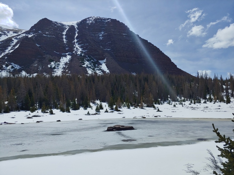
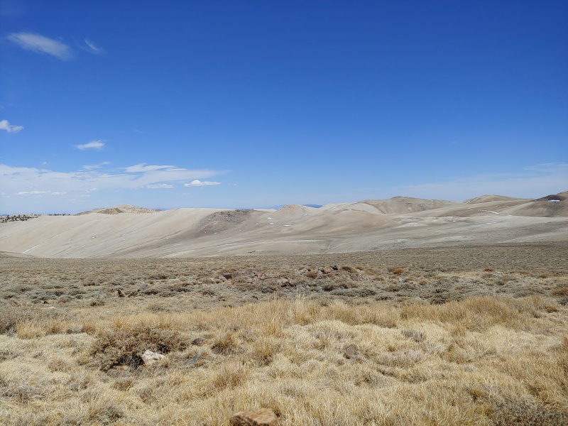
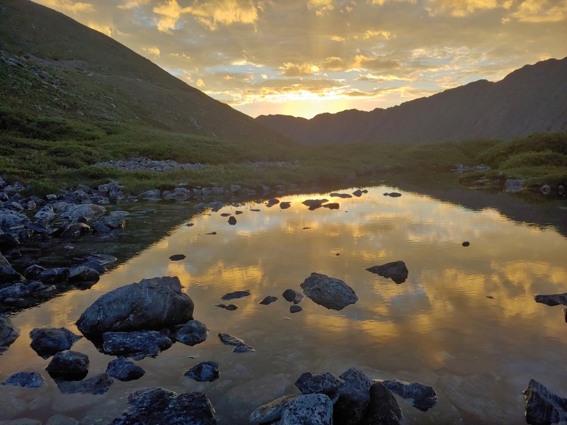
The log was too slick. Travis started to slip and so he jumped in, getting his lower half soaked. I tried to keep my balance and fell, putting most of me, save my head and shoulders and one arm that was grabbing the log, under water. The force of the current on my legs and pack was strong. It took a moment to get my feet under me and stand up. Strangely enough, I don't recall being scared. More of an, 'okay, this is how we'll deal with this issue.' I spend a few minutes being a soaking wet, mildly chilly, feast for mosquitoes as I wrung out my clothes and started hiking again. The trail on this side of the creek was very defined as it was an older, maintained trail to a lake. When we got to the stream and the trees on the trailhead side of arrow pass Travis said he was going to hike on and get to his car and wait there, try to grab a nap since he would be driving his car back to Denver. I took another painkiller and kept moving. Every so often I would stop and wince and shift from one foot to another, trying to get some relief. Self rescue is the best rescue, though it didn't feel like I needed rescuing, just a couple of days off and better shoes! I think I got back to his car about 3. I was hobbling for sure. It was such a relief to pull off my socks and crampon boots and let my feet rest. I had to run for work by the end of the week, and the sore on my ankles were pretty deep. a trip to urgent care and some doxycycline and I was mostly okay by the next weekend. Gannett was the most effort of any high point I had yet done, but the rock and the snow weren't nearly as difficult as I had been led to believe. I think Boundary had harder rock, though much shorter and maybe that was more a function of my mood on the two trips. 2 weeks later Erin and I returned to Kings peak on a 3 day weekend. I took off a tournament that didn't pay much, and with her work schedule she had every other Monday off. We had the same plan: hike to a lake, summit and return to camp, hike out and drive home on day 3. We just had far fewer layers and snow gear! The hike to Kings was still beautiful. It's one of the few high points which would be an all day drive that I'd return to. We saw a few dozen people, but didn't feel crowded, except right after the kings peak spur leaves the Highline trail. A couple of larger groups in a narrower spot caused a bottle neck. The alpine tundra was beautiful, with small streams and snowmelt pools next to wildflowers near 12.5k. I'm at 50 photos right now so I can only leave you with one, it's the same mountain and lake that was in photo #3 of this report. 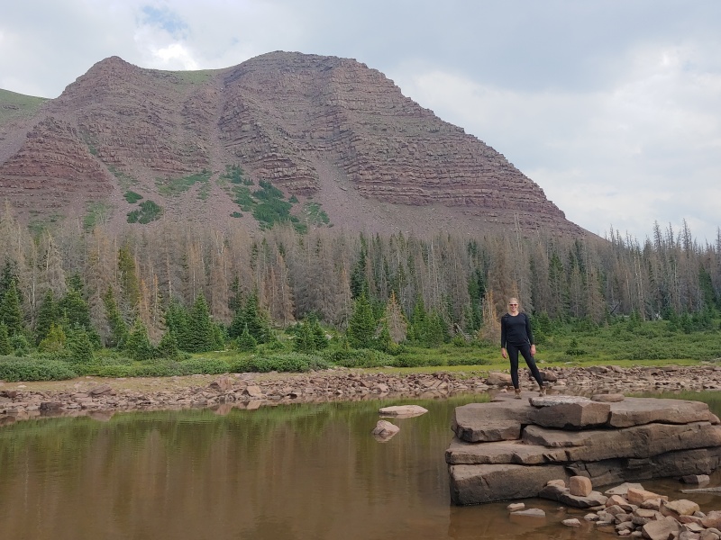
I was grateful to be out on Kings again, to enjoy the summer flowers and weather, and to be with someone special. I won't go through a step by step of the trip. It's along hike, but worth it. I was already planning a fall adventure in New England. To be continued... Thumbnails for uploaded photos (click to open slideshow): ")
")
")
")
")
")
")
")
")
")
")
")
")
")
")
")
")
")
")
")
")
")
")
")
")
")
")
")
")
")
")
")
")
")
")
")
")
")
")
")
")
")
")
")
")
")
")
")
")
")
|
| Comments or Questions | ||||||
|---|---|---|---|---|---|---|
|
Caution: The information contained in this report may not be accurate and should not be the only resource used in preparation for your climb. Failure to have the necessary experience, physical conditioning, supplies or equipment can result in injury or death. 14ers.com and the author(s) of this report provide no warranties, either express or implied, that the information provided is accurate or reliable. By using the information provided, you agree to indemnify and hold harmless 14ers.com and the report author(s) with respect to any claims and demands against them, including any attorney fees and expenses. Please read the 14ers.com Safety and Disclaimer pages for more information.
Please respect private property: 14ers.com supports the rights of private landowners to determine how and by whom their land will be used. In Colorado, it is your responsibility to determine if land is private and to obtain the appropriate permission before entering the property.


