| Report Type | Full |
| Peak(s) | |
| Date Posted | 12/02/2021 |
| Date Climbed | 08/14/2021 |
| Author | IntrepidXJ |
| Carved from Calf Creek Plateau: Powderhorn Lakes |
|---|
|
An Introduction to the Powderhorn Wilderness & Cannibal Point On Friday Diane finished another semester of school and finally had a full week off before she starts back up again. We had made plans to spend a couple of days in the Wind Rivers later in the week, but since she hasn’t been able to get out hiking much lately we thought it would be a good idea to get out on a quick overnight backpacking trip this weekend. As I looked over my maps of the San Juan Mountains for an easier overnight trip that wouldn’t be too far away from home, I thought it would be interesting to finally check out the Powderhorn Wilderness near Lake City with a hike up to the Powderhorn Lakes. The Powderhorn Wilderness is jointly managed by the BLM and the Gunnison National Forest and contains two huge plateaus over 12,000ft that make up the largest relatively flat expanse of alpine tundra in the lower 48 states, and I hoped to hike to the highpoint of the Calf Creek Plateau while we were up there. I also figured this area wouldn’t be very busy since it’s not a popular spot with the kind of high rugged peaks that seem to attract people. We left home early on Saturday morning and made our way over to the Powderhorn Lakes Trailhead at the end of the Indian Creek Road. We made sure we had everything we needed in our packs and were on the trail by 10:00am. Thankfully, there was much less smoke in the air today than there has been around the area lately. Diane was happy to forget about school this weekend and was ready to start hiking up the Powderhorn Lakes Trail.
Hiking around the lower lake as we made our way to the larger upper lake.
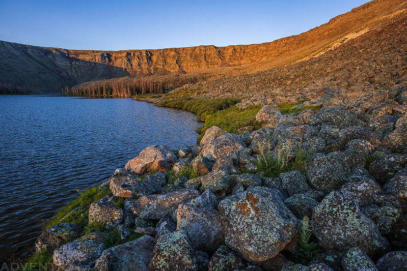
We found a nice campsite not far from the outlet of the upper lake and got our tent setup.
After resting in camp for a little bit I got started on my climb to the top of the Calf Creek Plateau. As I neared the top I got my first views of the La Garita Mountains to the southeast.
There was a steep grassy slope that made hiking to the top of the plateau easy enough.
Looking down the West Fork of Powderhorn Creek.
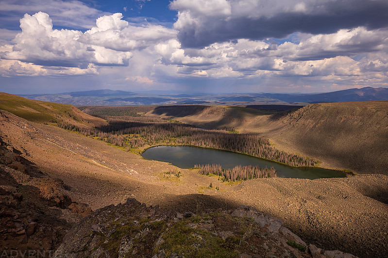
Here’s a view over Upper Powderhorn Lake with Stewart Peak and San Luis Peak on the horizon.
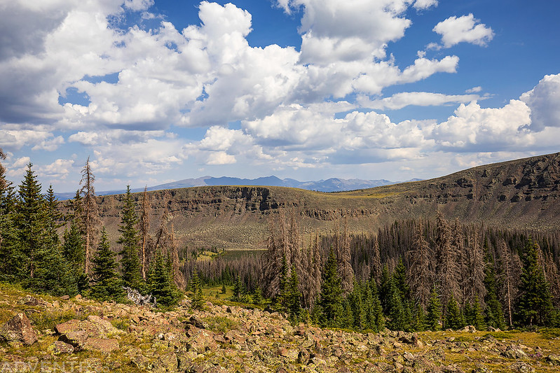
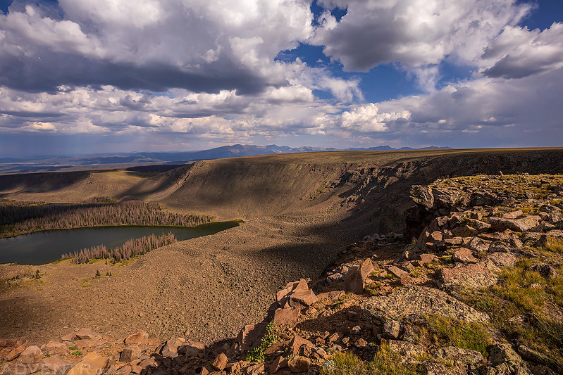
I kept close to the edge as I walked around this huge glacial-chiseled cirque beneath the eastern edge of the Calf Creek Plateau.
Following The Edge
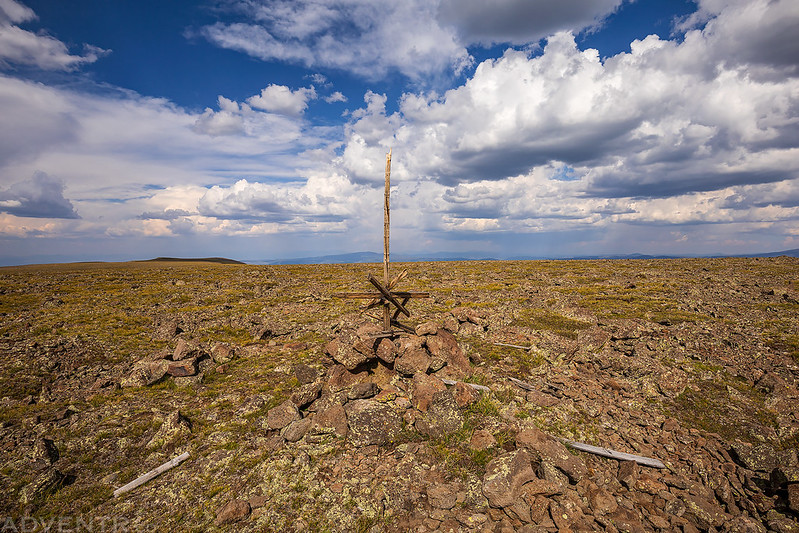
Once on top of the plateau the hike was relatively flat as I made my way to the highest point, which is labeled Cannibal Benchmark on the map. I find it strange that the Cannibal Benchmark is located on the Calf Creek Plateau instead of on the Cannibal Plateau which is the large plateau located to the southwest of here?
To the west I could see Uncompahgre Peak– the giant of the San Juan Mountains.
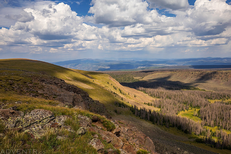
Headed back across the Calf Creek Plateau. Even though the top of the plateau was pretty flat, the hiking wasn’t always easy because of all the rocks and boulders along the way.
I returned to the edge of the cirque to take a few more photos of the Powderhorn Lakes on my way back.
Following The Ridge Back
Powderhorn Lakes & La Garita Mountains
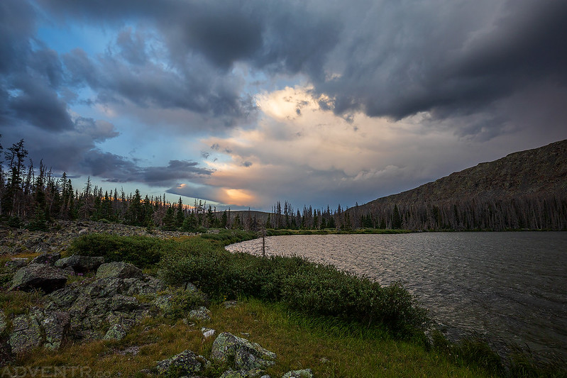
Storm clouds started moving into the area shortly after I returned to camp. We had our dinner and then I spent the rest of the evening relaxing and taking photos along the shore. There were a few distant rumbles of thunder and some light rain and even a little graupel. Dark Clouds Reflected
Powderhorn Lakeshore
An Evening at the Powderhorn Lakes
For a brief few moments there was a little color in the sky, but it didn’t stick around for long.
As soon as it started getting dark out I thought the storms were going to be over for the night, but unfortunately they were just beginning! There was a lot of lightning and thunder to the north of us that I thought was going to stay that way and pass us, but as we tried to get to sleep the storm got closer and closer. Pretty soon it was right on top of us and lasted for about an hour and a half. There were some very close lightning strikes with instantaneous thunder, and I’m assuming they stuck the ridge or the top of the plateau above us, but I didn’t get out of our tent to find out. I’m not going to lie, it was probably the scariest experience I have had camping in the wilderness. I am usually pretty good at planning trips around the weather forecast to avoid these situations, but in this case the forecast was completely wrong. Once the storm had finally passed we were able to get to sleep while it rained on and off for the rest of the night. Our campsite on Sunday morning after the storm. Thankfully, none of the nearby lightning strikes ignited the mostly dead forest of trees around the lakes that we were camped in.
Rocky Shore Morning
Once the sun was up, we packed up camp and started hiking back down to the trailhead.
We passed by the Lower Powderhorn Lake again.
I also stopped for a quick photo of Hidden Lake along the trail.
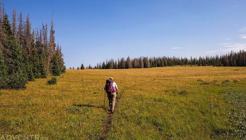
Most of the trail is in the trees, but there is one large meadow crossing that offers some open views.
I hiked up to the top of the meadow for a view over the edge.
Leaving the Powderhorn Wilderness and heading back home.
>> Powderhorn Lakes Photo Gallery |
| Comments or Questions |
|---|
|
|
Caution: The information contained in this report may not be accurate and should not be the only resource used in preparation for your climb. Failure to have the necessary experience, physical conditioning, supplies or equipment can result in injury or death. 14ers.com and the author(s) of this report provide no warranties, either express or implied, that the information provided is accurate or reliable. By using the information provided, you agree to indemnify and hold harmless 14ers.com and the report author(s) with respect to any claims and demands against them, including any attorney fees and expenses. Please read the 14ers.com Safety and Disclaimer pages for more information.
Please respect private property: 14ers.com supports the rights of private landowners to determine how and by whom their land will be used. In Colorado, it is your responsibility to determine if land is private and to obtain the appropriate permission before entering the property.