Download Agreement, Release, and Acknowledgement of Risk:
You (the person requesting this file download) fully understand mountain climbing ("Activity") involves risks and dangers of serious bodily injury, including permanent disability, paralysis, and death ("Risks") and you fully accept and assume all such risks and all responsibility for losses, costs, and damages you incur as a result of your participation in this Activity.
You acknowledge that information in the file you have chosen to download may not be accurate and may contain errors. You agree to assume all risks when using this information and agree to release and discharge 14ers.com, 14ers Inc. and the author(s) of such information (collectively, the "Released Parties").
You hereby discharge the Released Parties from all damages, actions, claims and liabilities of any nature, specifically including, but not limited to, damages, actions, claims and liabilities arising from or related to the negligence of the Released Parties. You further agree to indemnify, hold harmless and defend 14ers.com, 14ers Inc. and each of the other Released Parties from and against any loss, damage, liability and expense, including costs and attorney fees, incurred by 14ers.com, 14ers Inc. or any of the other Released Parties as a result of you using information provided on the 14ers.com or 14ers Inc. websites.
You have read this agreement, fully understand its terms and intend it to be a complete and unconditional release of all liability to the greatest extent allowed by law and agree that if any portion of this agreement is held to be invalid the balance, notwithstanding, shall continue in full force and effect.
By clicking "OK" you agree to these terms. If you DO NOT agree, click "Cancel"...
Date: Sunday, October 31, 2021 Route: Southwest Ridge from Cordova Pass (West TH) Stats: ~7 miles l 2,680' gain l 5.75 hrs RT
It's been a hot minute (actually a long and arduous 7 years) since I've written a trip report for this site, so bear with my rustiness. West Spanish Peak has been one of those intriguing peaks higher up on my priority list for some time now. With a great weather forecast, I left Saturday afternoon and camped at a pull-off along the side of CR 46. My friend Kristin and her 12 lb. Jack Russell Terrier (Swayze) met me at the West Trailhead just after 7am and we were on trail at 7:20am.
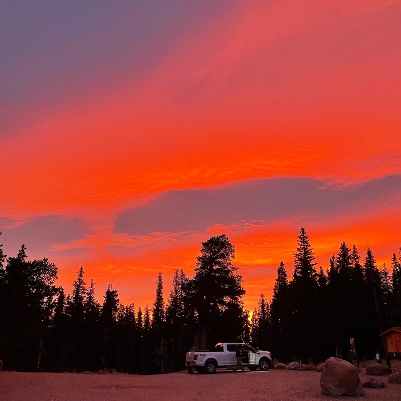
Starting the morning off with a fiery sunrise, Sangre-style. Someone spilled some paint:
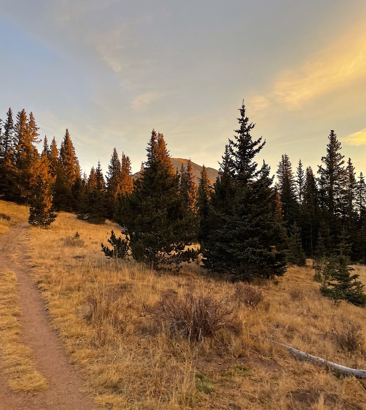
Following the Class 1 trail through the first meadow opening, West Spanish begins to reveal herself:
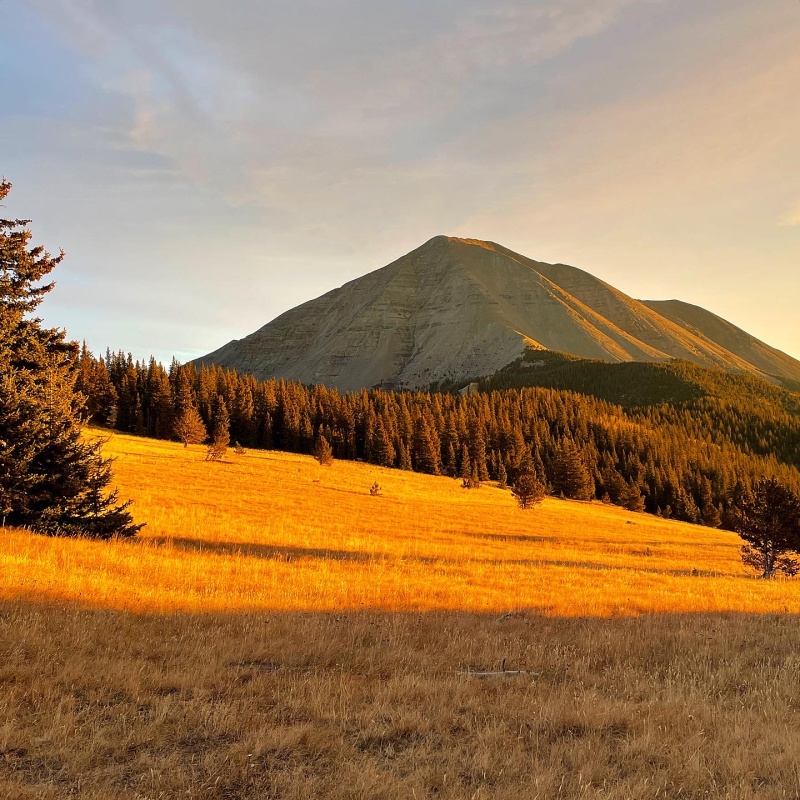
West Spanish in all of her morning glory comes into solid view as we cross the second meadow:
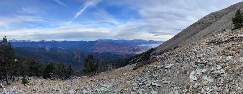
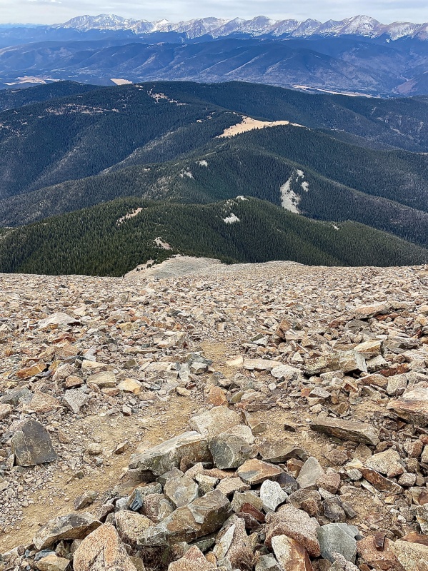
We were back in the trees for awhile following several switchbacks up the nice trail. A few spots on this section gave wonderful views of the Blanca Massif and Culebra Range. After leaving tree line the trails gets pretty steep pretty quickly, and is certainly showered with loose scree and talus in many areas, just as the other trip reports have stated.
Pano from the final switchback at 11,800' as we exit timberline; the awfully dry Blanca Massif is pictured in center.
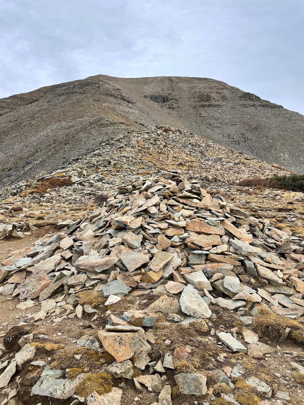
Taken near 11,900', it's impossible to miss the giant cairn in front of you. From here, the SW Ridge doesn't appear as steep as it truly is:
Looking back down the steep ridge from ~13,500'. The Culebra Range looms behind:
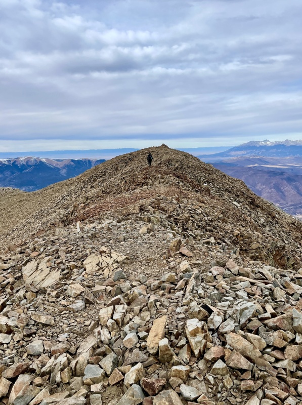
There definitely is a trail all the way to the summit with cairns, albeit faint in several places. I'll echo what other trip reports say to stay climbers left along the ridge when possible. Near 13,400', the steep grade lessens a little bit as you approach a small landing at ~13,500'. We reached the false summit (which has the summit cairn) just under 3 hours at 10:15am. The true summit is just a few minutes east of there and after a photo there, we went back for some wind protection at the false summit cairn.
The remaining route to the summit (false summit seen here) from ~13,500':
Kristin walking back to the false summit (taken from the true summit looking west). Blanca Group off to the distant right:
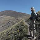
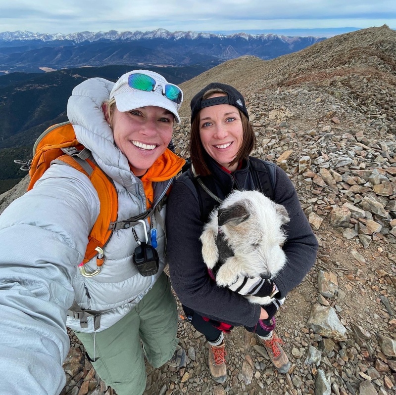
Kristin, Swayze (who was the star of the show), and I on the summit:
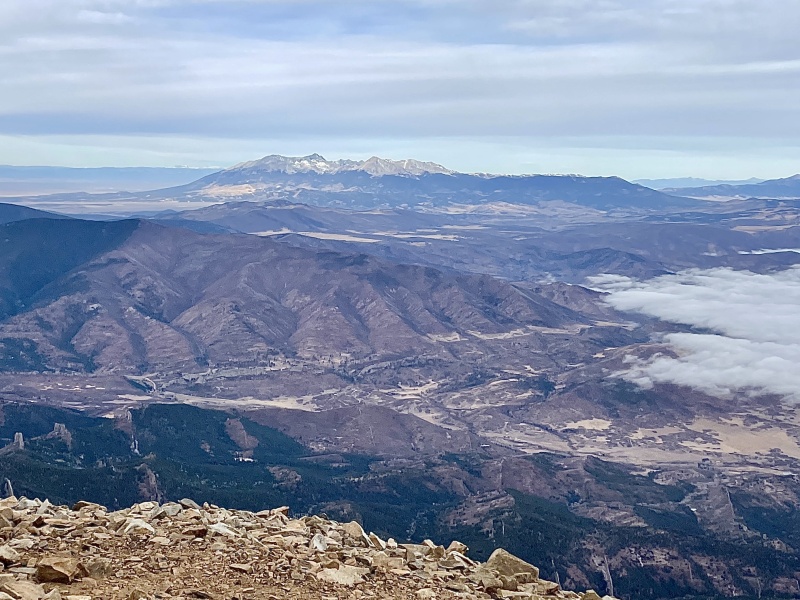
A closer look at the Blanca Group:
After a short 15-minute summit break, we started back down at 10:30am and made it back to the cars in 2.5 hours at 1:00pm. What an awesome fall day to spend in the beautifully unique Spanish Peaks Wilderness!
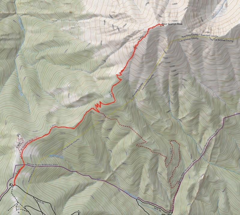
Topo of the route:
My GPS Tracks on Google Maps (made from a .GPX file upload):
..thanks for your report and photos...living in FL , I don't get out there enough..I camped at Puratory camp ground this June , but weather did not allow summit bid..
I cried as I read your story from the external link. I fell and endured recovery from a compound complex fracture. Now I'm working through knee replacement. I'm not going to complain one bit after reading what you experienced. So sorry for all your pain and here's praying it's all behind you.
Welcome back Caroline! So glad to see that your knee recovery has progressed and that God has given you healing and the opportunity climb these glorious mountains again. Woohoo! I celebrate with you!
That's not an easy peak for the knees. The summit is worth it, but it's sure a steep, unrelenting adversary. It was a peak I had wanted to get ever since I started getting summits back in 2007, I'm glad I got it under my belt. Looks like you did get a great weather day to get out there and grab the bull by the horns. Nicely done.
Hey Caroline, nice to see you active again and cool report. I was planning on the Spanish Peaks and a few others before Covid hit. Hope to put a dent in my still sad 13er list in 2022. Hope to see you out there!
I haven't logged in in years, nor written anything for a decade. But, I always lurk and it's just wonderful to see you sharing here again. The community built here during the mid-2000s went through a lot together and I always appreciated that time. Thank you for sharing!
I am very happy for you to be able to get back on the mountains and what has helped you get back. may you continue to find solace and joy in them. inspirational for the rest of us, thank you for sharing
Caution: The information contained in this report may not be accurate and should not be the only resource used in preparation for your climb. Failure to have the necessary experience, physical conditioning, supplies or equipment can result in injury or death. 14ers.com and the author(s) of this report provide no warranties, either express or implied, that the information provided is accurate or reliable. By using the information provided, you agree to indemnify and hold harmless 14ers.com and the report author(s) with respect to any claims and demands against them, including any attorney fees and expenses. Please read the 14ers.com Safety and Disclaimer pages for more information.
Please respect private property: 14ers.com supports the rights of private landowners to determine how and by whom their land will be used. In Colorado, it is your responsibility to determine if land is private and to obtain the appropriate permission before entering the property.

")
")
")
")
")
")
")
")
")
")
")