Download Agreement, Release, and Acknowledgement of Risk:
You (the person requesting this file download) fully understand mountain climbing ("Activity") involves risks and dangers of serious bodily injury, including permanent disability, paralysis, and death ("Risks") and you fully accept and assume all such risks and all responsibility for losses, costs, and damages you incur as a result of your participation in this Activity.
You acknowledge that information in the file you have chosen to download may not be accurate and may contain errors. You agree to assume all risks when using this information and agree to release and discharge 14ers.com, 14ers Inc. and the author(s) of such information (collectively, the "Released Parties").
You hereby discharge the Released Parties from all damages, actions, claims and liabilities of any nature, specifically including, but not limited to, damages, actions, claims and liabilities arising from or related to the negligence of the Released Parties. You further agree to indemnify, hold harmless and defend 14ers.com, 14ers Inc. and each of the other Released Parties from and against any loss, damage, liability and expense, including costs and attorney fees, incurred by 14ers.com, 14ers Inc. or any of the other Released Parties as a result of you using information provided on the 14ers.com or 14ers Inc. websites.
You have read this agreement, fully understand its terms and intend it to be a complete and unconditional release of all liability to the greatest extent allowed by law and agree that if any portion of this agreement is held to be invalid the balance, notwithstanding, shall continue in full force and effect.
By clicking "OK" you agree to these terms. If you DO NOT agree, click "Cancel"...
Texas Top Ten Finish on Shumard and Guadalupe Peaks
I enjoy the mountains more in good weather. Although I have a few winter ascents, the physical challenges of winter can detract from the simple joy and exhilaration of climbing, especially when icy wind gusts are knocking you off balance and penetrating deep through the multiple layers of your winter gear. This presents a challenge for staying mountain fit. Knowing the 14er adage, “the best way to get in shape for climbing mountains is to climb mountains,” how to stay fit in the off-season? My solution has been to climb further south where mountains have warmer weather and lower summit elevations, including many beautiful summits in Arizona, Utah, Nevada, New Mexico, Texas, and Southern California. But, as with many peak-baggers, life seems more interesting when you are working on a “list.” So I decided to climb the ten highest peaks in Texas.
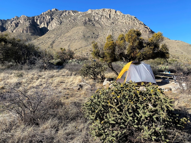
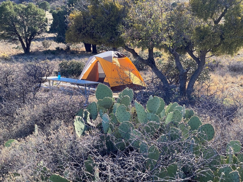
El Capitan in dawn light, seen from the road near the entrance to Guadalupe National ParkNo lodging in park other than Pine Springs Campground. Site #1 is my favorite, most private if you don't mind lugging your tent a few extra yardsCholla cactus south of tent, prickly pear to north. Watch out when you get up to pee at night, or you may do some serious damage.
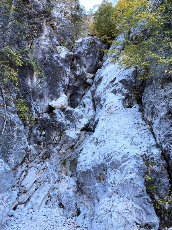
Climbing the high peaks of Texas is not a common objective. Only five of the ten peaks have trails to their summit. The summit register on Shumard Peak indicates that only six to eight parties reach the summit each year. I can understand why. The challenge is not mileage or vertical gain, but bushwhacking and route-finding. I bushwhacked more on my ascent of Shumard than on any of the Colorado 14ers or Centennial 13ers. The campground hosts at Guadalupe National Park’s Pine Springs Campground told me that the park administration has decided to remove all summit registers from the park, but hadn’t yet found an employee willing to go up Shumard to retrieve its register.
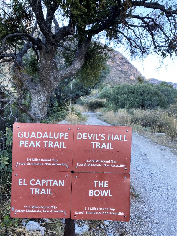
Seven of Texas’ ten highest peaks are in Guadalupe NP, including Shumard Peak, #3 at 8,615 ft. Based on trip reports, climbers reach the summit on two different routes. The first route follows a trail to Guadalupe Peak, the state highpoint, and then traverses a ridgeline to Shumard. The second route begins on the Devil’s Hall trail, continues up Pine Springs Canyon through the Devils Hall, and then ascends out of the canyon in a 2+ mile bushwhack to the summit (The description on Summitpost.com suggests a route up the Bush Mountain trail, but this trail ascends rapidly on the east side of Pine Springs Canyon, and would require a major loss of elevation. I didn’t find any trip reports that reached the summit this way so am skeptical of the route). The primary advantage of the first route is that the first 4 miles to Guadalupe Peak are on a Class 1 trail. The bushwhack on the ridge from Guadalupe is a little shorter than the bushwhack on the alternative route, and the higher ridge has less underbrush to whack. Also, route-finding is easier on the ridge route. The major disadvantage is that the route descends about 900 feet between Guadalupe and Shumard, which would add about 1800 vertical feet round-trip. The main route-finding issue on the lower route is finding an exit from Pine Springs Canyon, which is very steep in some places.
To assess both routes, I decided to ascend via the Devils Hall trail, then return via the ridge to Guadalupe Peak. Even after this trip, I don’t have a strong preference for either route. But if forced to make a recommendation I’d chose the Devil’s Hall trail. A GPS track from a report by Zack Lewis on Peakbagger.com helped me find a workable exit from Pine Springs Canyon.
Trailhead
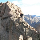
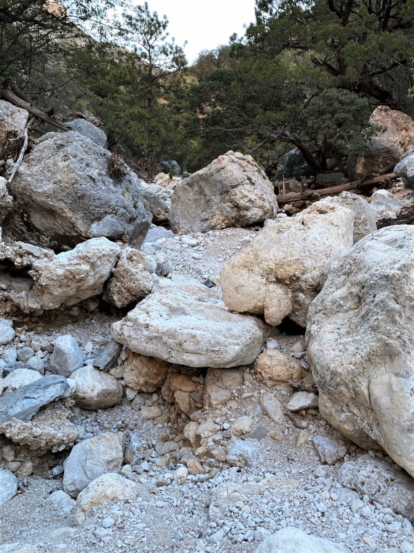
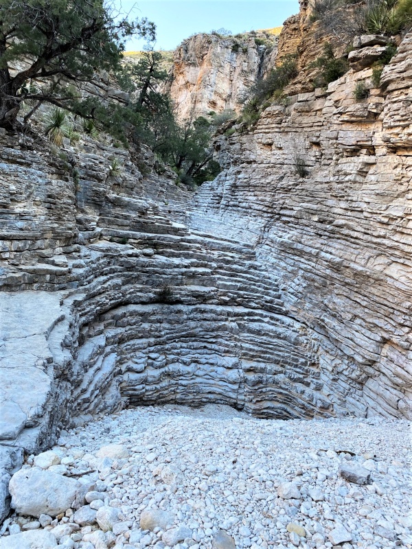
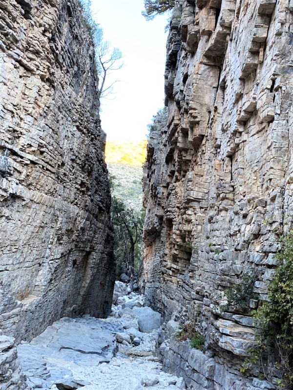
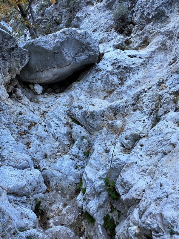
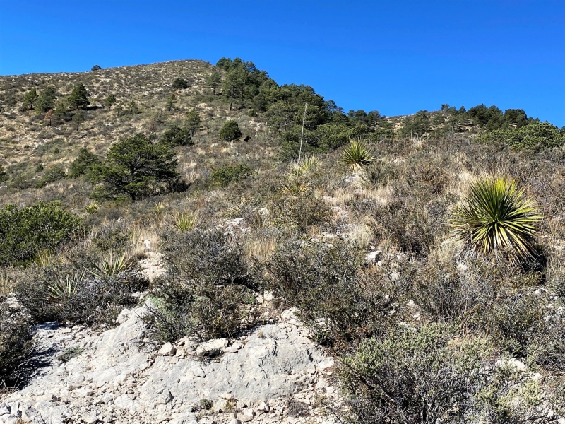
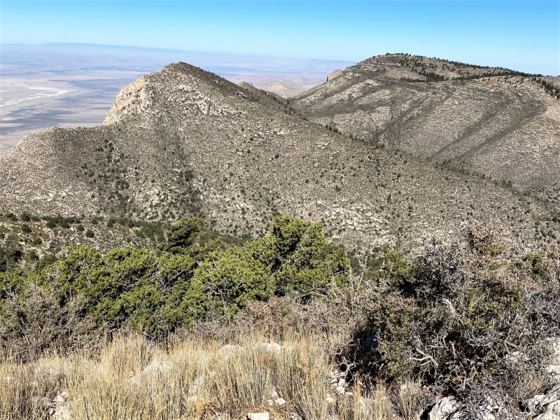
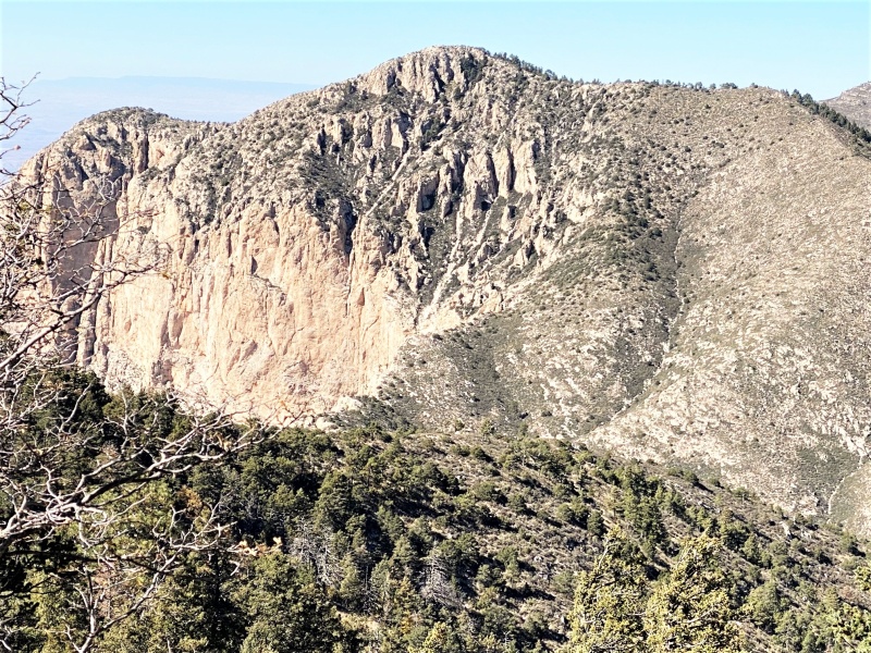
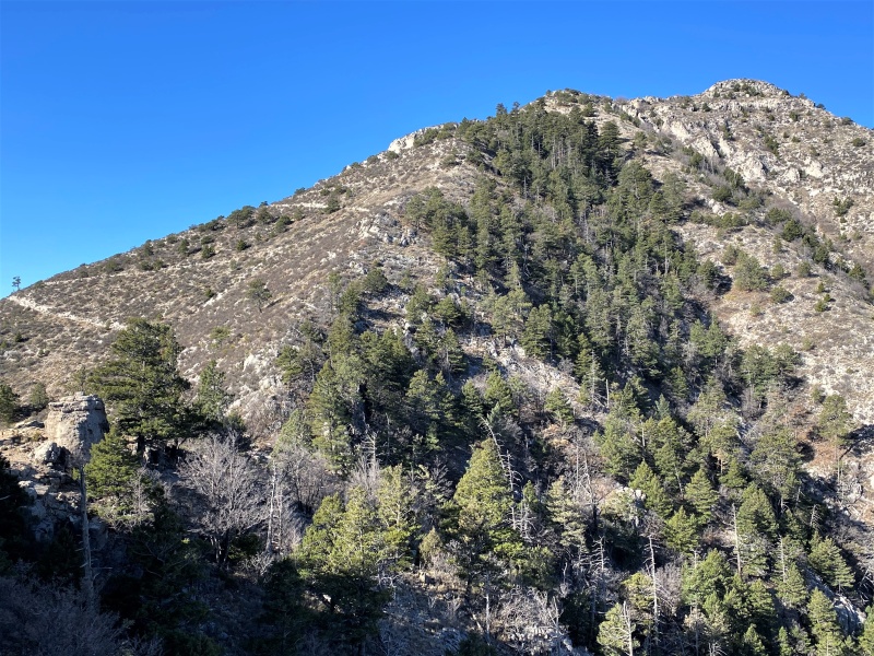
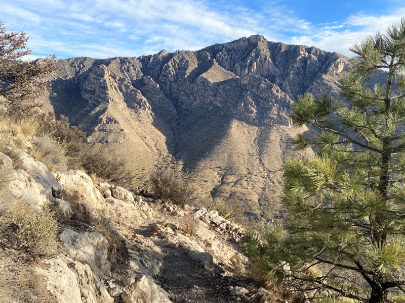
The trail starts at the north end of the parking lot. Follow signs for the Devil’s Hall trail, which gets more interesting about a mile in. The canyon floor is flat and rocky in some places but also requires substantial boulder hopping. The toughest section of the route is the climb from the canyon up to Shumard’s southeast ridge. No way to avoid steep bushwhacking through scrub oak, sagebrush, and pinon pine. I highly recommend avoiding cactus-bashing in the agave and prickly pear. Fearing the worse, I wore old pants and crocodile gaiters, but the underbrush was not as thorny as on a previous hike to Mt. Pratt in another section of the park. The underbrush becomes thinner higher on the ridge, so the hiking becomes easier. The summit offers nice views of the three other high Texas peaks, Guadalupe (#1), Bartlett (#4), and Bush (#2). Great to have a calm bluebird day.
Need to scramble over boulders along the trailInteresting formation in canyonDevil's Hall, don't try to ascend out of the canyon hereClass 3 section of Pine Springs Canyon above the hallToo tough for this geezer, I reversed course here to find exit from canyon Final ridge to summit, easy now that vegetation has thinnedSummit View north toward Bartlett Peak (center left) and Bush Mountain (center right)
The ridge to Guadalupe Peak requires some serious bushwhacking, the worse is through some dense scrub oaks. My final ascent to the summit required slipping through some steep scree and one class 3 move. From the Guadalupe summit, an easy 4.2 mile class 1 trail takes you back to the trailhead.
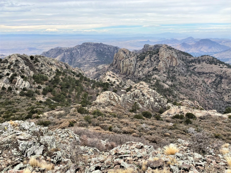
View of Shumard from ridge to GuadalupeView north from Guadalupe SummitLooking back toward Guadalupe summit from trail, see switchbacks on leftHunter Peak from Guadalupe trail
Summary observations of the Texas-10 for potential climbers (from easy to difficult):
The peaks are spread over three ranges, the Guadalupes (7 peaks), the Davis mountains (2 peaks, nearest town is Fort Davis), and the Chisos Mountains (1 peak) in Great Bend National Park.
The easiest peak is Mount Livermore in the Davis Mountains (#5 in elevation at 8,378’, aka Baldy Peak). The shortest route is only 6 miles round trip and 2000 ft. vertical. A more scenic route that leaves the Jeep trail is a little longer. There is a short class 2+ section near the summit, just watch where you reach or you might grab a cactus. A complication of hiking this peak is that it is on private land, owned by the Nature Conservancy. Pre-pandemic they opened the property to hikers several weekends per year, sometimes for day-hikes, sometimes for overnight camping. They ended this practice for 18 months during the pandemic, but allowed entry again in October 2021. No future open dates are shown on their website as of this writing.
Next is Hunter Mountain in the Guadalupes (#6 at 8,368’). There are two routes up the mountain, the Bear Canyon Trail and the Bush Mountain Trail, together they make a nice loop from the main parking area, about 9 miles round-trip and 2500 ft. vertical.
The state highpoint Guadalupe Peak (8,751’) is marginally more difficult than Hunter, though I’m not sure everyone would notice the difference, similar mileage and less than 400 ft. difference in vertical. The trail to Guadalupe is the most popular in the park, on other trails I’ve seldom seen more than a single hiker, often none.
Bush Mountain (#2 at 8631’) is over 100 feet lower than Guadalupe but has a longer Class 1 trail that goes up and down enough to add significantly to the total vertical ascent. From trip reports and my own GPS I estimate about 15 miles round trip and 4000’ vertical.
The trail to Emory Peak (#10 at 7,824’) in the Chisos Mountains is only 9 miles round-trip and 2340’ vertical, but the final summit block requires some class 3 scrambling. I climbed this twice in the 1980’s but my memory of it is a little sketchy. I read a trip report that claims 60 ft. of class 3. In my memory the class 3 section is shorter, but who trusts the 35 year-old memory of a septuagenarian. If you don’t like class 3, this one is more difficult than some of the following peaks.
None of the remaining peaks have trails to the summit, but Peak 7916 (#9) in the Guadalupes does not require much bushwhacking and is the easiest of those without summit trails. My GPS logged 11 miles and 2300 vertical feet, which included a short detour to unranked Lost Peak.
Bartlett Peak (#4 at 8,508’) is close to Bush Mountain in the Guadalupes. As many others have done, I climbed them both on a day hike. Although the prominence of Bartlett is only 427 feet, the easiest route from the Bush Mountain trail goes below the saddle so adds about 1000 vertical feet to the round-trip. I estimate the Bush/Bartlett combination at 16 miles and 5000 vertical feet.
Mt. Pratt (#7 at 8,342’, aka Peak 8342) is in the Guadalupes, but farther east than the other high peaks. Take the Bear Canyon Trail to the Juniper Bowl Trail and continue north until it turns sharply to the west. Leave the trail here and bushwhack to the north-northeast. The route bushwhacks for about 1.5 miles to the summit and has much thorny underbrush. I highly recommend gaiters. There are several rounded hills to the northeast, so study a topo map to make sure you tag the right one. There is no marker on the summit, and this peak doesn’t even show up on the Guadalupe NP brochure map.
Mescalero Mountain (#8 at 8040’, aka Peak 8040) is in the Davis Mountains, about a mile west of Mount Livermore. Follow the Mount Livermore trail to the west side of its summit block. Drop down to the west to find a fence line and follow it west toward Mescalero. The east face you are approaching is cliffy, so climb to a saddle left (south) of the summit, and circle around to the west. I wasted some time trying to navigate a class 4+ move on the west side. Don’t waste your time, continue traversing upwards clockwise around the summit and find a nice class 2 route. My GPS recorded 8.4 miles and 3100’ vertical on this route. I’ve heard reports of rattlesnakes both in this area and the Guadalupes but haven’t seen any yet. I like to think that my gaiters provide some protection, but always try to watch ahead when I’m bushwhacking.
Shumard Peak (#3 at 8,615’) in the Guadalupes is definitely the most difficult, but still an interesting climb. I finally made the summit on the 4th attempt, the loop route was about 11 miles round-trip with 3900 feet of elevation gain. I turned back twice at the summit of Guadalupe because of strong winds, and once from the Devil’s Hall route because of dense fog.
View of Mescalero Mountain from the summit of Mount Livermore
Final Note: I obtained my peak list from Wikipedia:
This list shows El Capitan Peak in the Guadalupes as unranked, with a prominence of 285’. Lists of John shows this peak ranked with 305’ prominence, which would make it #8 at 8,085 feet, which bumps Emory off the list. It’s accessible from the Guadalupe Peak trail and looks like a bushwhacking nightmare. Can’t wait to go back.
Thumbnails for uploaded photos (click to open slideshow):
seeing "non-traditional" TRs on here! Gorgeous pictures, makes me want to go back...I've done Guadalupe, raced nasty weather up Livermore, and had a fantastically beautiful day on Emory breaking through an undercast of clouds to see the Chisos Basin peaks rising out of the mist around me. Some fond memories out this way for sure. Chinati Peak is a perennial objective...
Mike, I climbed my first two Texas peaks on a road trip with a friend back in the late 1980s, Guadalupe and Emory Peak. Didn't climb any others until December 2018 when I tagged Mount Livermore on one of the Davis Mountains "open days." That's about when I started making a more serious effort to do some winter climbs to keep from deteriorating too much in the off-season, so began to think about the Texas ten. I chipped away at some others over the next year-and-a half, did my 8th (Mescalero) and 9th (Pratt) in March 2020, just before the pandemic started. Subsequently had 3 failed attempts on Shumard because of bad weather, so very satisfying to finally finish. I'd like to continue on down the Texas list, but many in the 11-20 range are in the Davis mountains, hope they start opening up more frequently again. Another challenge is Chinati Peak, which is in a Texas state park that is currently closed to the public.
I've hiked 3 of those peaks, including Guadalupe in June. That was a stupid and very hot mistake.
Was just in the Davis mountains a couple months ago, wanted to get Livermore but couldn't because they still had it closed.
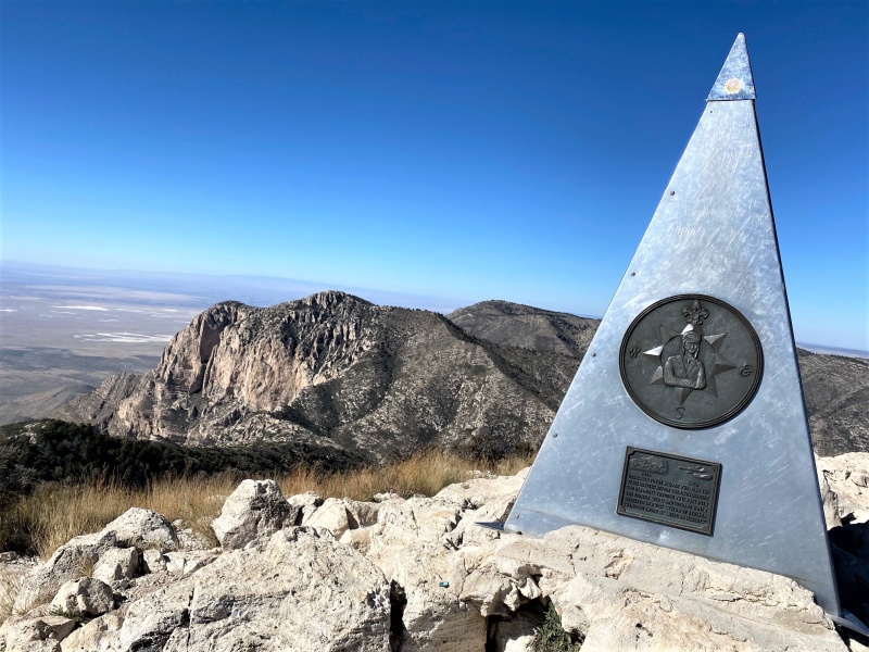
The summit monument looks like centennial anniversary of something, has dates 1858 and 1958. Text states: 'Dedicated to the airmen who, like the stage drivers before them, challenged the elements through this pass with the pioneer spirit and courage which resulted in a vast system of airline transport known as "American Airlines."'' Guess we know who paid for the monument.
Way to go John. Sounds like it was quite the adventure. I enjoy "lists" as well as it keeps the stoke up and gives you something to look forward to. It was nice climbing the Cielo Vista 13ers with you earlier this summer.
Terry
Caution: The information contained in this report may not be accurate and should not be the only resource used in preparation for your climb. Failure to have the necessary experience, physical conditioning, supplies or equipment can result in injury or death. 14ers.com and the author(s) of this report provide no warranties, either express or implied, that the information provided is accurate or reliable. By using the information provided, you agree to indemnify and hold harmless 14ers.com and the report author(s) with respect to any claims and demands against them, including any attorney fees and expenses. Please read the 14ers.com Safety and Disclaimer pages for more information.
Please respect private property: 14ers.com supports the rights of private landowners to determine how and by whom their land will be used. In Colorado, it is your responsibility to determine if land is private and to obtain the appropriate permission before entering the property.


")
")
")
")
")
")
")
")
")
")
")
")
")
")
")
")