| Report Type | Full |
| Peak(s) |
Lake Park Peak - 11403 Tarryall Peak - 11758 "Catamount" - 11695 McCurdy Mountain - 12168 "South McCurdy" - 12157 |
| Date Posted | 10/29/2021 |
| Date Climbed | 10/21/2021 |
| Author | twhalm |
| Additional Members | csmith |
| Lost Creek Grab Bag |
|---|
|
Overview I hiked Bison peak in 2015 and I distinctly remember the peak and its wild rock formations making an impression on me and it wasn't until last year when I did the short hike up to Harmonica Arch that I realized I really hadn't scratched the surface of the Lost Creek Wilderness. When csmith messaged me out of the blue about a last minute trip to the Wilderness I happily joined in! Day 1: 11er Adventures 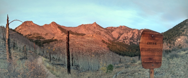
We started right at sunrise from the Goose Creek trailhead with the goal of camping for the night at McCurdy park. Lost creek wilderness is not particularly wet, especially in October, so if you plan a trip, make sure to plan ahead for water accessibility. There is water for the first few miles up Haskins pass but after that it is sparse until McCurdy Park. 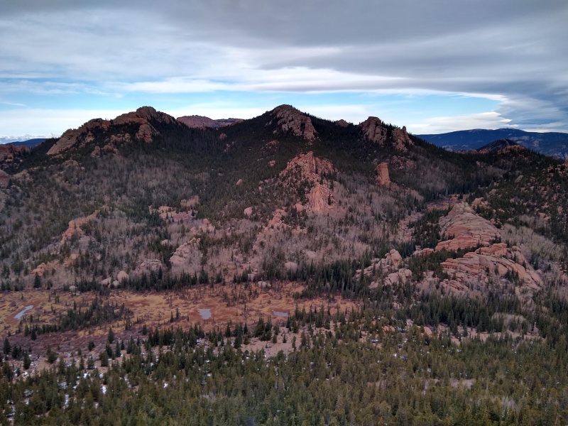
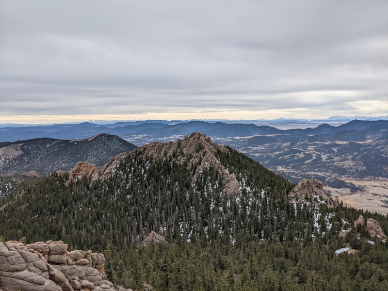
From Lake Park, the trail loops to the north of Tarryall, but since we also wanted to get The Catamount we decided to bushwack to the saddle between the two points. Luckily this area was dry so the forest was sparse making the path fairly straight forward. After a snack at the saddle we headed up The Catamount! 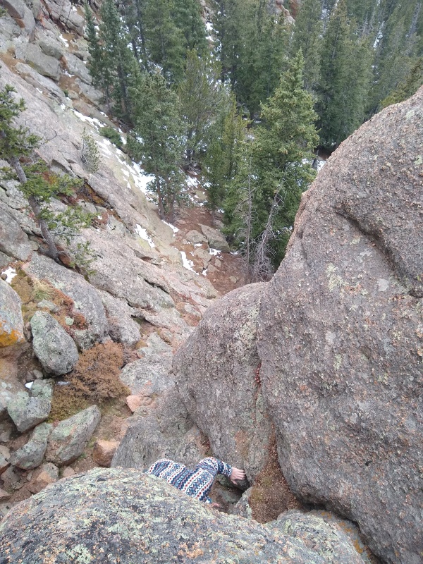
After taking in the great views from the top of The Catamount we headed back to the saddle. The climb was not nearly as fun on the way down but it was mercifully short and we were soon back to where we dropped our packs. From there, we made our way North the the west ridge of Terryall where we marveled at the weird rocks and once again dropped our packs for the push to the final summit of the day. 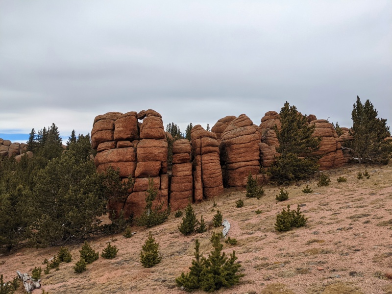
Tarryall ended up being the most straight forward peak of the day. We followed the ridge until we found a short class 3 scramble that landed us on the summit. The only trouble on this peak was the snow we were sliding through in our trail runners. 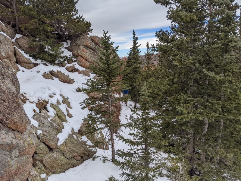
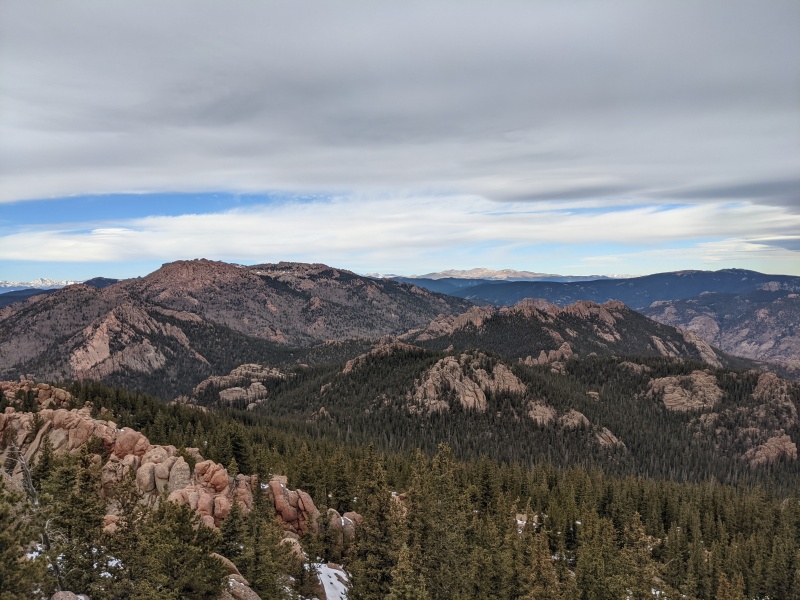
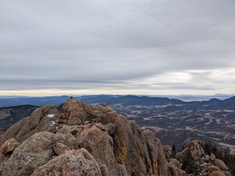
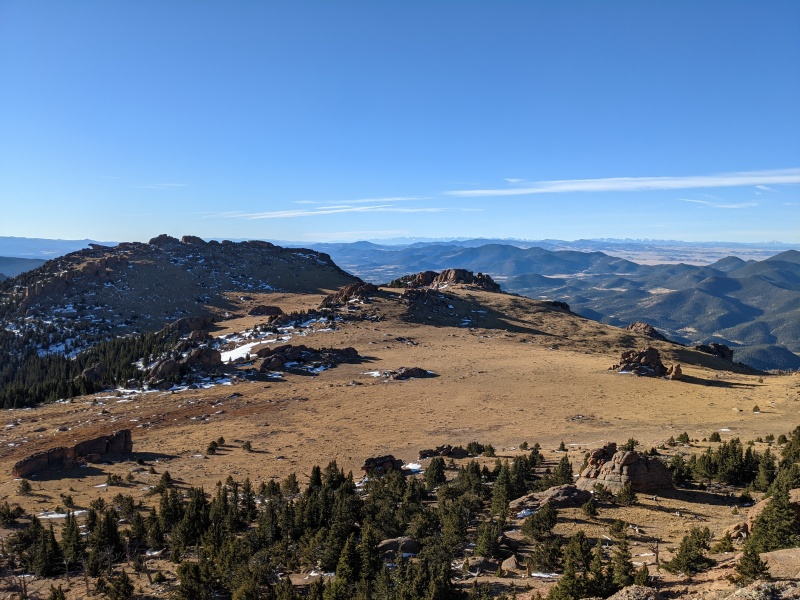
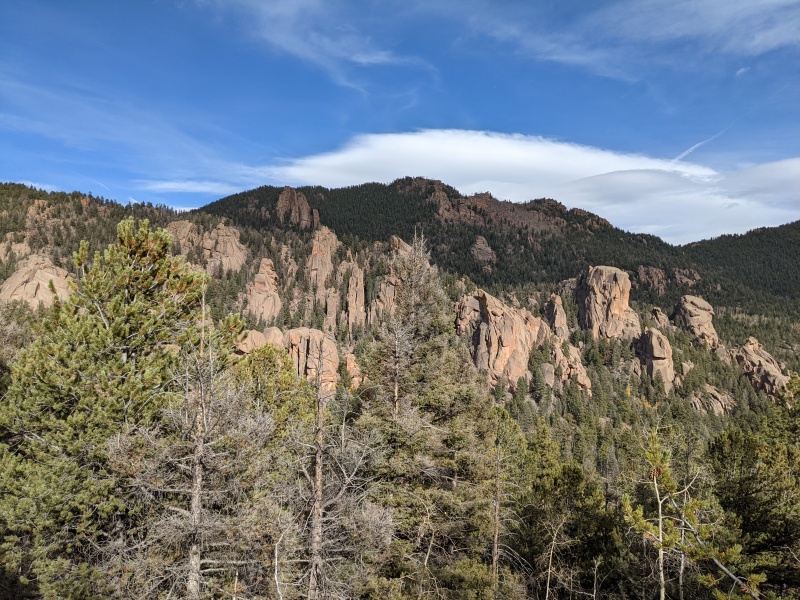
The rest of day one consisted of covering the rest of the mileage to McCurdy park where we knew there was water. Once there, we found fewer campsites than expected, but since we were the only ones there we had the opportunity to be picky and ended up camping at a nice spot a little further north than initially expected. The day ended with a total of ~13 miles and ~5300 feet of gain. Day 2/3: McCurdy and Lost Creek That first night ended up being significantly colder than expected. The creek running near our campsite nearly froze over overnight so we were ready to get up and start moving in the morning. From camp we backtracked back to the intersection of the Brookside McCurdy trail and the McCurdy Park Trail and followed the former around the south side of McCurdy until we reached the point where the trail approaches the summit plateau on the west side of the mountain. From there we broke off and climbed to where the plateau leveled off. I can say for certain that the summit plateaus of Bison and McCurdy are like nothing else in Colorado. The open tundra paired with the strange rock formations make a fantastic combo that need to be seen in person to fully appreciate. We fooled around on the rocks and took plenty of pictures on the way to the summit block to the North. 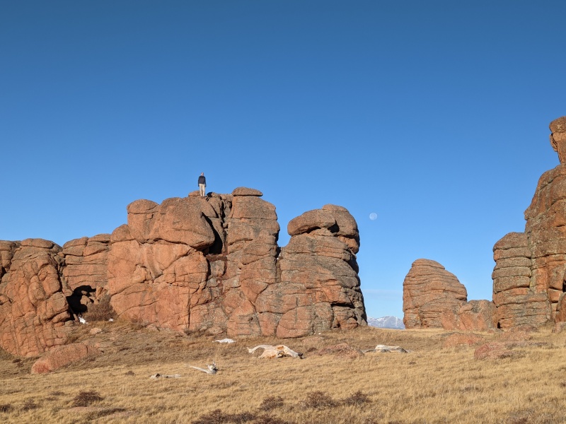
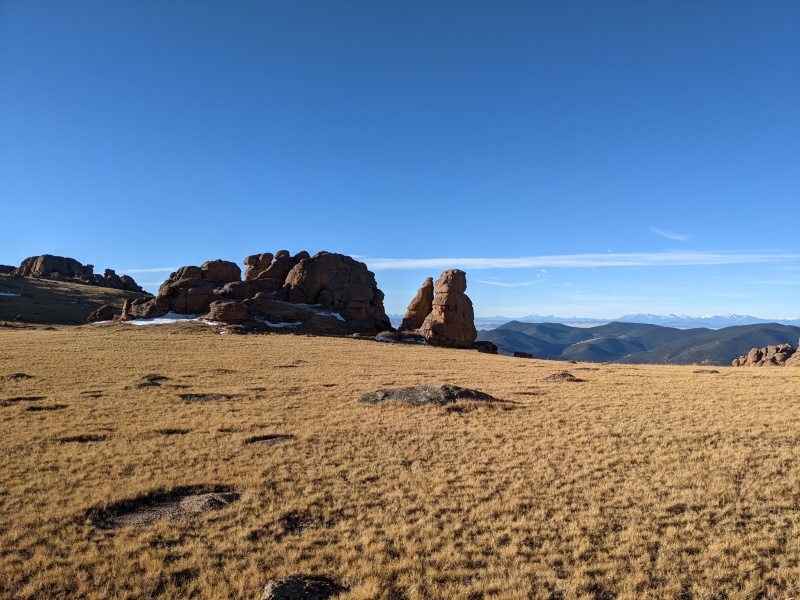
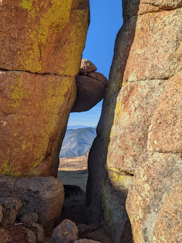
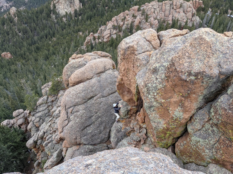
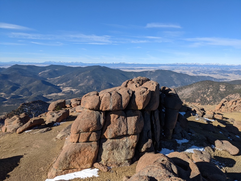
From a distance the summit "feature" looked imposing, but once there we were able to find an easy way to the top and we rewarded with great views. Looking south, we decided that the rock formations on the south summit of McCurdy looked interesting and fun so we made a detour to explore those features. From a distance it is not obvious which formation is the tallest, but once you are close it becomes obvious. Neither of us had read much on this sub-summit so we didn't even know if summiting was possible (without class 5). We poked around the summit formation, made a few attempts and almost gave up until I circled to the south and found a convoluted route up that included squeezing up a short crack at the top. While not high or overly exposed the moves were probably class 4ish. For the last "peak" of the trip it was well worth the detour! 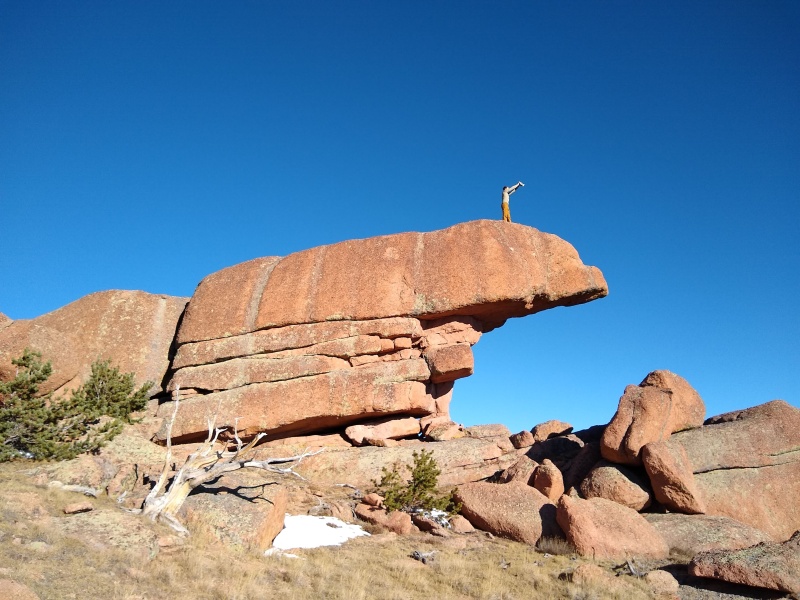
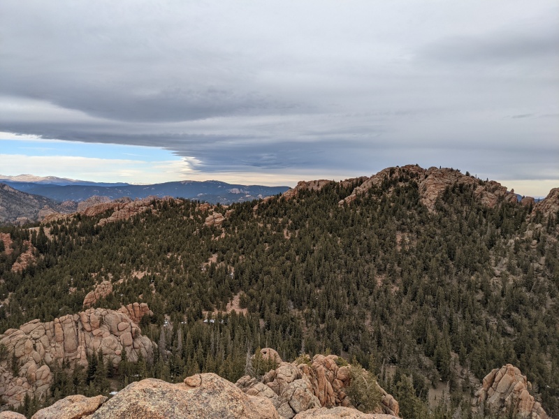
From the South summit of McCurdy we took a slightly more direct route back to the trail and eventually to our camp. Our first camp was essentially the midpoint of the loop so after playing on McCurdy the goal for the rest of the day was to find a campsite for the night. Our route out was to head north to the Goose Creek trail and follow that all the way back. Luckily, this section of the loop had more places where water was available and we had marked a few potential campsites on our map. Once again, we had our choice of sites and ended up finding a fantastic site left us only a handful of miles for day 3. Even though we were done with peaks, the hike for the rest of the loop was still phenomenal. The trail from McCurdy park to the Goose Creek trail weaves around dense formations of granite and opens to fantastic views over and over again. In the end, day 2 ended up being around 15 miles with 4000 ft of gain and almost 6000 of loss. That left a pleasant 5 miles out for the last day. 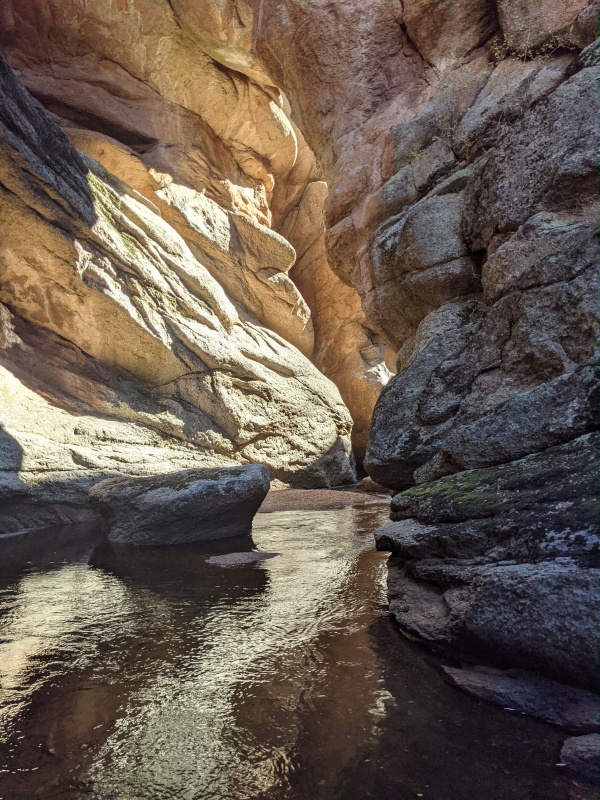
Overall this was a great trip with fun summits, good scrambling on solid rock, great weather and fantastic views. There is probably a lifetimes worth of good climbing/scrambling to be had in the LCW and I hope to be back soon. Thumbnails for uploaded photos (click to open slideshow): ")
")
")
")
")
")
")
")
")
")
")
")
")
")
")
")
")
")
|
| Comments or Questions | |||
|---|---|---|---|
|
Caution: The information contained in this report may not be accurate and should not be the only resource used in preparation for your climb. Failure to have the necessary experience, physical conditioning, supplies or equipment can result in injury or death. 14ers.com and the author(s) of this report provide no warranties, either express or implied, that the information provided is accurate or reliable. By using the information provided, you agree to indemnify and hold harmless 14ers.com and the report author(s) with respect to any claims and demands against them, including any attorney fees and expenses. Please read the 14ers.com Safety and Disclaimer pages for more information.
Please respect private property: 14ers.com supports the rights of private landowners to determine how and by whom their land will be used. In Colorado, it is your responsibility to determine if land is private and to obtain the appropriate permission before entering the property.


