Download Agreement, Release, and Acknowledgement of Risk:
You (the person requesting this file download) fully understand mountain climbing ("Activity") involves risks and dangers of serious bodily injury, including permanent disability, paralysis, and death ("Risks") and you fully accept and assume all such risks and all responsibility for losses, costs, and damages you incur as a result of your participation in this Activity.
You acknowledge that information in the file you have chosen to download may not be accurate and may contain errors. You agree to assume all risks when using this information and agree to release and discharge 14ers.com, 14ers Inc. and the author(s) of such information (collectively, the "Released Parties").
You hereby discharge the Released Parties from all damages, actions, claims and liabilities of any nature, specifically including, but not limited to, damages, actions, claims and liabilities arising from or related to the negligence of the Released Parties. You further agree to indemnify, hold harmless and defend 14ers.com, 14ers Inc. and each of the other Released Parties from and against any loss, damage, liability and expense, including costs and attorney fees, incurred by 14ers.com, 14ers Inc. or any of the other Released Parties as a result of you using information provided on the 14ers.com or 14ers Inc. websites.
You have read this agreement, fully understand its terms and intend it to be a complete and unconditional release of all liability to the greatest extent allowed by law and agree that if any portion of this agreement is held to be invalid the balance, notwithstanding, shall continue in full force and effect.
By clicking "OK" you agree to these terms. If you DO NOT agree, click "Cancel"...
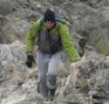
I wanted to get in one last peak before Interdependence Pass closes for the year. I was supposed to hike this peak o Tuesday, but weather was coming in, so I changed my plans and hiked it Monday morning instead.
I made it to Independence Pass and was on the trail by 5:30am. Side note: I was here October 25th, and the bathrooms were closed for the winter.
Obviously, mine was the only vehicle in the parking lot that early in the morning. The trail is obvious, and starts by heading south on a paved trail.
I’ve never been in this area in summer conditions, so I’m not really sure when the trail becomes a trail and no longer paved, but I know I was off pavement pretty quickly, heading west. This morning, before making it to Igloo Peak, snowshoes were needed some of the time, overkill most of the time.
Here’s an overall view of the route to the ridge
I headed towards the ridge, following an obvious route, which I am sure is class 1 in the summer.
As you can see from the pictures… obvious route. If it’s not obvious when you’re here, follow the contour of the ridge. It’s all tundra.
The route becomes briefly class 2 here
This is very easy to navigate
And then it’s back on a class 1 trail again
If you stay on the trail, the summit will be obvious
Here’s Mountain Boy from Igloo
From the summit of Igloo Peak, the trail towards Mountain Boy immediately gets fun. It’s class 2 from here on out, with one brief class 3 move (or two… it’s a chimney). Now is a good time to put on your microspikes. I continued southeast, heading down this briefly class 3 chimney
The rock will be loose until you make it to the saddle.
In order to get to the saddle, I headed straight south, down these scree/loose-rock filled gullies
The sun was just starting to rise at this point. Alpine sunrises are the best!
Since the sun was still rising, my view wasn’t that great. Here’s what I saw as I was descending, following the contour of the drainages. This is choose your own adventure, but it’ll be obvious when the drainages end. Don’t descend too early.
It’ll also be obvious when it’s time to head towards the saddle. There seem to be several social/game trails here. I chose to stay high, about level with the saddle, and didn’t regret it.
Once at the saddle, there were still a ton of social/game trails. I chose the one closest to the ridge. From the saddle, it was an easy hike to the summit of Mountain Boy Peak on scree/tundra
Easy, except for today’s wind!!! It was relentless, and difficult to catch I pictures/on video at its worst. This doesn’t begin to describe the gusts
Wind on Mountain Boy:
The summit is obvious, marked by a cairn
I summited Mountain Boy Peak at 7:45am.
Mountain Boy Peak:
The views of Grizzly Peak were stunning!
I turned and retraced my steps back to the Mountain Boy/Igloo saddle
Here’s the route I took back to Igloo, which is the same route I took down. Microspikes are helpful here, as it’s kitty litter in some areas.
Here are some close-up pictures of the route back up to Igloo
And back up those scree/rock gullies
And up that quick chimney to the peak
I re-summited Igloo Peak at 8:25am
Igloo Peak:
The trek was easy back to the trailhead in the daylight
I made it back to my truck at 9:15am, making this a 6.78 mile hike with 2151’ in elevation gain in 3 hours, 45 minutes
Side note: I didn’t have my microspikes. Well, I did, but they fell out of my pack when I took off my snowshoes, and I didn’t realize this until they were needed. So, when I went to find my microspikes, just before the kitty litter area on the south side of Igloo Peak, they weren’t in my pack. But I really could have used them! Especially on the snowy ascent/decent of Mountain Boy Peak. The kitty litter areas were so much more difficult than they needed to be without spikes as well. I cursed myself the entire time, thinking I’d lost them for good and vowing to buy new ones on my way home as soon as I got cell service. The reason my track shows movement near Igloo Peak is because, on my way back I realized when I must have lost them and went looking for them. I found my microspikes, along with a whiskey flask I hadn’t realized I’d lost, just before the summit of Igloo Peak. From now on, they’re going INSIDE my pack, not in the cup holder of my backpack (I know, I know, not the best decision).
Thumbnails for uploaded photos (click to open slideshow):
in the summer. I‘m not much if a winter hiker.
Question though. I‘ve been there in the summer and there are signs as I recall to not go off the path because of the tender tundra. So I guess these mountains should be done winter?
But that is really the case with all the 13-ers.
...was closed at 7 PM on Monday, Oct. 25 in anticipation of Tuesday's storm. It's a good thing you moved your climb up a day because the road's now closed for the season.
Caution: The information contained in this report may not be accurate and should not be the only resource used in preparation for your climb. Failure to have the necessary experience, physical conditioning, supplies or equipment can result in injury or death. 14ers.com and the author(s) of this report provide no warranties, either express or implied, that the information provided is accurate or reliable. By using the information provided, you agree to indemnify and hold harmless 14ers.com and the report author(s) with respect to any claims and demands against them, including any attorney fees and expenses. Please read the 14ers.com Safety and Disclaimer pages for more information.
Please respect private property: 14ers.com supports the rights of private landowners to determine how and by whom their land will be used. In Colorado, it is your responsibility to determine if land is private and to obtain the appropriate permission before entering the property.