| Report Type | Full |
| Peak(s) |
"Finnegan Peak" - 13,352 feet "Pika Peak" - 13,130 feet Gold Dust Peak - 13,398 feet |
| Date Posted | 10/20/2021 |
| Modified | 10/02/2022 |
| Date Climbed | 09/27/2021 |
| Author | Dobsons |
| Holy Cross Wilderness Scrambles + an alt Finnegan Route |
|---|
|
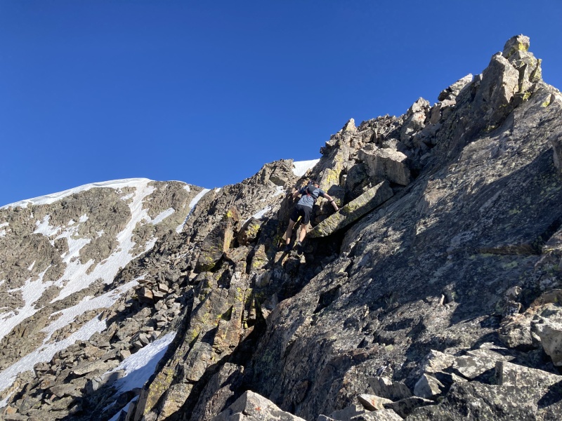
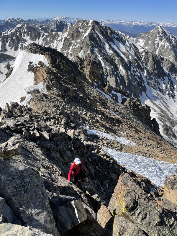
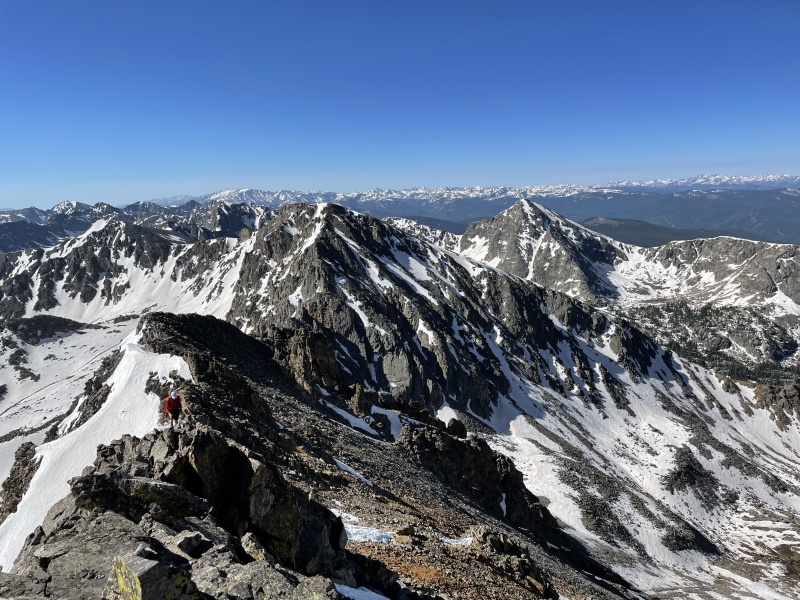
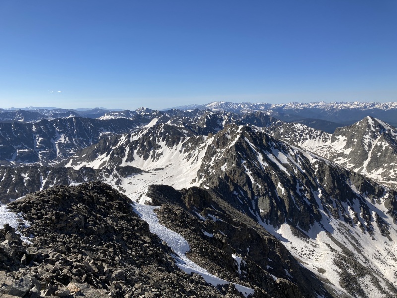
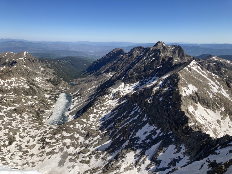
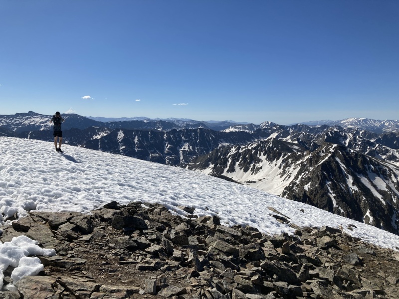
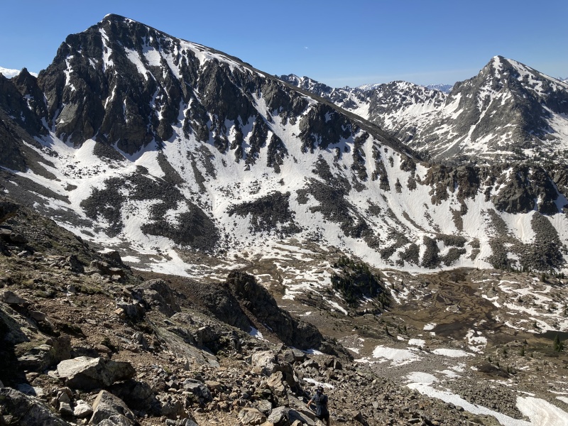
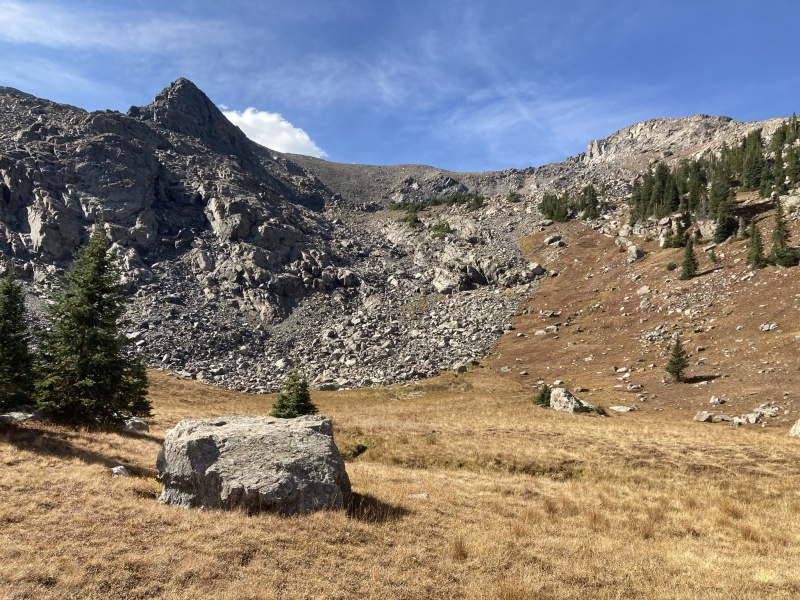
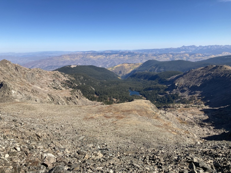
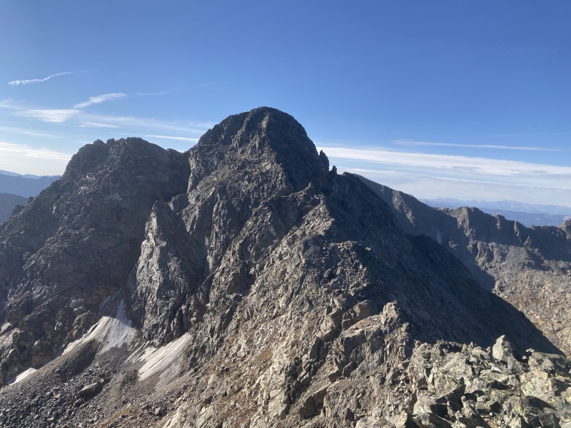
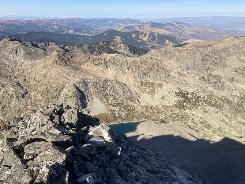
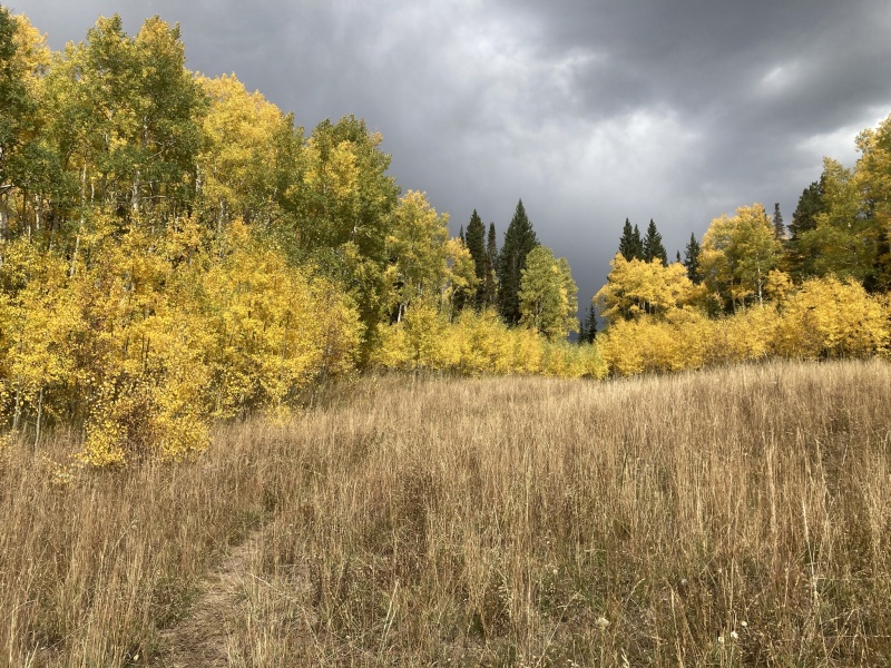
Western Most Sawatch Gems in the Holy Cross Wilderness I wanted to write a trip report on these peaks as I think I can add a bit of information to potential routes for these peaks (ie a route to avoid Finnegan's heinous scree slope) that aren’t in other reports or at least provide a different perspective. These peaks are some of my favorite peaks in the state as they are the peaks I can see straight from my home (there is just something about the peaks viewable from your house). As an Eagle resident, the two 13ers I can see from my house are Finnegan and the tip top of Gold Dust. I had the pleasure of finally climbing the peaks I gaze at daily from Eagle this summer in two separate highly enjoyable trips. The first was a link up of Pika and Gold Dust with a buddy Dan in June, and the second a solo outing up Finnegan where I incorporated a bow hunt. I hope the info is helpful to some in the future looking to climb these peaks. Pika and Gold Dust with Ridge traverse – w Dan June 13, 2021 For my first summit outing of the year Dan, a buddy from Minturn, would join. Dan met at my place in Eagle early that morning and we made the familiar drive up to Yeoman and then to the Fulford Cave campground parking lot. We often like to “rike” peaks – run the approach trails, power hike the off trail stuff and that was the plan for today. We started jogging at 615 AM and made the trip to lake Charles in just a hair over 1 hour. A typical approach to Negro basin/Gold Dust is turning north about 4 miles up the trail, approximately 0.5 miles before reaching Lake Charles but we headed all the way to Lake Charles before turning up. We were greeted with maybe one of my favorite views of the summer right off the bat with an amazing reflection of Fools peak on Lake Charles. After enjoying this a bit, we took a north easterly route up an easy to walk on rib from Lake Charles up towards Pika and Gold Dust. Our intention was to climb Gold Dust first but we ended up not contouring around enough into negro basin and got fairly high on Pika’s West ridge before realizing our mistake so we just decided to hit Pika first and then see if the traverse would go. Pika’s west ridge was an easy class 2 walk up. It took right at 2 hours to Pika’s summit for us. From the summit we hoped to get to Gold Dust but were concerned about the amount of snow and the difficulty of the traverse. Most reports mention two difficult towers on the pika side of the saddle. Most also mentioned a class 4 chimney route east of the northern most tower to bypass it, I was afraid this would be full of snow. Regardless we decided if we arrived to a no go spot we would reclimb pika and save Gold Dust for another day. The initial decent off Pika is steep! It can all be kept at class 3, however, and very quickly we arrived at the first tower. This is where I think some added information can be helpful to others wanting to link these two but are wary of the difficulty of the climbing. Both towers can be bypassed max class 3 and 2+ if willing to drop or contour around them on the Negro basin side of the ridge. The southern tower we traversed around on class 3 ground and arrived between the towers to find the chimney was indeed very full of snow. We therefore looked for another route around the tower and we were able to find a class 3/2+ detour around the northern tower again to the negro basin side. This was a decent drop off the ridge about 250 vertical feet but reclimbing to the saddle was just easy class 2 dirt. Once past the tower difficulties on the pika side of the traverse we stayed mostly ridge proper on a delightful easier 3rd class ridge practically all the way to Gold Dust’s summit. Overall, I had been nervous of the traverse and its difficulty but if bypassing the towers and willing to drop some elevation around the northern tower it really was quite reasonable and just a joy of a connecting ridge. The traverse took us 1:15 total. We made our way down to Negro basin then back to the TH at a jog down the rocky trail for a round trip time of 4:50. Perfect timing to get home to see the families for lunch. Running the approach trails sure is nice on the time department. Stats for the day came out at 11.4 miles 4500 feet. 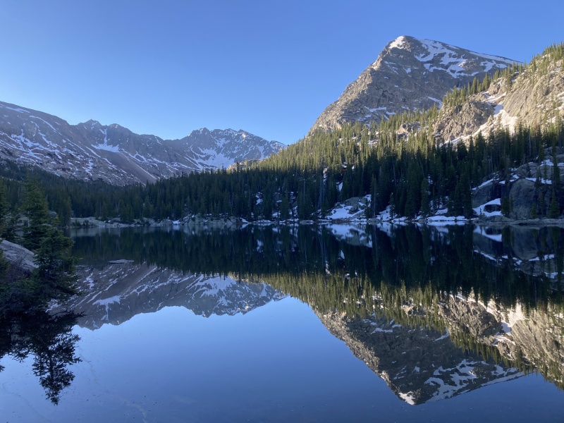
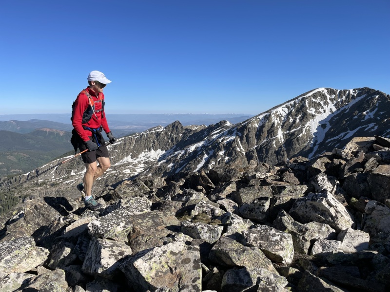
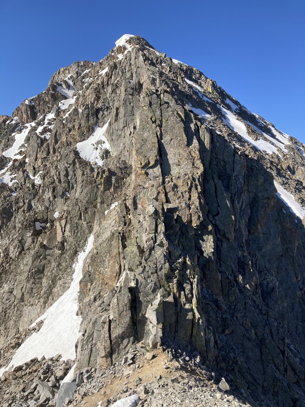
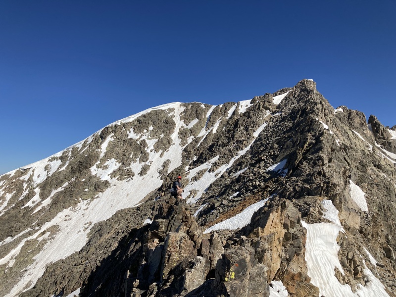

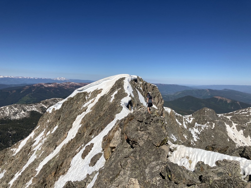
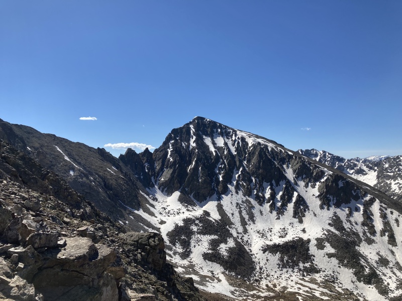
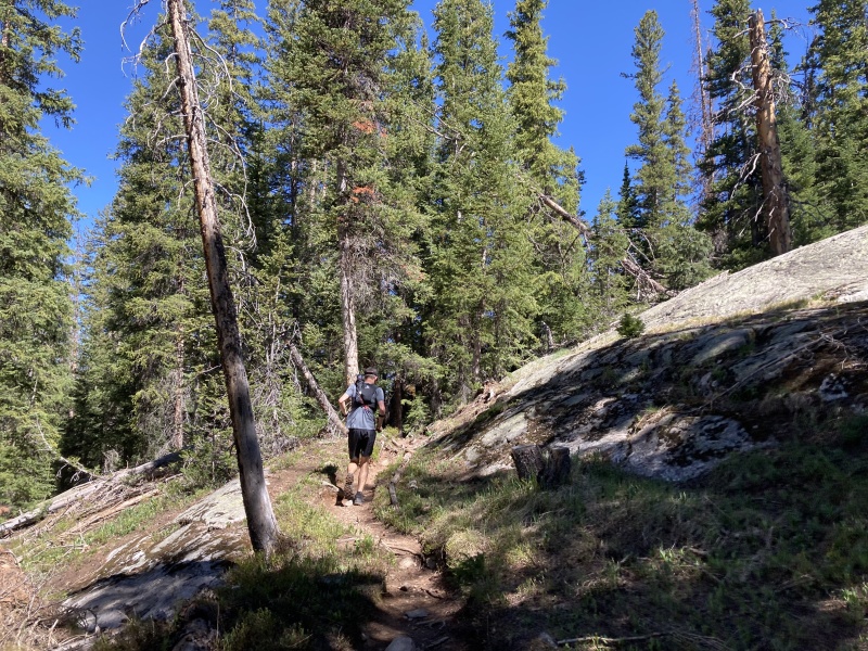
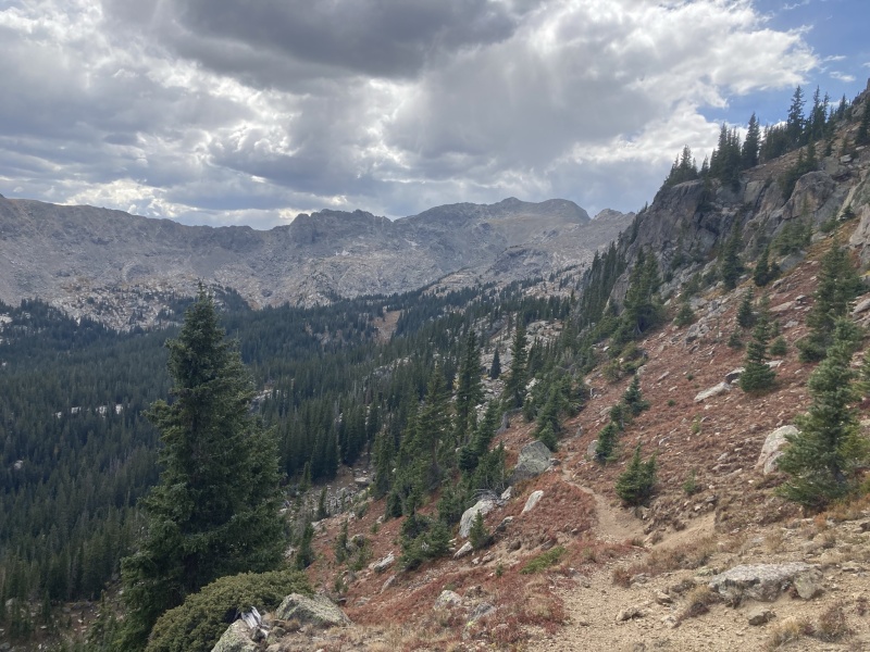
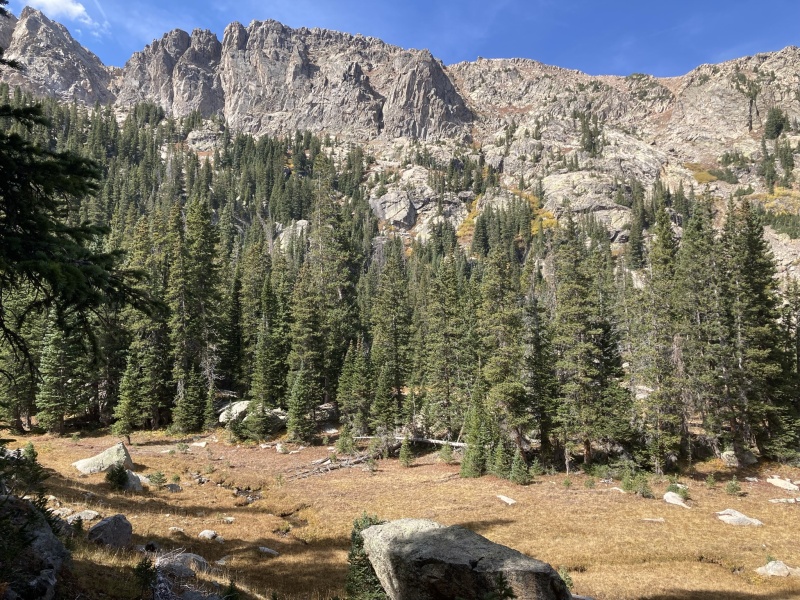
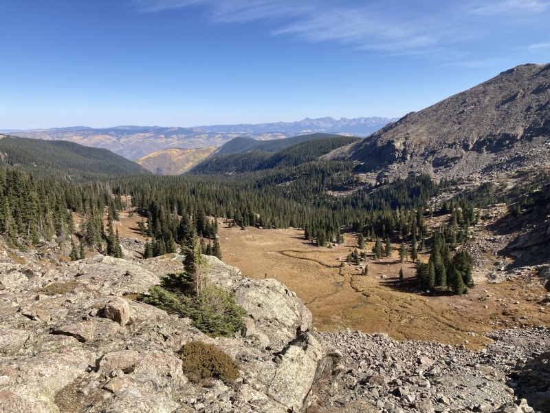
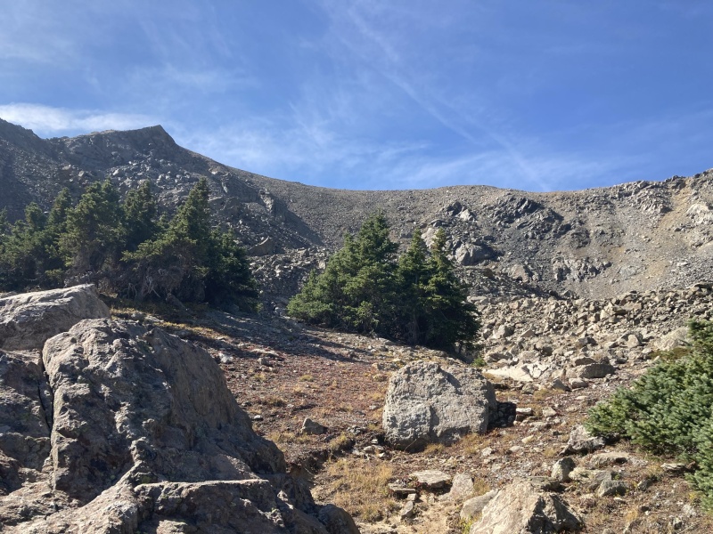
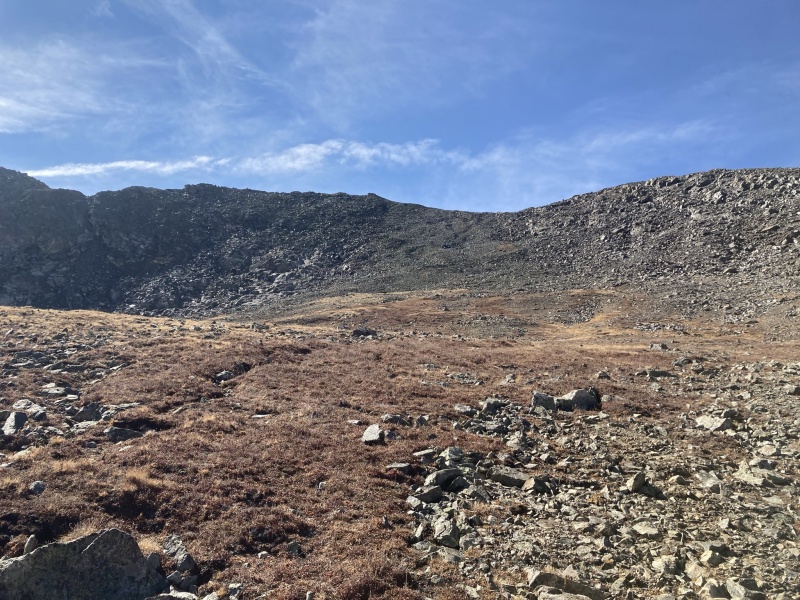
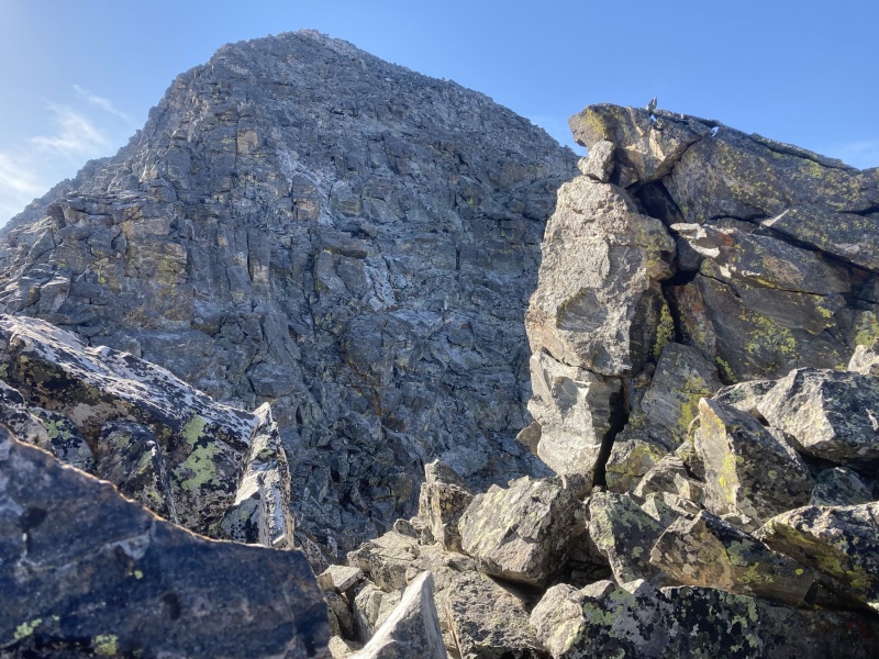
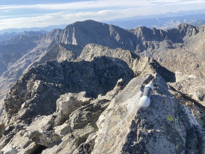
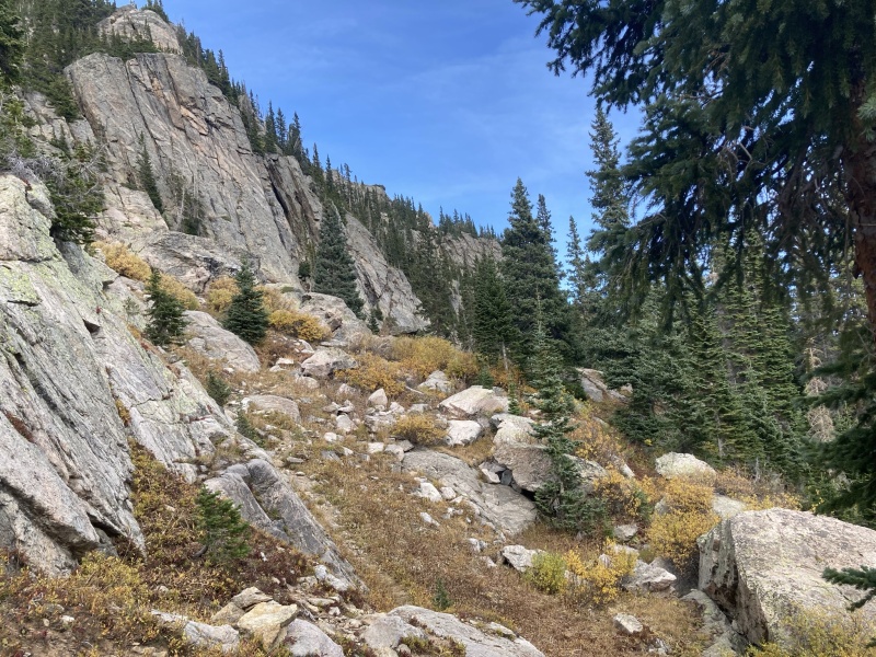
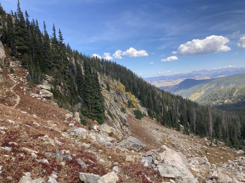
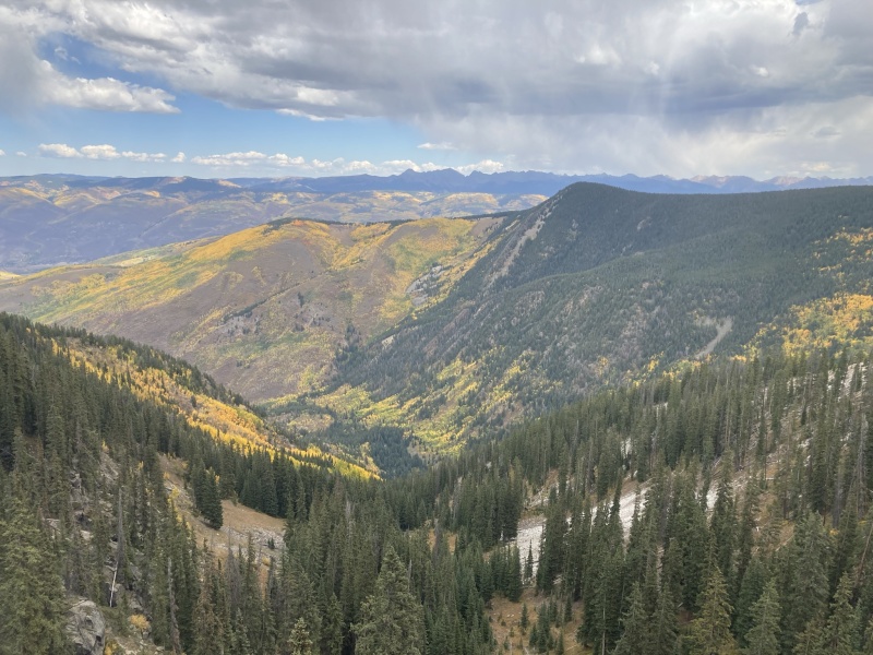
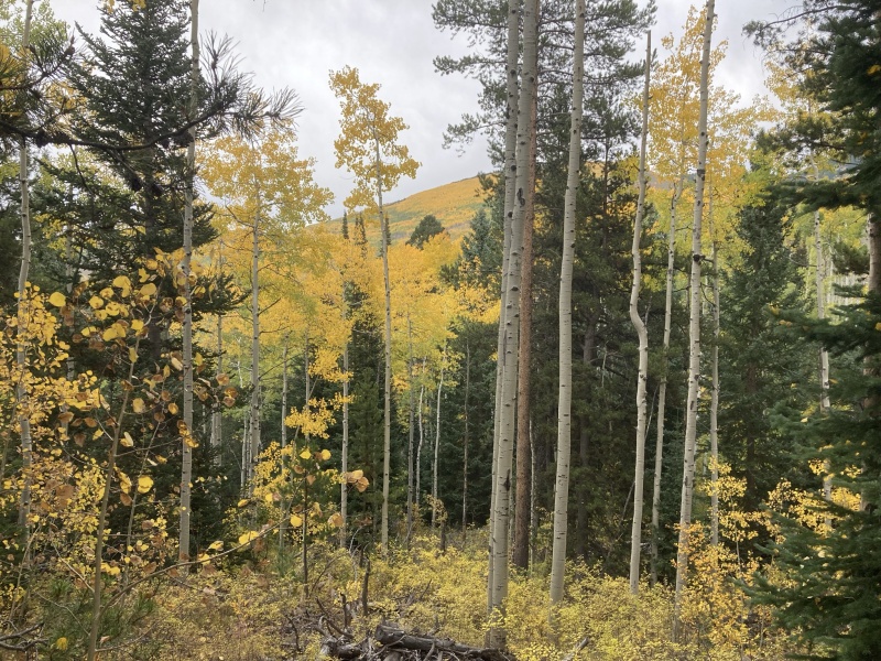
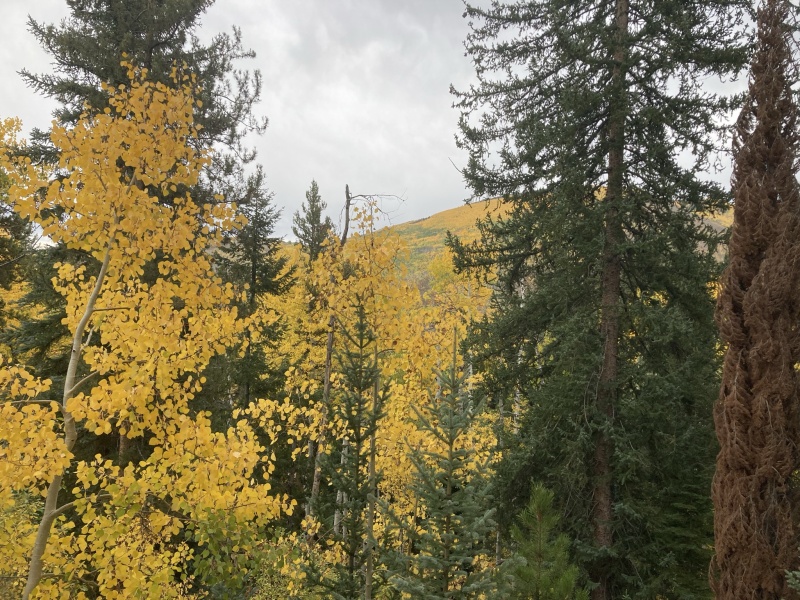
Finnegan Peak an alternative route – solo September 27, 2021 Finnegan is the main peak I see from my house in Eagle. Every report on this site talks about the heinously loose 2000 ft talus climb from New York Lake all after the initial 3rd-4th class gully decent off the 12er New York Mountain just to get to New York Lake. Having climbed New York Mountain on a bow hunt a few years back and seeing the route in its entirety I really wanted to try to find an alternative route to Finnegan’s summit. From Eagle there is a massive ridge viewable heading north from Finnegan to an unnamed 12er then running down towards Edwards. That ridge has always intrigued me just seeing it so well from Eagle. There appears to be a difficult notch in the ridge half the way to Finnegan so I am not certain how difficult the ridge would go. It looks like it could go 3rd-4th class at the notch from a far. Has anyone done the entire ridge from Dead Dog trail to Finnegan out of curiosity? Regardless coming from Edwards seemed from looking at maps to be an alternative approach to avoid the 2000 foot talus climb, albeit much longer. This fall I had been hunting unit 44 and getting skunked on finding the elk and snow was in the forecast, so I decided to do a huge bow hunt up into middle lake area and if I didn’t get into elk attack Finnegan from this area before the snow started flying for the season. I drove to the East Lake Creek Trailhead south of Edwards and was off under headlamp a hair after 5 AM in hope to get high to elk country around dawn. Dead dog trail is an amazing trail. It takes off right from the East lake trail about 0.8 miles from the trailhead and every turn of the hike is very well signed. Mile 3 is steep but otherwise it’s just a nice hike albeit long. At mile 4.5 you get an awesome view with the entire Gore range spread out in the distance. At mile 6 you come to timberline and a first view into the middle lake basin and high peaks of the area. I dropped down towards middle lake (you do have to descend about 500 feet towards the basin) on the still very nice trail then abandoned it heading into the high basin never going all the way to middle lake. From there it was amazing elk country with fantastic sign but despite my 5AM start I was still there too late and it seemed the elk were already in the trees. With a fall back plan summit in mind however, I wasn’t disappointed so I made it through the trees and tundra to where the talus began. I dropped my bow, waypointing it, and then attacked an initial steeper talus slope but nothing bad at all which took me to a nice very high grassy bench around 12,200 feet. The ascent was always trending towards point 13,092 (the unranked 13er directly north of Finnegan) on the path of least resistance from the basin. A nice easy mixed grass/talus slope led to point 13,092 from the upper bench. Mission accomplished, Finnegan’s summit was in sight, terrible talus avoided! It did come with another wilderness fee (as Roach puts it) however as it was ~8.5 miles to this point. So… pick your poison I suppose (terrible talus slope and gullies but short, or nice trail for 7 miles to easy talus and grassy slopes to fun traverse and final scramble to the summit) either way a fee will be deposited for Finnegan and I think it is the most difficult sawatch 13er I’ve done yet. From the town of Eagle it looks fairly straight forward from 13,092 to Finnegan but it was much more difficult than I expected. I started out ridge proper but found quickly that would be spicy beyond my comfort level. So, I bypassed the initial difficulties with a tad bit of moderately loose descending and some side sloping just below ridge proper on the New York Lake side of the ridge (never really needing to drop more then 30-50 feet below the ridge crest). Then there was an obvious stout tower without easy bypass New York Lake side of the ridge but I found a small dihedral to a grassy ledge (cairned) on the Lake Thomas side to bypass that difficulty. From there it was mostly ridge proper to the summit pyramid of Finnegan. The pyramid was a stout scramble out on the face mostly class 3 with maybe a few class 4 isolated moves in my estimation to a wonderful summit. After signing the nice register and a small break, I reversed the exact traverse to 13,092 and then had a gentle stroll down to my bow and back out the way I came. Reclimbing to the dead dog trail from the middle lake basin was not ideal but not terrible either and had fantastic views. 6 trail miles back to the car ended a wonderful holy cross wilderness outing. Total stats for Finnegan from this approach came to 18 miles with 6,700 feet of gain. I was out 9: hours 45 minutes total. Having not done the terrible talus slope from New York Lake it's hard to say which is better but from my perspective I'll hike 10 extra miles on a fantastic trail any day to avoid one of the slopes that I have never heard anyone talk fondly about. It certainly was a wonderful option to see a very remote part of the Holy Cross Wilderness and avoid the slopes of Mordor up from New York Lake followed by a pretty enjoyable and exciting scramble up top on the traverse and summit pyramid. A back pack to the Middle lake basin could be a very nice way to enjoy the area and climb Finnegan. 
Overall, these peaks are just gems! Some of the finest scrambling I have done in the Sawatch for sure, only the Apostles traverse seems to match them from what I have experienced so far in the Sawatch. Hope this was helpful to someone in the future. https://www.strava.com/activities/6029527711 - finnegan strava link if you want more details on the map or elevation gain - I added the GPX file for this route (can only add one) https://www.strava.com/activities/5464796257 - gold dust pika traverse strava link Thumbnails for uploaded photos (click to open slideshow): ")
")
")
")
")
")
")
")
")
")
")
")
")
")
")
")
")
")
")
")
")
")
")
")
")
")
")
")
")
")
")
")
")
|
| Comments or Questions | ||||||
|---|---|---|---|---|---|---|
|
Caution: The information contained in this report may not be accurate and should not be the only resource used in preparation for your climb. Failure to have the necessary experience, physical conditioning, supplies or equipment can result in injury or death. 14ers.com and the author(s) of this report provide no warranties, either express or implied, that the information provided is accurate or reliable. By using the information provided, you agree to indemnify and hold harmless 14ers.com and the report author(s) with respect to any claims and demands against them, including any attorney fees and expenses. Please read the 14ers.com Safety and Disclaimer pages for more information.
Please respect private property: 14ers.com supports the rights of private landowners to determine how and by whom their land will be used. In Colorado, it is your responsibility to determine if land is private and to obtain the appropriate permission before entering the property.


