| Report Type | Full |
| Peak(s) |
Sentinel Point |
| Date Posted | 10/19/2021 |
| Modified | 01/18/2022 |
| Date Climbed | 09/18/2021 |
| Author | JQDivide |
| Sentinel Point Loop Route Description |
|---|
|
Sentinel Point Loop 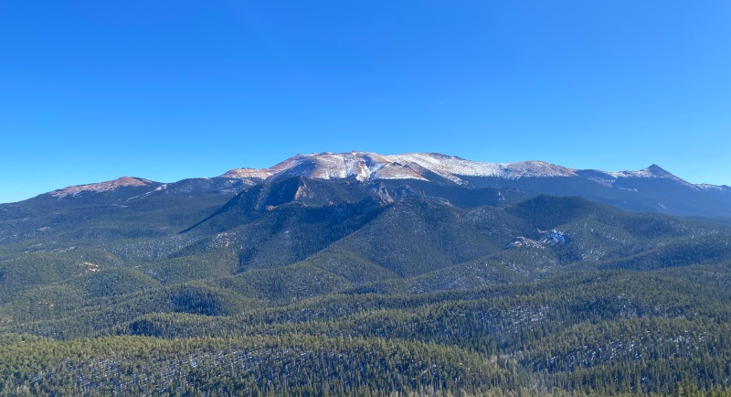
I’ve hiked Sentinel Point numerous times over the years. I can see it from our house. This is less of a trip report and more of a route description for the loop. 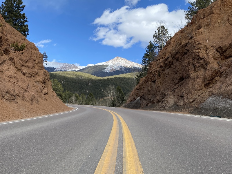
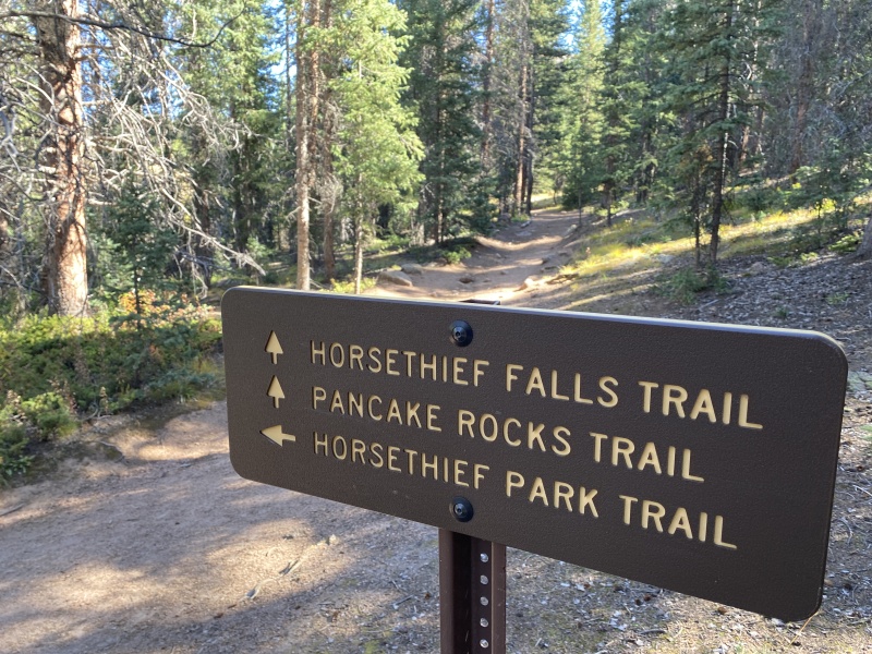
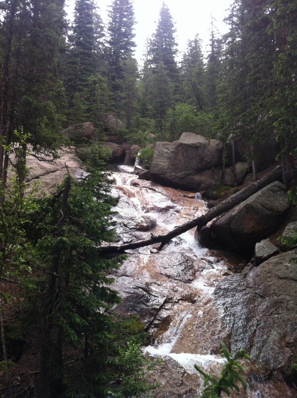
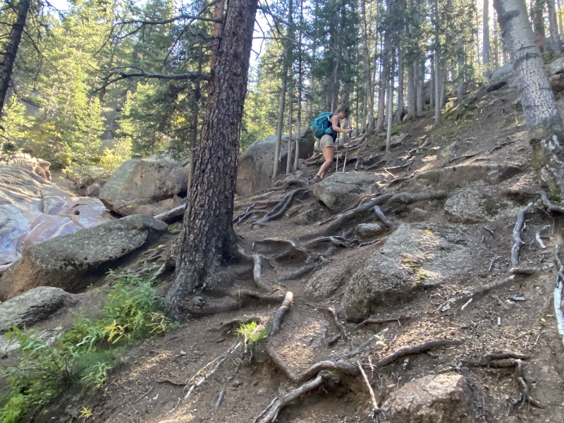
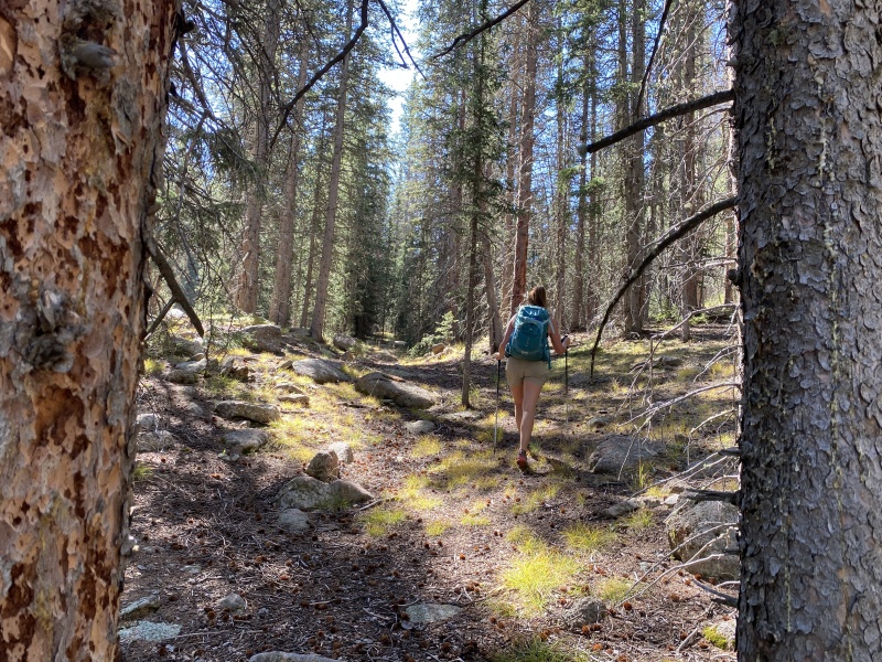
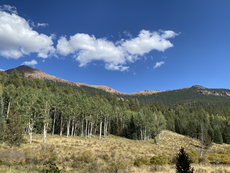
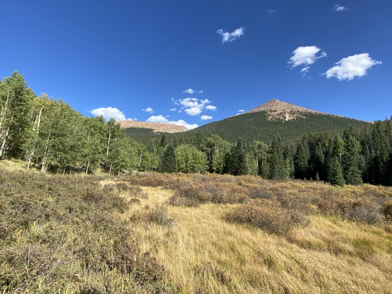
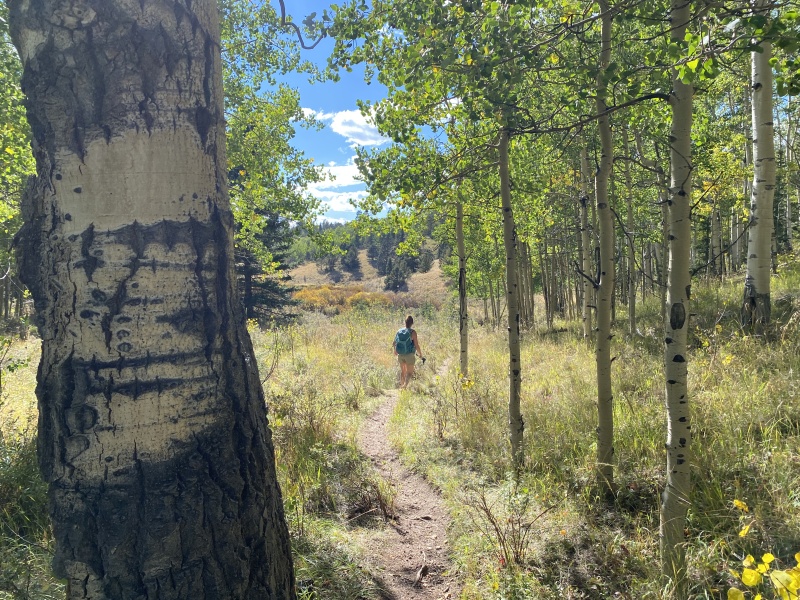
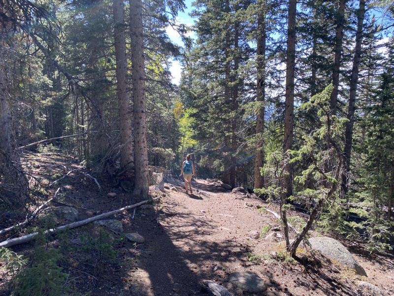
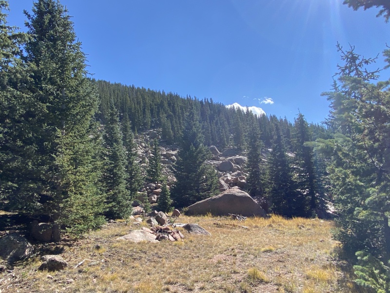
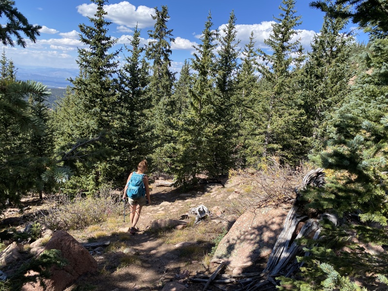
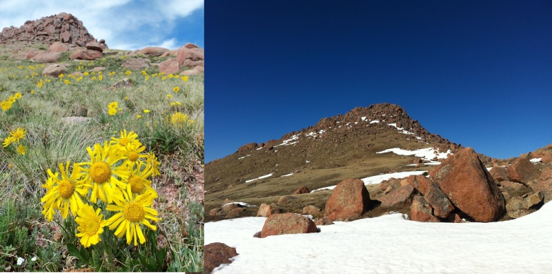
Sentinel Point is a 12,500+ foot point on the Pikes Peak massif, about 3.3 miles straight west of the summit. It is very noticeable if you are driving along Hwy 24 near Divide. It's a lone point on the right side. Though the point is really a ridge, from most angles it looks pointy. Several of the photos are from different hikes, but mostly from Sept. 2021. STATS The trialhead is on Hwy 67 about 9.2 miles south of Divide. It will be on your left after a blind curve. But look for the old railroad tunnel on the left just before the curve, the TH is on the other side. The parking area is obvious as it is next to the tunnel entry. It can be crowded on busy weekends. This is a popular trailhead for four different hikes which all share the same beginning: Horsethief Falls, Pancake Rocks, Horsethief Park and Ring the Peak Trail. Falls Approach There is a quick switch back at the beginning of the hike, then you come to an old road, which is more trail now than road. It’s a fairly straight hike with some gain, enough to cause out-of-staters to stop for air. When the trail levels out a bit, you’ll see the trail marker for Ring the Peak Trail which leads off to the left (about .7 miles from the TH). This is also the Horsethief Park route. Stay on the main trail and as you go, if you look left, you can see the open park and glimpses of Sentinel Point through the trees. You’ll pass the junction for Pancake Rocks (right) at just under 1 mile, but continue straight on the main trail. A bit more than half a mile later, you’ll hit Horsethief Falls. There is water running nearly all year from a small creek/drainage above the falls. In the winter, the falls freeze over but you can still hear the water trickling. Falls are near 10,300. 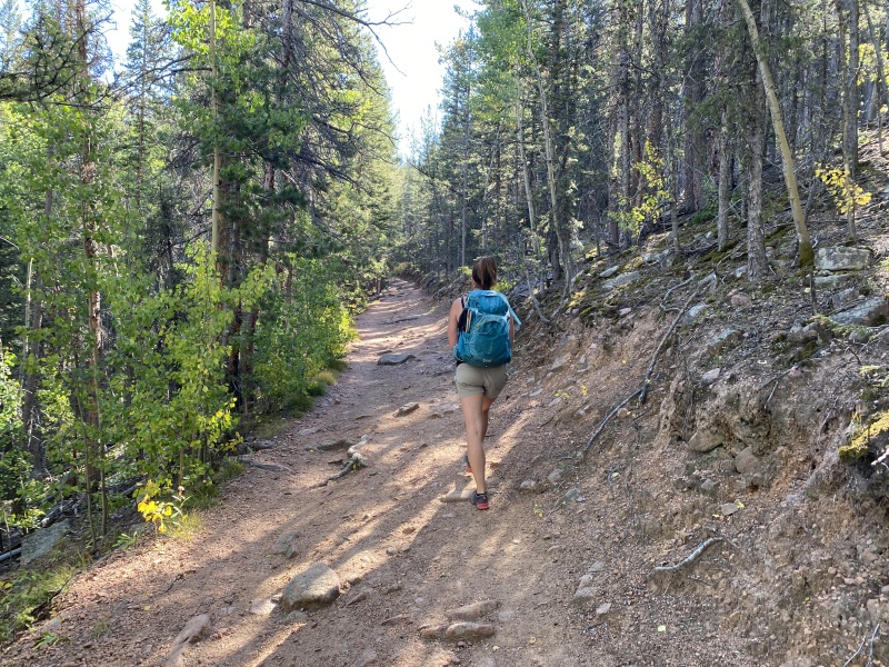
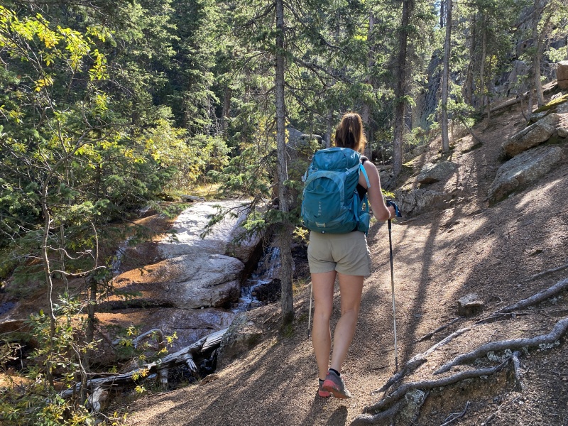
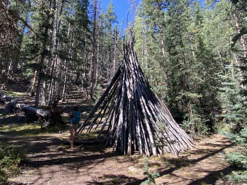
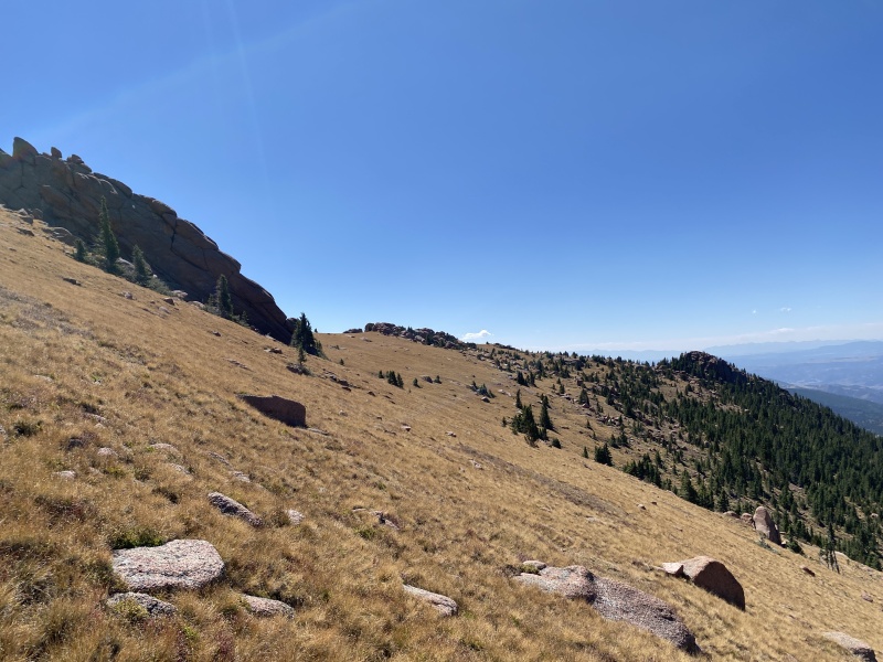
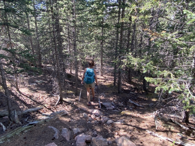
At the falls, take the slope to the right. It’s loose Pikes Peak granite and can be iffy footing. You’ll see where others have gone up. Go up and above the falls and follow the creek. The trail which is pretty good stays on the right side (west side) of the creek until you get near 10,600. Here you will come to short “up” section and a tree-trunk tipi. The trail ends here. But don’t worry, the route is easy. You will notice the creek ends here also, but the creek bed continues on. Looking left and right, you will also notice you are in a tight basin or valley, kind of like a halfpipe. Continuing moving south and up, but stay to the center of the half pipe. These trees are thin enough here and you can see to navigate. If the slope gets steep, double check your bearings that you are in the center of the halfpipe and not going up the side. There are no cairns on this route. The ridge on your right, the Pancake Rocks trail is just on the other side. Eventually the creek bed will fade out. Continue on. It gets steep at times. 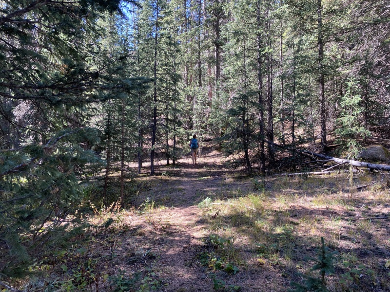
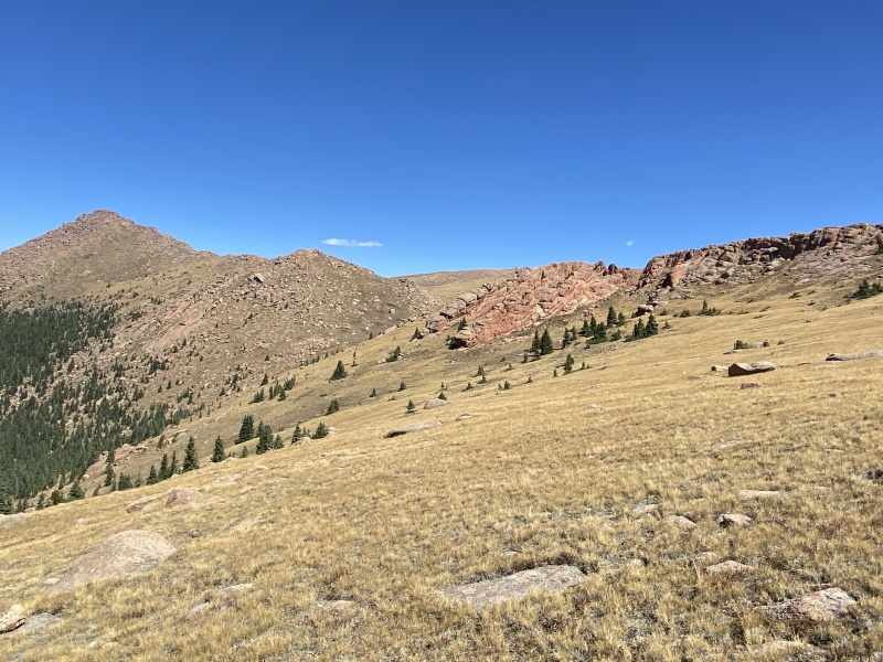
Near 11,000 you should be able to see the sky in between the trees. And soon you will at the end of this valley near 11,200. The valley ends at an overlook that is obvious. Cool rock formation up to the right. From the overlook area turn left, east. Again, there is no trail here. You’ll probably pass an old mining hole. Through the trees you see a large rock rib formation on the left. Follow this, but not too close, the terrain gets harder the closer you are. You are looking for a notch to cross up and over the rib. The first obvious looking spot, is not it. But it has some great views, including glimpses of the route you’ll be following. Hike up to near 11,400 and you’ll see the crossover notch. Up and over. (I've never followed the rib all the way up. Wonder where it ends?) 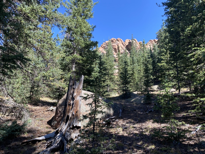
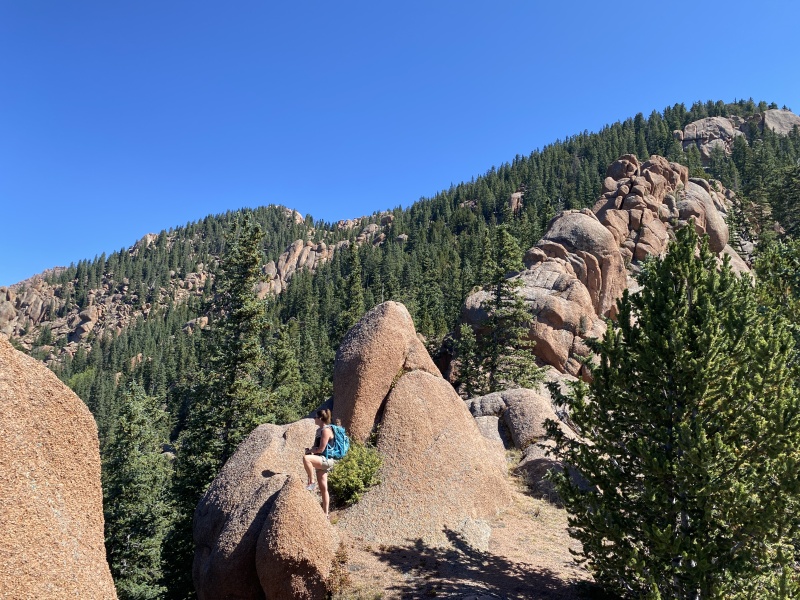
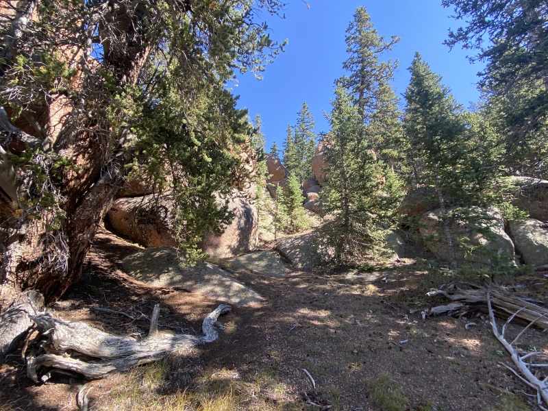
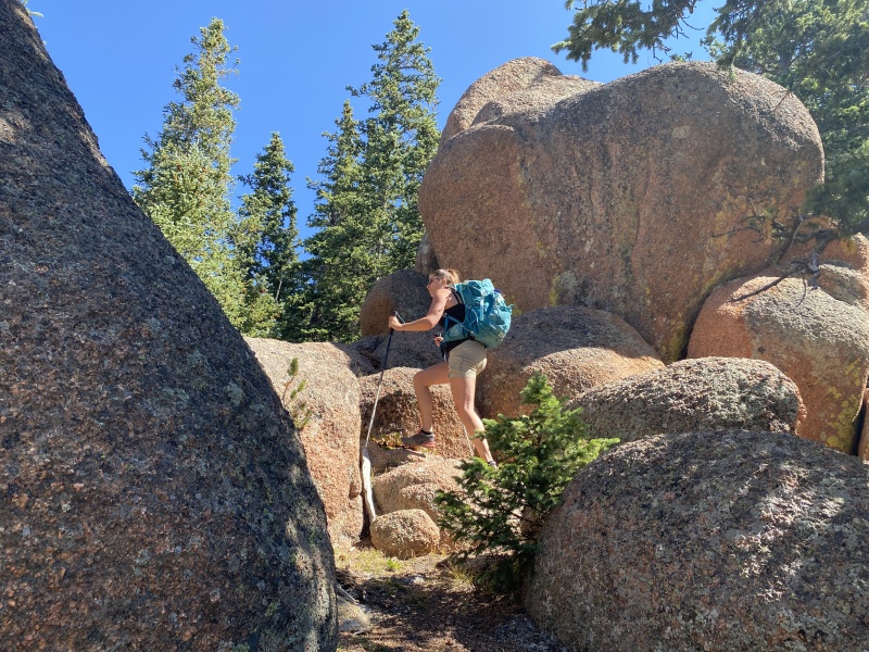
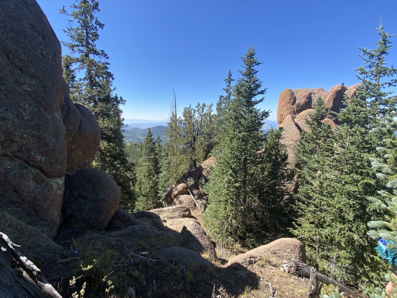
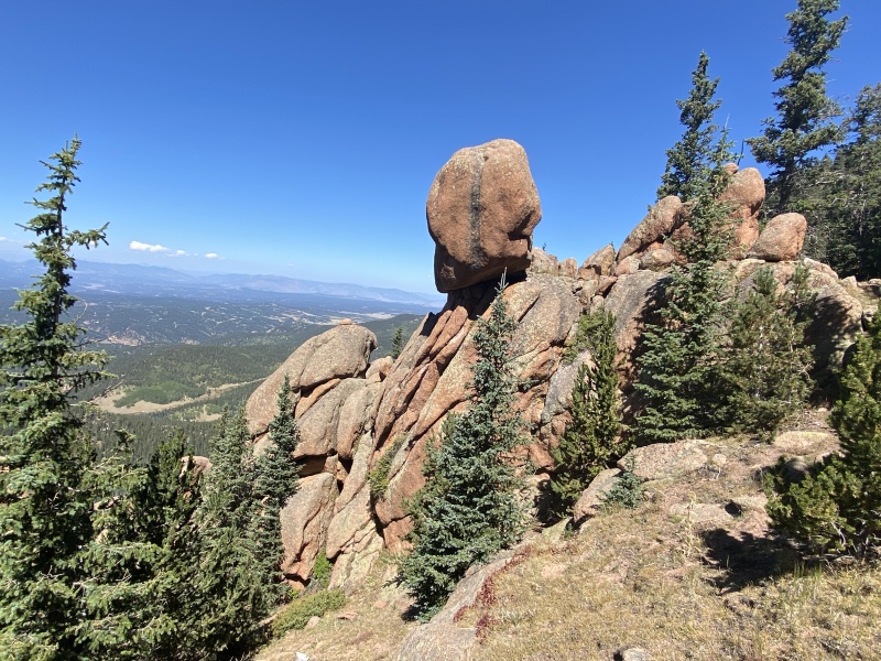
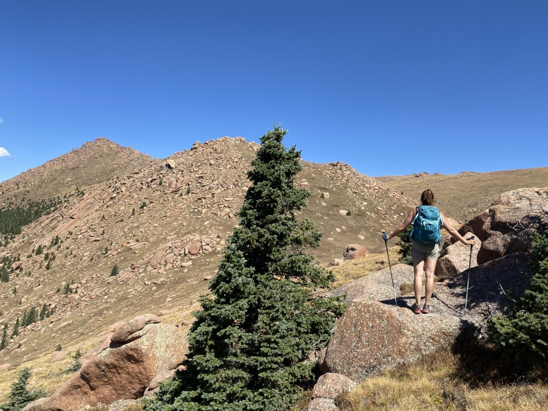
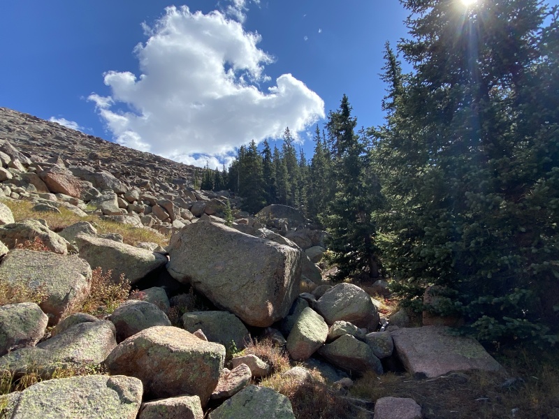
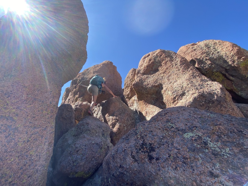
From here, you are going to sidehill all the way up to 11,700. So, move up and along the slope. You should pass three obvious rock outcroppings on the way. The first is General Ackbar, well, a house-sized reddish-brown rock that resembles his head, or maybe a turtle's head. You'll pass beneath it, don't go to it. Continue side hilling. Then second you’ll come to a pile of large boulders poking out of the ground with some trees, climb over or around it. Continue side hilling. The third rock outcropping is like a rock sitting on another rock. It is the most predominant of the three. Hike just above it, or it’s a fun little scramble with more good views. From here, you can see glimpses of “The Gate.” The large opening in the rocks that border the top of the ridge. You’ll move up and through The Gate. (This area is great for a quick day hike. Views. Some cool rock formations. And several Bristlecone pines trees that are very photogenic.) 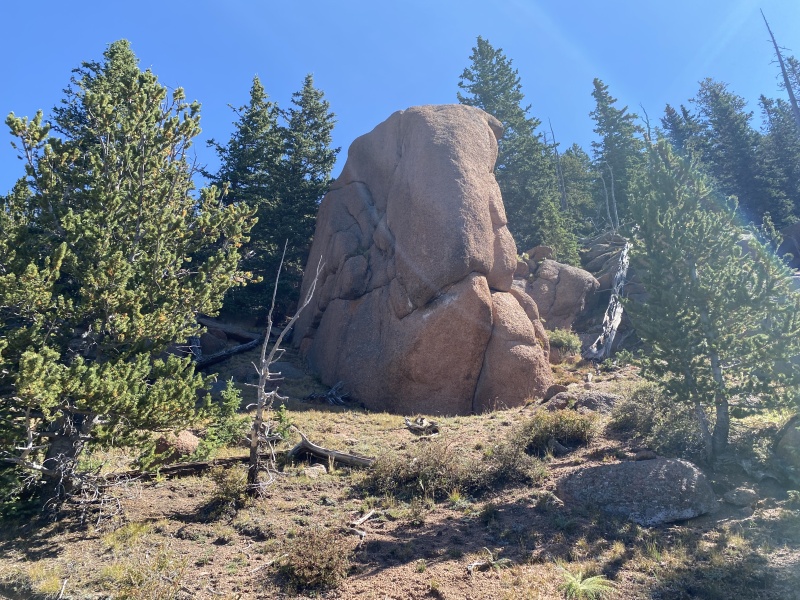
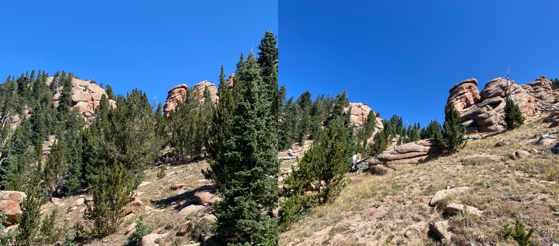
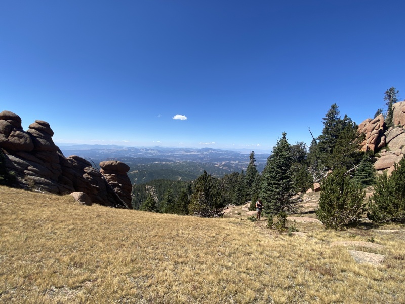
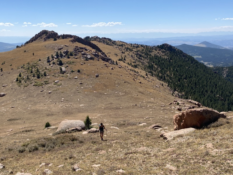
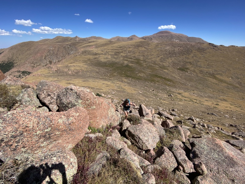
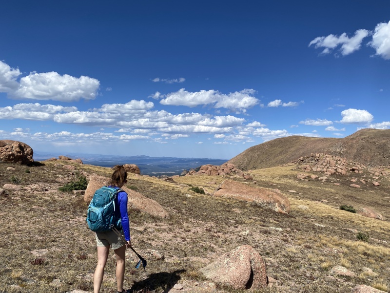
Through The Gate and turn left, NNE. You can see Sentinel Point. Pass through an area of grassy slopes filled with small trees, bushes and boulders. There is a rocky ridge to your right, but don’t go there, unless you want a closer look. Head towards the end of this ridge, toward a saddle with Sentinel Point. This is one of those areas where you don’t want to go too high or too low, all while trying to go as straight as possible. At the saddle, you want to be on the eastern side of Sentinel Point, the Pikes Peak side. You have about 1.25 miles to go before you climb to the summit. I haven’t heard of anyone doing ridge proper here, but it might go. It’s kind of sidehill, but not too bad. There are enough grass ledges to keep you flat. We moved from the 12,000-foot line, to 12,250 very gradually. I would not go much higher, as there are more obstacles and steeper terrain. Continue on this course until you are below what looks like the highest point of the Point. Look east, can you see the summit of Pikes Peak? It might be time to move straight up. There is a large boulder down in the grassy gully, you'll want to go just beyond this before going up. (This boulder will be very low, you won't be close to it.) 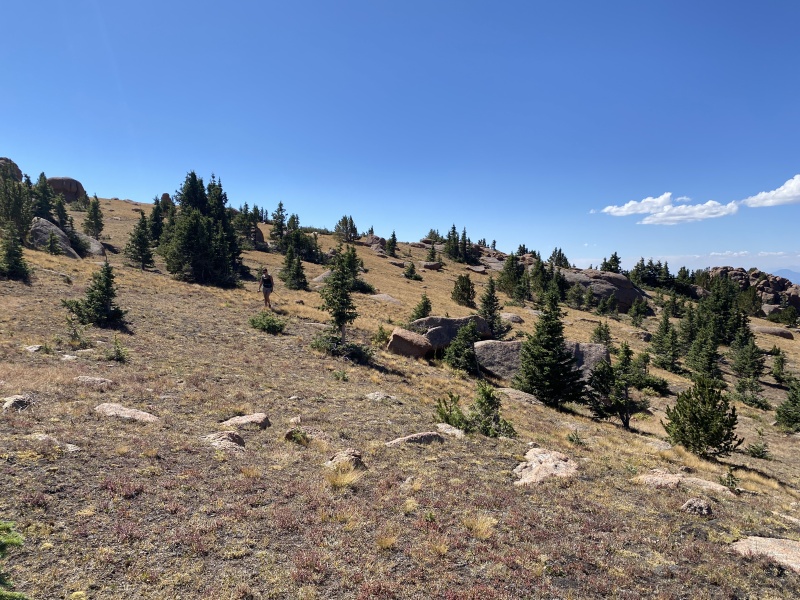

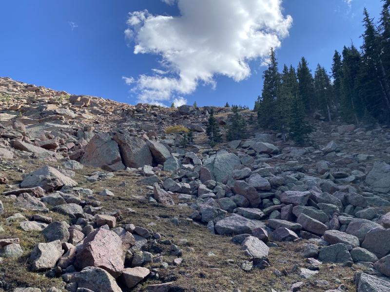
Horsethief Park Approach From Divide, you get a pretty good look at the upper portions of this route through the boulder fields. There is a large "V" in the treeline to the left of Sentinel Point. This "V" is the upper boulder field, of which you will skirt the right side, even going into the trees. The lower boulder field, down and to the right, is surrounded by trees. The trail will take you just to the left of this boulder field before you reach the upper boulder field. 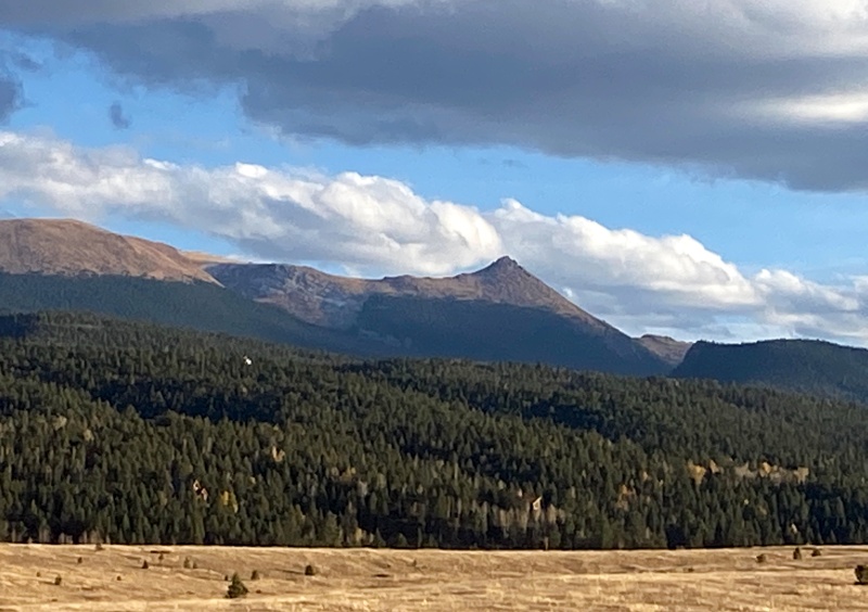
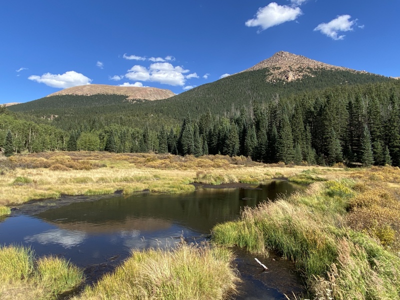
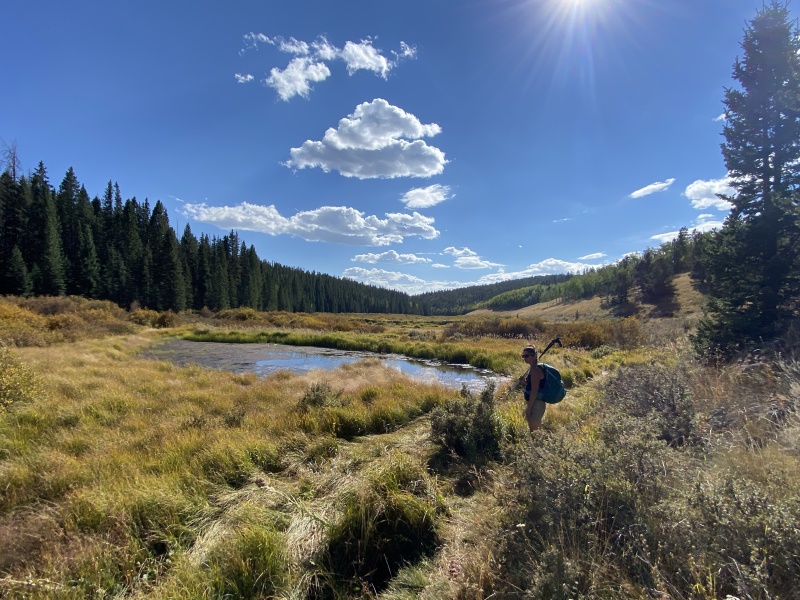
There is a quick switch back at the beginning of the hike, then you come to an old road, which is more trail now than road. It’s a fairly straight hike up with some gain, enough to cause out-of-staters to stop for air. When the trail levels out a bit, you’ll see the trail marker for Ring the Peak Trail which leads off to the left (about .7 miles from the TH). This is also the Horse Thief Park route. Go left. You head into the bushes and cross a creek and shortly you be in the park on a nice trail. You’ll have great views of Sentinel Point. If the beavers have been busy and it’s been wet, there will be some beaver ponds along Oil Creek. The trail skirts the left side of the park and will eventually split, left to Ring the Peak Trail and right to the end of the park. (If you go left, you can also connect to the Crags, via FS Rd 383.) Stay right on the main trail. Pass another pond or two and head towards the aspens as the park begins to narrow. I saw a moose in here one time running around in the snow. The trail leads into a mix or trees. At one point, there will be a meadow on your left with one aspen tree in the middle. The trail will move to the right side of the rock formation as it heads deeper into the trees. The trail will begin to gain elevation and will eventually turn right. This section of trail is fairly easy to follow. Near 10,500, as you move up, and the trail gets steeper, you’ll notice the trail looks more like drainage ditches in parts. When we first starting hiking this area, that’s what most people did, was follow the drainages up. Last time we were here, people had placed way too many BB-8 sized cairns along the route. Even saw some pink paint on rocks. (If you listen, you can find some running water to your left in spots.) Near 11,400, you’ll pop out of some trees and you’ll see the lower boulder field on your right. You can see this lower boulder field, which is surrounded by trees, from Divide. Back into the trees for a bit and you’ll eventually come to the upper boulder field, 11,600. This boulder field looks like a large "V" when looking from Divide. On the right side of this boulder field is a nice treeline. You’ll be in and out of the trees a couple times. Stay right. There is a slight trail through here, and a few cairns. This will lead you into the trees. There is kind of a rough trail, beaten dirt going up. Stay close to the treeline on your left. You’ll come out into the boulders and a steep grassy slope. (This area is why this isn't a great winter hike. Depending on the year, the snow can be waist deep and unsupportive in the trees. And deep enough on the boulders it's too risky to navigate through them without slipping and breaking an ankle.) Take the grassy slope up. You should be up and to the right of the boulder field near 12,000. Continue hiking between scattered boulders and over the rim of the slope and you’ll see Sentinel Point. Do not hike directly toward the summit. Skirt to the left and begin making your way to 12,200 and stay near or just above that elevation. With the Point on your right, and Pikes Peak visible on your left, look for what could be the highest rocks on the Point. 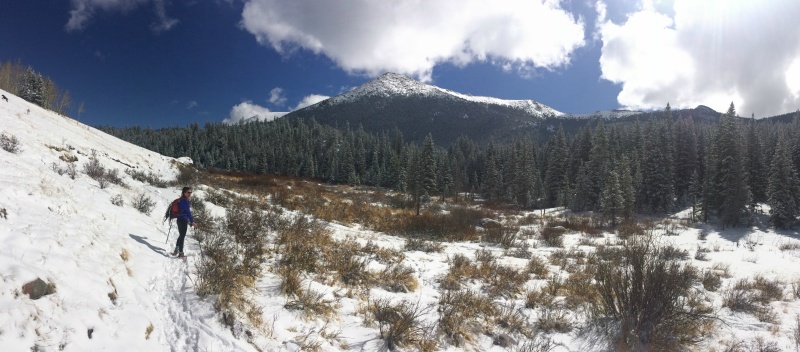
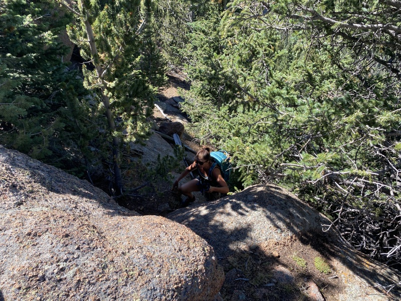
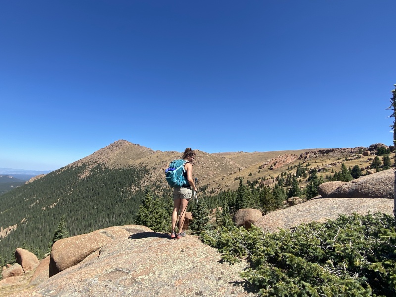
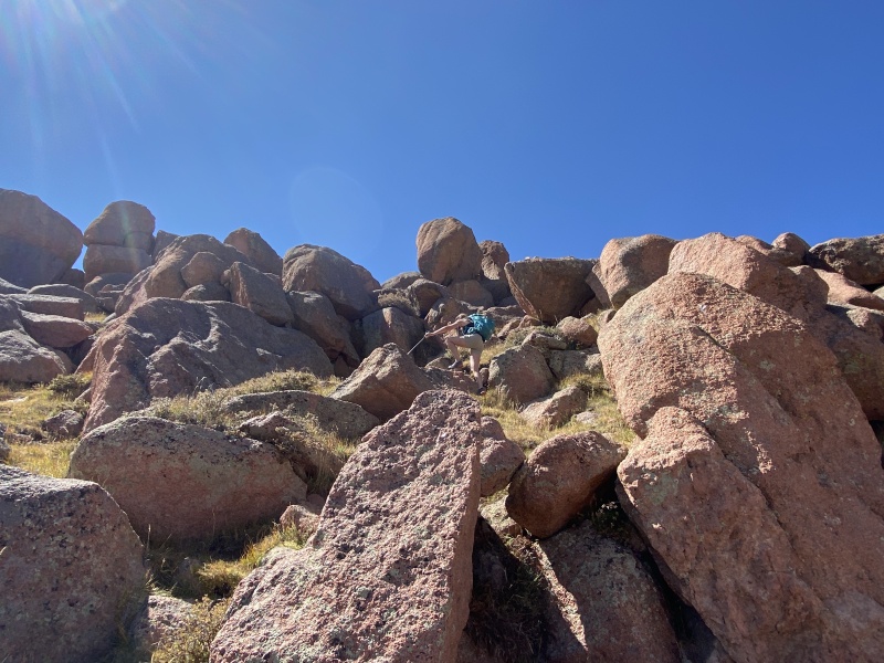
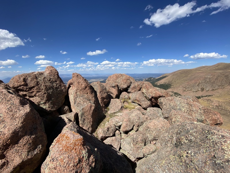
The Summit With the highest point in front of you, Pikes behind you. Move up. Below you, there should be huge square-ish boulder sitting alone, this should be to the south of you, over your left shoulder on the way up. I’d like to say there is an obvious large-flat, but rounded boulder above you, but it’s hard to decide which rock is which. And if you can which one it is, head toward that, staying just to the left. There are some cairns, sometimes. Been there when there were several, and when they weren’t there. This is a grassy slope with ledges of dirt and rock. Some turn into obvious trails moving through the boulders. Have fun. Climb up and over, or move around them. As you get higher, the slope gets steeper and you’re into Class 3 boulders. You can keep this Class 3, or make it harder if you want. But, if you want to keep it C3 and a move looks hard, you probably went the wrong way. Drop down and move around a boulder to the left or right. Before the summit, the grass and dirt mostly disappear, and it is boulders on boulders, with smaller boulders in between. Nice views of Pikes and the Divide area all the way to mountains to the west. Enjoy the summit. (There is a iPhone under one of those boulders. Don’t ask.) 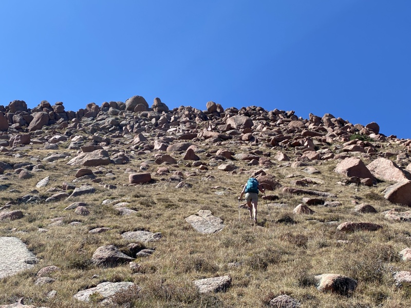
Going Down Follow the same boulder path you took up. If doing the loop and not sure about directions, go back to 12,200. To head towards the boulder field and Horsethief Park: Near 12,200, go left, north. Go over the lip of the slope until you see the boulder field. Head towards it, but stay in the grassy areas. Depending on your course, you might have to navigate a bouldery, rocky area before the boulder field. Once near the edge of the boulders, look for the grassy slope down towards the trees and reverse the directions above. You’ll probably spot a few cairns along the way. 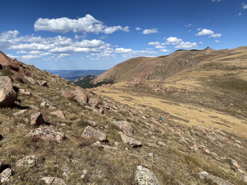
To head towards The Gate and Horsethief Falls: Near 12,200, go right, south. Stay at this elevation. Don’t get temped to crossover the ridge on your right. The terrain is doable, but it’s steep and lots of obstacles. Once you can see the saddle, you should be able to see the route ahead of you to The Gate, which is the rocky formation to the right in the distance. Cross the saddle and head towards The Gate. Through the gate, you should be able to see the rock rib, side hill down to your left and find the three rock outcroppings along the way. There are no cairns on this route. (If you want a quick, dirty and steep way down, once near the saddle, move right, directly toward the "halfpipe" valley. You’ll see a pointy rock outcropping below you on the slope, you can head to that, then to the creek and to the Horsethief Falls. I’ve done it, it’s not much fun.) If you want to hike Sentinel Point, but don't want the elevation gain, you can drive to Devil's Playground and journey from there. It's probably close to seven miles round trip from there. Thumbnails for uploaded photos (click to open slideshow): ")
")
")
")
")
")
")
")
")
")
")
")
")
")
")
")
")
")
")
")
")
")
")
")
")
")
")
")
")
")
")
")
")
")
")
")
")
")
")
")
")
")
")
")
")
")
")
")
")
|
| Comments or Questions | |||||||||
|---|---|---|---|---|---|---|---|---|---|
|
Caution: The information contained in this report may not be accurate and should not be the only resource used in preparation for your climb. Failure to have the necessary experience, physical conditioning, supplies or equipment can result in injury or death. 14ers.com and the author(s) of this report provide no warranties, either express or implied, that the information provided is accurate or reliable. By using the information provided, you agree to indemnify and hold harmless 14ers.com and the report author(s) with respect to any claims and demands against them, including any attorney fees and expenses. Please read the 14ers.com Safety and Disclaimer pages for more information.
Please respect private property: 14ers.com supports the rights of private landowners to determine how and by whom their land will be used. In Colorado, it is your responsibility to determine if land is private and to obtain the appropriate permission before entering the property.


