| Report Type | Full |
| Peak(s) |
American Peak - 13,814 feet Jones Mountain - 13,867 feet Half Peak - 13,866 feet Unnamed 13820 - 13,820 feet Unnamed 13838 - 13,838 feet |
| Date Posted | 10/14/2021 |
| Modified | 10/15/2021 |
| Date Climbed | 10/02/2021 |
| Author | madmattd |
| Additional Members | HikerBox |
| Lake City Centennial Weekend |
|---|
|
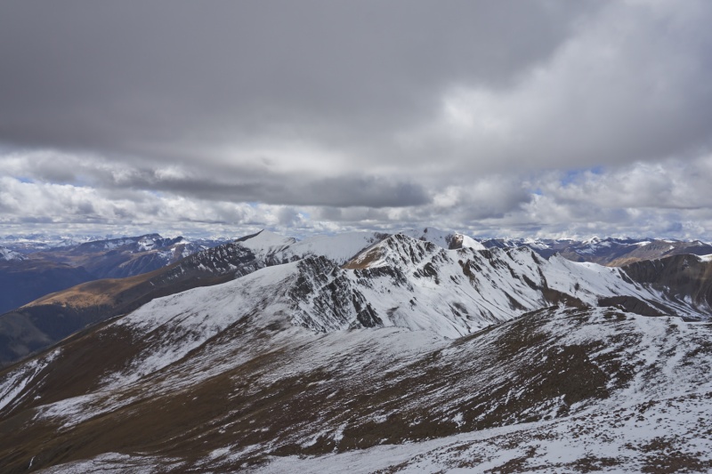
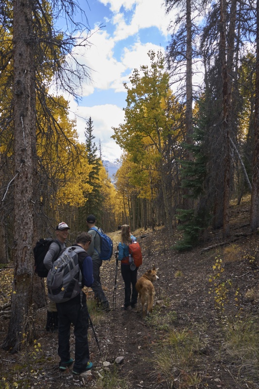
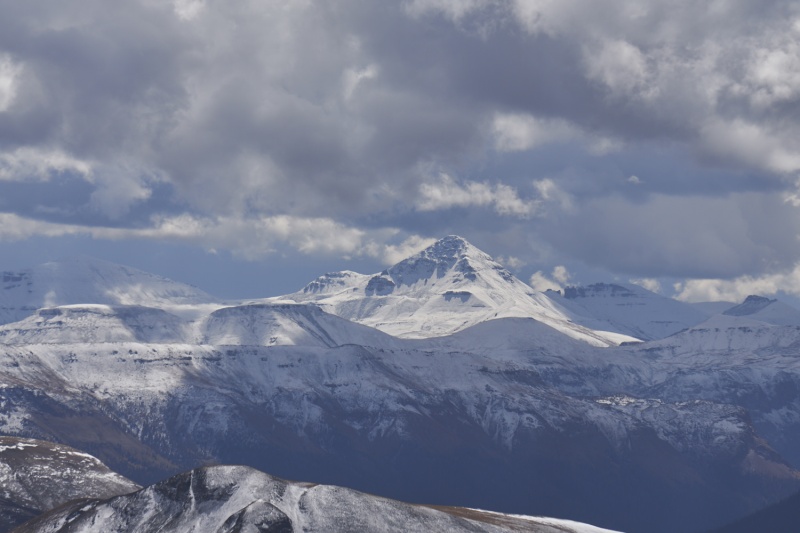
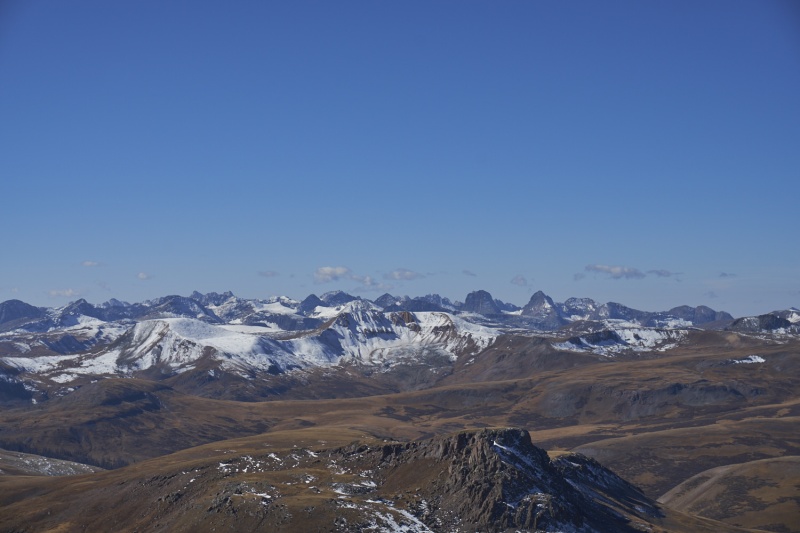
The 14ers.com Fall Gathering provided a perfect excuse to finally make another trip to Lake City (I last visited in 2018). HikerBox and I decided to stay for 3 days and try to hit all 4 centennials in the area in one shot, since they all have trailheads easily reached from the Mill Creek Campground. The original plan was to head down Thursday night and hike Friday-Saturday-Sunday, but an early shot of winter weather encouraged us to delay everything a day. Aside from some traffic near Kenosha Pass, the drive Friday afternoon was easy and pretty nice with the aspens and cottonwoods both really starting to show their colors. I haven't been over Monarch Pass since that 2018 trip to Lake City, and it was nice to get to just ride and look around instead of having to drive this time (thanks HikerBox!). Getting near Lake City we were getting enough peeks through the clouds to see that the snow line looked to be around 12,000' or higher, and not all that deep either. Ok, we might still have a shot at getting this done without too much trouble after all, nice! After finding one of the last spots at a surprisingly full Mill Creek Campground in the early evening, we joined the group at the campfire in the dark. It was nice to meet so many folks from here, and thank you to those that organized it this year. One thing seemed clear: a lot of folks were talking about doing the 2 unnamed Centennials near Redcloud, which was also our plan for the first day as it seemed like it would be the most straight-forward of the 3 hikes. Unfortunately we did a poor job of coordinating with those that were talking about traversing from Silver Creek/Grizzly Gulch to Williams Creek, but it planted the seed in our minds about that option. Day 1: UN 13,832' & UN 13,811' Morning came, and we headed up to Silver Creek, figuring we'd plan on the out-and-back, but if we ran into folks doing the traverse who were willing to let us in on their car spot, we'd jump on it. One thing that surprised both of us driving up the shelf road was how beat up it's gotten in the last couple years. In 2018 I drove a ~6" clearance vehicle to Silver Creek without any issues; now, I'd think twice (or thrice) about doing so. The mudslides of recent years were "cleared" but minimally, and there were a lot more holes, rocks, bumps, etc. A crossover would be my minimum recommendation now, though lesser vehicles can still manage it. The climb up to the saddle below Redcloud went smoothly; the trail is in good shape minus the same spot just past the South Fork of Silver Creek where the trail crosses a small talus field, getting a tad obscure along the way. Snow on the North-facing saddle started around 12,400', but was never more than a couple inches all the way to the saddle. 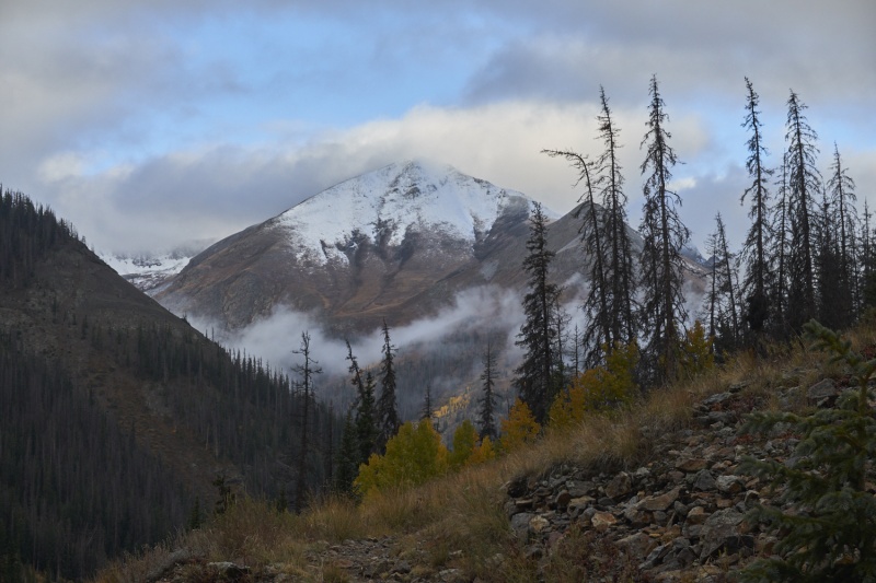
Reaching the saddle, we saw one set of footprints in the snow heading East. Apparently everyone in the parking lot was heading for Redcloud; where were all the people talking about hiking these peaks? Oh well, we headed off into the clouds towards the first peak, UN 13,832'. The footprints were nice for a while, but snow depth was still never more than 4-5", and calm winds meant the going was easy even if the visibility stunk. Around the 13,561'-13,832' saddle we encountered the sole hiker out ahead of us (Justin? - I'm bad with names...). He joined us for the remaining trek to the first centennial. With the low visibility, we ended up on the bypass trail, but eventually we realized this and just cut up to the summit on a steep, slightly loose slope, but it got the job done. 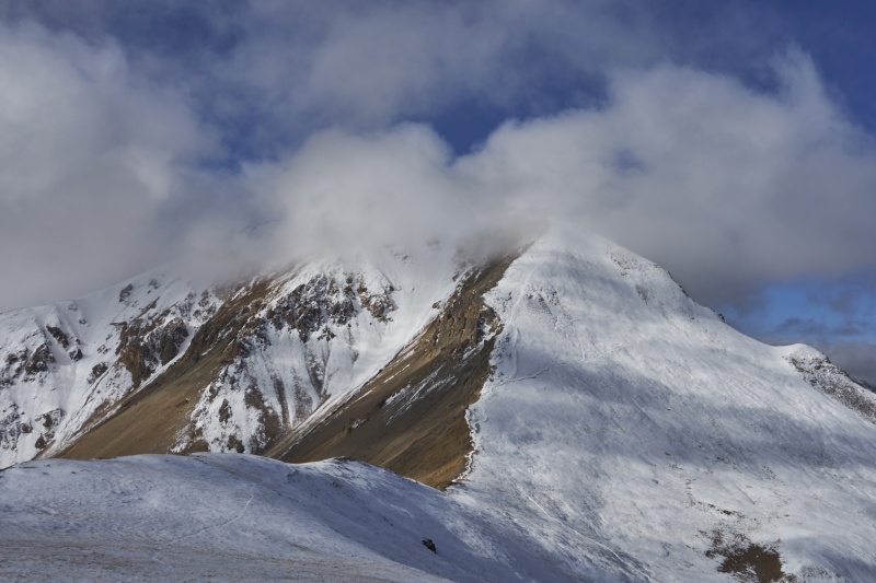
We headed off for the next peak, but Justin stayed behind to decide what he wanted to do. Around 13,632' (which we summitted because it was there; you can easily bypass the upper 50-75' of it if desired) the cloud deck started lifting and views improved. We could also see 4-5 people atop the previous peak now; we'd seen them coming as we left the summit so that was not a big surprise. A steady descent then ascent commenced, and in good order we were atop 13,811'. This would either be our turn around point, or we'd be bumming a ride back from the group coming behind us if they were traversing; we opted to hang out and see what they were up to. 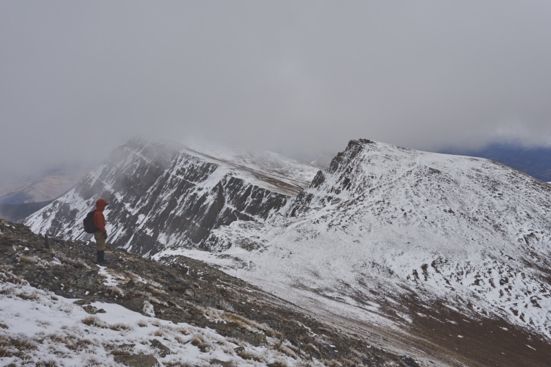
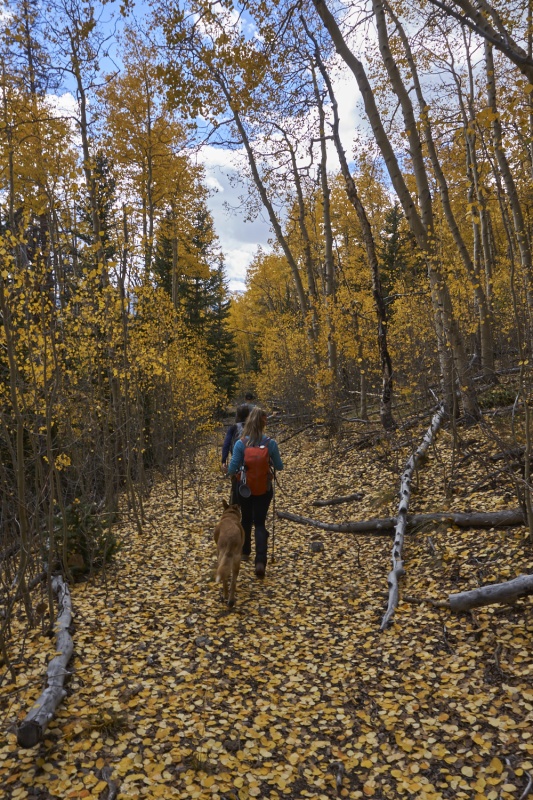
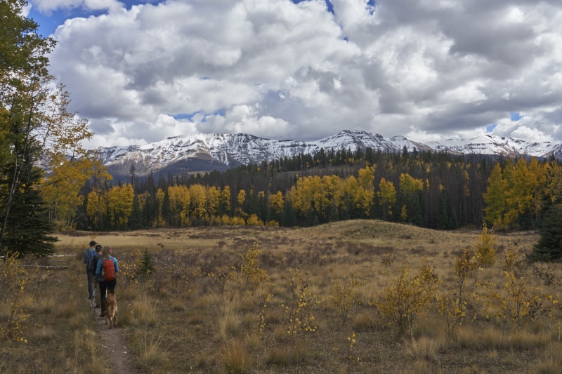
When the group behind us reached us, it was Trotter, Stephakett and Archer, Steve(?), Justin, and another hiker whose name I forget (I'm REALLY bad with names!). They were open to figuring out something to get HikerBox, Justin, and myself back to camp/our vehicles as needed if we wanted to join on the traverse. So we did, and we were very glad we did. The upper ridge is steep tundra, but we could see the road/trail we needed to pick up around 12,200'. Following that down to an actual road that entered the woods, we proceeded to hike through a couple miles of near-peak aspen foliage and meadows, simply awesome! We did make a minor navigational goof getting onto the actual Williams Creek Trail (don't go uphill on the rocky road...the trail is in the valley below), but that was easily corrected and soon enough we were back at the trailhead where we piled 6 people into Steve's 4Runner, dropped 3 of them off at the Mill Creek Campground, and got the rest to their waiting vehicles as needed. Thanks for letting us crash your traverse party, it was an awesome descent route for this time of the year, well worth the slightly longer distance! (And we never did see anyone else beyond the saddle with Redcloud - either we misunderstood how many folks were hiking these peaks on this day, or many changed plans. No matter, we enjoyed the quiet day on the trails!) 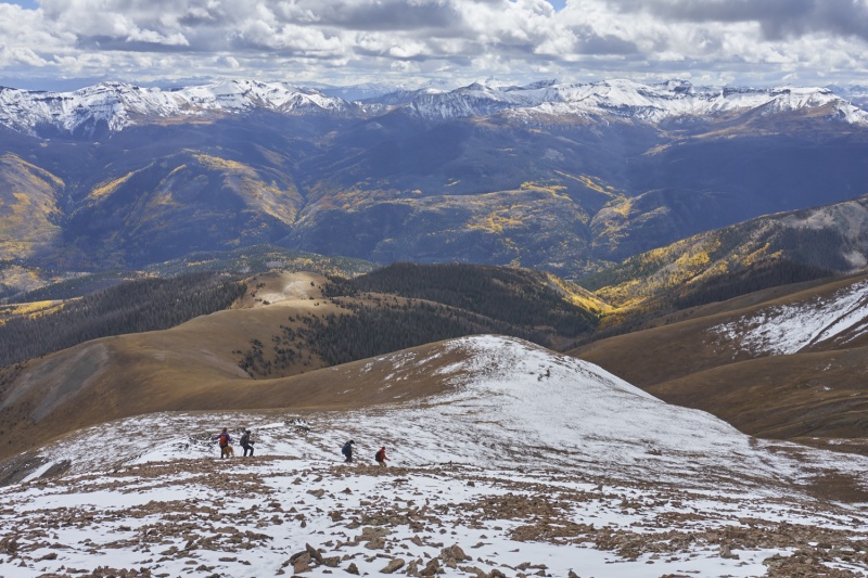
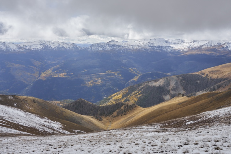
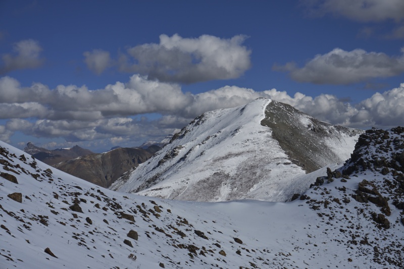
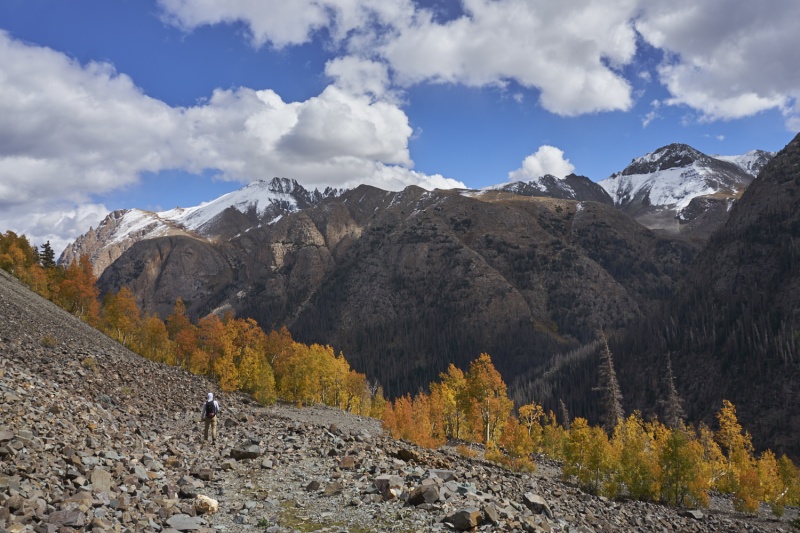
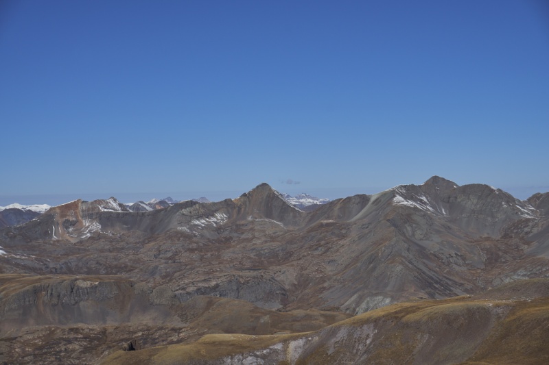
Day 2: American Peak & Jones Mountain A Saturday night at the campfire (after the 90 minutes of rain...) it became clear not a ton of people were hiking on Sunday, and none of those were interested in the Jones Group. Solo group of 2 it was then. After breaking into the bear box that iced shut due to the prior evening's rain followed by cold temps overnight, we quickly ate and drove the Tacoma up to Cuba Gulch; this is definitely a road you want 4WD and clearance for, while a lot of it is no big deal, there's several notable obstacles that would give an Outback a lot of trouble (the first is only 1/10-2/10mi up from the Cataract Gulch TH). In the lightly-lifted Tacoma we had no issues, and only briefly used 4Low, taking around 30 minutes from Mill Creek Campground to the upper trailhead.The parking lot was interesting: it was rockier and bumpier than most of the road up was! The road up the Snare Stairs was closed to vehicles (and bikes apparently :( ) around 15 years ago, and in the first 1/2 mile there are at least 5 signs reminding you of that. That said, the road is still in pretty good shape minus one deep, narrow washout about 1/2mi up, and one switchback that has some young aspens growing on it. Certainly it posed no issue to foot traffic, and the views it offered of the snow-capped mountains and yellow-coated valley below was very nice. Shortly up the road we also spotted a moose eating breakfast in the woods, she was pretty unconcerned by our presence and allowed us to take a bunch of photos. We would see a moose later while on our way down in a nearby place, presumably the same moose. We would see no people for the entirety of this hike, so moose sightings exceeded people sightings, that's pretty rare! 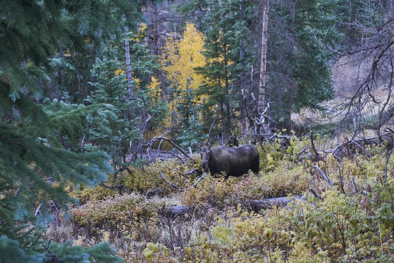
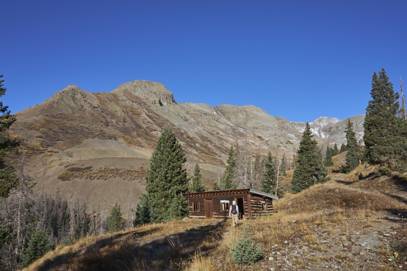
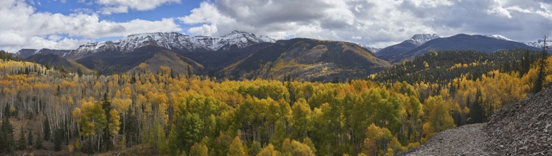
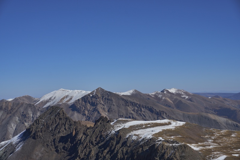
From the old cabin at the top of the Snare Stairs, we continued a little further up the road, past the next 2 switchbacks, before heading off on an old, faint road near 12,000' for ~1/10mi before it swung East away from the basin SE of American Peak. We spied what looked like a decent ramp higher up in the basin that we assumed was Roach's route up, but it got quite steep and loose for a while so I'm not entirely sure we found the best line up to the South Ridge; regardless we both agreed our line would be an awful route to descend (Roach mentions scree in here, so there just may not be a good line). Once gaining the ridge itself just before a minor saddle, we soon hit "consistent" light snow cover, but the rocks were also much more stable (as is often the case on ridge tops vs. just below), so we had no issues up to the summit of American from there. One thing we noted off to the West though was building clouds; the hike had started under typical clear blue CO skies, but this was an obvious sign of instability building, and it was only mid-morning. 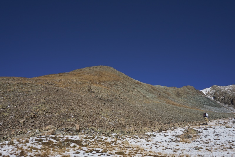
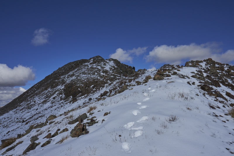
Leaving the summit of American we immediately put on microspikes. That initial descent was steep and filled in with a good bit of snow, and with the couloirs right there, there was no sense in chancing things. Once off that initial descent, it was actually a fairly pleasant traverse over to the Jones-American saddle. I had read in a few places that this stretch was a bit tedious, but either owing to the couple inches of snow smoothing things out or some other factor, we didn't find this stretch a big deal at all. 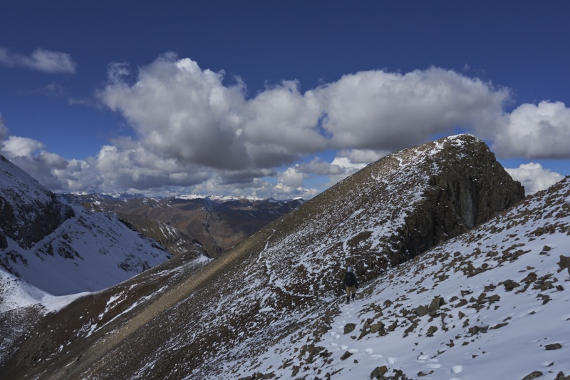
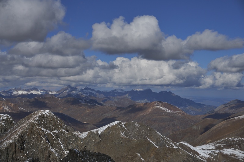
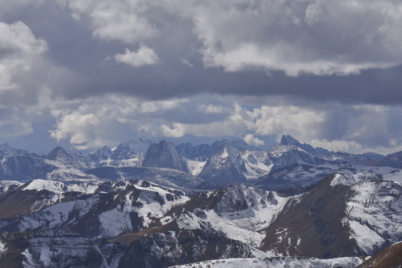
At the saddle, we found some day-old tracks coming over from American Basin, and they led most of the way up to the summit of Jones Mountain (I think these were from bergsteigen?). Microspikes were helpful for the first half of the ascent, then it was mostly bare, somewhat-loose rock from there, so we ditched them and scrambled straight up to the ridge for the somewhat better footing. Atop Jones it became clear that some weather was going to roll in; whether it would be thunder/lightning or just rain (in mid-30s temperatures, yuck) was hard to say, but we could see some rain action down by Chicago Basin, and dark skies off directly behind Niagara (and coming at us). So after a break, we spiked back up for the snowy (3-5") descent to the Jones-Niagara saddle, and at the saddle removed the spikes (no snow left) and sadly turned down into the valley, leaving Niagara for another day. 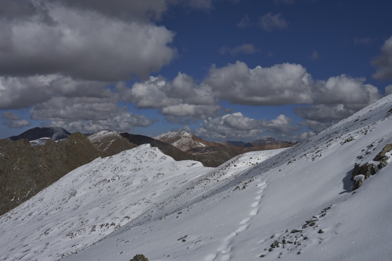
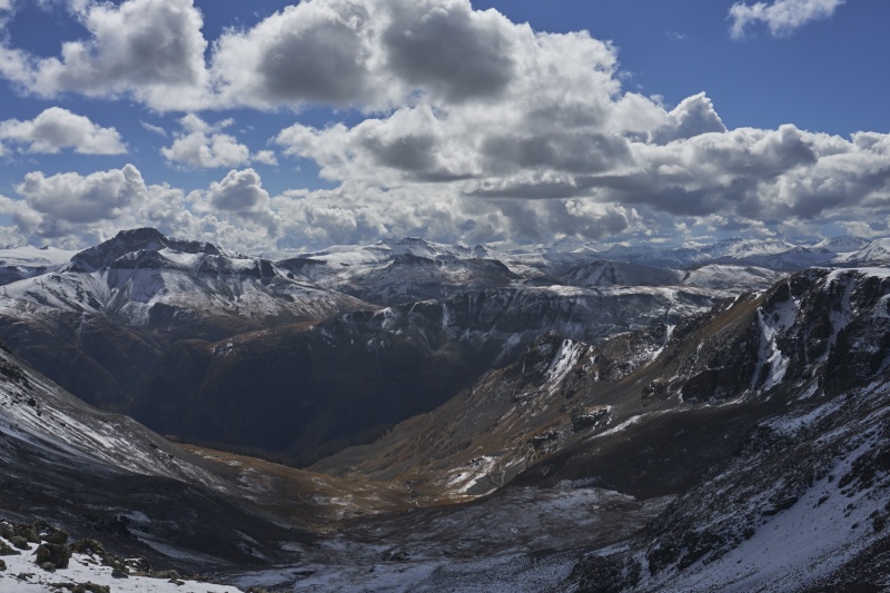
It was fairly simple to cut from the saddle down to an upper lake (pond), bypassing a few minor cliff bands along the way. At the upper lake we got a new experience: squishy talus. Apparently the ground conditions right near this little pond were just right to support the talus, but give when we stepped on it, for a very odd feeling. Soon below the squishy talus we picked up the old road that leads nicely around the South ridge of Jones back to a short ways above where we left the road a few hours before. From there it was just a matter of plodding down the Snare Stairs, and wondering if we'd reach the truck before the rain hit us; we got back dry, and back at camp that afternoon we had numerous waves of 5-10 minutes of light rain followed by clearing skies, then a repeat of the above. This went on for a couple hours, but never reached the soaking rain volumes of Saturday night. Side note: Mill Creek Campground was a ghost town when we returned, all of the folks from this site apparently pulled out during the day. A couple other sites got filled by dark, but only 4-5 sites were occupied Sunday night. 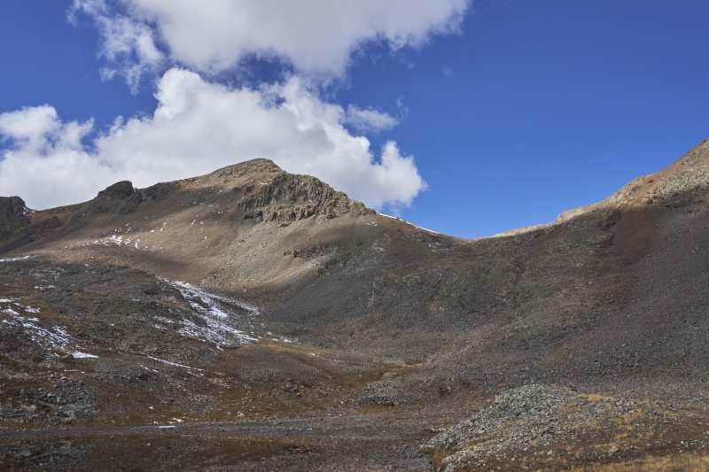
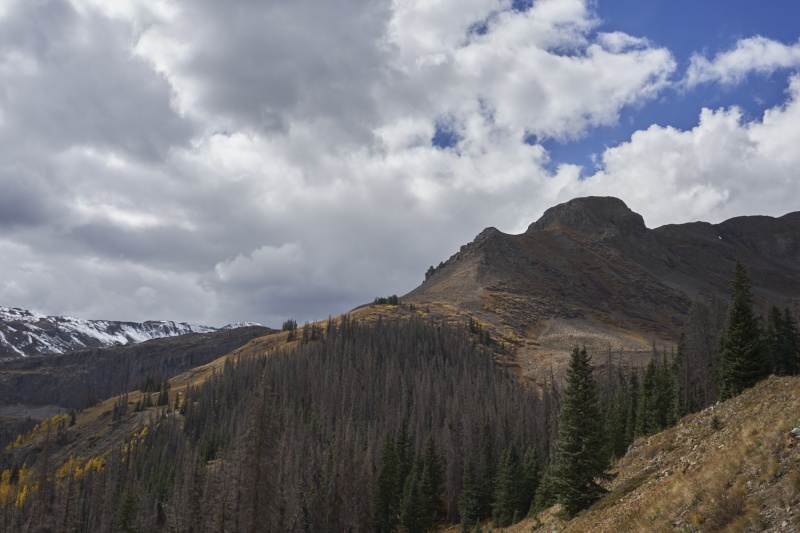
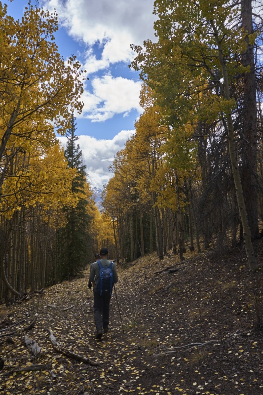
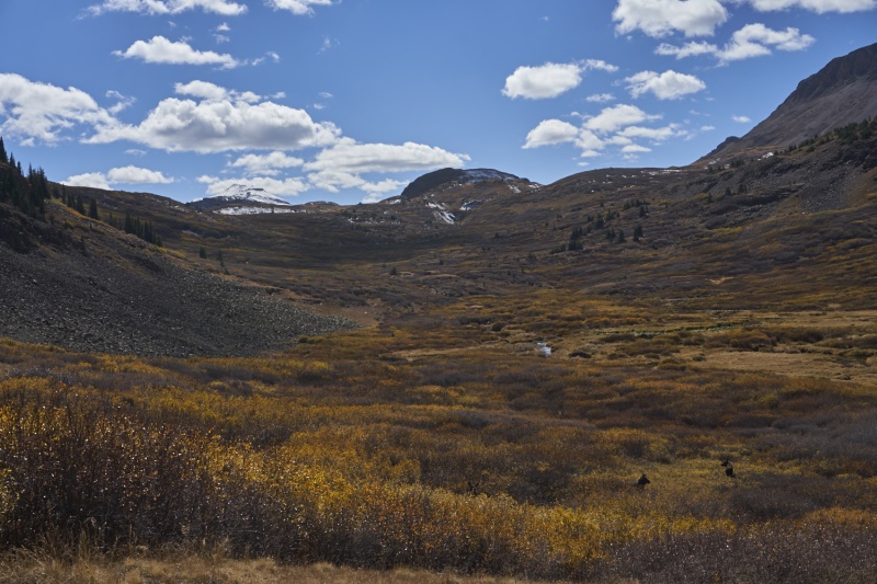
Day 3: Half Peak Originally based on Roach's descriptions we were thinking of tackling Half Peak from Cuba Gulch. But after reading the very few trip reports/conditions reports on that route from recent years, we reconsidered; there just wasn't a lot out there on the route, and the little there was suggested the route was pretty vague even before the 2019 avalanche season messed up the Cuba Gulch Trail. Talking to others around the campfire Friday and Saturday nights reinforced an overwhelming opinion to just take the Cataract Gulch Trail. It sounded like a longer, but simpler day with a lot of easy trail cruising, so that was our final decision. That said, I'd like to check out the Cuba approach at some point in the future, whether all the way to Half or to UN 13,164' at the head of the gulch or whatever else. There's a lot of sources out there stating that Roach's 12.6mi listing is more than just the little bit short that his distances usually are; reports suggested this to be more in the 15mi range. I traced the trail on the FS map on CalTopo and determined it would be around 13.5mi (more in line with reality vs. Roach most of the time I've compared them). So we were a little confused but figured the extra 2 miles wouldn't kill us. But we did opt to get up an hour earlier and hit the trail under headlamp (since it was also only a 5 minute drive from camp to the trailhead, yeay!). Almost immediately (after crossing a solid bridge and a few icy log bridges), the trail starts to switchback. That's not shown in the Forest Service overlay (often the case with the FS maps), so ok there's some extra distance. After around 2 miles and a good 1600ft of climbing, the trail passes a really nice waterfall (after crossing the stream on more icy logs). Shortly above this the grade eases notably and nears treeline. Then the trail swung backwards (towards the trailhead) and up the East side of the valley. Also not in the FS map, ok, we think we see where the discrepency in distance came from now. After this, the trail really flattens out and meanders generally uphill with minor downs to Cataract Lake. A short climb beyond saw us at the Continental Divide Trail junction. 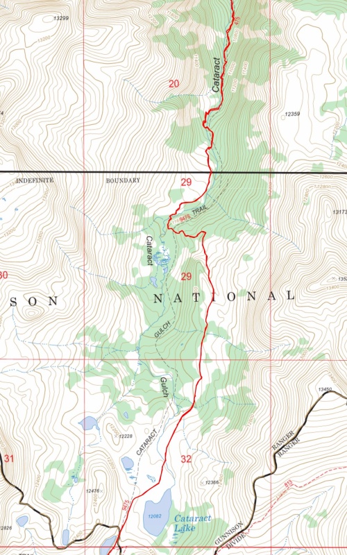
This doesn't show all the switchbacks in the first mile either. The USFS often simplifies their representation of trail routes, but this one is laughably inaccurate. 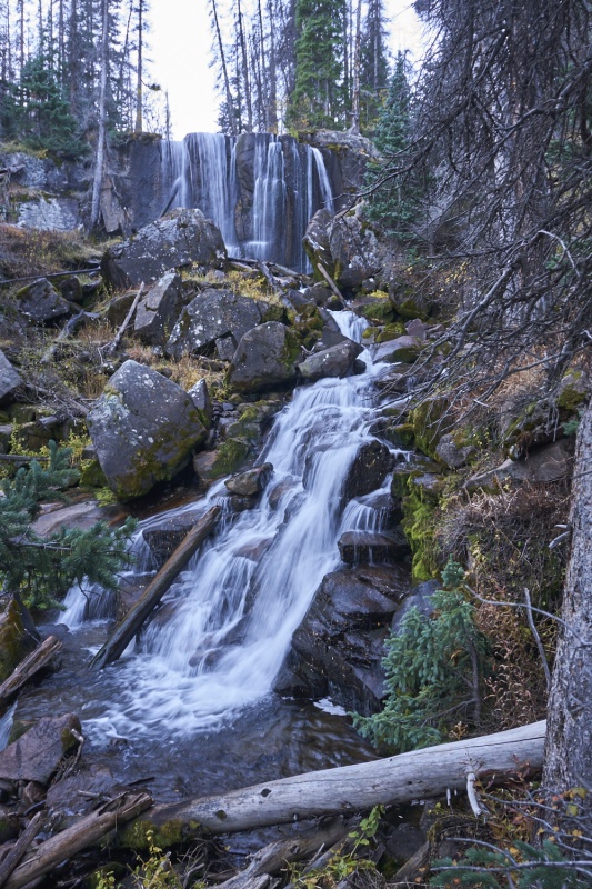
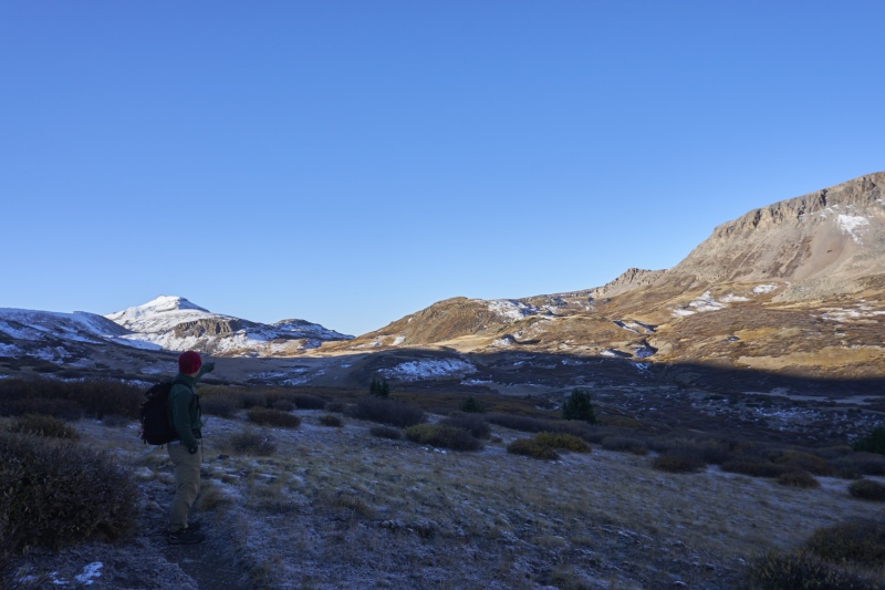
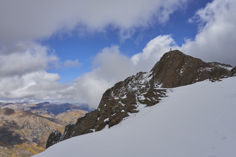
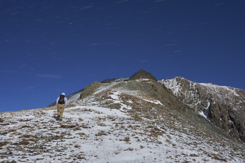
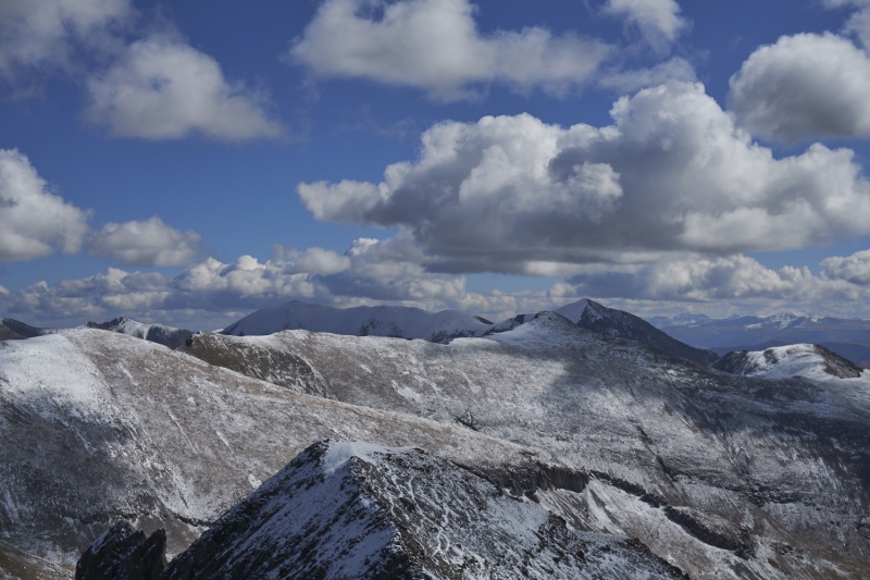
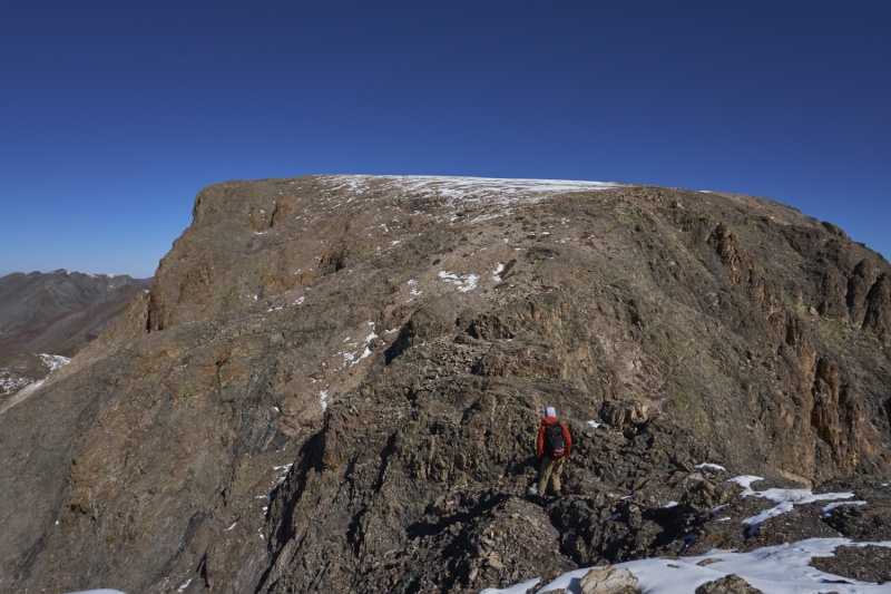
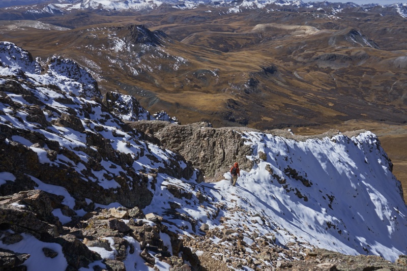
Following the CDT for ~1 mile, we headed NorthWest off trail up an obvious gully, staying just to ascender's right of a small rock gully down the middle, mostly on moderately steep tundra. The initial few yards off the trail were swampy (we started up just before a stream that comes down the gulley depending on the season - it was pretty dry this time of the year), and on the way down we found a good path through the willows to avoid this, but either way it worked well. From the upper part of this gully you head North uphill on moderate tundra to the false summit at the start of the Hourglass. In here is where we ran into the first consistent snow of the day; prior to this there were only a few patches in the shade near Cataract Lake. 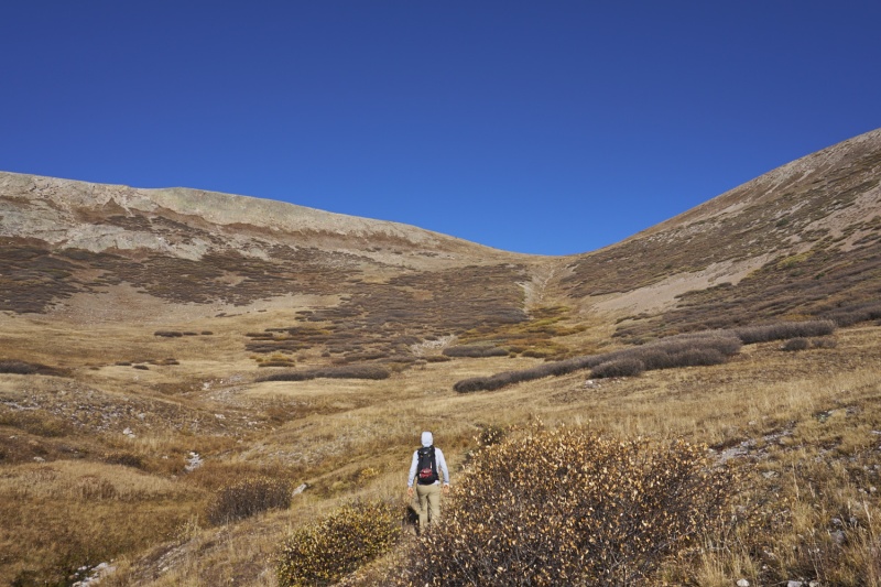
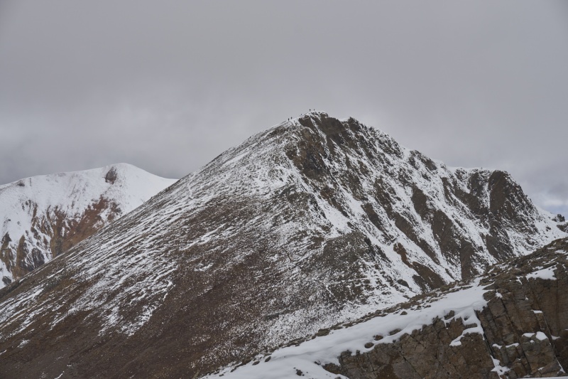
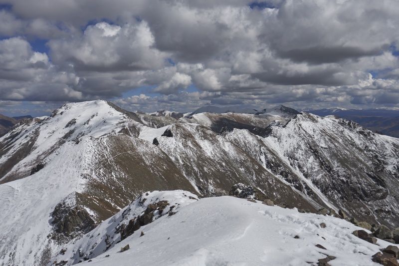
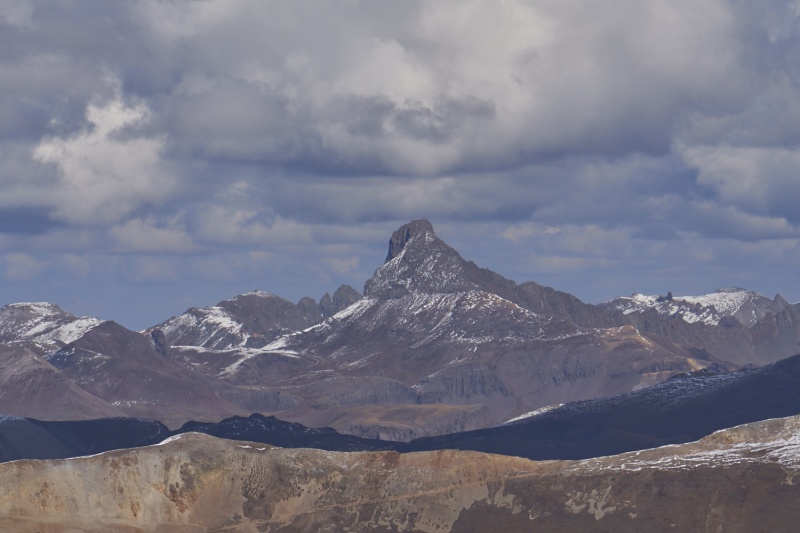
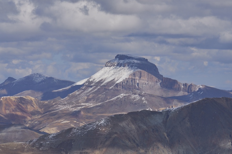
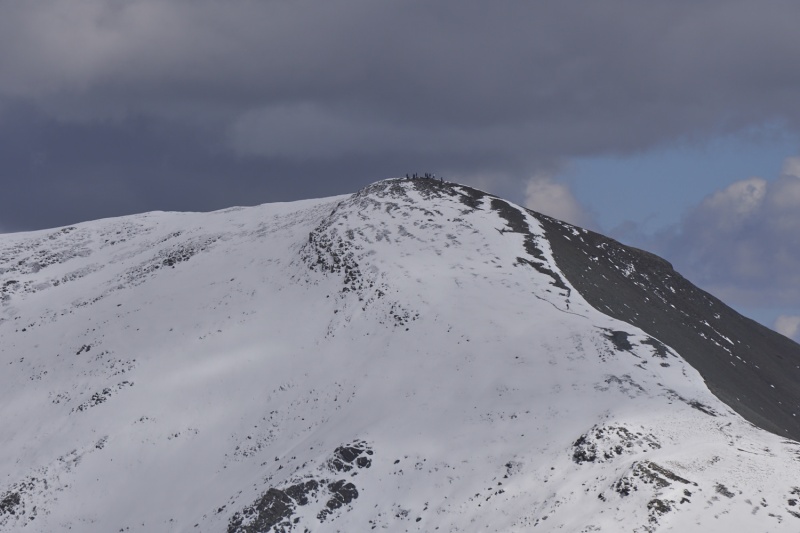
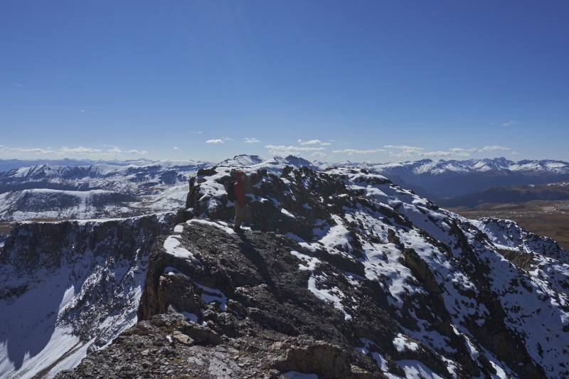
I was a little concerned about the hourglass, particularly the odds that it held snow in awkward places from the last couple days. I knew it had "some exposure", but hadn't seen many pictures of this section to understand that, and I'm not much of an exposure fan. Adding snow to the mix was my major concern. In my (wimp's) opinion, the exposure is solid in places on this section, with a sheer 1000' cliff to the East, and it's not a whole lot better to the West. Still, with HikerBox's aid, I made it across and back (back was much easier for me, likely because I'd already done it all at that point). There wasn't too much snow, and only one 15' stretch where microspikes would have been nice (and totally in the way for most of the rest of it), but ultimately neither of us used them. Roach's description suggests you drop as much as 80' on the West side, but we were never more than 30' below, and usually within 10' of the ridge crest. 80' down is off the cliffs... The rock is mostly solid, and the few loose spots were manageable. The class 2 rating feels a little light, there were a couple class 3 spots, nothing major or sustained, but there nonetheless. But all in all, I kind of enjoyed the trek back from the summit (outbound I was less enthused...). However, spots like this are why I'm unlikely to finish the 14ers (though you never know). I thought I took a bunch of good perspective pictures of this area to show, but most of them don't really convey it... 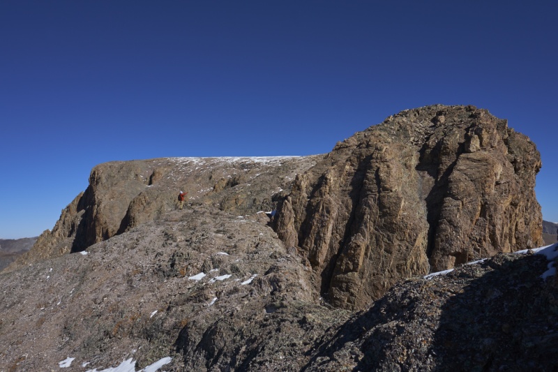
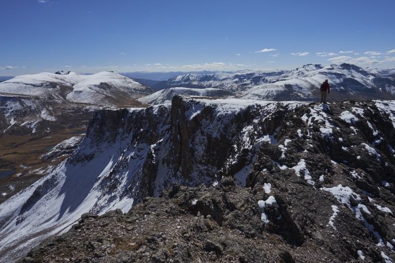
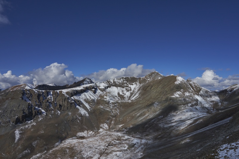
After a short stay at the summit (and it's undercut cliffs!), we sped out of there, as we had nearly 8 miles back, camp to break down and pack up, and a 5 hour drive home to do. We made great time once back to the trail at the base of the gully, getting back a good 45 minutes or so faster than expected. We also had flawless weather for this hike; once the sun finally rose over the 13ers on the East side of the basin it was comfortable (even a tad warm), there were basically no clouds all day, and hardly a breath of wind. 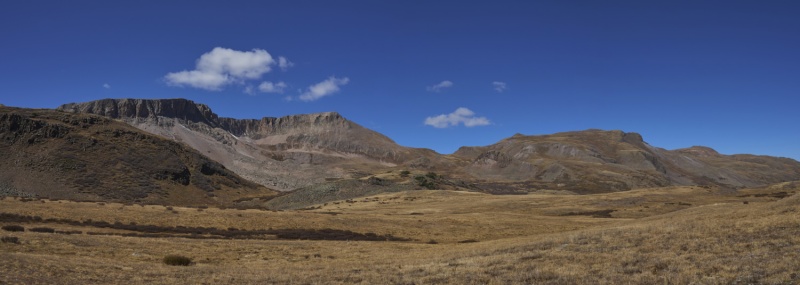
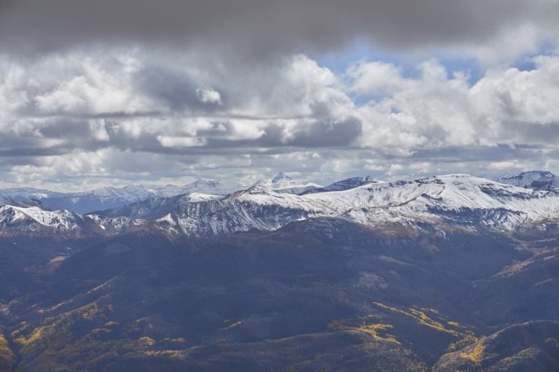
Someone at one of the campfires (I think it was yaktoleft?) mentioned this being their favorite non-scramble centennial, and I can see why. The Cataract Gulch Trail, while long, provides a pretty easy and scenic trail in and out, the hourglass is pretty cool, and the summit perch is awesome. The peak itself is really unique to look at; with 1000' near-vertical cliffs for ~350 degrees around the summit but the fairly gentle South slope approach to that narrow, it's like no other peak I've seen. Seeing no people for the second day in a row was pretty awesome too. A highly recommended hike. Oh, and Roach's 4241' elevation gain for this hike is really off. That's barely the net elevation gain from trailhead to summit (ignoring the ups and downs along the way that add up). 5000-5100' is what I've determined off the map with my GPS track, the exact value being obscured by the small ups and downs on the hourglass. That feels about right given there's a couple ~100ft ups/downs to add to the hourglass and such. Just something to be aware of. The Cuba Gulch approach does start 1000+' higher up, and appears to be a bit shorter in distance, but the ~25 minutes (each way) of driving on the 4WD road offsets a lot of that difference. All told a wonderful weekend in the San Juans. 38 miles and 13,690' of gain over 3 days. That's 2 trips for me this year to this corner of the state (this trip, plus Rio Grande Pyramid over Labor Day Weekend) after none since 2018. I need to make this area more of a priority, the scenery is always amazing! Thumbnails for uploaded photos (click to open slideshow): ")
")
")
")
")
")
")
")
")
")
")
")
")
")
")
")
")
")
")
")
")
")
")
")
")
")
")
")
")
")
")
")
")
")
")
")
")
")
")
")
")
")
")
")
")
")
")
")
")
")
|
| Comments or Questions | ||||||||||||
|---|---|---|---|---|---|---|---|---|---|---|---|---|
|
Caution: The information contained in this report may not be accurate and should not be the only resource used in preparation for your climb. Failure to have the necessary experience, physical conditioning, supplies or equipment can result in injury or death. 14ers.com and the author(s) of this report provide no warranties, either express or implied, that the information provided is accurate or reliable. By using the information provided, you agree to indemnify and hold harmless 14ers.com and the report author(s) with respect to any claims and demands against them, including any attorney fees and expenses. Please read the 14ers.com Safety and Disclaimer pages for more information.
Please respect private property: 14ers.com supports the rights of private landowners to determine how and by whom their land will be used. In Colorado, it is your responsibility to determine if land is private and to obtain the appropriate permission before entering the property.


