| Report Type | Full |
| Peak(s) |
Jagged Mountain - 13,833 feet Teakettle Mountain - 13,815 feet Dallas Peak - 13,812 feet Vestal Peak - 13,867 feet Arrow Peak - 13,817 feet |
| Date Posted | 09/30/2021 |
| Date Climbed | 09/13/2021 |
| Author | Will_E |
| Centennial Final Four |
|---|
|
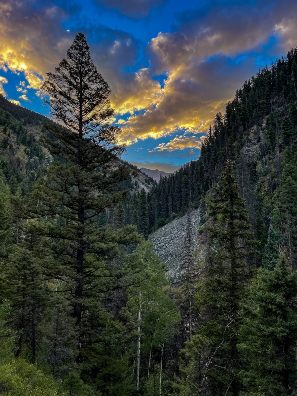
Centennial Final Four Technically, these were not my final 4 centennials. As I was working through the centennials this year, I thought it wise to keep an easy one in my pocket in case weather wasn't good, or I had a weekend that I was short on time and couldn't get to the San Juans. So I held on to Edwards as my contingency centennial, but never ended up with a situation I couldn't get a tougher, more distant peak, so Edwards ended up being my next to last centennial. I'm still calling these my final four, because they were the toughest and the most exciting. Just like when I completed the 14'ers, I saved the hardest for last. Also, I drug my feet on learning to rappel until I pretty much had no choice. As I was trying to decide what order to do the class 5 peaks that most people rappel on, I reached out to blazintoes and bmcqueen to get their advice on easiest to hardest. Blazintoes said Dallas is hardest, Teakettle is easiest. McQueen said Jagged is hardest, Teakettle is easiest. So since they both agreed that Teakettle was the easy one, I decided I'd start there, and since Dallas wasn't far from there, I'd try for it in the same weekend. I was working in Arkansas the few weeks prior to doing TK and Dallas, flew home on a Thursday afternoon with plans to unpack, repack, and head straight to the Blue Lakes TH, figured I'd get TK on Friday, Dallas on Saturday, then CaptainSuburbia and I were looking at doing Little Bear West ridge on Sunday. A nice full weekend. When I got home on Thursday, the driver side window was down on my toaster. First thought was that someone broke in. Look down the door, window isn't broken. Take apart door panel and discover the regulator is busted. Crap, there goes my weekend. Went to shop #1, they don't do that kind of work. Went to shop #2, he says he can have me fixed Friday by noon. Boom, back in business, but now I can't do LB with CaptainSuburbia because I lost a day. Shop finished up early, and I was on the road before noon. I camped at the Blue Lakes TH, I'd been wanting to see the Blue Lakes, the camping options aren't good in Yankee Basin, and honestly, doing TK from that side is such a short hike that I wouldn't earn much beer. 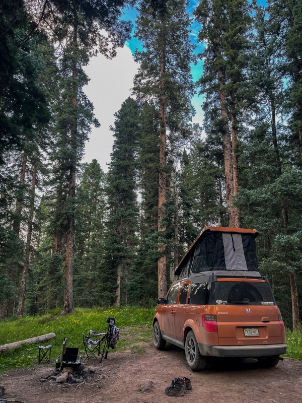
Woke up Saturday morning around sunrise and started up the trail. Not a ton of people out, once I reached the camping area below the first lake there were several tents set up. Continued through quietly. 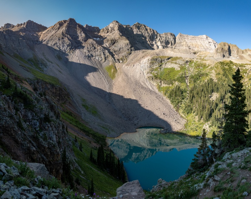
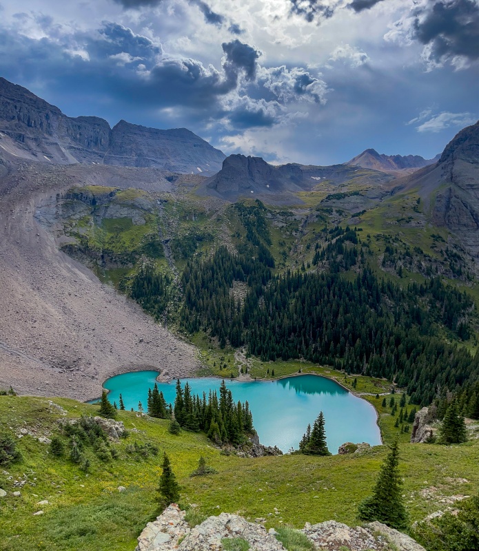
Took plenty of pics of Lower Blue Lake, the color is so cool. Continued up to Blue Lakes Pass, was making pretty good time, met a few at the top of the pass. Now it was time to descend all the way back to treeline before heading up towards TK. 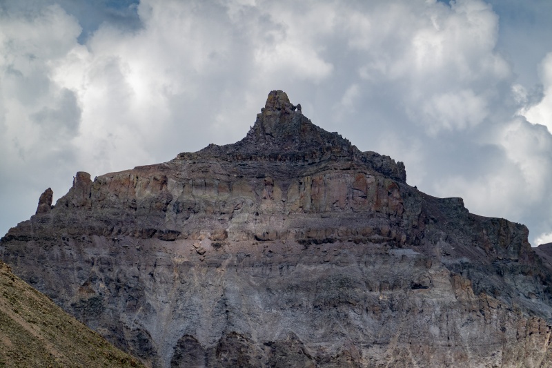
It was pretty steep initially after branching off the road, but not terrible to ascend. 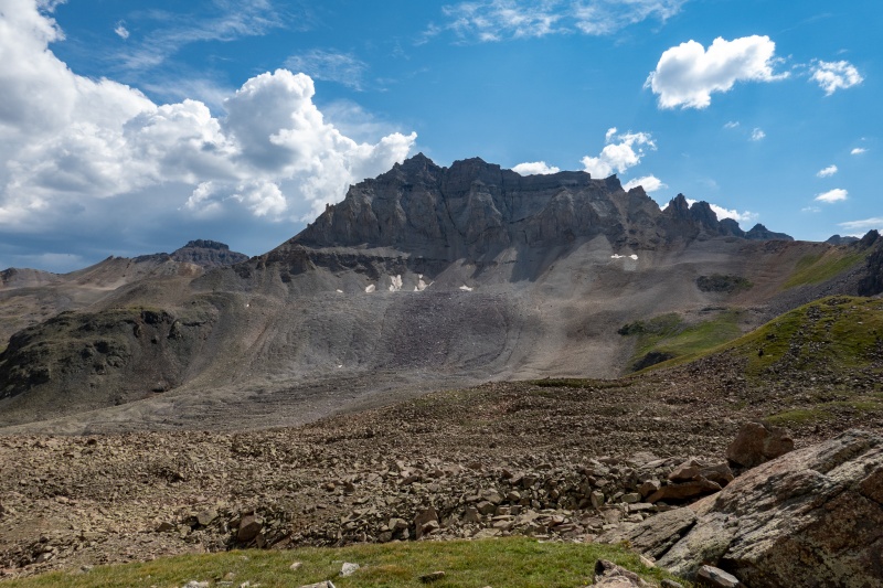
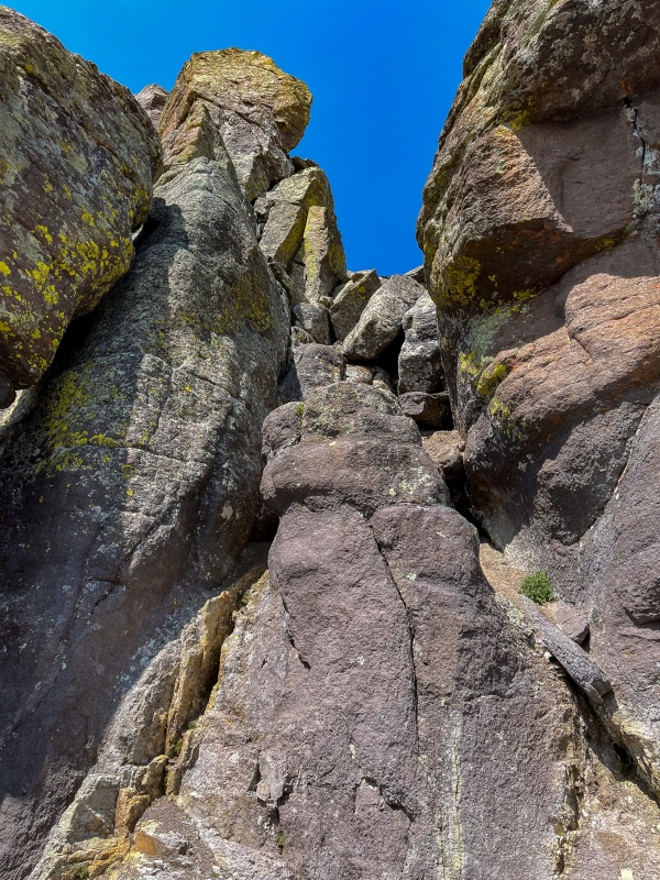
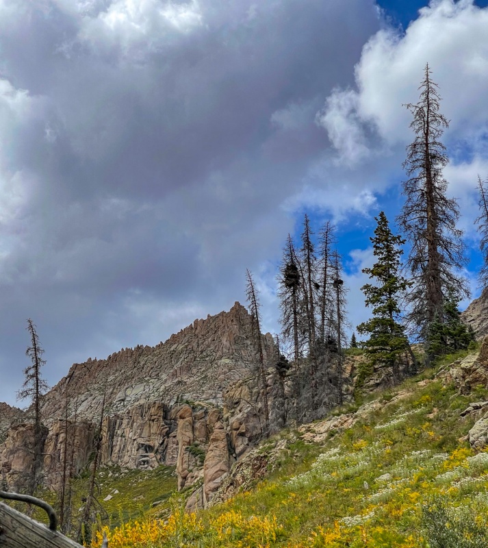
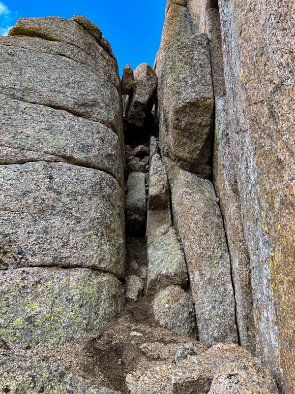
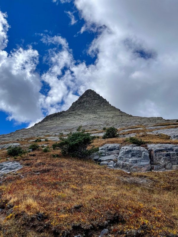
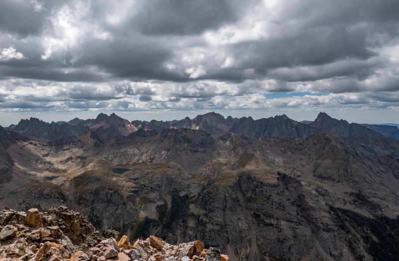
Eventually made my way to the nasty scree mess to gain TK's upper ridge. Honestly I didn't think it was terrible to ascend, I stayed mostly at the far right side. 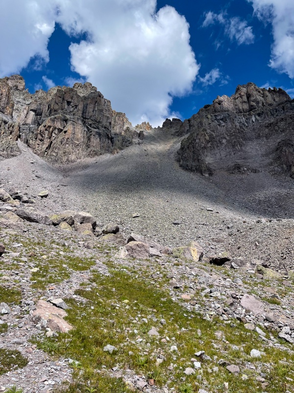
Once getting above the scree field its not far to get to the final tower. 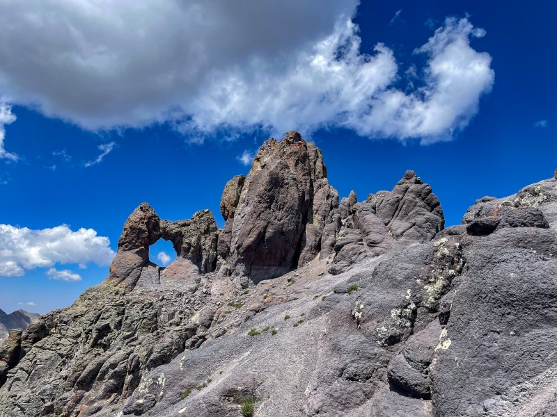
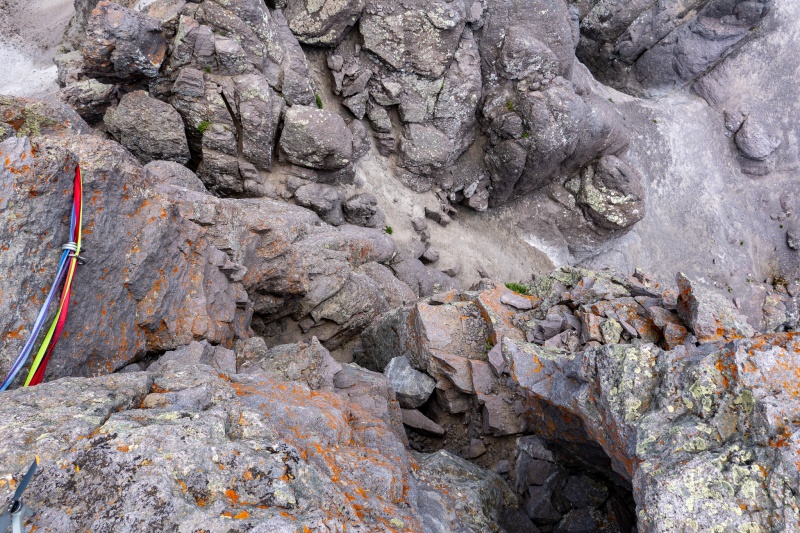
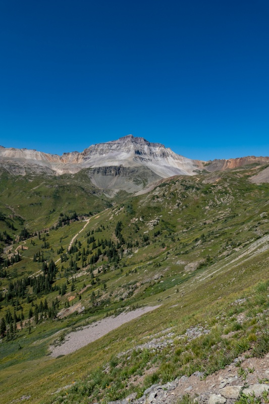
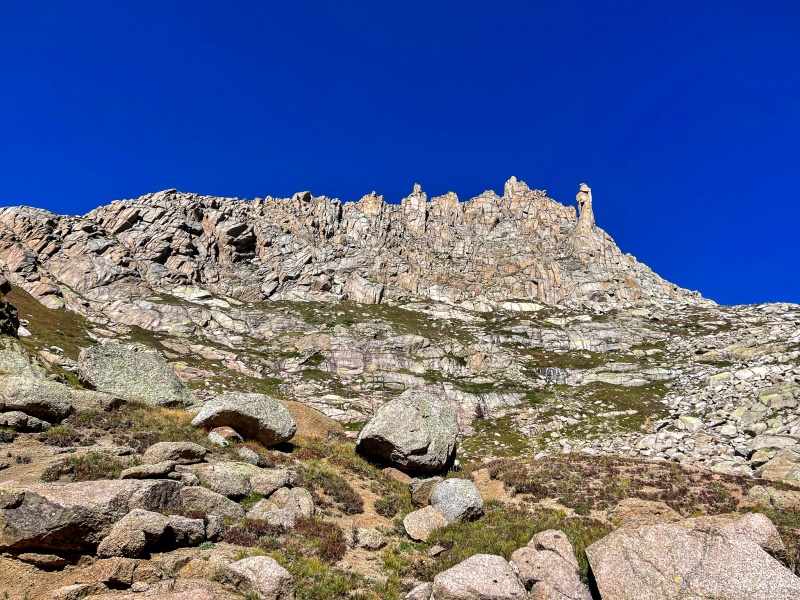
I brought a 30m rope with me, this would be my first real world rappel. I took a class with Denver Climbing Company (recommended), and did a bunch of practicing in Arkansas off my sister's deck. I find the actual rappelling to be easy, my only anxiety comes from setting everything up properly, screwing that up is what would cause me to go splat, I figure. After climbing to the summit, spent a while enjoying the views, weather was nice and calm. I like summits that are small, makes it feel more mountain like than if you could play a game of football on top, like Long's Peak. TK is particularly tiny, could maybe fit 4 people up there comfortably. When I was done at summit, busted out the rap gear. The existing webbing looked fine to me, so trusted it. Rappel went smooth, thankfully, and I was on my way down soon enough. Made my way to the scree field, which was miserable to descend, compounded by my never-ending desire to move quickly and make good time. I slid a few times, but nothing too serious, just some cuts. Fortunately nobody around to hear my cursing when I lost control. Made my way back to Blue Lakes pass without descending as far as I had on the way up, and got back to camp with plenty of daylight. Great long day, Apple says 20.64 miles and 7218' elevation gain, which felt accurate. The next day I woke up around sunrise, packed up camp and headed to the Mill Creek Trailhead to get Dallas. Started hiking a little after 9am, wasn't too worried about getting done too quickly, I knew if I was anywhere near the front range before 6pm I'd just be suffering in Sunday mountain traffic with my manual transmission toaster. Nice views on the approach to Dallas, good weather and not many people out. 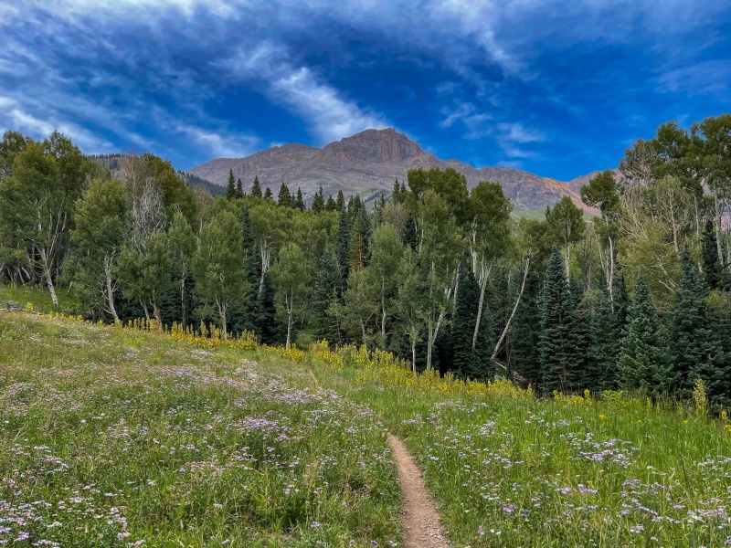
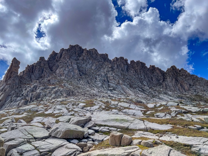
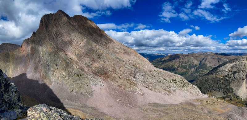
From where I left the Mill Creek trail to reach the rocky sections of Dallas wasn't bad, not terribly loose, and a short section of scrambling. After getting to the back side of the mountain the real fun begins. 

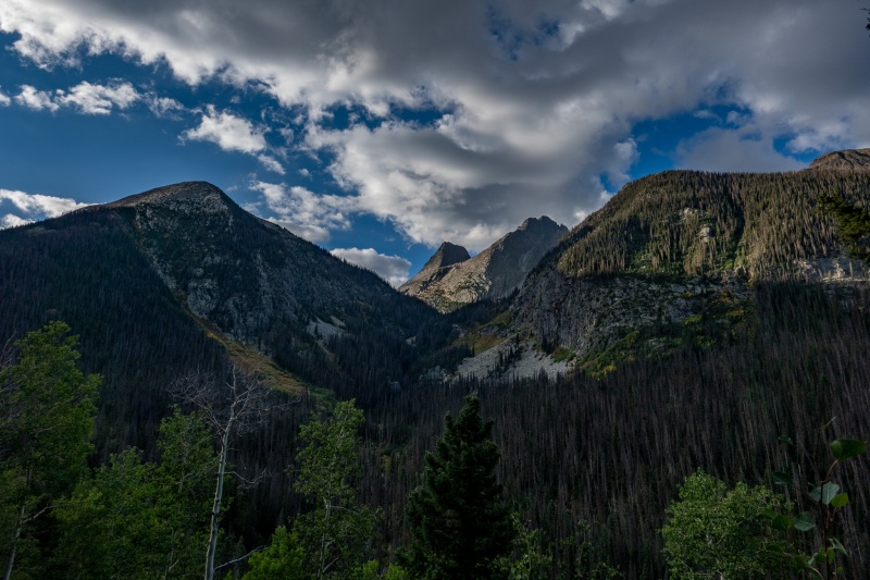
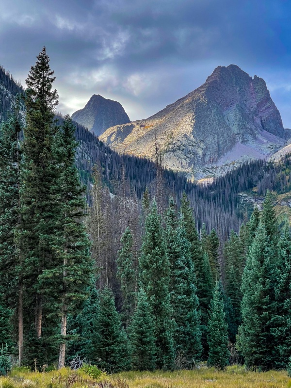
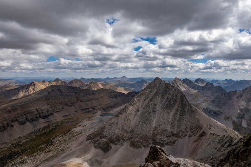
For me the hardest part of Dallas was the route finding. Its really not my strong suit anyway, there are lots of places it looks like you can ascend the final section of Dallas, I went up in 2 different places only to come back down and backtrack. It was sort of comforting knowing that I wouldn't need to down climb anything I went up on the final section. Summit of Dallas was nice, very calm and sunny. Views of lower Blue Lake and Sneffels was spectacular, I think Dallas has better views than Sneffels. Had good cell service at summit so texted my SAR watchers that I'd be heading down soon. I brought a 46 meter rope for Dallas, Blazintoes told me it'd be plenty, it worked well. 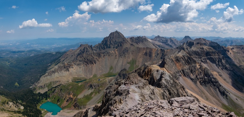
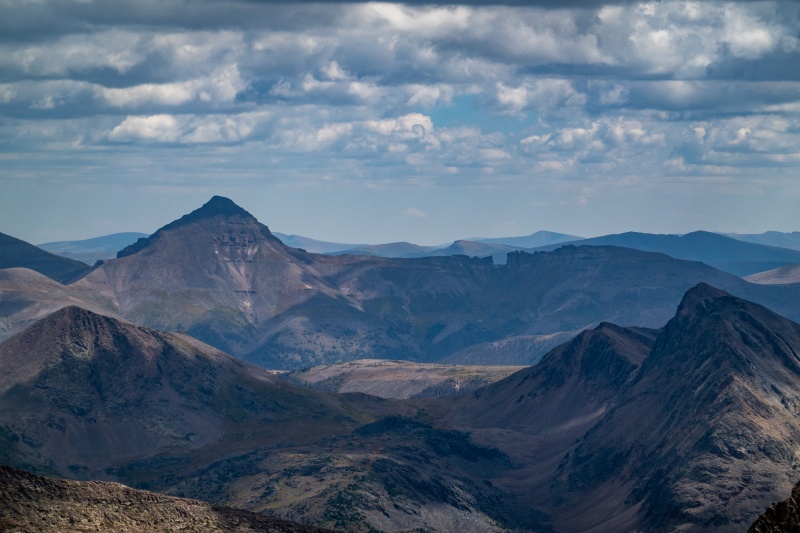
Getting down Dallas was uneventful, though I wasn't crazy about how close to the edge the summit rap station was, not a lot of space to test my setup, but the rap went fine. There are a few additional rap stations that I didn't use on the way down, they didn't really seam necessary. Retraced my path back to the trail and back to the car without issue. Apple says 12.04 miles and 4735' of elevation gain in 6 hours and 3 minutes. Not bad. Drove home to Aurora, unpacked, repacked and flew back to Arkansas for work the next morning. Another 11 day stretch in Arkansas losing some of my altitude acclimation. As my week started coming to a close in Arkansas I'd been watching the weather forecast, hoping it would be workable to try and get Jagged. Fortunately, it was looking good for both Friday and Saturday. I landed around noon at DIA, got home, unpacked, repacked and hit the road for Vallecito. I had planned to stay at the USFS campground at the Vallecito TH, but there were no spots able to be reserved online, so I was hoping that there'd be a spot available since I was getting there on a Thursday night. I pulled into the campground around 9pm and there were actually several spots open, which was great because I had no backup plan. This would be the first time I've actually paid money for a campsite, which I was happy to do to be right at the trailhead, as I was planning to day trip Jagged. I didn't need extra distance, or the hassle of packing up camp before heading out. Packed up my pack while my brats were cooking, ate dinner in the toaster, and was in bed a little after 10pm with my alarm set for 2am. Didn't sleep much, had a bit of anxiety about Jagged, because, well, its Jagged. Woke up and was on the trail around 2:30am, good weather to start, just a little cool, but good sweater weather. Around 3:30 it started raining, not terribly hard, but it lasted until around 5am, which I thought was kinda odd, it never rains in the morning in Colorado. The rain was steady enough that I got fairly wet, but it was never hard enough that I put on my rain gear. My shorts and shoes were pretty well drenched from how wet the foliage was. The positive was that for the 2 stream crossings I didn't need to take my shoes off. I was still making decent time, the rain just made it less than pleasant. 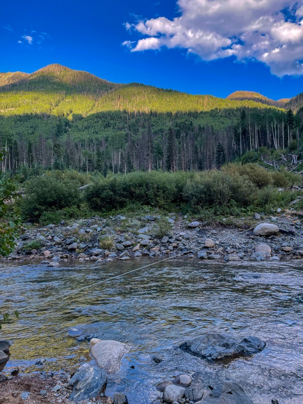
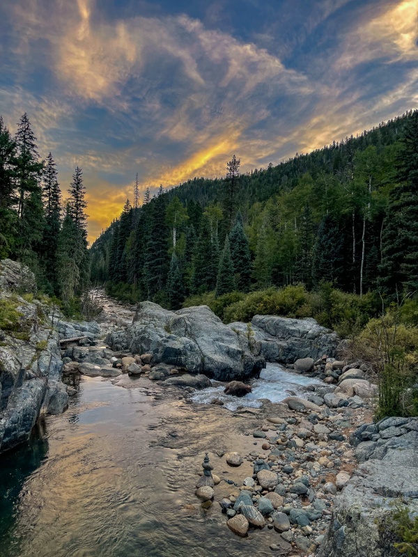
I couldn't take many pictures on the way in, these are some shots from the Vallecito trail on my way back: 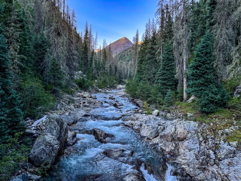
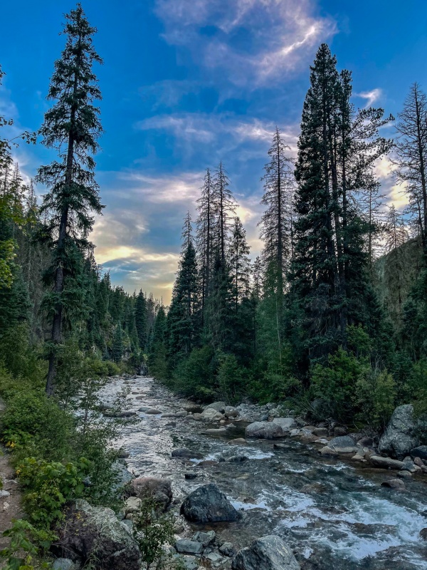
After branching off the Vallecito trail to head west towards Jagged I had in my head that I'd be bushwhacking until treeline. Not sure why I thought this, it was a pretty good trail all the way to the base of Jagged. Passed a group of 4 backpackers, they would be 4 of the 5 people I saw all day long. 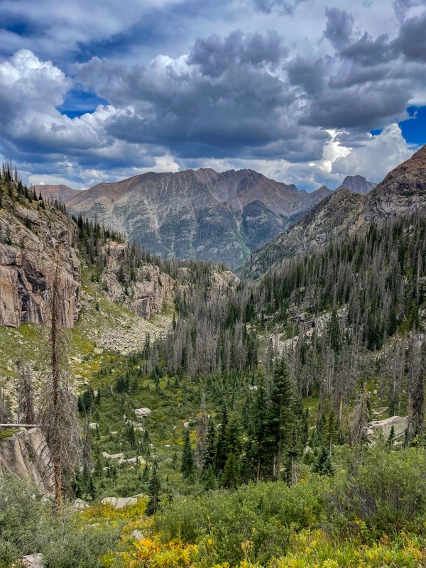
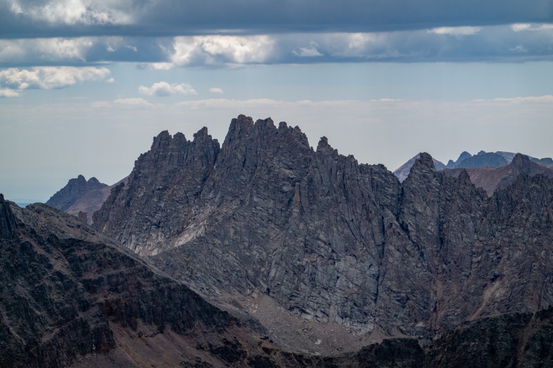
The route finding to get to the north side of Jagged wasn't bad, I enjoy jumping around on large boulders. Once I made it to the mountain's base on the north side, it wasn't terribly difficult to see the basic path up. 
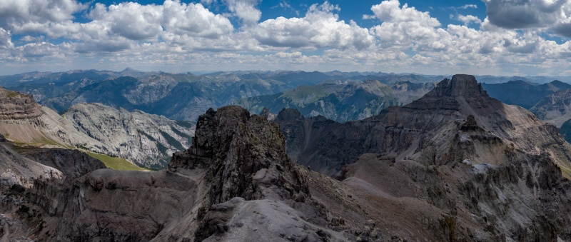
I reached Jagged's summit around 12:30, roughly 10 hours from starting. 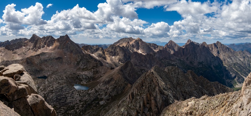
Return from Jagged went well, I only used 1 of the rap stations, the rest of the down climb didn't seem too tough. On return it was nice seeing some of the views that I missed in the morning darkness. My legs held up to the long distance just fine, but around mile 30 my shoulders were not enjoying the weight of a 70 meter rope and associated gear. Once I was back on the Vallecito trail I started taking a 5 minute break every 2-3 miles just to give my shoulders some relief. Made it back to camp just before 9pm, threw a big fat ribeye on the grill, and cracked an Avalanche Amber. It felt so good to have Jagged done. 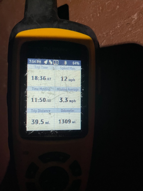
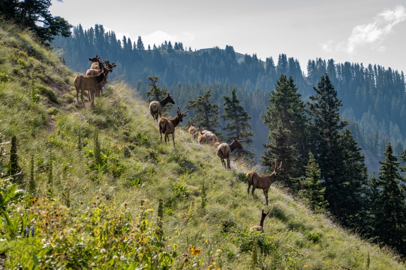
I slept in the morning after Jagged, didn't really have any plans for the rest of the weekend. Decided to head back towards Denver and hit up Helen/Father Dyer/Crystal on Sunday before heading home. I had attempted this loop in 2020, got Crystal and Father Dyer, but missed Helen due to hail/lightning/graupel. Also, it was the only centennial I hadn't done by myself, seemed kinda silly to do 99/100 solo, so did that loop on Sunday before heading home. Some fun stuff on that route, particularly between Helen and Father Dyer. Got back home Sunday night, flew back to Arkansas on Monday morning for work. After another 11 day stint in Arkansas, I flew back to Denver on Friday 9-10, first order of business was to nab Edwards, so did Kelso Mtn/Torreys/Grays/Edwards on Saturday. Had Kelso and Edwards to myself, Torreys and Grays were done Walmart style, as expected. Sunday I drove out to Molas Pass campground, excited to do Vestal on Monday. Woke up at 5 am on Monday morning, I knew Vestal was going to be a long day, but not a Jagged long day. McQueen had done a day trip to Arrow recently, told me it was a 20 mile day, so I figured a ~5 am start would be sufficient. I was up at 5, hiking by 5:35am. First few miles went quickly as its downhill to the Animas river crossing. Perfect weather was forecasted for the day, not much wind and no rain predicted. After my experience with rain and wet boots on Jagged, I decided that I'd take my approach shoes with in case my boots got wet, so I wouldn't have to climb Wham ridge with wet boots. Fortunately everything was dry so I didn't end up using my approach shoes. 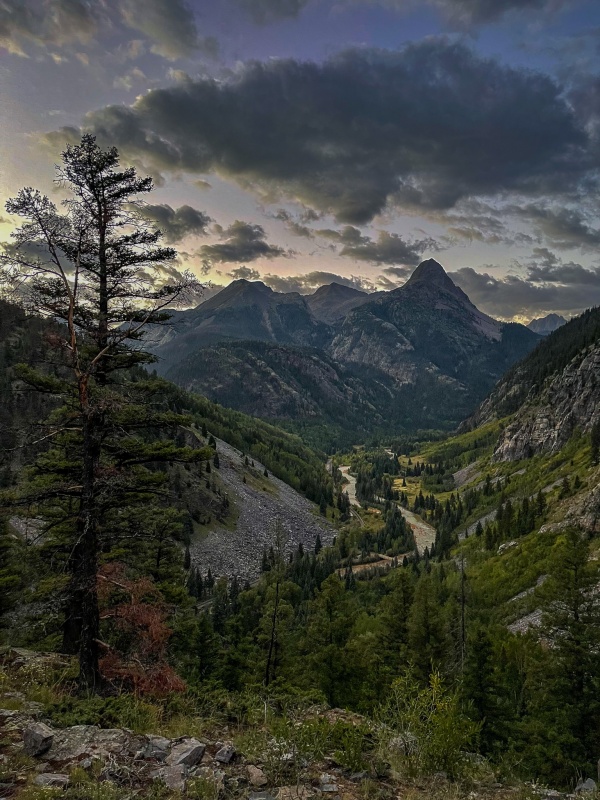
I was making pretty good time, the trail wasn't hard to follow, and conditions were good. I had only brought a couple of filter bottles with me to just refill water as needed, one of my favorite aspects of hiking in the Weminuche is that there is water literally everywhere. 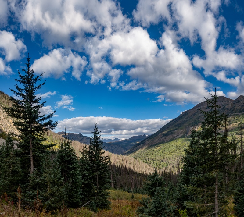
I had been completely alone so far, hadn't seen another human all day. When I reached Wham Ridge, it was like Holy f'in Jeesmany Crickets. That ridge is so beautimous/incredible/sexyfine. I had seen pictures, certainly knew what I had signed up for, but the reality of it was just crazy. If loving Wham Ridge is wrong, I don't want to be right. its so friggin' awesome. I took so many pictures I'm surprised I didn't eat up all my extra SD cards. 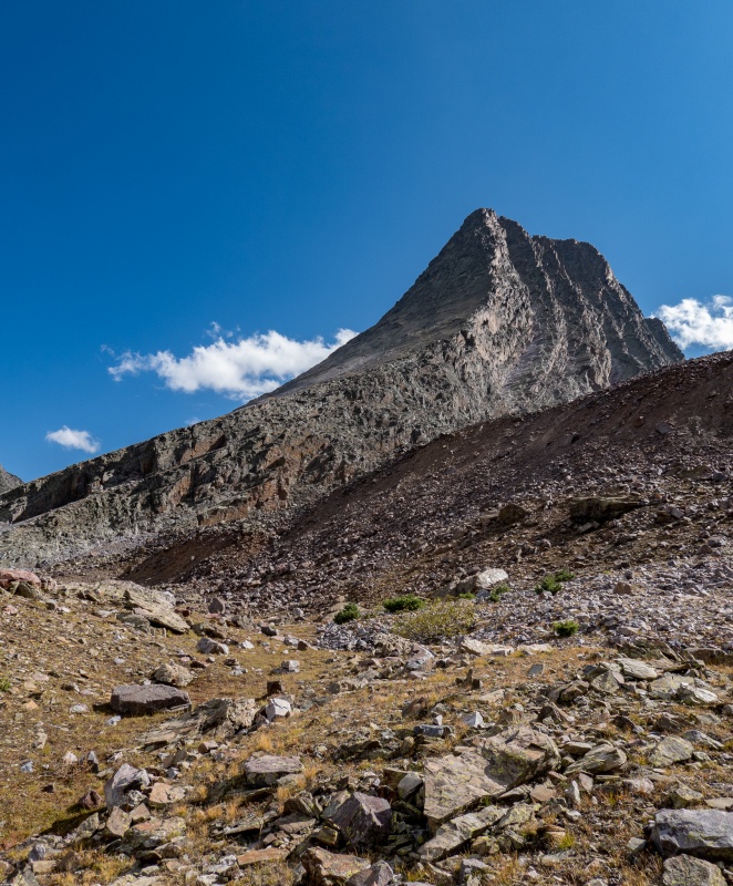
Wham starts out as a simple walk up nice solid rock, then slowly steepens until its nearly vertical. It was so awesome to climb up. not easy, but fantastically solid. The routefinding was a little challenging for me in a few places, mostly because A) I'm short and B) I really suck at route finding. 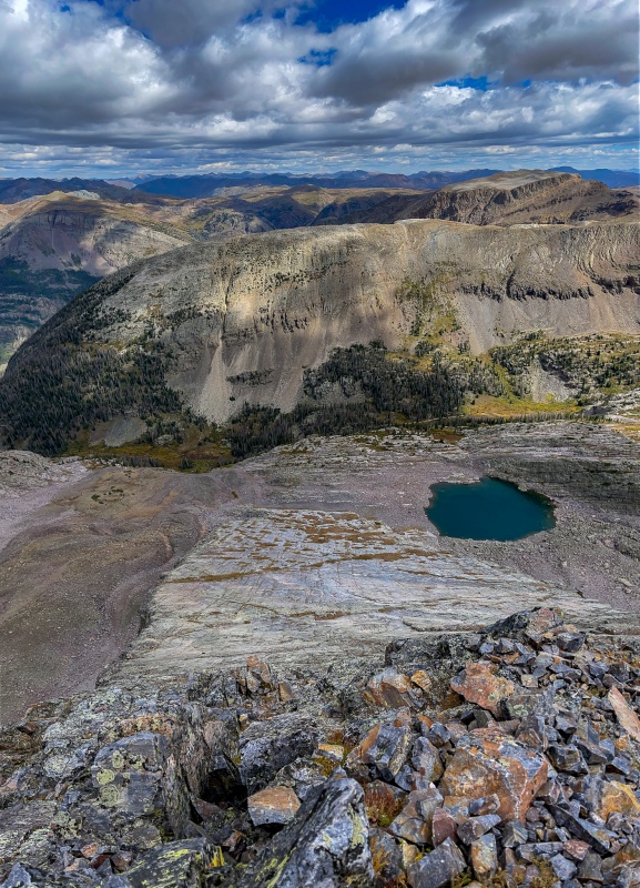
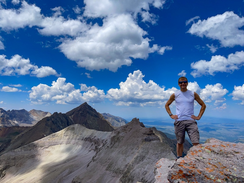
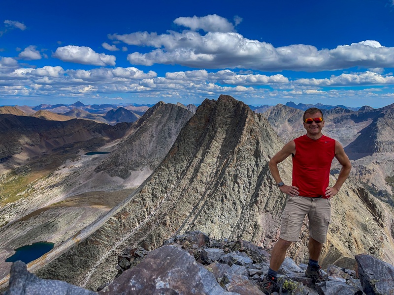
I made it from the bottom of Wham to summit of Vestal in just under an hour, and just under 6 hours from start of the day. I don't usually do the summit beer thing, but this was a special occasion, so I went the full 9 yards. Beer, cupcake and even a party hat. I finished the centennials 2 years and 1 day after completing the 14'ers. 
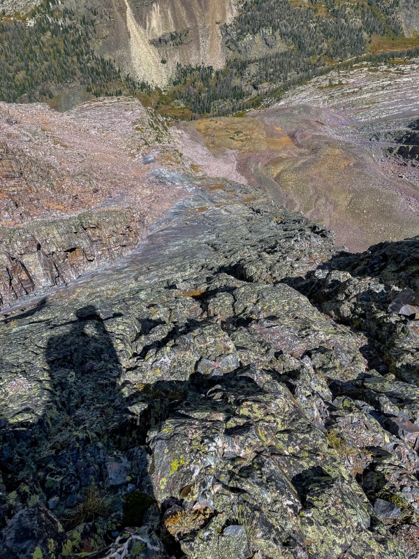
After spending some time reflecting on my accomplishment, I had a long trip back to camp, so started making my way down the back side of Vestal. Not terribly hard to find the way down and around, there were a fair amount of cairns to follow. One short nasty section of scree and I was at the saddle between Vestal and Arrow. It was 1:30, I had no afternoon storms to worry about, so planned to just go up Arrow a little ways to get more shots of Vestal and Wham Ridge. After making my way a short distance up Arrow, there was just no turning back. I'm not sure what I loved more: climbing Arrow (which was fantastic) or the amazing views of Wham along the way. Took way too many pictures, fortunately we're limited to 50 shots in a trip report. 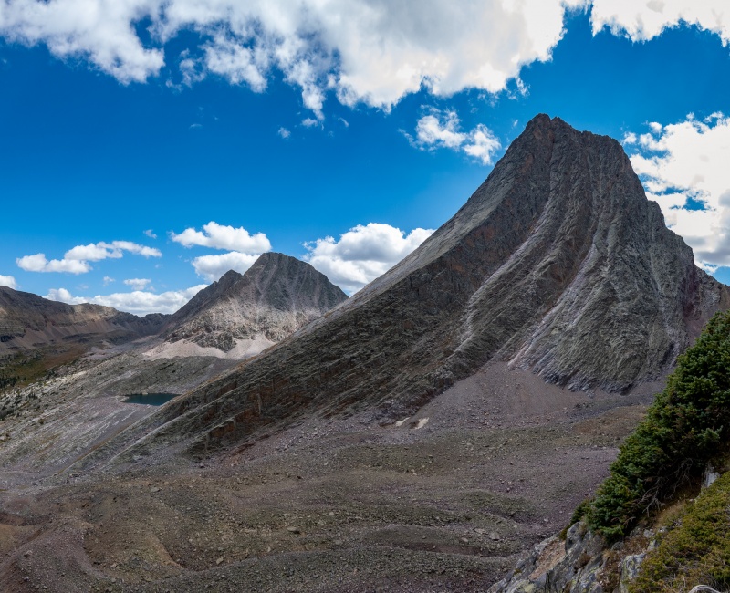
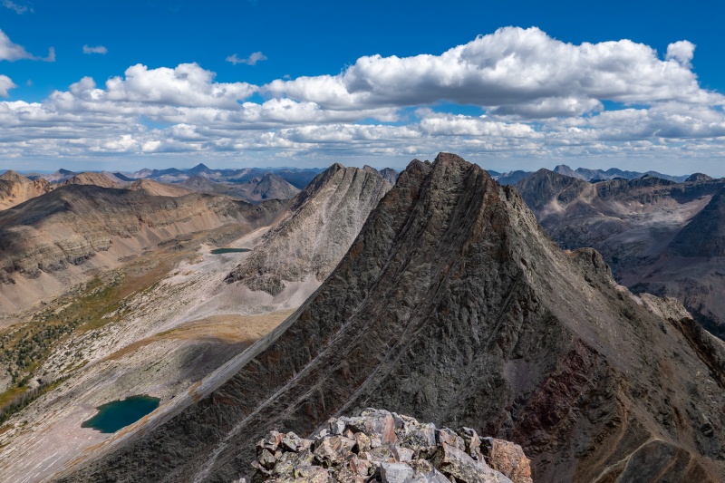
I went up arrow along the far east side of the ridge, it was really a great route. Coming down there's a really well cairned route sort of down the center of the mountain. After getting down Arrow, ran into my first human of the day, someone who had backpacked in and set up camp not far from the base of the peaks, he was planning an attempt tomorrow. Passed 3 other people on my return, which was nice and uneventful. Made it back to camp just before dark, it was an awesome day that I won't soon forget. 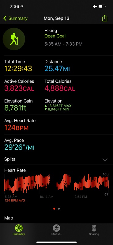
Thanks for reading. Thumbnails for uploaded photos (click to open slideshow): ")
")
")
")
")
")
")
")
")
")
")
")
")
")
")
")
")
")
")
")
")
")
")
")
")
")
")
")
")
")
")
")
")
")
")
")
")
")
")
")
")
")
")
")
")
")
")
")
")
|
| Comments or Questions | ||||||||||||||||||||||||||||||||||||
|---|---|---|---|---|---|---|---|---|---|---|---|---|---|---|---|---|---|---|---|---|---|---|---|---|---|---|---|---|---|---|---|---|---|---|---|---|
|
Caution: The information contained in this report may not be accurate and should not be the only resource used in preparation for your climb. Failure to have the necessary experience, physical conditioning, supplies or equipment can result in injury or death. 14ers.com and the author(s) of this report provide no warranties, either express or implied, that the information provided is accurate or reliable. By using the information provided, you agree to indemnify and hold harmless 14ers.com and the report author(s) with respect to any claims and demands against them, including any attorney fees and expenses. Please read the 14ers.com Safety and Disclaimer pages for more information.
Please respect private property: 14ers.com supports the rights of private landowners to determine how and by whom their land will be used. In Colorado, it is your responsibility to determine if land is private and to obtain the appropriate permission before entering the property.