Download Agreement, Release, and Acknowledgement of Risk:
You (the person requesting this file download) fully understand mountain climbing ("Activity") involves risks and dangers of serious bodily injury, including permanent disability, paralysis, and death ("Risks") and you fully accept and assume all such risks and all responsibility for losses, costs, and damages you incur as a result of your participation in this Activity.
You acknowledge that information in the file you have chosen to download may not be accurate and may contain errors. You agree to assume all risks when using this information and agree to release and discharge 14ers.com, 14ers Inc. and the author(s) of such information (collectively, the "Released Parties").
You hereby discharge the Released Parties from all damages, actions, claims and liabilities of any nature, specifically including, but not limited to, damages, actions, claims and liabilities arising from or related to the negligence of the Released Parties. You further agree to indemnify, hold harmless and defend 14ers.com, 14ers Inc. and each of the other Released Parties from and against any loss, damage, liability and expense, including costs and attorney fees, incurred by 14ers.com, 14ers Inc. or any of the other Released Parties as a result of you using information provided on the 14ers.com or 14ers Inc. websites.
You have read this agreement, fully understand its terms and intend it to be a complete and unconditional release of all liability to the greatest extent allowed by law and agree that if any portion of this agreement is held to be invalid the balance, notwithstanding, shall continue in full force and effect.
By clicking "OK" you agree to these terms. If you DO NOT agree, click "Cancel"...
Tough Roads, Mountain Sunsets, Dogs, and Uncompahgre Full Moon Fall Hike
Tough Roads, Mountain Sunsets, Dogs, and Uncompahgre Full Moon Fall Hike
Nellie Creek 4WD to Trailhead
First, I know it's been stated but it can't be overstated, that the 4WD road up Nellie Creek is atrocious. This is my primary reason for writing this trip report. I did it in a stock 2WD 2017 Tacoma. It is doable if you have experience navigating roads/terrain like this, but if you are unsure of your abilities and your vehicle is questionably low and/or not A/4WD then don't attempt. The initial part of the road is doable and you can probably make it in most vehicles. The road begins to get questionable at the first creek crossing (and you will know the creek crossings - not just some mud puddles in the road). The first creek crossing is about ~1.9 miles up the road and that is the first significant test with a tight switchback and decent size rocks that require navigating so that you don't annihilate your underside.
First creek crossing take the green arrow wide of the large rock, or cut 'under' the rock (red arrow).
Large rock and left turn after first creek crossing.
Left turn after the first creek crossing. From here, the road does not get any better. If this part is questionable to you, stop here (there is a big enough spot to turn around at both switchbacks here- see dirt bike in first photo). Continue up the road, more or less navigating annoying rocks/small boulders and switchbacks. You will cross a second creek crossing but the next and final test on this quest is the third and final creek crossing which comes at ~2.8 miles. There is a set of tight switchbacks, one of which with a decent size set of boulders in the middle of the road plus a good size rut. The navigating here is the most questionable in my opinion but once you get around this, the rest of the way to the TH is relatively easy considering what you just came through.
Picture doesn't do it justice, but as you can see there is no direct and easy route up this spot. You can swing wide to the right or go left over the boulder. The shadow in the middle of the picture masks the size of the rocks in the middle of the way. There is also a fairly good size rut in the middle but the angle of the picture doesn't catch it well.
Rock boulder on the left side of the road.
There is a pull off here (where I'm standing taking the pictures) but I recommend just turning around and finding another spot to park. The pull off is mostly for people to reverse and set up their ascent up the road, or for people going wide on the descent to navigate the turn. Parking a vehicle here would make it extremely difficult for other people. Once you're past this spot, you are solid! Nothing crazy to navigate from here up to the trailhead. Give yourself a solid hour from the Alpine Loop FR-20 to get up the 4 miles to the trailhead. This road is worse than getting to Engineer Pass from Lake City.
Nellie TH to Summit via Standard South Ridge Route
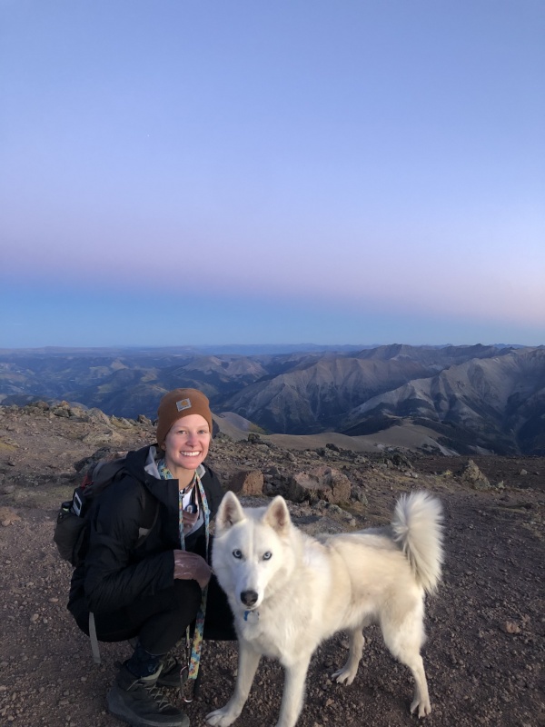
This is my second time in Lake City and now my 4th14er here in the area (first one Handies - and completed CCW Loop of Sunshine and Redcloud a few days after Uncompahgre). It was @daytripper00's 2nd 14er ever and we had her 6 year old Husky with us. One of our goals this trip was to hit a full moon 14er but we also heard the views from Uncompahgre were outstanding, so we opted to summit this at sunset to see the views and descend with the moon lighting our way. We arrived at the trailhead at 4:30p and began our ascent. Meant to get there a bit sooner but Nellie Creek took much longer than expected. The trail is very easy to follow. I will not give any advice here. Everything was in good shape and easy to navigate. The "crux" of the mountain at approximately 13,800' at the base of the easily recognizable tower (seen in photos on the 14er main route page) is very easy to follow and for the most part, sure footing and nothing too crazy.
View from the base of the Tower.
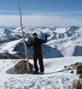
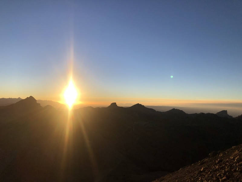
The dog was able to easily navigate this section up and down without any help. We took the right side route as you look at the tower. We made it to the summit right at sunset and watched the sun fall behind the mountains.
@daytripper00 the top.Brooke and Abita conquered their 2nd 14er!On the Summit
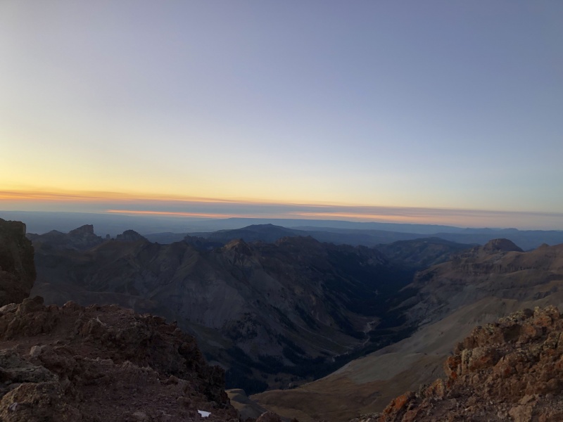
We booked it off the top pretty quick because we didn't want to do the tower section in the dark. We made it with some light left and no issues (I don't see it presenting any issues in the dark as long as you have your headlamp). As I said, the path is easy to find and stay on. We stopped at the base and took our celebratory 14er shots as well as put some layers on and headlamps. The trek down is quite self explanatory, even in the dark. The path is well traveled and there are a few signs on the ridge to help guide you down. The trail is mostly out of treeline so for a night hike this is perfectly lit and your eyes adjust well if the moon is full. I imagine with some snow out there you'd have no problem seeing. If you have never done a moonlight hike, I highly recommend it. Doesn't have to be a 14er, but Uncompahgre lit by the moon and the stars as a backdrop was outstanding. We arrived back at the TH by 9:30p. Our mileage was ~7.8 and trip time was 5 hours. Plenty of water for dogs to drink along the way as well. This hike was one of the "easier" 14er hikes in my opinion.
Thumbnails for uploaded photos (click to open slideshow):
Thanks for writing up the road description. Not only should you have 4wd, but great clearance, and amazing sturdy/tough tires, and a short wheel base helps as well. This road has deteriorated over time, and my guess is it is due to all the ATVs that whip up there just for the sake of riding the rough road (why? there aren't amazing views from the TH, go hike a 14er or 13er you lazy butts).
My family and I did Handies in 2020 and are interested in doing Uncompahgre this summer. This information is the best I've seen on exactly the condition of the road to the upper TH. We did Handies from Grizzly Gulch and getting there was an adventure in and of itself for this family from Wisconsin. Good to know exactly what to expect.
Caution: The information contained in this report may not be accurate and should not be the only resource used in preparation for your climb. Failure to have the necessary experience, physical conditioning, supplies or equipment can result in injury or death. 14ers.com and the author(s) of this report provide no warranties, either express or implied, that the information provided is accurate or reliable. By using the information provided, you agree to indemnify and hold harmless 14ers.com and the report author(s) with respect to any claims and demands against them, including any attorney fees and expenses. Please read the 14ers.com Safety and Disclaimer pages for more information.
Please respect private property: 14ers.com supports the rights of private landowners to determine how and by whom their land will be used. In Colorado, it is your responsibility to determine if land is private and to obtain the appropriate permission before entering the property.


")
")
")
")
")
")
")
")
")
")