Download Agreement, Release, and Acknowledgement of Risk:
You (the person requesting this file download) fully understand mountain climbing ("Activity") involves risks and dangers of serious bodily injury, including permanent disability, paralysis, and death ("Risks") and you fully accept and assume all such risks and all responsibility for losses, costs, and damages you incur as a result of your participation in this Activity.
You acknowledge that information in the file you have chosen to download may not be accurate and may contain errors. You agree to assume all risks when using this information and agree to release and discharge 14ers.com, 14ers Inc. and the author(s) of such information (collectively, the "Released Parties").
You hereby discharge the Released Parties from all damages, actions, claims and liabilities of any nature, specifically including, but not limited to, damages, actions, claims and liabilities arising from or related to the negligence of the Released Parties. You further agree to indemnify, hold harmless and defend 14ers.com, 14ers Inc. and each of the other Released Parties from and against any loss, damage, liability and expense, including costs and attorney fees, incurred by 14ers.com, 14ers Inc. or any of the other Released Parties as a result of you using information provided on the 14ers.com or 14ers Inc. websites.
You have read this agreement, fully understand its terms and intend it to be a complete and unconditional release of all liability to the greatest extent allowed by law and agree that if any portion of this agreement is held to be invalid the balance, notwithstanding, shall continue in full force and effect.
By clicking "OK" you agree to these terms. If you DO NOT agree, click "Cancel"...
Weather: 40-60F, winds NW 10mph gusts to 30, increasing clouds
Partners: Corey, Dan & Jon
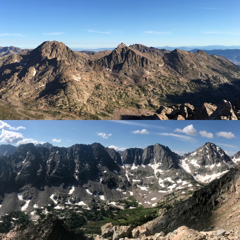
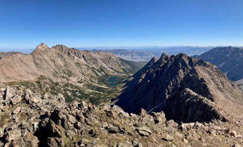
QRST from Pk W to the south and from Gore Thumb to the north
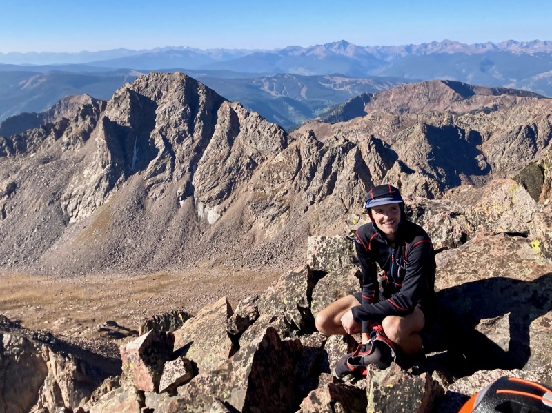
Back in July of this year I was humbled by an attempt at the self-supported FKT of the 14ers (16 days and change, I threw in the towel halfway through when the monsoon hit and I tucked tail on Yale's summit ridge) so I've been seeking some form of mountaineering redemption since. Being that I had only one 13er left to summit in the range next door, I decided to turn my attention from the popular 14ers to the stunning but largely overlooked Gore. My favorite partners for going long and fast in the Gore are all fathers like myself, thus requiring a reservation date months out. We rolled the dice on weather and settled on mid-September. Fortunately for us it was your typical, sunny, comfortable September day.
APPROACH
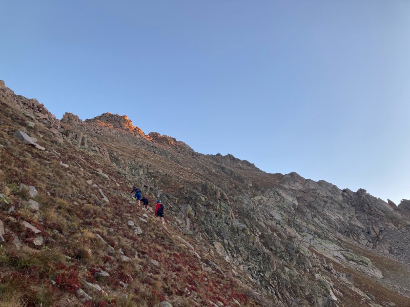
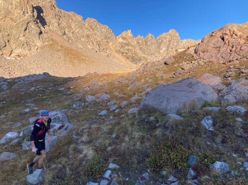
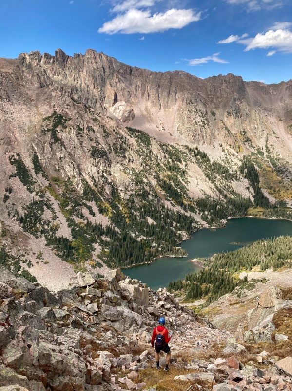
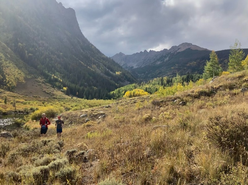
We convened at the Pitkin Creek TH in the dark at 0500 taking off shortly after. The run up to Pitkin Lake normally takes us 1:15 at a casual pace. But I was packing rope and carabiners for this one so it went at 1:20 at what felt like a hard effort. At the lake we redistributed some weight and started up toward Might Pass. A pass I only discovered about a week prior is not actually the low point between East and West Partner Peaks but actually a weakness just east of the summit of West Partner. Oof. The sky transitioned from ink to cerulean over the course of the 1300ft slog up to Might where we arrived in 2:10 and received our first view of Peak Q in the distance. The east side of the pass drops sharply over talus into the Lower/South Slate drainage - a remote basin without trail access. Views of the Partners, Rockinghorse, Peaks P, X, Y, and Z and our objective for the day were abundant from the basin floor. We made our way northeast into the drainage bypassing a questionable south ridge and began the ascent north toward the Q-R saddle, arriving atop a 2nd class grass gully in 3:25
First light ascending Might PassDescending the east side of Might PassEast Might Pass with Q, R and S behind. The east ridge of Q we skirted is clear.Jon treading through Lower Slate with Rockinghorse Ridge behindBilly Goat Gruff keeping an eye on us in Lower SlatePogo Pinnacle, Peak Q, Peak R
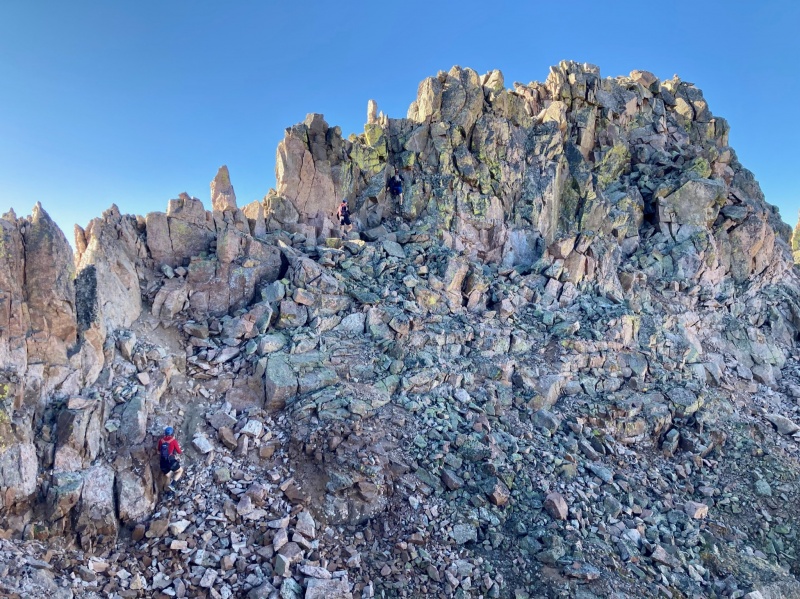
PEAK Q (4:10 from the TH)
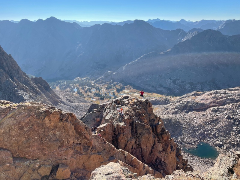
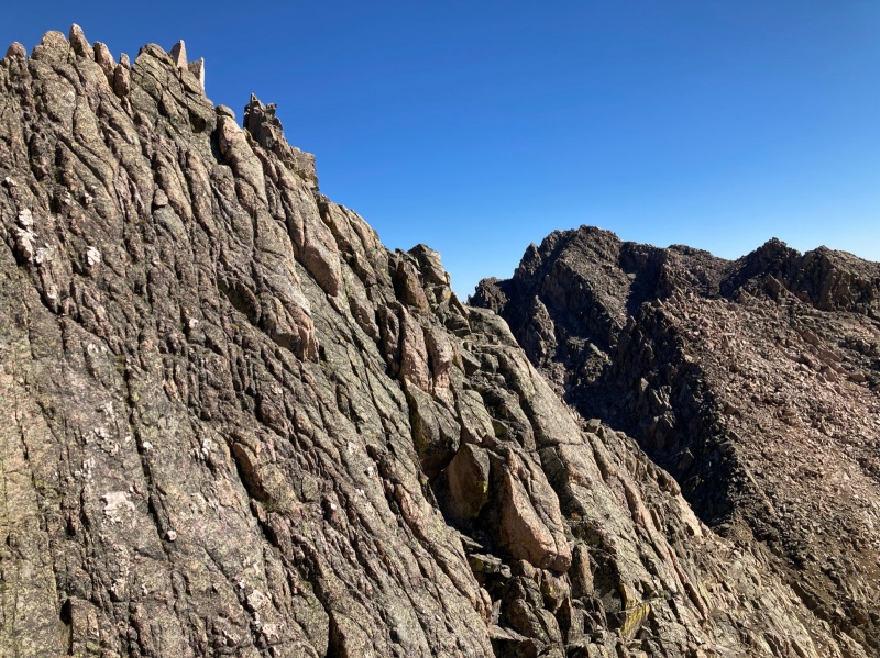
The Peak R route is fairly obvious from the saddle but the summit of Q is obscured by a steep wall of jumbled boulders, slabs and ledges. We picked our way through favoring the north side of the ridge until we arrived at a small knife edge where the route steepened. Weaving our way through the 3rd class ledges we soon arrived at the serrated spine summit block. The spine can be taken straight on (YAY) or bypassed (MEH) along the north side. Regardless, some 4th class, not overly exposed moves are required to navigate the chimneys guarding the summit. The summit of Q lies 8 miles from the Pitkin Ck TH.
Jon navigating the knife edgeApproaching the knife edgeCorey coming off the knife edge with East Partner behindJon emerging from a short chimney on Q's summit blockCorey topping out on a ledge at the base of the summit blockQ's summit blockJon hamming on Q's summitQ's chimney
PEAK R (5:28)
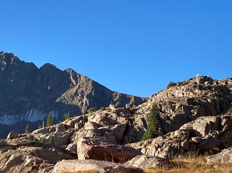
We retraced our route up Q (kind of anyway, I ended up on some cliffy terrain further north of the ridge but all's well) and found ourselves in a talus choked gully in the vicinity of the R-Q saddle. Having examined the route earlier we decided to completely avoid the west ridge and the grassy slopes along its north side. Corey noticed a grassy ramp occupied by goats earlier. When in doubt, defer to the wildlife. The ramp led to a broad couloir making a "C" shape that led directly to the summit. It ended up being the easiest summit climb of the day.
Dan and Jon admiring Q as we ascended R's north couloirUpper Slate from R
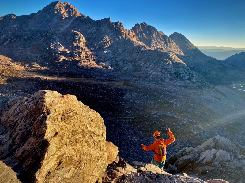
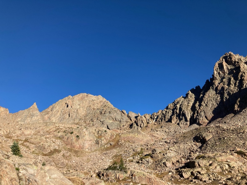
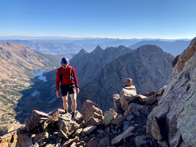
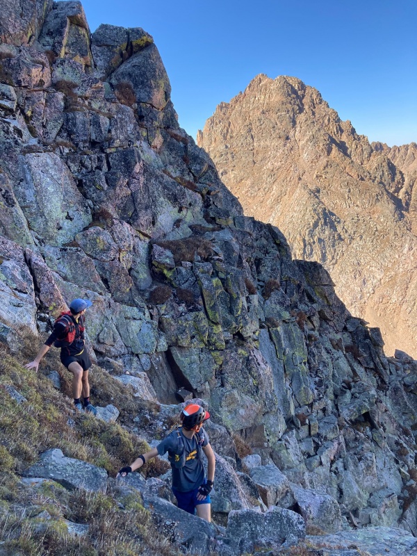
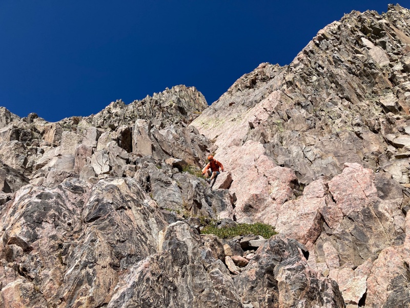
PEAK S (6:29)
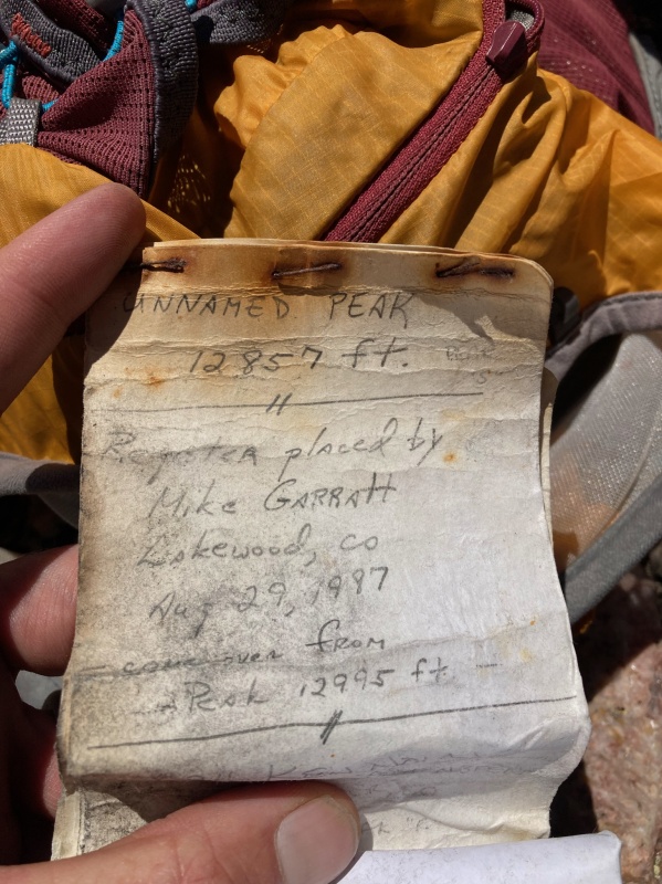
We were able to run down the ridge proper from R toward S until the ridge was bisected by a deep cleft. Here the route turns right (south). There's really no other option. Losing a couple hundred feet or so through grassy ledges we reached the base of the cleft and the low point of the R-S traverse. We made our way through some steep 4th cl dihedrals and chimneys to the obvious high point only to discover it was a false summit. Peak S lies a few hundred yards beyond over gentler terrain. Here we were surprised to find a register placed in 1987.
Cliffs blocking direct passage to SDescending from the cleftJon atop SPeak S summit registry
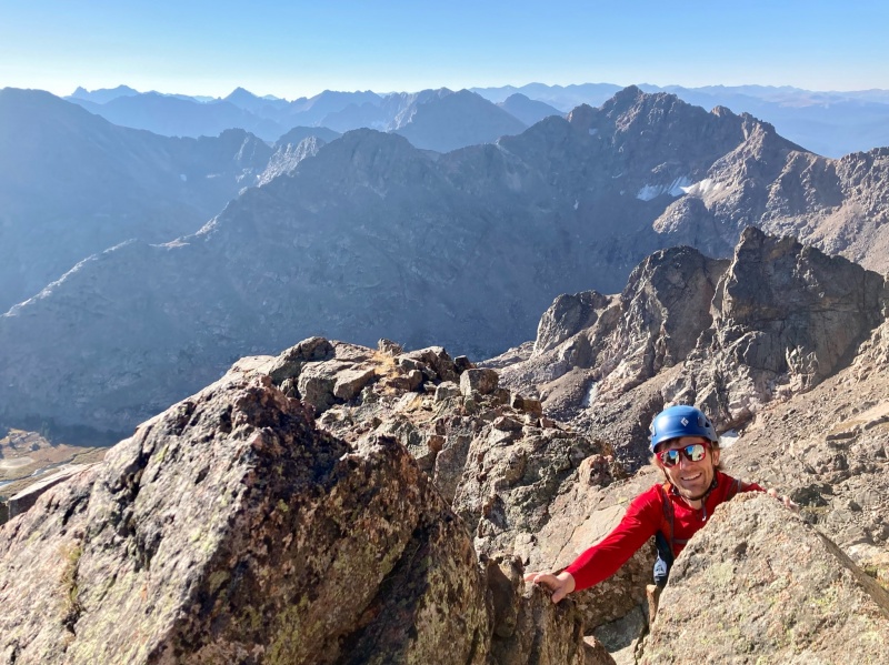
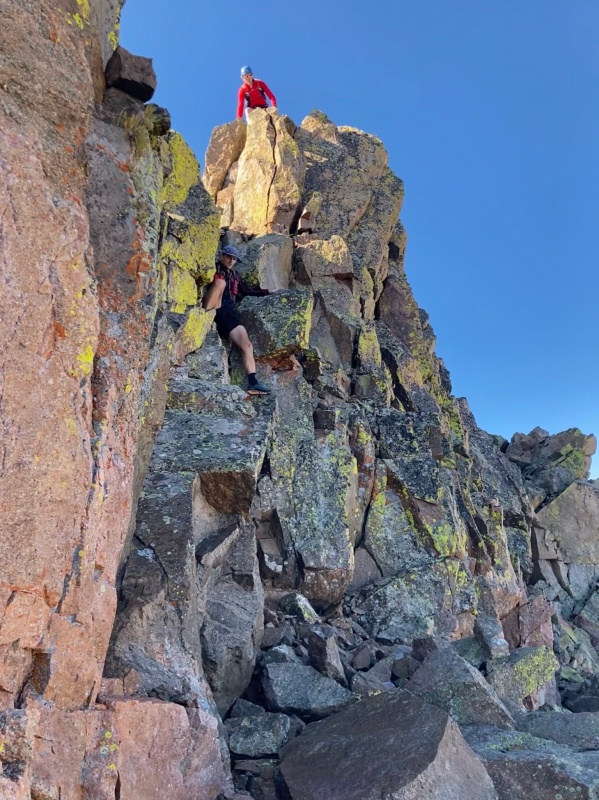
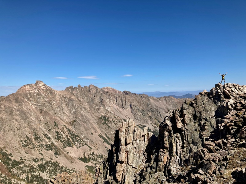
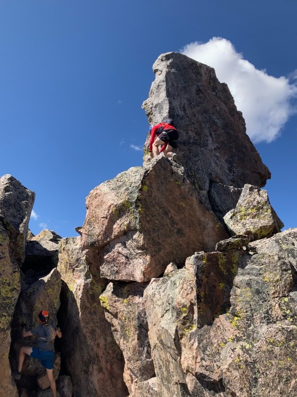
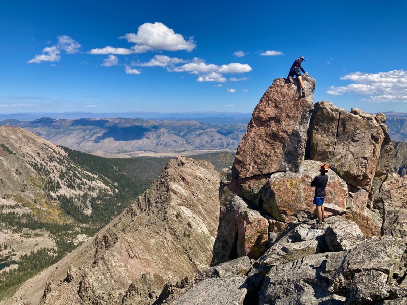
PEAK T (7:18)
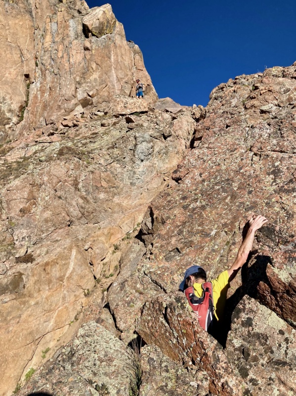
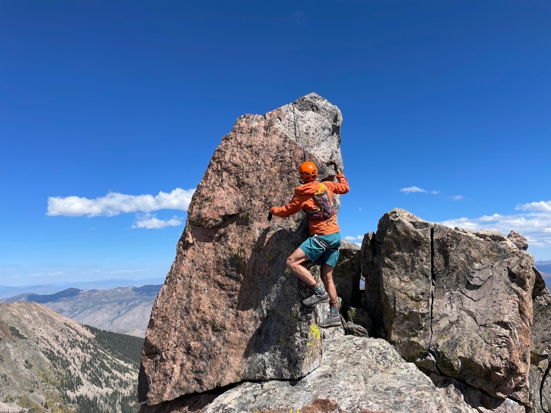
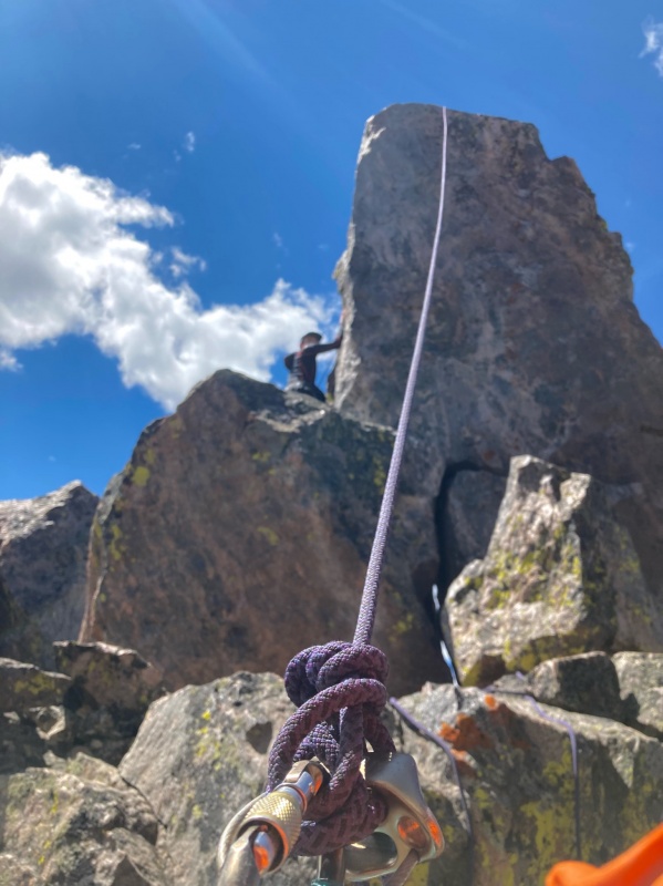
T looked delightfully close from atop S. I'd read on summitpost that the traverse goes fairly direct. We bobbed and weaved along the fractured rocky ridge until hitting some impassable cliffs about halfway. Again descending south, it was a painless bypass. Soon we were climbing steep 3rd class grass and slabs toward T's complex summit. I expected the search for the infamous summit block to be an arduous undertaking. Instead Dan and Corey hit the ridge crest, cut back west and were on it like ticks in tall grass. The teetering 12 ft. high block's exhilarating exposure stirs the soul. The north side drops off into the airy abyss, while the south and east sides step down to a sheltered shelf about 25 feet below. The weakness lies on the SW edge. Kramarsic (goregalore) grades it at 5.5. Perfectly within our ability yet none of us were willing to flash it without a rope. Glad I hadn't hauled the extra weight for nothing. I removed the 30m, 8mm rope from my pack and flaked it in preparation for an easy toss over the summit block...
Or not. After successive tries and fails, Jon said, "Give me that thing, just one throw!" and he was utterly deflated when his toss too slammed into the wall. Eventually Corey was able to chuck the coiled rope over from the foot of the summit block giving us our hero belay. We took turns summiting and signing the register. The moves were juggy making it an easy climb beyond nerves.
Dan and Corey storming the castleDan watching Jon topping out on TMe Climbing TThe Belay
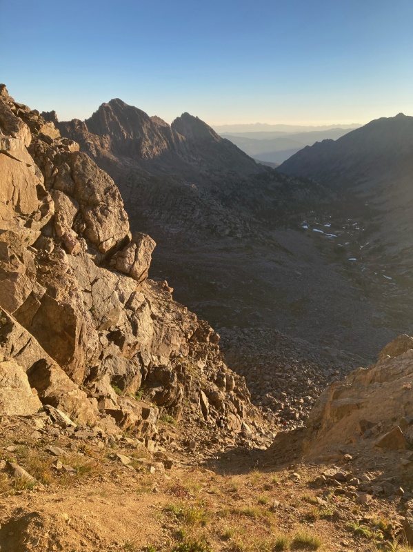
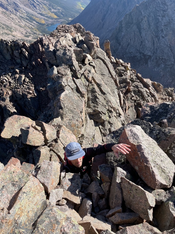
EGRESS
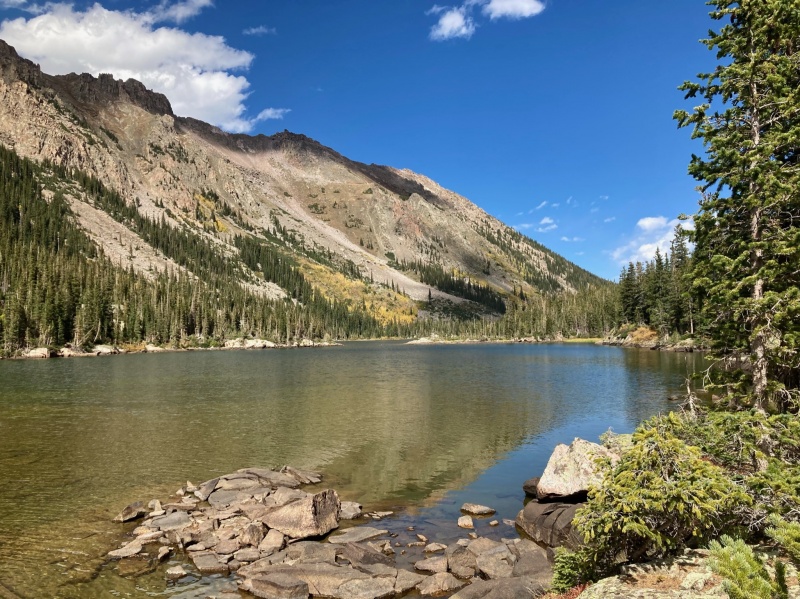
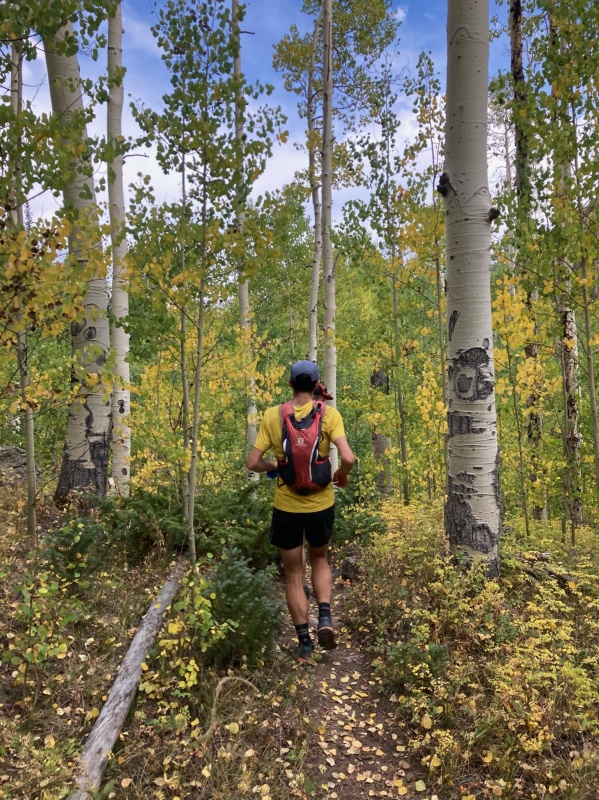
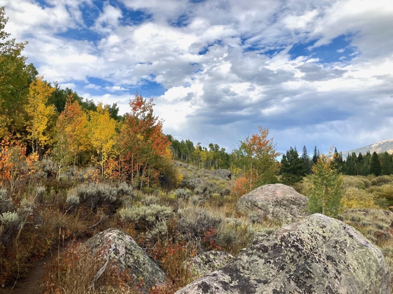
By the time the fwigging (fussing with gear) and summiting finished, we had spent nearly an hour atop T. There's little beta out there about the ascent/descent of T from Upper Slate. Backtracking to where we had gained the ridge crest, there was a catwalk leading to nothing but air. The southside of T offers a gentle slope all the way down to Lower/South Slate but that would require an unpleasant bushwhack out. The north facing couloir immediately beneath the catwalk looked like it would go for a couple thousand feet before rolling over far below. We decided to traverse beneath the catwalk, above the north couloir and further east along the north side of the ridge. There was one brief, marginally exposed 4th class move to get off the catwalk but then it was unexposed 2nd/3rd class traversing to the saddle east of T. There we encountered a broad grassy slope that led all the way down to Upper Slate Lake some 2000 feet below. The lake was a godsend after having run out of water up on T. We sat around for a bit trying our damndest to get hyponatremia while soaking up the sun. With the relief of having completed the technical sections of the day, fatigue set in. Yet the reality of still having to run out about 10 miles to Brush Creek TH had not set in. We took off down the trail at a leisurely jog passing a few day trippers along the way. Corey had powered through a head cold to make this trip happen and at 10 hours into the day it finally got the best of him. He was slowed to a death march on the GRT, walking the majority of it out to Brush Creek. We all reached the shuttle at Brush Creek at just before 1730 for a traverse time of just over 12 hours.
Corey descending the grassy gully to Upper SlateUpper Slate LakeAspensSlate Ck Trail
GORE 13ers MUSINGS (North to South)
Eaglesnest/Peak A (8/30/20): First recorded ascent found an unexplainable shotgun shell on top. Northernmost Gore 13er equally accessible from east or west.
Mt Powell/Peak B (7/25/2015): The "popular" Gore 13er. Kneeknocker has a Strava segment.
Peaks C, C', D, E, F (9/9/2018): Ripsaw Ridge, south through west summit routes go at 4th class, summit register from 1948 atop E.
Peaks G, Black BM, and H (6/27/20): Southern Ripsaw. Straight Arrow Couloir. G has too many summits and Black BM is hardly a highpoint at all.
Peaks L/Necklace, Gore Thumb, M/Guyselman, N, O/Little Powell (7/17/20): Route finding is critical. A delicate dance amongst serrated giants and fountains of gendarmes.
Peaks Q/Prisoner [with 12ers R/Bledsoe, S, T] (9/18/21): Deep Gore. Tough, exposed climbing. Way out there. Daytripped them anyway.
W. Partner/Peak U (10/6/2019): Jump off to Rockinghorse Ridge. The easier Partner. Mind the knife edges on the backside.
E. Partner/Peak V (9/15/2019): Fun slabs. Worth making the "Punchbuggy Traverse" to Pk. W. Dodging tourists on the way out Pitkin Ck is a bonus challenge.
Peaks X, Y, Z/Gorgeous (9/27/20): Usable Pass for easy access. Plenty of ridge crest ridge running. Not overly exposed.
Vista, Solitude, Climbers Point, Skiers Point (6/18/20): Unremarkable scrambling. Spectacular views.
Keller Peak (7/11/2015): Fun intro to Gore scrambling. Strong urge to continue on to North Traverse.
North and Grand Traverse (9/10/2019): Ever ski at Vail? You know those striking summits over there? Aesthetic but the difficulty of the traverse is overblown.
Mt. Valhalla, Snow Peak, Palomino Point (10/3/2019): 2nd class tour of the Deluge Lake cirque with a dash of spice on Palomino.
Rain (10/14/19): Northern sentinel of Salmon Lake. Easy off trail hike. Graupel Gully. Eastern terminus of the precipitation peaks.
Willow BM/Mt. Silverthorne, East Thorn (9/26/19): Big boulder hopping slog. Airy summit block on East Thorn. Rotten rock. 2 recent fatal accidents in this cirque.
Red Peak B (9/22/2017): The bigger bro in the shadow of attention monger Buffalo. Diamond Ridge looks daunting and Big Eyes is a sick line.
Jacques Peak (8/23/20): Gore poser with a ski resort.
Impressive day and report. Enjoyed the brief comments on all the Gore 13ers as well. P.S. - I would like this TR as well, but the button appears to be busted.
Cool report on a big day, congrats! I've had my eye on Peak T for a few years but never seem to make it into the alpine lately, more interested in other targets. But Peak T remains of interest, maybe next year? Thanks for posting!
What a day! Congrats again on finishing the Gore 13ers! It's such a stout list of amazing peaks and it was a huge pleasure to join you on several of them. Wonder how many people have finished the gore ranked and unranked 13ers? Can't be a big list at all I'd think...
Thanks for the TR, especially the brief impressions of Gore 13ers at the end. I was underwhelmed by the couple of things I did there some years ago, so your reviews will be useful when I return.
Also, nice work on the self-supported 14er attempt. Maybe give it another shot next year, post-monsoon?
Corey, I never would have set out to do them all without you, Dan and Jon. Thanks for being a great partner out there. seano, we'll see on the 14ers. I might shelve that one in perpetuity because it's such a time commitment away from family. Andrew, I kept looking over my shoulder back at Q as we traversed to T but I never saw you guys. Q's a monster... I think the summit is set too far back from the ridge to make anyone out. Thanks 12ersrule. Tom, T's a gem. Reasonably doable without the rope but the pucker factor is high. I enjoyed the comfort of a belay.
Caution: The information contained in this report may not be accurate and should not be the only resource used in preparation for your climb. Failure to have the necessary experience, physical conditioning, supplies or equipment can result in injury or death. 14ers.com and the author(s) of this report provide no warranties, either express or implied, that the information provided is accurate or reliable. By using the information provided, you agree to indemnify and hold harmless 14ers.com and the report author(s) with respect to any claims and demands against them, including any attorney fees and expenses. Please read the 14ers.com Safety and Disclaimer pages for more information.
Please respect private property: 14ers.com supports the rights of private landowners to determine how and by whom their land will be used. In Colorado, it is your responsibility to determine if land is private and to obtain the appropriate permission before entering the property.
")
")
")
")
")
")
")
")
")
")
")
")
")
")
")
")
")
")
")
")
")
")
")
")
")
")
")
")
")
")
")
")
")
")


