| Report Type | Full |
| Peak(s) |
"T 10" - 13,484 feet |
| Date Posted | 09/20/2021 |
| Modified | 06/08/2022 |
| Date Climbed | 09/06/2021 |
| Author | Tony1 |
| Teeny Day on T10 |
|---|
|
"T10" (13,477') Monday, September 6, 2021 Party of 1: Tony T10 had been on my wish list for a while, being an easily-accessible San Juan peak whether you have a 4x4 vehicle or not. 4x4 makes the peak practically a “gimme,” while any car can get you to the paved Red Mountain Pass, from where a hike of T10 is only a half-day outing. Although it pairs well with other peaks, I was going to go hike it by itself today. I was driving my 4x4 Hilux Surf and wanted a bit more than just a “gimme” hike, but also didn’t feel like hiking the full length of the road, so I drove almost exactly a mile up to the junction at around 11,550’ where there was plenty of room to pull out of the travel way and park. This would make a good launch point. I started my hike here and made my way up the road, leapfrogging a couple of vehicles as their operators stopped every once in a while for pictures and whatnot. 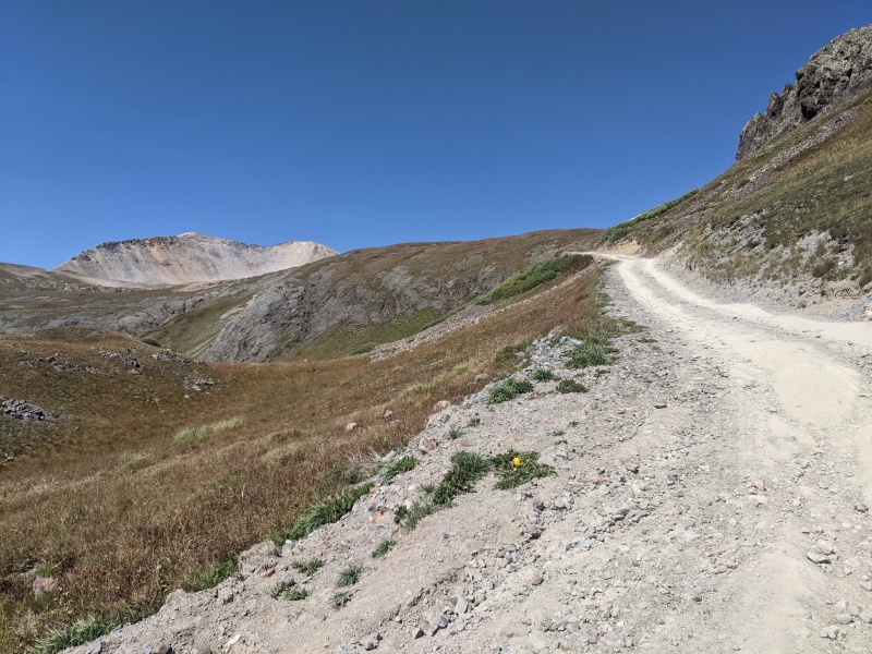
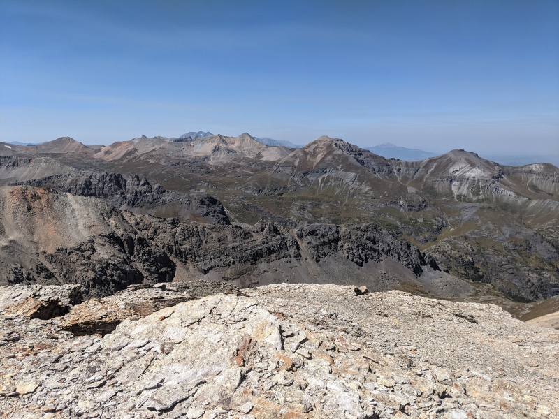
Before too long, I reached the summit of the pass. The majority of the hike has been completed and was nothing short of a cakewalk, but now it was time for the jaunt up to the summit on typical San Juan surfaces for the final ascent up the northeast ridge. From the top of Black Bear Pass, the summit of T10 is about 2000 horizontal feet and 650 vertical feet away. From the road, the ridge up to the summit of T10 looks horrible, but everything looks worse from farther away. It goes, with care. 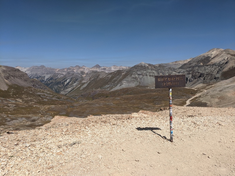
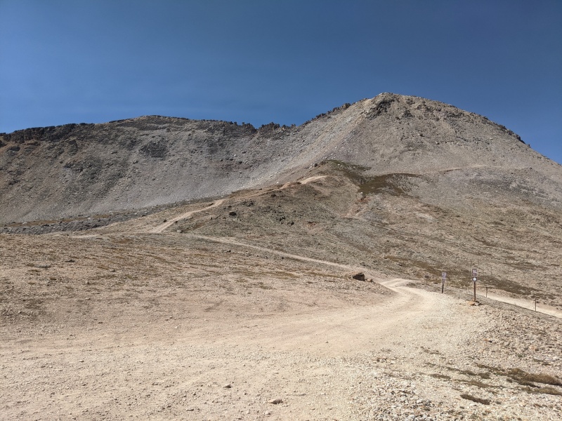
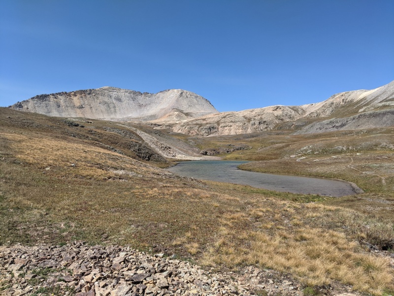
I took a spur road from the top of the pass to its end about 250 feet higher than the pass summit, then walked by a brief section of grass and finally onto the scree/talus. Like many San Juan slopes, it’s not quite talus and it’s not quite scree, but sort of feels like both. It’s a very character-building material. Scralus? 
I made my way onto the scralus and kept going up for the final 400 vertical feet to the summit. A faint use trail was identifiable in the rocks. It first goes just to the climber’s right of the ridge, and about halfway up the rock I followed it around to the left as it crossed over. After the crossover, things got a little more steep and the rocks got bigger, many looking somewhat precariously stacked. I tiptoed through, or at least it felt so. It all stayed at class 2, maybe class 2+ since we’re talking big chunks of San Juan scralus here. I used my hands several times to get the job done, and you probably will too. 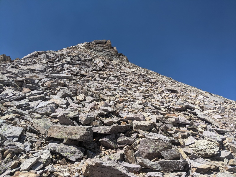
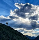
Before I knew it, the worn terrain I was following mellowed as the ridge began to transition to the small summit plateau. From here, I walked on over to the summit for pictures of the views and for my favorite summit activity: planting my butt down to stare off into alpine oblivion for a few minutes. 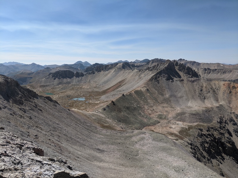
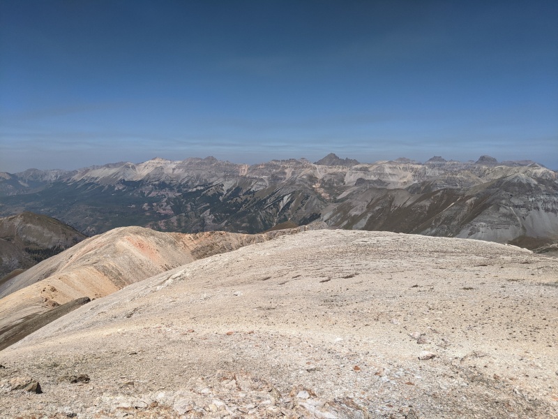
This mountain has two summits of equal elevation separated by a serrated ridge above, quite frankly, awful looking scralus. I have to admit I took the easy way today and only summited the north one, which is the one marked on most maps I’ve seen (not all). I’d like to summit the south one from Porphyry Basin in the future and saved that idea in the “short 4x4 hike” folder of my memory. Here’s a question: would that count as climbing the mountain twice? Hmm… 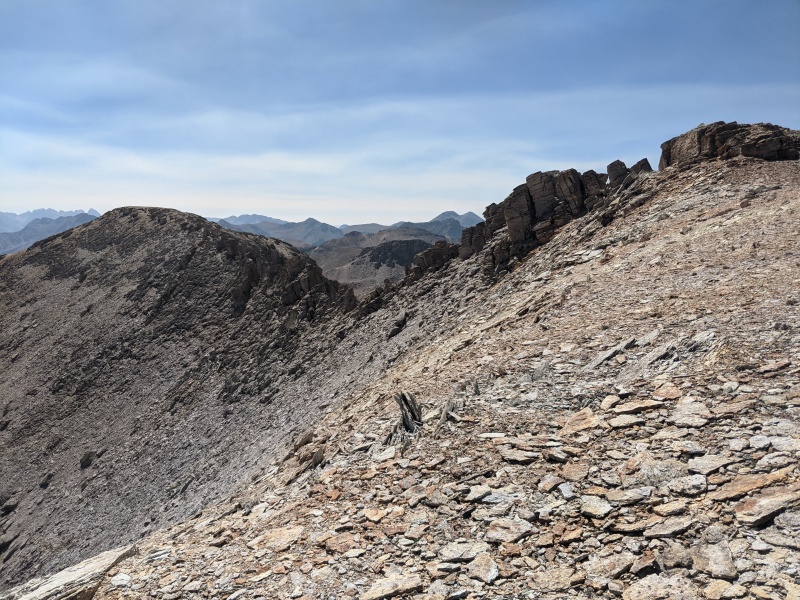
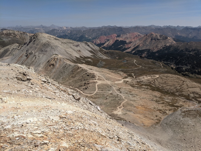
I left the summit after a wee bit and started back down the ridge. I found it mostly straightforward for descending and was able to follow pretty much the same route without difficulty. The loose and slippery terrain had me light on my feet. A short time later, I picked up the spur road to the top of the pass and used the same Black Bear road back down to the car. 
Useful information: In 2018, I drove up and back the San Juan County side of Black Bear Pass (hi RyGuy and Otina!) and opted out of the difficult ravine section near the top. I noticed today that the difficulties have been removed and you can now take your lowrider right through it. 
Useful information, part two: Statistics of summiting T10 for those who start at the top of Black Bear Pass and for those who start at the bottom, at the top of Red Mountain Pass just a hair south of its summit: Thumbnails for uploaded photos (click to open slideshow): ")
")
")
")
")
")
")
")
")
")
")
")
")
|
| Comments or Questions | |||
|---|---|---|---|
|
Caution: The information contained in this report may not be accurate and should not be the only resource used in preparation for your climb. Failure to have the necessary experience, physical conditioning, supplies or equipment can result in injury or death. 14ers.com and the author(s) of this report provide no warranties, either express or implied, that the information provided is accurate or reliable. By using the information provided, you agree to indemnify and hold harmless 14ers.com and the report author(s) with respect to any claims and demands against them, including any attorney fees and expenses. Please read the 14ers.com Safety and Disclaimer pages for more information.
Please respect private property: 14ers.com supports the rights of private landowners to determine how and by whom their land will be used. In Colorado, it is your responsibility to determine if land is private and to obtain the appropriate permission before entering the property.