| Report Type | Full |
| Peak(s) |
Granite Peak (12,799) |
| Date Posted | 09/21/2021 |
| Modified | 07/06/2023 |
| Date Climbed | 08/14/2021 |
| Author | Hoot |
| Granite Peak Montana via Sky Top Creek and S/W Ramp |
|---|
|
Granite Peak (12,799’, Montana #1) Intro Ever since I started getting serious about visiting state high points a few years ago, Granite Peak in Montana has been high on my list. Granite’s long approach and steep climbing make it one of the most challenging state highpoints. Some rank Granite as the second most challenging state highpoint after Denali. However, unlike Rainer, Gannett, and Hood, Granite can occasionally be climbed without traveling on snow via a non-technical route. After studying our options, I decided we’d hike in on the southern Sky Top Lakes approach. This increasingly popular approach is a little longer than the traditional approaches from the east (via Froze To Death Plateau or Huckleberry Creek), but offers an easier finish via the Class 3 Southwest Ramp. 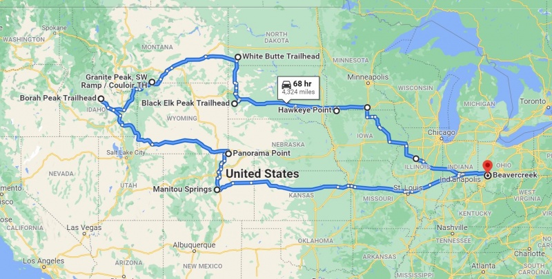
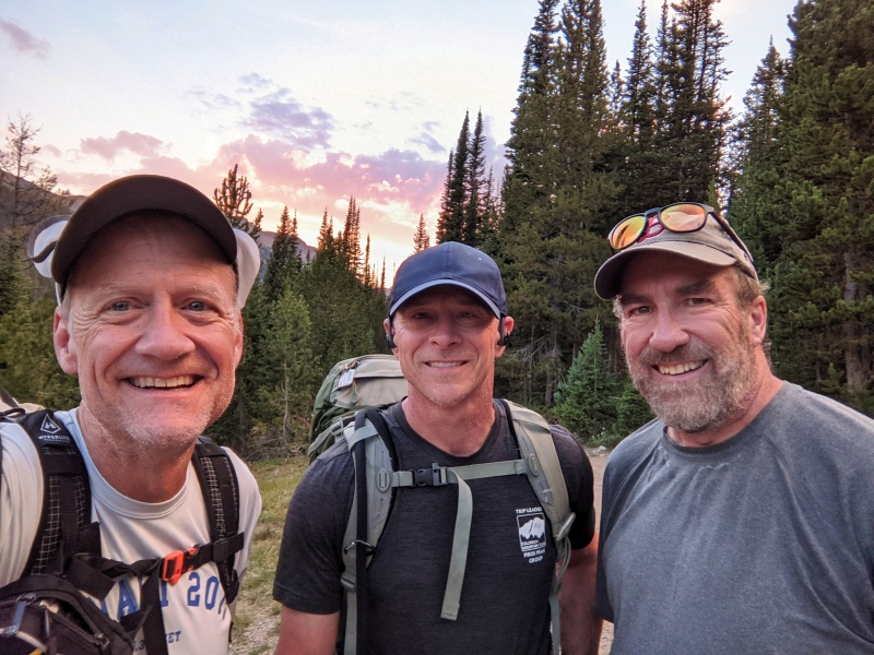
Granite was the fourth of six state highpoints on my two-week road trip west from Ohio. While I was game to climb (or walk over to) the other five highpoints solo, I definitely wanted partners for Granite. I was super happy to have Greg, my 2009 HAMS instructor, and Dave, with whom I’ve scrambled before, join me on this adventure. As a bonus, Greg joined me climbing Black Elk Peak and White Butte in the Dakotas, before we got to Granite. That Thursday, Greg and I stopped for lunch in cool Red Lodge and then drove along the beautiful Beartooth Highway up and over 10,947-foot Beartooth Pass in northern Wyoming before meeting Dave at the Colter Pass Campground back in southern Montana. After dinner (mine was some of the tastiest curry I’ve ever had) in nearby Cooke City, we each slept in our vehicles at the campground as tent camping was not allowed due to grizzly bears in the area just east of Yellowstone National Park. The Approach Friday morning Greg, Dave, and I ate breakfast at the campground, left one of the cars there (at the camp host’s invitation), and drove up the gravel Lulu Pass Trail road to the upper trailhead at the old cabin. It only took about 20 minutes to reach the upper trailhead from the campground. Passenger cars with reasonable clearance should have no problems getting to the Lady of the Lake trailhead just off Lulu Pass Trail road at 8760’. The 4WD road to the upper trailhead was a bit rougher and narrower. As the upper trailhead saves less than half a mile and only 80 feet of climbing on the trail, the main Lady of the Lake trailhead seems like a perfectly good option. 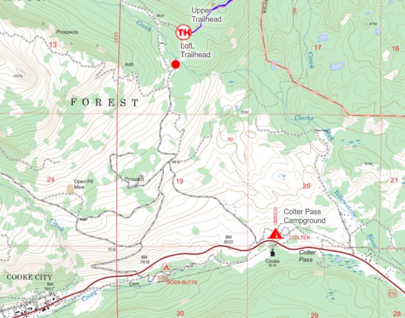
Based on a little beta we had and knowing it had been not been a heavy snow year, we made a small gamble and left our ice axes and crampons in the car. We did pack in a 30-meter rope, harnesses, belay devices, and helmets. With 1.5 liters of water, my backpack weighed in at a reasonable 21.5 pounds, not the lightest, but not the heaviest of our three packs. 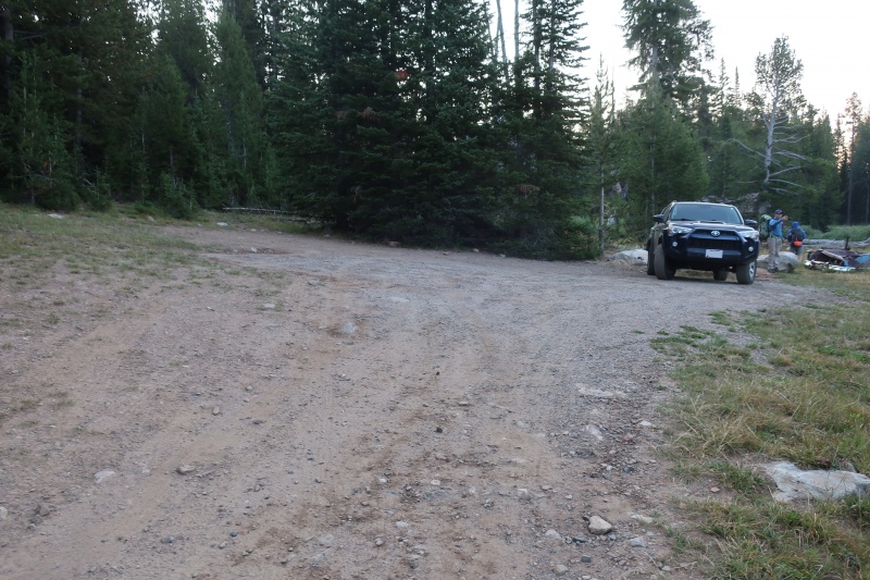
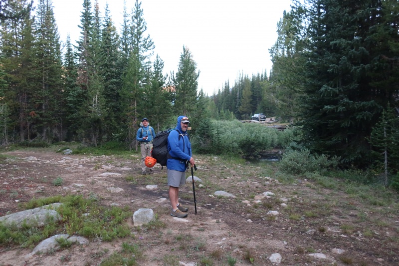
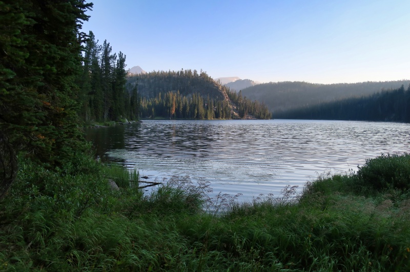
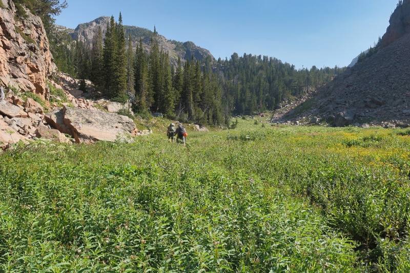
We started hiking from the parking area on the west side of the cabin at 6:50 am Friday morning. After walking around the cabin, we crossed a small creek and were on the well-signed Lady of the Lake trail. The first 1.5 miles to the Lady of the Lake lake was on an excellent trail that actually descended a bit more than it climbed. The Lady of the Lake is a beautiful destination for most of the hikers on this trail. Near the end of a meadow a little north of the lake, we hiked past our first creek crossing, following what looked like a trail along the Lady of the Lake creek for a few minutes before checking our GPSs and turning back. On our return, we found the creek crossing well-marked with a good-sized cairn! 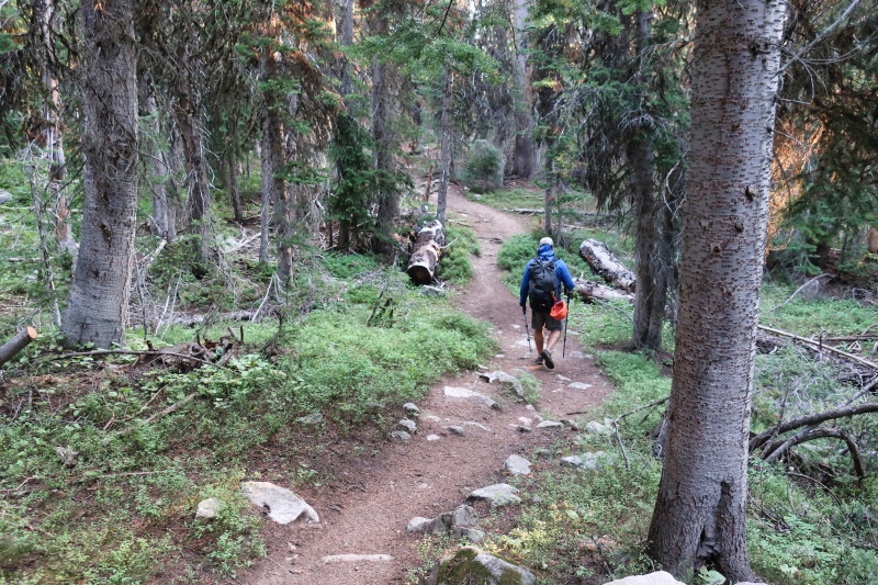

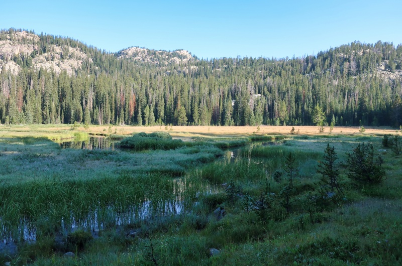
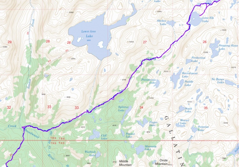
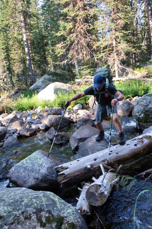
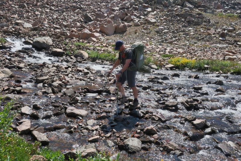
Not long after the first creek crossing, we came to the Broadwater River (still a just creek) a little downstream from confluence of the Star and Zimmer creeks. Here we diverged from the trail leading to Aero Lakes, crossed the Broadwater on rocks and a log, and followed the still excellent trail through the woods east toward Sky Top Creek. At some point along this section we met a man and his daughter (we assume) who had summited Granite the day before and provided us will a lot of very useful information. The best news was that the Southwest Ramp was completely dry, meaning we wouldn’t need the ice axes and crampons we had left behind, and that these two had had no need for a rope or protection on the climb. 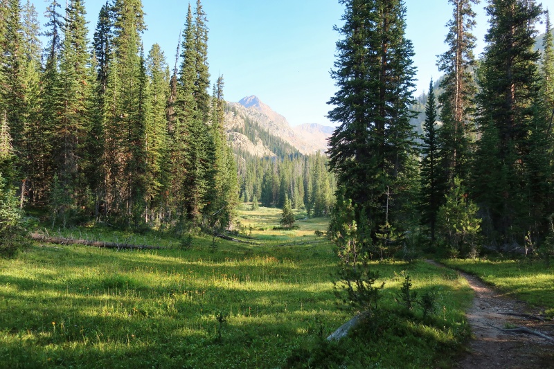

For the next couple of hours we followed the trail on the north side of Sky Top Creek to Lone Elk Lake, gradually gaining 1000 feet in elevation, the majority of our climbing for the day. Along the way we crossed the creek draining the Aero Lakes on a log a little upstream from the trail and we crossed the creek draining Shelter Lake on rocks. Around 11:30 am, we stopped for a lunch break on a knoll overlooking the beautiful Lone Elk Lake and chatted with a group there to fish. It was a sunny warm day and we sat next to a big bush to get a little shade. 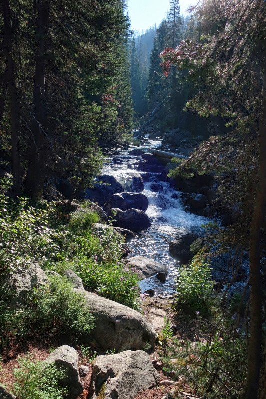

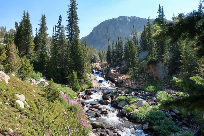

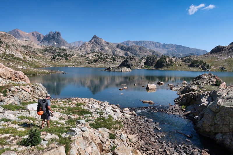
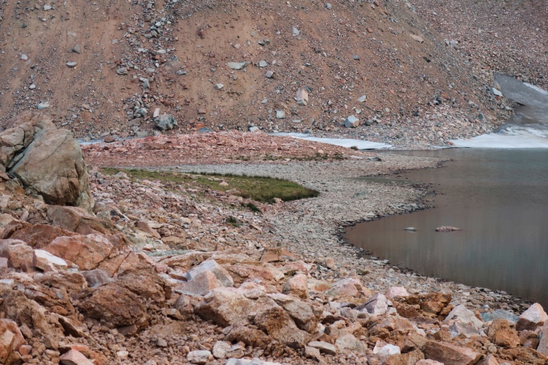
After lunch, we hiked around the west side of Lone Elk Lake and then crossed to the east side of Sky Top Creek on rocks near the outlet of Rough Lake. The next mile along the south side of Rough Lake was relatively flat. A little past the east end of Rough Lake we re-crossed Sky Top Creek on rocks and began climbing our final few hundred feet up into the Sky Top Lakes basin. As we entered the basin, we got or first view of Granite’s summit, which still looked like a long ways away. 
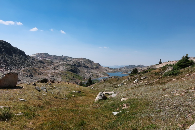
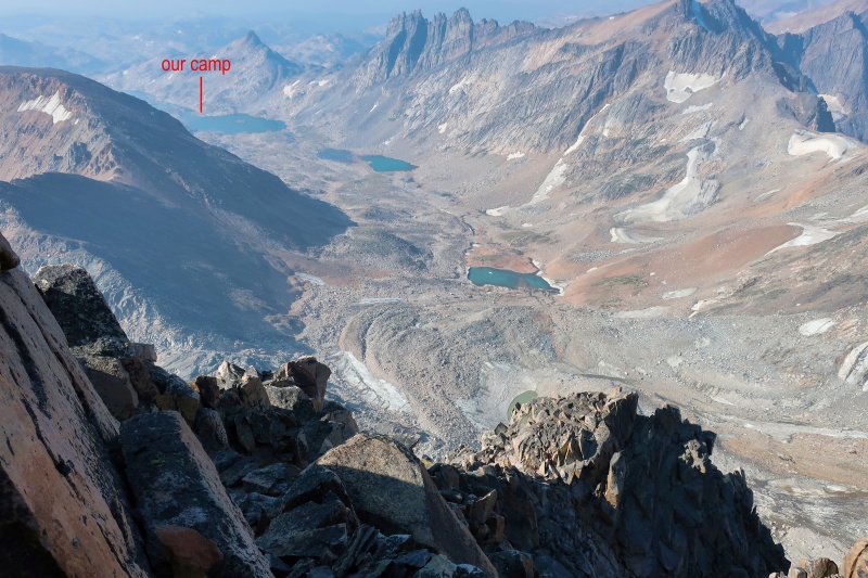
Once in the basin above the trees, we hiked along the shore on the west side of the lakes looking for a grassy spot large enough for three small tents. Of course, the nicest grassy spot we found already had several tents on it. Dave and I found a nice spot between two lakes, but Greg continued on to another good grassy spot on the south shore of the last big lake, the one with the small island in the middle. As camping further up in the basin meant a shorter summit day, Dave and I were happy to go with Greg’s site. The next day saw camping options as far as 1.5 miles further up the in basin, the last on the shore of a small tarn near 11,800’. Dave and I reached the campsite just before 2:00 pm after seven hours of hiking from the trailhead. According to my GPS, we had hiked 10.8 miles gaining only 1600 feet, not a difficult day at all. 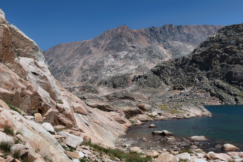
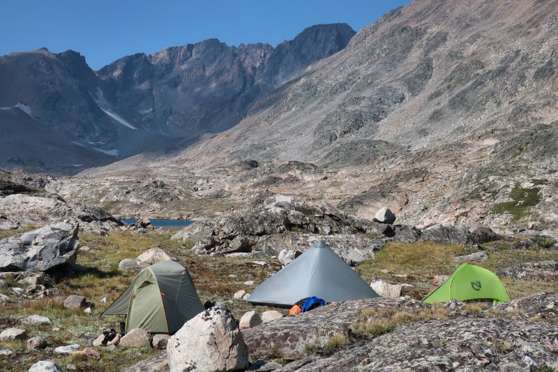
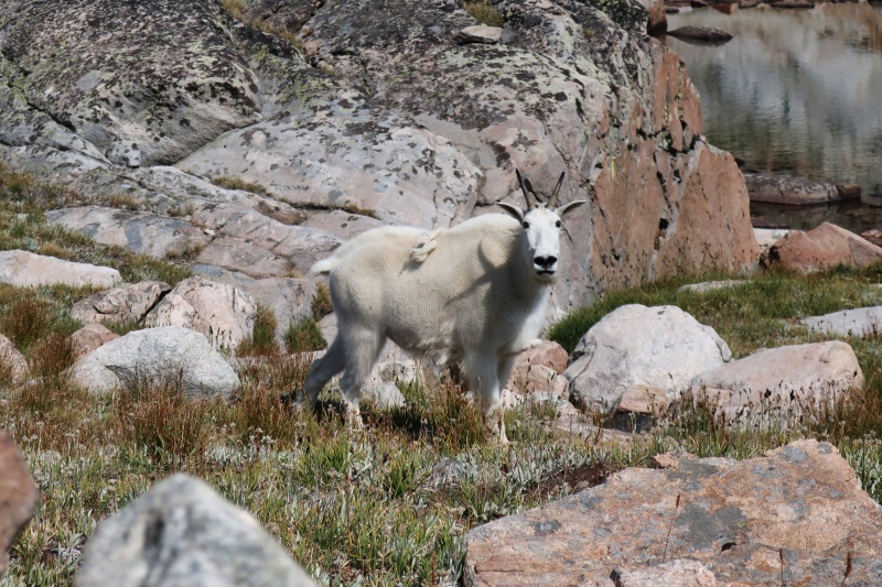
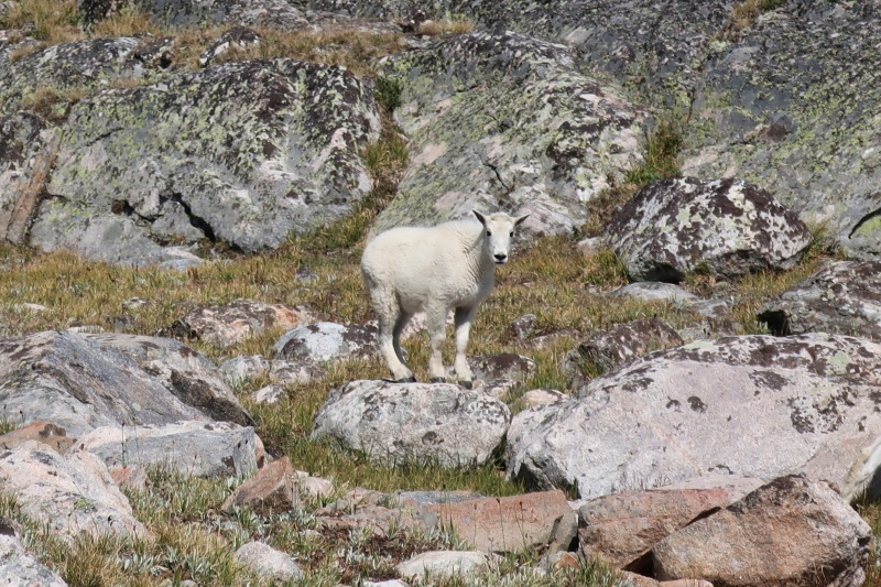
After setting up camp we tried to escape the afternoon sun and gnat-like non-biting insects by napping and baking inside our tents. A family of several mountain goats visited our camp a few times that afternoon, clearly looking for some salty liquid. The goats were not shy and it took a few good-sized rocks landing near them to encourage them to back off a bit. At camp we enjoyed the beautiful scenery of the basin, filtered the clear cool water from the lake, talked with a few hikers returning from Granite’s summit, and stared at the intimidating summit about two miles away as the crow flies. Most of the climbers we talked with reported a roundtrip climb from the lakes of at least eight hours with a few considerably longer. 
To be safe, we put most of our food and smellables in my 7-liter bear canister. However, it seemed very unlikely that bears would visit this rocky basin above the trees with few sources of food (aside from goats and humans :-). After cooking dinner and re-packing without the rope, harnesses, and belay devices, we hit the sack early knowing tomorrow would be a long day. I slept comfortably. On one short excursion outside the tent, I saw a shooting star from the Perseid meteor shower and the amazingly bright Milky Way plastered across the sky. The Climb I got up at 4:15 am Saturday morning to prepare for our planned 5:30 am start. After hot coffee and oatmeal for breakfast, I topped off my water, visited some boulders well away from camp, and placed a few big rocks inside my tent just in case it got windy. The weather forecast was for a clear morning with possible scattered showers later in the afternoon. With our headlamps lighting the way, Greg, Dave, and I started out from camp at 5:23 am, a little ahead of schedule. 
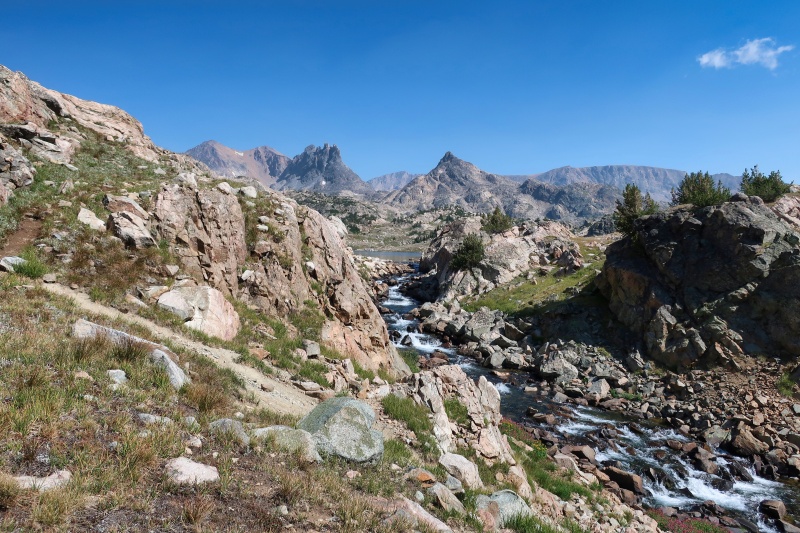
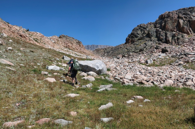
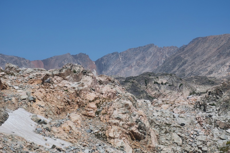
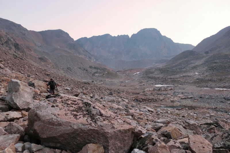
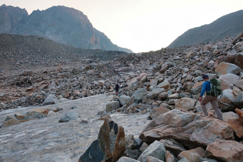
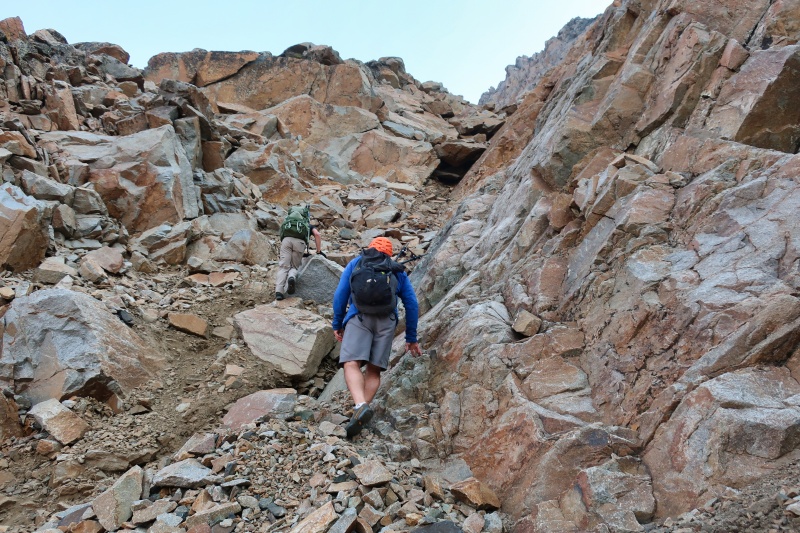
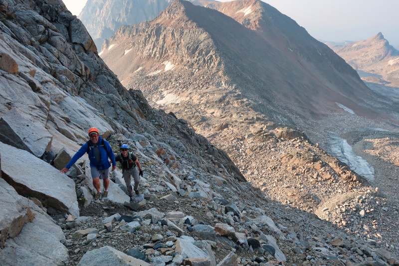
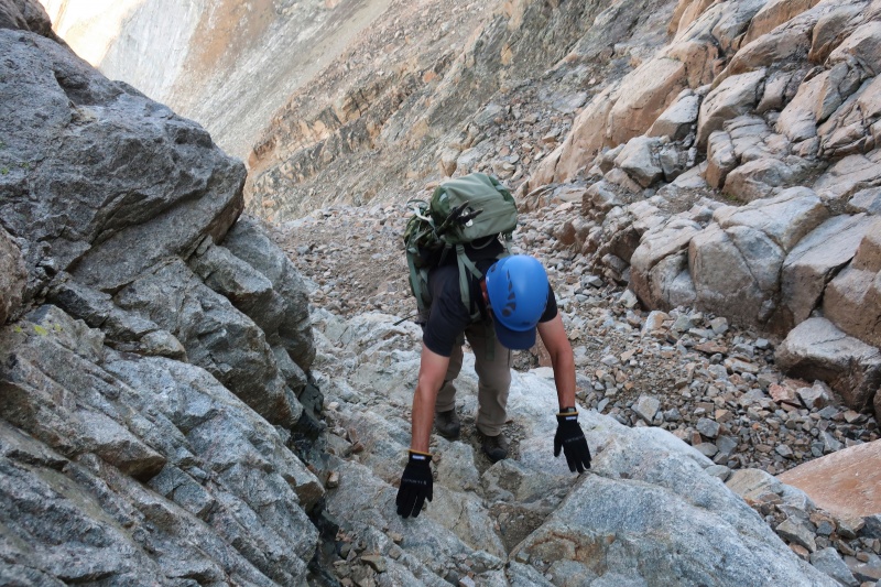
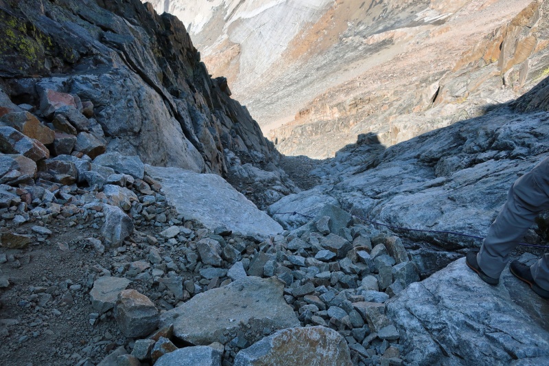
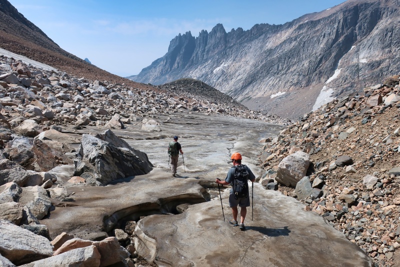
The hiking above our camp was slow going as we worked our way over and around two miles of rocks and boulders. On our way up, we generally followed a GPS track that I had downloaded. It took us an hour and 20 minutes of hiking to reach the small tarn at 10,800’ which has the highest patch of grass for camping. Just above that tarn, we came to the first two large snowfields that were once the toe of the Sky Top Glacier, but this summer were disconnected from what remained of the glacier. As the low-angle snow was still hard and slick, we continued up along the right (east) edge of these snow fields on large boulders. At the end of the second snow field, we veered right and climbed up to the 11,300-foot saddle between Granite and Point 11,894. 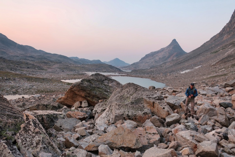
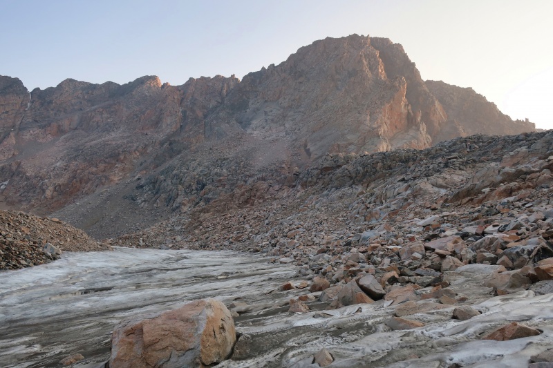
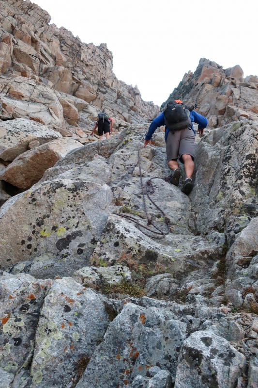
From the saddle, our route to the bottom of the Southwest Ramp was pretty obvious. With rock fall much more likely on the remainder of our climb, we put on our helmets here. Keeping the base of the ridge between the saddle and the summit on our right, we climbed up steep talus gaining 600 feet pretty fast. Not far above the saddle, we scrambled up one difficult section with a bit of exposure. But on our return, we followed cairns around this section, avoiding the difficult moves. As we approached the ramp, the rock forming a large smooth slab on our right became darker. The end of this slab, which we could see from our camp, marked the start of the Southwest Ramp. 
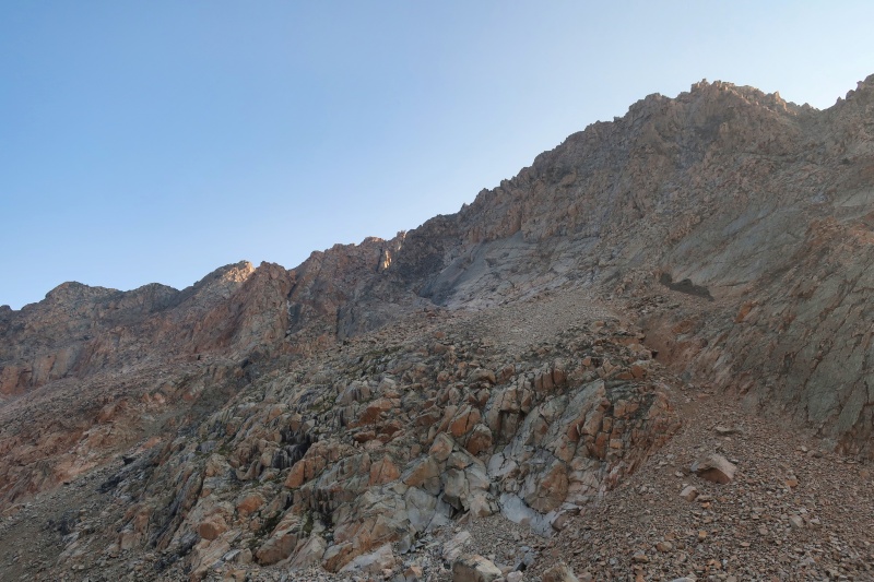

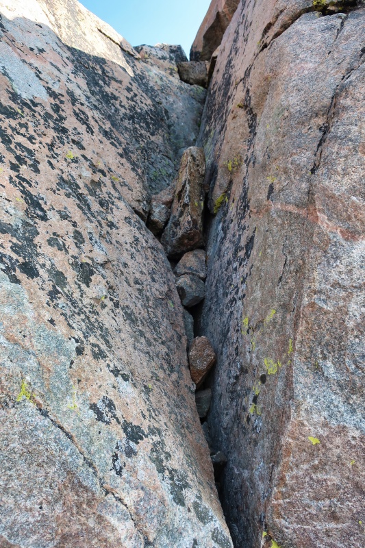
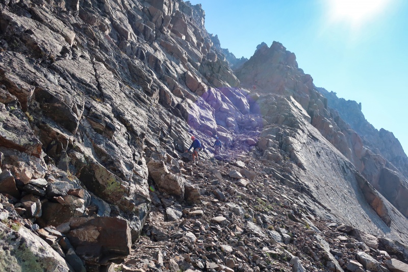
We scrambled up to the Southwest Ramp, a moderately steep couloir, and began climbing it at 8:20 am, just under three hours from camp. The Class 3 scrambling in the wide bottom section of the couloir was fairly easy. After just a few minutes of climbing we came to the first steep section with a rope fixed in place to aid climbers. This short section required more careful Class 3 scrambling, but on solid dry rock, I felt no need to use the rope. As we climbed, the couloir generally got steeper and narrowed in a few places. While the couloir did contain a lot of loose rock, the scrambling at the steeper sections was on solid rock and fun. 
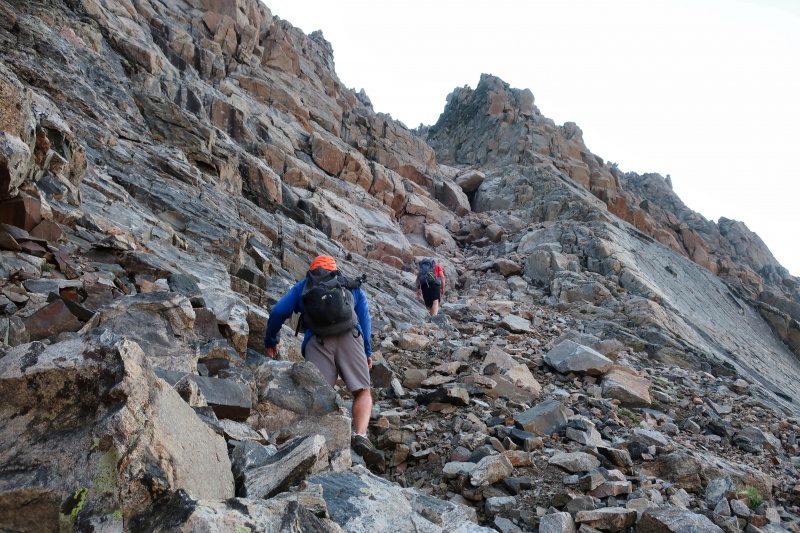
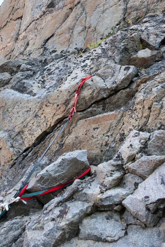
We reached the steepest section of the couloir with another fixed rope after ten minutes of climbing. Once again, I felt no need to use the rope. I read that Beartooth Mountain Guides out of Red Lodge maintains fixed ropes on Granite’s East Ridge, but I don’t know who, if anyone, maintains the ropes we saw. The ropes did appear to be in decent condition. It took us 34 minutes to climb the couloir from bottom to top. At the top of the couloir, we turned to the left and continued climbing up to the summit ridge. A number of small cairns with blue tape marked a way through this section which had some of the most fun climbing of the route. It only took us 16 minutes from the top of the couloir to reach the summit. 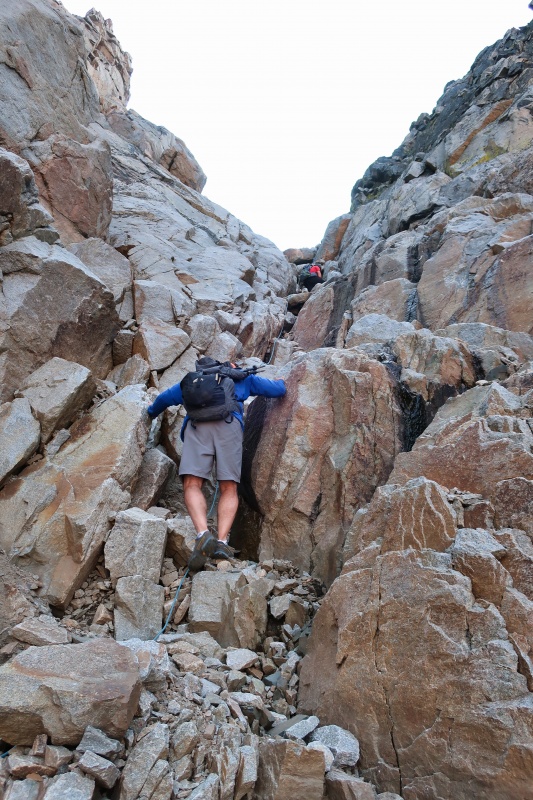

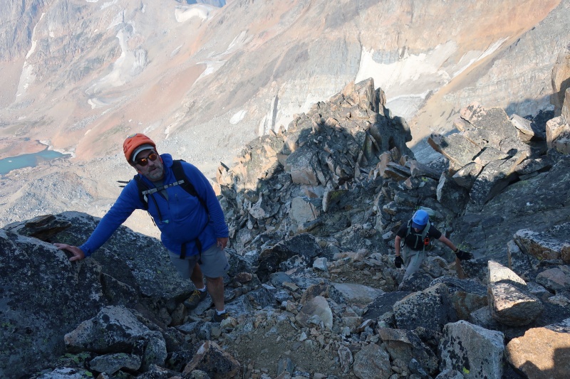
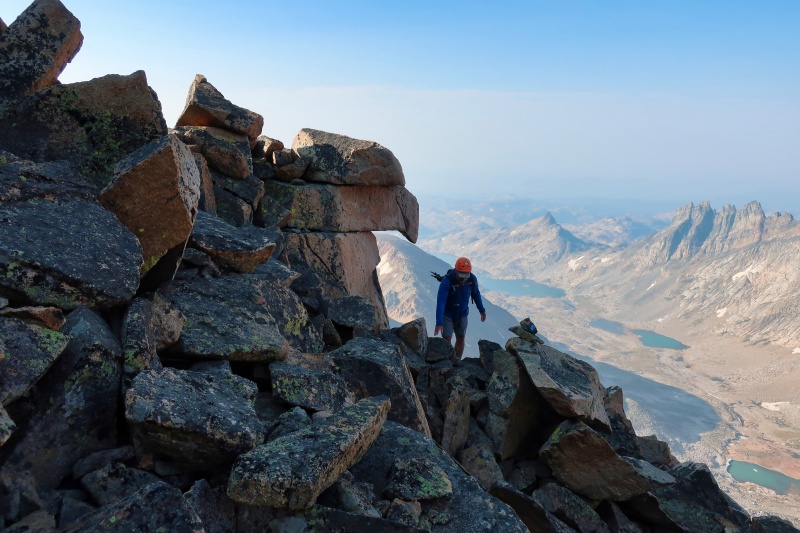
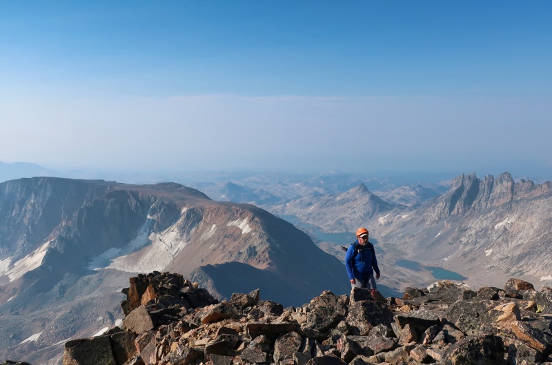
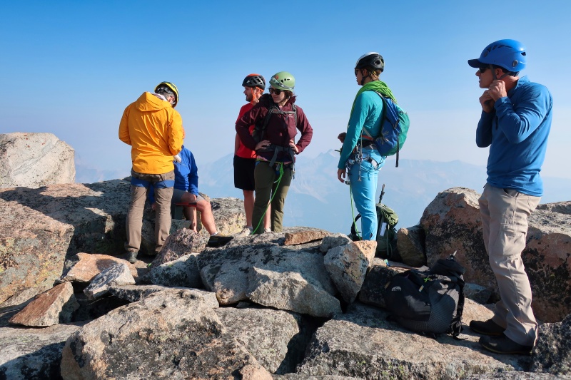
We reached Granite Peak’s 12,799-foot summit at 9:09 am, 3 hours and 46 minutes after leaving camp. While distant views were a bit hazy due to smoke from to the western wild fires, the views were still amazing and the weather was great with no clouds in sight! In addition to the three of us, there were five others on the summit, one guy who had passed us and a guided group of four. The guided group had climbed Granite’s East Ridge, the traditional route, and were still roped together while hanging out on the summit. Always the instructor, Greg observed that the clients were stepping on their rope. We enjoyed the summit for about 20 minutes, taking photos, snacking, and talking with the other climbers. 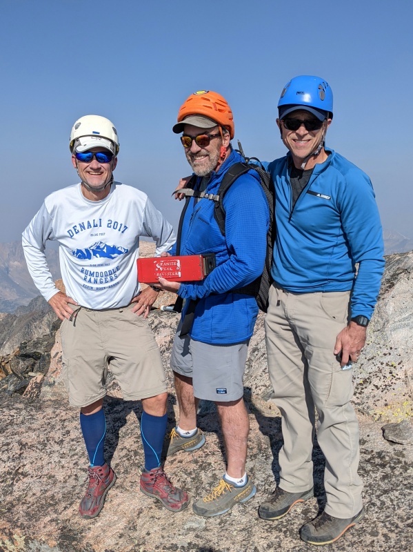
The three of us started back down the way we came at 9:32 am, still early in the day. We quickly passed a group of four on their way up. Near the top of the Southwest Ramp couloir, we started descending in a couloir. After climbing down for several minutes we got stuck and figured we were on the wrong side of the couloir. We climbed back up a bit and then started climbing down on the other side of the couloir. The terrain here seemed more difficult that I remembered and we didn’t find the upper fixed rope. Before we had made it too far down, we realized that we were in the wrong couloir which a quick check of the GPS confirmed. Woops! While Dave and I hung out, Greg descended a bit further checking around a corner to see if we could get back to the Southwest ramp without climbing back up. No such luck. The three of us then climbed back up and before long found a relatively easy way to get back on route a bit below the top of the correct couloir. 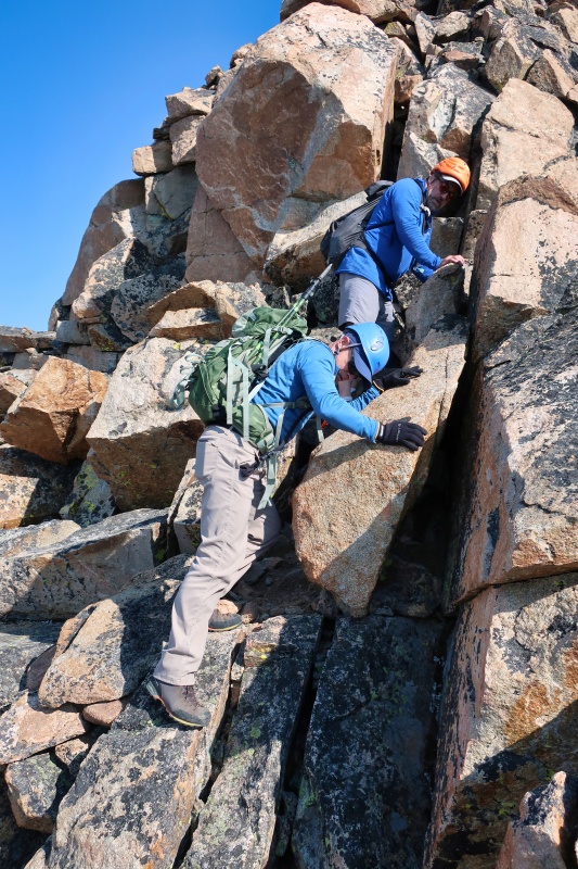


While our detour only set us back about 25 minutes, it got us back in the couloir a little below the group of four, now descending. At least one member of this group was not being particularly careful and sent several loose rocks flying down the couloir toward us. The rocks went past me, but banged both Greg and Dave on their helmets. Neither Greg nor Dave was hurt, but I was furious and told the group not to move until we had descended to a safe spot out of the line of fire. The three of us climbed down through a narrow section before letting the group above know they could continue descending. When we didn’t see any more rocks flying past, we quickly descended to the lower section of the couloir where rock fall was less of a threat. While down climbing is almost always trickier than climbing up, I felt comfortable scrambling down the two steepest sections without using the fixed ropes. Based on my experience, I would rate the Southwest Ramp couloir as difficult Class 3, but not as difficult as Class 4 climbing. And I thought the occasional exposure on the route was minor. When dry, as it was for us, climbing this couloir should not be a problem for a decent scrambler. However, if the rocks in the couloir are wet, snow-covered, or icy, as they are for most of the year, that’s a whole other ball game! 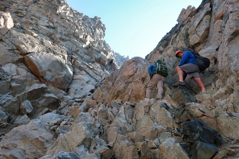
The remainder of our descent back to camp was uneventful. By noon, when we got back down to the snow fields below the glacier, the snow had softened enough to safely walk on. In fact, the snow was pretty wet and slushy, getting my feet wet. When we got back down to 10,600’ below this highest lake, we stayed east of the creek and the next lake, hiking on much easier terrain that we had on our way up. We got back to camp at 1:23 pm, exactly 8 hours after we had started out. If we had had a day to spare, I would have been very happy to spend that night right where we were camped. However, Dave and Greg needed to get back to Colorado and I had other climbing plans. So we filtered water for the hike out, ate lunch, broke camp, and started back down the trail at 2:15 pm under still mostly clear skies. 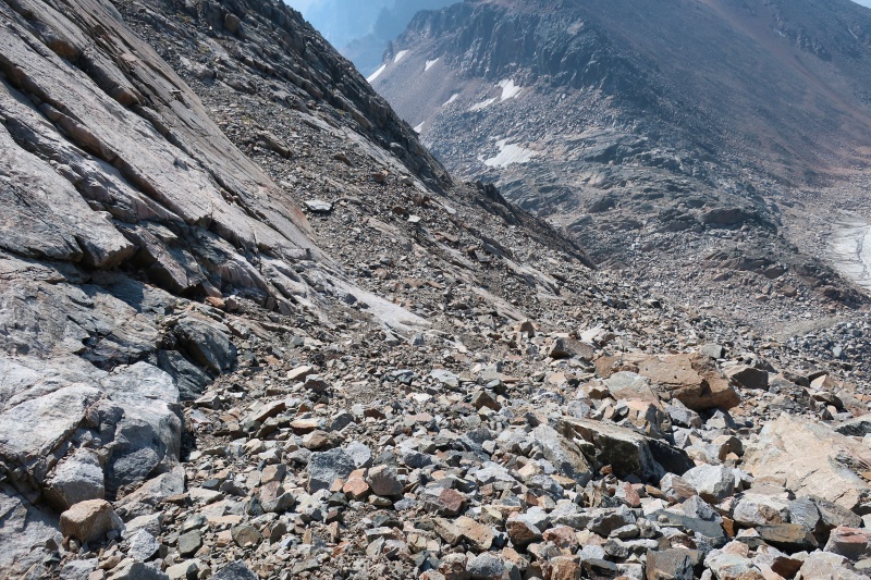
The Hike Out In my experience, hiking back down a trail after a climb often takes as long as hiking up the same distance. If it was going to take us 7 hours to hike back down to the trailhead, we’d be hiking out in the dark. While we could have camped lower on the trail, camping with the grizzly bears was not on the agenda! So we keep each other moving at a decent pace for much of the way down. 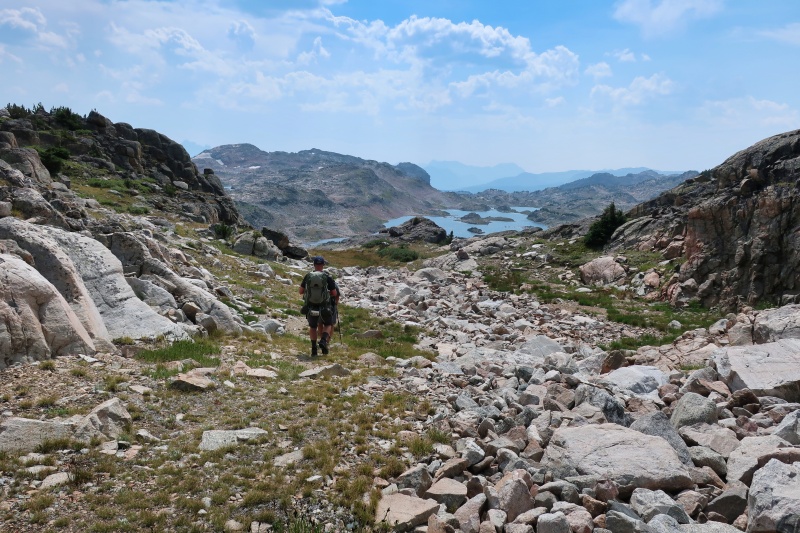
Checking the GPS less frequently, and perhaps following other hikers, we took a slightly different route down to Rough Lake from the Sky Top Lakes basin. This made crossing Sky Top Creek, more difficult and Dave and I soaked our shoes walking through the creek, shallow and wide at this point. Above Lone Elk Lake we diverged from our ascent route and had to decide whether to try going around the east side of the lake or climb back up to the route we had been on the day before. We hiked back up about a quarter mile and followed the known route. By this time the skies had clouded up a bit and we heard thunder rumbling to the west. We were still above the trees so that provided some incentive to pick up the pace. Then quite suddenly, we started getting pelted with pea-sized hail. When I dug into my pack for my rain jacket, I pulled out my climbing helmet and put that on too! Fortunately the hail did not last long and the weather was pleasant for the rest of our hike. 
As we kept moving down the trail at a good pace, our prospects for a daylight finish were looking better and better. At Lady of the Lake we took a 15-minute break for some blister management. In my case, my high-top Altra Lone Peaks once again proved they’re great hiking shoes for me from backpacking to scrambling. At 8:14 pm, 5 hours and 59 minutes from camp, we reached trailhead just 13 minutes before a beautiful sunset. According to my GPS, our return trip was 10.4 miles making it a 17.4-mile day – long but very rewarding! 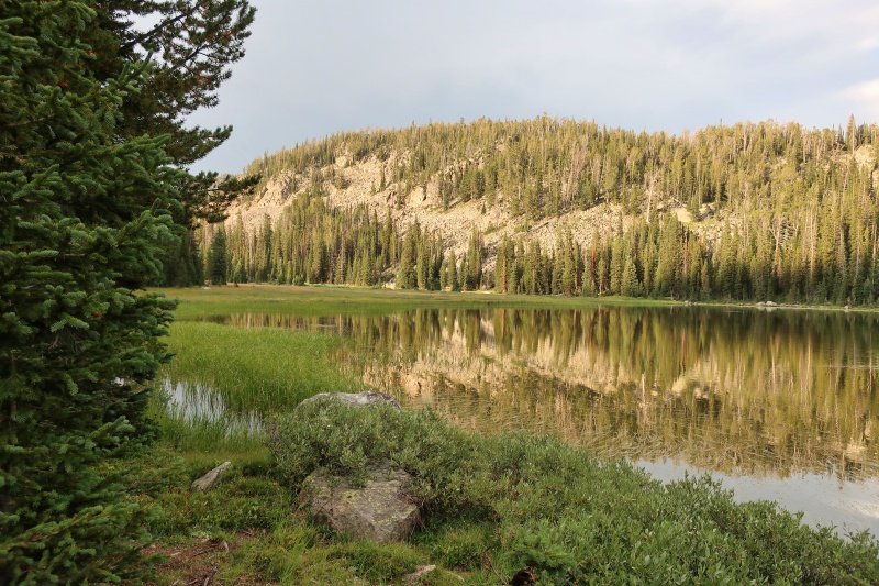
The day ended well. As soon as I got in my 4Runner, I headed straight to Cooke City to search for a hotel room – late on a summer Saturday night in a small resort town just outside of Yellowstone. After striking out at a couple places, I got lucky and snagged the last available hotel room in town for the three of us. Then we managed to get some beers and a good dinner as the last open restaurant in town was closing down. The next morning Dave and Greg got going early to head by to Colorado. I slept in before heading through Yellowstone National Park on my way to Idaho to climb Borah Peak. Conclusion Overall, Granite was a fun challenging climb in a beautiful area. If you get lucky with the conditions and weather, as we did, Granite can be climbed in two days with scrambling no more difficult than Class 3. If you like low Class 5 scrambling or don’t mind hauling a rope a long way, the eastern approaches sound like fun as well. Or you can just run the whole thing and try to beat Will Porter’s 2016 FKT of 5 hours, 24 minutes and 54 seconds, car-to-car, from the West Rosebud trailhead! However, I recommend a slower pace and at least 3 days to really enjoy the area. Thumbnails for uploaded photos (click to open slideshow): ")
")
")
")
")
")
")
")
")
")
")
")
")
")
")
")
")
")
")
")
")
")
")
")
")
")
")
")
")
")
")
")
")
")
")
")
")
")
")
")
")
")
")
")
")
")
")
")
")
")
")
")
")
")
")
")
")
")
")
")
")
")
")
")
")
")
")
")
")
")
")
|
| Comments or Questions | |||||||||||||||
|---|---|---|---|---|---|---|---|---|---|---|---|---|---|---|---|
|
Caution: The information contained in this report may not be accurate and should not be the only resource used in preparation for your climb. Failure to have the necessary experience, physical conditioning, supplies or equipment can result in injury or death. 14ers.com and the author(s) of this report provide no warranties, either express or implied, that the information provided is accurate or reliable. By using the information provided, you agree to indemnify and hold harmless 14ers.com and the report author(s) with respect to any claims and demands against them, including any attorney fees and expenses. Please read the 14ers.com Safety and Disclaimer pages for more information.
Please respect private property: 14ers.com supports the rights of private landowners to determine how and by whom their land will be used. In Colorado, it is your responsibility to determine if land is private and to obtain the appropriate permission before entering the property.


