Download Agreement, Release, and Acknowledgement of Risk:
You (the person requesting this file download) fully understand mountain climbing ("Activity") involves risks and dangers of serious bodily injury, including permanent disability, paralysis, and death ("Risks") and you fully accept and assume all such risks and all responsibility for losses, costs, and damages you incur as a result of your participation in this Activity.
You acknowledge that information in the file you have chosen to download may not be accurate and may contain errors. You agree to assume all risks when using this information and agree to release and discharge 14ers.com, 14ers Inc. and the author(s) of such information (collectively, the "Released Parties").
You hereby discharge the Released Parties from all damages, actions, claims and liabilities of any nature, specifically including, but not limited to, damages, actions, claims and liabilities arising from or related to the negligence of the Released Parties. You further agree to indemnify, hold harmless and defend 14ers.com, 14ers Inc. and each of the other Released Parties from and against any loss, damage, liability and expense, including costs and attorney fees, incurred by 14ers.com, 14ers Inc. or any of the other Released Parties as a result of you using information provided on the 14ers.com or 14ers Inc. websites.
You have read this agreement, fully understand its terms and intend it to be a complete and unconditional release of all liability to the greatest extent allowed by law and agree that if any portion of this agreement is held to be invalid the balance, notwithstanding, shall continue in full force and effect.
By clicking "OK" you agree to these terms. If you DO NOT agree, click "Cancel"...
Late fall seems to usually give me the time to actually write trip reports from the previous summer. This area is pretty popular with the 14er community so I don't plan to go into much details regarding route info and beta. Instead, I completed a really enjoyable two night backpacking and mountain climbing trip in the San Juans and thought I would share some photos and memories for future me and others who are interested. Coming from the Front Range I generally have the time to really make one solid trip to SW Colorado each year and enjoy this beautiful area.
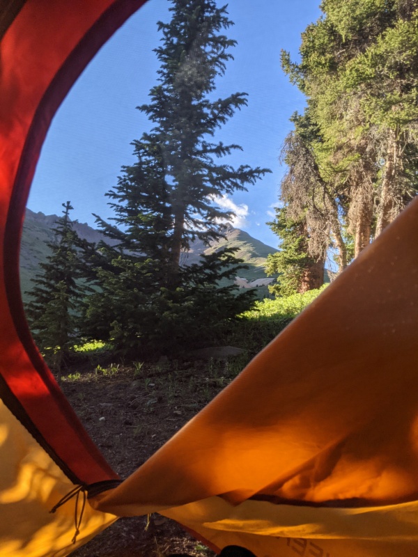
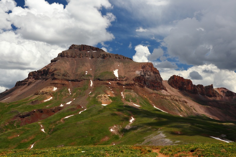
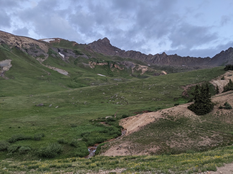
After grabbing some lunch in Lake City I made my way to the Matterhorn Creek trailhead; I thought the Henson Creek Rd was pretty rough and I had to do more slowing down and picking a line through the ruts than I expected; eventually I made it to the upper trailhead where the last 0.7 mile felt like the max my full size truck could handle. I set off up the Matterhorn Creek trail at 1545 and hiked for about 45 minutes to near treeline where I found a spot on the East side of the trail to pitch my camp. Seeing Matterhorn and Wetterhorn Peak on the way in was sublime and got me pretty excited for the next two days. After pitching camp, eating, reading, and snapping some pictures I got to sleep early ready to make an alpine start the next day.
CampsiteTrail near campsite
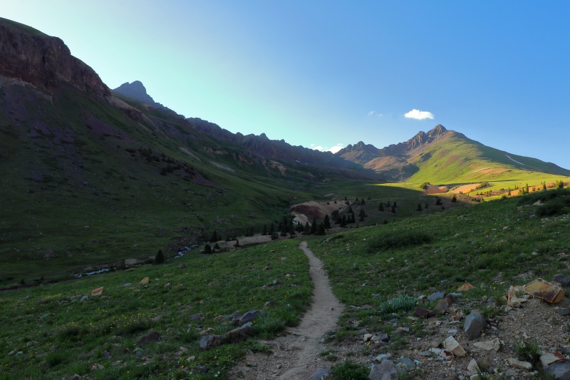
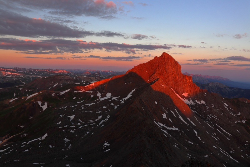
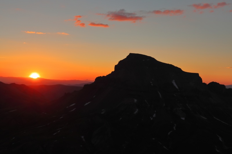
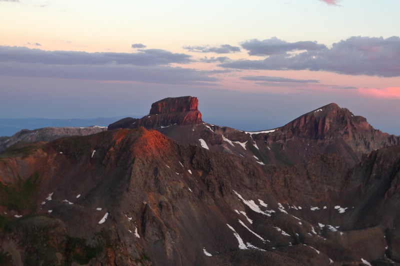
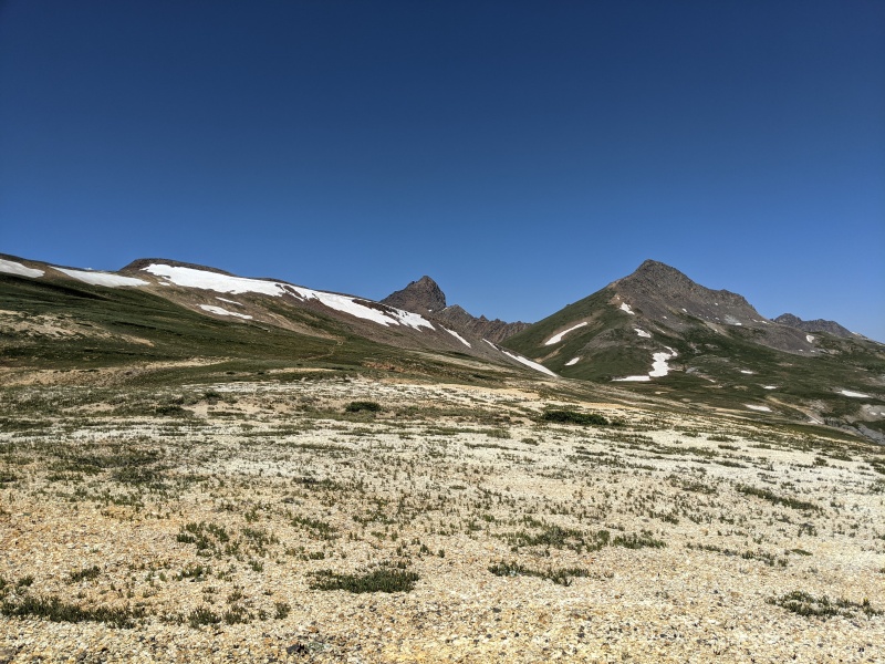
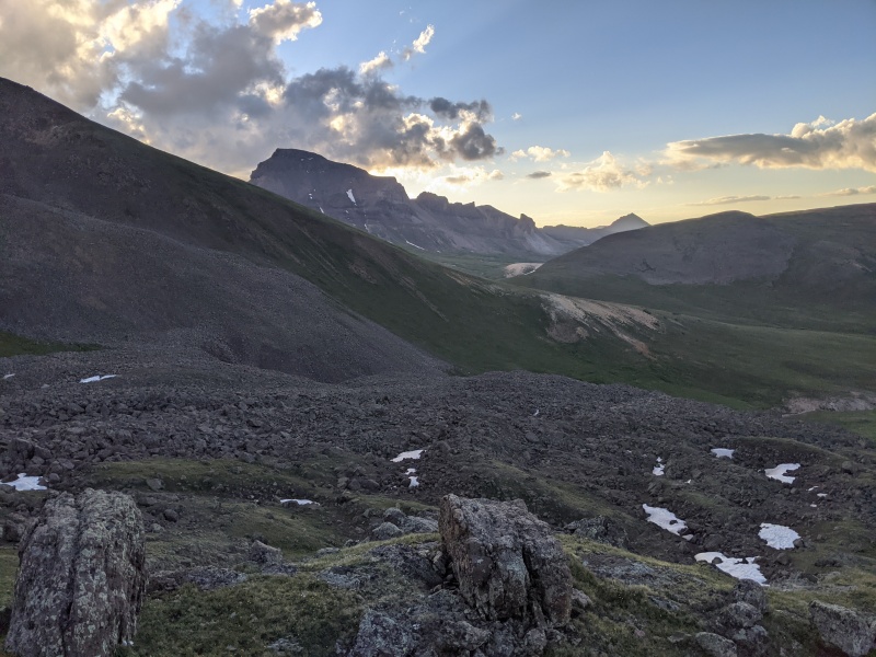
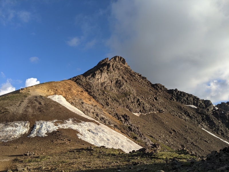
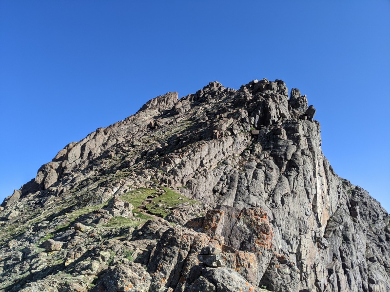
On day 2 I woke up for some breakfast and coffee and set off up the trail at 425. My first goal of the day was to climb Matterhorn Peak. There are several social trails leading up to the pass between Matterhorn and Broken Hill and I didn't follow the obvious trail in the dark; regardless I made good time to the pass and could make out the dawn outline of Uncompahgre. The grind up the grassy south slope of Matterhorn Peak was tough but quick and I picked up a climbers trail as the terrain became more rocky. A few fun class 3 moves put me on the summit ridge where an easy walk over allowed me to reach the summit at 550. With sunrise set for 552 all I can say is that this was one of the most beautiful and surreal summit experiences I've ever had.
Caption HereCaption HereSunrise from MatterhornCaption HereClass 3 section near summitUncompahgre from Matterhorn-Broken Hill saddle.
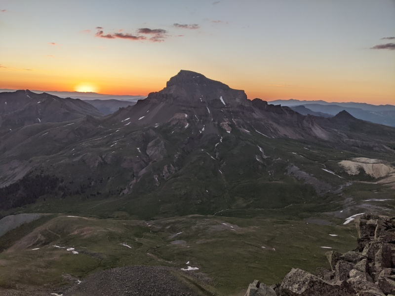
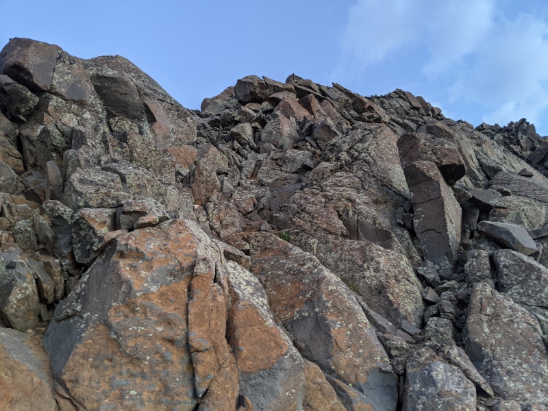
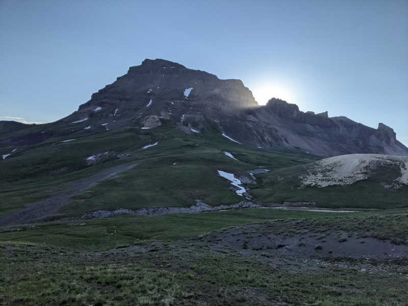
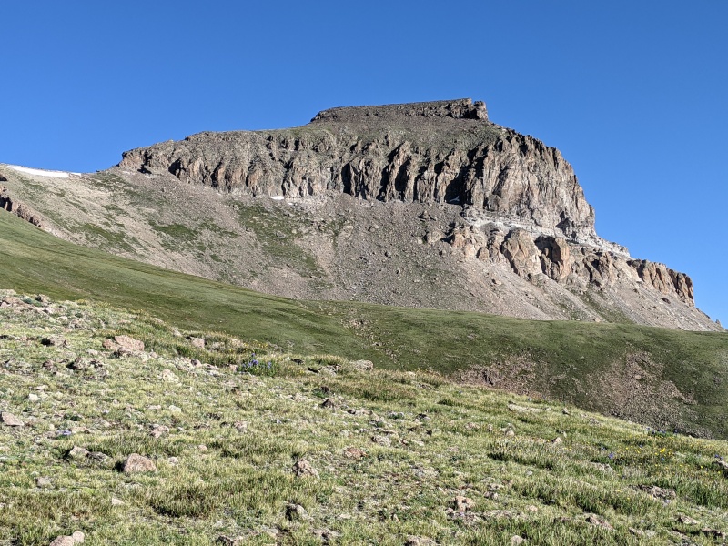
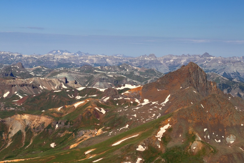
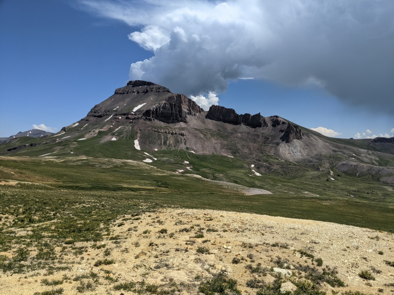
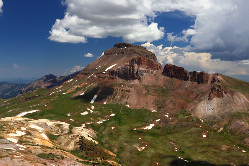
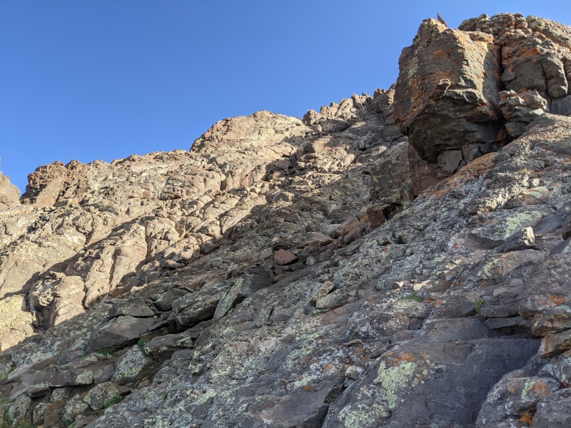
After taking in the summit I returned to the trail and began making my way to Uncompahgre. Though I didn't see anyone on this route all day and didn't think the trails here are frequently traveled the trail and junctions were well-marked and easy to follow. During this stretch Uncompahgre dominates the views to the East. After eventually joining up with the standard route I walked up the trail to the class 2 climb through Uncompahgre's upper cliffs. I did find the path to the right of the tower in the route description to be easier though both ways are loose compared to the trail I had been cruising on for almost two hours. A quick quarter mile from the class 2 stretch lead me to the summit before 900. There wasn't a sunrise but I thought the views from Uncompahgre were some of the best among the 14ers I've done. Combined with how imposing this mountain looks on the trails below I found Uncompahgre to be one of my favorite hikes in Colorado.
Approaching UncompahgreClass 2 sectionCaption HereCaption HereSummit of Uncompahgre
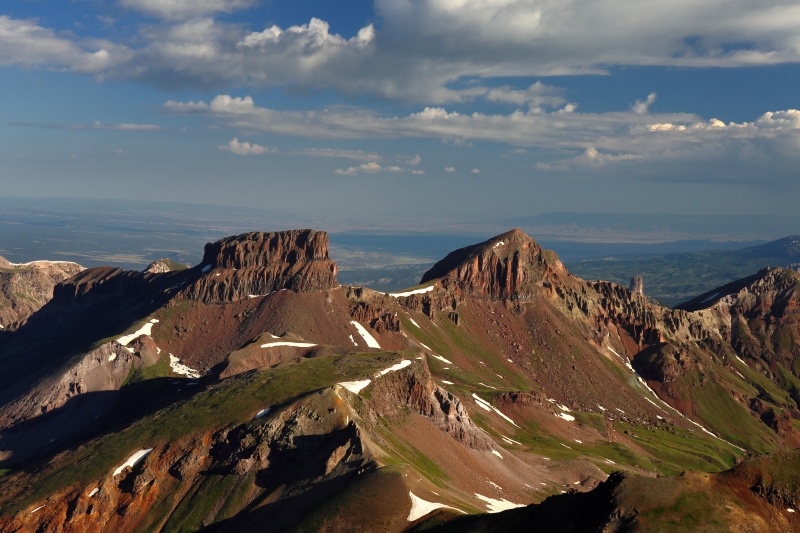
Storm brewing on UncompahgreTotally clear to the west though
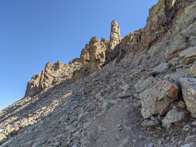
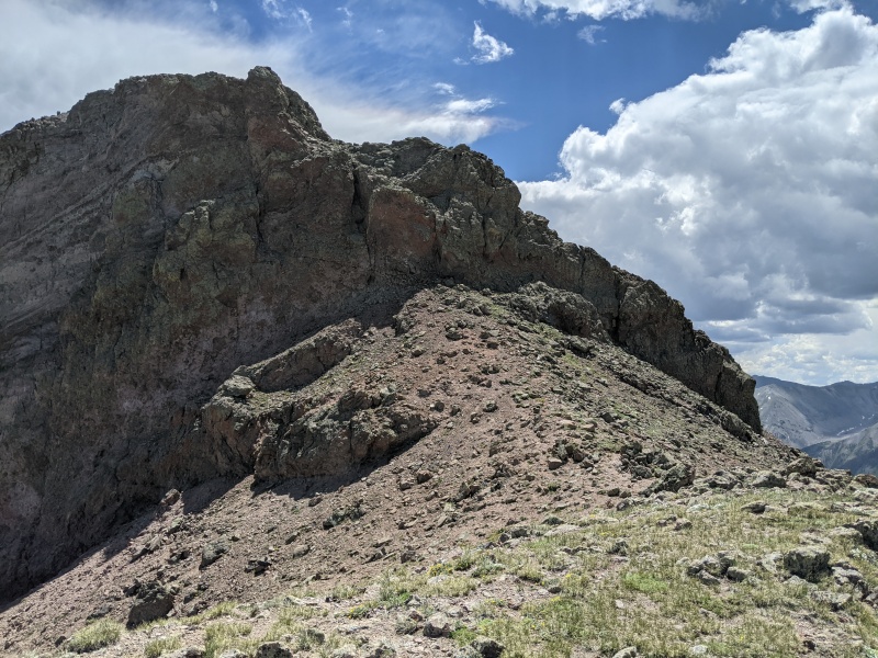
As I descended back to the El Paso Creek drainage some thunderclouds began to build and threaten my plans to tag Broken Hill. As I reached the lowpoint of the drainage I could hear thunder coming from the looming cloud over Uncompahgre, meanwhile, there wasn't a cloud in the sky on the Wetterhorn side. I decided to stop for lunch and watch the developing storm over Uncompahgre. There was a prediction for rain with possible thunderstorms in the afternoon though it was only 1100 and this storm looked pretty isolated. After watching it for 10 minutes and noting that it had come no closer to me or Broken Hill I left the trail and headed due South, crossing some muddy areas and a brief snowfield to gain the North ridge of Broken Hill. I made my way up a mix of steep grass and talus to reach a disheartening view of the summit block; this wouldn't be a simple class 2 walk-up to the top. After checking out some possible lines through the cliffs I decided to use the ledge on the West side which led to a loose slope up to the top; I didn't find any secure footing here but pushed through to reach the top at 1155. I was again stunned by the views I found and took them in during a quick snack. Knowing I still had to get back to camp before afternoon rain I didn't spend much time on the summit; luckily I found an old use trail that stayed above the El Paso creek drainage which allowed me to pretty much cruise back to the trail and back to the saddle between Matterhorn and Broken Hill. Returning to camp was also easy; I was able to find the actual trail during the day; please do not use braided trails as this causes erosion and can make finding trails difficult in the dark. The rain finally did come later in the afternoon but only lasted for an hour and a half or so; I was able to nap in my tent and read while waiting it out in relative comfort.
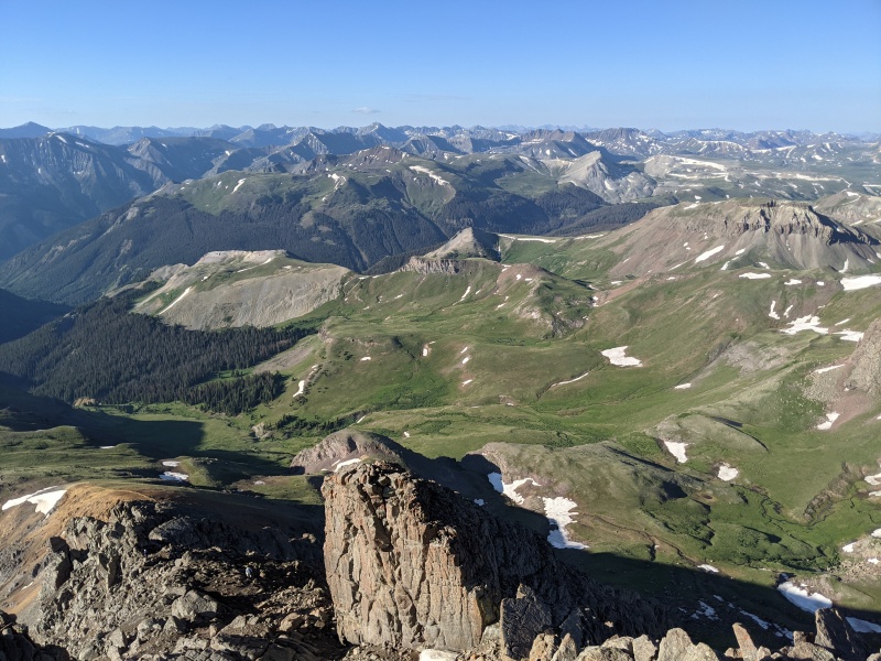
Broken Hill summit blockUncompahgre from Broken HillWetterhorn, Matterhorn, Coxcomb from Broken HillOne last view of UncompahgreAfternoon shot of Wetterhorn
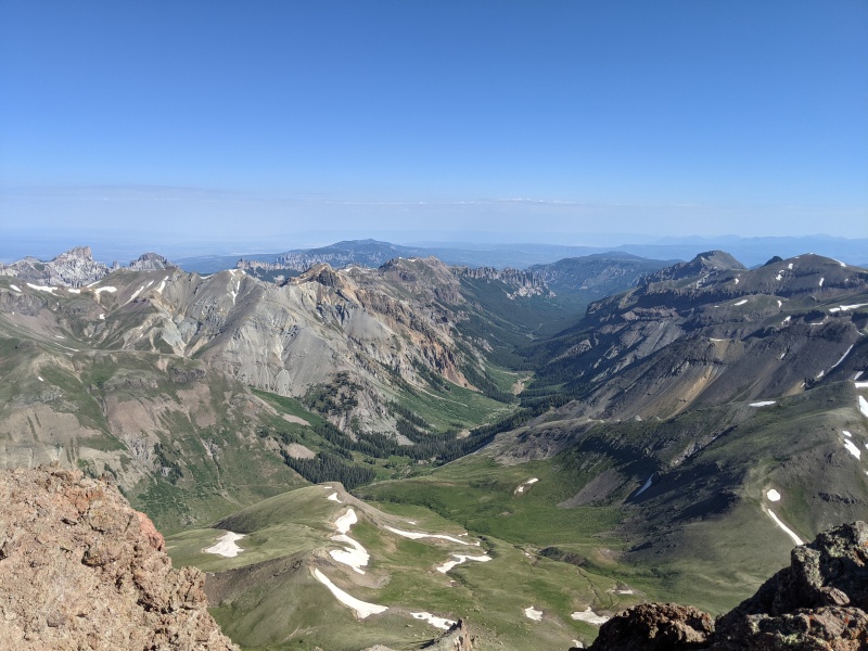
On day 3, knowing that climbing Wetterhorn could go relatively quickly and there was a chance of precipitation in the afternoon I got a bit of a later start and left camp by 0545. I pretty much followed the standard route as described on this site, though I did take some of the variations. After finding my way to the final pitch I went straight up without traversing on the ledge and met another climber leaving the summit; I reached the summit at 0730 and had it to myself for a snack and more photos. 25 minutes later I began my descent, passing several more climbers. There was one who was on his way up, not wearing a helmet, and carrying a minimal pack. As I continued descending the thought crossed my mind that Andrew Hamilton was going for the centennial speed record and that this fast mover could be him. I kept up a pretty solid pace on the descent but stopped for a snack at the saddle where the trail ends, and sure enough he caught up to me and we had a quick chat. It was indeed Andrew Hamilton, who claimed to be quite tired and beat up; I wished him luck and watched him set off looking none the worse for wear. I returned to my camp by 0930 and lay down to relax for 20 minutes before packing up and heading back down to the trailhead. I concluded this trip by returning to the trailhead around 1100 and immediately made my way to the Packer Saloon in Lake City for a burger and some beers.
Sunrise on the way to WetterhornWetterhorn from saddleThe beginning of the difficulties.Another climber gives a sense of scale.First class 3 pitch
Caption HereCaption Here
Thumbnails for uploaded photos (click to open slideshow):
I really like Uncompahgre and it was also one of my favorite winter 14ers. Albeit long but that is the name of the game. I bet your campsite was peaceful. Your sunset and sunrise pictures really capture the peace and solitude. Well done.
I, too, was intimidated by Broken Hill's summit block from the North. It turns out that there is a very easy way around the difficulties on the West side, a little ledge that is almost like a trail. An unforgettable area I can't wait to get back to.
Caution: The information contained in this report may not be accurate and should not be the only resource used in preparation for your climb. Failure to have the necessary experience, physical conditioning, supplies or equipment can result in injury or death. 14ers.com and the author(s) of this report provide no warranties, either express or implied, that the information provided is accurate or reliable. By using the information provided, you agree to indemnify and hold harmless 14ers.com and the report author(s) with respect to any claims and demands against them, including any attorney fees and expenses. Please read the 14ers.com Safety and Disclaimer pages for more information.
Please respect private property: 14ers.com supports the rights of private landowners to determine how and by whom their land will be used. In Colorado, it is your responsibility to determine if land is private and to obtain the appropriate permission before entering the property.


")
")
")
")
")
")
")
")
")
")
")
")
")
")
")
")
")
")
")
")
")
")
")
")
")
")
")
")
")


